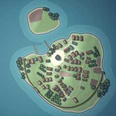
Village Generator
Right click to open the context menu with all the options. Press Enter to generate a new village; more shortcuts⌨️here. Additional style presets are available 🎨here.
This generator is a part of 🃏Procgen Arcana.
You can use images created by the generator as you like: copy, modify, include in your commercial rpg adventures etc. Attribution is appreciated, but not required. Please consider supporting this project on Patreon☕!
| Status | In development |
| Category | Tool |
| Platforms | HTML5 |
| Rating | Rated 4.9 out of 5 stars (789 total ratings) |
| Author | watabou |
| Made with | Haxe,OpenFL |
| Tags | City Builder,Generator,Procedural Generation |
| Average session | A few seconds |
| Languages | English |
| Inputs | Keyboard,Mouse,Touchscreen |
| Accessibility | Color-blind friendly,High-contrast |
| Links | Twitter/X,Patreon |
Development log
Comments
Log in with itch.io to leave a comment.
I would like to use the maps generated on this for making patreon posts. I am building content of one shots and skill challenges and think this is the most amazing tool every. I will absolutely always give you credit with links to your work.
I was trying to find any disclaimer or licensing agreements
For sure! Here are a few that I had used for previous games:
https://www.artstation.com/artwork/zD8rzQ
https://www.reddit.com/r/dndmaps/comments/bowrus/mountain_village_inkarnate_my_f...
https://www.reddit.com/r/dndmaps/comments/jlcmn4/bramble_a_small_mountain_town/
https://www.pinterest.com/pin/city-river-mountain-cliff-farmland-forest--7754636...
https://www.peakpx.com/en/hd-wallpaper-desktop-nvoiu
Realised the second and third link links the first link for some reason :( I'm reposting them here!
https://www.reddit.com/r/dndmaps/comments/bowrus/mountain_village_inkarnate_my_f...
https://www.reddit.com/r/dndmaps/comments/jlcmn4/bramble_a_small_mountain_town/
Sometimes I'll get a generation that's near-perfect, but it has a road or a river that's just not quite where I'd like it to be in comparison to a world map I'm trying to match it to. Would it be possible to add an option to place guide markers so users can give a general idea where they want these roads and rivers to meet the edges of the map? Ofc I could also just sit here for 3 hours clicking "generate" until I find one that actually is perfect.
And/or something similar to the Warp feature in the City generator so you can manipulate stuff around.
I'll think about it, but yeah, actually the idea was that you could generate villages until you got the right one. Generation takes a fraction of a second, and it's not like there are a huge number of parameters, so it shouldn't take 3 hours.
If you have specific requirements for a river or a highway, you can first find a map that satisfies those requirements ignoring the village itself. Then you can"Reroll village" (via the context menu or by pressingShift+Enter) to get a good distribution of secondary roads and houses.
I hear you, and maybe I just got bad luck (or maybe I'm just too particularly picky) but it took me hours to find one where the river and roads went the right direction with the right orientation specific to what I needed (I also had to do this for 5 different towns, so it really was an all-day event). "Reroll village" was the quickest part after I found the exact right setup.
Some little troubles with JSON file...
Hi Watabou,
Still using the VG with my greatest satisfaction. Congrat !
I am using some JSON exports of VG. I analyze them and create splatmap in UNITY. I am able to create different textures for different features (water, fields, square, ...). I have troubles with the "water" MultiPolygon geometry, in case of tag "island".
Here the PNG :

And a splatmap of the polygons of "water", except the last polygon :

It seems that, contrary to other generations ("pond", "river", ...), in case of "island", the last polygon being equal to "earth", the logic is "earth", minus previous polygons ? Is it correct ?
I have an other question. In a generation with tag "estuary", I got that :

And the splatmap of all polygons of "water" is :

Seems good. But I also draw vertices of each polygon (not obvious to see, but they are the small yellow points). I got "extra" points. Are they still polygons of something ?
Best Regards
Mallatius
Hi,
- Yes, for islands the "main" water polygon is the last one and the rest of them are "holes" in it.
- I have no idea what those rogue vertices are in your image. Usually, there is only one water polygon in an estuary map unless there is an additional island. Could it be a degenerate zero area island or something like that?
Here: https://www.patreon.com/posts/desktop-versions-96122791. Or install theitch.io app.
I'll send you a copy. Here is a link to my email. info@arcanumsyndicate.com
First of all, amazing work! Thank you Watabou for creating such a beautiful and inspiring tool.
I noticed that most of the houses in the generator are positioned perpendicular to the road. In reality, some houses are often parallel to the road as well. Have you considered adding an option to let users customize the orientation of the houses? I think it could add even more flexibility and realism to the tool.
Thanks again for your wonderful creation!
You can request a map with the aspect ratio you need by adjustingSize values in the "Map parameters" dialog ("Tags..." in the context menu).
For example:https://watabou.github.io/village-generator/?seed=1140703949&tags=island,no%20sq...
There is no such problem in general. I mean, if a road is not exported then it's something more specific, than just the "isolated" tag which I tested many times before (especially since it's a default tag now). Here is a very similar village:
https://watabou.github.io/village-generator/?seed=1026162478&tags=isolated,palis...
And that's how its exported version looks:

As you can see, both the regular (solid) part of the road and the trail part (dotted) are present. Anyway, if you will be able to reproduce the bug, please send me the link so can examine the case more closely.
Hi! I love your work and on procgen arcana! I just wanted to ask if there is someway to use your generators offline? I ask as my country suffers a lot of either power cuts, rolling blackouts, internet outages, etc. So if I were able to run this locally on my craptop, it could still enjoy your work? The github repo's seems very out of date, especially the town generator. Whether its a yes or a no, thank you for your time in advance!
 I can't get this to work properly on Firefox, but it works apparently just fine on chrome. what is going on?? Chrome it works just fine, but it's slow and laggy.


