


Earth
Your home. Our mission.

NASA is an exploration agency, and one of our missions is to know our home. We develop novel tools and techniques for understanding how our planet works -- for the benefit of humanity and for insights we need to explore other moons and planets. NASA's Earth Science Division operates more than 20 satellites in orbit, sponsors hundreds of research programs and studies, and funds opportunities to put data to use for societal needs. We develop new ways to observe the oceans, land cover, ice, atmosphere, and life, and we measure how changes in one drive changes in others over the short and long term. While listening to and collaborating with industry leaders, international partners, academic institutions, and other users of our data, we drive innovations and deliver science to help inform decisions that benefit the nation and the world.
Recent News and Articles

NASA-ISRO Satellite Sends First Radar Images of Earth’s Surface

4 min read
NASA Science Flights Venture to Improve Severe Winter Weather Warnings
Article3 weeks ago

2 min read
NASA Analysis Shows La Niña Limited Sea Level Rise in 2025
Article2 weeks ago

6 min read
NASA Data Helps Maine Oyster Farmers Choose Where to Grow
Article1 month ago
Earth Observatory Image of the Day

Stonebreen’s Beating Heart
3 min read
The glacier in southeastern Svalbard pulses with the changing seasons, speeding up and slowing its flow toward the sea.
Feb 13, 2026

Reaching Top Speed in the Dolomites
4 min read
Cortina d'Ampezzo, flanked by steep-sided mountain peaks, is the site of several skiing and sliding events in the 2026 Winter…
Feb 12, 2026

Summer Heat Hits Southeastern Australia
4 min read
January brought blistering extremes Down Under as record temperatures scorched the nation’s southeast.
Feb 11, 2026
Featured Video
Inside the Visualization: Aerosols
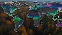
NASA uses satellites, ground measurements, and powerful computer models to track tiny particles floating in our air called aerosols. These small particles can travel thousands of miles, affecting the air we breathe and how far we can see, even far from where they originated.
Watch on YoutubeNISAR
Carrying an advanced radar system that will produce a dynamic, three-dimensional view of Earth in unprecedented detail, the NISAR (NASA-ISRO Synthetic Aperture Radar) satellite waslaunched from Indiaon July 30, 2025. Jointly developed by NASA and the Indian Space Research Organisation (ISRO), the satellite can detect the movement of land and ice surfaces down to the centimeter. The mission will help protect communities by providing unique, actionable information to decision-makers in a diverse range of areas, including disaster response, infrastructure monitoring, and agricultural management.

5 min read
How New NASA, India Earth Satellite NISAR Will See Earth
Article1 year ago

6 min read
5 Things to Know About Powerful New U.S.-India Satellite, NISAR
Article7 months ago

6 min read
NASA-ISRO Mission Will Map Farmland From Planting to Harvest
Article11 months ago

6 min read
Powerful New US-Indian Satellite Will Track Earth’s Changing Surface
Article1 year ago
Recent Videos & Visualizations
Leaf Year: Seeing Plants in Hyperspectral Color
Researchers have now gathered a complete year of PACE data to tell a story about the health of land vegetation. PACE now allows scientists to see three different pigments in vegetation: chlorophyll, anthocyanins, and carotenoids. The combination of these three pigments helps scientists pinpoint even more information about plant health.
Watch on YouTubeScience in Action for Society
Learn how NASA’s studies of Earth bring benefits to the nation and world.

6 min read
NASA Data Powers New Tool to Protect Water Supply After Fires
Article5 months ago

6 min read
Meet Mineral Mappers Flying NASA Tech Out West
Article7 months ago

5 min read
How NASA Is Testing AI to Make Earth-Observing Satellites Smarter
Article7 months ago

4 min read
NASA Mission Monitoring Air Quality from Space Extended
Article8 months ago

4 min read
NASA Tech to Use Moonlight to Enhance Measurements from Space
Article8 months ago

3 min read
NASA Aircraft, Sensor Technology, Aid in Texas Flood Recovery Efforts
Article7 months ago

4 min read
NASA Sensor on Space Station Eyes Contamination off California Coast
Article8 months ago

6 min read
NASA’s Ready-to-Use Dataset Details Land Motion Across North America
Article8 months ago
NASA’s Hurricane Science, Tech, Data Help American Communities
With hurricane season underway, NASA is gearing up to produce cutting-edge research to bolster the nation’s readiness and response to severe weather.
Read Article
Hurricane Milton swirls over the ocean in this view from the International Space Station.
Credits: ISS Astronaut/Earth Observatory
Sensing the Seas
For more than forty years, NASA has found unique ways to study the surface layers of the ocean from the tropics to the poles. With three new missions since 2020 – PACE, SWOT, and Sentinel 6-Michael Freilich – we are now ushering in a new era of ocean studies.
4 min read
NASA’s PACE Mission Reveals a Year of Terrestrial Data on Plant Health
Article9 months ago

6 min read
NASA, French SWOT Satellite Offers Big View of Small Ocean Features
Article9 months ago

6 min read
Next-Generation Water Satellite Maps Seafloor From Space
Article11 months ago

6 min read
NASA’s PACE, US-European SWOT Satellites Offer Combined Look at Ocean
Article1 year ago

5 min read
NASA Analysis Shows Irreversible Sea Level Rise for Pacific Islands
Article1 year ago


Earth Information Center
For more than 50 years, NASA satellites have provided data on Earth's land, water, air, temperature, and climate. NASA's Earth Information Center allows visitors to see how our planet is changing in six key areas: sea level rise and coastal impacts, health and air quality, wildfires, greenhouse gases, sustainable energy, and agriculture.
Explore
Connect with NASAEarth
Keep Exploring
Explore Earth Science

Earth Science Missions
In order to study the Earth as a whole system and understand how it is changing, NASA develops and supports…

Earth Science at Work
NASA Earth Science helps Americans respond to challenges and societal needs — such as wildland fires, hurricanes, and water supplies…

Earth Science Data
