


Lunar Discovery and Exploration
The Exploration Science Strategy Integration Office (ESSIO) ensures science is infused into all aspects of lunar exploration.
In the Science Mission Directorate (SMD), the Exploration Science Strategy Integration Office (ESSIO) ensures science is infused into all aspects of lunar exploration. Through researching the Moon and its environment, and by using the Moon as an observation platform, NASA strives to gain a greater understanding of the Moon, the solar system, the universe, and the deep space environment. We integrate goals of the National Academy’sDecadal Surveys as well as other scientific community documents with the priorities of the Agency into a comprehensive strategy for lunar science. Amongst other things, our office is tasked with the integration of science intoArtemis and theMoon to Mars architecture.
ESSIO leads integration between SMD Divisions, NASA Mission Directorates, other government agencies, international partners, as well as the broad scientific and commercial communities.
This integration is accomplished through development of instruments/payloads, leading cross-directorate activities, fostering international partnerships, and creating innovative methods of sending payloads to the lunar surface with commercial entities.

On June 10th, 2011, the Lunar Reconnaissance Orbiter (LRO) captured this striking image of the Tycho crater. The crater is in the southern lunar highlands and is approximately 82km in diameter. The crater’s notable feature is how steep it is which is due to the fact is a relatively young crater (110 million years old).
NASA
The Commercial Lunar Payload Services (CLPS) aims to build a sustainable lunar economy that will produce rapid, frequent, and affordable access to the lunar surface and cislunar space.
The payloads we are sending to the Moon have instruments that will produce new and complementary lunar datasets to aid in scientific research and exploration of the Moon and beyond. These payloads will help us answer high priority science questions, allow us to test new technologies, and help us prepare and reduce risk for human surface exploration.

Orion spacecraft is pictured here aboard NASA’s Space Launch System (SLS) rocket on top of the mobile launcher. This launch attempt in August 2022, pushed back due to engine temperatures, was later followed by a successful launch of Artemis I in November 2022, which was the first integrated test of NASA’s deep space exploration system.
NASA/Joel Kowsky
Lunar Stories


Overview
The Moon is a cornerstone for solar system science and exoplanet studies.
Understanding the Moon helps us understand other planets, how they have evolved and the processes which have shaped their surfaces. It also helps us understand the influence the Moon has had on the Earth, the record of the ancient Sun, and it serves as a platform to study the rest of the universe.

NASA’s Lunar Reconnaissance Orbiter (LRO) team released this topographical image of the Moon’s surface which was achieved by using the LRO Wide Angle Camera (WAC) and the Lunar Orbiter Laser Altimeter (LOLA). The pixel scale is about 100 meters which means a single measure of elevation (one pixel) is about two football fields side-by-side. This map is a near-globe representation of the moon with an elevation color chart on the right measured in meters.
NASA’s Goddard Space Flight Center/DLR/Arizona State University
Elements
The Lunar Discovery and Exploration Program (LDEP) has several coordinated and focused elements to facilitate study and exploration of the Moon.
DEP supports industry partnerships and innovative approaches to accomplishing exploration and science goals, including the Commercial Lunar Payload Services (CLPS).

Tim Crain, second from the right, speaks with Thomas Zurbuchen, second from the left, about the lunar lander pictured. Crain is the vice president of Research and Development of Intuitive Machines which is one of three companies that will provide the first lunar landers for the Artemis program’s lunar surface exploration. Zurbuchen is the NASA Associate Administrator for the Science Mission Directorate (SMD) and he met Crain at Goddard Space Flight Center in Maryland. Image credit: NASA/Aubrey Gemignani
CLPS Overview
Commercial Lunar Payload Services Deliveries
CLPS deliveries and lunar surface destinations that are planned for the near-term and represent the deliveries for which there are selected instruments/payloads.

Artist’s infographic of planned flights through CLPS and their approximate landing locations on the Moon; includes name and image likeness of commercial CLPS landers.
Jenny Mottar

Pictured is the Lunar Swirl Reiner Gamma, a geological feature on the surface of the moon. This photo was taken by LRO. The feature is a bright patch amid the otherwise dark Oceanus Procellarum mare on the near side of the Moon.
NASA/GSFC/Arizona State University
Featured Story
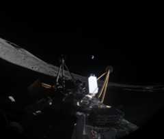
Surface and Exosphere Alterations by Landers (SEAL): NASA’s Next Lunar Payload?
PROJECT Surface and Exosphere Alterations by Landers (SEAL) SNAPSHOT SEAL will provide valuable in situ lunar data to give scientists…
Read the Story


