US7783417B2 - Methods and apparatus for determining a route having an estimated minimum fuel usage for a vehicle - Google Patents
Methods and apparatus for determining a route having an estimated minimum fuel usage for a vehicleDownload PDFInfo
- Publication number
- US7783417B2 US7783417B2US11/684,301US68430107AUS7783417B2US 7783417 B2US7783417 B2US 7783417B2US 68430107 AUS68430107 AUS 68430107AUS 7783417 B2US7783417 B2US 7783417B2
- Authority
- US
- United States
- Prior art keywords
- route
- vehicle
- estimated
- determining
- user
- Prior art date
- Legal status (The legal status is an assumption and is not a legal conclusion. Google has not performed a legal analysis and makes no representation as to the accuracy of the status listed.)
- Active, expires
Links
- 239000000446fuelSubstances0.000titleclaimsabstractdescription134
- 238000000034methodMethods0.000titleclaimsabstractdescription37
- 230000006399behaviorEffects0.000claimsdescription7
- LFQSCWFLJHTTHZ-UHFFFAOYSA-NEthanolChemical compoundCCOLFQSCWFLJHTTHZ-UHFFFAOYSA-N0.000claimsdescription4
- 230000001133accelerationEffects0.000claims1
- 238000012544monitoring processMethods0.000claims1
- 238000004891communicationMethods0.000description9
- 230000000694effectsEffects0.000description6
- 238000013461designMethods0.000description3
- 238000010586diagramMethods0.000description3
- 238000012545processingMethods0.000description3
- 238000002485combustion reactionMethods0.000description2
- VNWKTOKETHGBQD-UHFFFAOYSA-NmethaneChemical compoundCVNWKTOKETHGBQD-UHFFFAOYSA-N0.000description2
- 238000010276constructionMethods0.000description1
- 230000001934delayEffects0.000description1
- 230000005611electricityEffects0.000description1
- 239000001257hydrogenSubstances0.000description1
- 229910052739hydrogenInorganic materials0.000description1
- 125000004435hydrogen atomChemical class[H]*0.000description1
- 238000012986modificationMethods0.000description1
- 230000004048modificationEffects0.000description1
- 239000003345natural gasSubstances0.000description1
- 230000008520organizationEffects0.000description1
- 230000000717retained effectEffects0.000description1
- 230000000630rising effectEffects0.000description1
- 238000006467substitution reactionMethods0.000description1
Images


Classifications
- G—PHYSICS
- G01—MEASURING; TESTING
- G01C—MEASURING DISTANCES, LEVELS OR BEARINGS; SURVEYING; NAVIGATION; GYROSCOPIC INSTRUMENTS; PHOTOGRAMMETRY OR VIDEOGRAMMETRY
- G01C21/00—Navigation; Navigational instruments not provided for in groups G01C1/00 - G01C19/00
- G01C21/26—Navigation; Navigational instruments not provided for in groups G01C1/00 - G01C19/00 specially adapted for navigation in a road network
- G01C21/34—Route searching; Route guidance
- G01C21/3453—Special cost functions, i.e. other than distance or default speed limit of road segments
- G01C21/3469—Fuel consumption; Energy use; Emission aspects
Definitions
- the present inventionrelates to navigation systems and more specifically to navigation systems for suggesting routes for vehicles navigating streets where the suggested routes are based at least partially on fuel efficiency for the vehicle even more specifically the present invention relates to suggesting a route based on at least one estimated speed for the suggested route.
- GPSGlobal Positioning Systems
- U.S. Pat. No. 5,742,922 entitled “Vehicle Navigation System and Method for Selecting a Route According to Fuel Consumption”provides for determining a least fuel consumption route in view of the altitude information of the route, but does not account for the effect of speed on the fuel efficiency of the vehicle and does not account for the usage of fuel for stopping or slowing down to turn.
- the estimated fuel consumptionis further based on the number of estimated stops in a route and on the estimated number of times the vehicle will slow down to turn.
- the suggested routehas constraints placed on it by user preferences.
- real-time information and actual driver behavior datais used in computing the estimated amount of fuel usage.
- an apparatusfor determining a suggested route having an estimated minimum fuel usage from a start location to a destination location for a vehicle based on estimated fuel efficiency for the vehicle and further based on at least one estimated speed for at least a portion of the route.
- the apparatuscomprises an antenna for receiving signals from GPS satellites, and a GPS operable to determine the current location of the vehicle based on the received signals from the GPS satellites.
- the apparatusfurther comprises a navigation system having a route determiner operable to determine the suggested route based on estimated fuel efficiency for the vehicle and further based on at least one estimated speed for at least a portion of the route.
- the estimated fuel efficiency for the vehicleis based on at least aggregated data for the vehicle or at least on aggregated data for the class of vehicle.
- FIG. 1is a representative diagram of one embodiment of a navigation system for determining a route having an estimated minimum fuel usage
- FIG. 2is a representative diagram of one embodiment of the navigation system of FIG. 1 ;
- FIG. 3is a schematic diagram of an example of three routes having segments and nodes with a start location and a destination location;
- FIG. 4is a flow chart of an illustrative example of using the route determiner of FIG. 1 for determining a route having an estimated minimum fuel usage
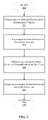
- FIG. 5is a flowchart of one embodiment of a method on an apparatus for determining a route having an estimated minimum fuel usage.
- FIG. 1depicts one embodiment of a navigation system 20 situated in a vehicle 22 for determining a suggested route having an estimated minimum fuel usage based at least on an estimated effect of speed of the vehicle on the efficiency of fuel consumption.
- the navigation system 20determines the suggested route further based on the number of estimated stops in a route and the estimated number of times the vehicle will slow down to turn.
- the vehicle 22is a means of transport on land such as a passenger car, sport utility vehicle, truck, scooter, or motorcycle.
- the vehicle 22includes a user 24 , a motive source 26 , a fuel 28 , and a fuel efficiency curve 30 .
- the user 24is a person such as the driver of the vehicle 22 or a passenger of the vehicle 22 .
- the user 24is remotely located from the vehicle 22 and communicates remotely with the navigation system 20 .
- the user 24can be a person remotely located assisting the driver of the vehicle 22 in navigating the vehicle 22 .
- the motive source 26is an internal combustion engine running on gasoline, or one of the many alternatives such as an electric motor using electricity.
- the motive source 26uses the fuel 28 .
- the fuel 28is gasoline, or a substitute or alternative such as diesel gasoline, alcohol, ethanol, hydrogen, natural gas, etc.
- the fuel 28is a battery or alternatively a fuel cell.
- the fuel efficiency curve 30is how efficiently the motive source 26 uses the fuel 28 to propel the vehicle 22 at different speeds of the vehicle 22 .
- a typical passenger carmight get 30 miles/gallon for a speed of 55 miles/hour, but only get 20 miles/gallon for a speed of 85 miles/hour.
- the fuel efficiency curve 30in this case would have miles/gallon on the vertical axis and miles/hour on the horizontal axis. There are many reasons why the efficiency of the motive source 26 varies depending on the speed of the vehicle 22 .
- the reasonsinclude reasons inherent to the design of the motive source 26 , reasons inherent to the design of the fuel 28 , e.g. a battery, reasons inherent to the design of the vehicle 22 , and reasons inherent to the physics of moving a vehicle 22 on the surface of the earth, including wind resistance.
- the navigation system 20includes a CPU 34 , a memory 36 , a communication device 38 , a GPS system 40 , a display device 42 , and an input device 44 , all of which are communicatively coupled with one each other. In some embodiments, the communication device 38 and/or the GPS system 40 are not included.
- the navigation system 20further includes a route determiner 46 disposed in the memory 36 and a street and road data 46 disposed in the memory 36 .
- the CPU 34is a central processing unit (“CPU”), or alternatively any device disposed for processing the instructions and data contained in the memory 36 .
- the memory 36is random access memory (“RAM”), and non-volatile storage of read-only memory (“ROM”), or alternatively a hard-disk, or flash memory.
- the memory 36is remotely located and accessed by the navigation system 20 by using the communication device 38 .
- the communication device 38has an antenna and electronics for transmitting and receiving signals such as GSM, or alternatively a local area network (LAN) signals such as 802.11.
- the communication device 38is shared with the GPS system 40 .
- the display device 42is an LCD display within the vehicle 22 or alternatively a speaker giving voice commands.
- the input device 44is a touch screen or alternatively a microphone with the CPU 34 disposed for voice recognition, or input device can be a keyboard.
- the display device 42 and the input device 44can be remotely located and in communication with the navigation system 20 over the communication device 38 .
- the display device 42can be a home computer LCD monitor and the input device 44 can be the mouse on the home computer with a friend of the driver of the vehicle 22 remotely aiding the driver in navigating the vehicle 22 .
- the GPS system 40includes an antenna 48 , a signal processor 50 , CPU 52 , and a memory 54 .
- GPS systems 40are well-known in the art.
- the antenna 48is for receiving signals from the GPS satellite constellation 60 .
- the signal processor 50is for processing the signals received from the GPS satellite constellation 60 into a digital format that the CPU 52 can process.
- the GPS system 40includes a separate CPU 52 and memory 54 enabled to process the signals received from the satellite constellation 60 and calculate a location on the surface of the Earth based on the received signals.
- the GPS system 40shares one or more of the antenna 48 , the signal process 50 , the CPU 52 , and the memory 54 , with the navigation system 20 .
- FIG. 2depicts the street and road data 58 , the route determiner 46 , a route 60 , and a suggested route 62 .
- the street and road data 58includes an aggregated efficiency data 64 , a user route preferences data 62 , a real-time route information data 64 , a segment information data 66 , and an actual driver behavior data 70 .
- street and road data 58is depicted as having a particular organization for ease of discussion that the data itself may be organized differently. For example, in some embodiments all the data in street and road data 58 resides in a single database.
- the aggregated efficiency data 64includes efficiency data that is not specific to the particular vehicle 22 , but rather based on aggregated efficiency data 64 for the vehicle 22 , such as the year the vehicle 22 was manufactured, or the number of cylinders of the vehicle 22 , or the make and the model of the vehicle 22 .
- Table 4 belowis an example of aggregated efficiency data 64 showing the estimated fuel efficiency curves 30 for vehicles 22 manufactured in the years 1973, 1984, or 1997.
- the aggregated efficiency data 64is used to approximate the fuel efficiency curve 30 for the vehicle 22 .
- User route preferences data 66includes, but is not necessarily limited to, data relevant to user route preferences such as whether the user 24 would like to avoid dangerous intersection, whether the user 24 would like to avoid frequent stops, and whether the user 24 would like to avoid highways or backstreets.
- Real-time route information data 68includes current traffic conditions, current accident reports, weather information, current construction sites, etc.
- Actual driver behavior data 70includes data collected from the driving behavior of a user 20 such as whether a user 20 regularly speeds, whether the user 20 accelerates fast and thus uses more fuel in a stop then a typical driver, etc.
- Segment information data 72includes the speed limit of streets, the direction of travel for streets, whether there is a stop sign or stop light at an intersection, bends in streets, length of streets, whether a vehicle 22 will need to slow down to turn, whether a vehicle will have to slow down due to a bend in the street, etc.
- the data 64 , 66 , 68 , 70 , 72is locally stored, or in the alternative the data 64 , 66 , 68 , 70 , 72 can be remotely stored. In some embodiments, the data 64 , 66 , 68 , 70 , 72 is partially stored locally and partially stored remotely.
- the route 60is a route from a start location 76 of a vehicle 22 to a destination location 78 for the vehicle 22 having one or more of a segment 80 .
- the start location 76 and the destination location 78are places on the surface of the Earth.
- the segment 80is a street, road, turnpike, or other path for a vehicle with a speed limit.
- the speed limit for a segment 80is estimated based on data in street and road data 58 .
- the route 60may contain turn information between two of the segments 80 and information regarding the intersection between two of the segments 80 .
- the suggested route 62is a selected one of one or more of the routes 60 having an estimated minimum fuel usage 74 .
- the estimated minimum fuel usage 74is calculated by the route determiner 46 . In some embodiments the estimated minimum fuel usage 74 is discarded and only the suggested route 62 is retained.
- the route determiner 46determines the suggested route 62 having an estimated minimum fuel usage 74 from a start location 76 of a vehicle 22 to a destination location 78 for the vehicle 22 based on estimated fuel efficiency for the vehicle 22 and further based on at least one estimated speed for the vehicle 22 for at least one segment 80 of the suggested route 62 .
- the route determiner 46is arranged to determine the start location 76 for the vehicle 22 by receiving input from the user 24 of the navigation system 20 using the input device 44 or in the alternative the route determiner 46 can determine a start location 76 for the vehicle 22 by receiving the current location from the GPS system 40 .
- the route determiner 46is arranged to receive the destination location 78 for the vehicle 22 from the user 24 using the input device 44 .
- the route determiner 46determines the route 60 by developing partial routes from both the start location 76 and the destination location 78 , always keeping the lower fuel use partial routes as the partial routes are expanded. Eventually the partial routes that started from the destination location 78 and the partial routes that started from the start location 76 meet to form complete routes 60 and these complete routes 60 are used to choose the suggested route 62 having the estimated minimum fuel usage 74 .
- the route determiner 46uses the data in segment information data 72 for estimating the number of stops and the estimated speed, and the estimated number of times the vehicle 22 will slow down to turn, and the estimated number of times the vehicle 22 will slow down due to a bend in the segment 80 .
- the route determiner 46uses the data in aggregated efficiency data 64 for estimating the fuel efficiency of the vehicle 22 which is based on aggregated data for the vehicle 22 .
- Table 4is an example of the type of data that is in aggregated efficiency data 64 and which is used to estimate the amount of fuel the vehicle 22 will use for a route 60 .
- the route determiner 46uses data gathered from the operation of the vehicle 22 for estimating the fuel efficiency of the vehicle 22 .
- the route determiner 46displays turn-by-turn instructions on display device 42 , guiding the driver of the vehicle 22 to the destination location 78 .
- the route determiner 46is arranged to continuously display on the display device 42 a recommended speed for the vehicle 22 to travel in order to attain the estimated minimum fuel usage 74 that was calculated for the suggested route 62 . In some embodiments, the route determiner 46 is arranged to continuously recalculate a new suggested route 62 based on the current location of the vehicle 22 .
- the route determiner 46is arranged to adjust calculations based on actual driver behavior data 70 in building the route 60 .
- the route determiner 46uses the speed limit of a segment 80 plus 10 miles per hour for the estimated speed in calculating the estimated amount of fuel that will be used for a user 22 that typically speeds 10 miles per hour over the speed limit.
- the route determiner 46is arranged to output for consumption by the user 22 a list of driving styles, for example “like to speed”, “don't usually speed”, etc., and receive from the input device 44 a selected driving style from the user 24 , and then determine the suggested route 62 based on this received driving style by basing calculations of estimated fuel usage using the received driving style of the user 24 .
- the route determiner 46is arranged to build the route 60 based on the real-time route information 68 by adjusting the estimated fuel usage for segments 80 with traffic delays. In some embodiments, the route determiner 46 is arranged to adjust the estimated speed of segments based on the use of real time route information 68 . In some embodiments, real time route information 68 includes historical route traffic information. In some embodiments, the route determiner 46 is arranged to reject one or more of the segment 80 or to add fuel usage to one or more of the segment 80 based on the user route preferences data 66 . For example, if a user 24 chooses to avoid dangerous intersections, the route determiner 46 will then in some embodiments not include a segment 80 if that segment 80 includes a dangerous intersection. In another example, the route determiner 46 only chooses a route 60 that does not include traveling on highways.
- FIG. 3depicts an example of three possible routes route A, route B, and route C from a start location to a destination location.
- Route Ahas 5 segments.
- Route Bhas 4 segments.
- Route Chas 5 segments.
- the three routesare alternatives for the route determiner 46 to select from in determining a suggested route 62 having an estimated minimum fuel usage 74 from the start location to the destination location.
- Table 1depicts information for route A. The information in Table 1 is stored in segment information data 72 .
- route Ahas 5 segments forming a route from the start location to the destination location.
- a segment in this embodimentis a street or multiple streets that have the same speed limit and do not include a right or left turn.
- Segment 1 of route Ais 8 miles long and has 2 extra nodes or cross streets (illustrated in FIG. 3 ) and has a speed limit of 35 miles per hour.
- An extra nodeis a cross street, where it is not known whether or not the vehicle 22 will have to stop at the cross street or not.
- the total length of the 5 segments in Route Ais 20 miles.
- the route determiner 46determines the “Time” column of Table 1.
- the “Time” columnis an estimated time for the vehicle 22 to travel the segment.
- the route determiner 46estimates that it will take the vehicle 22 0.2305 hours to travel segment 1 .
- the “Fuel” column of Table 1refers to an estimated amount of fuel for the vehicle 22 to travel segment 1 as calculated by the route determiner 46 .
- the route determiner 46estimates that it will take the vehicle 22 0.4280 fuel units to travel segment 1 .
- Fuel unitsare used rather than a specific unit of measure such as gallons since in this case the estimates for fuel use are based on aggregated data for the vehicle that includes data for vehicles that have different weights. It turns out that the fuel efficiency curve 30 has the same shape for different vehicles manufactured in the same year, but due to the weight differences of the vehicles the absolute values of fuel use are different, therefore to compensate a relative measure of fuel use is used by the route determiner 46 .
- Table 2 and FIG. 3is information regarding route B, having segment 1 , segment 2 , segment 3 , and segment 4 .
- Table 3 and FIG. 3is information regarding route C, having segment 1 , segment 2 , segment 3 , segment 4 , and segment 5 .
- the route determiner 46will determine which of the three candidate routes A, B, and C from the start location 76 to the destination location 78 , has the estimated minimum fuel usage 74 for a vehicle 22 .
- Table 4illustrates expected miles per gallon for a typical vehicle 22 manufactured in 1973, 1984, and 1997.
- the data in Table 4is stored in aggregated efficiency data 64 .
- the estimated fuel efficiencyis 30.5 miles/fuel unit 92 for a speed of 25 miles/hour; 31.2 miles/fuel unit 94 for a speed of 35 miles/hour; and, 29.2 miles/fuel unit 96 for a speed of 65 miles/hour.
- the estimated fuel efficiencyis for a typical vehicle 22 manufactured in 1973, 1984, or 1997. This data is then being used to estimate the actual fuel efficiency curve 30 of the vehicle 22 . For this example, we assume the vehicle 22 was manufactured in 1997.
- the aggregated data in Table 4is for a typical vehicle 22 manufactured in 1997, where relative measures of fuel efficiency were aggregated. The reason relative data was aggregated rather than absolute data is partially due to the differences in vehicle weight.
- the relative estimated fuel consumedis compared by the route determiner 46 .
- the fuel efficiency for 15 miles/houris 24.4 miles/gallon and the estimated fuel efficiency for 55 miles/hour is 32.4, so for any particular 1997 vehicle 22 , the fuel efficiency can be compared between the two speeds with, (32.4/24.4)*100, or a 1997 vehicle 22 is estimated to be 133 percent more efficient using fuel at 55 miles per hour than at 15 miles per hour.
- FIG. 4depicts a flow chart of an illustrative example of using the route determiner 46 .
- the route determiner 46estimates a relative amount of fuel usage for the vehicle 22 for a route 60 having n segments 80 , based on the estimated fuel efficiency for different speeds of the vehicle 22 from Table 4 and estimated speeds for the routes 60 using Table 1, Table 2, Table 3, and based on the number of nodes (cross streets where it is not known whether the vehicle will have to stop) in a route 60 using Table 1, Table 2, Table 3, the number of turns in a route 60 , the number of toll booths in a route 60 , and the number of estimated stops in a route 60 , where the number of estimated stops is estimated based on the speed limits of the segment 80 .
- route Athere are 5 segments depicted in FIG. 3 , and as illustrated in Table 1.
- the vehicle 22was manufactured in 1997.
- the total fuel estimateis set to zero.
- the route determiner 46will do the following statements for each segment of the route A where i will be the current segment.
- step 106look up fuel efficiency (“FE”) which is based on vehicle 22 and speed of segment 1 of route A.
- Table 1represents that the estimated speed, here the speed limit, for segment 1 of route A is 35 mile/hour.
- Table 4represents that the estimated fuel efficiency for a 1997 vehicle 22 at a speed of 35 miles/hour is 31.2 miles/fuel unit.
- step 110it is determined whether this is a restricted access segment?. Segment 1 of route A is not a restricted access segment (from Table 1).
- step 112it is determined whether there is a toll booth on this segment? Segment 1 of route A does not a toll booth (from Table 1).
- step 116it is determined whether segment 1 's speed class is greater than 25 mph?
- Segment 1 of route A speed classis 35 mph (from Table 1), so the answer is yes.
- the speedis being used here to estimate the number of stops in that it is not known if there is a stop sign or light at an intersection, but a heuristic is used based on the speed limit of the segment.
- a nodeis an intersection, where the vehicle 22 may have to stop.
- F 10.423 as just calculated and as represented in Table 1 for segment 1 of route A.
- the methodcontinues back to step 104 where i is incremented to 2 and then F 2 is calculated in a similar manner as F 1 was just calculated.
- the methodcontinues through each remaining segment 2 , 3 , 4 , 5 and then the estimated fuel for each segment is added to give 1.2417 as depicted in Table 1 for route A.
- This relative fuel usage estimate for route Acan then be compared to the relative fuel usage estimate of route B , 1.3168 from Table 2 and to route C 1.4581 from Table 3.
- Route Athen has the least estimated fuel usage and so the route determiner 46 would assign route A as the suggested route 62 having the estimated minimum fuel usage 74 .
- route B illustrated in Table 2is the shortest in length at 16 miles, but uses more fuel than route A illustrated in Table 1.
- Route C illustrated in Table 3has the fastest estimated time at 0.5213 hours, compared to 0.5906 hours for Route A.
- FIG. 5depicts an embodiment of a method that is performed by the system of FIG. 1 for determining a suggested route 62 having an estimated minimum fuel usage 74 .
- the flowstarts at Block 200 .
- the flowcontinues with Block 202 determining at a computer device a start location 76 for a vehicle 22 . This is accomplished by the GPS system 40 of FIG. 1 , or in another embodiment received from a user 24 .
- the flowproceeds to Block 204 receiving at a computer device a destination location 78 .
- the destination location 78is received from an input device 44 by the user 24 .
- the destination location 78is received across a communication link.
- the flowproceeds to Block 206 determining a suggested route 62 having an estimated minimum fuel usage 74 from the start location 76 to the destination location 78 for the vehicle 22 based on estimated fuel efficiency for the vehicle 22 and further based on at least one estimated speed for at least a portion of the route 60 .
- the suggested route 62is be determined locally by the navigation system 20 of the vehicle 22 , or alternatively it is determined across a communication device 38 .
- the estimated fuel efficiency of the vehicle 22is based on the year the vehicle 22 was manufactured or the number of cylinders of the vehicle 22 , or on the make and model of the vehicle 22 , or another source of information such as historical fuel usage, measured fuel usage, etc.
- the flowproceeds to Block 208 to outputting at a display device 42 the route for consumption by a user 24 .
- the suggested route 62is displayed on the display device 42 in street by street directions. Alternatively, the suggested route 62 could be communicated to the user 24 by use of a speaker.
Landscapes
- Engineering & Computer Science (AREA)
- Radar, Positioning & Navigation (AREA)
- Remote Sensing (AREA)
- Automation & Control Theory (AREA)
- Physics & Mathematics (AREA)
- General Physics & Mathematics (AREA)
- Navigation (AREA)
Abstract
Description
| TABLE 1 |
| Route A Determination |
| Length | Extra | Speed | ||||
| Segment | (miles) | Nodes | m/ | Time | Fuel | |
| 1 | 8 | 2 | 35 | 0.2305 | 0.4230 |
| 2 | 7 | 0 | 35 | 0.2013 | 0.3243 |
| 3 | 1 | 0 | 35 | 0.0299 | 0.1320 |
| 4 | 3 | 0 | 35 | 0.0873 | 0.2294 |
| 5 | 1 | 1 | 25 | 0.0413 | 0.1327 |
| Totals: | 20 | 0.5906 | 1.2417 | ||
| TABLE 2 |
| Route B Determination |
| Length | Extra | Speed | ||||
| Segment | (miles) | Nodes | m/ | Time | Fuel | |
| 1 | 3.5 | 3 | 25 | 0.1422 | 0.3147 |
| 2 | 0.5 | 1 | 35 | 0.0187 | 0.1493 |
| 3 | 10 | 5 | 35 | 0.2884 | 0.5871 |
| 4 | 2 | 1 | 25 | 0.0816 | 0.2655 |
| Totals: | 16 | 0.5311 | 1.3168 | ||
| TABLE 3 |
| Route C Determination |
| Length | Extra | Speed | ||||
| Segment | (miles) | Nodes | m/ | Time | Fuel | |
| 1 | 1 | 0 | 35 | 0.0299 | 0.1320 |
| 2 | 1.5 | 0 | 25 | 0.0613 | 0.1491 |
| 3 | 22 | 0 | 65 | 0.3398 | 0.8534 |
| 4 | 0.75 | 0 | 25 | 0.0313 | 0.1245 |
| 5 | 2 | 1 | 35 | 0.0588 | 0.1989 |
| Totals: | 27.25 | 0.5213 | 1.4581 | ||
| TABLE 4 |
| Expected mile/gallon for a typical vehicle manufactured |
| in 1973, 1984, and 1997 |
| Speed | ||||
| (Miles/hour) | 1973 | 1984 | 1997 | |
| 15 | d | 21.1 | 24.4 | |
| 20 | d | 25.5 | 27.9 | |
| 25 | d | 30.0 | 30.5 |  |
| 30 | 21.1 | 31.8 | 31.7 | |
| 35 | 21.1 | 33.6 | 31.2 | |
| 40 | 21.1 | 33.6 | 31.0 | |
| 45 | 20.3 | 33.5 | 31.6 | |
| 50 | 19.5 | 31.9 | 32.4 | |
| 55 | 18.5 | 30.3 | 32.4 | |
| 60 | 17.5 | 27.6 | 31.4 | |
| 65 | 16.2 | 24.9 | 29.2 | |
| 70 | 14.9 | 22.5 | 26.8 | |
| 75 | d | 20.0 | 24.8 | |
Claims (20)
Priority Applications (3)
| Application Number | Priority Date | Filing Date | Title |
|---|---|---|---|
| US11/684,301US7783417B2 (en) | 2007-03-09 | 2007-03-09 | Methods and apparatus for determining a route having an estimated minimum fuel usage for a vehicle |
| DE112008000625TDE112008000625T5 (en) | 2007-03-09 | 2008-01-10 | Method and apparatus for determining a route with an estimated minimum fuel consumption for a vehicle |
| PCT/US2008/050759WO2008112335A1 (en) | 2007-03-09 | 2008-01-10 | Methods and apparatus for determining a route having an estimated minimum fuel usage for a vehicle |
Applications Claiming Priority (1)
| Application Number | Priority Date | Filing Date | Title |
|---|---|---|---|
| US11/684,301US7783417B2 (en) | 2007-03-09 | 2007-03-09 | Methods and apparatus for determining a route having an estimated minimum fuel usage for a vehicle |
Publications (2)
| Publication Number | Publication Date |
|---|---|
| US20080221787A1 US20080221787A1 (en) | 2008-09-11 |
| US7783417B2true US7783417B2 (en) | 2010-08-24 |
Family
ID=39742492
Family Applications (1)
| Application Number | Title | Priority Date | Filing Date |
|---|---|---|---|
| US11/684,301Active2027-12-05US7783417B2 (en) | 2007-03-09 | 2007-03-09 | Methods and apparatus for determining a route having an estimated minimum fuel usage for a vehicle |
Country Status (3)
| Country | Link |
|---|---|
| US (1) | US7783417B2 (en) |
| DE (1) | DE112008000625T5 (en) |
| WO (1) | WO2008112335A1 (en) |
Cited By (26)
| Publication number | Priority date | Publication date | Assignee | Title |
|---|---|---|---|---|
| US20060291396A1 (en)* | 2005-06-27 | 2006-12-28 | Monplaisir Hamilton | Optimizing driving directions |
| US20070249284A1 (en)* | 2004-07-15 | 2007-10-25 | Ken Asami | Mover, Information Center, and Mobile Communication System |
| US20090082952A1 (en)* | 2007-09-26 | 2009-03-26 | Denso Corporation | Route Search Apparatus |
| US20090222338A1 (en)* | 2008-03-03 | 2009-09-03 | Hamilton Ii Rick A | Monitoring and Rewards Methodologies for "Green" Use of Vehicles |
| US20100106407A1 (en)* | 2007-06-11 | 2010-04-29 | Wataru Yamazaki | Navigation system |
| US20100114473A1 (en)* | 2008-10-31 | 2010-05-06 | Clarion Co., Ltd. | Navigation Device and Navigation Method |
| US20110029168A1 (en)* | 2007-07-06 | 2011-02-03 | Howard Barry Talberg | Route oriented paradigm for hybrid vehicles using route calculation and system utilizing same |
| US20110279255A1 (en)* | 2010-05-11 | 2011-11-17 | Denso Corporation | Route retrieval apparatus and navigation apparatus |
| US20120022781A1 (en)* | 2008-12-22 | 2012-01-26 | Tele Atlas North America Inc. | Methods, Devices and Map Databases for Green Routing |
| US20120072049A1 (en)* | 2009-05-29 | 2012-03-22 | Siemens Aktiengesellschaft | Computer-supported monitoring of an energy consumption of a means of transportation |
| US8155868B1 (en)* | 2009-03-31 | 2012-04-10 | Toyota Infotechnology Center Co., Ltd. | Managing vehicle efficiency |
| US20130173147A1 (en)* | 2010-09-22 | 2013-07-04 | Denso Corporation | Section setting method, mileage information generation device, and operation assist device |
| US20130245870A1 (en)* | 2010-03-30 | 2013-09-19 | Honda Motor Co., Ltd. | Minimum Energy Route For A Motor Vehicle |
| US8706416B2 (en) | 2012-04-03 | 2014-04-22 | Ford Global Technologies, Llc | System and method for determining a vehicle route |
| US20140236434A1 (en)* | 2013-02-21 | 2014-08-21 | Vivek A. Sujan | System and method for route identification using a low cost gps system |
| US20140365105A1 (en)* | 2008-10-31 | 2014-12-11 | Clarion Co., Ltd. | Navigation System and Navigation Method of Route Planning Using Variations of Mechanical Energy |
| US8935090B2 (en) | 2010-03-30 | 2015-01-13 | Honda Motor Co., Ltd. | Energy mapping systems |
| US9020664B2 (en) | 2013-04-15 | 2015-04-28 | Honeywell International Inc. | Methods and systems for displaying procedure information on an aircraft display |
| US20150158397A1 (en)* | 2013-12-05 | 2015-06-11 | Ford Global Technologies, Llc | Method and Apparatus for Predicting Electric Vehicle Energy Consumption |
| US20150369620A1 (en)* | 2013-01-16 | 2015-12-24 | Lg Electronics Inc. | Electronic device and control method for the electronic device |
| US9709969B2 (en) | 2013-03-15 | 2017-07-18 | Deere & Company | Methods and apparatus to control machine configurations |
| US20170307391A1 (en)* | 2009-11-24 | 2017-10-26 | Telogis, Inc. | Vehicle route selection based on energy usage |
| US10161754B2 (en)* | 2012-07-17 | 2018-12-25 | Nissan Motor Co., Ltd. | Driving assistance system and driving assistance method |
| US10281296B2 (en)* | 2014-01-16 | 2019-05-07 | Ford Global Technologies, Llc | Method and apparatus for electric vehicle trip and recharge planning |
| US10317908B2 (en) | 2017-08-11 | 2019-06-11 | Toyota Motor Engineering & Manufacturing North America, Inc. | Peak efficiency recommendation and sharing |
| US20210166275A1 (en)* | 2019-03-12 | 2021-06-03 | Xevo Inc. | System and method for providing content to a user based on a predicted route identified from audio or images |
Families Citing this family (51)
| Publication number | Priority date | Publication date | Assignee | Title |
|---|---|---|---|---|
| US9067565B2 (en) | 2006-05-22 | 2015-06-30 | Inthinc Technology Solutions, Inc. | System and method for evaluating driver behavior |
| US7859392B2 (en) | 2006-05-22 | 2010-12-28 | Iwi, Inc. | System and method for monitoring and updating speed-by-street data |
| US7865298B2 (en)* | 2007-05-03 | 2011-01-04 | Ford Motor Company | System and method for providing route information to a driver of a vehicle |
| US9129460B2 (en) | 2007-06-25 | 2015-09-08 | Inthinc Technology Solutions, Inc. | System and method for monitoring and improving driver behavior |
| US8818618B2 (en)* | 2007-07-17 | 2014-08-26 | Inthinc Technology Solutions, Inc. | System and method for providing a user interface for vehicle monitoring system users and insurers |
| US9117246B2 (en) | 2007-07-17 | 2015-08-25 | Inthinc Technology Solutions, Inc. | System and method for providing a user interface for vehicle mentoring system users and insurers |
| US8554475B2 (en) | 2007-10-01 | 2013-10-08 | Mitac International Corporation | Static and dynamic contours |
| US8290703B2 (en) | 2008-01-18 | 2012-10-16 | Mitac International Corporation | Method and apparatus for access point recording using a position device |
| US8498808B2 (en) | 2008-01-18 | 2013-07-30 | Mitac International Corp. | Method and apparatus for hybrid routing using breadcrumb paths |
| US8700314B2 (en) | 2008-01-18 | 2014-04-15 | Mitac International Corporation | Method and apparatus to search for local parking |
| US8374781B2 (en)* | 2008-07-09 | 2013-02-12 | Chrysler Group Llc | Method for vehicle route planning |
| US8249804B2 (en) | 2008-08-20 | 2012-08-21 | Mitac International Corporation | Systems and methods for smart city search |
| US8326525B2 (en)* | 2008-08-25 | 2012-12-04 | Honda Motor Co., Ltd. | Navigation server |
| US8219317B2 (en) | 2008-09-22 | 2012-07-10 | Mitac International Corporation | Route navigation via a proximity point |
| US10161758B2 (en) | 2009-01-16 | 2018-12-25 | Tomtom Global Content B.V. | Method for creating speed profiles for digital maps |
| US8963702B2 (en) | 2009-02-13 | 2015-02-24 | Inthinc Technology Solutions, Inc. | System and method for viewing and correcting data in a street mapping database |
| US9008955B2 (en)* | 2009-05-05 | 2015-04-14 | GM Global Technology Operations LLC | Route planning system for vehicles |
| DE112010003789T5 (en)* | 2009-09-24 | 2012-11-29 | Mitsubishi Electric Corporation | DRIVING PATTERN GENERATION DEVICE |
| US8793067B2 (en)* | 2009-12-28 | 2014-07-29 | Honda Motor Co., Ltd. | Route searching device |
| US9046379B2 (en)* | 2009-12-28 | 2015-06-02 | Honda Motor Co., Ltd. | Devices and methods for determining fuel consumption and searching vehicle routes |
| EP2354762B1 (en) | 2010-02-05 | 2013-11-27 | Harman Becker Automotive Systems GmbH | Navigation system and method for determining parameters in a navigation system |
| DE102010003723A1 (en)* | 2010-04-08 | 2011-10-13 | Robert Bosch Gmbh | Navigational method for determining consumption-optimized route of motor car, involves determining consumption value of motor car on portion based on another consumption value detected on another portion of road network |
| DE102010018334A1 (en)* | 2010-04-27 | 2011-10-27 | Gm Global Technology Operations Llc (N.D.Ges.D. Staates Delaware) | Navigation device for a vehicle |
| US20110320113A1 (en)* | 2010-06-25 | 2011-12-29 | Gm Global Technology Operations, Inc. | Generating driving route traces in a navigation system using a probability model |
| US20120016576A1 (en)* | 2010-07-13 | 2012-01-19 | Telenav, Inc. | Navigation system with ecological route based destination guidance mechanism and method of operation thereof |
| DE102010027172B4 (en)* | 2010-07-14 | 2013-09-26 | Deutsches Zentrum für Luft- und Raumfahrt e.V. | Method and device for determining a minimum energy route |
| JP5549520B2 (en)* | 2010-10-08 | 2014-07-16 | アイシン・エィ・ダブリュ株式会社 | Route related information providing apparatus, route related information providing method, route related information providing program, and route guidance system |
| US8755993B2 (en)* | 2011-03-08 | 2014-06-17 | Navteq B.V. | Energy consumption profiling |
| EP2557395A1 (en) | 2011-08-11 | 2013-02-13 | Harman Becker Automotive Systems GmbH | Method and system for navigation |
| US8892359B2 (en)* | 2013-01-11 | 2014-11-18 | Toyota Motor Engineering & Manufacturing North America, Inc. | Systems and methods for estimating time of arrival for vehicle navigation |
| JP6205919B2 (en)* | 2013-07-10 | 2017-10-04 | 住友電気工業株式会社 | Information estimation device for electric vehicles, route search system, and computer program |
| US9557179B2 (en)* | 2013-08-20 | 2017-01-31 | Qualcomm Incorporated | Navigation using dynamic speed limits |
| US9172477B2 (en) | 2013-10-30 | 2015-10-27 | Inthinc Technology Solutions, Inc. | Wireless device detection using multiple antennas separated by an RF shield |
| KR102113769B1 (en)* | 2013-11-26 | 2020-05-21 | 현대모비스 주식회사 | Warning Apparatus and Method for Safe-Driving Assistance Service Based on V2X |
| US20210009136A1 (en)* | 2014-03-03 | 2021-01-14 | Inrix, Inc. | Presenting geographic search results using location projection and time windows |
| US10692370B2 (en)* | 2014-03-03 | 2020-06-23 | Inrix, Inc. | Traffic obstruction detection |
| US9008858B1 (en)* | 2014-03-31 | 2015-04-14 | Toyota Motor Engineering & Manufacturing North America, Inc. | System and method for providing adaptive vehicle settings based on a known route |
| US9759573B2 (en) | 2014-08-29 | 2017-09-12 | Ford Global Technologies, Llc | Route based energy consumption estimation using physical models |
| US9476719B2 (en) | 2014-08-29 | 2016-10-25 | Ford Global Technologies, Llc | Route-based distance to empty calculation for a vehicle |
| US10048082B2 (en) | 2014-08-29 | 2018-08-14 | Ford Global Technologies, Llc | Route and model based energy estimation |
| US9429436B2 (en) | 2015-01-13 | 2016-08-30 | Toyota Motor Engineering & Manufacturing North America, Inc. | Estimated time of arrival for vehicle navigation |
| CN105517675B (en)* | 2015-07-16 | 2018-02-02 | 深圳市锐明技术股份有限公司 | Method and system for speed limit of vehicles by section |
| CN105354221A (en)* | 2015-09-30 | 2016-02-24 | 百度在线网络技术(北京)有限公司 | Path query method and apparatus |
| US9970780B2 (en)* | 2015-11-19 | 2018-05-15 | GM Global Technology Operations LLC | Method and apparatus for fuel consumption prediction and cost estimation via crowd sensing in vehicle navigation system |
| US10885783B2 (en)* | 2018-06-29 | 2021-01-05 | Palo Alto Research Center Incorporated | Generating collaboratively optimal transport plans |
| US11067403B2 (en)* | 2018-07-05 | 2021-07-20 | GM Global Technology Operations LLC | Vehicle energy usage tracking |
| CN109191886A (en)* | 2018-08-29 | 2019-01-11 | 汽解放汽车有限公司 | A kind of fleet's paths planning method based on big data analysis platform |
| JP2021018091A (en)* | 2019-07-18 | 2021-02-15 | 株式会社エムティーアイ | Programs and information processing equipment |
| DE102021111427A1 (en) | 2021-05-04 | 2022-11-10 | Bayerische Motoren Werke Aktiengesellschaft | Method for operating a motor vehicle, control unit and motor vehicle |
| US12287216B2 (en)* | 2022-10-06 | 2025-04-29 | Rivian Ip Holdings, Llc | High-definition energy consumption map for vehicles |
| US20250198776A1 (en)* | 2023-12-15 | 2025-06-19 | Adeia Guides Inc. | System and methods for delivering fueling plans |
Citations (136)
| Publication number | Priority date | Publication date | Assignee | Title |
|---|---|---|---|---|
| US5515283A (en) | 1994-06-20 | 1996-05-07 | Zexel Corporation | Method for identifying highway access ramps for route calculation in a vehicle navigation system |
| US5742922A (en) | 1996-02-12 | 1998-04-21 | Hyundai Motor Company | Vehicle navigation system and method for selecting a route according to fuel consumption |
| US5802492A (en) | 1994-06-24 | 1998-09-01 | Delorme Publishing Company, Inc. | Computer aided routing and positioning system |
| KR19990011004A (en) | 1997-07-21 | 1999-02-18 | 홍종만 | Parking lot guidance system and method |
| KR19990040849U (en) | 1998-05-02 | 1999-12-06 | 신석균 | Pyramid box |
| US6067502A (en) | 1996-08-21 | 2000-05-23 | Aisin Aw Co., Ltd. | Device for displaying map |
| US6078864A (en) | 1998-07-17 | 2000-06-20 | Magellan Dis, Inc. | Navigation system with predetermined indication of next maneuver |
| US6081609A (en) | 1996-11-18 | 2000-06-27 | Sony Corporation | Apparatus, method and medium for providing map image information along with self-reproduction control information |
| US6084989A (en) | 1996-11-15 | 2000-07-04 | Lockheed Martin Corporation | System and method for automatically determining the position of landmarks in digitized images derived from a satellite-based imaging system |
| US6092076A (en) | 1998-03-24 | 2000-07-18 | Navigation Technologies Corporation | Method and system for map display in a navigation application |
| US6108603A (en) | 1998-04-07 | 2000-08-22 | Magellan Dis, Inc. | Navigation system using position network for map matching |
| US6108604A (en) | 1997-08-08 | 2000-08-22 | Aisin Aw Co., Ltd. | Vehicular navigation system and storage medium |
| US6107944A (en) | 1994-06-24 | 2000-08-22 | Navigation Technologies Corporation | Electronic navigation system and method |
| US6115669A (en) | 1996-02-01 | 2000-09-05 | Aisin Aw Co., Ltd. | Navigation system for vehicles and waypoint entering and storage method |
| US6124826A (en) | 1994-10-07 | 2000-09-26 | Mannesmann Aktiengesellschaft | Navigation device for people |
| US6125326A (en) | 1996-09-30 | 2000-09-26 | Mazda Motor Corporation | Navigation system |
| US6141621A (en) | 1996-08-02 | 2000-10-31 | Magellan Dis, Inc. | Method of providing a textual description of a remote vehicle location |
| US6148261A (en) | 1997-06-20 | 2000-11-14 | American Calcar, Inc. | Personal communication system to send and receive voice data positioning information |
| US6151552A (en) | 1997-08-28 | 2000-11-21 | Denso Corporation | Route guidance apparatus |
| US6154699A (en) | 1995-10-06 | 2000-11-28 | Williams; Brian | Gritting systems and methods |
| US6163269A (en) | 1998-05-05 | 2000-12-19 | Magellan Dis, Inc. | Navigation system with anti-alias map display |
| US6172641B1 (en) | 1998-04-09 | 2001-01-09 | Magellan Dis, Inc. | Navigation system with audible route guidance instructions |
| US6175801B1 (en) | 1998-06-19 | 2001-01-16 | Magelan Dts, Inc. | Navigation system map panning directional indicator |
| US6178380B1 (en) | 1998-10-22 | 2001-01-23 | Magellan, Dis, Inc. | Street identification for a map zoom of a navigation system |
| US6177943B1 (en) | 1996-11-08 | 2001-01-23 | Jed Margolin | Digital map compression and display method |
| US6184823B1 (en) | 1998-05-01 | 2001-02-06 | Navigation Technologies Corp. | Geographic database architecture for representation of named intersections and complex intersections and methods for formation thereof and use in a navigation application program |
| US6189130B1 (en) | 1998-04-30 | 2001-02-13 | International Business Machines Corporation | System and method for determining density maps in hierarchical designs |
| US6201540B1 (en) | 1998-01-07 | 2001-03-13 | Microsoft Corporation | Graphical interface components for in-dash automotive accessories |
| US6204778B1 (en) | 1998-05-15 | 2001-03-20 | International Road Dynamics Inc. | Truck traffic monitoring and warning systems and vehicle ramp advisory system |
| US6205397B1 (en) | 1999-08-03 | 2001-03-20 | At&T Corp | Route engineering technique |
| US6212474B1 (en) | 1998-11-19 | 2001-04-03 | Navigation Technologies Corporation | System and method for providing route guidance with a navigation application program |
| US6223118B1 (en) | 1998-05-15 | 2001-04-24 | Kabushiki Kaisha Equos Research | Vehicle deceleration control unit |
| US6229546B1 (en) | 1997-09-09 | 2001-05-08 | Geosoftware, Inc. | Rapid terrain model generation with 3-D object features and user customization interface |
| US6249740B1 (en) | 1998-01-21 | 2001-06-19 | Kabushikikaisha Equos Research | Communications navigation system, and navigation base apparatus and vehicle navigation apparatus both used in the navigation system |
| US6252814B1 (en) | 1999-04-29 | 2001-06-26 | International Business Machines Corp. | Dummy wordline circuitry |
| US6253151B1 (en) | 2000-06-23 | 2001-06-26 | Navigation Technologies Corp. | Navigation system with feature for reporting errors |
| US6256029B1 (en) | 1998-03-10 | 2001-07-03 | Magellan, Dis, Inc. | Navigation system with all character support |
| JP2001194172A (en) | 2000-01-14 | 2001-07-19 | Hitachi Ltd | Navigation device and information distribution device |
| US6278942B1 (en) | 2000-03-21 | 2001-08-21 | Navigation Technologies Corp. | Method and system for providing routing guidance |
| US20010018628A1 (en)* | 1997-03-27 | 2001-08-30 | Mentor Heavy Vehicle Systems, Lcc | System for monitoring vehicle efficiency and vehicle and driver perfomance |
| US6308134B1 (en) | 1996-12-27 | 2001-10-23 | Magellan Dis, Inc. | Vehicle navigation system and method using multiple axes accelerometer |
| US6320517B1 (en) | 1997-06-20 | 2001-11-20 | Mitsubishi Denki Kabushiki Kaisha | Map information displaying device |
| US6321158B1 (en) | 1994-06-24 | 2001-11-20 | Delorme Publishing Company | Integrated routing/mapping information |
| JP2002048574A (en) | 2000-07-31 | 2002-02-15 | Fujitsu Ten Ltd | Map information distribution method and map information distribution system |
| US6349257B1 (en) | 1999-09-15 | 2002-02-19 | International Business Machines Corporation | System for personalized mobile navigation information |
| US6356210B1 (en) | 1996-09-25 | 2002-03-12 | Christ G. Ellis | Portable safety mechanism with voice input and voice output |
| US6360167B1 (en) | 1999-01-29 | 2002-03-19 | Magellan Dis, Inc. | Vehicle navigation system with location-based multi-media annotation |
| US6363322B1 (en) | 1999-12-22 | 2002-03-26 | Magellan Dis, Inc. | Navigation system with unique audio tones for maneuver notification |
| US6362751B1 (en) | 1998-06-11 | 2002-03-26 | Magellan Dis, Inc. | Navigation system with a route exclusion list system |
| US6370475B1 (en) | 1997-10-22 | 2002-04-09 | Intelligent Technologies International Inc. | Accident avoidance system |
| US6377278B1 (en) | 1995-05-02 | 2002-04-23 | Amesmaps, Llc | Method and apparatus for generating digital map images of a uniform format |
| US6381536B1 (en) | 1999-06-21 | 2002-04-30 | Nissan Motor Co., Ltd. | Apparatus for generating road information from stored digital map database |
| US6385535B2 (en) | 2000-04-07 | 2002-05-07 | Alpine Electronics, Inc. | Navigation system |
| US6385542B1 (en) | 2000-10-18 | 2002-05-07 | Magellan Dis, Inc. | Multiple configurations for a vehicle navigation system |
| US6397145B1 (en) | 2000-03-06 | 2002-05-28 | Magellan Dis, Inc. | Navigation system with complex maneuver instruction |
| US6405130B1 (en) | 1996-12-11 | 2002-06-11 | Magellan Dis, Inc. | Navigation system using forward-looking origin selection for route re-calculation |
| US6408243B1 (en) | 2000-10-26 | 2002-06-18 | Honda Giken Kogyo Kabushiki Kaisha | Service delivery system |
| US6427115B1 (en) | 1999-06-23 | 2002-07-30 | Toyota Jidosha Kabushiki Kaisha | Portable terminal and on-vehicle information processing device |
| US6430501B1 (en) | 2000-01-19 | 2002-08-06 | Magellan Dis, Inc. | Navigation system with route indicators |
| US6453235B1 (en) | 1995-12-28 | 2002-09-17 | Alpine Electronics Inc. | Vehicle navigation apparatus providing proper guidance for off-road net conditions |
| US20020151315A1 (en) | 2000-12-13 | 2002-10-17 | Gravitate, Inc. | Managing and querying moving point data |
| KR20020084716A (en) | 2001-05-02 | 2002-11-11 | 엘지이노텍 주식회사 | Method and system serving for navigation and parking information via network |
| US6484089B1 (en) | 1999-10-15 | 2002-11-19 | Magellan Dis, Inc. | Navigation system with road condition sampling |
| US6487494B2 (en) | 2001-03-29 | 2002-11-26 | Wingcast, Llc | System and method for reducing the amount of repetitive data sent by a server to a client for vehicle navigation |
| US6515595B1 (en) | 1997-06-20 | 2003-02-04 | American Calcar, Inc. | Personal communication and positioning system |
| US20030036848A1 (en) | 2001-08-16 | 2003-02-20 | Sheha Michael A. | Point of interest spatial rating search method and system |
| US20030036842A1 (en) | 1996-08-22 | 2003-02-20 | Go2 Systems, Inc. | Nesting grid structure for a geographic referencing system and method of creating and using the same |
| US6529822B1 (en) | 2000-04-11 | 2003-03-04 | Magellan Dis, Inc. | Navigation system with zoomed maneuver instruction |
| US6539301B1 (en) | 1996-08-02 | 2003-03-25 | Magellan Dis, Inc. | System and method for controlling a vehicle emergency response network |
| US6565610B1 (en) | 1999-02-11 | 2003-05-20 | Navigation Technologies Corporation | Method and system for text placement when forming maps |
| US6574551B1 (en) | 1998-05-05 | 2003-06-03 | Magellan Dis, Inc. | Autoscaling of recommended route |
| US20030167120A1 (en) | 2002-02-26 | 2003-09-04 | Shingo Kawasaki | Vehicle navigation device and method of displaying POI information using same |
| US6631322B1 (en) | 2002-12-06 | 2003-10-07 | General Electric Co. | Method and apparatus for vehicle management |
| US20030191578A1 (en) | 2000-03-14 | 2003-10-09 | Cynthia Paulauskas | Method and system for providing reminders about points of interests while traveling |
| US6704649B2 (en) | 2001-07-31 | 2004-03-09 | Pioneer Corporation | Satellite navigation system of which map data are partially updateable |
| US20040049339A1 (en)* | 2000-07-04 | 2004-03-11 | Markus Kober | Assistance system for selecting routes |
| US6728636B2 (en) | 2001-09-26 | 2004-04-27 | Kabushiki Kaisha Toshiba | Destination guidance system and method for generating individually tailored routes within a complex structure |
| US6728608B2 (en) | 2002-08-23 | 2004-04-27 | Applied Perception, Inc. | System and method for the creation of a terrain density model |
| US6748323B2 (en) | 2002-07-31 | 2004-06-08 | Thales North America, Inc. | Displaying data |
| KR20040063088A (en) | 2003-01-04 | 2004-07-12 | 박용성 | An Automobile Fuel Consumption and Driving Fuel Economy Measurement Device |
| US6774932B1 (en) | 2000-09-26 | 2004-08-10 | Ewing Golf Associates, Llc | System for enhancing the televised broadcast of a golf game |
| US6782319B1 (en) | 2002-11-26 | 2004-08-24 | Navteq North America, Llc | Method for organizing map data |
| US6816596B1 (en) | 2000-01-14 | 2004-11-09 | Microsoft Corporation | Encrypting a digital object based on a key ID selected therefor |
| US6819301B2 (en) | 2002-10-23 | 2004-11-16 | Hitachi, Ltd. | Information providing system and information providing apparatus for mobile object |
| KR20040106688A (en) | 2003-06-11 | 2004-12-18 | 현대자동차주식회사 | Parking guide service apparatus of vehicle and method thereof |
| US6842695B1 (en) | 2001-04-17 | 2005-01-11 | Fusionone, Inc. | Mapping and addressing system for a secure remote access system |
| US20050021226A1 (en)* | 2003-07-25 | 2005-01-27 | Mario Kustosch | Method for operating a vehicle |
| US6873907B1 (en) | 1998-05-05 | 2005-03-29 | Magellan Dis, Inc. | Navigation system with user interface |
| US6885874B2 (en) | 2001-11-27 | 2005-04-26 | Motorola, Inc. | Group location and route sharing system for communication units in a trunked communication system |
| US20050107948A1 (en) | 2003-11-14 | 2005-05-19 | Bernard Catalinotto | System and method for establishing a local page and grid numbering system in a geographic referencing system |
| US6917982B1 (en) | 1998-12-19 | 2005-07-12 | International Business Machines Corporation | Method and system for controlling package-oriented network traffic |
| US6938028B1 (en) | 1998-09-21 | 2005-08-30 | Fuji Photo Film Co., Ltd. | Image encrypting method, image encrypting device, recording medium on which image encrypting procedures are recorded, and recording medium on which encrypted image file is recorded |
| KR20060028237A (en) | 2004-09-24 | 2006-03-29 | 엘지전자 주식회사 | Path search method considering user preference |
| US20060080031A1 (en) | 2004-09-07 | 2006-04-13 | Cooper Clive W | System and method of wireless downloads of map and geographic based data to portable computing devices |
| US7031836B2 (en) | 2003-10-28 | 2006-04-18 | Thales Navigation, Inc. | Grid mapping utility for a GPS device |
| US7031834B2 (en) | 2002-12-24 | 2006-04-18 | Denso Corporation | Navigation system |
| US20060089788A1 (en) | 2004-10-22 | 2006-04-27 | Tom Laverty | Method and apparatus for navigation system for searching easily accessible POI along route |
| US20060106534A1 (en) | 2002-10-22 | 2006-05-18 | Yukihiro Kawamata | Map data delivering method for communication-type navigation system |
| US20060212217A1 (en) | 2004-10-01 | 2006-09-21 | Networks In Motion, Inc. | Method and system for enabling an off board navigation solution |
| JP2006250875A (en) | 2005-03-14 | 2006-09-21 | Alpine Electronics Inc | Navigation device and method for correcting position of mobile body |
| KR20060101929A (en) | 2005-03-22 | 2006-09-27 | 주식회사 현대오토넷 | Fuel Consumption Prediction System and Method of Navigation System |
| US20060265422A1 (en) | 2005-03-15 | 2006-11-23 | Sony Corporation | Point searching apparatus and method of searching |
| US7170518B1 (en) | 2000-03-27 | 2007-01-30 | Magellan Dis, Inc. | Selective rendering of cartographic entities for a navigation system |
| US20070027628A1 (en) | 2003-06-02 | 2007-02-01 | Palmtop Software B.V. | A personal gps navigation device |
| US20070073480A1 (en) | 2005-09-23 | 2007-03-29 | Mona Singh | System and method for selecting and presenting a route to a user |
| US20070088494A1 (en) | 2004-06-29 | 2007-04-19 | Rothman Michael A | System and method for enabling wireless traffic message passing |
| US20070130153A1 (en) | 2005-12-02 | 2007-06-07 | Palm, Inc. | Techniques to communicate and process location information from communications networks on a mobile computing device |
| US7233860B2 (en) | 2003-07-16 | 2007-06-19 | Magellan Navigation, Inc. | Intelligent modular navigation information capability |
| JP2007155582A (en) | 2005-12-07 | 2007-06-21 | Casio Hitachi Mobile Communications Co Ltd | Navigation system, navigation method, and program |
| JP2007178182A (en) | 2005-12-27 | 2007-07-12 | Alpine Electronics Inc | Own vehicle position determination device |
| KR20070080726A (en) | 2006-02-08 | 2007-08-13 | 에스케이 텔레콤주식회사 | Map data upgrade method for telematics service of mobile communication terminal and map upgrade server and system performing same |
| US7260475B2 (en) | 2004-04-07 | 2007-08-21 | Denso Corporation | Navigation system with licensing function |
| US20070204218A1 (en) | 2006-02-24 | 2007-08-30 | Weber Karon A | User-defined private maps |
| US20070213929A1 (en) | 2006-03-10 | 2007-09-13 | Masaaki Tanizaki | Computer readable medium storing a map data updating program and map data updating terminal |
| US20070233384A1 (en) | 2005-08-31 | 2007-10-04 | Garmin Ltd. | Method and system for off-board navigation with a portable device |
| JP2008002978A (en) | 2006-06-23 | 2008-01-10 | Nissan Motor Co Ltd | Navigation device and information center |
| US7333820B2 (en) | 2001-07-17 | 2008-02-19 | Networks In Motion, Inc. | System and method for providing routing, mapping, and relative position information to users of a communication network |
| US7343242B2 (en) | 2003-12-19 | 2008-03-11 | Bayerische Motoren Werke Aktiengesellschaft | Traffic status detection with a threshold method |
| US7353107B2 (en) | 2003-12-19 | 2008-04-01 | Bayerische Motoren Werke Aktiengesellschaft | Verifying the validity of traffic status information |
| US7379812B2 (en) | 2005-04-08 | 2008-05-27 | Matsushita Electric Industrial Co., Ltd. | Map information updating apparatus and map information updating method |
| US20080125958A1 (en)* | 2006-11-27 | 2008-05-29 | Gregory Jensen Boss | Method and system for calculating least-cost routes based on historical fuel efficiency, street mapping and location based services |
| US20080133120A1 (en)* | 2006-11-30 | 2008-06-05 | Romanick Ian D | Method for determining and outputting travel instructions for most fuel-efficient route |
| US20080134088A1 (en) | 2006-12-05 | 2008-06-05 | Palm, Inc. | Device for saving results of location based searches |
| US20080177470A1 (en) | 2005-06-30 | 2008-07-24 | Sehat Sutardja | GPS-based traffic monitoring system |
| US7421334B2 (en) | 2003-04-07 | 2008-09-02 | Zoom Information Systems | Centralized facility and intelligent on-board vehicle platform for collecting, analyzing and distributing information relating to transportation infrastructure and conditions |
| US20080270016A1 (en)* | 2005-11-21 | 2008-10-30 | Ford Motor Company | Navigation System for a Vehicle |
| US7512487B1 (en)* | 2006-11-02 | 2009-03-31 | Google Inc. | Adaptive and personalized navigation system |
| US20090138190A1 (en) | 2007-11-26 | 2009-05-28 | Magellan Navigation, Inc. | System and Method of Providing Traffic Data to a Mobile Device |
| US7546202B2 (en) | 2005-03-04 | 2009-06-09 | Lg Electroncis Inc. | Navigation apparatus and method for searching for point of interest using the same |
| US20090171584A1 (en) | 2007-12-31 | 2009-07-02 | Magellan Navigation, Inc. | System and Method for Accessing a Navigation System |
| US20090182500A1 (en) | 2008-01-14 | 2009-07-16 | Research In Motion Limited | System and method for dynamically downloading and displaying map data |
| US20090182498A1 (en) | 2008-01-11 | 2009-07-16 | Magellan Navigation, Inc. | Systems and Methods to Provide Navigational Assistance Using an Online Social Network |
| US20090187341A1 (en) | 2008-01-18 | 2009-07-23 | Magellan Navigation, Inc. | Method and apparatus to search for local parking |
| US20090187342A1 (en) | 2008-01-18 | 2009-07-23 | Magellan Navigation, Inc. | Method and apparatus for access point recording using a position device |
| US20090187340A1 (en) | 2008-01-18 | 2009-07-23 | Magellan Navigation, Inc. | Method and apparatus for hybrid routing using breadcrumb paths |
| US7590490B2 (en) | 2006-01-09 | 2009-09-15 | Mitac International Corporation | Smart detour |
- 2007
- 2007-03-09USUS11/684,301patent/US7783417B2/enactiveActive
- 2008
- 2008-01-10DEDE112008000625Tpatent/DE112008000625T5/ennot_activeCeased
- 2008-01-10WOPCT/US2008/050759patent/WO2008112335A1/enactiveApplication Filing
Patent Citations (146)
| Publication number | Priority date | Publication date | Assignee | Title |
|---|---|---|---|---|
| US5515283A (en) | 1994-06-20 | 1996-05-07 | Zexel Corporation | Method for identifying highway access ramps for route calculation in a vehicle navigation system |
| US5802492A (en) | 1994-06-24 | 1998-09-01 | Delorme Publishing Company, Inc. | Computer aided routing and positioning system |
| US6321158B1 (en) | 1994-06-24 | 2001-11-20 | Delorme Publishing Company | Integrated routing/mapping information |
| US6107944A (en) | 1994-06-24 | 2000-08-22 | Navigation Technologies Corporation | Electronic navigation system and method |
| US20030182052A1 (en) | 1994-06-24 | 2003-09-25 | Delorme David M. | Integrated routing/mapping information system |
| US6124826A (en) | 1994-10-07 | 2000-09-26 | Mannesmann Aktiengesellschaft | Navigation device for people |
| US6377278B1 (en) | 1995-05-02 | 2002-04-23 | Amesmaps, Llc | Method and apparatus for generating digital map images of a uniform format |
| US6154699A (en) | 1995-10-06 | 2000-11-28 | Williams; Brian | Gritting systems and methods |
| US6453235B1 (en) | 1995-12-28 | 2002-09-17 | Alpine Electronics Inc. | Vehicle navigation apparatus providing proper guidance for off-road net conditions |
| US6115669A (en) | 1996-02-01 | 2000-09-05 | Aisin Aw Co., Ltd. | Navigation system for vehicles and waypoint entering and storage method |
| US5742922A (en) | 1996-02-12 | 1998-04-21 | Hyundai Motor Company | Vehicle navigation system and method for selecting a route according to fuel consumption |
| US6539301B1 (en) | 1996-08-02 | 2003-03-25 | Magellan Dis, Inc. | System and method for controlling a vehicle emergency response network |
| US6141621A (en) | 1996-08-02 | 2000-10-31 | Magellan Dis, Inc. | Method of providing a textual description of a remote vehicle location |
| US6067502A (en) | 1996-08-21 | 2000-05-23 | Aisin Aw Co., Ltd. | Device for displaying map |
| US20030036842A1 (en) | 1996-08-22 | 2003-02-20 | Go2 Systems, Inc. | Nesting grid structure for a geographic referencing system and method of creating and using the same |
| US6609062B2 (en) | 1996-08-22 | 2003-08-19 | Wgrs Licensing Company, Llc | Nesting grid structure for a geographic referencing system and method of creating and using the same |
| US6356210B1 (en) | 1996-09-25 | 2002-03-12 | Christ G. Ellis | Portable safety mechanism with voice input and voice output |
| US6125326A (en) | 1996-09-30 | 2000-09-26 | Mazda Motor Corporation | Navigation system |
| US6177943B1 (en) | 1996-11-08 | 2001-01-23 | Jed Margolin | Digital map compression and display method |
| US6084989A (en) | 1996-11-15 | 2000-07-04 | Lockheed Martin Corporation | System and method for automatically determining the position of landmarks in digitized images derived from a satellite-based imaging system |
| US6081609A (en) | 1996-11-18 | 2000-06-27 | Sony Corporation | Apparatus, method and medium for providing map image information along with self-reproduction control information |
| US6405130B1 (en) | 1996-12-11 | 2002-06-11 | Magellan Dis, Inc. | Navigation system using forward-looking origin selection for route re-calculation |
| US6308134B1 (en) | 1996-12-27 | 2001-10-23 | Magellan Dis, Inc. | Vehicle navigation system and method using multiple axes accelerometer |
| US20010018628A1 (en)* | 1997-03-27 | 2001-08-30 | Mentor Heavy Vehicle Systems, Lcc | System for monitoring vehicle efficiency and vehicle and driver perfomance |
| US6320517B1 (en) | 1997-06-20 | 2001-11-20 | Mitsubishi Denki Kabushiki Kaisha | Map information displaying device |
| US6148261A (en) | 1997-06-20 | 2000-11-14 | American Calcar, Inc. | Personal communication system to send and receive voice data positioning information |
| US6515595B1 (en) | 1997-06-20 | 2003-02-04 | American Calcar, Inc. | Personal communication and positioning system |
| US6529824B1 (en) | 1997-06-20 | 2003-03-04 | American Calcar, Inc. | Personal communication system for communicating voice data positioning information |
| KR19990011004A (en) | 1997-07-21 | 1999-02-18 | 홍종만 | Parking lot guidance system and method |
| US6108604A (en) | 1997-08-08 | 2000-08-22 | Aisin Aw Co., Ltd. | Vehicular navigation system and storage medium |
| US6151552A (en) | 1997-08-28 | 2000-11-21 | Denso Corporation | Route guidance apparatus |
| US6229546B1 (en) | 1997-09-09 | 2001-05-08 | Geosoftware, Inc. | Rapid terrain model generation with 3-D object features and user customization interface |
| US6370475B1 (en) | 1997-10-22 | 2002-04-09 | Intelligent Technologies International Inc. | Accident avoidance system |
| US6201540B1 (en) | 1998-01-07 | 2001-03-13 | Microsoft Corporation | Graphical interface components for in-dash automotive accessories |
| US6249740B1 (en) | 1998-01-21 | 2001-06-19 | Kabushikikaisha Equos Research | Communications navigation system, and navigation base apparatus and vehicle navigation apparatus both used in the navigation system |
| US6256029B1 (en) | 1998-03-10 | 2001-07-03 | Magellan, Dis, Inc. | Navigation system with all character support |
| US6765554B2 (en) | 1998-03-10 | 2004-07-20 | Magellan Dis, Inc. | Navigation system character input device |
| US6092076A (en) | 1998-03-24 | 2000-07-18 | Navigation Technologies Corporation | Method and system for map display in a navigation application |
| US6108603A (en) | 1998-04-07 | 2000-08-22 | Magellan Dis, Inc. | Navigation system using position network for map matching |
| US6172641B1 (en) | 1998-04-09 | 2001-01-09 | Magellan Dis, Inc. | Navigation system with audible route guidance instructions |
| US6189130B1 (en) | 1998-04-30 | 2001-02-13 | International Business Machines Corporation | System and method for determining density maps in hierarchical designs |
| US6184823B1 (en) | 1998-05-01 | 2001-02-06 | Navigation Technologies Corp. | Geographic database architecture for representation of named intersections and complex intersections and methods for formation thereof and use in a navigation application program |
| KR19990040849U (en) | 1998-05-02 | 1999-12-06 | 신석균 | Pyramid box |
| US6574551B1 (en) | 1998-05-05 | 2003-06-03 | Magellan Dis, Inc. | Autoscaling of recommended route |
| US6163269A (en) | 1998-05-05 | 2000-12-19 | Magellan Dis, Inc. | Navigation system with anti-alias map display |
| US6873907B1 (en) | 1998-05-05 | 2005-03-29 | Magellan Dis, Inc. | Navigation system with user interface |
| US6223118B1 (en) | 1998-05-15 | 2001-04-24 | Kabushiki Kaisha Equos Research | Vehicle deceleration control unit |
| US6204778B1 (en) | 1998-05-15 | 2001-03-20 | International Road Dynamics Inc. | Truck traffic monitoring and warning systems and vehicle ramp advisory system |
| US6362751B1 (en) | 1998-06-11 | 2002-03-26 | Magellan Dis, Inc. | Navigation system with a route exclusion list system |
| US6175801B1 (en) | 1998-06-19 | 2001-01-16 | Magelan Dts, Inc. | Navigation system map panning directional indicator |
| US6078864A (en) | 1998-07-17 | 2000-06-20 | Magellan Dis, Inc. | Navigation system with predetermined indication of next maneuver |
| US6938028B1 (en) | 1998-09-21 | 2005-08-30 | Fuji Photo Film Co., Ltd. | Image encrypting method, image encrypting device, recording medium on which image encrypting procedures are recorded, and recording medium on which encrypted image file is recorded |
| US6178380B1 (en) | 1998-10-22 | 2001-01-23 | Magellan, Dis, Inc. | Street identification for a map zoom of a navigation system |
| US6212474B1 (en) | 1998-11-19 | 2001-04-03 | Navigation Technologies Corporation | System and method for providing route guidance with a navigation application program |
| US6917982B1 (en) | 1998-12-19 | 2005-07-12 | International Business Machines Corporation | Method and system for controlling package-oriented network traffic |
| US6360167B1 (en) | 1999-01-29 | 2002-03-19 | Magellan Dis, Inc. | Vehicle navigation system with location-based multi-media annotation |
| US6565610B1 (en) | 1999-02-11 | 2003-05-20 | Navigation Technologies Corporation | Method and system for text placement when forming maps |
| US6252814B1 (en) | 1999-04-29 | 2001-06-26 | International Business Machines Corp. | Dummy wordline circuitry |
| US6381536B1 (en) | 1999-06-21 | 2002-04-30 | Nissan Motor Co., Ltd. | Apparatus for generating road information from stored digital map database |
| US6427115B1 (en) | 1999-06-23 | 2002-07-30 | Toyota Jidosha Kabushiki Kaisha | Portable terminal and on-vehicle information processing device |
| US6205397B1 (en) | 1999-08-03 | 2001-03-20 | At&T Corp | Route engineering technique |
| US6349257B1 (en) | 1999-09-15 | 2002-02-19 | International Business Machines Corporation | System for personalized mobile navigation information |
| US6484089B1 (en) | 1999-10-15 | 2002-11-19 | Magellan Dis, Inc. | Navigation system with road condition sampling |
| US6363322B1 (en) | 1999-12-22 | 2002-03-26 | Magellan Dis, Inc. | Navigation system with unique audio tones for maneuver notification |
| JP2001194172A (en) | 2000-01-14 | 2001-07-19 | Hitachi Ltd | Navigation device and information distribution device |
| US6816596B1 (en) | 2000-01-14 | 2004-11-09 | Microsoft Corporation | Encrypting a digital object based on a key ID selected therefor |
| US6430501B1 (en) | 2000-01-19 | 2002-08-06 | Magellan Dis, Inc. | Navigation system with route indicators |
| US6397145B1 (en) | 2000-03-06 | 2002-05-28 | Magellan Dis, Inc. | Navigation system with complex maneuver instruction |
| US20030191578A1 (en) | 2000-03-14 | 2003-10-09 | Cynthia Paulauskas | Method and system for providing reminders about points of interests while traveling |
| US6278942B1 (en) | 2000-03-21 | 2001-08-21 | Navigation Technologies Corp. | Method and system for providing routing guidance |
| US7170518B1 (en) | 2000-03-27 | 2007-01-30 | Magellan Dis, Inc. | Selective rendering of cartographic entities for a navigation system |
| US6385535B2 (en) | 2000-04-07 | 2002-05-07 | Alpine Electronics, Inc. | Navigation system |
| US6529822B1 (en) | 2000-04-11 | 2003-03-04 | Magellan Dis, Inc. | Navigation system with zoomed maneuver instruction |
| US6253151B1 (en) | 2000-06-23 | 2001-06-26 | Navigation Technologies Corp. | Navigation system with feature for reporting errors |
| US20040049339A1 (en)* | 2000-07-04 | 2004-03-11 | Markus Kober | Assistance system for selecting routes |
| JP2002048574A (en) | 2000-07-31 | 2002-02-15 | Fujitsu Ten Ltd | Map information distribution method and map information distribution system |
| US6774932B1 (en) | 2000-09-26 | 2004-08-10 | Ewing Golf Associates, Llc | System for enhancing the televised broadcast of a golf game |
| US6385542B1 (en) | 2000-10-18 | 2002-05-07 | Magellan Dis, Inc. | Multiple configurations for a vehicle navigation system |
| US6408243B1 (en) | 2000-10-26 | 2002-06-18 | Honda Giken Kogyo Kabushiki Kaisha | Service delivery system |
| US20020151315A1 (en) | 2000-12-13 | 2002-10-17 | Gravitate, Inc. | Managing and querying moving point data |
| US6671617B2 (en) | 2001-03-29 | 2003-12-30 | Intellisist, Llc | System and method for reducing the amount of repetitive data sent by a server to a client for vehicle navigation |
| US6487494B2 (en) | 2001-03-29 | 2002-11-26 | Wingcast, Llc | System and method for reducing the amount of repetitive data sent by a server to a client for vehicle navigation |
| US6842695B1 (en) | 2001-04-17 | 2005-01-11 | Fusionone, Inc. | Mapping and addressing system for a secure remote access system |
| KR20020084716A (en) | 2001-05-02 | 2002-11-11 | 엘지이노텍 주식회사 | Method and system serving for navigation and parking information via network |
| US7333820B2 (en) | 2001-07-17 | 2008-02-19 | Networks In Motion, Inc. | System and method for providing routing, mapping, and relative position information to users of a communication network |
| US6704649B2 (en) | 2001-07-31 | 2004-03-09 | Pioneer Corporation | Satellite navigation system of which map data are partially updateable |
| US20080076451A1 (en) | 2001-08-16 | 2008-03-27 | Networks In Motion, Inc. | Point of interest spatial rating search |
| US20030036848A1 (en) | 2001-08-16 | 2003-02-20 | Sheha Michael A. | Point of interest spatial rating search method and system |
| US7321826B2 (en) | 2001-08-16 | 2008-01-22 | Networks In Motion, Inc. | Point on interest spatial rating search |
| US6728636B2 (en) | 2001-09-26 | 2004-04-27 | Kabushiki Kaisha Toshiba | Destination guidance system and method for generating individually tailored routes within a complex structure |
| US6885874B2 (en) | 2001-11-27 | 2005-04-26 | Motorola, Inc. | Group location and route sharing system for communication units in a trunked communication system |
| US20030167120A1 (en) | 2002-02-26 | 2003-09-04 | Shingo Kawasaki | Vehicle navigation device and method of displaying POI information using same |
| US6748323B2 (en) | 2002-07-31 | 2004-06-08 | Thales North America, Inc. | Displaying data |
| US6728608B2 (en) | 2002-08-23 | 2004-04-27 | Applied Perception, Inc. | System and method for the creation of a terrain density model |
| US20060106534A1 (en) | 2002-10-22 | 2006-05-18 | Yukihiro Kawamata | Map data delivering method for communication-type navigation system |
| US6819301B2 (en) | 2002-10-23 | 2004-11-16 | Hitachi, Ltd. | Information providing system and information providing apparatus for mobile object |
| US6782319B1 (en) | 2002-11-26 | 2004-08-24 | Navteq North America, Llc | Method for organizing map data |
| US7058504B2 (en) | 2002-11-26 | 2006-06-06 | Navteq North America, Llc | Method for organizing map data |
| US6631322B1 (en) | 2002-12-06 | 2003-10-07 | General Electric Co. | Method and apparatus for vehicle management |
| US7031834B2 (en) | 2002-12-24 | 2006-04-18 | Denso Corporation | Navigation system |
| KR20040063088A (en) | 2003-01-04 | 2004-07-12 | 박용성 | An Automobile Fuel Consumption and Driving Fuel Economy Measurement Device |
| US7421334B2 (en) | 2003-04-07 | 2008-09-02 | Zoom Information Systems | Centralized facility and intelligent on-board vehicle platform for collecting, analyzing and distributing information relating to transportation infrastructure and conditions |
| US20090150064A1 (en) | 2003-06-02 | 2009-06-11 | Pieter Geelen | Personal GPS navigation device |
| US20070027628A1 (en) | 2003-06-02 | 2007-02-01 | Palmtop Software B.V. | A personal gps navigation device |
| KR20040106688A (en) | 2003-06-11 | 2004-12-18 | 현대자동차주식회사 | Parking guide service apparatus of vehicle and method thereof |
| US7233860B2 (en) | 2003-07-16 | 2007-06-19 | Magellan Navigation, Inc. | Intelligent modular navigation information capability |
| US20090177360A1 (en)* | 2003-07-25 | 2009-07-09 | Mario Kustosch | Method for operating a vehicle |
| US20050021226A1 (en)* | 2003-07-25 | 2005-01-27 | Mario Kustosch | Method for operating a vehicle |
| US7031836B2 (en) | 2003-10-28 | 2006-04-18 | Thales Navigation, Inc. | Grid mapping utility for a GPS device |
| US20050107948A1 (en) | 2003-11-14 | 2005-05-19 | Bernard Catalinotto | System and method for establishing a local page and grid numbering system in a geographic referencing system |
| US7343242B2 (en) | 2003-12-19 | 2008-03-11 | Bayerische Motoren Werke Aktiengesellschaft | Traffic status detection with a threshold method |
| US7353107B2 (en) | 2003-12-19 | 2008-04-01 | Bayerische Motoren Werke Aktiengesellschaft | Verifying the validity of traffic status information |
| US7260475B2 (en) | 2004-04-07 | 2007-08-21 | Denso Corporation | Navigation system with licensing function |
| US20070088494A1 (en) | 2004-06-29 | 2007-04-19 | Rothman Michael A | System and method for enabling wireless traffic message passing |
| US20060080031A1 (en) | 2004-09-07 | 2006-04-13 | Cooper Clive W | System and method of wireless downloads of map and geographic based data to portable computing devices |
| KR20060028237A (en) | 2004-09-24 | 2006-03-29 | 엘지전자 주식회사 | Path search method considering user preference |
| US20060212217A1 (en) | 2004-10-01 | 2006-09-21 | Networks In Motion, Inc. | Method and system for enabling an off board navigation solution |
| US20060089788A1 (en) | 2004-10-22 | 2006-04-27 | Tom Laverty | Method and apparatus for navigation system for searching easily accessible POI along route |
| US7546202B2 (en) | 2005-03-04 | 2009-06-09 | Lg Electroncis Inc. | Navigation apparatus and method for searching for point of interest using the same |
| JP2006250875A (en) | 2005-03-14 | 2006-09-21 | Alpine Electronics Inc | Navigation device and method for correcting position of mobile body |
| US20060265422A1 (en) | 2005-03-15 | 2006-11-23 | Sony Corporation | Point searching apparatus and method of searching |
| KR20060101929A (en) | 2005-03-22 | 2006-09-27 | 주식회사 현대오토넷 | Fuel Consumption Prediction System and Method of Navigation System |
| US7379812B2 (en) | 2005-04-08 | 2008-05-27 | Matsushita Electric Industrial Co., Ltd. | Map information updating apparatus and map information updating method |
| US20080177470A1 (en) | 2005-06-30 | 2008-07-24 | Sehat Sutardja | GPS-based traffic monitoring system |
| US20070233384A1 (en) | 2005-08-31 | 2007-10-04 | Garmin Ltd. | Method and system for off-board navigation with a portable device |
| US20070073480A1 (en) | 2005-09-23 | 2007-03-29 | Mona Singh | System and method for selecting and presenting a route to a user |
| US20080270016A1 (en)* | 2005-11-21 | 2008-10-30 | Ford Motor Company | Navigation System for a Vehicle |
| US20070130153A1 (en) | 2005-12-02 | 2007-06-07 | Palm, Inc. | Techniques to communicate and process location information from communications networks on a mobile computing device |
| JP2007155582A (en) | 2005-12-07 | 2007-06-21 | Casio Hitachi Mobile Communications Co Ltd | Navigation system, navigation method, and program |
| JP2007178182A (en) | 2005-12-27 | 2007-07-12 | Alpine Electronics Inc | Own vehicle position determination device |
| US7590490B2 (en) | 2006-01-09 | 2009-09-15 | Mitac International Corporation | Smart detour |
| KR20070080726A (en) | 2006-02-08 | 2007-08-13 | 에스케이 텔레콤주식회사 | Map data upgrade method for telematics service of mobile communication terminal and map upgrade server and system performing same |
| US20070204218A1 (en) | 2006-02-24 | 2007-08-30 | Weber Karon A | User-defined private maps |
| US20070213929A1 (en) | 2006-03-10 | 2007-09-13 | Masaaki Tanizaki | Computer readable medium storing a map data updating program and map data updating terminal |
| JP2008002978A (en) | 2006-06-23 | 2008-01-10 | Nissan Motor Co Ltd | Navigation device and information center |
| US7512487B1 (en)* | 2006-11-02 | 2009-03-31 | Google Inc. | Adaptive and personalized navigation system |
| US20080125958A1 (en)* | 2006-11-27 | 2008-05-29 | Gregory Jensen Boss | Method and system for calculating least-cost routes based on historical fuel efficiency, street mapping and location based services |
| US20080133120A1 (en)* | 2006-11-30 | 2008-06-05 | Romanick Ian D | Method for determining and outputting travel instructions for most fuel-efficient route |
| US20080134088A1 (en) | 2006-12-05 | 2008-06-05 | Palm, Inc. | Device for saving results of location based searches |
| US20090138190A1 (en) | 2007-11-26 | 2009-05-28 | Magellan Navigation, Inc. | System and Method of Providing Traffic Data to a Mobile Device |
| US20090171584A1 (en) | 2007-12-31 | 2009-07-02 | Magellan Navigation, Inc. | System and Method for Accessing a Navigation System |
| US20090182498A1 (en) | 2008-01-11 | 2009-07-16 | Magellan Navigation, Inc. | Systems and Methods to Provide Navigational Assistance Using an Online Social Network |
| US20090182500A1 (en) | 2008-01-14 | 2009-07-16 | Research In Motion Limited | System and method for dynamically downloading and displaying map data |
| US20090187341A1 (en) | 2008-01-18 | 2009-07-23 | Magellan Navigation, Inc. | Method and apparatus to search for local parking |
| US20090187342A1 (en) | 2008-01-18 | 2009-07-23 | Magellan Navigation, Inc. | Method and apparatus for access point recording using a position device |
| US20090187340A1 (en) | 2008-01-18 | 2009-07-23 | Magellan Navigation, Inc. | Method and apparatus for hybrid routing using breadcrumb paths |
Non-Patent Citations (109)
| Title |
|---|
| International Patent Application No. PCT/US2008/084659, Written Opinion and International Search Report, Apr. 28, 2009. |
| International Patent Application No. PCT/US2009/030177, Written Opinion and International Search Report, Apr. 29, 2009. |
| International Patent Application No. PCT/US2009/030314, Written Opinion and International Search Report, May 25, 2009. |
| International Patent Application Serial No. PCT/US2009/030176, Written Opinion and International Search Report, mailed Sep. 1, 2009. |
| PCT/US08/50759-International Search Report (mailed May 9, 2008). |
| PCT/US08/50759-Written Opinion (mailed May 9, 2008). |
| Shamir, Adi et al., "Playing 'Hide and Seek' with Stored Keys," Lecture Notes in Computer Science, vol. 1648, 1991, pp. 118-124. |
| Transaction History of related U.S. Appl. No. 08/691,663, filed Aug. 2, 1996, entitled "Method Providing a Textual Description of a Remote Vehicle Location," now U.S. Patent No. 6,141,621. |
| Transaction History of related U.S. Appl. No. 08/691,727, filed Aug. 2, 1996, entitled "System and Method for Controlling a Vehicle Emergency Response Network," now U.S. Patent No. 6,539,301. |
| Transaction History of related U.S. Appl. No. 08/710,473, filed Sep. 18, 1996, entitled "Navigation Simulator and Recorder," now U.S. Patent No. 5,922,041. |
| Transaction History of related U.S. Appl. No. 08/713,625, filed Sep. 13, 1996, entitled "Navigation System With Vehicle Service Information," now U.S. Patent No. 5,819,201. |
| Transaction History of related U.S. Appl. No. 08/713,627, filed Sep. 13, 1996, entitled "Navigation System With User Definable Cost Values," now U.S. Patent No. 5,878,368. |
| Transaction History of related U.S. Appl. No. 08/762,012, filed Dec. 11, 1996, entitled "Navigation System With Forward Looking Origin Selection for Route Re-Calculation," now U.S. Patent No. 6,405,130. |
| Transaction History of related U.S. Appl. No. 09/037,772, filed Mar. 10, 1998, entitled "Navigation System Character Input Device," now U.S. Patent No. 6,037,942. |
| Transaction History of related U.S. Appl. No. 09/062,518, filed Apr. 17, 1998, entitled "3-Dimensional Intersection Display for Vehicle Navigation System," now U.S. Patent No. 6,611,753. |
| Transaction History of related U.S. Appl. No. 09/096,103, filed Jun. 11, 1998, entitled "Navigation System With a Route Exclusion List System," now U.S. Patent No. 6,362,751. |
| Transaction History of related U.S. Appl. No. 09/099,963, filed Jun. 19, 1998, entitled "Autoscaling of Recommended Route," now U.S. Patent No. 6,574,551. |
| Transaction History of related U.S. Appl. No. 09/100,683, filed Jun. 19, 1998, entitled "Navigation System Map Panning Directional Indicator," now U.S. Patent No. 6,175,801. |
| Transaction History of related U.S. Appl. No. 09/114,670, filed Jul. 13, 1998, entitled "Navigation System Vehicle Location Display," now U.S. Patent No. 6,049,755. |
| Transaction History of related U.S. Appl. No. 09/118,030, filed Jul. 17, 1998, entitled "Navigation System With Predetermined Indication of Next Maneuver," now U.S. Patent No. 6,078,684. |
| Transaction History of related U.S. Appl. No. 09/160,068, filed Sep. 24, 1998, entitled "Navigation System With Anti-Alias Map Display," now U.S. Patent No. 6,163,269. |
| Transaction History of related U.S. Appl. No. 09/176,630, filed Oct. 22, 1998, entitled "Street Identification for a Map Zoom of a Navigation System," now U.S. Patent No. 6,178,380. |
| Transaction History of related U.S. Appl. No. 09/239,692, filed Jan. 29, 1999, entitled "Vehicle Navigation System With Location Based Multi-Media Annotation," now U.S. Patent No. 6,360,167. |
| Transaction History of related U.S. Appl. No. 09/418,749, filed Oct. 15, 1999, entitled "Navigation System With Road Condition Sampling," now U.S. Patent No. 6,484,089. |
| Transaction History of related U.S. Appl. No. 09/435,381, filed Nov. 5, 1999, entitled "Navigation System Character Input Device," now U.S. Patent No. 6,765,554. |
| Transaction History of related U.S. Appl. No. 09/470,438, filed Dec. 22, 1999, entitled "Navigation System With All Character Support," now U.S. Patent No. 6,256,029. |
| Transaction History of related U.S. Appl. No. 09/470,441, filed Dec. 22, 1999, entitled "Navigation System With Unique Audio Tones for Maneuver Notification," now U.S. Patent No. 6,363,322. |
| Transaction History of related U.S. Appl. No. 09/487,654, filed Jan. 19, 2000, entitled "Navigation System With Route Indicators," now U.S. Patent No. 6,430,501. |
| Transaction History of related U.S. Appl. No. 09/519,143, filed Mar. 6, 2000, entitled "Navigation System With Complex Maneuver Instruction," now U.S. Patent No. 6,397,145. |
| Transaction History of related U.S. Appl. No. 09/535,733, filed Mar. 27, 2000, entitled "Selective Rendering of Cartographic Entities for Navigation System," now U.S. Patent No. 7,170,518. |
| Transaction History of related U.S. Appl. No. 09/547,004, filed Apr. 11, 2000, entitled "Navigation System With Zoomed Maneuver Instruction," now U.S. Patent No. 6,529,822. |
| Transaction History of related U.S. Appl. No. 09/661,982, filed Sep. 18, 2000, entitled "Points of Interest for Navigation System," now U.S. Patent No. 6,374,180. |
| Transaction History of related U.S. Appl. No. 09/679,671, filed Oct. 5, 2000, entitled "Navigation System With Run-Time Training Instruction," now abandoned. |
| Transaction History of related U.S. Appl. No. 09/691,531, filed Oct. 18, 2000, entitled "Multiple Configurations for a Vehicle Navigation System," now U.S. Patent No. 6,385,542. |
| Transaction History of related U.S. Appl. No. 09/799,876, filed Mar. 6, 2001, entitled "Navigation System With Figure of Merit Determination," now U.S. Patent No. 6,741,928. |
| Transaction History of related U.S. Appl. No. 10/088,017, filed Sep. 9, 2002, entitled "Navigation System With User Interface," now U.S. Patent No. 6,873,907. |
| Transaction History of related U.S. Appl. No. 10/208,261, filed Jul. 31, 2002, entitled "Displaying Data," now U.S. Patent No. 6,748,323. |
| Transaction History of related U.S. Appl. No. 10/619,619, filed Jul. 16, 2003, entitled "Intelligent Modular Navigation Information Capability," now U.S. Patent No. 7,233,860. |
| Transaction History of related U.S. Appl. No. 11/327,450, filed Jan. 9, 2006, entitled "Smart Detour." |
| Transaction History of related U.S. Appl. No. 11/518,205, filed Sep. 11, 2006, entitled "Method and System of Securing Content and Destination of Digital Download Via the Internet." |
| Transaction History of related U.S. Appl. No. 11/675,817, filed Feb. 16, 2007, entitled "A Method of Generating Curved Baseline for Map Labeling." |
| Transaction History of related U.S. Appl. No. 11/737,125, filed Apr. 18, 2007, entitled "Method and System Navigation Using GPS Velocity Vector ." |
| Transaction History of related U.S. Appl. No. 11/740,280, filed Apr. 25, 2007, entitled "Adjusting Spatial Operations Based on Map Density." |
| Transaction History of related U.S. Appl. No. 11/840,610, filed Aug. 17, 2007, entitled "Methods and Apparatus for Measuring the Effectiveness of Advertisements Presented on a Mobile Navigation Device." |
| Transaction History of related U.S. Appl. No. 11/844,321, filed Aug. 23, 2007, entitled "Rerouting in Vehicle Navigation Systems." |
| Transaction History of related U.S. Appl. No. 11/852,973, filed Sep. 10, 2007, entitled "Nearest Neighbor Geographic Search." |
| Transaction History of related U.S. Appl. No. 11/906,277, filed Oct. 1, 2007, entitled "Static and Dynamic Contours." |
| Transaction History of related U.S. Appl. No. 11/945,211, filed Nov. 26, 2007, entitled "System and Method of Providing Traffic Data to a Mobile Device." |
| Transaction History of related U.S. Appl. No. 11/967,889, filed Jan. 1, 2008, entitled "System and Method for Accessing a Navigation System." |
| Transaction History of related U.S. Appl. No. 12/013,384, filed Jan. 11, 2008, entitled "System and Method to Provide Navigational Assistance Using an Online Social Network." |
| Transaction History of related U.S. Appl. No. 12/016,949, filed Jan. 18, 2008, entitled "Method and Apparatus for Hybrid Routing Using Breadcrumb Paths." |
| Transaction History of related U.S. Appl. No. 12/016,980, filed Jan. 18, 2008, entitled "Method and Apparatus to Search for Local Parking." |
| Transaction History of related U.S. Appl. No. 12/016,982, filed Jan. 18, 2008, entitled "Method and Apparatus for Access Point Recording Using a Position Device." |
| Transaction History of related U.S. Appl. No. 12/188,139, filed Aug. 7, 2008, entitled "System and Method to Record a Present Trip." |
| Transaction History of related U.S. Appl. No. 12/192,018, filed Aug. 14, 2008, entitled "Route Navigation via a Proximity Point." |
| Transaction History of related U.S. Appl. No. 12/195,152, filed Aug. 20, 2008, entitled "Systems and Methods for Smart City Search." |
| Transaction History of relatedU.S. Appl. No. 09/056,218, filed Apr. 7, 1998, entitled "Navigation System using Position Network for Map Matching," now U.S. Patent No. 6,108,603. |
| Transaction History of U.S. Appl. No. 12/195,152, filed Aug. 20, 2008, entitled "Systems and Methods for Smart City Search." |
| Transaction History of U.S. Appl. No. 61/122,640, filed Dec. 15, 2008, entitled "Systems and Methods for Providing Global Navigation Satellite System Assisted Maneuvering Guidance to a Vehicle Operator." |
| USPTO Tranaction History of related U.S. Appl. No. 08/691,663, filed Aug. 2, 1996, entitled "Method Providing a Textual Description of a Remote Vehicle Location," now U.S. Patent No. 6,141,621. |
| USPTO Transaction History of related U.S. Appl. No. 08/691,727, filed Aug. 2, 1996, entitled "System and Method for Controlling a Vehicle Emergency Response Network," now U.S. Patent No. 6,539,301. |
| USPTO Transaction History of related U.S. Appl. No. 08/710,473, filed Sep. 18, 1996, entitled "Navigation Simulator and Recorder," now U.S. Patent No. 5,922,041. |
| USPTO Transaction History of related U.S. Appl. No. 08/713,627, filed Sep. 13, 1996, entitled "Navigation System With User Definable Cost Values," now U.S. Patent No. 5,878,368. |
| USPTO Transaction History of related U.S. Appl. No. 08/762,012, filed Dec. 11, 1996, entitled "Navigation System With Forward Looking Origin Selection for Route Re-Calculation," now U.S. Patent No. 6,405,130. |
| USPTO Transaction History of related U.S. Appl. No. 09/037,772, filed Mar. 10, 1998, entitled "Navigation System Character Input Device," now U.S. Patent No. 6,037,942. |
| USPTO Transaction History of related U.S. Appl. No. 09/056,218, filed Apr. 7, 1998, entitled "Navigation System using Position Network for Map Matching," now U.S. Patent No. 6,108,603. |
| USPTO Transaction History of related U.S. Appl. No. 09/062,518, filed Apr. 17, 1998, entitled "3-Dimensional Intersection Display for Vehicle Navigation System," now U.S. Patent No. 6,611,753. |
| USPTO Transaction History of related U.S. Appl. No. 09/096,103, filed Jun. 11, 1998, entitled "Navigation System With a Route Exclusion List System," now U.S. Patent No. 6,362,751. |
| USPTO Transaction History of related U.S. Appl. No. 09/099,963, filed Jun. 19, 1998, entitled "Autoscaling of Recommended Route," now U.S. Patent No. 6,574,551. |
| USPTO Transaction History of related U.S. Appl. No. 09/100,683, filed Jun. 19, 1998, entitled "Navigation System Map Panning Directional Indicator," now U.S. Patent No. 6,175,801. |
| USPTO Transaction History of related U.S. Appl. No. 09/114,670, filed Jul. 13, 1998, entitled "Navigation System Vehicle Location Display," now U.S. Patent No. 6,049,755. |
| USPTO Transaction History of related U.S. Appl. No. 09/118,030, filed Jul. 17, 1998, entitled "Navigation System With Predetermined Indication of Next Maneuver," now U.S. Patent No. 6,078,684. |
| USPTO Transaction History of related U.S. Appl. No. 09/160,068, filed Sep. 24, 1998, entitled "Navigation System With Anti-Alias Map Display," now U.S. Patent No. 6,163,269. |
| USPTO Transaction History of related U.S. Appl. No. 09/176,630, filed Oct. 22, 1998, entitled "Street Identification for a Map Zoom of a Navigation System," now U.S. Patent No. 6,178,380. |
| USPTO Transaction History of related U.S. Appl. No. 09/239,692, filed Jan. 29, 1999, entitled "Vehicle Navigation System With Location Based Multi-Media Annotation," now U.S. Patent No. 6,360,167. |
| USPTO Transaction History of related U.S. Appl. No. 09/418,749, filed Oct. 15, 1999, entitled "Navigation System With Road Condition Sampling," now U.S. Patent No. 6,484,089. |
| USPTO Transaction History of related U.S. Appl. No. 09/435,381, filed Nov. 5, 1999, entitled "Navigation System Character Input Device," now U.S. Patent No. 6,765,554. |
| USPTO Transaction History of related U.S. Appl. No. 09/470,438, filed Dec. 22, 1999, entitled "Navigation System With All Character Support," now U.S. Patent No. 6,256,029. |
| USPTO Transaction History of related U.S. Appl. No. 09/470,441, filed Dec. 22, 1999, entitled "Navigation System With Unique Audio Tones for Maneuver Notification," now U.S. Patent No. 6,363,322. |
| USPTO Transaction History of related U.S. Appl. No. 09/487,654, filed Jan. 19, 2000, entitled "Navigation System With Route Indicators," now U.S. Patent No. 6,430,501. |
| USPTO Transaction History of related U.S. Appl. No. 09/519,143, filed Mar. 6, 2000, entitled "Navigation System With Complex Maneuver Instruction," now U.S. Patent No. 6,397,145. |
| USPTO Transaction History of related U.S. Appl. No. 09/535,733, filed Mar. 27, 2000, entitled "Selective Rendering of Cartographic Entities for Navigation System," now U.S. Patent No. 7,170,518. |
| USPTO Transaction History of related U.S. Appl. No. 09/547,004, filed Apr. 11, 2000, entitled "Navigation System With Zoomed Maneuver Instruction," now U.S. Patent No. 6,529,822. |
| USPTO Transaction History of related U.S. Appl. No. 09/661,982, filed Sep. 18, 2000, entitled "Points of Interest for Navigation System," now U.S. Patent No. 6,374,180. |
| USPTO Transaction History of related U.S. Appl. No. 09/679,671, filed Oct. 5, 2000, entitled "Navigation System With Run-Time Training Instruction," now abandoned. |
| USPTO Transaction History of related U.S. Appl. No. 09/691,531, filed Oct. 18, 2000, entitled "Multiple Configurations for a Vehicle Navigation System," now U.S. Patent No. 6,385,542. |
| USPTO Transaction History of related U.S. Appl. No. 09/799,876, filed Mar. 6, 2001, entitled "Navigation System With Figure of Merit Determination," now U.S. Patent No. 6,741,928. |
| USPTO Transaction History of related U.S. Appl. No. 10/088,017, filed Sep. 9, 2002, entitled "Navigation System With User Interface," now U.S. Patent No. 6,873,907. |
| USPTO Transaction History of related U.S. Appl. No. 10/208,261, filed Jul. 31, 2002, entitled "Displaying Data," now U.S. Patent No. 6,748,323. |
| USPTO Transaction History of related U.S. Appl. No. 10/619,619, filed Jul. 16, 2003, entitled "Intelligent Modular Navigation Information Capability," now U.S. Patent No. 7,233,860. |
| USPTO Transaction History of related U.S. Appl. No. 11/327,450, filed Jan. 9, 2006, entitled "Smart Detour." |
| USPTO Transaction History of related U.S. Appl. No. 11/518,205, filed Sep. 11, 2006, entitled "Method and System of Securing Content and Destination of Digital Download Via the Internet." |
| USPTO Transaction History of related U.S. Appl. No. 11/675,817, filed Feb. 16, 2007, entitled "A Method of Generating Curved Baseline for Map Labeling." |
| USPTO Transaction History of related U.S. Appl. No. 11/737,125, filed Apr. 18, 2007, entitled "Method and System Navigation Using GPS Velocity Vector." |
| USPTO Transaction History of related U.S. Appl. No. 11/740,280, filed Apr. 25, 2007, entitled "Adjusting Spatial Operations Based on Map Density." |
| USPTO Transaction History of related U.S. Appl. No. 11/840,610, filed Aug. 17, 2007, entitled "Methods and Apparatus for Measuring the Effectiveness of Advertisements Presented on a Mobile Navigation Device." |
| USPTO Transaction History of related U.S. Appl. No. 11/844,321, filed Aug. 23, 2007, entitled "Rerouting in Vehicle Navigation Systems." |
| USPTO Transaction History of related U.S. Appl. No. 11/852,973, filed Sep. 10, 2007, entitled "Nearest Neighbor Geographic Search." |
| USPTO Transaction History of related U.S. Appl. No. 11/906,277, filed Oct. 1, 2007, entitled "Static and Dynamic Contours." |
| USPTO Transaction History of related U.S. Appl. No. 11/945,211, filed Nov. 26, 2007, entitled "System and Method of Providing Traffic Data to a Mobile Device." |
| USPTO Transaction History of related U.S. Appl. No. 11/967,889, filed Jan. 1, 2008, entitled "System and Method for Accessing a Navigation System." |
| USPTO Transaction History of related U.S. Appl. No. 12/013,384, filed Jan. 11, 2008, entitled "System and Method to Provide Navigational Assistance Using an Online Social Network." |
| USPTO Transaction History of related U.S. Appl. No. 12/016,949, filed Jan. 18, 2008, entitled "Method and Apparatus for Hybrid Routing Using Breadcrumb Paths." |
| USPTO Transaction History of related U.S. Appl. No. 12/016,980, filed Jan. 18, 2008, entitled "Method and Apparatus to Search for Local Parking." |
| USPTO Transaction History of related U.S. Appl. No. 12/016,982, filed Jan. 18, 2008, entitled "Method and Apparatus for Access Point Recording Using a Position Device." |
| USPTO Transaction History of related U.S. Appl. No. 12/188,139, filed Aug. 7, 2008, entitled "System and Method to Record a Present Trip." |
| USPTO Transaction History of related U.S. Appl. No. 12/192,018, filed Aug. 14, 2008, entitled "Route Navigation via a Proximity Point." |
| USPTO Transaction History of related U.S. Appl. No. 12/195,152, filed Aug. 20, 2008, entitled "Systems and Methods for Smart City Search." |
| USPTO Transaction History of relatedd U.S. Appl. No. 08/713,625, filed Sep. 13, 1996, entitled "Navigation System With Vehicle Service Information," now U.S. Patent No. 5,819,201. |
Cited By (38)
| Publication number | Priority date | Publication date | Assignee | Title |
|---|---|---|---|---|
| US7881655B2 (en)* | 2004-07-15 | 2011-02-01 | Honda Motor Co., Ltd. | Mover, information center, and mobile communication system |
| US20070249284A1 (en)* | 2004-07-15 | 2007-10-25 | Ken Asami | Mover, Information Center, and Mobile Communication System |
| US20060291396A1 (en)* | 2005-06-27 | 2006-12-28 | Monplaisir Hamilton | Optimizing driving directions |
| US20100106407A1 (en)* | 2007-06-11 | 2010-04-29 | Wataru Yamazaki | Navigation system |
| US20110029168A1 (en)* | 2007-07-06 | 2011-02-03 | Howard Barry Talberg | Route oriented paradigm for hybrid vehicles using route calculation and system utilizing same |
| US8175795B2 (en)* | 2007-09-26 | 2012-05-08 | Denso Corporation | Route search apparatus |
| US20090082952A1 (en)* | 2007-09-26 | 2009-03-26 | Denso Corporation | Route Search Apparatus |
| US20090222338A1 (en)* | 2008-03-03 | 2009-09-03 | Hamilton Ii Rick A | Monitoring and Rewards Methodologies for "Green" Use of Vehicles |
| US9043141B2 (en)* | 2008-10-31 | 2015-05-26 | Clarion Co., Ltd. | Navigation system and navigation method of route planning using variations of mechanical energy |
| US20100114473A1 (en)* | 2008-10-31 | 2010-05-06 | Clarion Co., Ltd. | Navigation Device and Navigation Method |
| US20140365105A1 (en)* | 2008-10-31 | 2014-12-11 | Clarion Co., Ltd. | Navigation System and Navigation Method of Route Planning Using Variations of Mechanical Energy |
| US20120022781A1 (en)* | 2008-12-22 | 2012-01-26 | Tele Atlas North America Inc. | Methods, Devices and Map Databases for Green Routing |
| US10175058B2 (en)* | 2008-12-22 | 2019-01-08 | Tomtom Global Content B.V. | Methods, devices and map databases for green routing |
| US8155868B1 (en)* | 2009-03-31 | 2012-04-10 | Toyota Infotechnology Center Co., Ltd. | Managing vehicle efficiency |
| US20120072049A1 (en)* | 2009-05-29 | 2012-03-22 | Siemens Aktiengesellschaft | Computer-supported monitoring of an energy consumption of a means of transportation |
| US8515662B2 (en)* | 2009-05-29 | 2013-08-20 | Siemens Aktiengesellschaft | Computer-supported monitoring of an energy consumption of a means of transportation |
| US10429199B2 (en)* | 2009-11-24 | 2019-10-01 | Verizon Patent And Licensing Inc. | Vehicle route selection based on energy usage |
| US20170307391A1 (en)* | 2009-11-24 | 2017-10-26 | Telogis, Inc. | Vehicle route selection based on energy usage |
| US8935090B2 (en) | 2010-03-30 | 2015-01-13 | Honda Motor Co., Ltd. | Energy mapping systems |
| US20130245870A1 (en)* | 2010-03-30 | 2013-09-19 | Honda Motor Co., Ltd. | Minimum Energy Route For A Motor Vehicle |
| US8547211B2 (en)* | 2010-05-11 | 2013-10-01 | Denso Corporation | Route retrieval apparatus and navigation apparatus |
| US20110279255A1 (en)* | 2010-05-11 | 2011-11-17 | Denso Corporation | Route retrieval apparatus and navigation apparatus |
| US8897999B2 (en)* | 2010-09-22 | 2014-11-25 | Toyota Jidosha Kabushiki Kaisha | Section setting method, mileage information generation device, and operation assist device |
| US20130173147A1 (en)* | 2010-09-22 | 2013-07-04 | Denso Corporation | Section setting method, mileage information generation device, and operation assist device |
| US8706416B2 (en) | 2012-04-03 | 2014-04-22 | Ford Global Technologies, Llc | System and method for determining a vehicle route |
| US10161754B2 (en)* | 2012-07-17 | 2018-12-25 | Nissan Motor Co., Ltd. | Driving assistance system and driving assistance method |
| US9557186B2 (en)* | 2013-01-16 | 2017-01-31 | Lg Electronics Inc. | Electronic device and control method for the electronic device |
| US20150369620A1 (en)* | 2013-01-16 | 2015-12-24 | Lg Electronics Inc. | Electronic device and control method for the electronic device |
| US9194309B2 (en)* | 2013-02-21 | 2015-11-24 | Cummins Intellectual Properties, Inc. | System and method for route identification using a low cost GPS system |
| US20140236434A1 (en)* | 2013-02-21 | 2014-08-21 | Vivek A. Sujan | System and method for route identification using a low cost gps system |
| US9709969B2 (en) | 2013-03-15 | 2017-07-18 | Deere & Company | Methods and apparatus to control machine configurations |
| US10539935B2 (en) | 2013-03-15 | 2020-01-21 | Deere & Company | Methods and apparatus to control machine configurations |
| US11422519B2 (en) | 2013-03-15 | 2022-08-23 | Deere & Company | Methods and apparatus to control machine configurations |
| US9020664B2 (en) | 2013-04-15 | 2015-04-28 | Honeywell International Inc. | Methods and systems for displaying procedure information on an aircraft display |
| US20150158397A1 (en)* | 2013-12-05 | 2015-06-11 | Ford Global Technologies, Llc | Method and Apparatus for Predicting Electric Vehicle Energy Consumption |
| US10281296B2 (en)* | 2014-01-16 | 2019-05-07 | Ford Global Technologies, Llc | Method and apparatus for electric vehicle trip and recharge planning |
| US10317908B2 (en) | 2017-08-11 | 2019-06-11 | Toyota Motor Engineering & Manufacturing North America, Inc. | Peak efficiency recommendation and sharing |
| US20210166275A1 (en)* | 2019-03-12 | 2021-06-03 | Xevo Inc. | System and method for providing content to a user based on a predicted route identified from audio or images |
Also Published As
| Publication number | Publication date |
|---|---|
| DE112008000625T5 (en) | 2010-04-15 |
| US20080221787A1 (en) | 2008-09-11 |
| WO2008112335A1 (en) | 2008-09-18 |
Similar Documents
| Publication | Publication Date | Title |
|---|---|---|
| US7783417B2 (en) | Methods and apparatus for determining a route having an estimated minimum fuel usage for a vehicle | |
| EP2387699B1 (en) | Method for computing an energy efficient route | |
| US20220187089A1 (en) | Systems and methods for selecting vehicle routes | |
| CN102944887B (en) | Vehicle three-dimension navigation method based on fuel consumption and tail gas exhaust | |
| JP4486866B2 (en) | Navigation device and method for providing cost information | |
| EP3745087B1 (en) | Method, apparatus, and computer program product for determining lane level vehicle speed profiles | |
| US9046379B2 (en) | Devices and methods for determining fuel consumption and searching vehicle routes | |
| US8612139B2 (en) | Systems and methods for planning vehicle routes based on safety factors | |
| US8755993B2 (en) | Energy consumption profiling | |
| US20100036599A1 (en) | Safest transportation routing | |
| US20110184642A1 (en) | Fuel efficient routing system and method | |
| US20110238292A1 (en) | Method of operating a navigation system | |
| US11624629B2 (en) | Method, apparatus, and computer program product for generating parking lot geometry | |
| CN107610498A (en) | A kind of automobile trip of city traffic peak period automatically selects route methods | |
| KR101308264B1 (en) | Navigation apparatus and method that consider energy attrition rate fuel efficiency | |
| US20220034667A1 (en) | Method, apparatus, and computer program product for estimating a time-of-arrival at a destination | |
| US11081000B2 (en) | Method and system for generating heading information of vehicles | |
| US11879739B2 (en) | Method, apparatus and computer program product for estimating hazard duration | |
| KR20110061374A (en) | How to find fuel economy paths to minimize fuel consumption | |
| JP2008032439A (en) | Route search device | |
| JP2006275869A (en) | Navigation system, navigation method and navigation program | |
| WO2008059590A1 (en) | Search device, search method, search program, and computer readable recording medium | |
| JP2010175372A (en) | Information display apparatus | |
| JP2004085266A (en) | Vehicle navigation system | |
| CN115601979A (en) | Method and device for judging street lane road set single-way traffic organization |
Legal Events
| Date | Code | Title | Description |
|---|---|---|---|
| AS | Assignment | Owner name:MAGELLAN NAVIGATION INC, CALIFORNIA Free format text:ASSIGNMENT OF ASSIGNORS INTEREST;ASSIGNOR:VAVRUS, JON;REEL/FRAME:018991/0216 Effective date:20070214 | |
| AS | Assignment | Owner name:MITAC INTERNATIONAL CORPORATION,TAIWAN Free format text:ASSIGNMENT OF ASSIGNORS INTEREST;ASSIGNOR:MAGELLAN NAVIGATION, INC.;REEL/FRAME:022384/0904 Effective date:20090112 Owner name:MITAC INTERNATIONAL CORPORATION, TAIWAN Free format text:ASSIGNMENT OF ASSIGNORS INTEREST;ASSIGNOR:MAGELLAN NAVIGATION, INC.;REEL/FRAME:022384/0904 Effective date:20090112 | |
| STCF | Information on status: patent grant | Free format text:PATENTED CASE | |
| FPAY | Fee payment | Year of fee payment:4 | |
| MAFP | Maintenance fee payment | Free format text:PAYMENT OF MAINTENANCE FEE, 8TH YEAR, LARGE ENTITY (ORIGINAL EVENT CODE: M1552) Year of fee payment:8 | |
| MAFP | Maintenance fee payment | Free format text:PAYMENT OF MAINTENANCE FEE, 12TH YEAR, LARGE ENTITY (ORIGINAL EVENT CODE: M1553); ENTITY STATUS OF PATENT OWNER: LARGE ENTITY Year of fee payment:12 |