US7007228B1 - Encoding geographic coordinates in a fuzzy geographic address - Google Patents
Encoding geographic coordinates in a fuzzy geographic addressDownload PDFInfo
- Publication number
- US7007228B1 US7007228B1US09/523,811US52381100AUS7007228B1US 7007228 B1US7007228 B1US 7007228B1US 52381100 AUS52381100 AUS 52381100AUS 7007228 B1US7007228 B1US 7007228B1
- Authority
- US
- United States
- Prior art keywords
- geographic
- coordinates
- address
- reference point
- location
- Prior art date
- Legal status (The legal status is an assumption and is not a legal conclusion. Google has not performed a legal analysis and makes no representation as to the accuracy of the status listed.)
- Expired - Lifetime
Links
Images


Classifications
- G—PHYSICS
- G01—MEASURING; TESTING
- G01C—MEASURING DISTANCES, LEVELS OR BEARINGS; SURVEYING; NAVIGATION; GYROSCOPIC INSTRUMENTS; PHOTOGRAMMETRY OR VIDEOGRAMMETRY
- G01C21/00—Navigation; Navigational instruments not provided for in groups G01C1/00 - G01C19/00
- G01C21/26—Navigation; Navigational instruments not provided for in groups G01C1/00 - G01C19/00 specially adapted for navigation in a road network
- G—PHYSICS
- G06—COMPUTING OR CALCULATING; COUNTING
- G06F—ELECTRIC DIGITAL DATA PROCESSING
- G06F16/00—Information retrieval; Database structures therefor; File system structures therefor
- G06F16/90—Details of database functions independent of the retrieved data types
- G06F16/95—Retrieval from the web
- G06F16/953—Querying, e.g. by the use of web search engines
- G06F16/9537—Spatial or temporal dependent retrieval, e.g. spatiotemporal queries
- Y—GENERAL TAGGING OF NEW TECHNOLOGICAL DEVELOPMENTS; GENERAL TAGGING OF CROSS-SECTIONAL TECHNOLOGIES SPANNING OVER SEVERAL SECTIONS OF THE IPC; TECHNICAL SUBJECTS COVERED BY FORMER USPC CROSS-REFERENCE ART COLLECTIONS [XRACs] AND DIGESTS
- Y10—TECHNICAL SUBJECTS COVERED BY FORMER USPC
- Y10S—TECHNICAL SUBJECTS COVERED BY FORMER USPC CROSS-REFERENCE ART COLLECTIONS [XRACs] AND DIGESTS
- Y10S707/00—Data processing: database and file management or data structures
- Y10S707/99931—Database or file accessing
- Y10S707/99933—Query processing, i.e. searching
Definitions
- the present inventionrelates to Internet and network computing technologies and more particularly to a system and method for automatically searching, retrieving and mapping from the World Wide Web (www) a geographic distribution of places where specific types of resources are located or certain types of services provided (hospitals, bus terminals, historical places, oil-posts, restaurants, hotels, etc.).
- wwwWorld Wide Web
- TCP/IPTransmission Control Protocol/Internet Protocol
- TCP/IP protocolsupports three basic applications on the Internet:
- the World Wide Web(“WWW” or “the Web”) is a recent superior navigation system.
- the Webis:
- GUIgraphical user interface
- the Webuses hypertext and hypermedia.
- Hypertextis a subset of hypermedia and refers to computer-based “documents” in which readers move from one place to another in a document, or to another document, in a non-linear manner.
- the Webuses a client-server architecture.
- the Web serversenable the user to access hypertext and hypermedia information through the Web and the user's computer. (The user's computer is referred to as a client computer of the Web server computers.)
- the clientssend requests to the Web servers, which react, search and respond.
- the Weballows client application software to request and receive hypermedia documents (including formatted text, audio, video and graphics) with hypertext link capabilities to other hypermedia documents, from a Web file server.
- the Webcan be viewed as a collection of document files residing on Web host computers that are interconnected by hyperlinks using networking protocols, forming a virtual “web” that spans the Internet.
- a resource of the Internetis unambiguously identified by a Uniform Resource Locator (URL), which is a pointer to a particular resource at a particular location.
- a URLspecifies the protocol used to access a server (e.g. HTTP, FTP,. . . ), the name of the server, and the location of a file on that server.
- Each Web page that appears on clients of the Webmay appear as a complex document that integrates, for example, text, images, sounds and animation.
- Each such pagemay also contain hyperlinks to other Web documents so that a user at a client computer using a mouse may click on icons and may activate hyperlink jumps to a new page (which is a graphical representation of another document file) on the same or a different Web server.
- a Web serveris a software program on a Web host computer that answers requests from Web clients, typically over the Internet. All Web servers use a language or protocol to communicate with Web clients which is called Hyper Text Transfer Protocol (“HTTP”). All types of data can be exchanged among Web servers and clients using this protocol, including Hyper Text Mark-up Language (“HTML”), graphics, sound and video. HTML describes the layout, contents and hyperlinks of the documents and pages. Web clients when browsing:
- the first version of HTTPis stateless, meaning that there is no continuous connection between each client and each server in the initial protocol.
- the Web client using HTTPreceives a response as HTML data or other data.
- This descriptionapplies to version 1.0 of HTTP protocol, while the new version breaks this barrier of stateless protocol by keeping the connection between the server and client alive under certain conditions.
- the Web clientAfter receipt, the Web client formats and presents the data or activates an ancillary application such as a sound player to present the data. To do this, the server or the client determines the various types of data received.
- the Web Clientis also referred to as the Web Browser, since it in fact browses documents retrieved from the Web Server.
- GISGeographic Information Systems
- cartographic information providerse.g.: Netscape Local Channel on http://www.netscape.com/local/index.html.
- Those institutions and many othere.g.: travel agencies, government agencies, local authorities, etc. today provide geographic and cartographic information in the Web by means of several services that enable the user to access, browse or download many different types of digitized maps for practically all regions of the world.
- the WebGIS(abbreviation used to call the GIS applications on the Web) has the potential to make distributed geographic information (DGI) available to a very large worldwide audience.
- DGIdistributed geographic information
- dynamic informationcan be used with GIS systems using “vector” maps, where additional information can be extracted by means of advanced functions such as area, distance, gravity center . . . , where links to other maps can be created . . .
- Proprietary, static and specialized mapsin general provide a limited amount of information and in many instances they lack the information that the user is interested in knowing.
- the design, content richness, maintenance, scale or resolutionare limited most of the time for cost reasons.
- proprietary mapsare outdated, and they do not contain the required, updated and useful information.
- Out of very limited geometric operations(translate, rotate, pan, zoom), most of them lack powerful advanced tools to modify the information (the views) shown or to increase the information content (the view) of the map to reflect the geographic distribution of all possible kinds of selectable types of locations, establishments or service points (e.g.: locations of restaurants, pharmacies, parking, police stations, hospitals, historic monuments, bakeries, pubs, etc.).
- some services on the Webe.g.: Netscape Local Channel
- Some services on the Webe.g.: Netscape Local Channel
- Simplicity of use of the new systemmust be such that all that is requested from the user's side is limited to a simple questions like: “What I am looking for?” (i.e.: hospitals, bus terminals, water springs, restaurants, etc.).
- the userIn some other cases the user must be able to restrict the search to a geographic region.
- the usermust be able to point over a digital map or to specify coordinates (longitude/latitude) of a central reference point of the world, even distant from his actual position to execute the search in a region around this point.
- Web serverse.g.: HTML documents
- the present inventionrelated to a system and method in a server system for processing documents comprising information related to geographic locations in a network comprising one or a plurality of server systems.
- the methodcomprises for each document the steps of:
- the present inventionalso relates to a document that can be accessed on a server system from a client system in a network, comprising information related to a geographic location.
- the documentis characterized in that it comprises:
- the present inventionalso relates to a system and method in a client system for searching claimed documents.
- the methodcomprises the steps of:
- FIG. 1describes the concept of Absolute Geographic Coordinates (AGCs) and gives the mathematical formulas to compute the AGCs from the geographic coordinates (latitude and longitude in seconds of arc).
- AGCsAbsolute Geographic Coordinates
- FIG. 2describes the concept of “fuzzy geographic coordinates” (X*, Y*) and more particularly shows how said “fuzzy geographic coordinates” (X*, Y*) determine an area of land (geodesic parallelogram or square) around a reference point.
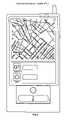
- FIG. 3shows a conventional digital map (Belgrade city, Yugoslavia), as it can be shown on a conventional computer display or public information kiosk operating according to the present invention.
- FIG. 4shows how works the present invention once implemented on a computer system.
- FIG. 5shows a Personal Information Locator (PIL) according to the present invention.
- PILPersonal Information Locator
- FIG. 6shows the result of a “geographic fuzzy query” according to the present invention.
- FIG. 7shows how the information of a selected hyperlink icon is retrieved from the Web according to the present invention.
- the present inventionrelates to a system and method for accessing, retrieving, representing and browsing geographic or location related information from the Web (i.e.: HTML documents that describe physical places). More particularly, the present invention relates to a system and method for automatically searching, retrieving, representing and browsing from the Web a geographic distribution of places where selectable types of resources are located or certain types of services provided (hospitals, bus terminals, historical places, oil-posts, restaurants, hotels, etc. . . .). These places are located inside regions of different sizes around any reference point of the world. The invention enables a user to select any one of the automatically mapped locations and to browse the information retrieved from the World Wide Web for this location, without any resort to services of specialized geographic information systems or geographic information providers.
- the systemcomprises means for tagging each document accessible through the Web with the cartographic coordinates (longitude, latitude and optionally altitude) of the physical location referenced in the document and, optionally, with one or a plurality of attributes of this physical location.
- the inventionalso comprises a method for searching and retrieving from the Web the tagged documents from a computer system by means of queries specifying:
- a query before its sending to the Webis first transformed into a “geographic fuzzy query”.
- a geographic fuzzy queryDepending on the size of the geographic area to cover, one or several of the less significative digits of the reference coordinates are replaced by a single wild card character, like “*”.
- the geographic fuzzy querythus specifies at the same time all possible cartographic coordinates (longitude and latitude) of locations that have in common a set of most significative digits.
- the geographic fuzzy queryis therefore interpreted by all Web search tools or database search tools as an instruction to search and retrieve from the Web all documents tagged comprising cartographic coordinates of points located inside a geographic area (geodesic parallelogram) of the specified size around a reference point.
- the reference coordinates specified on the querycorrespond to the reference point within this geographic area.
- the collection of hyperlinksi.e.: URLs
- the collection of hyperlinksretrieved from the Web by means of the above class of geographic fuzzy queries is stored on the computer system along with the coordinates tagged on each one of the corresponding HTML documents, thus creating a table of hyperlinks/coordinates for all retrieved documents.
- the relative coordinates of each retrieved documentare computed with respect to the coordinates of the reference point specified in the query.
- Those relative geographic coordinatesi.e. relative longitude and relative latitude
- the hyperlink maprepresenting the geographic distribution of locations referenced on all retrieved documents is displayed. Additionally, by using the same scales and coordinates system, the position of the reference point specified in the query is displayed on the hyperlink map.
- a retrieved document displayed on the hyperlink mapcan be represented by an icon (selected from an icon library or defined in any one of many possible forms).
- the hyperlink corresponding to the HTML documentcan be associated to this icon position in such a form that, when pointing or clicking by means of some pointer device over the icon's position, the associated HTML document is selected and retrieved from the Web and displayed and browsed by the user.
- Hyperlink mapsconsist in constellations of icons scattered over an area of the user's display. Each icon points to the physical address (cartographic coordinates) of a location of a specific class or type that belong to a specific region in the world. At the same time, each icon points to the logical address (hyperlink URL) of an HTML document where the information concerning this location can be found.
- Cartographic coordinates for the reference pointcan be those corresponding with the actual user's location. These coordinates can be known in advance or, alternatively, be determined by some of different types of today available automatic positioning and navigation means or can be derived by pointing to a conventional digitized map. Cartographic coordinates for remote locations can be specified manually by the end user or, alternatively, can be automatically derived by map.
- the present inventionis shared between Web Servers and Web Clients.
- Web documentsi.e.: HTLM documents
- HTLM documentsdescribing information related with physical locations (geographic positions) are tagged by means of these “geographic Uniform Resource Locators” (gURLs).
- “Absolute Geographic Coordinates” (AGCs) of physical locationsare encoded (latitude, longitude and optionally altitude) in these “gURLs”, optionally with a plurality of “geographic descriptors” identifying the geographic attributes (region name, county name, city name, street name, etc . . . ), the type of resources (restaurant, water spring, lake, hospital, etc.) or other relevant attributes of the physical locations.
- HTML documents in this formallow queries on the Web of the type “geographic fuzzy queries”. Users can map the coordinates of a location and link and browse the associated HTML document describing said location.
- FIG. 1describes the concept of an Absolute Geographic Coordinates (AGCs) and gives the mathematical formulas to compute the AGCs from the coordinates (latitude and longitude in seconds of arc) of any location of the world.
- AGCsAbsolute Geographic Coordinates
- coordinates convention of AGCsis such that absolute longitude X and absolute latitude Y, are both integer positive numbers (natural numbers).
- a monument in the Spanish city of Burgosis the “Cathedral”.
- the geographic coordinates (Latitude, Longitude) of a reference point on this monumentare:
- the information providercan tag the HTML document with the gURL of the “Burgos Cathedral” computed from the cartographic coordinates of the “Burgos Cathedral”:
- Burgos Cathedralis much closer to the northern Gothic style.
- the lowest story of the facadeis severe and planar.
- the upper storiesare linear and vertical in style.
- Elegant tracery forms throughoutgive lightness to the design, most notably in the tall openwork spires.
- the method according to the present inventioncomprises the steps of:
- the Web clientFrom the geographic coordinates of a selected reference point in the world (i.e.: the user's actual position or any other reference position in the world determined by any means), the Web client:
- a “geographic fuzzy query”is computed from the AGCs of the reference point (natural numbers Xr, Yr) specified in the query. Depending on the size of the area to cover, the less significative digits of the pair (Xr, Yr) associated with this reference point are replaced by a single wild card (“*”) character.
- the concept of geographic “fuzzy query”is based on the concept of “fuzzy geographic coordinates”, illustrated in FIG. 2 .
- the “Fuzzy geographic coordinates” (X*, Y*)are obtained from the AGCs (X, Y) of a geographic point. They determine an area of land (geodesic parallelogram) around this point.
- a “geographic fuzzy query”is sent to retrieve all referenced HTML documents, placed on the Web by any public or private information provider. retrieved HTML documents:
- the graphical informationis scaled in a way to obtain an optimal representation with the best possible resolution.
- the point corresponding to the reference point [Xr, Yr]can be displayed on the user's screen.
- a gURL map(hyperlink map) is therefore plotted on the user's screen.
- This gURL maprepresents the geographic distribution inside the search area (around the reference point [Xr, Yr] if specified) of locations [Xi, Yi] described in HTML documents.
- the mapis displayed with appropriate scales information, distances between each location [Xi, Yi] and the reference point [Xr, Yr] (if specified), directions marks, etc. . . to make easy the visualization, positioning and orientation tasks.
- the geographic coordinates retrieved by one or a plurality of queriescan be processed by different algorithms for different purposes (i.e.: to measure distances between locations, to determine the gravity center of locations distribution, to draw a polygonal envelope of locations distribution, to measure the density of locations or number of locations by unit area, to cluster sets of locations, to determine the optimal route to travel through locations, etc.).
- the distribution of the iconsis displayed on a digital map with the same scale and reference point that are used to map and plot said sensible icons.
- the geographic mapis retrieved from one or a plurality of server systems, or stored on the client system once for all.
- the present applicationshows that it is possible to get an “alive hyper-links map” (over a background of a raster map or “static” map) by plotting over it a constellation of specific-topic icons.
- This constellationis equivalent on the web to a vector map in a GIS system because it contains “dynamic information”.
- a plurality of different constellations for a plurality of topicscan be interactively retrieved on the same map (e.g.: all restaurants, cafeterias and monuments in that area). The most important thing is that the information is retrieved at the same time from all the web sites (not from any specific information provider, like Fodor's directories of restaurants or hotels) and for all possible types of locations around the world.
- FIG. 3shows a conventional digital map (Belgrade city), as can be shown on a conventional computer display or public information kiosk and retrieved from a network or permanently stored on a computer by any one of the today available means.
- Belgrade citya digital map
- FIG. 3shows a conventional digital map (Belgrade city), as can be shown on a conventional computer display or public information kiosk and retrieved from a network or permanently stored on a computer by any one of the today available means.
- FIG. 4shows how works the invention once implemented in a computer system.
- a queryas been done over a digital map for searching all HOSPITALs on an area of 1 ⁇ 1 mile in Belgrade city around a reference location pointed in the center of the computer screen (in gray).
- the result of the queryis the representation of all Hospitals located inside the search area.
- Hyperlink iconsare in this example small circles with a number inside. The icons are ordered automatically according to the relative distance of each HOSPITAL from the reference point. The user can click on any one of these hyperlink icons to have access to the corresponding HTML document (e.g.: considering HOSPITAL number 2 , the URL of this HOSPITAL is accessed on the Web and the information of the HTML document of this HOSPITAL is displayed to the user).
- FIG. 5shows a Personal Information Locator (PIL) designed according to the present invention.
- a PILcomprises:
- the screen of the PILcomprises two areas:
- FIG. 6shows the result of a query for locating all HOSPITALs on an area of 1 ⁇ 1 miles around the actual user's position (shown in the screen center).
- the user's positionhas been determined by the GPS integrated into the PIL (any kind of positioning device able to determine or receive its own geographic coordinates in the world can be used: GPS, LORAN, GLONASS, radars, radio beacons, pseudolites).
- the screen shown in FIG. 6could be the screen of a public information kiosk in Belgrade city and situated in the position shown in the center of the upper (gray) screen. This position corresponds to the (fixed) position of the kiosk previously computed and stored in the kiosk. In this case the background (static) map corresponds to the area of Belgrade assigned to this public information kiosk.
- Pseudolitesare position/time reference transmitters placed on earth. They play (locally) a function which is equivalent to the function of the constellation of earth orbiting satellites for the GPS or GLONASS positioning systems.
- FIG. 7shows how the information of a selected hyperlink icon is retrieved from the Web and displayed in the bottom area of the Personal Information Locator (PIL) screen.
- PILPersonal Information Locator
Landscapes
- Engineering & Computer Science (AREA)
- Radar, Positioning & Navigation (AREA)
- Remote Sensing (AREA)
- Databases & Information Systems (AREA)
- Physics & Mathematics (AREA)
- General Physics & Mathematics (AREA)
- Theoretical Computer Science (AREA)
- Automation & Control Theory (AREA)
- Data Mining & Analysis (AREA)
- General Engineering & Computer Science (AREA)
- Information Transfer Between Computers (AREA)
- Information Retrieval, Db Structures And Fs Structures Therefor (AREA)
Abstract
Description
- transmitting and receiving electronic mail (e-mail),
- logging into remote computers (the “Telnet”), and
- transferring files and programs from one computer to another (“FTP” or “File Transfer Protocol”).
World Wide Web
- an Internet-based navigation system,
- an information distribution and management system for the Internet, and
- a dynamic format for communicating on the Web.
- convert user specified commands into HTTP GET requests,
- connect to the appropriate Web server to get information, and
- wait for a response. The response from the server can be the requested document or an error message.
- “We have all heard of the perils of information overload. In contrast with “Internet addiction,” information overload wreaks more subtle effects, creating a sense of pervasive angst or apathy in this frenetic Cyber Age. As more and more information becomes available in ever more intricate forms on the Net, the problem promises only to become worse, particularly as it is so difficult to distinguish good, reliable information from the false or outdated variety.”—Marguerite Holloway—“Labeling the Web”, by Marguerite Holloway, IBM Research Magazine, Vol. 35, No. 3, 1997.
- Server-side strategies allow users (Web clients) to submit requests for data and analysis to a Web server. The Web server processes the requests and returns data or a solution to the remote Web client.
- Client-side strategies allow users to perform some data manipulation and analysis locally on their own workstation.
- Server and client processes can be combined in hybrid strategies for optimizing performance and for meeting special user needs.
- is proprietary. The information is centrally owned, administered, actualized and distributed by some individual authority or information provider.
- is static. It is not possible, directly from the maps, to link and get access to the information associated to the different locations represented on the maps.
- is specialized and limited to certain types of data selected by the information provider (e.g. Fodor's restaurant index on http://www.fodors.com/ri.cgi, Fodor's hotel index on http://www.fodors.com/hi.cgi).
Note: The expression “static information” means that maps provided on the Web are simple scanned images (named also “rasted” images, like a simple GIF or TIF file). The information cannot be panned, zoomed or translated. The information is simply limited to “what you see”.
- “Even good map[s] . . . are but approximations of what is out there.”—Barry Lopez—“Arctic dreams”, by Barry Holstun Lopez, 1945; Scribner, N. Y., 1986, ISBN: 0684185784
- “Ultimately maps . . . gain their power and usefulness from making connections and enabling unanticipated connections.”—David Turnbull—“Maps are Territories, Science is an Atlas”, by David Turnbull, University of Chicago Press, Chicago, 1993
- “All maps begin to lose their accuracy as soon as they are printed.”—Gregory C. Staple—“Notes on Mapping the Net: From Tribal Space to Corporate Space”, by Gregory C. Staple, TeleGeography Inc, 1995
Specialized, Static and Proprietary Maps
- 1. to know in advance the URL or the name, address or any other specific reference concerning the location, or alternatively
- 2. to make a generic search by means of some generic geographic terms or generic search names (like city name, street name, county name, business name). The problem is then to identify the location sometimes from a very large list of documents.
- having a preliminary knowledge of the geography and locations names to select, classify or discard (e.g. without knowing in advance city street names or distances to access a particular service or location).
- doing complex queries (that normally require to have a preliminary knowledge about the subject to ask for),
- being dependent on the quantity or the quality of the information provided by servers.
New Generation of Geographic Information System
- determining geographic coordinates of the geographic location described or referenced in the document;
- encoding the geographic coordinates in a geographic address (gURL);
- tagging the document with said geographic address (gURL).
The method comprises also the further step of: - tagging the document with one or a plurality of geographic attributes related to the geographic location described or referenced in the document.
- a tag including a geographic address (gURL), the geographic address comprising encoded geographic coordinates of the geographic location described or referenced in the document.
In particular, the tag includes: - one or a plurality of attributes related to the geographic location described or referenced in the document.
- a tag including a geographic address (gURL), the geographic address comprising encoded geographic coordinates of the geographic location described or referenced in the document.
- specifying a reference point;
- determining geographic coordinates of the reference point;
- encoding the geographic coordinates in a geographic address (gURL);
- searching on the one or plurality of server systems for documents tagged with the geographic address (gURL).
The method comprises the further steps of: - specifying one or a plurality of geographic attributes;
- searching on the one or plurality of server systems, for documents tagged with the one or plurality of geographic attributes.
The method comprises the further steps of: - specifying a geographic area around the reference point;
- determining geographic coordinates of the geographic area;
- encoding the geographic coordinates in a fuzzy geographic address;
- searching on the one or plurality of server systems, for documents tagged with a geographic address corresponding to a geographic location within the geographic area.
The present invention also relates to a system and method in a client system for displaying geographic information comprised in claimed documents. Said method comprises for each document the steps of: - retrieving the absolute geographic coordinates from the geographic address tagged on the documents;
- mapping the geographic location according to the absolute geographic coordinates.
- the cartographic coordinates (longitude and latitude) of a reference location anywhere in the world, and the size of the geographic area to search around this reference location, and/or
- one or several attributes of the locations to search (location type key words) inside that geographic area.
Geographic Fuzzy Query
Cartographic Coordinates
- 1. The absolute longitude X, as the length in meters of the arc of the terrestrial parallel that goes from the Greenwich meridian to that point in clockwise direction.
- 2. The absolute latitude Y, as the length in meters of the arc of terrestrial meridian from North Pole to that point.
X=Longitude″×(2.500/81)×cos(Latitude″×90/324.000) m
Y=10.000.000−Latitude″×(2.500/81) m
B/ For a point situated at (Longitude″ E, Latitude″ N):
X=(1.296.000−Longitude″)×(2.500/81)×cos(Latitude″×90/324.000) m
Y=10.000.000−Latitude″×(2.500/81) m
C/ For a point situated at (Longitude″ W, Latitude″ S):
X=Longitude″×(2.500/81)×cos(Latitude″×90/324.000) m
Y=10.000.000+Latitude″×(2.500/81) m
D/ For a point situated at (Longitude″ E, Latitude″ S):
X=(1.296.000−Longitude″)×(2.500/81)×cos(Latitude″×90/324.000) m
Y=10.000.000+Latitude″×(2.500/81) m
By example, the AGCs for a point with geographic coordinates:
- Latitude: 42° 35′ 37″ N=42×3.600+35×60+37=153.337″
- Longitude: 3° 70′ 59″ W=3×3.600+70×60+59=15.059″
are computed by the formulas:
Y=10.000.000−Latitude″×(2.500/81)=05267376 m
X=Longitude″×(2.500/81)×cos(Latitude″×90/324.000)=00342161 m
By definition, for any point of the world with AGCs:
X=xxxxxxxx
Y=yyyyyyyy
the associated gURL will be: - GURLXxxxxxxxx GURLYyyyyyyyy
where prefixes GURLX and GURLY are—by some agreed universal convention—tags used to mark the AGCs (X, Y) for any HTML document that references any location of the world.
In the above example, the gURL from the computed AGCs is (by convention) equal to: - GURLX00342161 GURLY05267376
Burgos Cathedral
- Latitude: 42° 35′ 37″ N
- Longitude: 3° 70′ 59″ W
The computed associated AGCs are:
Y=05267376 m
X=00342161 m
- http://www.tulane.edu/lester/text/Gothic/Late.Gothic/Late.Gothic43.html
- GURLX00342161 GURLY05267376
- computing fuzzy geographic coordinates from the geographic coordinates of a selected reference point and from a specified search area;
- sending a geographic fuzzy query;
- retrieving Absolute Geographic Coordinates (AGCs) from found documents;
- displaying the locations corresponding to the retrieved Absolute Geographic Coordinates;
- accessing the documents associated with displayed locations.
Fuzzy Geographic Coordinates
- a. Computes the AGCs (Xr: xxxxxxxx, Yr: yyyyyyyy) of this reference point.
- b. Specifies one or more geographic descriptors (DESC1, DESC2, . . . , DESCn) to perform the search.
- c. Specifies the area to be covered by the search (e.g.: 10×10 m, 100×100 m, 1×1 Km, 10×10 Km, 100×100 Km, . . . , or all the world).
Then a query string of the following form is executed: - +GURLXxxxxxxx*+GURLYyyyyyyy*+DESC1+DESC2+DESC3 . . . +DESCn
- to perform a search in an area of 10×10 m
- +GURLXxxxxxx*+GURLYyyyyyy*+DESC1+DESC2+DESC3 . . . +DESCn
- to perform a search in an area of 100×100 m
- +GURLXxxxxx*+GURLYyyyyy*+DESC1+DESC2+DESC3 . . . +DESCn
- to perform a search in an area of 1×1 Km,
- +GURLXxxxx*+GURLYyyyy*+DESC1+DESC2+DESC3 . . . +DESCn
- to perform a search in an area of 10×10 Km,
- +GURLXxxx*+GURLYyyy*+DESC1+DESC2+DESC3 . . . +DESCn
- to perform a search in an area of 100×100 Km
- +GURLXxx*+GURLYyy*+DESC1+DESC2+DESC3 . . . +DESCn
- to perform a search in an area of 1.000×1.000 Km,
- +GURLXX*+GURLYY*+DESC1+DESC2+DESC3 . . . +DESCn
- to perform a search in an area of 10.000×10.000 Km, and, finally
- +GURLX*+GURLY*+DESC1+DESC2+DESC3 . . . +DESCn
- to perform a search “EVERYWHERE IN THE WORLD”
- +GURLX*+GURLY*+DESC1+DESC2+DESC3 . . . +DESCn
does not require the specification in advance of a reference point to locate, map and retrieve the information of “all places of the world” that have in common the same geographic descriptors.
Geographic Fuzzy Query
- +GURLX*+GURLY*+DESC1+DESC2+DESC3 . . . +DESCn
- a) have been tagged with one or several gURLs and include AGCs corresponding to points “located inside” the area covered by the “fuzzy AGCs” of the query. That means, for example, that an HTML document that contains the AGCs:
- GURLXxxxxx??? GURLYyyyyy??? (where “?” is any number)
- will match a “geographic fuzzy query” of the form:
- +GURLXxxxxx*+GURLYyyyyy*
- b) have been tagged with the geographic descriptors specified in the query:
- DESC1 DESC2 DESC3 . . . . DESCn
- For example, a query of the type:
- +GURLXxxxxx*+GURLYyyyyy*+DESC1+DESC2
- will retrieve all HTML documents containing geographic descriptors DESC1 and DESC2 and located inside the (1 km×1 Km) geodesic square:
- xxxxx000<=X<=xxxxx999; yyyyy000<=Y<=yyyyy999 (meters)
- The retrieved HTML documents will contain strings of the type:
- GURLXxxxxx??? GURLYyyyyy??? DESC1 DESC2
- (where“?” is any number)
As another example, a DUMMY query of the type: - +GURLX*+GURLY*+DESC1+DESC2
will retrieve all HTML documents containing the geographic descriptors DESC1 and DESC2 in any point of the world. HTML documents will contain strings of the type: - GURLX???????? GURLY???????? DESC1 DESC2
Therefore, the Web search tool will retrieve the list of all URLs that point to HTML documents that match the query: - a. HTML documents that contain gURLs of points located inside the geographic area covered by the query, and
- b. HTML documents that contain the same geographic descriptors than these included in the query.
Absolute Geographic Coordinates (AGCs)
- a. Points to a geographic position (AGCs coordinates [Xi, Yi] of this point in the world).
- b. Points to an URL (“network address” or “logic address”): URLi. This is the URL from where the information associated to the AGCs coordinates (and the gURL) can be retrieved.
- a. Title of this URL or NAME of the location;
- b. Abstract or short description of the location [Xi, Yi] associated with this URL;
- c. The UTM or other selected standard or normalized cartographic coordinates of this location [Xi, Yi];
- d. The distance from the location [Xi, Yi] to the reference point [Xr, Yr] (if specified).
Access to HTML Documents
- a Global Positioning System (GPS) receiver,
- a wireless modem (e.g.: a GSM cell phone), and
- a computer system similar to the one shown in the Figure.
- the upper screen area is reserved to display hyperlink maps,
- the bottom screen area is reserved for entering queries and for displaying the information contained in the HTML documents corresponding to the location selected by means of a pointing device and control keys.
Claims (20)
Applications Claiming Priority (1)
| Application Number | Priority Date | Filing Date | Title |
|---|---|---|---|
| EP99480071AEP1072987A1 (en) | 1999-07-29 | 1999-07-29 | Geographic web browser and iconic hyperlink cartography |
Publications (1)
| Publication Number | Publication Date |
|---|---|
| US7007228B1true US7007228B1 (en) | 2006-02-28 |
Family
ID=8242458
Family Applications (1)
| Application Number | Title | Priority Date | Filing Date |
|---|---|---|---|
| US09/523,811Expired - LifetimeUS7007228B1 (en) | 1999-07-29 | 2000-03-13 | Encoding geographic coordinates in a fuzzy geographic address |
Country Status (2)
| Country | Link |
|---|---|
| US (1) | US7007228B1 (en) |
| EP (1) | EP1072987A1 (en) |
Cited By (101)
| Publication number | Priority date | Publication date | Assignee | Title |
|---|---|---|---|---|
| US20040046805A1 (en)* | 2002-05-31 | 2004-03-11 | Heidelberger Druckmaschinen Ag | Device and method for finding and displaying information |
| US20040068582A1 (en)* | 2000-04-03 | 2004-04-08 | Mark Anderson | Method and system to initiate geolocation activities on demand and responsive to receipt of a query |
| US20050004830A1 (en)* | 2003-07-03 | 2005-01-06 | Travelweb Llc | System and method for indexing travel accommodations in a network environment |
| US20050023524A1 (en)* | 2003-07-31 | 2005-02-03 | Microsoft Corporation | Compact text encoding of latitude/longitude coordinates |
| US20050154724A1 (en)* | 2000-07-20 | 2005-07-14 | Microsoft Corporation | Method and apparatus for identifying programming object attributes |
| US20050171691A1 (en)* | 2003-12-19 | 2005-08-04 | Smartt Brian E. | Geocoding locations near a specified city |
| US20050285876A1 (en)* | 2004-06-29 | 2005-12-29 | Piotr Balaga | Composition of raster and vector graphics in geographical information systems |
| US20060037990A1 (en)* | 2002-05-03 | 2006-02-23 | Geise Doran J | System to navigate within images spatially referenced to a computed space |
| US20060125828A1 (en)* | 2002-02-11 | 2006-06-15 | Landnet Corporation | Land software tool |
| US20060129636A1 (en)* | 2004-11-04 | 2006-06-15 | Masaki Matsuura | Vehicle-mounted apparatus |
| US20060136387A1 (en)* | 2004-12-20 | 2006-06-22 | Microsoft Corporation | Method and system for updating a summary page of a document |
| US20060142027A1 (en)* | 2004-12-29 | 2006-06-29 | Nokia Corporation | Methods, apparatus and computer program product providing enhanced location-based services for mobile users |
| US20060197763A1 (en)* | 2002-02-11 | 2006-09-07 | Landnet Corporation | Document geospatial shape tagging, searching, archiving, and retrieval software |
| US20070011150A1 (en)* | 2005-06-28 | 2007-01-11 | Metacarta, Inc. | User Interface For Geographic Search |
| US20070015521A1 (en)* | 2005-07-12 | 2007-01-18 | Qwest Communications International Inc. | Correlating activities with the location of a mobile communications device systems and methods |
| US20070015520A1 (en)* | 2005-07-12 | 2007-01-18 | Qwest Communications International Inc. | Efficiently determining the location of a mobile communications device system and methods |
| US20070013560A1 (en)* | 2005-07-12 | 2007-01-18 | Qwest Communications International Inc. | Mapping the location of a mobile communications device systems and methods |
| US20070015519A1 (en)* | 2005-07-12 | 2007-01-18 | Qwest Communications International Inc. | User defined location based notification for a mobile communications device systems and methods |
| US20070050128A1 (en)* | 2005-08-31 | 2007-03-01 | Garmin Ltd., A Cayman Islands Corporation | Method and system for off-board navigation with a portable device |
| US20070143317A1 (en)* | 2004-12-30 | 2007-06-21 | Andrew Hogue | Mechanism for managing facts in a fact repository |
| US20070143282A1 (en)* | 2005-03-31 | 2007-06-21 | Betz Jonathan T | Anchor text summarization for corroboration |
| US20070156332A1 (en)* | 2005-10-14 | 2007-07-05 | Yahoo! Inc. | Method and system for navigating a map |
| US20070198951A1 (en)* | 2006-02-10 | 2007-08-23 | Metacarta, Inc. | Systems and methods for spatial thumbnails and companion maps for media objects |
| US20070226004A1 (en)* | 2001-06-01 | 2007-09-27 | Landnet Corporation | Identification, storage and display of land data on a website |
| US20070288648A1 (en)* | 2002-11-18 | 2007-12-13 | Lara Mehanna | Host-based intelligent results related to a character stream |
| US20080005264A1 (en)* | 2006-06-28 | 2008-01-03 | Microsoft Corporation | Anonymous and secure network-based interaction |
| US20080010262A1 (en)* | 2006-06-12 | 2008-01-10 | Metacarta, Inc. | System and methods for providing statstically interesting geographical information based on queries to a geographic search engine |
| US20080033935A1 (en)* | 2006-08-04 | 2008-02-07 | Metacarta, Inc. | Systems and methods for presenting results of geographic text searches |
| US20080052638A1 (en)* | 2006-08-04 | 2008-02-28 | Metacarta, Inc. | Systems and methods for obtaining and using information from map images |
| US20080065685A1 (en)* | 2006-08-04 | 2008-03-13 | Metacarta, Inc. | Systems and methods for presenting results of geographic text searches |
| US20080109713A1 (en)* | 2000-02-22 | 2008-05-08 | Metacarta, Inc. | Method involving electronic notes and spatial domains |
| US20080125960A1 (en)* | 2006-11-29 | 2008-05-29 | Patrick Ralf Wipplinger | System and method for terminal charts, airport maps and aeronautical context display |
| US20080140348A1 (en)* | 2006-10-31 | 2008-06-12 | Metacarta, Inc. | Systems and methods for predictive models using geographic text search |
| US20080155060A1 (en)* | 2006-12-22 | 2008-06-26 | Yahoo! Inc. | Exported overlays |
| US20080196098A1 (en)* | 2004-12-31 | 2008-08-14 | Cottrell Lance M | System For Protecting Identity in a Network Environment |
| US20080195308A1 (en)* | 2007-02-12 | 2008-08-14 | Microsoft Corporation | Accessing content via a geographic map |
| US20080307498A1 (en)* | 2006-12-27 | 2008-12-11 | Waterstone Environmental Hydrology & Engineering, Inc. | Access control for server-based geographic information system |
| US20080319803A1 (en)* | 2007-06-20 | 2008-12-25 | Amadeus S.A.S. | Method and system for booking travel products online on the basis of up-to-date availability data displayed on a map-based client interface |
| US20090100323A1 (en)* | 2007-10-10 | 2009-04-16 | 39 Degrees North, Llc | Link generator |
| US20090119255A1 (en)* | 2006-06-28 | 2009-05-07 | Metacarta, Inc. | Methods of Systems Using Geographic Meta-Metadata in Information Retrieval and Document Displays |
| US20090265388A1 (en)* | 2008-04-22 | 2009-10-22 | Microsoft Corporation | Discovering co-located queries in geographic search logs |
| US7685279B2 (en) | 2004-03-04 | 2010-03-23 | Quova, Inc. | Geo-location and geo-compliance utilizing a client agent |
| US20100083157A1 (en)* | 2008-09-30 | 2010-04-01 | Nokia Corporation | Methods, apparatuses, and computer program products for providing activity coordination information |
| US7698336B2 (en) | 2006-10-26 | 2010-04-13 | Microsoft Corporation | Associating geographic-related information with objects |
| US20100138796A1 (en)* | 2001-04-30 | 2010-06-03 | Activemap Llc | Interactive electronically presented map |
| US20100146132A1 (en)* | 2008-12-04 | 2010-06-10 | Morris Robert P | Methods, Systems, And Computer Program Products For Accessing A Resource Having A Network Address Associated With A Location On A Map |
| US20100146114A1 (en)* | 2008-12-04 | 2010-06-10 | Morris Robert P | Methods, Systems, And Computer Program Products For Accessing A Resource Based On Metadata Associated With A Location On A Map |
| US20100162091A1 (en)* | 2008-12-22 | 2010-06-24 | Ncr Corporation | Methods and Apparatus for Internet Browsing and Searching Employing Geographic Location Information |
| US20110047153A1 (en)* | 2005-05-31 | 2011-02-24 | Betz Jonathan T | Identifying the Unifying Subject of a Set of Facts |
| US7962504B1 (en) | 2005-05-26 | 2011-06-14 | Aol Inc. | Sourcing terms into a search engine |
| US7970766B1 (en) | 2007-07-23 | 2011-06-28 | Google Inc. | Entity type assignment |
| US8001199B2 (en) | 2002-11-18 | 2011-08-16 | Aol Inc. | Reconfiguring an electronic message to effect an enhanced notification |
| US20110231453A1 (en)* | 2006-05-16 | 2011-09-22 | Waterstone Environmental Hydrology & Engineering, Inc. | State saver/restorer for a geospatial decision management system |
| US20110307516A1 (en)* | 2010-06-14 | 2011-12-15 | Samsung Electronics Co., Ltd | Apparatus and method for searching for content in a portable terminal |
| US8122026B1 (en) | 2006-10-20 | 2012-02-21 | Google Inc. | Finding and disambiguating references to entities on web pages |
| US20120089326A1 (en)* | 2010-10-08 | 2012-04-12 | Thomas Bouve | Selected driver notification of transitory roadtrip events |
| US20120123680A1 (en)* | 2006-11-29 | 2012-05-17 | Patrick Ralf Wipplinger | System and method for electronic moving map and aeronautical context display |
| US20120197757A1 (en)* | 2011-01-28 | 2012-08-02 | Dare Ajala | Systems and methods for online matching of consumers and retailers |
| US8260785B2 (en) | 2006-02-17 | 2012-09-04 | Google Inc. | Automatic object reference identification and linking in a browseable fact repository |
| US8321497B1 (en)* | 2001-04-17 | 2012-11-27 | Hewlett-Packard Development Company, L.P. | Data structure disposed in a computer readable memory that provides information corresponding to a location |
| US8347202B1 (en)* | 2007-03-14 | 2013-01-01 | Google Inc. | Determining geographic locations for place names in a fact repository |
| WO2013006847A1 (en)* | 2011-07-07 | 2013-01-10 | Som Anup | System and method for simplified representation of geographic addresses |
| US8385964B2 (en) | 2005-04-04 | 2013-02-26 | Xone, Inc. | Methods and apparatuses for geospatial-based sharing of information by multiple devices |
| US20130117666A1 (en)* | 2000-04-14 | 2013-05-09 | Samsung Electronics Co., Ltd. | User interface systems and methods for manipulating and viewing digital documents |
| US8543323B1 (en)* | 2004-03-24 | 2013-09-24 | A9.Com, Inc. | Displaying representative images in a visual mapping system |
| US8577972B1 (en) | 2003-09-05 | 2013-11-05 | Facebook, Inc. | Methods and systems for capturing and managing instant messages |
| US8584013B1 (en)* | 2007-03-20 | 2013-11-12 | Google Inc. | Temporal layers for presenting personalization markers on imagery |
| US8650175B2 (en) | 2005-03-31 | 2014-02-11 | Google Inc. | User interface for facts query engine with snippets from information sources that include query terms and answer terms |
| US8682913B1 (en) | 2005-03-31 | 2014-03-25 | Google Inc. | Corroborating facts extracted from multiple sources |
| US8701014B1 (en) | 2002-11-18 | 2014-04-15 | Facebook, Inc. | Account linking |
| US8812435B1 (en) | 2007-11-16 | 2014-08-19 | Google Inc. | Learning objects and facts from documents |
| EP2558993A4 (en)* | 2010-04-12 | 2014-08-27 | Hiodz Ltd | SYSTEM FOR COLLABORATIVE TRANSACTIONS |
| US8855856B2 (en)* | 2007-05-08 | 2014-10-07 | GM Global Technology Operations LLC | Vehicle roll control method using controllable friction force of MR dampers |
| US8874672B2 (en) | 2003-03-26 | 2014-10-28 | Facebook, Inc. | Identifying and using identities deemed to be known to a user |
| US8965964B1 (en) | 2002-11-18 | 2015-02-24 | Facebook, Inc. | Managing forwarded electronic messages |
| US8996470B1 (en) | 2005-05-31 | 2015-03-31 | Google Inc. | System for ensuring the internal consistency of a fact repository |
| US20150242421A1 (en)* | 2014-02-21 | 2015-08-27 | Quixey, Inc. | Location-Based Searching |
| US9175973B2 (en) | 2014-03-26 | 2015-11-03 | Trip Routing Technologies, Llc | Selected driver notification of transitory roadtrip events |
| US9203879B2 (en) | 2000-03-17 | 2015-12-01 | Facebook, Inc. | Offline alerts mechanism |
| US9203647B2 (en) | 2002-11-18 | 2015-12-01 | Facebook, Inc. | Dynamic online and geographic location of a user |
| US9246975B2 (en) | 2000-03-17 | 2016-01-26 | Facebook, Inc. | State change alerts mechanism |
| US9319356B2 (en) | 2002-11-18 | 2016-04-19 | Facebook, Inc. | Message delivery control settings |
| US9544729B2 (en) | 2012-11-02 | 2017-01-10 | Ge Intelligent Platforms, Inc. | Apparatus and method for geolocation intelligence |
| US20170061077A1 (en)* | 2015-08-26 | 2017-03-02 | Lightbeam Health Solutions, LLC | Medical visual referral tool and remote portal |
| US9647872B2 (en) | 2002-11-18 | 2017-05-09 | Facebook, Inc. | Dynamic identification of other users to an online user |
| US9667585B2 (en) | 2002-11-18 | 2017-05-30 | Facebook, Inc. | Central people lists accessible by multiple applications |
| WO2018039120A1 (en)* | 2016-08-25 | 2018-03-01 | Latloc, LLC | Method of gathering, storing, and distributing user defined geographic location identities |
| US10187334B2 (en) | 2003-11-26 | 2019-01-22 | Facebook, Inc. | User-defined electronic message preferences |
| US10359518B2 (en)* | 2016-12-30 | 2019-07-23 | DeepMap Inc. | Vector data encoding of high definition map data for autonomous vehicles |
| US10958768B1 (en) | 2009-10-08 | 2021-03-23 | Luminati Networks Ltd. | System providing faster and more efficient data communication |
| US10963531B2 (en) | 2019-02-25 | 2021-03-30 | Luminati Networks Ltd. | System and method for URL fetching retry mechanism |
| US10979533B2 (en) | 2013-08-28 | 2021-04-13 | Luminati Networks Ltd. | System and method for improving internet communication by using intermediate nodes |
| US10985934B2 (en) | 2017-08-28 | 2021-04-20 | Luminati Networks Ltd. | System and method for improving content fetching by selecting tunnel devices |
| US11093102B2 (en)* | 2003-09-09 | 2021-08-17 | James A. Roskind | Location-based applications |
| US11190374B2 (en) | 2017-08-28 | 2021-11-30 | Bright Data Ltd. | System and method for improving content fetching by selecting tunnel devices |
| US20210372811A1 (en)* | 2009-07-27 | 2021-12-02 | Palantir Technologies, Inc. | Geotagging Structured Data |
| CN114116938A (en)* | 2021-11-23 | 2022-03-01 | 浪潮通信信息系统有限公司 | A method and device for map drawing based on WebGIS |
| US11411922B2 (en) | 2019-04-02 | 2022-08-09 | Bright Data Ltd. | System and method for managing non-direct URL fetching service |
| US11757961B2 (en) | 2015-05-14 | 2023-09-12 | Bright Data Ltd. | System and method for streaming content from multiple servers |
| US12260364B2 (en) | 2015-04-24 | 2025-03-25 | United Parcel Service Of America, Inc. | Location-based pick up and delivery services |
| US12445511B2 (en) | 2023-01-22 | 2025-10-14 | Bright Data Ltd. | System and method for streaming content from multiple servers |
Families Citing this family (23)
| Publication number | Priority date | Publication date | Assignee | Title |
|---|---|---|---|---|
| GB2364225A (en)* | 2000-06-26 | 2002-01-16 | Beacon Dodsworth Ltd | Graphical user interface for the display of internet hyperlinks |
| JP2002132806A (en)* | 2000-10-18 | 2002-05-10 | Fujitsu Ltd | Server system, information providing service system, and information providing service method |
| AU2005229711B2 (en)* | 2001-02-09 | 2008-02-07 | Excalibur Ip, Llc | Information retrieval system and method employing spatially selective features |
| CA2335445A1 (en)* | 2001-02-09 | 2002-08-09 | Lasoo Inc. | Internet search tool using geographically selective features |
| KR100425322B1 (en)* | 2002-01-29 | 2004-03-30 | 삼성전자주식회사 | Hand-held terminal displaying map information and displaying method thereof |
| US7707140B2 (en) | 2002-10-09 | 2010-04-27 | Yahoo! Inc. | Information retrieval system and method employing spatially selective features |
| US20050278378A1 (en)* | 2004-05-19 | 2005-12-15 | Metacarta, Inc. | Systems and methods of geographical text indexing |
| US7801897B2 (en) | 2004-12-30 | 2010-09-21 | Google Inc. | Indexing documents according to geographical relevance |
| US7373246B2 (en) | 2005-05-27 | 2008-05-13 | Google Inc. | Using boundaries associated with a map view for business location searching |
| EP1902391A4 (en)* | 2005-07-08 | 2011-12-28 | Nokia Corp | METHOD AND SYSTEM FOR REALIZING AN INTERROGATION AND PRESENTING THE SEARCHING RESULT ON A GEOGRAPHIC MAP |
| ES2394002T3 (en)* | 2005-10-10 | 2013-01-04 | Searchteq Gmbh | Search engine to perform a search referring to a place |
| WO2007067760A2 (en) | 2005-12-08 | 2007-06-14 | Decarta, Inc. | High precision internet local search |
| US7606581B2 (en) | 2005-12-13 | 2009-10-20 | Yahoo! Inc. | System and method for providing geo-relevant information based on a location |
| US8050689B2 (en) | 2005-12-13 | 2011-11-01 | Yahoo! Inc. | System and method for creating minimum bounding rectangles for use in a geo-coding system |
| US7616964B2 (en) | 2005-12-13 | 2009-11-10 | Yahoo! Inc. | System and method for providing geo-relevant information based on a mobile device |
| US7606582B2 (en) | 2005-12-13 | 2009-10-20 | Yahoo! Inc. | System and method for populating a geo-coding database |
| US7680697B2 (en) | 2006-01-25 | 2010-03-16 | Kelkoo Sas | Searching for a seller of a product |
| US8122341B1 (en)* | 2006-06-17 | 2012-02-21 | Google Inc. | Sharing geographical information between users |
| US8533217B2 (en) | 2006-11-01 | 2013-09-10 | Yahoo! Inc. | System and method for dynamically retrieving data specific to a region of a layer |
| US8452784B2 (en)* | 2009-10-22 | 2013-05-28 | Nokia Corporation | Method and apparatus for searching geo-tagged information |
| WO2012070929A1 (en)* | 2010-11-24 | 2012-05-31 | Greenflower Intercode Holding B.V. | Method and system for compiling a unique sample code for a digital sample being at least partially related to a geographical location |
| CN112632992B (en)* | 2019-09-24 | 2023-09-29 | 北京京东振世信息技术有限公司 | Test method, test device, computer equipment and medium |
| CN114491351B (en)* | 2022-04-18 | 2022-08-23 | 北京航空航天大学杭州创新研究院 | Lattice point data visualization method and system adaptable to WebGIS platform |
Citations (17)
| Publication number | Priority date | Publication date | Assignee | Title |
|---|---|---|---|---|
| US5774828A (en)* | 1995-04-07 | 1998-06-30 | Delco Electronics Corporation | Mapless GPS navigation system with user modifiable data base |
| AU5303198A (en) | 1997-02-21 | 1998-08-27 | Dudley John Mills | Network-based classified information systems |
| US5893093A (en) | 1997-07-02 | 1999-04-06 | The Sabre Group, Inc. | Information search and retrieval with geographical coordinates |
| US6138072A (en)* | 1997-04-24 | 2000-10-24 | Honda Giken Kogyo Kabushiki Kaisha | Navigation device |
| US6148260A (en)* | 1996-11-08 | 2000-11-14 | Zip2 | Interactive network directory service with integrated maps and directions |
| US6202022B1 (en)* | 1997-09-25 | 2001-03-13 | Toyota Jidosha Kabushiki Kaisha | Vehicle-use data processing system, on-vehicle terminal device constituting such system, and navigation device |
| US6202023B1 (en)* | 1996-08-22 | 2001-03-13 | Go2 Systems, Inc. | Internet based geographic location referencing system and method |
| US6263343B1 (en)* | 1996-01-11 | 2001-07-17 | Sony Corporation | System for providing and linking regularity updated map data with data related to the map |
| US6266676B1 (en)* | 1994-03-17 | 2001-07-24 | Hitachi, Ltd. | Link information management method |
| US6336072B1 (en)* | 1998-11-20 | 2002-01-01 | Fujitsu Limited | Apparatus and method for presenting navigation information based on instructions described in a script |
| US6466940B1 (en)* | 1997-02-21 | 2002-10-15 | Dudley John Mills | Building a database of CCG values of web pages from extracted attributes |
| US6487495B1 (en)* | 2000-06-02 | 2002-11-26 | Navigation Technologies Corporation | Navigation applications using related location-referenced keywords |
| US6487305B2 (en)* | 1996-06-19 | 2002-11-26 | Matsushita Electric Industrial Co. Ltd. | Deformed map automatic generation system including automatic extraction of road area from a block map and shape deformation of at least one road area drawn in the map |
| US6504571B1 (en)* | 1998-05-18 | 2003-01-07 | International Business Machines Corporation | System and methods for querying digital image archives using recorded parameters |
| US6584328B1 (en)* | 2000-01-10 | 2003-06-24 | Compal Electronics, Inc. | Wireless communication system that uses keywords to find and display map graphic data |
| US6650647B1 (en)* | 1998-09-11 | 2003-11-18 | International Business Machines Corporation | Systems, apparatus and methods for data distribution and display |
| US6735585B1 (en)* | 1998-08-17 | 2004-05-11 | Altavista Company | Method for search engine generating supplemented search not included in conventional search result identifying entity data related to portion of located web page |
- 1999
- 1999-07-29EPEP99480071Apatent/EP1072987A1/ennot_activeCeased
- 2000
- 2000-03-13USUS09/523,811patent/US7007228B1/ennot_activeExpired - Lifetime
Patent Citations (18)
| Publication number | Priority date | Publication date | Assignee | Title |
|---|---|---|---|---|
| US6266676B1 (en)* | 1994-03-17 | 2001-07-24 | Hitachi, Ltd. | Link information management method |
| US5774828A (en)* | 1995-04-07 | 1998-06-30 | Delco Electronics Corporation | Mapless GPS navigation system with user modifiable data base |
| US6263343B1 (en)* | 1996-01-11 | 2001-07-17 | Sony Corporation | System for providing and linking regularity updated map data with data related to the map |
| US6487305B2 (en)* | 1996-06-19 | 2002-11-26 | Matsushita Electric Industrial Co. Ltd. | Deformed map automatic generation system including automatic extraction of road area from a block map and shape deformation of at least one road area drawn in the map |
| US6202023B1 (en)* | 1996-08-22 | 2001-03-13 | Go2 Systems, Inc. | Internet based geographic location referencing system and method |
| US6148260A (en)* | 1996-11-08 | 2000-11-14 | Zip2 | Interactive network directory service with integrated maps and directions |
| US6466940B1 (en)* | 1997-02-21 | 2002-10-15 | Dudley John Mills | Building a database of CCG values of web pages from extracted attributes |
| AU5303198A (en) | 1997-02-21 | 1998-08-27 | Dudley John Mills | Network-based classified information systems |
| US6138072A (en)* | 1997-04-24 | 2000-10-24 | Honda Giken Kogyo Kabushiki Kaisha | Navigation device |
| US6202065B1 (en)* | 1997-07-02 | 2001-03-13 | Travelocity.Com Lp | Information search and retrieval with geographical coordinates |
| US5893093A (en) | 1997-07-02 | 1999-04-06 | The Sabre Group, Inc. | Information search and retrieval with geographical coordinates |
| US6202022B1 (en)* | 1997-09-25 | 2001-03-13 | Toyota Jidosha Kabushiki Kaisha | Vehicle-use data processing system, on-vehicle terminal device constituting such system, and navigation device |
| US6504571B1 (en)* | 1998-05-18 | 2003-01-07 | International Business Machines Corporation | System and methods for querying digital image archives using recorded parameters |
| US6735585B1 (en)* | 1998-08-17 | 2004-05-11 | Altavista Company | Method for search engine generating supplemented search not included in conventional search result identifying entity data related to portion of located web page |
| US6650647B1 (en)* | 1998-09-11 | 2003-11-18 | International Business Machines Corporation | Systems, apparatus and methods for data distribution and display |
| US6336072B1 (en)* | 1998-11-20 | 2002-01-01 | Fujitsu Limited | Apparatus and method for presenting navigation information based on instructions described in a script |
| US6584328B1 (en)* | 2000-01-10 | 2003-06-24 | Compal Electronics, Inc. | Wireless communication system that uses keywords to find and display map graphic data |
| US6487495B1 (en)* | 2000-06-02 | 2002-11-26 | Navigation Technologies Corporation | Navigation applications using related location-referenced keywords |
Non-Patent Citations (6)
| Title |
|---|
| "Laura Lemay's Web Workshop Creating Commercial Web Pages", Lemay et al, Sams, 1996, pp. 73-75.* |
| Computer Networks & ISDN Systems, "Maps Alive: Viewing Geospatial Information on the WWW" by M. Potmesil, North Holland Publishing, Amsterdam, Sep. 1997, vol. 29, No. 8-13, pp. 1327-1342. |
| Gardels, K., "Open GIS and On-Line Environment Libraries", ACM Sigmod Record, Mar. 1997, vol. 26, Issue 1.* |
| Imielinsky et al, "GPS-Based Geographic Addressing, Routing, and Resource Discovery", Comm. of the ACM, Apr. 1999, vol. 42, No. 4.* |
| Research and Advanced Technology for Digital Libraries, First European Conference, ECDL '97 Proceedings, Pisa, Italy, Sep. 1-3, 1997. |
| Tochtermann et al, Using Semantic, Geographical, and Temporal Relationships to Enhance Search and Retrieval in Digital Catalogs, p. 73-86. |
Cited By (470)
| Publication number | Priority date | Publication date | Assignee | Title |
|---|---|---|---|---|
| US7953732B2 (en) | 2000-02-22 | 2011-05-31 | Nokia Corporation | Searching by using spatial document and spatial keyword document indexes |
| US20080109713A1 (en)* | 2000-02-22 | 2008-05-08 | Metacarta, Inc. | Method involving electronic notes and spatial domains |
| US20080114736A1 (en)* | 2000-02-22 | 2008-05-15 | Metacarta, Inc. | Method of inferring spatial meaning to text |
| US20080115076A1 (en)* | 2000-02-22 | 2008-05-15 | Metacarta, Inc. | Query parser method |
| US20080126343A1 (en)* | 2000-02-22 | 2008-05-29 | Metacarta, Inc. | Method for defining the georelevance of documents |
| US20080228754A1 (en)* | 2000-02-22 | 2008-09-18 | Metacarta, Inc. | Query method involving more than one corpus of documents |
| US20080228729A1 (en)* | 2000-02-22 | 2008-09-18 | Metacarta, Inc. | Spatial indexing of documents |
| US20080228728A1 (en)* | 2000-02-22 | 2008-09-18 | Metacarta, Inc. | Geospatial search method that provides for collaboration |
| US9201972B2 (en) | 2000-02-22 | 2015-12-01 | Nokia Technologies Oy | Spatial indexing of documents |
| US7908280B2 (en) | 2000-02-22 | 2011-03-15 | Nokia Corporation | Query method involving more than one corpus of documents |
| US7917464B2 (en) | 2000-02-22 | 2011-03-29 | Metacarta, Inc. | Geotext searching and displaying results |
| US9203879B2 (en) | 2000-03-17 | 2015-12-01 | Facebook, Inc. | Offline alerts mechanism |
| US9736209B2 (en) | 2000-03-17 | 2017-08-15 | Facebook, Inc. | State change alerts mechanism |
| US9246975B2 (en) | 2000-03-17 | 2016-01-26 | Facebook, Inc. | State change alerts mechanism |
| US7809857B2 (en) | 2000-04-03 | 2010-10-05 | Quova, Inc. | Method and system to collect geographic location information for a network address utilizing geographically dispersed data collection agents |
| US9021080B2 (en) | 2000-04-03 | 2015-04-28 | Ebay Inc. | Method and system to associate geographic location information with a network address using a combination of automated and manual processes |
| US20040068582A1 (en)* | 2000-04-03 | 2004-04-08 | Mark Anderson | Method and system to initiate geolocation activities on demand and responsive to receipt of a query |
| US7472172B2 (en)* | 2000-04-03 | 2008-12-30 | Quova, Inc. | Method and system to initiate geolocation activities on demand and responsive to receipt of a query |
| US20130117666A1 (en)* | 2000-04-14 | 2013-05-09 | Samsung Electronics Co., Ltd. | User interface systems and methods for manipulating and viewing digital documents |
| US9778836B2 (en)* | 2000-04-14 | 2017-10-03 | Samsung Electronics Co., Ltd. | User interface systems and methods for manipulating and viewing digital documents |
| US7457821B2 (en) | 2000-07-20 | 2008-11-25 | Microsoft Corporation | Method and apparatus for identifying programming object attributes |
| US20050165767A1 (en)* | 2000-07-20 | 2005-07-28 | Microsoft Corporation | Method and apparatus for identifying programming object attributes |
| US20050262137A1 (en)* | 2000-07-20 | 2005-11-24 | Microsoft Corporation | Method and apparatus for identifying programming object attributes |
| US7451159B2 (en)* | 2000-07-20 | 2008-11-11 | Micosoft Corporation | Method and apparatus for identifying programming object attributes |
| US20050154724A1 (en)* | 2000-07-20 | 2005-07-14 | Microsoft Corporation | Method and apparatus for identifying programming object attributes |
| US7584169B2 (en) | 2000-07-20 | 2009-09-01 | Microsoft Corporation | Method and apparatus for identifying programming object attributes |
| US8321497B1 (en)* | 2001-04-17 | 2012-11-27 | Hewlett-Packard Development Company, L.P. | Data structure disposed in a computer readable memory that provides information corresponding to a location |
| US10365795B2 (en) | 2001-04-30 | 2019-07-30 | Activemap Llc | Interactive electronically presented map |
| US20110161861A1 (en)* | 2001-04-30 | 2011-06-30 | Activemap Llc | Interactive Electronically Presented Map |
| US20100138796A1 (en)* | 2001-04-30 | 2010-06-03 | Activemap Llc | Interactive electronically presented map |
| US10444943B2 (en) | 2001-04-30 | 2019-10-15 | Activemap Llc | Interactive electronically presented map |
| US9570047B2 (en) | 2001-04-30 | 2017-02-14 | Activemap Llc | Interactive electronically presented area representation |
| US20110161872A1 (en)* | 2001-04-30 | 2011-06-30 | Activemap Llc | Interactive Electronically Presented Map |
| US10908782B2 (en) | 2001-04-30 | 2021-02-02 | Activemap Llc | Interactive electronically presented map |
| US8468464B2 (en)* | 2001-04-30 | 2013-06-18 | Activemap Llc | Interactive electronically presented map |
| US20070226004A1 (en)* | 2001-06-01 | 2007-09-27 | Landnet Corporation | Identification, storage and display of land data on a website |
| US20100293193A1 (en)* | 2001-06-01 | 2010-11-18 | Landnet Corporation | Document geospatial shape tagging, searching, archiving, and retrieval software |
| US7580045B2 (en) | 2002-02-11 | 2009-08-25 | Landnet Corporation | Land software tool |
| US20080130955A1 (en)* | 2002-02-11 | 2008-06-05 | Landnet Corporation | Land software tool |
| US20060125828A1 (en)* | 2002-02-11 | 2006-06-15 | Landnet Corporation | Land software tool |
| US20060197763A1 (en)* | 2002-02-11 | 2006-09-07 | Landnet Corporation | Document geospatial shape tagging, searching, archiving, and retrieval software |
| US7356406B2 (en) | 2002-02-11 | 2008-04-08 | Landnet Corporation | Land software tool |
| US7827507B2 (en)* | 2002-05-03 | 2010-11-02 | Pixearth Corporation | System to navigate within images spatially referenced to a computed space |
| US20060037990A1 (en)* | 2002-05-03 | 2006-02-23 | Geise Doran J | System to navigate within images spatially referenced to a computed space |
| US20040046805A1 (en)* | 2002-05-31 | 2004-03-11 | Heidelberger Druckmaschinen Ag | Device and method for finding and displaying information |
| US7712038B2 (en)* | 2002-05-31 | 2010-05-04 | Heidelberger Druckmaschinen Ag | Device and method for finding and displaying information |
| US9075867B2 (en) | 2002-11-18 | 2015-07-07 | Facebook, Inc. | Intelligent results using an assistant |
| US8954531B2 (en) | 2002-11-18 | 2015-02-10 | Facebook, Inc. | Intelligent messaging label results related to a character stream |
| US9774560B2 (en) | 2002-11-18 | 2017-09-26 | Facebook, Inc. | People lists |
| US9769104B2 (en) | 2002-11-18 | 2017-09-19 | Facebook, Inc. | Methods and system for delivering multiple notifications |
| US8452849B2 (en) | 2002-11-18 | 2013-05-28 | Facebook, Inc. | Host-based intelligent results related to a character stream |
| US8701014B1 (en) | 2002-11-18 | 2014-04-15 | Facebook, Inc. | Account linking |
| US8775560B2 (en) | 2002-11-18 | 2014-07-08 | Facebook, Inc. | Host-based intelligent results related to a character stream |
| US9729489B2 (en) | 2002-11-18 | 2017-08-08 | Facebook, Inc. | Systems and methods for notification management and delivery |
| US10033669B2 (en) | 2002-11-18 | 2018-07-24 | Facebook, Inc. | Managing electronic messages sent to reply telephone numbers |
| US9667585B2 (en) | 2002-11-18 | 2017-05-30 | Facebook, Inc. | Central people lists accessible by multiple applications |
| US9647872B2 (en) | 2002-11-18 | 2017-05-09 | Facebook, Inc. | Dynamic identification of other users to an online user |
| US8005919B2 (en)* | 2002-11-18 | 2011-08-23 | Aol Inc. | Host-based intelligent results related to a character stream |
| US8001199B2 (en) | 2002-11-18 | 2011-08-16 | Aol Inc. | Reconfiguring an electronic message to effect an enhanced notification |
| US9621376B2 (en) | 2002-11-18 | 2017-04-11 | Facebook, Inc. | Dynamic location of a subordinate user |
| US9571440B2 (en) | 2002-11-18 | 2017-02-14 | Facebook, Inc. | Notification archive |
| US9571439B2 (en) | 2002-11-18 | 2017-02-14 | Facebook, Inc. | Systems and methods for notification delivery |
| US8819176B2 (en) | 2002-11-18 | 2014-08-26 | Facebook, Inc. | Intelligent map results related to a character stream |
| US9560000B2 (en) | 2002-11-18 | 2017-01-31 | Facebook, Inc. | Reconfiguring an electronic message to effect an enhanced notification |
| US9852126B2 (en) | 2002-11-18 | 2017-12-26 | Facebook, Inc. | Host-based intelligent results related to a character stream |
| US9171064B2 (en) | 2002-11-18 | 2015-10-27 | Facebook, Inc. | Intelligent community based results related to a character stream |
| US10389661B2 (en) | 2002-11-18 | 2019-08-20 | Facebook, Inc. | Managing electronic messages sent to mobile devices associated with electronic messaging accounts |
| US9515977B2 (en) | 2002-11-18 | 2016-12-06 | Facebook, Inc. | Time based electronic message delivery |
| US8954534B2 (en) | 2002-11-18 | 2015-02-10 | Facebook, Inc. | Host-based intelligent results related to a character stream |
| US8954530B2 (en) | 2002-11-18 | 2015-02-10 | Facebook, Inc. | Intelligent results related to a character stream |
| US9356890B2 (en) | 2002-11-18 | 2016-05-31 | Facebook, Inc. | Enhanced buddy list using mobile device identifiers |
| US20070288648A1 (en)* | 2002-11-18 | 2007-12-13 | Lara Mehanna | Host-based intelligent results related to a character stream |
| US9319356B2 (en) | 2002-11-18 | 2016-04-19 | Facebook, Inc. | Message delivery control settings |
| US8965964B1 (en) | 2002-11-18 | 2015-02-24 | Facebook, Inc. | Managing forwarded electronic messages |
| US10778635B2 (en) | 2002-11-18 | 2020-09-15 | Facebook, Inc. | People lists |
| US9313046B2 (en) | 2002-11-18 | 2016-04-12 | Facebook, Inc. | Presenting dynamic location of a user |
| US9253136B2 (en) | 2002-11-18 | 2016-02-02 | Facebook, Inc. | Electronic message delivery based on presence information |
| US9047364B2 (en) | 2002-11-18 | 2015-06-02 | Facebook, Inc. | Intelligent client capability-based results related to a character stream |
| US9053175B2 (en) | 2002-11-18 | 2015-06-09 | Facebook, Inc. | Intelligent results using a spelling correction agent |
| US9053173B2 (en) | 2002-11-18 | 2015-06-09 | Facebook, Inc. | Intelligent results related to a portion of a search query |
| US9203647B2 (en) | 2002-11-18 | 2015-12-01 | Facebook, Inc. | Dynamic online and geographic location of a user |
| US9053174B2 (en) | 2002-11-18 | 2015-06-09 | Facebook, Inc. | Intelligent vendor results related to a character stream |
| US9203794B2 (en) | 2002-11-18 | 2015-12-01 | Facebook, Inc. | Systems and methods for reconfiguring electronic messages |
| US9075868B2 (en) | 2002-11-18 | 2015-07-07 | Facebook, Inc. | Intelligent results based on database queries |
| US9894018B2 (en) | 2002-11-18 | 2018-02-13 | Facebook, Inc. | Electronic messaging using reply telephone numbers |
| US8874672B2 (en) | 2003-03-26 | 2014-10-28 | Facebook, Inc. | Identifying and using identities deemed to be known to a user |
| US9736255B2 (en) | 2003-03-26 | 2017-08-15 | Facebook, Inc. | Methods of providing access to messages based on degrees of separation |
| US9531826B2 (en) | 2003-03-26 | 2016-12-27 | Facebook, Inc. | Managing electronic messages based on inference scores |
| US9516125B2 (en) | 2003-03-26 | 2016-12-06 | Facebook, Inc. | Identifying and using identities deemed to be known to a user |
| US20110106583A1 (en)* | 2003-07-03 | 2011-05-05 | Rozell James M | System and method for indexing travel accommodations in a network environment |
| US7848945B2 (en)* | 2003-07-03 | 2010-12-07 | Travelweb Llc | System and method for indexing travel accommodations in a network environment |
| US8688490B2 (en)* | 2003-07-03 | 2014-04-01 | Travelweb Llc | System and method for determining a hotel marketability index score in a network environment |
| US20050004830A1 (en)* | 2003-07-03 | 2005-01-06 | Travelweb Llc | System and method for indexing travel accommodations in a network environment |
| US20080046169A1 (en)* | 2003-07-31 | 2008-02-21 | Microsoft Corporation | Compact text encoding of latitude/longitude coordinates |
| US20050023524A1 (en)* | 2003-07-31 | 2005-02-03 | Microsoft Corporation | Compact text encoding of latitude/longitude coordinates |
| US7302343B2 (en)* | 2003-07-31 | 2007-11-27 | Microsoft Corporation | Compact text encoding of latitude/longitude coordinates |
| US10102504B2 (en) | 2003-09-05 | 2018-10-16 | Facebook, Inc. | Methods for controlling display of electronic messages captured based on community rankings |
| US8577972B1 (en) | 2003-09-05 | 2013-11-05 | Facebook, Inc. | Methods and systems for capturing and managing instant messages |
| US9070118B2 (en) | 2003-09-05 | 2015-06-30 | Facebook, Inc. | Methods for capturing electronic messages based on capture rules relating to user actions regarding received electronic messages |
| US11093102B2 (en)* | 2003-09-09 | 2021-08-17 | James A. Roskind | Location-based applications |
| US10187334B2 (en) | 2003-11-26 | 2019-01-22 | Facebook, Inc. | User-defined electronic message preferences |
| US20110004399A1 (en)* | 2003-12-19 | 2011-01-06 | Smartt Brian E | Geocoding Locations Near A Specified City |
| US20160364411A1 (en)* | 2003-12-19 | 2016-12-15 | Uber Technologies, Inc. | Geocoding Locations Near A Specified City |
| WO2005062870A3 (en)* | 2003-12-19 | 2006-07-27 | Telcontar Inc | Geocoding locations near a specified city |
| US20050171691A1 (en)* | 2003-12-19 | 2005-08-04 | Smartt Brian E. | Geocoding locations near a specified city |
| US10713285B2 (en)* | 2003-12-19 | 2020-07-14 | Uber Technologies, Inc. | Geocoding locations near a specified city |
| US7813873B2 (en)* | 2003-12-19 | 2010-10-12 | Decarta Inc. | Geocoding locations near a specified city |
| US9453739B2 (en)* | 2003-12-19 | 2016-09-27 | Uber Technologies, Inc. | Geocoding locations near a specified city |
| US7685279B2 (en) | 2004-03-04 | 2010-03-23 | Quova, Inc. | Geo-location and geo-compliance utilizing a client agent |
| US9818173B2 (en)* | 2004-03-24 | 2017-11-14 | A9.Com, Inc. | Displaying representative images in a visual mapping system |
| US9710886B2 (en)* | 2004-03-24 | 2017-07-18 | A9.Com, Inc. | Displaying representative images in a visual mapping system |
| US8606493B1 (en)* | 2004-03-24 | 2013-12-10 | A9.Com, Inc. | Displaying representative images in a visual mapping system |
| US10127633B2 (en)* | 2004-03-24 | 2018-11-13 | A9.Com, Inc. | Displaying representative images in a visual mapping system |
| US9996901B2 (en)* | 2004-03-24 | 2018-06-12 | A9.Com, Inc. | Displaying representative images in a visual mapping system |
| US8572077B2 (en) | 2004-03-24 | 2013-10-29 | A9.Com, Inc. | System and method for displaying information in response to a request |
| US8543323B1 (en)* | 2004-03-24 | 2013-09-24 | A9.Com, Inc. | Displaying representative images in a visual mapping system |
| US20160026379A1 (en)* | 2004-03-24 | 2016-01-28 | A9.Com, Inc. | Displaying representative images in a visual mapping system |
| US9182895B1 (en)* | 2004-03-24 | 2015-11-10 | A9.Com, Inc. | Displaying representative images in a visual mapping system |
| US20190080436A1 (en)* | 2004-03-24 | 2019-03-14 | A9.Com, Inc. | Displaying representative images in a visual mapping system |
| US20050285876A1 (en)* | 2004-06-29 | 2005-12-29 | Piotr Balaga | Composition of raster and vector graphics in geographical information systems |
| US7792331B2 (en)* | 2004-06-29 | 2010-09-07 | Acd Systems, Ltd. | Composition of raster and vector graphics in geographic information systems |
| US20060129636A1 (en)* | 2004-11-04 | 2006-06-15 | Masaki Matsuura | Vehicle-mounted apparatus |
| US7873468B2 (en)* | 2004-11-04 | 2011-01-18 | Alpine Electronics, Inc. | Vehicle-mounted apparatus |
| US20060136387A1 (en)* | 2004-12-20 | 2006-06-22 | Microsoft Corporation | Method and system for updating a summary page of a document |
| US20060142027A1 (en)* | 2004-12-29 | 2006-06-29 | Nokia Corporation | Methods, apparatus and computer program product providing enhanced location-based services for mobile users |
| US20070143317A1 (en)* | 2004-12-30 | 2007-06-21 | Andrew Hogue | Mechanism for managing facts in a fact repository |
| US20080196098A1 (en)* | 2004-12-31 | 2008-08-14 | Cottrell Lance M | System For Protecting Identity in a Network Environment |
| US8375434B2 (en) | 2004-12-31 | 2013-02-12 | Ntrepid Corporation | System for protecting identity in a network environment |
| US8650175B2 (en) | 2005-03-31 | 2014-02-11 | Google Inc. | User interface for facts query engine with snippets from information sources that include query terms and answer terms |
| US9208229B2 (en) | 2005-03-31 | 2015-12-08 | Google Inc. | Anchor text summarization for corroboration |
| US20070143282A1 (en)* | 2005-03-31 | 2007-06-21 | Betz Jonathan T | Anchor text summarization for corroboration |
| US8682913B1 (en) | 2005-03-31 | 2014-03-25 | Google Inc. | Corroborating facts extracted from multiple sources |
| US9942705B1 (en) | 2005-04-04 | 2018-04-10 | X One, Inc. | Location sharing group for services provision |
| US9955298B1 (en) | 2005-04-04 | 2018-04-24 | X One, Inc. | Methods, systems and apparatuses for the formation and tracking of location sharing groups |
| US10341808B2 (en) | 2005-04-04 | 2019-07-02 | X One, Inc. | Location sharing for commercial and proprietary content applications |
| US9749790B1 (en) | 2005-04-04 | 2017-08-29 | X One, Inc. | Rendez vous management using mobile phones or other mobile devices |
| US10341809B2 (en) | 2005-04-04 | 2019-07-02 | X One, Inc. | Location sharing with facilitated meeting point definition |
| US9736618B1 (en) | 2005-04-04 | 2017-08-15 | X One, Inc. | Techniques for sharing relative position between mobile devices |
| US10149092B1 (en) | 2005-04-04 | 2018-12-04 | X One, Inc. | Location sharing service between GPS-enabled wireless devices, with shared target location exchange |
| US11778415B2 (en) | 2005-04-04 | 2023-10-03 | Xone, Inc. | Location sharing application in association with services provision |
| US10299071B2 (en) | 2005-04-04 | 2019-05-21 | X One, Inc. | Server-implemented methods and systems for sharing location amongst web-enabled cell phones |
| US9854402B1 (en) | 2005-04-04 | 2017-12-26 | X One, Inc. | Formation of wireless device location sharing group |
| US10200811B1 (en) | 2005-04-04 | 2019-02-05 | X One, Inc. | Map presentation on cellular device showing positions of multiple other wireless device users |
| US8712441B2 (en) | 2005-04-04 | 2014-04-29 | Xone, Inc. | Methods and systems for temporarily sharing position data between mobile-device users |
| US10165059B2 (en) | 2005-04-04 | 2018-12-25 | X One, Inc. | Methods, systems and apparatuses for the formation and tracking of location sharing groups |
| US9185522B1 (en) | 2005-04-04 | 2015-11-10 | X One, Inc. | Apparatus and method to transmit content to a cellular wireless device based on proximity to other wireless devices |
| US9615204B1 (en) | 2005-04-04 | 2017-04-04 | X One, Inc. | Techniques for communication within closed groups of mobile devices |
| US8750898B2 (en) | 2005-04-04 | 2014-06-10 | X One, Inc. | Methods and systems for annotating target locations |
| US9854394B1 (en) | 2005-04-04 | 2017-12-26 | X One, Inc. | Ad hoc location sharing group between first and second cellular wireless devices |
| US8798593B2 (en) | 2005-04-04 | 2014-08-05 | X One, Inc. | Location sharing and tracking using mobile phones or other wireless devices |
| US8798647B1 (en) | 2005-04-04 | 2014-08-05 | X One, Inc. | Tracking proximity of services provider to services consumer |
| US8798645B2 (en) | 2005-04-04 | 2014-08-05 | X One, Inc. | Methods and systems for sharing position data and tracing paths between mobile-device users |
| US9584960B1 (en) | 2005-04-04 | 2017-02-28 | X One, Inc. | Rendez vous management using mobile phones or other mobile devices |
| US10856099B2 (en) | 2005-04-04 | 2020-12-01 | X One, Inc. | Application-based two-way tracking and mapping function with selected individuals |
| US9467832B2 (en) | 2005-04-04 | 2016-10-11 | X One, Inc. | Methods and systems for temporarily sharing position data between mobile-device users |
| US10791414B2 (en) | 2005-04-04 | 2020-09-29 | X One, Inc. | Location sharing for commercial and proprietary content applications |
| US8831635B2 (en) | 2005-04-04 | 2014-09-09 | X One, Inc. | Methods and apparatuses for transmission of an alert to multiple devices |
| US9967704B1 (en) | 2005-04-04 | 2018-05-08 | X One, Inc. | Location sharing group map management |
| US10750309B2 (en) | 2005-04-04 | 2020-08-18 | X One, Inc. | Ad hoc location sharing group establishment for wireless devices with designated meeting point |
| US9253616B1 (en) | 2005-04-04 | 2016-02-02 | X One, Inc. | Apparatus and method for obtaining content on a cellular wireless device based on proximity |
| US10750310B2 (en) | 2005-04-04 | 2020-08-18 | X One, Inc. | Temporary location sharing group with event based termination |
| US10750311B2 (en) | 2005-04-04 | 2020-08-18 | X One, Inc. | Application-based tracking and mapping function in connection with vehicle-based services provision |
| US8538458B2 (en) | 2005-04-04 | 2013-09-17 | X One, Inc. | Location sharing and tracking using mobile phones or other wireless devices |
| US8385964B2 (en) | 2005-04-04 | 2013-02-26 | Xone, Inc. | Methods and apparatuses for geospatial-based sharing of information by multiple devices |
| US9654921B1 (en) | 2005-04-04 | 2017-05-16 | X One, Inc. | Techniques for sharing position data between first and second devices |
| US11356799B2 (en) | 2005-04-04 | 2022-06-07 | X One, Inc. | Fleet location sharing application in association with services provision |
| US10313826B2 (en) | 2005-04-04 | 2019-06-04 | X One, Inc. | Location sharing and map support in connection with services request |
| US9031581B1 (en) | 2005-04-04 | 2015-05-12 | X One, Inc. | Apparatus and method for obtaining content on a cellular wireless device based on proximity to other wireless devices |
| US9883360B1 (en) | 2005-04-04 | 2018-01-30 | X One, Inc. | Rendez vous management using mobile phones or other mobile devices |
| US9167558B2 (en) | 2005-04-04 | 2015-10-20 | X One, Inc. | Methods and systems for sharing position data between subscribers involving multiple wireless providers |
| US8874606B2 (en) | 2005-05-26 | 2014-10-28 | Facebook, Inc. | Sourcing terms into a search engine |
| US20110208768A1 (en)* | 2005-05-26 | 2011-08-25 | Aol Inc. | Sourcing terms into a search engine |
| US9753972B2 (en) | 2005-05-26 | 2017-09-05 | Facebook, Inc. | Searching based on user interest |
| US8996560B2 (en) | 2005-05-26 | 2015-03-31 | Facebook, Inc. | Search engine utilizing user navigated documents |
| US7962504B1 (en) | 2005-05-26 | 2011-06-14 | Aol Inc. | Sourcing terms into a search engine |
| US9558186B2 (en) | 2005-05-31 | 2017-01-31 | Google Inc. | Unsupervised extraction of facts |
| US20110047153A1 (en)* | 2005-05-31 | 2011-02-24 | Betz Jonathan T | Identifying the Unifying Subject of a Set of Facts |
| US8719260B2 (en) | 2005-05-31 | 2014-05-06 | Google Inc. | Identifying the unifying subject of a set of facts |
| US20070150800A1 (en)* | 2005-05-31 | 2007-06-28 | Betz Jonathan T | Unsupervised extraction of facts |
| US8825471B2 (en) | 2005-05-31 | 2014-09-02 | Google Inc. | Unsupervised extraction of facts |
| US8078573B2 (en) | 2005-05-31 | 2011-12-13 | Google Inc. | Identifying the unifying subject of a set of facts |
| US8996470B1 (en) | 2005-05-31 | 2015-03-31 | Google Inc. | System for ensuring the internal consistency of a fact repository |
| US20080270366A1 (en)* | 2005-06-28 | 2008-10-30 | Metacarta, Inc. | User interface for geographic search |
| US20070011150A1 (en)* | 2005-06-28 | 2007-01-11 | Metacarta, Inc. | User Interface For Geographic Search |
| US8200676B2 (en) | 2005-06-28 | 2012-06-12 | Nokia Corporation | User interface for geographic search |
| US8725173B2 (en) | 2005-07-12 | 2014-05-13 | Qwest Communications International Inc. | User defined location based notification for a mobile communications device systems and methods |
| US9420453B2 (en) | 2005-07-12 | 2016-08-16 | Qwest Communications International Inc. | Correlating and mapping mobile device locations on a mobile device |
| US20070015520A1 (en)* | 2005-07-12 | 2007-01-18 | Qwest Communications International Inc. | Efficiently determining the location of a mobile communications device system and methods |
| US20070013560A1 (en)* | 2005-07-12 | 2007-01-18 | Qwest Communications International Inc. | Mapping the location of a mobile communications device systems and methods |
| US9462461B2 (en) | 2005-07-12 | 2016-10-04 | Qwest Communications International Inc. | Correlating mobile device locations |
| US9462462B2 (en) | 2005-07-12 | 2016-10-04 | Qwest Communications International Inc. | Providing location-based information to a user of a mobile communication device |
| US7336964B2 (en) | 2005-07-12 | 2008-02-26 | Qwest Communications International Inc. | Correlating activities with the location of a mobile communications device systems and methods |
| US20110081921A1 (en)* | 2005-07-12 | 2011-04-07 | Owest Communications International Inc. | User Defined Location Based Notification for a Mobile Communications Device Systems and Methods |
| US7259668B2 (en)* | 2005-07-12 | 2007-08-21 | Qwest Communications International Inc. | Mapping the location of a mobile communications device systems and methods |
| US20070015519A1 (en)* | 2005-07-12 | 2007-01-18 | Qwest Communications International Inc. | User defined location based notification for a mobile communications device systems and methods |
| US7899469B2 (en) | 2005-07-12 | 2011-03-01 | Qwest Communications International, Inc. | User defined location based notification for a mobile communications device systems and methods |
| US7515917B2 (en) | 2005-07-12 | 2009-04-07 | Qwest Communications International Inc. | Efficiently determining the location of a mobile communications device system and methods |
| US20070015521A1 (en)* | 2005-07-12 | 2007-01-18 | Qwest Communications International Inc. | Correlating activities with the location of a mobile communications device systems and methods |
| US20070233384A1 (en)* | 2005-08-31 | 2007-10-04 | Garmin Ltd. | Method and system for off-board navigation with a portable device |
| US20070050128A1 (en)* | 2005-08-31 | 2007-03-01 | Garmin Ltd., A Cayman Islands Corporation | Method and system for off-board navigation with a portable device |
| US9588987B2 (en)* | 2005-10-14 | 2017-03-07 | Jollify Management Limited | Method and system for navigating a map |
| US20070156332A1 (en)* | 2005-10-14 | 2007-07-05 | Yahoo! Inc. | Method and system for navigating a map |
| US9092495B2 (en) | 2006-01-27 | 2015-07-28 | Google Inc. | Automatic object reference identification and linking in a browseable fact repository |
| US9684655B2 (en) | 2006-02-10 | 2017-06-20 | Nokia Technologies Oy | Systems and methods for spatial thumbnails and companion maps for media objects |
| US10810251B2 (en) | 2006-02-10 | 2020-10-20 | Nokia Technologies Oy | Systems and methods for spatial thumbnails and companion maps for media objects |
| US20070198951A1 (en)* | 2006-02-10 | 2007-08-23 | Metacarta, Inc. | Systems and methods for spatial thumbnails and companion maps for media objects |
| US20070219968A1 (en)* | 2006-02-10 | 2007-09-20 | Metacarta, Inc. | Systems and methods for spatial thumbnails and companion maps for media objects |
| US11645325B2 (en) | 2006-02-10 | 2023-05-09 | Nokia Technologies Oy | Systems and methods for spatial thumbnails and companion maps for media objects |
| US9411896B2 (en) | 2006-02-10 | 2016-08-09 | Nokia Technologies Oy | Systems and methods for spatial thumbnails and companion maps for media objects |
| US8260785B2 (en) | 2006-02-17 | 2012-09-04 | Google Inc. | Automatic object reference identification and linking in a browseable fact repository |
| US8682891B2 (en) | 2006-02-17 | 2014-03-25 | Google Inc. | Automatic object reference identification and linking in a browseable fact repository |
| US20110231453A1 (en)* | 2006-05-16 | 2011-09-22 | Waterstone Environmental Hydrology & Engineering, Inc. | State saver/restorer for a geospatial decision management system |
| US20080010262A1 (en)* | 2006-06-12 | 2008-01-10 | Metacarta, Inc. | System and methods for providing statstically interesting geographical information based on queries to a geographic search engine |
| US20080010605A1 (en)* | 2006-06-12 | 2008-01-10 | Metacarta, Inc. | Systems and methods for generating and correcting location references extracted from text |
| US8015183B2 (en)* | 2006-06-12 | 2011-09-06 | Nokia Corporation | System and methods for providing statstically interesting geographical information based on queries to a geographic search engine |
| US8458349B2 (en) | 2006-06-28 | 2013-06-04 | Microsoft Corporation | Anonymous and secure network-based interaction |
| US20110238829A1 (en)* | 2006-06-28 | 2011-09-29 | Microsoft Corporation | Anonymous and secure network-based interaction |
| US7984169B2 (en)* | 2006-06-28 | 2011-07-19 | Microsoft Corporation | Anonymous and secure network-based interaction |
| US20080005264A1 (en)* | 2006-06-28 | 2008-01-03 | Microsoft Corporation | Anonymous and secure network-based interaction |
| US9286404B2 (en) | 2006-06-28 | 2016-03-15 | Nokia Technologies Oy | Methods of systems using geographic meta-metadata in information retrieval and document displays |
| US20090119255A1 (en)* | 2006-06-28 | 2009-05-07 | Metacarta, Inc. | Methods of Systems Using Geographic Meta-Metadata in Information Retrieval and Document Displays |
| US9721157B2 (en) | 2006-08-04 | 2017-08-01 | Nokia Technologies Oy | Systems and methods for obtaining and using information from map images |
| US20080065685A1 (en)* | 2006-08-04 | 2008-03-13 | Metacarta, Inc. | Systems and methods for presenting results of geographic text searches |
| US20080033944A1 (en)* | 2006-08-04 | 2008-02-07 | Metacarta, Inc. | Systems and methods for presenting results of geographic text searches |
| US20080056538A1 (en)* | 2006-08-04 | 2008-03-06 | Metacarta, Inc. | Systems and methods for obtaining and using information from map images |
| US20080059452A1 (en)* | 2006-08-04 | 2008-03-06 | Metacarta, Inc. | Systems and methods for obtaining and using information from map images |
| US20080033936A1 (en)* | 2006-08-04 | 2008-02-07 | Metacarta, Inc. | Systems and methods for presenting results of geographic text searches |
| US20080052638A1 (en)* | 2006-08-04 | 2008-02-28 | Metacarta, Inc. | Systems and methods for obtaining and using information from map images |
| US20080033935A1 (en)* | 2006-08-04 | 2008-02-07 | Metacarta, Inc. | Systems and methods for presenting results of geographic text searches |
| US20080040336A1 (en)* | 2006-08-04 | 2008-02-14 | Metacarta, Inc. | Systems and methods for presenting results of geographic text searches |
| US8122026B1 (en) | 2006-10-20 | 2012-02-21 | Google Inc. | Finding and disambiguating references to entities on web pages |
| US9760570B2 (en) | 2006-10-20 | 2017-09-12 | Google Inc. | Finding and disambiguating references to entities on web pages |
| US8751498B2 (en) | 2006-10-20 | 2014-06-10 | Google Inc. | Finding and disambiguating references to entities on web pages |
| US7698336B2 (en) | 2006-10-26 | 2010-04-13 | Microsoft Corporation | Associating geographic-related information with objects |
| US20080140348A1 (en)* | 2006-10-31 | 2008-06-12 | Metacarta, Inc. | Systems and methods for predictive models using geographic text search |
| US8234066B2 (en)* | 2006-11-29 | 2012-07-31 | The Boeing Company | System and method for terminal charts, airport maps and aeronautical context display |
| US8645056B2 (en)* | 2006-11-29 | 2014-02-04 | The Boeing Company | System and method for electronic moving map and aeronautical context display |
| US7966125B2 (en)* | 2006-11-29 | 2011-06-21 | The Boeing Company | System and method for terminal charts, airport maps and aeronautical context display |
| US20080125960A1 (en)* | 2006-11-29 | 2008-05-29 | Patrick Ralf Wipplinger | System and method for terminal charts, airport maps and aeronautical context display |
| US20120123680A1 (en)* | 2006-11-29 | 2012-05-17 | Patrick Ralf Wipplinger | System and method for electronic moving map and aeronautical context display |
| US20080155060A1 (en)* | 2006-12-22 | 2008-06-26 | Yahoo! Inc. | Exported overlays |
| US9734257B2 (en)* | 2006-12-22 | 2017-08-15 | Excalibur Ip, Llc | Exported overlays |
| US20080307498A1 (en)* | 2006-12-27 | 2008-12-11 | Waterstone Environmental Hydrology & Engineering, Inc. | Access control for server-based geographic information system |
| US20080195308A1 (en)* | 2007-02-12 | 2008-08-14 | Microsoft Corporation | Accessing content via a geographic map |
| US7840344B2 (en) | 2007-02-12 | 2010-11-23 | Microsoft Corporation | Accessing content via a geographic map |
| WO2008100652A1 (en)* | 2007-02-12 | 2008-08-21 | Microsoft Corporation | Accessing content via a geographic map |
| US10459955B1 (en) | 2007-03-14 | 2019-10-29 | Google Llc | Determining geographic locations for place names |
| US8347202B1 (en)* | 2007-03-14 | 2013-01-01 | Google Inc. | Determining geographic locations for place names in a fact repository |
| US9892132B2 (en) | 2007-03-14 | 2018-02-13 | Google Llc | Determining geographic locations for place names in a fact repository |
| US8584013B1 (en)* | 2007-03-20 | 2013-11-12 | Google Inc. | Temporal layers for presenting personalization markers on imagery |
| US10585920B2 (en) | 2007-03-20 | 2020-03-10 | Google Llc | Temporal layers for presenting personalization markers on imagery |
| US11636138B1 (en) | 2007-03-20 | 2023-04-25 | Google Llc | Temporal layers for presenting personalization markers on imagery |
| US8855856B2 (en)* | 2007-05-08 | 2014-10-07 | GM Global Technology Operations LLC | Vehicle roll control method using controllable friction force of MR dampers |
| US20080319803A1 (en)* | 2007-06-20 | 2008-12-25 | Amadeus S.A.S. | Method and system for booking travel products online on the basis of up-to-date availability data displayed on a map-based client interface |
| US7970766B1 (en) | 2007-07-23 | 2011-06-28 | Google Inc. | Entity type assignment |
| US20090100323A1 (en)* | 2007-10-10 | 2009-04-16 | 39 Degrees North, Llc | Link generator |
| US8812435B1 (en) | 2007-11-16 | 2014-08-19 | Google Inc. | Learning objects and facts from documents |
| US20090265388A1 (en)* | 2008-04-22 | 2009-10-22 | Microsoft Corporation | Discovering co-located queries in geographic search logs |
| US9092454B2 (en) | 2008-04-22 | 2015-07-28 | Microsoft Technology Licensing, Llc | Discovering co-located queries in geographic search logs |
| US20100083157A1 (en)* | 2008-09-30 | 2010-04-01 | Nokia Corporation | Methods, apparatuses, and computer program products for providing activity coordination information |
| WO2010037896A1 (en)* | 2008-09-30 | 2010-04-08 | Nokia Corporation | Methods, apparatuses, and computer program products for providing activity coordination information |
| US8151205B2 (en)* | 2008-09-30 | 2012-04-03 | Nokia Corporation | Methods, apparatuses, and computer program products for providing activity coordination information |
| US20100146132A1 (en)* | 2008-12-04 | 2010-06-10 | Morris Robert P | Methods, Systems, And Computer Program Products For Accessing A Resource Having A Network Address Associated With A Location On A Map |
| US20100146114A1 (en)* | 2008-12-04 | 2010-06-10 | Morris Robert P | Methods, Systems, And Computer Program Products For Accessing A Resource Based On Metadata Associated With A Location On A Map |
| US20100162091A1 (en)* | 2008-12-22 | 2010-06-24 | Ncr Corporation | Methods and Apparatus for Internet Browsing and Searching Employing Geographic Location Information |
| US20210372811A1 (en)* | 2009-07-27 | 2021-12-02 | Palantir Technologies, Inc. | Geotagging Structured Data |
| US11841238B2 (en)* | 2009-07-27 | 2023-12-12 | Palantir Technologies Inc. | Geotagging structured data |
| US11038989B2 (en) | 2009-10-08 | 2021-06-15 | Bright Data Ltd. | System providing faster and more efficient data communication |
| US12200038B2 (en) | 2009-10-08 | 2025-01-14 | Bright Data Ltd. | System providing faster and more efficient data communication |
| US11611607B2 (en) | 2009-10-08 | 2023-03-21 | Bright Data Ltd. | System providing faster and more efficient data communication |
| US12323287B2 (en) | 2009-10-08 | 2025-06-03 | Bright Data Ltd. | System providing faster and more efficient data communication |
| US12301401B2 (en) | 2009-10-08 | 2025-05-13 | Bright Data Ltd. | System providing faster and more efficient data communication |
| US11659018B2 (en) | 2009-10-08 | 2023-05-23 | Bright Data Ltd. | System providing faster and more efficient data communication |
| US11659017B2 (en) | 2009-10-08 | 2023-05-23 | Bright Data Ltd. | System providing faster and more efficient data communication |
| US12107911B2 (en) | 2009-10-08 | 2024-10-01 | Bright Data Ltd. | System providing faster and more efficient data communication |
| US11671476B2 (en) | 2009-10-08 | 2023-06-06 | Bright Data Ltd. | System providing faster and more efficient data communication |
| US10958768B1 (en) | 2009-10-08 | 2021-03-23 | Luminati Networks Ltd. | System providing faster and more efficient data communication |
| US12101372B2 (en) | 2009-10-08 | 2024-09-24 | Bright Data Ltd. | System providing faster and more efficient data communication |
| US12095840B2 (en) | 2009-10-08 | 2024-09-17 | Bright Data Ltd. | System providing faster and more efficient data communication |
| US12095843B2 (en) | 2009-10-08 | 2024-09-17 | Bright Data Ltd. | System providing faster and more efficient data communication |
| US12095841B2 (en) | 2009-10-08 | 2024-09-17 | Bright Data Ltd. | System providing faster and more efficient data communication |
| US10986216B2 (en) | 2009-10-08 | 2021-04-20 | Luminati Networks Ltd. | System providing faster and more efficient data communication |
| US12081612B2 (en) | 2009-10-08 | 2024-09-03 | Bright Data Ltd. | System providing faster and more efficient data communication |
| US12021914B2 (en) | 2009-10-08 | 2024-06-25 | Bright Data Ltd. | System providing faster and more efficient data communication |
| US12021916B2 (en) | 2009-10-08 | 2024-06-25 | Bright Data Ltd. | System providing faster and more efficient data communication |
| US12003569B2 (en) | 2009-10-08 | 2024-06-04 | Bright Data Ltd. | System providing faster and more efficient data communication |
| US11616826B2 (en) | 2009-10-08 | 2023-03-28 | Bright Data Ltd. | System providing faster and more efficient data communication |
| US11044341B2 (en) | 2009-10-08 | 2021-06-22 | Bright Data Ltd. | System providing faster and more efficient data communication |
| US11044346B2 (en) | 2009-10-08 | 2021-06-22 | Bright Data Ltd. | System providing faster and more efficient data communication |
| US11044342B2 (en) | 2009-10-08 | 2021-06-22 | Bright Data Ltd. | System providing faster and more efficient data communication |
| US11044344B2 (en) | 2009-10-08 | 2021-06-22 | Bright Data Ltd. | System providing faster and more efficient data communication |
| US11044345B2 (en) | 2009-10-08 | 2021-06-22 | Bright Data Ltd. | System providing faster and more efficient data communication |
| US11050852B2 (en) | 2009-10-08 | 2021-06-29 | Bright Data Ltd. | System providing faster and more efficient data communication |
| US11089135B2 (en) | 2009-10-08 | 2021-08-10 | Bright Data Ltd. | System providing faster and more efficient data communication |
| US11700295B2 (en) | 2009-10-08 | 2023-07-11 | Bright Data Ltd. | System providing faster and more efficient data communication |
| US12003568B2 (en) | 2009-10-08 | 2024-06-04 | Bright Data Ltd. | System providing faster and more efficient data communication |
| US12003567B2 (en) | 2009-10-08 | 2024-06-04 | Bright Data Ltd. | System providing faster and more efficient data communication |
| US11128738B2 (en) | 2009-10-08 | 2021-09-21 | Bright Data Ltd. | Fetching content from multiple web servers using an intermediate client device |
| US11178258B2 (en) | 2009-10-08 | 2021-11-16 | Bright Data Ltd. | System providing faster and more efficient data communication |
| US12003566B2 (en) | 2009-10-08 | 2024-06-04 | Bright Data Ltd. | System providing faster and more efficient data communication |
| US11962636B2 (en) | 2009-10-08 | 2024-04-16 | Bright Data Ltd. | System providing faster and more efficient data communication |
| US11190622B2 (en) | 2009-10-08 | 2021-11-30 | Bright Data Ltd. | System providing faster and more efficient data communication |
| US12177285B2 (en) | 2009-10-08 | 2024-12-24 | Bright Data Ltd. | System providing faster and more efficient data communication |
| US11206317B2 (en) | 2009-10-08 | 2021-12-21 | Bright Data Ltd. | System providing faster and more efficient data communication |
| US11228666B2 (en) | 2009-10-08 | 2022-01-18 | Bright Data Ltd. | System providing faster and more efficient data communication |
| US11233879B2 (en) | 2009-10-08 | 2022-01-25 | Bright Data Ltd. | System providing faster and more efficient data communication |
| US11233881B2 (en) | 2009-10-08 | 2022-01-25 | Bright Data Ltd. | System providing faster and more efficient data communication |
| US11956299B2 (en) | 2009-10-08 | 2024-04-09 | Bright Data Ltd. | System providing faster and more efficient data communication |
| US11233880B2 (en) | 2009-10-08 | 2022-01-25 | Bright Data Ltd. | System providing faster and more efficient data communication |
| US11949729B2 (en) | 2009-10-08 | 2024-04-02 | Bright Data Ltd. | System providing faster and more efficient data communication |
| US11916993B2 (en) | 2009-10-08 | 2024-02-27 | Bright Data Ltd. | System providing faster and more efficient data communication |
| US11297167B2 (en) | 2009-10-08 | 2022-04-05 | Bright Data Ltd. | System providing faster and more efficient data communication |
| US11303734B2 (en) | 2009-10-08 | 2022-04-12 | Bright Data Ltd. | System providing faster and more efficient data communication |
| US11902351B2 (en) | 2009-10-08 | 2024-02-13 | Bright Data Ltd. | System providing faster and more efficient data communication |
| US11888921B2 (en) | 2009-10-08 | 2024-01-30 | Bright Data Ltd. | System providing faster and more efficient data communication |
| US11888922B2 (en) | 2009-10-08 | 2024-01-30 | Bright Data Ltd. | System providing faster and more efficient data communication |
| US11876853B2 (en) | 2009-10-08 | 2024-01-16 | Bright Data Ltd. | System providing faster and more efficient data communication |
| US12284069B2 (en) | 2009-10-08 | 2025-04-22 | Bright Data Ltd. | System providing faster and more efficient data communication |
| US11838119B2 (en) | 2009-10-08 | 2023-12-05 | Bright Data Ltd. | System providing faster and more efficient data communication |
| US11539779B2 (en) | 2009-10-08 | 2022-12-27 | Bright Data Ltd. | System providing faster and more efficient data communication |
| US11811850B2 (en) | 2009-10-08 | 2023-11-07 | Bright Data Ltd. | System providing faster and more efficient data communication |
| US11412025B2 (en) | 2009-10-08 | 2022-08-09 | Bright Data Ltd. | System providing faster and more efficient data communication |
| US11811848B2 (en) | 2009-10-08 | 2023-11-07 | Bright Data Ltd. | System providing faster and more efficient data communication |
| US11811849B2 (en) | 2009-10-08 | 2023-11-07 | Bright Data Ltd. | System providing faster and more efficient data communication |
| US12294481B2 (en) | 2009-10-08 | 2025-05-06 | Bright Data Ltd. | System providing faster and more efficient data communication |
| US11770435B2 (en) | 2009-10-08 | 2023-09-26 | Bright Data Ltd. | System providing faster and more efficient data communication |
| US11457058B2 (en) | 2009-10-08 | 2022-09-27 | Bright Data Ltd. | System providing faster and more efficient data communication |
| EP2558993A4 (en)* | 2010-04-12 | 2014-08-27 | Hiodz Ltd | SYSTEM FOR COLLABORATIVE TRANSACTIONS |
| US20110307516A1 (en)* | 2010-06-14 | 2011-12-15 | Samsung Electronics Co., Ltd | Apparatus and method for searching for content in a portable terminal |
| US9151617B2 (en) | 2010-10-08 | 2015-10-06 | Trip Routing Technologies, Llc | Selected driver notification of transitory roadtrip events |
| US8566026B2 (en)* | 2010-10-08 | 2013-10-22 | Trip Routing Technologies, Inc. | Selected driver notification of transitory roadtrip events |
| US20120089326A1 (en)* | 2010-10-08 | 2012-04-12 | Thomas Bouve | Selected driver notification of transitory roadtrip events |
| US8412591B2 (en)* | 2011-01-28 | 2013-04-02 | Eczell Corporation | Systems and methods for online matching of consumers and retailers |
| US20120197757A1 (en)* | 2011-01-28 | 2012-08-02 | Dare Ajala | Systems and methods for online matching of consumers and retailers |
| WO2013006847A1 (en)* | 2011-07-07 | 2013-01-10 | Som Anup | System and method for simplified representation of geographic addresses |
| US9544729B2 (en) | 2012-11-02 | 2017-01-10 | Ge Intelligent Platforms, Inc. | Apparatus and method for geolocation intelligence |
| US11758018B2 (en) | 2013-08-28 | 2023-09-12 | Bright Data Ltd. | System and method for improving internet communication by using intermediate nodes |
| US12021946B2 (en) | 2013-08-28 | 2024-06-25 | Bright Data Ltd. | System and method for improving internet communication by using intermediate nodes |
| US11595496B2 (en) | 2013-08-28 | 2023-02-28 | Bright Data Ltd. | System and method for improving internet communication by using intermediate nodes |
| US12438956B2 (en) | 2013-08-28 | 2025-10-07 | Bright Data Ltd. | System and method for improving internet communication by using intermediate nodes |
| US11595497B2 (en) | 2013-08-28 | 2023-02-28 | Bright Data Ltd. | System and method for improving internet communication by using intermediate nodes |
| US12425492B2 (en) | 2013-08-28 | 2025-09-23 | Bright Data Ltd. | System and method for improving internet communication by using intermediate nodes |
| US11588920B2 (en) | 2013-08-28 | 2023-02-21 | Bright Data Ltd. | System and method for improving internet communication by using intermediate nodes |
| US11575771B2 (en) | 2013-08-28 | 2023-02-07 | Bright Data Ltd. | System and method for improving internet communication by using intermediate nodes |
| US12413648B2 (en) | 2013-08-28 | 2025-09-09 | Bright Data Ltd. | System and method for improving internet communication by using intermediate nodes |
| US11677856B2 (en) | 2013-08-28 | 2023-06-13 | Bright Data Ltd. | System and method for improving internet communication by using intermediate nodes |
| US11689639B2 (en) | 2013-08-28 | 2023-06-27 | Bright Data Ltd. | System and method for improving Internet communication by using intermediate nodes |
| US12375582B2 (en) | 2013-08-28 | 2025-07-29 | Bright Data Ltd. | System and method for improving internet communication by using intermediate nodes |
| US12368789B2 (en) | 2013-08-28 | 2025-07-22 | Bright Data Ltd. | System and method for improving internet communication by using intermediate nodes |
| US12355855B2 (en) | 2013-08-28 | 2025-07-08 | Bright Data Ltd. | System and method for improving internet communication by using intermediate nodes |
| US12341860B2 (en) | 2013-08-28 | 2025-06-24 | Bright Data Ltd. | System and method for improving internet communication by using intermediate nodes |
| US11729297B2 (en) | 2013-08-28 | 2023-08-15 | Bright Data Ltd. | System and method for improving internet communication by using intermediate nodes |
| US11451640B2 (en) | 2013-08-28 | 2022-09-20 | Bright Data Ltd. | System and method for improving internet communication by using intermediate nodes |
| US12323501B2 (en) | 2013-08-28 | 2025-06-03 | Bright Data Ltd. | System and method for improving internet communication by using intermediate nodes |
| US12323500B2 (en) | 2013-08-28 | 2025-06-03 | Bright Data Ltd. | System and method for improving internet communication by using intermediate nodes |
| US12309241B2 (en) | 2013-08-28 | 2025-05-20 | Bright Data Ltd. | System and method for improving internet communication by using intermediate nodes |
| US12289383B2 (en) | 2013-08-28 | 2025-04-29 | Bright Data Ltd. | System and method for improving internet communication by using intermediate nodes |
| US12278880B2 (en) | 2013-08-28 | 2025-04-15 | Bright Data Ltd. | System and method for improving internet communication by using intermediate nodes |
| US12278878B2 (en) | 2013-08-28 | 2025-04-15 | Bright Data Ltd. | System and method for improving internet communication by using intermediate nodes |
| US11799985B2 (en) | 2013-08-28 | 2023-10-24 | Bright Data Ltd. | System and method for improving internet communication by using intermediate nodes |
| US12231519B2 (en) | 2013-08-28 | 2025-02-18 | Bright Data Ltd. | System and method for improving internet communication by using intermediate nodes |
| US11412066B2 (en) | 2013-08-28 | 2022-08-09 | Bright Data Ltd. | System and method for improving internet communication by using intermediate nodes |
| US11388257B2 (en) | 2013-08-28 | 2022-07-12 | Bright Data Ltd. | System and method for improving internet communication by using intermediate nodes |
| US11349953B2 (en) | 2013-08-28 | 2022-05-31 | Bright Data Ltd. | System and method for improving internet communication by using intermediate nodes |
| US11838388B2 (en) | 2013-08-28 | 2023-12-05 | Bright Data Ltd. | System and method for improving internet communication by using intermediate nodes |
| US11838386B2 (en) | 2013-08-28 | 2023-12-05 | Bright Data Ltd. | System and method for improving internet communication by using intermediate nodes |
| US11336746B2 (en) | 2013-08-28 | 2022-05-17 | Bright Data Ltd. | System and method for improving Internet communication by using intermediate nodes |
| US12200084B2 (en) | 2013-08-28 | 2025-01-14 | Bright Data Ltd. | System and method for improving internet communication by using intermediate nodes |
| US11870874B2 (en) | 2013-08-28 | 2024-01-09 | Bright Data Ltd. | System and method for improving internet communication by using intermediate nodes |
| US12200083B2 (en) | 2013-08-28 | 2025-01-14 | Bright Data Ltd. | System and method for improving internet communication by using intermediate nodes |
| US11336745B2 (en) | 2013-08-28 | 2022-05-17 | Bright Data Ltd. | System and method for improving internet communication by using intermediate nodes |
| US11316950B2 (en) | 2013-08-28 | 2022-04-26 | Bright Data Ltd. | System and method for improving internet communication by using intermediate nodes |
| US12166843B2 (en) | 2013-08-28 | 2024-12-10 | Bright Data Ltd. | System and method for improving internet communication by using intermediate nodes |
| US11310341B2 (en) | 2013-08-28 | 2022-04-19 | Bright Data Ltd. | System and method for improving internet communication by using intermediate nodes |
| US12143460B2 (en) | 2013-08-28 | 2024-11-12 | Bright Data Ltd. | System and method for improving internet communication by using intermediate nodes |
| US12143462B2 (en) | 2013-08-28 | 2024-11-12 | Bright Data Ltd. | System and method for improving internet communication by using intermediate nodes |
| US11902400B2 (en) | 2013-08-28 | 2024-02-13 | Bright Data Ltd. | System and method for improving internet communication by using intermediate nodes |
| US12143461B2 (en) | 2013-08-28 | 2024-11-12 | Bright Data Ltd. | System and method for improving internet communication by using intermediate nodes |
| US11303724B2 (en) | 2013-08-28 | 2022-04-12 | Bright Data Ltd. | System and method for improving internet communication by using intermediate nodes |
| US10979533B2 (en) | 2013-08-28 | 2021-04-13 | Luminati Networks Ltd. | System and method for improving internet communication by using intermediate nodes |
| US11272034B2 (en) | 2013-08-28 | 2022-03-08 | Bright Data Ltd. | System and method for improving internet communication by using intermediate nodes |
| US11924307B2 (en) | 2013-08-28 | 2024-03-05 | Bright Data Ltd. | System and method for improving internet communication by using intermediate nodes |
| US11924306B2 (en) | 2013-08-28 | 2024-03-05 | Bright Data Ltd. | System and method for improving internet communication by using intermediate nodes |
| US11949756B2 (en) | 2013-08-28 | 2024-04-02 | Bright Data Ltd. | System and method for improving internet communication by using intermediate nodes |
| US11949755B2 (en) | 2013-08-28 | 2024-04-02 | Bright Data Ltd. | System and method for improving internet communication by using intermediate nodes |
| US10986208B2 (en) | 2013-08-28 | 2021-04-20 | Luminati Networks Ltd. | System and method for improving internet communication by using intermediate nodes |
| US12088684B2 (en) | 2013-08-28 | 2024-09-10 | Bright Data Ltd. | System and method for improving internet communication by using intermediate nodes |
| US11233872B2 (en) | 2013-08-28 | 2022-01-25 | Bright Data Ltd. | System and method for improving internet communication by using intermediate nodes |
| US10999402B2 (en) | 2013-08-28 | 2021-05-04 | Bright Data Ltd. | System and method for improving internet communication by using intermediate nodes |
| US12069148B2 (en) | 2013-08-28 | 2024-08-20 | Bright Data Ltd. | System and method for improving internet communication by using intermediate nodes |
| US12069150B2 (en) | 2013-08-28 | 2024-08-20 | Bright Data Ltd. | System and method for improving internet communication by using intermediate nodes |
| US11979475B2 (en) | 2013-08-28 | 2024-05-07 | Bright Data Ltd. | System and method for improving internet communication by using intermediate nodes |
| US11005967B2 (en) | 2013-08-28 | 2021-05-11 | Bright Data Ltd. | System and method for improving internet communication by using intermediate nodes |
| US11985212B2 (en) | 2013-08-28 | 2024-05-14 | Bright Data Ltd. | System and method for improving internet communication by using intermediate nodes |
| US11985210B2 (en) | 2013-08-28 | 2024-05-14 | Bright Data Ltd. | System and method for improving internet communication by using intermediate nodes |
| US11178250B2 (en) | 2013-08-28 | 2021-11-16 | Bright Data Ltd. | System and method for improving internet communication by using intermediate nodes |
| US12021945B2 (en) | 2013-08-28 | 2024-06-25 | Bright Data Ltd. | System and method for improving internet communication by using intermediate nodes |
| US11102326B2 (en) | 2013-08-28 | 2021-08-24 | Bright Data Ltd. | System and method for improving internet communication by using intermediate nodes |
| US11012530B2 (en) | 2013-08-28 | 2021-05-18 | Bright Data Ltd. | System and method for improving internet communication by using intermediate nodes |
| US12003605B2 (en) | 2013-08-28 | 2024-06-04 | Bright Data Ltd. | System and method for improving internet communication by using intermediate nodes |
| US11012529B2 (en) | 2013-08-28 | 2021-05-18 | Luminati Networks Ltd. | System and method for improving internet communication by using intermediate nodes |
| US12021944B2 (en) | 2013-08-28 | 2024-06-25 | Bright Data Ltd. | System and method for improving internet communication by using intermediate nodes |
| US12010196B2 (en) | 2013-08-28 | 2024-06-11 | Bright Data Ltd. | System and method for improving internet communication by using intermediate nodes |
| US11632439B2 (en) | 2013-08-28 | 2023-04-18 | Bright Data Ltd. | System and method for improving internet communication by using intermediate nodes |
| US20150242421A1 (en)* | 2014-02-21 | 2015-08-27 | Quixey, Inc. | Location-Based Searching |
| US9677903B2 (en) | 2014-03-26 | 2017-06-13 | Trip Routing Technologies, Llc. | Selected driver notification of transitory roadtrip events |
| US9175973B2 (en) | 2014-03-26 | 2015-11-03 | Trip Routing Technologies, Llc | Selected driver notification of transitory roadtrip events |
| US12260364B2 (en) | 2015-04-24 | 2025-03-25 | United Parcel Service Of America, Inc. | Location-based pick up and delivery services |
| US12088651B2 (en) | 2015-05-14 | 2024-09-10 | Bright Data Ltd. | System and method for streaming content from multiple servers |
| US12003562B2 (en) | 2015-05-14 | 2024-06-04 | Bright Data Ltd. | System and method for streaming content from multiple servers |
| US11757961B2 (en) | 2015-05-14 | 2023-09-12 | Bright Data Ltd. | System and method for streaming content from multiple servers |
| US11770429B2 (en) | 2015-05-14 | 2023-09-26 | Bright Data Ltd. | System and method for streaming content from multiple servers |
| US20170061077A1 (en)* | 2015-08-26 | 2017-03-02 | Lightbeam Health Solutions, LLC | Medical visual referral tool and remote portal |
| WO2018039120A1 (en)* | 2016-08-25 | 2018-03-01 | Latloc, LLC | Method of gathering, storing, and distributing user defined geographic location identities |
| US10852921B2 (en) | 2016-08-25 | 2020-12-01 | Latloc, LLC | Method of gathering, storing, and distributing user defined geographic location identities |
| US10359518B2 (en)* | 2016-12-30 | 2019-07-23 | DeepMap Inc. | Vector data encoding of high definition map data for autonomous vehicles |
| US11909547B2 (en) | 2017-08-28 | 2024-02-20 | Bright Data Ltd. | System and method for improving content fetching by selecting tunnel devices |
| US12250089B2 (en) | 2017-08-28 | 2025-03-11 | Bright Data Ltd. | System and method for improving content fetching by selecting tunnel devices |
| US11190374B2 (en) | 2017-08-28 | 2021-11-30 | Bright Data Ltd. | System and method for improving content fetching by selecting tunnel devices |
| US11558215B2 (en) | 2017-08-28 | 2023-01-17 | Bright Data Ltd. | System and method for content fetching using a selected intermediary device and multiple servers |
| US10985934B2 (en) | 2017-08-28 | 2021-04-20 | Luminati Networks Ltd. | System and method for improving content fetching by selecting tunnel devices |
| US11711233B2 (en) | 2017-08-28 | 2023-07-25 | Bright Data Ltd. | System and method for improving content fetching by selecting tunnel devices |
| US11729013B2 (en) | 2017-08-28 | 2023-08-15 | Bright Data Ltd. | System and method for improving content fetching by selecting tunnel devices |
| US11729012B2 (en) | 2017-08-28 | 2023-08-15 | Bright Data Ltd. | System and method for improving content fetching by selecting tunnel devices |
| US12137008B2 (en) | 2017-08-28 | 2024-11-05 | Bright Data Ltd. | System and method for improving content fetching by selecting tunnel devices |
| US11757674B2 (en) | 2017-08-28 | 2023-09-12 | Bright Data Ltd. | System and method for improving content fetching by selecting tunnel devices |
| US11902044B2 (en) | 2017-08-28 | 2024-02-13 | Bright Data Ltd. | System and method for improving content fetching by selecting tunnel devices |
| US11888639B2 (en) | 2017-08-28 | 2024-01-30 | Bright Data Ltd. | System and method for improving content fetching by selecting tunnel devices |
| US12149374B2 (en) | 2017-08-28 | 2024-11-19 | Bright Data Ltd. | System and method for improving content fetching by selecting tunnel devices |
| US11115230B2 (en) | 2017-08-28 | 2021-09-07 | Bright Data Ltd. | System and method for improving content fetching by selecting tunnel devices |
| US11888638B2 (en) | 2017-08-28 | 2024-01-30 | Bright Data Ltd. | System and method for improving content fetching by selecting tunnel devices |
| US11962430B2 (en) | 2017-08-28 | 2024-04-16 | Bright Data Ltd. | System and method for improving content fetching by selecting tunnel devices |
| US12184437B2 (en) | 2017-08-28 | 2024-12-31 | Bright Data Ltd. | System and method for improving content fetching by selecting tunnel devices |
| US12192026B2 (en) | 2017-08-28 | 2025-01-07 | Bright Data Ltd. | System and method for improving content fetching by selecting tunnel devices |
| US11979250B2 (en) | 2017-08-28 | 2024-05-07 | Bright Data Ltd. | System and method for improving content fetching by selecting tunnel devices |
| US11876612B2 (en) | 2017-08-28 | 2024-01-16 | Bright Data Ltd. | System and method for improving content fetching by selecting tunnel devices |
| US11863339B2 (en) | 2017-08-28 | 2024-01-02 | Bright Data Ltd. | System and method for monitoring status of intermediate devices |
| US12218777B2 (en) | 2017-08-28 | 2025-02-04 | Bright Data Ltd. | Selecting a proxy device based on communication property |
| US12218776B2 (en) | 2017-08-28 | 2025-02-04 | Bright Data Ltd. | Content fetching by client device selected based on hardware feature |
| US12231253B2 (en) | 2017-08-28 | 2025-02-18 | Bright Data Ltd. | Software development kit (SDK) for selecting and implementing client devices as proxies |
| US11979249B2 (en) | 2017-08-28 | 2024-05-07 | Bright Data Ltd. | System and method for improving content fetching by selecting tunnel devices |
| US11764987B2 (en) | 2017-08-28 | 2023-09-19 | Bright Data Ltd. | System and method for monitoring proxy devices and selecting therefrom |
| US12250090B2 (en) | 2017-08-28 | 2025-03-11 | Bright Data Ltd. | System and method for improving content fetching by selecting tunnel devices |
| US11956094B2 (en) | 2017-08-28 | 2024-04-09 | Bright Data Ltd. | System and method for improving content fetching by selecting tunnel devices |
| US12261712B2 (en) | 2017-08-28 | 2025-03-25 | Bright Data Ltd. | Managing and selecting proxy devices by multiple servers |
| US12057958B2 (en) | 2017-08-28 | 2024-08-06 | Bright Data Ltd. | System and method for improving content fetching by using an appliance as a proxy device |
| US12034559B2 (en) | 2017-08-28 | 2024-07-09 | Bright Data Ltd. | System and method for selecting and using a proxy device |
| US12040910B2 (en) | 2017-08-28 | 2024-07-16 | Bright Data Ltd. | Content fetching by mobile device selected based on battery changing level |
| US12047191B2 (en) | 2017-08-28 | 2024-07-23 | Bright Data Ltd. | System and method for improving content fetching by selecting tunnel devices |
| US11424946B2 (en) | 2017-08-28 | 2022-08-23 | Bright Data Ltd. | System and method for improving content fetching by selecting tunnel devices |
| US12332960B2 (en) | 2019-02-25 | 2025-06-17 | Bright Data Ltd. | System and method for URL fetching retry mechanism |
| US12056202B2 (en) | 2019-02-25 | 2024-08-06 | Bright Data Ltd. | System and method for URL fetching retry mechanism |
| US11593446B2 (en) | 2019-02-25 | 2023-02-28 | Bright Data Ltd. | System and method for URL fetching retry mechanism |
| US12277189B2 (en) | 2019-02-25 | 2025-04-15 | Bright Data Ltd. | System and method for URL fetching retry mechanism |
| US12277188B2 (en) | 2019-02-25 | 2025-04-15 | Bright Data Ltd. | System and method for URL fetching retry mechanism |
| US12229210B2 (en) | 2019-02-25 | 2025-02-18 | Bright Data Ltd. | System and method for URL fetching retry mechanism |
| US11657110B2 (en) | 2019-02-25 | 2023-05-23 | Bright Data Ltd. | System and method for URL fetching retry mechanism |
| US12411902B2 (en) | 2019-02-25 | 2025-09-09 | Bright Data Ltd. | System and method for URL fetching retry mechanism |
| US11675866B2 (en) | 2019-02-25 | 2023-06-13 | Bright Data Ltd. | System and method for URL fetching retry mechanism |
| US12147490B2 (en) | 2019-02-25 | 2024-11-19 | Bright Data Ltd. | System and method for URL fetching retry mechanism |
| US10963531B2 (en) | 2019-02-25 | 2021-03-30 | Luminati Networks Ltd. | System and method for URL fetching retry mechanism |
| US12277187B2 (en) | 2019-02-25 | 2025-04-15 | Bright Data Ltd. | System and method for URL fetching retry mechanism |
| US12069029B2 (en) | 2019-04-02 | 2024-08-20 | Bright Data Ltd. | System and method for managing non-direct URL fetching service |
| US12010101B2 (en) | 2019-04-02 | 2024-06-11 | Bright Data Ltd. | System and method for managing non-direct URL fetching service |
| US11902253B2 (en) | 2019-04-02 | 2024-02-13 | Bright Data Ltd. | System and method for managing non-direct URL fetching service |
| US11411922B2 (en) | 2019-04-02 | 2022-08-09 | Bright Data Ltd. | System and method for managing non-direct URL fetching service |
| US12309123B2 (en) | 2019-04-02 | 2025-05-20 | Bright Data Ltd. | System and method for managing non-direct URL fetching service |
| US11418490B2 (en) | 2019-04-02 | 2022-08-16 | Bright Data Ltd. | System and method for managing non-direct URL fetching service |
| CN114116938A (en)* | 2021-11-23 | 2022-03-01 | 浪潮通信信息系统有限公司 | A method and device for map drawing based on WebGIS |
| US12445511B2 (en) | 2023-01-22 | 2025-10-14 | Bright Data Ltd. | System and method for streaming content from multiple servers |
Also Published As
| Publication number | Publication date |
|---|---|
| EP1072987A1 (en) | 2001-01-31 |
Similar Documents
| Publication | Publication Date | Title |
|---|---|---|
| US7007228B1 (en) | Encoding geographic coordinates in a fuzzy geographic address | |
| US7096233B2 (en) | Server, user terminal, information providing service system and information providing service method for providing information in conjunction with a geographical mapping application | |
| US7246109B1 (en) | Method and apparatus for browsing using position information | |
| US9729381B2 (en) | Unified geograhic database and methods of creating, maintaining and using the same | |
| US6611751B2 (en) | Method and apparatus for providing location based data services | |
| CA2229733C (en) | Computer system for identifying local resources | |
| US6597983B2 (en) | Geographic location multiple listing service identifier and method of assigning and using the same | |
| US6295502B1 (en) | Method of identifying geographical location using hierarchical grid address that includes a predefined alpha code | |
| US20020029226A1 (en) | Method for combining data with maps | |
| US6609062B2 (en) | Nesting grid structure for a geographic referencing system and method of creating and using the same | |
| US6985929B1 (en) | Distributed object-oriented geospatial information distribution system and method thereof | |
| WO2002017130A2 (en) | Location bookmark system and method for creating and using location information | |
| US8060535B2 (en) | Method and apparatus for information and document management | |
| JP2011129143A (en) | Information providing system, information processing device and program | |
| Bertolotto et al. | Bus catcher: A context sensitive prototype system for public transportation users | |
| Leclerc et al. | The geoweb—a new paradigm for finding data on the web | |
| WO2002063853A2 (en) | Unified geographic database and metod of creating, maintaining and using the same | |
| JP2007234057A (en) | server | |
| CA2342030C (en) | Method and apparatus for providing location based data services | |
| Lee et al. | GEOGRAPHICAL INFORMATION APPLICATIONS OVER THE NET | |
| Tokuda et al. | On extraction of www pages with spatial information for mediating their distribution | |
| JP2002108876A (en) | System for retrieving area information | |
| Seong | Development of GIS databases and applications on the WWW for the upper Peninsula, Michigan | |
| Andersen | Digital maps on the web and accessibility | |
| Mearns | Requirements of a Web-Based Geographic Information System Clearinghouse |
Legal Events
| Date | Code | Title | Description |
|---|---|---|---|
| AS | Assignment | Owner name:INTERNATIONAL BUSINESS MACHINES CORPORATION, NEW Y Free format text:ASSIGNMENT OF ASSIGNORS INTEREST;ASSIGNOR:CARRO, FERNANDO INCERTIS;REEL/FRAME:010673/0274 Effective date:20000224 | |
| FEPP | Fee payment procedure | Free format text:PAYOR NUMBER ASSIGNED (ORIGINAL EVENT CODE: ASPN); ENTITY STATUS OF PATENT OWNER: LARGE ENTITY | |
| STCF | Information on status: patent grant | Free format text:PATENTED CASE | |
| CC | Certificate of correction | ||
| AS | Assignment | Owner name:RIGHT CHANCE, INC., VIRGIN ISLANDS, BRITISH Free format text:ASSIGNMENT OF ASSIGNORS INTEREST;ASSIGNOR:INTERNATIONAL BUSINESS MACHINES CORPORATION;REEL/FRAME:020617/0762 Effective date:20071205 | |
| FPAY | Fee payment | Year of fee payment:4 | |
| FPAY | Fee payment | Year of fee payment:8 | |
| AS | Assignment | Owner name:MEDIATEK INC., TAIWAN Free format text:ASSIGNMENT OF ASSIGNORS INTEREST;ASSIGNOR:RIGHT CHANCE INC.;REEL/FRAME:032661/0456 Effective date:20131130 | |
| AS | Assignment | Owner name:MEDIATEK INC., TAIWAN Free format text:ASSIGNMENT OF ASSIGNORS INTEREST;ASSIGNOR:RIGHT CHANCE INC.;REEL/FRAME:032754/0468 Effective date:20131130 | |
| MAFP | Maintenance fee payment | Free format text:PAYMENT OF MAINTENANCE FEE, 12TH YEAR, LARGE ENTITY (ORIGINAL EVENT CODE: M1553) Year of fee payment:12 |