US6853913B2 - System and method for updating, enhancing, or refining a geographic database using feedback - Google Patents
System and method for updating, enhancing, or refining a geographic database using feedbackDownload PDFInfo
- Publication number
- US6853913B2 US6853913B2US10/298,798US29879802AUS6853913B2US 6853913 B2US6853913 B2US 6853913B2US 29879802 AUS29879802 AUS 29879802AUS 6853913 B2US6853913 B2US 6853913B2
- Authority
- US
- United States
- Prior art keywords
- data
- vehicles
- end users
- database
- geographic database
- Prior art date
- Legal status (The legal status is an assumption and is not a legal conclusion. Google has not performed a legal analysis and makes no representation as to the accuracy of the status listed.)
- Expired - Lifetime
Links
- 238000000034methodMethods0.000titleclaimsdescription85
- 230000002708enhancing effectEffects0.000titleabstractdescription7
- 238000007670refiningMethods0.000titleabstractdescription3
- 238000013480data collectionMethods0.000claimsdescription61
- 238000007619statistical methodMethods0.000claimsdescription8
- 238000001914filtrationMethods0.000claims2
- 230000008569processEffects0.000abstractdescription39
- 238000004590computer programMethods0.000abstractdescription5
- 238000004891communicationMethods0.000description17
- 238000012545processingMethods0.000description7
- 238000010586diagramMethods0.000description5
- 102220518700Mitochondrial import inner membrane translocase subunit TIM50_L11A_mutationHuman genes0.000description4
- 230000009471actionEffects0.000description3
- 238000012935AveragingMethods0.000description2
- 230000008859changeEffects0.000description2
- 238000013500data storageMethods0.000description2
- 238000001514detection methodMethods0.000description2
- 238000005516engineering processMethods0.000description2
- 230000001965increasing effectEffects0.000description2
- 238000012546transferMethods0.000description2
- 230000005540biological transmissionEffects0.000description1
- 230000001413cellular effectEffects0.000description1
- 238000010276constructionMethods0.000description1
- 238000007796conventional methodMethods0.000description1
- 238000012937correctionMethods0.000description1
- 230000003247decreasing effectEffects0.000description1
- 230000001934delayEffects0.000description1
- 230000001419dependent effectEffects0.000description1
- 238000011156evaluationMethods0.000description1
- 238000003384imaging methodMethods0.000description1
- 230000001788irregularEffects0.000description1
- 238000005259measurementMethods0.000description1
- 238000012986modificationMethods0.000description1
- 230000004048modificationEffects0.000description1
- 238000010606normalizationMethods0.000description1
- 230000008439repair processEffects0.000description1
- 238000010561standard procedureMethods0.000description1
- 230000003068static effectEffects0.000description1
- 230000003442weekly effectEffects0.000description1
Images


Classifications
- G—PHYSICS
- G01—MEASURING; TESTING
- G01C—MEASURING DISTANCES, LEVELS OR BEARINGS; SURVEYING; NAVIGATION; GYROSCOPIC INSTRUMENTS; PHOTOGRAMMETRY OR VIDEOGRAMMETRY
- G01C21/00—Navigation; Navigational instruments not provided for in groups G01C1/00 - G01C19/00
- G01C21/38—Electronic maps specially adapted for navigation; Updating thereof
- G01C21/3804—Creation or updating of map data
- G01C21/3833—Creation or updating of map data characterised by the source of data
- G01C21/3841—Data obtained from two or more sources, e.g. probe vehicles
- G—PHYSICS
- G01—MEASURING; TESTING
- G01C—MEASURING DISTANCES, LEVELS OR BEARINGS; SURVEYING; NAVIGATION; GYROSCOPIC INSTRUMENTS; PHOTOGRAMMETRY OR VIDEOGRAMMETRY
- G01C21/00—Navigation; Navigational instruments not provided for in groups G01C1/00 - G01C19/00
- G01C21/26—Navigation; Navigational instruments not provided for in groups G01C1/00 - G01C19/00 specially adapted for navigation in a road network
- G—PHYSICS
- G01—MEASURING; TESTING
- G01C—MEASURING DISTANCES, LEVELS OR BEARINGS; SURVEYING; NAVIGATION; GYROSCOPIC INSTRUMENTS; PHOTOGRAMMETRY OR VIDEOGRAMMETRY
- G01C21/00—Navigation; Navigational instruments not provided for in groups G01C1/00 - G01C19/00
- G01C21/38—Electronic maps specially adapted for navigation; Updating thereof
- G01C21/3804—Creation or updating of map data
- G01C21/3807—Creation or updating of map data characterised by the type of data
- G01C21/3811—Point data, e.g. Point of Interest [POI]
- G—PHYSICS
- G01—MEASURING; TESTING
- G01C—MEASURING DISTANCES, LEVELS OR BEARINGS; SURVEYING; NAVIGATION; GYROSCOPIC INSTRUMENTS; PHOTOGRAMMETRY OR VIDEOGRAMMETRY
- G01C21/00—Navigation; Navigational instruments not provided for in groups G01C1/00 - G01C19/00
- G01C21/38—Electronic maps specially adapted for navigation; Updating thereof
- G01C21/3804—Creation or updating of map data
- G01C21/3807—Creation or updating of map data characterised by the type of data
- G01C21/3815—Road data
- G01C21/3819—Road shape data, e.g. outline of a route
- G—PHYSICS
- G01—MEASURING; TESTING
- G01C—MEASURING DISTANCES, LEVELS OR BEARINGS; SURVEYING; NAVIGATION; GYROSCOPIC INSTRUMENTS; PHOTOGRAMMETRY OR VIDEOGRAMMETRY
- G01C21/00—Navigation; Navigational instruments not provided for in groups G01C1/00 - G01C19/00
- G01C21/38—Electronic maps specially adapted for navigation; Updating thereof
- G01C21/3804—Creation or updating of map data
- G01C21/3807—Creation or updating of map data characterised by the type of data
- G01C21/3815—Road data
- G01C21/3822—Road feature data, e.g. slope data
- G—PHYSICS
- G01—MEASURING; TESTING
- G01C—MEASURING DISTANCES, LEVELS OR BEARINGS; SURVEYING; NAVIGATION; GYROSCOPIC INSTRUMENTS; PHOTOGRAMMETRY OR VIDEOGRAMMETRY
- G01C21/00—Navigation; Navigational instruments not provided for in groups G01C1/00 - G01C19/00
- G01C21/38—Electronic maps specially adapted for navigation; Updating thereof
- G01C21/3804—Creation or updating of map data
- G01C21/3833—Creation or updating of map data characterised by the source of data
- G01C21/3848—Data obtained from both position sensors and additional sensors
- G—PHYSICS
- G08—SIGNALLING
- G08G—TRAFFIC CONTROL SYSTEMS
- G08G1/00—Traffic control systems for road vehicles
- G08G1/09—Arrangements for giving variable traffic instructions
- G08G1/0962—Arrangements for giving variable traffic instructions having an indicator mounted inside the vehicle, e.g. giving voice messages
- G08G1/0968—Systems involving transmission of navigation instructions to the vehicle
- G08G1/0969—Systems involving transmission of navigation instructions to the vehicle having a display in the form of a map
Definitions
- the data in the geographic database representing physical features in the geographic regionare updated, enhanced, or refined based upon the significance determined by the feedback program.
- an out-of-calibration sensor in an end-user's vehicleis detected and re-calibrated using the data which has been updated, enhanced or refined using a feedback process.
- levels of confidence of accuracyare assigned to data in the geographic database representing physical features in the geographic region, thereby enabling the data to be used for purposes requiring high levels of confidence.
- FIG. 1is a diagram illustrating a system according to a first embodiment.
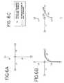
- FIGS. 2A-2Care diagrams illustrating alternative embodiments of the data collection vehicles shown in FIG. 1 .
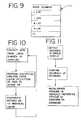
- FIG. 11is a flow chart indicating the steps for re-calibrating an out-of-calibration sensor in a vehicle.
- Each of the data collection vehicles 50includes a data collection system 39 .
- Each data collection system 39includes one or more sensors capable of collecting data representing physical features about the environment of the vehicle or the vehicle's physical position as the vehicle is moving or while it is stopped. As each of the data collection vehicles 50 moves on the roads (or is stopped) in the geographic area 47 , the sensors in the data collection system of the vehicle sense physical features.
- These data collection vehicles 50may include vehicles in which in-vehicle navigation systems are installed, or vehicles which have only data collection system equipment without on-board navigation systems, or may include both types of vehicles.
- the plurality of vehicles 50may include vehicles which are owned (or leased) by private party end-users as well as fleet vehicles. Some of the data collection vehicles 50 include local copies of a geographic database 56 (shown in FIGS. 2A and 2B ) which may be a copy or version of a portion of the central geographic database 20 . The data collection vehicles 50 communicate data derived from their data collection systems to the central geographic data manager 10 using suitable communications links 49 .
- FIGS. 2A-2Cillustrate alternative embodiments of the data collection vehicles 50 .
- FIG. 2Billustrates another embodiment of a data collection vehicle 50 ( 2 ).
- the embodiment 50 ( 2 ) of FIG. 2Bcollects raw sensor data and communicates it to the central geographic data manager 10 .
- the data collection vehicle 50 ( 2 )includes a data collection system 39 ( 2 ) which includes a sensor driver 51 , a vehicle computing system 52 , a communications manager 58 , a local map database 56 , and one or more sensors 60 .
- the data collection vehicle 50 ( 2 )may also include an update manager 59 which is not necessarily part of the data collection system 39 ( 2 ).
- an in-vehicle navigation systemmay be used as part of the data collection system.
- the outputs of the one or more sensor devices 60provide sensor device data 54 .
- the sensor devices 60collect data as the vehicle 50 ( 2 ) moves around or stops in the geographic region 47 .
- a sensor driver 51which may be a software program, processes the sensor device data 54 into raw sensor data 55 R.
- the functions performed by the sensor driver 51may include, for example, converting essentially analog outputs of sensors 60 into appropriate digital data, scaling the data, time stamping the data, compressing the data, identifying the types of sensors that generate the data, organizing the raw data for storage purposes, and so on.
- the raw sensor data 55 Rmay be temporarily stored in a data storage device (not shown) in the vehicle 50 ( 2 ).
- the raw sensor data 55 Ris communicated to the central data manager 10 .
- the communications manager 58which may be similar to the communications manager in the embodiment of FIG. 2A , may be used for this purpose.
- the central geographic data manager 10receives raw sensor data 55 R from the data collection vehicles 50 ( 2 ), 50 ( 3 ) that communicate non-filtered data at a raw data collector 28 .
- the central geographic data manager 10receives filtered data 55 F from the data collection vehicles 50 ( 1 ) at a filtered data collector 12 .
- the filtered sensor data collector 12 and the raw sensor data collector 28are interfaces to the communication links 49 and may be implemented by any suitable technology for receiving data.
- Each collectorhandles the data received from its corresponding plurality of data collection vehicles 50 and forwards the data to the appropriate processes in the central geographic data manager 10 .
- the filtered data collector 12stores and organizes the filtered sensor data 55 F in a central filtered sensor database 14 .
- the raw data collector 28organizes the raw sensor data from the plurality of vehicles in a central raw data database 30 .
- This collection of datais analyzed for variances by a central sensor data processor 32 .
- the central sensor data processoris a computer program, similar to the local sensor data processor 53 of FIG. 2A , capable of calculating variances based on comparisons of the raw data with the geographic data in the central database 20 .
- the central sensor data processor 32stores variances as filtered sensor data in the filtered sensor database 14 .
- the statistical analysis techniquescan also take into account historical information. For example, if a highly traveled road segment that was sensed thousands of times a day for years suddenly had no reported sensor readings, it would be an indication that the road was no longer open. An appropriate update to the central database, or at least an indication to verify a possible change in the database record, would be processed accordingly.
- the statistical data analyzer 16also provides for any layout changes that may be necessary when the database is modified. Such layout changes may involve creating new links, modifying the geometry of existing links, and designating features known about the new and existing links.
- the steps performed in the manager 10including the determination of variances, the collection of data from the vehicles, the analysis of statistical significance, and the updating of the central database, are performed on an ongoing and continuous basis. However, in alternative embodiments, it may be preferred to perform some of these tasks intermittently or periodically.
- data reflecting the updating process applied to the central databaseis released to the end-users.
- the release and/or distribution of datamay be performed by an update distributor 26 .
- Distributionmay be accomplished electronically using the wireless communication links 49 .
- the update distributor 26may communicate updated information from the central data manager 10 directly back to the local communications managers 58 in the individual data collection vehicles 50 .
- Other alternative means of distributionmay be used including distribution of hard media, such as CD-ROM discs and PCMCIA cards, downloading to personal computers, and so on.
- the end-usersmay include persons who use local versions 56 of geographic databases in their vehicles.
- the end-usersmay also include various others including, for example, personal computer users 46 and networks 48 , such as on-line services, services that use the Internet and organizations that incorporate all or parts of the geographic database in applications such as emergency dispatch centers, truck fleet tracking and package delivery fleet tracking.
- the releasesmay occur on a continuous basis, or may occur from time to time, or on a regular or irregular basis, a staggered basis, and so on.
- the release of data reflecting the updating processcan be made in any of several different formats.
- the updated datamay be released as a series of update transactions which are applied to each user's local copy of the geographic database, as needed.
- versions of the entire database reflecting the updated datamay be provided.
- vehicle sensors in the various end-users' vehiclesare fine-tuned for very high levels of accuracy by a feedback process.
- the feedback processuses the collection of sensor data from a large number of vehicles (using the process described above, for example) to provide highly accurate geographic data in the central database which in turn is distributed to individual end-user vehicles and used to adjust and calibrate the sensors in each of the individual end-user vehicles to conform to the known-to-be-highly accurate geographic data.
- the continued use of data collection vehicles and the redistribution of known-to-be-highly accurate data to the individual end-users' vehicles for calibrating of the sensors in the vehiclesforms a feedback loop which pumps up the accuracy of the sensors in each of the individual vehicles.
- the accuracy that can be obtained in this mannercan exceed the accuracy that could be obtained by any one vehicle or any one sensor measurement using conventional techniques.
- a diagram illustrating this processis shown in FIG. 10 .
- the levels of accuracy that can be achievedcan be as high as ⁇ 1 cm, or better. Given these levels of accuracy, it is possible to use a geographic database for vehicle control and safety systems. With high levels of accuracy in both the geographic database and the vehicle positioning sensors, the safety systems can automatically determine if the vehicle is deviating from the roadway, veering out of its lane, and so on. In conjunction with the high levels of accuracy, the safety systems or vehicle control systems use the confidence level attributes, described above, to confirm that the data is not only accurate but also reliable.
- out-of-alignment sensors in a vehiclecan be detected and corrected using a feedback process.
- a feedback process to develop highly accurate dataas described above, once geographic data is known-to-be highly accurate (i.e. its confidence level is high) as a result of statistical analysis of a large number of data records collected from a large number of vehicles over a significant period of time, if one vehicle using the data reports variances, then it can be determined that the sensors in the variance-reporting vehicle are likely out of calibration. Then, using only the variance data reported from the one vehicle and the known-to-be-highly accurate data, the sensors in the variance-reporting vehicle are re-calibrated to the same level of accuracy as all the other vehicles.
- FIG. 11A diagram illustrating this process is shown in FIG. 11 .
- the data collection systems in each of the data collection vehiclesprovide data that identifies of the types of sensors being used to collect the data. Then, when variances from a vehicle are collected, the type of sensors measuring the variances are taken into account. For example, if a type of sensor reports variances that suggest it should be re-calibrated, it is first compared to similar kinds of sensors. This permits a better evaluation of the extent to which the particular type of sensor can be calibrated based on the accuracy which is achievable in like-equipped vehicles.
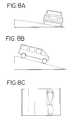
- FIGS. 4A-4CProcessing of a modification to an existing database based upon the collection of data from a single vehicle is illustrated in connection with FIGS. 4A-4C .
- This examplerefers to positional information (latitude, longitude, and altitude) and illustrates attempts to match positional sensor data to the elements in a geographic database (e.g. the central geographic database 20 in FIG. 1 or the map database 56 in FIGS. 2 A and 2 B). Similar steps would be used for other types of data.
- FIG. 4Agraphically depicts an area that may be represented in a geographic database.
- FIG. 4Aillustrates map positions 80 ( 1 ), 80 ( 2 ) . . . 80 ( n ) and map links 100 ( 1 ), 100 ( 2 ), . . . 100 ( n ) representing road segments, connecting the map positions 80 .
- FIG. 4Ba set of actual positions 90 ( 1 ) . . . 90 ( n ) established by the sensor devices on the vehicle are denoted as arrows with time sequence identifiers T 1 -T 14 .
- the map matching processuses the vehicle's bearing, proximity to that link 100 ( 1 ), and various link features to place the vehicle on a matched link 100 ( 1 ).
- the sensor data pointsare compared to map positions 80 and the matched link 100 ( 1 ) by determining the shortest distance from the sensor data point to the matched link 100 ( 1 ). If the resulting distance exceeds specified tolerance levels, or if sensor data conflicts with features of the matched link 100 ( 1 ), a record of this variance is created along with relevant sensor data.
- the record, illustrated in FIG. 4C as a new link 110 ( 1 ),is then stored in the filtered sensor database ( 55 F of FIG. 2A or 14 of FIG. 1 ).
- a linkis traversed with all sensor samples within the tolerance level, a record is created in the filtered sensor database, certifying the accuracy of the matched link and its features and identifying the sensor device or devices used.
- the filtered sensor dataincludes information regarding potential new links and may be used to determine whether the geographic database is to be updated. During the update of the geographic database, features relative to the actual position may be determined from the sensor data. Data relating to such features may be included as filtered sensor data so that the features may be included in the update of the geographic database. For example, if only the data collection shown in FIGS. 4B and 4C were available, the new link 100 ( m ) (also labeled L 9 ) can be traversed from left to right (in the direction the collector vehicle traveled) based on the single collection of sensor data.
- the filtered sensor datamay provide information regarding other features that may be used during the update of the geographic database.
- the addition of the new link 100 ( m )forms two new links labeled 100 ( 1 )( 2 ) (also L 3 b ) and 100 ( 1 )( 1 ) (also L 3 a ) where previously only 100 ( 1 ) (labeled L 3 ) existed as illustrated in FIG. 4 C.
- the update of the geographic databasemay include a feature allowing vehicles to traverse from link L 3 a ) to L 9 (labeled 100 ( m )), but not from L 3 b to L 9 .
- the featuremay be revised if data supporting travel from L 3 b to L 9 is received.
- FIGS. 5A-5Lillustrate time sequence examples of using sensor data to update the geographic database.
- FIGS. 5A-5Fillustrate a method of using sensor data to update the geographic database for a single sample of sensor data.
- FIGS. 5G-5Lillustrate a method of using sensor data to update the geographic database after a second sample of data has been collected on the same link.
- FIG. 5Acontains a sample road network 120 and an example of a graphical representation 122 of the geographic database 20 (shown in FIG. 1 ) at its time of release.
- the geographic database 20contains no link for Market St. between 1st St. and 2nd St.
- FIG. 5Billustrates the tracking of a vehicle with sensor devices generating actual positions 130 , in relation to both the road network 120 and the database 122 .
- the unfilled triangles 130 U in FIG. 5Crepresent positions which were able to match to links in the database as denoted by the arrows.
- the filled triangles 130 F in FIG. 5Crepresent positions which would exceed map matching tolerance levels and therefore induce the map matching process to store these positions as unmatched in the filtered sensor database.
- the unmatched positionsmay be stored as an ordered set of points 136 as shown in FIG. 5 D.
- the contents of the entry in the filtered sensor databasewould be the previous link L 8 successfully matched, the latitude/longitude of each unmatched position, and the next link L 11 successfully matched.
- the data analyzer processor 16(in FIGS. 1 and 2A ) then derives a new link using the method illustrated in FIGS. 5E and 5F .
- the new link 100 ( q )is constructed by joining all unmatched positions and terminating at the intersection of links L 11 A and L 11 B as shown in FIG. 5 E.
- the filtered position databaseis then updated to associate all unmatched positions with the new link 100 ( q ).
- FIG. 5 FThe resulting database content is illustrated in FIG. 5 F.
- featuresmay be added to this new link which may include the direction of travel (from left to right), the average speed, and the fact that turns can legally be made from L 8 B to 100 ( q ), and from 100 ( q ) to L 11 A.
- FIGS. 5G-5Lillustrate a process of using sensor data to update the geographic database after a second sample of data has been collected.
- FIG. 5Gcontains the same example of the road network 120 , and the depiction of the map database 122 as updated in FIGS. 5A-5F .
- FIG. 5Hcontains a new set of sensor data points 202 for a vehicle traveling in the opposite direction.
- FIG. 5Ihighlights the positions 202 U which exceeded map matching tolerance levels, but may have been determined to match the new link 100 ( q ).
- the map matching processwill store these positions 202 U with the filtered sensor data as an ordered set of points 206 as shown in FIG. 5 J.
- the filtered sensor datamay include the previous link matched L 11 A, the ordered set of points 206 , the next link matched L 8 B, and the assumed match 100 ( q ).
- the sensor data processorwould then update the geographic database using a process described below with reference to FIGS. 5J , 5 K and 5 L.
- all ordered sets of points from the filtered sensor data which have been associated with the new link 100 ( q ), which in this example is the ordered sets of points 206are identified.
- all positions for the same direction of travel as the positions being processedare identified.
- the positions represented by the ordered set of points 206are for the direction opposite the direction of the new link 100 ( q ).
- the ordered set of points 206are then averaged using a sequential averaging or curve fitting technique to create a single sequence of positions.
- All points having a direction of travel opposite the direction of the ordered set of points 136are then averaged using the sequential averaging or curve-fitting technique to create an opposite direction ordered set of points 136 A.
- no pointswere collected in the second sample traveling in the same direction as the new link 100 ( q ). Therefore, the new link 100 ( q ), or points in the new link 100 ( q ), may be used for the opposite direction ordered set of points 136 A.
- Sensor devices which can identify objects in the path of a vehiclecan be confused by permanent structures (for example signs, pillars, overpasses, poles, etc.). Maintaining an accurate model of these permanent structures can enable the sensor devices to filter out objects that may otherwise be interpreted as a potential hazard.
- systems that identify road hazardscan engage with the appropriate action more reliably.
- Variancesmay be determined for database elements that represent objects when compared to images sensed from image sensors using a process similar to the process in FIG. 3 .
- signs or other landmarkscan be detected by cameras using image or shape detecting programs. The sign text on the signs is recorded and variances are stored, as described above.
Landscapes
- Engineering & Computer Science (AREA)
- Remote Sensing (AREA)
- Radar, Positioning & Navigation (AREA)
- Physics & Mathematics (AREA)
- General Physics & Mathematics (AREA)
- Automation & Control Theory (AREA)
- Traffic Control Systems (AREA)
- Navigation (AREA)
- Instructional Devices (AREA)
- Information Retrieval, Db Structures And Fs Structures Therefor (AREA)
Abstract
Description
Claims (19)
Priority Applications (2)
| Application Number | Priority Date | Filing Date | Title |
|---|---|---|---|
| US10/298,798US6853913B2 (en) | 1997-10-16 | 2002-11-18 | System and method for updating, enhancing, or refining a geographic database using feedback |
| US11/044,139US20050149259A1 (en) | 1997-10-16 | 2005-01-27 | System and method for updating, enhancing, or refining a geographic database using feedback |
Applications Claiming Priority (3)
| Application Number | Priority Date | Filing Date | Title |
|---|---|---|---|
| US08/951,767US6047234A (en) | 1997-10-16 | 1997-10-16 | System and method for updating, enhancing or refining a geographic database using feedback |
| US09/532,751US6516267B1 (en) | 1997-10-16 | 2000-03-22 | System and method for updating, enhancing or refining a geographic database using feedback |
| US10/298,798US6853913B2 (en) | 1997-10-16 | 2002-11-18 | System and method for updating, enhancing, or refining a geographic database using feedback |
Related Parent Applications (1)
| Application Number | Title | Priority Date | Filing Date |
|---|---|---|---|
| US09/532,751ContinuationUS6516267B1 (en) | 1997-10-16 | 2000-03-22 | System and method for updating, enhancing or refining a geographic database using feedback |
Related Child Applications (1)
| Application Number | Title | Priority Date | Filing Date |
|---|---|---|---|
| US11/044,139ContinuationUS20050149259A1 (en) | 1997-10-16 | 2005-01-27 | System and method for updating, enhancing, or refining a geographic database using feedback |
Publications (2)
| Publication Number | Publication Date |
|---|---|
| US20030125871A1 US20030125871A1 (en) | 2003-07-03 |
| US6853913B2true US6853913B2 (en) | 2005-02-08 |
Family
ID=25492123
Family Applications (4)
| Application Number | Title | Priority Date | Filing Date |
|---|---|---|---|
| US08/951,767Expired - LifetimeUS6047234A (en) | 1997-10-16 | 1997-10-16 | System and method for updating, enhancing or refining a geographic database using feedback |
| US09/532,751Expired - LifetimeUS6516267B1 (en) | 1997-10-16 | 2000-03-22 | System and method for updating, enhancing or refining a geographic database using feedback |
| US10/298,798Expired - LifetimeUS6853913B2 (en) | 1997-10-16 | 2002-11-18 | System and method for updating, enhancing, or refining a geographic database using feedback |
| US11/044,139AbandonedUS20050149259A1 (en) | 1997-10-16 | 2005-01-27 | System and method for updating, enhancing, or refining a geographic database using feedback |
Family Applications Before (2)
| Application Number | Title | Priority Date | Filing Date |
|---|---|---|---|
| US08/951,767Expired - LifetimeUS6047234A (en) | 1997-10-16 | 1997-10-16 | System and method for updating, enhancing or refining a geographic database using feedback |
| US09/532,751Expired - LifetimeUS6516267B1 (en) | 1997-10-16 | 2000-03-22 | System and method for updating, enhancing or refining a geographic database using feedback |
Family Applications After (1)
| Application Number | Title | Priority Date | Filing Date |
|---|---|---|---|
| US11/044,139AbandonedUS20050149259A1 (en) | 1997-10-16 | 2005-01-27 | System and method for updating, enhancing, or refining a geographic database using feedback |
Country Status (4)
| Country | Link |
|---|---|
| US (4) | US6047234A (en) |
| EP (1) | EP0921509B1 (en) |
| JP (1) | JP4559551B2 (en) |
| DE (1) | DE69823462T2 (en) |
Cited By (100)
| Publication number | Priority date | Publication date | Assignee | Title |
|---|---|---|---|---|
| US20030200259A1 (en)* | 2002-04-18 | 2003-10-23 | Nec Corporation | Information providing system and information providing server for providing a reliable provision information |
| US20040088110A1 (en)* | 2002-08-26 | 2004-05-06 | Keizo Suzuki | Method and apparatus for displaying navigation information |
| US20050021224A1 (en)* | 2003-07-21 | 2005-01-27 | Justin Gray | Hazard countermeasure system and method for vehicles |
| US20050049783A1 (en)* | 2003-08-29 | 2005-03-03 | Hunzinger Jason F. | Iterative logical renewal of navigable map database |
| US20050149259A1 (en)* | 1997-10-16 | 2005-07-07 | Kevin Cherveny | System and method for updating, enhancing, or refining a geographic database using feedback |
| US20050278386A1 (en)* | 2004-06-15 | 2005-12-15 | Geographic Data Technology, Inc. | Geospatial information system and method for updating same |
| US20050283699A1 (en)* | 2004-06-21 | 2005-12-22 | Kimihiro Nomura | Map error information obtaining system and map error information obtaining method |
| US20060156338A1 (en)* | 2002-12-24 | 2006-07-13 | Matthias Hessling | Method for the transmisson of location-related information |
| US20060271552A1 (en)* | 2005-05-26 | 2006-11-30 | Venture Capital & Consulting Group, Llc. | Targeted delivery of content |
| US20070168112A1 (en)* | 2006-01-17 | 2007-07-19 | Ratliff Emily J | Method and system for providing travel direction annotations over a network |
| US7275014B1 (en)* | 2005-02-10 | 2007-09-25 | At&T Corporation | Distributed graph layout for sensor node networks |
| US20080071467A1 (en)* | 2006-09-19 | 2008-03-20 | Johnson Christopher S | Collection, monitoring, analyzing and reporting of traffic data via vehicle sensor devices placed at multiple remote locations |
| US20080103692A1 (en)* | 2006-10-25 | 2008-05-01 | Denso Corporation | Road information storage apparatus, program for the same, and system for the same |
| US20080117201A1 (en)* | 2006-11-22 | 2008-05-22 | Ronald Martinez | Methods, Systems and Apparatus for Delivery of Media |
| US20080117202A1 (en)* | 2006-11-22 | 2008-05-22 | Ronald Martinez | Methods, Systems and Apparatus for Delivery of Media |
| US20080126961A1 (en)* | 2006-11-06 | 2008-05-29 | Yahoo! Inc. | Context server for associating information based on context |
| US20090037465A1 (en)* | 2007-07-31 | 2009-02-05 | Lukas Michael Marti | Method of improving database integrity for driver assistance applications |
| US20090070031A1 (en)* | 2007-09-07 | 2009-03-12 | On Time Systems Inc. | System and method for automated updating of map information |
| US7519472B1 (en) | 2008-05-15 | 2009-04-14 | International Business Machines Corporation | Inferring static traffic artifact presence, location, and specifics from aggregated navigation system data |
| US20090109020A1 (en)* | 2007-10-29 | 2009-04-30 | At&T Bls Intellectual Property, Inc. | Methods, systems, devices, and computer program products for implementing condition alert services |
| US20090138497A1 (en)* | 2007-11-06 | 2009-05-28 | Walter Bruno Zavoli | Method and system for the use of probe data from multiple vehicles to detect real world changes for use in updating a map |
| US20090150514A1 (en)* | 2007-12-10 | 2009-06-11 | Yahoo! Inc. | System and method for contextual addressing of communications on a network |
| US20090150373A1 (en)* | 2007-12-06 | 2009-06-11 | Yahoo! Inc. | System and method for synchronizing data on a network |
| US20090150501A1 (en)* | 2007-12-10 | 2009-06-11 | Marc Eliot Davis | System and method for conditional delivery of messages |
| US20090171939A1 (en)* | 2007-12-28 | 2009-07-02 | Yahoo! Inc. | User-generated activity maps |
| US20090176509A1 (en)* | 2008-01-04 | 2009-07-09 | Davis Marc E | Interest mapping system |
| US20090177378A1 (en)* | 2008-01-07 | 2009-07-09 | Theo Kamalski | Navigation device and method |
| US20090177484A1 (en)* | 2008-01-06 | 2009-07-09 | Marc Eliot Davis | System and method for message clustering |
| US20090222304A1 (en)* | 2008-03-03 | 2009-09-03 | Yahoo! Inc. | Method and Apparatus for Social Network Marketing with Advocate Referral |
| US20090259360A1 (en)* | 2008-04-15 | 2009-10-15 | Robert Bosch Gmbh | Determining microenvironment conditions |
| US20090326800A1 (en)* | 2008-06-27 | 2009-12-31 | Yahoo! Inc. | System and method for determination and display of personalized distance |
| US20100027527A1 (en)* | 2008-07-30 | 2010-02-04 | Yahoo! Inc. | System and method for improved mapping and routing |
| US20100049702A1 (en)* | 2008-08-21 | 2010-02-25 | Yahoo! Inc. | System and method for context enhanced messaging |
| US20100063993A1 (en)* | 2008-09-08 | 2010-03-11 | Yahoo! Inc. | System and method for socially aware identity manager |
| US20100077017A1 (en)* | 2008-09-19 | 2010-03-25 | Yahoo! Inc. | System and method for distributing media related to a location |
| US20100083169A1 (en)* | 2008-09-30 | 2010-04-01 | Athellina Athsani | System and method for context enhanced mapping within a user interface |
| US20100082688A1 (en)* | 2008-09-30 | 2010-04-01 | Yahoo! Inc. | System and method for reporting and analysis of media consumption data |
| US20100094381A1 (en)* | 2008-10-13 | 2010-04-15 | Electronics And Telecommunications Research Institute | Apparatus for driving artificial retina using medium-range wireless power transmission technique |
| US20100125605A1 (en)* | 2008-11-18 | 2010-05-20 | Yahoo! Inc. | System and method for data privacy in url based context queries |
| US20100125562A1 (en)* | 2008-11-18 | 2010-05-20 | Yahoo, Inc. | System and method for generation of url based context queries |
| US20100125604A1 (en)* | 2008-11-18 | 2010-05-20 | Yahoo, Inc. | System and method for url based query for retrieving data related to a context |
| US20100161600A1 (en)* | 2008-12-19 | 2010-06-24 | Yahoo! Inc. | System and method for automated service recommendations |
| US20100185517A1 (en)* | 2009-01-21 | 2010-07-22 | Yahoo! Inc. | User interface for interest-based targeted marketing |
| US20100185518A1 (en)* | 2009-01-21 | 2010-07-22 | Yahoo! Inc. | Interest-based activity marketing |
| US20100228582A1 (en)* | 2009-03-06 | 2010-09-09 | Yahoo! Inc. | System and method for contextual advertising based on status messages |
| US20100241689A1 (en)* | 2009-03-19 | 2010-09-23 | Yahoo! Inc. | Method and apparatus for associating advertising with computer enabled maps |
| US20100250727A1 (en)* | 2009-03-24 | 2010-09-30 | Yahoo! Inc. | System and method for verified presence tracking |
| US20100272512A1 (en)* | 2009-04-23 | 2010-10-28 | Bomag Gmbh | Multipurpose Compactor and Method for Operating the Multipurpose Compactor |
| US20100280879A1 (en)* | 2009-05-01 | 2010-11-04 | Yahoo! Inc. | Gift incentive engine |
| US20100280913A1 (en)* | 2009-05-01 | 2010-11-04 | Yahoo! Inc. | Gift credit matching engine |
| US20100305851A1 (en)* | 2007-09-21 | 2010-12-02 | Fraunhofer-Gesellschaft Zur Foerderung Der Angewandten Forschung E.V. | Device and method for updating cartographic data |
| US20110035265A1 (en)* | 2009-08-06 | 2011-02-10 | Yahoo! Inc. | System and method for verified monetization of commercial campaigns |
| US20110037618A1 (en)* | 2009-08-11 | 2011-02-17 | Ginsberg Matthew L | Driver Safety System Using Machine Learning |
| US20110037619A1 (en)* | 2009-08-11 | 2011-02-17 | On Time Systems, Inc. | Traffic Routing Using Intelligent Traffic Signals, GPS and Mobile Data Devices |
| US20110087433A1 (en)* | 2009-10-08 | 2011-04-14 | Honda Motor Co., Ltd. | Method of Dynamic Intersection Mapping |
| US20110161032A1 (en)* | 2007-08-29 | 2011-06-30 | Continental Teves Ag & Co.Ohg | Correction of a vehicle position by means of landmarks |
| US20110191161A1 (en)* | 2010-02-02 | 2011-08-04 | Xia Dai | Secured Mobile Transaction Device |
| US8024317B2 (en) | 2008-11-18 | 2011-09-20 | Yahoo! Inc. | System and method for deriving income from URL based context queries |
| US20110238294A1 (en)* | 2010-03-23 | 2011-09-29 | Denso Corporation | Vehicular navigation device |
| US8055675B2 (en) | 2008-12-05 | 2011-11-08 | Yahoo! Inc. | System and method for context based query augmentation |
| US8086700B2 (en) | 2008-07-29 | 2011-12-27 | Yahoo! Inc. | Region and duration uniform resource identifiers (URI) for media objects |
| US8166168B2 (en) | 2007-12-17 | 2012-04-24 | Yahoo! Inc. | System and method for disambiguating non-unique identifiers using information obtained from disparate communication channels |
| US8271506B2 (en) | 2008-03-31 | 2012-09-18 | Yahoo! Inc. | System and method for modeling relationships between entities |
| US20120277993A1 (en)* | 2009-10-22 | 2012-11-01 | Heiko Mund | Incremental map generation, refinement and extension with gps traces |
| US8364611B2 (en) | 2009-08-13 | 2013-01-29 | Yahoo! Inc. | System and method for precaching information on a mobile device |
| US20130131980A1 (en)* | 2007-09-07 | 2013-05-23 | On Time Systems, Inc. | Resolving gps ambiguity in electronic maps |
| US8452855B2 (en) | 2008-06-27 | 2013-05-28 | Yahoo! Inc. | System and method for presentation of media related to a context |
| US8554623B2 (en) | 2008-03-03 | 2013-10-08 | Yahoo! Inc. | Method and apparatus for social network marketing with consumer referral |
| US8560390B2 (en) | 2008-03-03 | 2013-10-15 | Yahoo! Inc. | Method and apparatus for social network marketing with brand referral |
| US8583668B2 (en) | 2008-07-30 | 2013-11-12 | Yahoo! Inc. | System and method for context enhanced mapping |
| US8589486B2 (en) | 2008-03-28 | 2013-11-19 | Yahoo! Inc. | System and method for addressing communications |
| US8618952B2 (en) | 2011-01-21 | 2013-12-31 | Honda Motor Co., Ltd. | Method of intersection identification for collision warning system |
| US8618951B2 (en) | 2010-09-17 | 2013-12-31 | Honda Motor Co., Ltd. | Traffic control database and distribution system |
| DE102012216788A1 (en)* | 2012-09-19 | 2014-05-28 | Bayerische Motoren Werke Aktiengesellschaft | Method for obtaining quality data relating to information of switching times/conditions of traffic lights and/or variable message signs, involves comparing actual and expected states of traffic lights and/or variable message signs |
| US20140145864A1 (en)* | 2012-11-27 | 2014-05-29 | Hyundai Motor Company | Apparatus of establishing lane information using driving information of vehicle and method of establishing the same |
| US8745133B2 (en) | 2008-03-28 | 2014-06-03 | Yahoo! Inc. | System and method for optimizing the storage of data |
| US8769099B2 (en) | 2006-12-28 | 2014-07-01 | Yahoo! Inc. | Methods and systems for pre-caching information on a mobile computing device |
| US20140218214A1 (en)* | 2010-09-02 | 2014-08-07 | Honda Motor Co., Ltd. | Warning System For A Motor Vehicle Determining An Estimated Intersection Control |
| US8813107B2 (en) | 2008-06-27 | 2014-08-19 | Yahoo! Inc. | System and method for location based media delivery |
| US8818641B2 (en) | 2009-12-18 | 2014-08-26 | Honda Motor Co., Ltd. | Method of intersection estimation for a vehicle safety system |
| US8892495B2 (en) | 1991-12-23 | 2014-11-18 | Blanding Hovenweep, Llc | Adaptive pattern recognition based controller apparatus and method and human-interface therefore |
| US8914342B2 (en) | 2009-08-12 | 2014-12-16 | Yahoo! Inc. | Personal data platform |
| US20150057920A1 (en)* | 2011-10-21 | 2015-02-26 | Robert Bosch Gmbh | Transfer of data from image-data-based map services into an assistance system |
| US9224172B2 (en) | 2008-12-02 | 2015-12-29 | Yahoo! Inc. | Customizable content for distribution in social networks |
| US9384394B2 (en) | 2013-10-31 | 2016-07-05 | Toyota Motor Engineering & Manufacturing North America, Inc. | Method for generating accurate lane level maps |
| US9417076B2 (en)* | 2014-12-29 | 2016-08-16 | Here Global B.V. | Total route score to measure quality of map content |
| US9507778B2 (en) | 2006-05-19 | 2016-11-29 | Yahoo! Inc. | Summarization of media object collections |
| US9535563B2 (en) | 1999-02-01 | 2017-01-03 | Blanding Hovenweep, Llc | Internet appliance system and method |
| US9626685B2 (en) | 2008-01-04 | 2017-04-18 | Excalibur Ip, Llc | Systems and methods of mapping attention |
| US10074093B2 (en) | 2008-01-16 | 2018-09-11 | Excalibur Ip, Llc | System and method for word-of-mouth advertising |
| US10083607B2 (en) | 2007-09-07 | 2018-09-25 | Green Driver, Inc. | Driver safety enhancement using intelligent traffic signals and GPS |
| US10198942B2 (en) | 2009-08-11 | 2019-02-05 | Connected Signals, Inc. | Traffic routing display system with multiple signal lookahead |
| US10223380B2 (en) | 2016-03-23 | 2019-03-05 | Here Global B.V. | Map updates from a connected vehicle fleet |
| US10311724B2 (en) | 2007-09-07 | 2019-06-04 | Connected Signals, Inc. | Network security system with application for driver safety system |
| US10678776B1 (en)* | 2010-10-06 | 2020-06-09 | Google Llc | Automated identification of anomalous map data |
| US10764713B2 (en) | 2016-05-11 | 2020-09-01 | Here Global B.V. | Map based feedback loop for vehicle observation |
| US10896334B2 (en) | 2018-11-28 | 2021-01-19 | Here Global B.V. | Method and system of a machine learning model for detection of physical dividers |
| US10970317B2 (en) | 2015-08-11 | 2021-04-06 | Continental Automotive Gmbh | System and method of a two-step object data processing by a vehicle and a server database for generating, updating and delivering a precision road property database |
| US11085774B2 (en) | 2015-08-11 | 2021-08-10 | Continental Automotive Gmbh | System and method of matching of road data objects for generating and updating a precision road database |
| US11537587B2 (en)* | 2015-12-14 | 2022-12-27 | Amazon Technologies, Inc. | Techniques and systems for storage and processing of operational data |
Families Citing this family (383)
| Publication number | Priority date | Publication date | Assignee | Title |
|---|---|---|---|---|
| US10361802B1 (en) | 1999-02-01 | 2019-07-23 | Blanding Hovenweep, Llc | Adaptive pattern recognition based control system and method |
| US6526352B1 (en)* | 2001-07-19 | 2003-02-25 | Intelligent Technologies International, Inc. | Method and arrangement for mapping a road |
| US7629899B2 (en)* | 1997-10-22 | 2009-12-08 | Intelligent Technologies International, Inc. | Vehicular communication arrangement and method |
| US20040139049A1 (en)* | 1996-08-22 | 2004-07-15 | Wgrs Licensing Company, Llc | Unified geographic database and method of creating, maintaining and using the same |
| US5999866A (en)* | 1996-11-05 | 1999-12-07 | Carnegie Mellon University | Infrastructure independent position determining system |
| US6009355A (en)* | 1997-01-28 | 1999-12-28 | American Calcar Inc. | Multimedia information and control system for automobiles |
| US8332247B1 (en) | 1997-06-12 | 2012-12-11 | G. William Bailey | Methods and systems for optimizing network travel costs |
| US7412398B1 (en) | 1997-06-12 | 2008-08-12 | Bailey G William | Method for analyzing net demand for a market area utilizing weighted bands |
| US6604083B1 (en)* | 1997-06-12 | 2003-08-05 | G. William Bailey | Market determination based on travel time bands |
| US6148261A (en)* | 1997-06-20 | 2000-11-14 | American Calcar, Inc. | Personal communication system to send and receive voice data positioning information |
| US6275231B1 (en)* | 1997-08-01 | 2001-08-14 | American Calcar Inc. | Centralized control and management system for automobiles |
| JPH1165435A (en)* | 1997-08-21 | 1999-03-05 | Toyota Motor Corp | Map data processing device for vehicles |
| JP3546659B2 (en)* | 1997-09-25 | 2004-07-28 | トヨタ自動車株式会社 | Vehicle data processing system, in-vehicle terminal device and navigation device constituting the system |
| DE19743705C1 (en)* | 1997-10-02 | 1998-12-17 | Ibs Integrierte Business Syste | Method of collecting and combining positioning data from satellite location systems and other data |
| US6381533B1 (en) | 1997-10-16 | 2002-04-30 | Navigation Technologies Corp. | Method and system using positions of cellular phones matched to road network for collecting data |
| US20080154629A1 (en)* | 1997-10-22 | 2008-06-26 | Intelligent Technologies International, Inc. | Vehicle Speed Control Method and Arrangement |
| US8209120B2 (en)* | 1997-10-22 | 2012-06-26 | American Vehicular Sciences Llc | Vehicular map database management techniques |
| US10358057B2 (en)* | 1997-10-22 | 2019-07-23 | American Vehicular Sciences Llc | In-vehicle signage techniques |
| US7266560B2 (en)* | 1998-01-30 | 2007-09-04 | Navteq North America, Llc | Parcelized geographic data medium with internal spatial indices and method and system for use and formation thereof |
| US6697103B1 (en) | 1998-03-19 | 2004-02-24 | Dennis Sunga Fernandez | Integrated network for monitoring remote objects |
| JP2000194726A (en)* | 1998-10-19 | 2000-07-14 | Sony Corp | Device, method and system for processing information and providing medium |
| US6505165B1 (en)* | 1999-01-28 | 2003-01-07 | International Business Machines Corporation | Method and apparatus for locating facilities through an automotive computing system |
| US6343301B1 (en)* | 1999-02-24 | 2002-01-29 | Navigation Technologies Corp. | Method and system for collecting data for updating a geographic database |
| US8630795B2 (en) | 1999-03-11 | 2014-01-14 | American Vehicular Sciences Llc | Vehicle speed control method and arrangement |
| CA2266208C (en)* | 1999-03-19 | 2008-07-08 | Wenking Corp. | Remote road traffic data exchange and intelligent vehicle highway system |
| ATE403847T1 (en)* | 1999-03-23 | 2008-08-15 | Sony Deutschland Gmbh | SYSTEM AND METHOD FOR AUTOMATICALLY MANAGING GEOLOCALIZATION INFORMATION |
| US20060074546A1 (en)* | 1999-04-19 | 2006-04-06 | Dekock Bruce W | System for providing traffic information |
| US6466862B1 (en)* | 1999-04-19 | 2002-10-15 | Bruce DeKock | System for providing traffic information |
| DE19930796A1 (en) | 1999-07-03 | 2001-01-11 | Bosch Gmbh Robert | Method and device for transmitting navigation information from a data center to a vehicle-based navigation system |
| DE19933639A1 (en)* | 1999-07-17 | 2001-01-18 | Bosch Gmbh Robert | Procedure for calculating a route from a start to a destination |
| DE19933638A1 (en) | 1999-07-17 | 2001-01-18 | Bosch Gmbh Robert | Navigational method for a means of transportation |
| DE19935770A1 (en)* | 1999-07-23 | 2001-02-01 | Ddg Ges Fuer Verkehrsdaten Mbh | Feedback cascade |
| DE19935769C2 (en)* | 1999-07-23 | 2002-02-07 | Ddg Ges Fuer Verkehrsdaten Mbh | Traffic condition forecast through feedback cascade |
| US7107286B2 (en)* | 1999-07-26 | 2006-09-12 | Geoqwest International Inc. | Integrated information processing system for geospatial media |
| US6681231B1 (en) | 1999-07-26 | 2004-01-20 | The Real Estate Cable Network, Inc. | Integrated information processing system for geospatial media |
| US6438491B1 (en) | 1999-08-06 | 2002-08-20 | Telanon, Inc. | Methods and apparatus for stationary object detection |
| US6385539B1 (en)* | 1999-08-13 | 2002-05-07 | Daimlerchrysler Ag | Method and system for autonomously developing or augmenting geographical databases by mining uncoordinated probe data |
| DE19938691A1 (en)* | 1999-08-14 | 2001-02-15 | Volkswagen Ag | Traffic-guided influencing and/or support of motor vehicles involves detecting objects, including relative speed, using distance measurements to detect traffic situations |
| AU768488B2 (en)† | 1999-09-07 | 2003-12-11 | Robert Bosch Gmbh | Method for coding and decoding objects in a road traffic network |
| EP1218694B1 (en) | 1999-09-16 | 2006-11-15 | Sirf Technology, Inc. | Navigation system and method for tracking the position of an object |
| US6341255B1 (en) | 1999-09-27 | 2002-01-22 | Decell, Inc. | Apparatus and methods for providing route guidance to vehicles |
| US7236462B2 (en)* | 1999-10-04 | 2007-06-26 | General Electric Company | Method for data exchange with a mobile asset considering communication link quality |
| US6292724B1 (en)* | 1999-10-12 | 2001-09-18 | Micrologic, Inc. | Method of and system and apparatus for remotely monitoring the location, status, utilization and condition of widely geographically dispresed fleets of vehicular construction equipment and the like and providing and displaying such information |
| US6366851B1 (en)* | 1999-10-25 | 2002-04-02 | Navigation Technologies Corp. | Method and system for automatic centerline adjustment of shape point data for a geographic database |
| US6674434B1 (en)* | 1999-10-25 | 2004-01-06 | Navigation Technologies Corp. | Method and system for automatic generation of shape and curvature data for a geographic database |
| US6516273B1 (en)* | 1999-11-04 | 2003-02-04 | Veridian Engineering, Inc. | Method and apparatus for determination and warning of potential violation of intersection traffic control devices |
| WO2001043104A1 (en)* | 1999-12-10 | 2001-06-14 | David Sitrick | Methodology, apparatus, and system for electronic visualization of traffic conditions |
| EP1250691B1 (en)* | 1999-12-15 | 2006-05-17 | Vert, Inc. | System and method for managing advertisement and information displays on vehicles based on an e-commerce site |
| DE19962997B4 (en)* | 1999-12-24 | 2010-06-02 | Robert Bosch Gmbh | Method for calibrating a sensor system |
| US6314365B1 (en) | 2000-01-18 | 2001-11-06 | Navigation Technologies Corp. | Method and system of providing navigation services to cellular phone devices from a server |
| DE10004969A1 (en)* | 2000-02-04 | 2001-08-16 | Bosch Gmbh Robert | Method and device for managing traffic disruptions for navigation devices |
| GB2358975B (en) | 2000-02-05 | 2004-05-05 | Jaguar Cars | Motor vehicle trajectory measurement |
| DE10007348C2 (en)* | 2000-02-18 | 2003-07-10 | Harman Becker Automotive Sys | navigation system |
| JP4599649B2 (en)* | 2000-03-09 | 2010-12-15 | 株式会社エクォス・リサーチ | Billing processing apparatus in data communication network |
| US7187947B1 (en) | 2000-03-28 | 2007-03-06 | Affinity Labs, Llc | System and method for communicating selected information to an electronic device |
| US6381537B1 (en)* | 2000-06-02 | 2002-04-30 | Navigation Technologies Corp. | Method and system for obtaining geographic data using navigation systems |
| US6253151B1 (en)* | 2000-06-23 | 2001-06-26 | Navigation Technologies Corp. | Navigation system with feature for reporting errors |
| JP2002116689A (en)* | 2000-07-06 | 2002-04-19 | Pioneer Electronic Corp | Updating method of road information in map information providing system, its updating server, server program and recording medium recorded with the program |
| US7375728B2 (en)* | 2001-10-01 | 2008-05-20 | University Of Minnesota | Virtual mirror |
| US6977630B1 (en) | 2000-07-18 | 2005-12-20 | University Of Minnesota | Mobility assist device |
| US20050149251A1 (en)* | 2000-07-18 | 2005-07-07 | University Of Minnesota | Real time high accuracy geospatial database for onboard intelligent vehicle applications |
| EP1305573B1 (en)* | 2000-07-25 | 2008-04-30 | Deutsche Telekom AG | Method for providing traffic information |
| US20090109037A1 (en)* | 2000-08-11 | 2009-04-30 | Telanon, Inc. | Automated consumer to business electronic marketplace system |
| US20030130893A1 (en)* | 2000-08-11 | 2003-07-10 | Telanon, Inc. | Systems, methods, and computer program products for privacy protection |
| US7339483B1 (en) | 2000-08-11 | 2008-03-04 | Telanon, Inc. | Automated consumer to business electronic marketplace system |
| US20050091175A9 (en)* | 2000-08-11 | 2005-04-28 | Telanon, Inc. | Automated consumer to business electronic marketplace system |
| US6587781B2 (en) | 2000-08-28 | 2003-07-01 | Estimotion, Inc. | Method and system for modeling and processing vehicular traffic data and information and applying thereof |
| US6873998B1 (en)* | 2000-10-18 | 2005-03-29 | Navteq North America, Llc | System and method for updating a geographic database using satellite imagery |
| US6397143B1 (en)* | 2000-10-26 | 2002-05-28 | George Peschke | Layout based method for map navigation |
| US6766319B1 (en) | 2000-10-31 | 2004-07-20 | Robert J. Might | Method and apparatus for gathering and evaluating information |
| DE10055156A1 (en) | 2000-11-07 | 2002-05-16 | Harman Becker Automotive Sys | Method for generating a navigation map and navigation map |
| AU2001214805A1 (en)* | 2000-11-10 | 2002-05-21 | Roger L. Martin | Route data base generation procedures and systems, processes and products relating thereto |
| KR20020070491A (en)* | 2000-11-22 | 2002-09-09 | 코닌클리케 필립스 일렉트로닉스 엔.브이. | Candidate level multi-modal integration system |
| GB0029656D0 (en)* | 2000-12-06 | 2001-01-17 | Roke Manor Research | Location aware mobile phones |
| EP1213905B1 (en) | 2000-12-06 | 2011-08-17 | Siemens AG | Location dependent data collection |
| JP5041638B2 (en)* | 2000-12-08 | 2012-10-03 | パナソニック株式会社 | Method for transmitting location information of digital map and device used therefor |
| US6816798B2 (en)* | 2000-12-22 | 2004-11-09 | General Electric Company | Network-based method and system for analyzing and displaying reliability data |
| DE10065593A1 (en)* | 2000-12-28 | 2002-07-04 | Bosch Gmbh Robert | Method and device for generating road segment data for a digital map |
| JP2004533034A (en)* | 2001-02-22 | 2004-10-28 | コーヨームセン アメリカ,インコーポレイテッド | Apparatus, method and system for capturing, analyzing, integrating, distributing and utilizing data on current events |
| EP1241447A1 (en)* | 2001-03-13 | 2002-09-18 | Matsushita Electric Industrial Co., Ltd. | Information terminal and cartographic information providing system |
| AU2002346211B2 (en) | 2001-06-27 | 2008-06-12 | Sony Corporation | Integrated circuit device, information processing device, information recording device memory management method, mobile terminal device, semiconductor integrated circuit device, and communication method using mobile terminal device |
| US7548875B2 (en) | 2001-06-27 | 2009-06-16 | John Mikkelsen | Media delivery platform |
| US7552008B2 (en)* | 2001-07-18 | 2009-06-23 | Regents Of The University Of Minnesota | Populating geospatial database for onboard intelligent vehicle applications |
| JP2003051095A (en)* | 2001-08-07 | 2003-02-21 | Mazda Motor Corp | Server, method and program for changing control gain of automobile |
| DE10146098B4 (en)* | 2001-09-19 | 2005-05-19 | Robert Bosch Gmbh | Method for detecting and storing supplementary digitized route information and navigation system for this purpose |
| DE10148224A1 (en)* | 2001-09-28 | 2003-04-30 | Bosch Gmbh Robert | Method and system for determining card data |
| US7089162B2 (en)* | 2001-11-07 | 2006-08-08 | Harman International Industries, Incorporated | Navigation map creation system |
| DE10162335A1 (en)* | 2001-12-18 | 2003-07-10 | Zf Lemfoerder Metallwaren Ag | Method and device for generating and updating a route and / or route status map |
| US6636799B2 (en)* | 2001-12-21 | 2003-10-21 | Motorola, Inc. | Method and apparatus for modification of vehicular navigation information |
| US6725152B2 (en) | 2002-02-21 | 2004-04-20 | Lockheed Martin Corporation | Real-time route and sensor planning system with variable mission objectives |
| US6718261B2 (en) | 2002-02-21 | 2004-04-06 | Lockheed Martin Corporation | Architecture for real-time maintenance of distributed mission plans |
| US6687606B1 (en) | 2002-02-21 | 2004-02-03 | Lockheed Martin Corporation | Architecture for automatic evaluation of team reconnaissance and surveillance plans |
| US7647232B2 (en) | 2002-02-21 | 2010-01-12 | Lockheed Martin Corporation | Real-time team coordination system for reconnaissance and surveillance missions |
| US7209051B2 (en)* | 2002-03-05 | 2007-04-24 | University Of Minnesota | Intersection assistance system and method |
| US6816784B1 (en) | 2002-03-08 | 2004-11-09 | Navteq North America, Llc | Method and system using delivery trucks to collect address location data |
| US6651001B2 (en)* | 2002-03-18 | 2003-11-18 | Micrologics, Inc. | Method of and system and apparatus for integrating maintenance vehicle and service personnel tracking information with the remote monitoring of the location, status, utilization and condition of widely geographically dispersed fleets of vehicular construction equipment and the like to be maintained, and providing and displaying together both construction and maintenance vehicle information |
| US8407065B2 (en)* | 2002-05-07 | 2013-03-26 | Polyremedy, Inc. | Wound care treatment service using automatic wound dressing fabricator |
| CA2524934C (en)* | 2002-05-07 | 2011-11-22 | Polyremedy Llc | Method for treating wound, dressing for use therewith and apparatus and system for fabricating dressing |
| US7433889B1 (en) | 2002-08-07 | 2008-10-07 | Navteq North America, Llc | Method and system for obtaining traffic sign data using navigation systems |
| US7499949B2 (en)* | 2002-08-07 | 2009-03-03 | Navteq North America, Llc | Method and system for obtaining recurring delay data using navigation systems |
| US20040077347A1 (en)* | 2002-08-30 | 2004-04-22 | Ronald Lauber | Modular analog wireless data telemetry system adapted for use with web based location information distribution method and method for developing and disseminating information for use therewith |
| WO2004028061A2 (en)* | 2002-09-20 | 2004-04-01 | Racom Products, Inc. | Method for wireless data system distribution and disseminating information for use with web base location information |
| DE10244329A1 (en)* | 2002-09-23 | 2004-04-01 | Daimlerchrysler Ag | Sensor device for a motor vehicle system |
| US7127352B2 (en)* | 2002-09-30 | 2006-10-24 | Lucent Technologies Inc. | System and method for providing accurate local maps for a central service |
| DE10258470B4 (en)* | 2002-12-09 | 2012-01-19 | Volkswagen Ag | Navigation device for motor vehicles |
| US7162338B2 (en) | 2002-12-17 | 2007-01-09 | Evolution Robotics, Inc. | Systems and methods for computing a relative pose for global localization in a visual simultaneous localization and mapping system |
| JP4380151B2 (en)* | 2002-12-20 | 2009-12-09 | 株式会社デンソー | Map evaluation system and map evaluation device |
| US20040203909A1 (en)* | 2003-01-01 | 2004-10-14 | Koster Karl H. | Systems and methods for location dependent information download to a mobile telephone |
| US8032659B2 (en)* | 2003-01-21 | 2011-10-04 | Nextio Inc. | Method and apparatus for a shared I/O network interface controller |
| US6847887B1 (en)* | 2003-03-04 | 2005-01-25 | Navteq North America, Llc | Method and system for obtaining road grade data |
| US7099882B2 (en) | 2003-04-29 | 2006-08-29 | Navteq North America, Llc | Method and system for forming, updating, and using a geographic database |
| US6850841B1 (en) | 2003-05-15 | 2005-02-01 | Navtech North American, Llc | Method and system for obtaining lane data |
| USRE47986E1 (en) | 2003-05-15 | 2020-05-12 | Speedgauge, Inc. | System and method for evaluating vehicle and operator performance |
| GB0318194D0 (en)* | 2003-08-02 | 2003-09-03 | Nissan Technical Ct Europ Ltd | Navigation system |
| AT500123B1 (en)* | 2003-08-28 | 2007-01-15 | Oesterreichisches Forschungs U | METHOD AND ARRANGEMENT FOR DETERMINING THE ROUTES OF TRANSPORT PARTICIPANTS |
| US20050060299A1 (en)* | 2003-09-17 | 2005-03-17 | George Filley | Location-referenced photograph repository |
| US7035733B1 (en)* | 2003-09-22 | 2006-04-25 | Navteq North America, Llc | Method and system for obtaining road grade data |
| US6856897B1 (en) | 2003-09-22 | 2005-02-15 | Navteq North America, Llc | Method and system for computing road grade data |
| JP4604474B2 (en)* | 2003-10-14 | 2011-01-05 | 株式会社エクォス・リサーチ | Road information correction device |
| JP4606036B2 (en)* | 2004-02-12 | 2011-01-05 | アルパイン株式会社 | Navigation system and map data update method |
| US7689321B2 (en)* | 2004-02-13 | 2010-03-30 | Evolution Robotics, Inc. | Robust sensor fusion for mapping and localization in a simultaneous localization and mapping (SLAM) system |
| JP4684565B2 (en)* | 2004-03-23 | 2011-05-18 | 三菱電機株式会社 | Guidance information retrieval apparatus and guidance information retrieval system using the same |
| JP4703136B2 (en)* | 2004-06-02 | 2011-06-15 | トヨタ自動車株式会社 | Line drawing processing equipment |
| US7620402B2 (en) | 2004-07-09 | 2009-11-17 | Itis Uk Limited | System and method for geographically locating a mobile device |
| CA2573833A1 (en)* | 2004-07-16 | 2006-02-23 | Polyremedy, Inc. | Wound dressing and apparatus for manufacturing |
| GB0418201D0 (en)* | 2004-08-14 | 2004-09-15 | Koninkl Philips Electronics Nv | A fibre or filament |
| JP4581564B2 (en)* | 2004-08-31 | 2010-11-17 | 株式会社デンソー | Map display device |
| US7835856B2 (en)* | 2004-10-25 | 2010-11-16 | General Motors Llc | Method and system for telematics location sensing |
| WO2006060518A2 (en) | 2004-11-30 | 2006-06-08 | Circumnav Networks, Inc. | Methods for deducing road geometry and connectivity |
| JP2006171456A (en)* | 2004-12-16 | 2006-06-29 | Denso Corp | Method, apparatus, and program for evaluating accuracy of map data, and method for generating correction map data |
| US7908080B2 (en) | 2004-12-31 | 2011-03-15 | Google Inc. | Transportation routing |
| US7355527B2 (en)* | 2005-01-10 | 2008-04-08 | William Franklin | System and method for parking infraction detection |
| US8565788B2 (en) | 2005-02-03 | 2013-10-22 | Mexens Intellectual Property Holding Llc | Method and system for obtaining location of a mobile device |
| US9392406B2 (en)* | 2005-02-03 | 2016-07-12 | Trueposition, Inc. | Method and system for location-based monitoring of a mobile device |
| US7397424B2 (en)* | 2005-02-03 | 2008-07-08 | Mexens Intellectual Property Holding, Llc | System and method for enabling continuous geographic location estimation for wireless computing devices |
| US7360124B2 (en)* | 2005-02-09 | 2008-04-15 | Viasat Geo-Technologie Inc. | Autonomous network fault detection and management system |
| JP4627007B2 (en)* | 2005-05-06 | 2011-02-09 | 三菱電機株式会社 | Map correction information selection device, map correction information selection method, and map correction information selection program |
| US7636632B2 (en)* | 2005-06-09 | 2009-12-22 | Toyota Motor Engineering & Manufacturing North America, Inc. | Intelligent navigation system |
| JP4654823B2 (en)* | 2005-08-03 | 2011-03-23 | 株式会社デンソー | Road map data update system and road detection system |
| JP4645352B2 (en)* | 2005-08-08 | 2011-03-09 | 株式会社デンソー | Map information update system |
| US20070035563A1 (en)* | 2005-08-12 | 2007-02-15 | The Board Of Trustees Of Michigan State University | Augmented reality spatial interaction and navigational system |
| US7783612B2 (en)* | 2005-09-21 | 2010-08-24 | The Boeing Company | Creation of optimized terrain databases |
| JP5075331B2 (en)* | 2005-09-30 | 2012-11-21 | アイシン・エィ・ダブリュ株式会社 | Map database generation system |
| JP4760274B2 (en)* | 2005-09-30 | 2011-08-31 | 株式会社豊田中央研究所 | Map update device |
| US7720581B2 (en)* | 2005-10-11 | 2010-05-18 | Toshiba America Research, Inc. | Monitoring of vehicle conditions utilizing cellular broadcasts |
| US7948918B2 (en)* | 2005-10-11 | 2011-05-24 | Toshiba America Research, Inc. | Network discovery utilizing cellular broadcasts/multicasts |
| JP4735179B2 (en)* | 2005-10-12 | 2011-07-27 | 株式会社デンソー | Vehicle control device |
| AU2006304589B2 (en)* | 2005-10-14 | 2011-03-10 | Blackberry Corporation | System and method for identifying road features |
| WO2007060435A1 (en)* | 2005-11-23 | 2007-05-31 | Trw Automotive U.S. L.L.C. | Electrical power assisted steering system |
| JP4812415B2 (en)* | 2005-11-30 | 2011-11-09 | 富士通株式会社 | Map information update system, central device, map information update method, and computer program |
| US20070150138A1 (en) | 2005-12-08 | 2007-06-28 | James Plante | Memory management in event recording systems |
| US10878646B2 (en) | 2005-12-08 | 2020-12-29 | Smartdrive Systems, Inc. | Vehicle event recorder systems |
| WO2007065725A1 (en)* | 2005-12-09 | 2007-06-14 | Technische Universität Darmstadt | Digital database system for a navigation device, and system for monitoring a driving corridor of a means of locomotion |
| US20070179820A1 (en)* | 2006-01-27 | 2007-08-02 | Robin Gaster | Regional Benchmarking System |
| DE102006004130B4 (en)* | 2006-01-27 | 2012-02-16 | Audi Ag | Method for determining a future course of the road by communicating between motor vehicles |
| JP2007226111A (en)* | 2006-02-27 | 2007-09-06 | Pioneer Electronic Corp | Map information editing apparatus, map information investigation apparatus, map information investigation system, map information investigation method, map information editing program, and map information investigation program |
| DE102006010572A1 (en)* | 2006-03-06 | 2007-09-13 | Gerhard Lauche | Traffic guidance system for use in vehicle, has data processing unit transmitting processed data to application unit over communication unit, where application unit uses data for computing vehicle travel route |
| JP4598120B2 (en)* | 2006-03-14 | 2010-12-15 | パイオニア株式会社 | Location registration device, route search device, location registration method, location registration program, and recording medium |
| US9201842B2 (en) | 2006-03-16 | 2015-12-01 | Smartdrive Systems, Inc. | Vehicle event recorder systems and networks having integrated cellular wireless communications systems |
| US8996240B2 (en) | 2006-03-16 | 2015-03-31 | Smartdrive Systems, Inc. | Vehicle event recorders with integrated web server |
| US20080215237A1 (en)* | 2006-05-17 | 2008-09-04 | International Business Machines Corporation | Design structure for adaptive route planning for gps-based navigation |
| US20070271034A1 (en)* | 2006-05-17 | 2007-11-22 | Perry Patrick E | Adaptive route planning for gps-based navigation |
| US9067565B2 (en) | 2006-05-22 | 2015-06-30 | Inthinc Technology Solutions, Inc. | System and method for evaluating driver behavior |
| US7859392B2 (en) | 2006-05-22 | 2010-12-28 | Iwi, Inc. | System and method for monitoring and updating speed-by-street data |
| US8892517B2 (en) | 2006-06-09 | 2014-11-18 | Aisin Aw Co., Ltd. | Data updating system, navigation device, server, and method of data updating |
| US7314786B1 (en)* | 2006-06-16 | 2008-01-01 | International Business Machines Corporation | Metal resistor, resistor material and method |
| JP4910510B2 (en)* | 2006-06-30 | 2012-04-04 | 株式会社デンソー | Control information storage device and program |
| GB0614184D0 (en)* | 2006-07-18 | 2006-08-23 | Farnham John | Integrated data logging unit |
| GB0614530D0 (en)* | 2006-07-21 | 2006-08-30 | Trw Ltd | Determining The Location of a Vehicle on a Map |
| JP4950590B2 (en)* | 2006-08-07 | 2012-06-13 | クラリオン株式会社 | Traffic information providing apparatus, traffic information providing system, traffic information transmission method, and traffic information request method |
| CN101154318B (en)* | 2006-09-05 | 2010-09-22 | 株式会社查纳位资讯情报 | Traffic information collection/distribution method and system, center device and vehicle-mounted terminal device |
| TWI287621B (en)* | 2006-09-15 | 2007-10-01 | Sin Etke Technology Co Ltd | Precision positioning system for vehicles |
| DE102006061650A1 (en)* | 2006-09-20 | 2008-04-03 | Fraunhofer-Gesellschaft zur Förderung der angewandten Forschung e.V. | Concept for locating a position on a path |
| US20080082254A1 (en)* | 2006-10-02 | 2008-04-03 | Yka Huhtala | Route-assisted GPS location sensing via mobile device |
| JP4267050B2 (en)* | 2006-10-10 | 2009-05-27 | 三菱電機株式会社 | In-vehicle information terminal, map information providing apparatus, and map information providing system using them |
| US7512487B1 (en)* | 2006-11-02 | 2009-03-31 | Google Inc. | Adaptive and personalized navigation system |
| US8649933B2 (en) | 2006-11-07 | 2014-02-11 | Smartdrive Systems Inc. | Power management systems for automotive video event recorders |
| US8989959B2 (en) | 2006-11-07 | 2015-03-24 | Smartdrive Systems, Inc. | Vehicle operator performance history recording, scoring and reporting systems |
| US8868288B2 (en) | 2006-11-09 | 2014-10-21 | Smartdrive Systems, Inc. | Vehicle exception event management systems |
| JP4663620B2 (en)* | 2006-12-07 | 2011-04-06 | 日立オートモティブシステムズ株式会社 | In-vehicle information terminal, map server, and in-vehicle system |
| US8073617B2 (en)* | 2006-12-27 | 2011-12-06 | Aisin Aw Co., Ltd. | Map information generating systems, methods, and programs |
| AU2008204792A1 (en)* | 2007-01-10 | 2008-07-17 | Polyremedy, Inc. | Wound dressing with controllable permeability |
| JP2008176160A (en)* | 2007-01-22 | 2008-07-31 | Fujitsu Ltd | Map data processing method and apparatus |
| DE102007003387A1 (en)* | 2007-01-23 | 2008-07-31 | Michael Cloos | New route path making method for map system, involves adding new route path with route-away-specific data and vehicle-specific data, and providing new route path to map system on central map system database |
| US8935086B2 (en)* | 2007-02-06 | 2015-01-13 | GM Global Technology Operations LLC | Collision avoidance system and method of detecting overpass locations using data fusion |
| US20080243378A1 (en)* | 2007-02-21 | 2008-10-02 | Tele Atlas North America, Inc. | System and method for vehicle navigation and piloting including absolute and relative coordinates |
| CN101275854A (en)* | 2007-03-26 | 2008-10-01 | 日电(中国)有限公司 | Method and equipment for updating map data |
| JP4569837B2 (en)* | 2007-03-30 | 2010-10-27 | アイシン・エィ・ダブリュ株式会社 | Feature information collecting apparatus and feature information collecting method |
| JP4437556B2 (en)* | 2007-03-30 | 2010-03-24 | アイシン・エィ・ダブリュ株式会社 | Feature information collecting apparatus and feature information collecting method |
| JP4453046B2 (en)* | 2007-03-30 | 2010-04-21 | アイシン・エィ・ダブリュ株式会社 | Vehicle behavior learning apparatus and vehicle behavior learning program |
| US8155826B2 (en) | 2007-03-30 | 2012-04-10 | Aisin Aw Co., Ltd. | Vehicle behavior learning apparatuses, methods, and programs |
| JP4446201B2 (en)* | 2007-03-30 | 2010-04-07 | アイシン・エィ・ダブリュ株式会社 | Image recognition apparatus and image recognition method |
| US8990003B1 (en)* | 2007-04-04 | 2015-03-24 | Harris Technology, Llc | Global positioning system with internet capability |
| US20100088021A1 (en)* | 2007-04-26 | 2010-04-08 | Marcus Rishi Leonard Viner | Collection methods and devices |
| JP4561769B2 (en)* | 2007-04-27 | 2010-10-13 | アイシン・エィ・ダブリュ株式会社 | Route guidance system and route guidance method |
| US8239092B2 (en) | 2007-05-08 | 2012-08-07 | Smartdrive Systems Inc. | Distributed vehicle event recorder systems having a portable memory data transfer system |
| US9129460B2 (en) | 2007-06-25 | 2015-09-08 | Inthinc Technology Solutions, Inc. | System and method for monitoring and improving driver behavior |
| US9117246B2 (en) | 2007-07-17 | 2015-08-25 | Inthinc Technology Solutions, Inc. | System and method for providing a user interface for vehicle mentoring system users and insurers |
| US8818618B2 (en) | 2007-07-17 | 2014-08-26 | Inthinc Technology Solutions, Inc. | System and method for providing a user interface for vehicle monitoring system users and insurers |
| DE102008012661A1 (en)* | 2007-08-25 | 2009-02-26 | Continental Teves Ag & Co. Ohg | Update unit and method for updating a digital map |
| DE102008046683A1 (en)* | 2007-09-13 | 2009-03-26 | Continental Teves Ag & Co. Ohg | Creation of quality parameters of a digital map |
| JP2009075647A (en)* | 2007-09-18 | 2009-04-09 | Aisin Aw Co Ltd | Statistical processing server, probe information statistical method, and probe information statistical program |
| US7594441B2 (en)* | 2007-09-27 | 2009-09-29 | Caterpillar Inc. | Automated lost load response system |
| JP4501983B2 (en) | 2007-09-28 | 2010-07-14 | アイシン・エィ・ダブリュ株式会社 | Parking support system, parking support method, parking support program |
| US7876205B2 (en) | 2007-10-02 | 2011-01-25 | Inthinc Technology Solutions, Inc. | System and method for detecting use of a wireless device in a moving vehicle |
| KR20100100842A (en)* | 2007-11-02 | 2010-09-15 | 콘티넨탈 테베스 아게 운트 코. 오하게 | Verification of digital maps |
| US9103671B1 (en) | 2007-11-29 | 2015-08-11 | American Vehicular Sciences, LLC | Mapping techniques using probe vehicles |
| US7418342B1 (en) | 2007-12-03 | 2008-08-26 | International Business Machines Corporation | Autonomous destination determination |
| CA2709740A1 (en)* | 2007-12-20 | 2009-07-02 | Tomtom International B.V. | Improved navigation device and method |
| JP4831434B2 (en) | 2007-12-27 | 2011-12-07 | アイシン・エィ・ダブリュ株式会社 | Feature information collection device, feature information collection program, own vehicle position recognition device, and navigation device |
| CN101952688A (en)* | 2008-02-04 | 2011-01-19 | 电子地图北美公司 | Method for map matching with sensor detected objects |
| US8351684B2 (en)* | 2008-02-13 | 2013-01-08 | Caterpillar Inc. | Terrain map updating system |
| US8666591B2 (en)* | 2008-02-15 | 2014-03-04 | Continental Teves Ag & Co. Ohg | Vehicle system for navigation and/or driver assistance |
| US20090216442A1 (en)* | 2008-02-26 | 2009-08-27 | Nokia Corporation | Method, apparatus and computer program product for map feature detection |
| CN101533561B (en)* | 2008-03-12 | 2011-11-30 | 歌乐株式会社 | Traffic information management server, navigation terminal and method thereof |
| US20100332119A1 (en)* | 2008-03-14 | 2010-12-30 | Tom Tom International B.V. | Navigation device and method |
| US20100241447A1 (en)* | 2008-04-25 | 2010-09-23 | Polyremedy, Inc. | Customization of wound dressing using rule-based algorithm |
| DE102009017731A1 (en)* | 2008-04-30 | 2009-11-05 | Continental Teves Ag & Co. Ohg | Self-learning map based on environmental sensors |
| US8762035B2 (en)* | 2008-05-19 | 2014-06-24 | Waze Mobile Ltd. | System and method for realtime community information exchange |
| US8237009B2 (en)* | 2008-06-30 | 2012-08-07 | Polyremedy, Inc. | Custom patterned wound dressings having patterned fluid flow barriers and methods of manufacturing and using same |
| US8247634B2 (en)* | 2008-08-22 | 2012-08-21 | Polyremedy, Inc. | Expansion units for attachment to custom patterned wound dressings and custom patterned wound dressings adapted to interface with same |
| US8612136B2 (en)* | 2008-08-27 | 2013-12-17 | Waze Mobile Ltd. | System and method for road map creation |
| US20100076710A1 (en)* | 2008-09-19 | 2010-03-25 | Caterpillar Inc. | Machine sensor calibration system |
| CN102037317A (en)* | 2008-10-08 | 2011-04-27 | 通腾科技股份有限公司 | Improvements relating to navigation apparatus used in-vehicle |
| US20100131194A1 (en)* | 2008-11-25 | 2010-05-27 | Jeyhan Karaoguz | Map data management using road ghosting characteristics |
| RU2011132131A (en)* | 2008-12-31 | 2013-02-10 | Теле Атлас Норт Америка, Инк. | SYSTEMS AND METHODS FOR PROCESSING INFORMATION RELATED TO THE GEOGRAPHICAL AREA |
| GB0901588D0 (en) | 2009-02-02 | 2009-03-11 | Itis Holdings Plc | Apparatus and methods for providing journey information |
| US8963702B2 (en) | 2009-02-13 | 2015-02-24 | Inthinc Technology Solutions, Inc. | System and method for viewing and correcting data in a street mapping database |
| US8271057B2 (en)* | 2009-03-16 | 2012-09-18 | Waze Mobile Ltd. | Condition-based activation, shut-down and management of applications of mobile devices |
| KR101609679B1 (en)* | 2009-03-31 | 2016-04-06 | 팅크웨어(주) | Apparatus for map matching of navigation using planar data of road and method thereof |
| DE102009016055A1 (en)* | 2009-04-02 | 2010-10-07 | Bayerische Motoren Werke Aktiengesellschaft | Method for operating a driver assistance system of a vehicle |
| US8432288B2 (en)* | 2009-06-15 | 2013-04-30 | Qualcomm Incorporated | Sensors in communication devices |
| WO2011016819A1 (en)* | 2009-08-03 | 2011-02-10 | Tele Atlas North America | Method of verifying attribute information of a digital transport network database using interpolation and probe traces |
| WO2011023242A1 (en)* | 2009-08-25 | 2011-03-03 | Tele Atlas B.V. | System and method of identifying potential errors in a digital map database |
| WO2011023244A1 (en)* | 2009-08-25 | 2011-03-03 | Tele Atlas B.V. | Method and system of processing data gathered using a range sensor |
| DE102009041586B4 (en) | 2009-09-15 | 2017-06-01 | Deutsches Zentrum für Luft- und Raumfahrt e.V. | Method for increasing the accuracy of sensor-detected position data |
| US8959070B2 (en)* | 2009-09-15 | 2015-02-17 | Factual Inc. | Processes and systems for collaborative manipulation of data |
| US8812015B2 (en) | 2009-10-01 | 2014-08-19 | Qualcomm Incorporated | Mobile device locating in conjunction with localized environments |
| US9116003B2 (en)* | 2009-10-01 | 2015-08-25 | Qualcomm Incorporated | Routing graphs for buildings |
| US8880103B2 (en)* | 2009-10-12 | 2014-11-04 | Qualcomm Incorporated | Method and apparatus for transmitting indoor context information |
| PT104798B (en)* | 2009-10-23 | 2018-12-31 | Inst Politecnico De Beja | METHOD FOR GENERATING OBSTACLE AIRCRAFT CARDS BASED ON THE MERGER OF INTERFEROMETRY DATA BY SYNTHETIC OPENING RADARS BASED ON SPACE PLATFORMS WITH OTHER DATA CATCHED BY REMOTE SENSORS |
| US20110098915A1 (en)* | 2009-10-28 | 2011-04-28 | Israel Disatnik | Device, system, and method of dynamic route guidance |
| US20110106448A1 (en)* | 2009-10-29 | 2011-05-05 | Delphi Technologies, Inc. | Database System and Method of Obtaining and Communicating Data |
| US8504512B2 (en) | 2009-12-02 | 2013-08-06 | Microsoft Corporation | Identifying geospatial patterns from device data |
| US9341488B2 (en) | 2009-12-23 | 2016-05-17 | Tomtom North America Inc. | Time and/or accuracy dependent weights for network generation in a digital map |
| US20110153266A1 (en)* | 2009-12-23 | 2011-06-23 | Regents Of The University Of Minnesota | Augmented vehicle location system |
| US9689685B2 (en)* | 2010-01-21 | 2017-06-27 | Qualcomm Incorporated | Methods and apparatuses for use in route navigation involving a mobile station |
| US9389085B2 (en)* | 2010-01-22 | 2016-07-12 | Qualcomm Incorporated | Map handling for location based services in conjunction with localized environments |
| JP5066206B2 (en)* | 2010-03-11 | 2012-11-07 | 日立オートモティブシステムズ株式会社 | Link string conversion method, road information providing apparatus, and road information providing system |
| JP5057183B2 (en) | 2010-03-31 | 2012-10-24 | アイシン・エィ・ダブリュ株式会社 | Reference data generation system and position positioning system for landscape matching |
| US8791996B2 (en) | 2010-03-31 | 2014-07-29 | Aisin Aw Co., Ltd. | Image processing system and position measurement system |
| DE102010028090A1 (en)* | 2010-04-22 | 2011-12-01 | Robert Bosch Gmbh | Method for navigating e.g. vehicle, involves implementing navigation of vehicle in dependent upon stored navigation data, which comprises confidence levels that indicate confidence of correctness of navigation data that includes objects |
| WO2011155929A1 (en)* | 2010-06-09 | 2011-12-15 | Tele Atlas North America Inc. | Systems and methods for processing information related to a geographic region |
| US8650193B1 (en)* | 2010-07-23 | 2014-02-11 | Google Inc. | Road splitting in a map editor |
| US9077958B2 (en)* | 2010-08-30 | 2015-07-07 | Honda Motor Co., Ltd. | Road departure warning system |
| US8612138B2 (en)* | 2010-09-15 | 2013-12-17 | The University Of Hong Kong | Lane-based road transport information generation |
| JP5745067B2 (en) | 2010-09-24 | 2015-07-08 | アイロボット・コーポレーション | System and method for VSLAM optimization |
| US8849552B2 (en) | 2010-09-29 | 2014-09-30 | Ford Global Technologies, Llc | Advanced map information delivery, processing and updating |
| KR20120064276A (en)* | 2010-12-09 | 2012-06-19 | 한국전자통신연구원 | System and method for providing navigation routes for mobile terminal |
| EP2659228B1 (en)* | 2010-12-30 | 2023-11-15 | TomTom Global Content B.V. | Generation of a seamless network of road or line segments in a digital map |
| WO2012119087A1 (en)* | 2011-03-03 | 2012-09-07 | Telogis, Inc. | Vehicle route calculation |
| JP5353926B2 (en)* | 2011-03-09 | 2013-11-27 | 株式会社デンソー | Navigation device |
| US20120233102A1 (en)* | 2011-03-11 | 2012-09-13 | Toyota Motor Engin. & Manufact. N.A.(TEMA) | Apparatus and algorithmic process for an adaptive navigation policy in partially observable environments |
| DE102011005843B4 (en)* | 2011-03-21 | 2025-08-07 | Robert Bosch Gmbh | Method for reducing the clamping force exerted by a parking brake |
| GB2492369B (en) | 2011-06-29 | 2014-04-02 | Itis Holdings Plc | Method and system for collecting traffic data |
| DE102011106828B4 (en)* | 2011-07-07 | 2013-07-04 | Audi Ag | Method for providing track data in a motor vehicle, as well as a floor-mounted device |
| DE102011083378B4 (en) | 2011-09-26 | 2015-07-16 | Robert Bosch Gmbh | Device and method for checking route data |
| US8798840B2 (en)* | 2011-09-30 | 2014-08-05 | Irobot Corporation | Adaptive mapping with spatial summaries of sensor data |
| DE102011084275A1 (en) | 2011-10-11 | 2013-04-11 | Robert Bosch Gmbh | Method for operating a driver assistance system and method for processing vehicle environment data |
| DE102011084264A1 (en) | 2011-10-11 | 2013-04-11 | Robert Bosch Gmbh | Method and device for calibrating an environmental sensor |
| DE102011116245B4 (en)* | 2011-10-18 | 2018-10-25 | Audi Ag | Method for determining current route information of a digital map |
| DE102011086244A1 (en)* | 2011-11-14 | 2013-05-16 | Robert Bosch Gmbh | Method for operating a sensor |
| US8676506B1 (en) | 2011-11-15 | 2014-03-18 | Google Inc. | Systems and methods for identifying missing signage |
| US9075141B2 (en)* | 2011-12-08 | 2015-07-07 | Cambridge Silicon Radio Limited | Mini-map-matching for navigation systems |
| DE102012200192A1 (en)* | 2012-01-09 | 2013-07-11 | Robert Bosch Gmbh | Method and device for operating a vehicle |
| DE102012202186A1 (en) | 2012-02-14 | 2013-08-14 | Robert Bosch Gmbh | Method for providing environmental information |
| US8494707B1 (en)* | 2012-02-29 | 2013-07-23 | International Business Machines Corporation | Maintaining a dynamic service registry for a self-diagnosing device |
| DE102012102693A1 (en)* | 2012-03-29 | 2013-10-02 | Continental Automotive Gmbh | Method for providing traffic information in vehicle, involves receiving transmitted traffic information of secondary vehicle through primary communication device and outputting through optical output unit and acoustic output unit |
| US8676428B2 (en)* | 2012-04-17 | 2014-03-18 | Lytx, Inc. | Server request for downloaded information from a vehicle-based monitor |
| US9240079B2 (en) | 2012-04-17 | 2016-01-19 | Lytx, Inc. | Triggering a specialized data collection mode |
| JP5913743B2 (en) | 2012-06-08 | 2016-04-27 | アイロボット コーポレイション | Carpet drift estimation using differential sensors or visual measurements |
| GB201211636D0 (en) | 2012-06-29 | 2012-08-15 | Tomtom Belgium Nv | Method and apparatus for detecting deviations from map data |
| US9728228B2 (en) | 2012-08-10 | 2017-08-08 | Smartdrive Systems, Inc. | Vehicle event playback apparatus and methods |
| FR2997183B1 (en)* | 2012-10-24 | 2017-10-13 | Renault Sas | ROUND-POINT DETECTING METHOD FOR VEHICLE APPLICATION |
| DE102012110219A1 (en)* | 2012-10-25 | 2014-04-30 | Continental Teves Ag & Co. Ohg | Method and device for detecting marked danger and / or construction sites in the area of roadways |
| US9816823B2 (en)* | 2013-03-15 | 2017-11-14 | Hewlett Packard Enterprise Development Lp | Updating road maps |
| DE102013207658A1 (en)* | 2013-04-26 | 2014-10-30 | Bayerische Motoren Werke Aktiengesellschaft | Method for determining a lane course of a traffic lane |
| US9488483B2 (en) | 2013-05-17 | 2016-11-08 | Honda Motor Co., Ltd. | Localization using road markings |
| DE102013107960B4 (en)* | 2013-07-25 | 2020-11-05 | Deutsches Zentrum für Luft- und Raumfahrt e.V. | Method for updating a database as well as device and computer program |
| US9501878B2 (en) | 2013-10-16 | 2016-11-22 | Smartdrive Systems, Inc. | Vehicle event playback apparatus and methods |
| DE102013221187A1 (en) | 2013-10-18 | 2015-04-23 | Robert Bosch Gmbh | Method for processing data of a digital map |
| US9610955B2 (en) | 2013-11-11 | 2017-04-04 | Smartdrive Systems, Inc. | Vehicle fuel consumption monitor and feedback systems |
| US9165477B2 (en) | 2013-12-06 | 2015-10-20 | Vehicle Data Science Corporation | Systems and methods for building road models, driver models, and vehicle models and making predictions therefrom |
| CA2891051C (en) | 2014-01-06 | 2016-05-10 | Geodigital International Inc. | Determining portions of a roadway model requiring updating |
| US9342888B2 (en) | 2014-02-08 | 2016-05-17 | Honda Motor Co., Ltd. | System and method for mapping, localization and pose correction of a vehicle based on images |
| US8892310B1 (en) | 2014-02-21 | 2014-11-18 | Smartdrive Systems, Inc. | System and method to detect execution of driving maneuvers |
| DE102014204317B4 (en)* | 2014-03-10 | 2025-10-09 | Bayerische Motoren Werke Aktiengesellschaft | Method and device for determining crossing parameters |
| JP6253467B2 (en)* | 2014-03-24 | 2017-12-27 | 東芝アルパイン・オートモティブテクノロジー株式会社 | Image processing apparatus and image processing program |
| JP6427908B2 (en) | 2014-03-24 | 2018-11-28 | アイシン・エィ・ダブリュ株式会社 | Map information generation system, method and program |
| WO2015155292A1 (en) | 2014-04-09 | 2015-10-15 | Continental Teves Ag & Co. Ohg | Position correction of a vehicle by referencing to objects in the surroundings |
| GB201407643D0 (en) | 2014-04-30 | 2014-06-11 | Tomtom Global Content Bv | Improved positioning relatie to a digital map for assisted and automated driving operations |
| US9576478B2 (en) | 2014-07-29 | 2017-02-21 | Here Global B.V. | Apparatus and associated methods for designating a traffic lane |
| DE102014217847A1 (en)* | 2014-09-08 | 2016-03-10 | Conti Temic Microelectronic Gmbh | Driver assistance system, traffic telematics system and method for updating a digital map |
| US9780960B2 (en)* | 2014-09-25 | 2017-10-03 | Dell Products, L.P. | Event notifications in a shared infrastructure environment |
| DE102014015073B4 (en)* | 2014-10-11 | 2021-02-25 | Audi Ag | Method for updating and / or expanding a map data set in a limited environment |
| DE102014220687A1 (en)* | 2014-10-13 | 2016-04-14 | Continental Automotive Gmbh | Communication device for a vehicle and method for communicating |
| US9663127B2 (en) | 2014-10-28 | 2017-05-30 | Smartdrive Systems, Inc. | Rail vehicle event detection and recording system |
| US11069257B2 (en) | 2014-11-13 | 2021-07-20 | Smartdrive Systems, Inc. | System and method for detecting a vehicle event and generating review criteria |
| CN112902975B (en)* | 2015-02-10 | 2024-04-30 | 御眼视觉技术有限公司 | Autonomous vehicle navigation method, readable device, server, vehicle and system |
| JP6658088B2 (en)* | 2015-03-23 | 2020-03-04 | 株式会社豊田中央研究所 | Information processing apparatus, program, and map data updating system |
| DE102015004067A1 (en)* | 2015-03-30 | 2016-10-06 | Technisat Digital Gmbh | Providing additional map data for an off-road route with a navigation device |
| US9679420B2 (en) | 2015-04-01 | 2017-06-13 | Smartdrive Systems, Inc. | Vehicle event recording system and method |
| DE102015206605A1 (en)* | 2015-04-14 | 2016-10-20 | Continental Teves Ag & Co. Ohg | Calibration and monitoring of environmental sensors with the aid of highly accurate maps |
| DE102015005987B4 (en)* | 2015-05-08 | 2017-02-02 | Audi Ag | Method for operating a radar sensor in a motor vehicle, radar sensor and motor vehicle |
| DE102015210015A1 (en) | 2015-06-01 | 2016-12-01 | Robert Bosch Gmbh | Method and device for determining the position of a vehicle |
| DE102015212128A1 (en) | 2015-06-30 | 2017-01-05 | Robert Bosch Gmbh | Method and device for uploading data of a motor vehicle |
| CN107850445B (en) | 2015-08-03 | 2021-08-27 | 通腾全球信息公司 | Method and system for generating and using positioning reference data |
| EP3130945B1 (en)* | 2015-08-11 | 2018-05-02 | Continental Automotive GmbH | System and method for precision vehicle positioning |
| DE102015218809A1 (en)* | 2015-09-29 | 2017-03-30 | Continental Teves Ag & Co. Ohg | Method for updating an electronic map of a vehicle |
| DE102016200759B4 (en) | 2015-11-12 | 2023-03-30 | Volkswagen Aktiengesellschaft | Method, device and processing device for controlling functions in a vehicle |
| CN105388897A (en)* | 2015-11-13 | 2016-03-09 | 深圳市步科电气有限公司 | Method and system for realizing AGV automatic exploration path algorithm and AGV |
| US20170186317A1 (en) | 2015-12-29 | 2017-06-29 | Tannery Creek Systems Inc. | System and Method for Determining Parking Infraction |
| US10386480B1 (en)* | 2016-02-02 | 2019-08-20 | Waymo Llc | Radar based mapping and localization for autonomous vehicles |
| DE102016204805A1 (en)* | 2016-03-23 | 2017-09-28 | Bayerische Motoren Werke Aktiengesellschaft | Method and devices for providing data for a driver assistance system of a motor vehicle |
| US10317519B2 (en)* | 2016-04-15 | 2019-06-11 | Huawei Technologies Co., Ltd. | Systems and methods for environment sensing using radar |
| EP3236212B1 (en)* | 2016-04-22 | 2023-01-25 | Volvo Car Corporation | Method for generating navigation data and a navigation device for performing the method |
| DE102016207984B3 (en) | 2016-05-10 | 2017-07-06 | Continental Automotive Gmbh | Method and device for transmitting track data collected by a moving vehicle to a central database with improved privacy |
| US10184800B2 (en) | 2016-05-17 | 2019-01-22 | Here Global B.V. | Sharing safety driving metrics for navigable segments |
| US10309792B2 (en) | 2016-06-14 | 2019-06-04 | nuTonomy Inc. | Route planning for an autonomous vehicle |
| US10126136B2 (en) | 2016-06-14 | 2018-11-13 | nuTonomy Inc. | Route planning for an autonomous vehicle |
| US11092446B2 (en) | 2016-06-14 | 2021-08-17 | Motional Ad Llc | Route planning for an autonomous vehicle |
| DE102016210495A1 (en)* | 2016-06-14 | 2017-12-14 | Robert Bosch Gmbh | Method and apparatus for creating an optimized location map and method for creating a location map for a vehicle |
| US10502577B2 (en) | 2016-06-30 | 2019-12-10 | Here Global B.V. | Iterative map learning based on vehicle on-board sensor data |
| US11248925B2 (en)* | 2016-07-28 | 2022-02-15 | Toyota Motor Engineering & Manufacturing North America, Inc. | Augmented road line detection and display system |
| DE102016214868A1 (en)* | 2016-08-10 | 2018-02-15 | Volkswagen Aktiengesellschaft | Method and device for creating or supplementing a map for a motor vehicle |
| DE102016217079A1 (en)* | 2016-09-08 | 2018-03-08 | Robert Bosch Gmbh | Method and device for operating a first vehicle |
| FR3058515B1 (en)* | 2016-10-13 | 2025-06-20 | Valeo Schalter & Sensoren Gmbh | DEVICE AND METHOD FOR LOCATING A VEHICLE |
| US10857994B2 (en) | 2016-10-20 | 2020-12-08 | Motional Ad Llc | Identifying a stopping place for an autonomous vehicle |
| US10681513B2 (en) | 2016-10-20 | 2020-06-09 | nuTonomy Inc. | Identifying a stopping place for an autonomous vehicle |
| US10331129B2 (en) | 2016-10-20 | 2019-06-25 | nuTonomy Inc. | Identifying a stopping place for an autonomous vehicle |
| US10473470B2 (en) | 2016-10-20 | 2019-11-12 | nuTonomy Inc. | Identifying a stopping place for an autonomous vehicle |
| US10197413B2 (en) | 2016-11-26 | 2019-02-05 | Thinkware Corporation | Image processing apparatus, image processing method, computer program and computer readable recording medium |
| US11892311B2 (en) | 2016-11-26 | 2024-02-06 | Thinkware Corporation | Image processing apparatus, image processing method, computer program and computer readable recording medium |
| DE102016224351A1 (en)* | 2016-12-07 | 2018-06-07 | Robert Bosch Gmbh | Concept for testing a sensor system for detecting an occupancy state of a parking space for errors |
| US10317240B1 (en)* | 2017-03-30 | 2019-06-11 | Zoox, Inc. | Travel data collection and publication |
| DE102017205939A1 (en)* | 2017-04-06 | 2018-10-11 | Knorr-Bremse Systeme für Schienenfahrzeuge GmbH | Automatic generation of infrastructure data for a route network |
| US10761541B2 (en)* | 2017-04-21 | 2020-09-01 | X Development Llc | Localization with negative mapping |
| JP7062892B2 (en)* | 2017-07-13 | 2022-05-09 | トヨタ自動車株式会社 | Dynamic map updater, dynamic map update method, dynamic map update program |
| US10089894B1 (en)* | 2017-08-30 | 2018-10-02 | Honeywell International Inc. | Apparatus and method of implementing an augmented reality processed terrain and obstacle threat scouting service |
| DE102017122440A1 (en) | 2017-09-27 | 2019-03-28 | Valeo Schalter Und Sensoren Gmbh | A method for locating and further developing a digital map by a motor vehicle; localization device |
| DE102017217297B4 (en) | 2017-09-28 | 2019-05-23 | Continental Automotive Gmbh | System for generating and / or updating a digital model of a digital map |
| DE102017217299A1 (en)* | 2017-09-28 | 2019-03-28 | Continental Automotive Gmbh | Method and device |
| US10802485B2 (en)* | 2017-10-09 | 2020-10-13 | Here Global B.V. | Apparatus, method and computer program product for facilitating navigation of a vehicle based upon a quality index of the map data |
| DE102017223632A1 (en)* | 2017-12-21 | 2019-06-27 | Continental Automotive Gmbh | System for calculating an error probability of vehicle sensor data |
| DE102018203237A1 (en)* | 2018-03-05 | 2019-09-05 | Bayerische Motoren Werke Aktiengesellschaft | A method for providing map data of a cross-section of a vehicle, computer readable medium, system, and vehicle comprising the system |
| DE102018205322A1 (en) | 2018-04-10 | 2019-10-10 | Audi Ag | Method and control device for detecting a malfunction of at least one environmental sensor of a motor vehicle |
| WO2019200182A2 (en)* | 2018-04-11 | 2019-10-17 | SeeScan, Inc. | Geographic map updating methods and systems |
| US11293769B2 (en) | 2018-05-14 | 2022-04-05 | Qualcomm Incorporated | Techniques for route selection |
| US10943152B2 (en) | 2018-05-23 | 2021-03-09 | Here Global B.V. | Method, apparatus, and system for detecting a physical divider on a road segment |
| US10546200B2 (en) | 2018-05-23 | 2020-01-28 | Here Global B.V. | Method, apparatus, and system for detecting a physical divider on a road segment |
| WO2019241061A1 (en)* | 2018-06-11 | 2019-12-19 | Apex.AI, Inc. | Management of data and software for autonomous vehicles |
| JP6680319B2 (en)* | 2018-08-24 | 2020-04-15 | アイシン・エィ・ダブリュ株式会社 | Map information generation system, method and program |
| DE102018214971A1 (en)* | 2018-09-04 | 2020-03-05 | Robert Bosch Gmbh | Method for creating a map of the surroundings of a vehicle |
| DE102018007658A1 (en) | 2018-09-27 | 2019-03-07 | Daimler Ag | Method for providing extended environment models for at least partially autonomous vehicles, control unit for carrying out such a method, and vehicle having such a control unit |
| KR102763880B1 (en)* | 2018-09-28 | 2025-02-10 | 현대오토에버 주식회사 | Apparatus for updating precise map and method thereof |
| DE102018007960A1 (en) | 2018-10-09 | 2019-03-28 | Daimler Ag | Method for matching map material with a detected environment of a vehicle, control device configured to carry out such a method, and vehicle having such a control device |
| CN109448373A (en)* | 2018-11-09 | 2019-03-08 | 百度在线网络技术(北京)有限公司 | Method and apparatus for generating information |
| DE102018221740B4 (en) | 2018-12-14 | 2025-06-05 | Volkswagen Aktiengesellschaft | Method, device and computer program for a vehicle |
| CN111366164B (en) | 2018-12-26 | 2023-12-29 | 华为技术有限公司 | Positioning method and electronic equipment |
| CN109766405B (en)* | 2019-03-06 | 2022-07-12 | 路特迩科技(杭州)有限公司 | Traffic and travel information service system and method based on electronic map |
| US11117591B2 (en) | 2019-05-08 | 2021-09-14 | Pony Ai Inc. | System and method for recalibration of an uncalibrated sensor |
| DE102019207212A1 (en) | 2019-05-17 | 2020-11-19 | Robert Bosch Gmbh | Method and device for processing sensor data |
| DE102019207215A1 (en)* | 2019-05-17 | 2020-11-19 | Robert Bosch Gmbh | Method for using a feature-based localization map for a vehicle |
| CN112579614B (en) | 2019-09-27 | 2024-06-11 | 阿波罗智能技术(北京)有限公司 | Method and device for collecting map data, electronic equipment and medium |
| DE102019217658A1 (en)* | 2019-11-15 | 2021-05-20 | Robert Bosch Gmbh | Method for extracting features from crowd-based collected measurement data |
| US11521398B2 (en) | 2019-11-26 | 2022-12-06 | GM Global Technology Operations LLC | Method and apparatus for traffic light positioning and mapping using crowd-sensed data |
| US20240263960A1 (en)* | 2020-02-20 | 2024-08-08 | Tomtom Global Content B.V. | Generating Map Change Data |
| DE102020210515A1 (en) | 2020-08-19 | 2022-03-24 | Volkswagen Aktiengesellschaft | Method for checking detected changes for an environment model of a digital environment map |
| CN112683284B (en)* | 2020-12-01 | 2024-01-02 | 北京罗克维尔斯科技有限公司 | Method and device for updating high-precision map |
| US20220335821A1 (en)* | 2021-04-16 | 2022-10-20 | Wejo Limited | Producing vehicle data products using dynamic vehicle data streams |
| USD959552S1 (en) | 2021-07-21 | 2022-08-02 | Speedfind, Inc | Display sign |
| CN113911123B (en)* | 2021-12-15 | 2022-02-18 | 深圳佑驾创新科技有限公司 | Road model updating method and device |
| WO2025197284A1 (en)* | 2024-03-18 | 2025-09-25 | ソニーセミコンダクタソリューションズ株式会社 | Information processing device, information processing method, and program |
Citations (40)
| Publication number | Priority date | Publication date | Assignee | Title |
|---|---|---|---|---|
| EP0377480A2 (en) | 1989-01-06 | 1990-07-11 | Teleatlas International B.V. | Procedure for setting up and keeping up-to-date data files for road traffic |
| US4982332A (en) | 1988-06-27 | 1991-01-01 | Pioneer Electronic Corporation | Road data generating method for use in an on-board navigation system |
| US4989151A (en) | 1988-02-23 | 1991-01-29 | Kabushiki Kaisha Toshiba | Navigation apparatus and matching method for navigation |
| US5046011A (en)* | 1988-07-05 | 1991-09-03 | Mazda Motor Corporation | Apparatus for navigating vehicle |
| US5146219A (en) | 1987-01-10 | 1992-09-08 | Robert Bosch Gmbh | Device for the output of safety-related road information in locating and navigating systems of land vehicles |
| US5164904A (en) | 1990-07-26 | 1992-11-17 | Farradyne Systems, Inc. | In-vehicle traffic congestion information system |
| US5243528A (en) | 1990-09-12 | 1993-09-07 | Motorola, Inc. | Land vehicle navigation apparatus with visual display |
| US5272638A (en)* | 1991-05-31 | 1993-12-21 | Texas Instruments Incorporated | Systems and methods for planning the scheduling travel routes |
| US5315295A (en) | 1991-01-18 | 1994-05-24 | Mazda Motor Corporation | Vehicle speed control system |
| US5374933A (en) | 1993-01-05 | 1994-12-20 | Zexel Corporation | Position correction method for vehicle navigation system |
| US5440484A (en)* | 1992-05-15 | 1995-08-08 | Zexel Corporation | Calibration method for a relative heading sensor |
| US5483453A (en)* | 1992-04-20 | 1996-01-09 | Mazda Motor Corporation | Navigation control system with adaptive characteristics |
| US5485161A (en)* | 1994-11-21 | 1996-01-16 | Trimble Navigation Limited | Vehicle speed control based on GPS/MAP matching of posted speeds |
| US5488559A (en)* | 1993-08-02 | 1996-01-30 | Motorola, Inc. | Map-matching with competing sensory positions |
| US5504482A (en)* | 1993-06-11 | 1996-04-02 | Rockwell International Corporation | Automobile navigation guidance, control and safety system |
| EP0715286A1 (en) | 1994-11-28 | 1996-06-05 | MANNESMANN Aktiengesellschaft | Method for reducing the amount of data to be transmitted from vehicles of a fleet of sample vehicles |
| US5543789A (en) | 1994-06-24 | 1996-08-06 | Shields Enterprises, Inc. | Computerized navigation system |
| US5566072A (en) | 1993-08-10 | 1996-10-15 | Mitsubishi Jidosha Kogyo Kabushiki Kaisha | Method and apparatus for estimating a road traffic condition and method and apparatus for controlling a vehicle running characteristic |
| EP0752692A1 (en) | 1995-07-03 | 1997-01-08 | MANNESMANN Aktiengesellschaft | Method and system for updating digital road maps |
| EP0755039A2 (en) | 1995-07-07 | 1997-01-22 | MANNESMANN Aktiengesellschaft | Method and system for the prognosis of traffic flow |
| US5614895A (en)* | 1993-11-19 | 1997-03-25 | Honda Giken Kogyo Kabushiki Kaisha | Map information regenerating device |
| WO1997029470A1 (en) | 1996-02-08 | 1997-08-14 | Mannesmann Ag | Process for obtaining traffic data |
| US5699056A (en) | 1994-12-28 | 1997-12-16 | Omron Corporation | Traffic information system |
| US5699255A (en)* | 1995-10-18 | 1997-12-16 | Trimble Navigation Limited | Map transmission for in-vehicle navigation system with dynamic scale/detail adjustment |
| US5731978A (en) | 1995-06-07 | 1998-03-24 | Zexel Corporation | Method and apparatus for enhancing vehicle navigation through recognition of geographical region types |
| US5774824A (en)* | 1995-08-24 | 1998-06-30 | The Penn State Research Foundation | Map-matching navigation system |
| US5828585A (en) | 1997-01-17 | 1998-10-27 | Delco Electronics Corporation | Vehicle speed signal calibration |
| US5844505A (en) | 1997-04-01 | 1998-12-01 | Sony Corporation | Automobile navigation system |
| WO1998054682A1 (en) | 1997-05-30 | 1998-12-03 | Booth David S | Generation and delivery of travel-related, location-sensitive information |
| US5922036A (en) | 1996-05-28 | 1999-07-13 | Matsushita Electric Industrial Co., Ltd. | Lane detection sensor and navigation system employing the same |
| US5933100A (en)* | 1995-12-27 | 1999-08-03 | Mitsubishi Electric Information Technology Center America, Inc. | Automobile navigation system with dynamic traffic data |
| US5951620A (en)* | 1996-01-26 | 1999-09-14 | Navigation Technologies Corporation | System and method for distributing information for storage media |
| US5961571A (en) | 1994-12-27 | 1999-10-05 | Siemens Corporated Research, Inc | Method and apparatus for automatically tracking the location of vehicles |
| US6006161A (en)* | 1996-08-02 | 1999-12-21 | Aisin Aw Co., Ltd. | Land vehicle navigation system with multi-screen mode selectivity |
| US6072396A (en) | 1994-12-30 | 2000-06-06 | Advanced Business Sciences | Apparatus and method for continuous electronic monitoring and tracking of individuals |
| US6144916A (en) | 1992-05-15 | 2000-11-07 | Micron Communications, Inc. | Itinerary monitoring system for storing a plurality of itinerary data points |
| US6154152A (en) | 1997-10-16 | 2000-11-28 | Toyota Jidosha Kabushiki Kaisha | Road data maintenance system and on-vehicle terminal apparatus compatible therewith |
| US6173231B1 (en) | 2000-01-31 | 2001-01-09 | Navigation Technologies Corp. | Method and system for collecting data concerning thermal properties of roads for a geographic database and use thereof in a vehicle safety system |
| US6178374B1 (en) | 1996-10-10 | 2001-01-23 | Mannesmann Ag | Method and device for transmitting data on traffic assessment |
| US20040098191A1 (en)* | 2000-05-02 | 2004-05-20 | Becker Lisa M. | Navigation system with sign assistance |
Family Cites Families (38)
| Publication number | Priority date | Publication date | Assignee | Title |
|---|---|---|---|---|
| US4894662A (en)* | 1982-03-01 | 1990-01-16 | Western Atlas International, Inc. | Method and system for determining position on a moving platform, such as a ship, using signals from GPS satellites |
| NL8503378A (en)* | 1985-12-06 | 1987-07-01 | Theo Jogchum Poelstra | NEW METHOD FOR BUILDING AND TRACKING DATA FILES FOR ROAD TRAFFIC. |
| JP2696169B2 (en)* | 1987-12-11 | 1998-01-14 | マツダ株式会社 | Navigation device |
| US4891761A (en)* | 1988-03-31 | 1990-01-02 | Mets, Inc. | Method for accurately updating positional information provided on a digital map |
| JPH02122214A (en)* | 1988-10-31 | 1990-05-09 | Nippon Telegr & Teleph Corp <Ntt> | Sensor correcting system for moving body navigation device |
| JPH03237482A (en)* | 1990-02-15 | 1991-10-23 | Daihatsu Motor Co Ltd | Navigation device |
| IT1257073B (en)* | 1992-08-11 | 1996-01-05 | Ist Trentino Di Cultura | RECOGNITION SYSTEM, ESPECIALLY FOR THE RECOGNITION OF PEOPLE. |
| JP2778374B2 (en)* | 1992-09-07 | 1998-07-23 | 日産自動車株式会社 | Vehicle navigation system |
| JPH06180235A (en)* | 1992-12-14 | 1994-06-28 | Pioneer Electron Corp | Navigation apparatus |
| US5332180A (en)* | 1992-12-28 | 1994-07-26 | Union Switch & Signal Inc. | Traffic control system utilizing on-board vehicle information measurement apparatus |
| JP3269156B2 (en)* | 1993-01-14 | 2002-03-25 | 住友電気工業株式会社 | Road map data collection device |
| EP0707763B1 (en)* | 1993-07-07 | 2001-08-29 | Picturetel Corporation | Reduction of background noise for speech enhancement |
| US5517419A (en)* | 1993-07-22 | 1996-05-14 | Synectics Corporation | Advanced terrain mapping system |
| JPH07294274A (en)* | 1994-04-28 | 1995-11-10 | Nec Home Electron Ltd | Navigation system |
| US5848373A (en)* | 1994-06-24 | 1998-12-08 | Delorme Publishing Company | Computer aided map location system |
| US5636245A (en)* | 1994-08-10 | 1997-06-03 | The Mitre Corporation | Location based selective distribution of generally broadcast information |
| GB9417600D0 (en)* | 1994-09-01 | 1994-10-19 | British Telecomm | Navigation information system |
| JPH08101039A (en)* | 1994-09-30 | 1996-04-16 | Oki Electric Ind Co Ltd | Navigation device |
| US5625818A (en)* | 1994-09-30 | 1997-04-29 | Apple Computer, Inc. | System for managing local database updates published to different online information services in different formats from a central platform |
| CA2158500C (en)* | 1994-11-04 | 1999-03-30 | Ender Ayanoglu | Navigation system for an automotive vehicle |
| US5596494A (en)* | 1994-11-14 | 1997-01-21 | Kuo; Shihjong | Method and apparatus for acquiring digital maps |
| US5758257A (en)* | 1994-11-29 | 1998-05-26 | Herz; Frederick | System and method for scheduling broadcast of and access to video programs and other data using customer profiles |
| JP3472896B2 (en)* | 1994-12-28 | 2003-12-02 | オムロン株式会社 | Traffic information system |
| JPH08247775A (en)* | 1995-03-15 | 1996-09-27 | Toshiba Corp | Mobile body self-position identification device and self-position identification method |
| JPH0933267A (en)* | 1995-07-18 | 1997-02-07 | Matsushita Electric Ind Co Ltd | Travel position display device |
| US6067500A (en)* | 1995-08-14 | 2000-05-23 | Aisin Aw Co., Ltd. | Navigation system |
| JP3413318B2 (en)* | 1995-12-25 | 2003-06-03 | トヨタ自動車株式会社 | Route information providing method and route information providing system |
| JP3008839B2 (en)* | 1996-01-08 | 2000-02-14 | ソニー株式会社 | Navigation device |
| JP3557776B2 (en)* | 1996-03-08 | 2004-08-25 | 日産自動車株式会社 | Route guidance device for vehicles |
| US5731997A (en)* | 1996-03-19 | 1998-03-24 | Trimble Navigation Limited | Method and apparatus for collecting recording and displaying data pertaining to an artifact |
| JP2707237B2 (en)* | 1996-04-15 | 1998-01-28 | マツダ株式会社 | Vehicle navigation system |
| JP3760958B2 (en)* | 1996-04-24 | 2006-03-29 | アイシン・エィ・ダブリュ株式会社 | Navigation device |
| US6199045B1 (en)* | 1996-08-15 | 2001-03-06 | Spatial Adventures, Inc. | Method and apparatus for providing position-related information to mobile recipients |
| US5968109A (en)* | 1996-10-25 | 1999-10-19 | Navigation Technologies Corporation | System and method for use and storage of geographic data on physical media |
| US5999878A (en)* | 1997-04-11 | 1999-12-07 | Navigation Technologies Corp. | System and method for acquiring geographic data for forming a digital database of road geometry in a geographic region |
| US6199013B1 (en)* | 1997-07-15 | 2001-03-06 | Navigation Technologies Corp. | Maneuver generation program and method |
| US6047234A (en)* | 1997-10-16 | 2000-04-04 | Navigation Technologies Corporation | System and method for updating, enhancing or refining a geographic database using feedback |
| US6480783B1 (en)* | 2000-03-17 | 2002-11-12 | Makor Issues And Rights Ltd. | Real time vehicle guidance and forecasting system under traffic jam conditions |
- 1997
- 1997-10-16USUS08/951,767patent/US6047234A/ennot_activeExpired - Lifetime
- 1998
- 1998-10-09EPEP98308256Apatent/EP0921509B1/ennot_activeExpired - Lifetime
- 1998-10-09DEDE69823462Tpatent/DE69823462T2/ennot_activeExpired - Lifetime
- 1998-10-14JPJP29211698Apatent/JP4559551B2/ennot_activeExpired - Lifetime
- 2000
- 2000-03-22USUS09/532,751patent/US6516267B1/ennot_activeExpired - Lifetime
- 2002
- 2002-11-18USUS10/298,798patent/US6853913B2/ennot_activeExpired - Lifetime
- 2005
- 2005-01-27USUS11/044,139patent/US20050149259A1/ennot_activeAbandoned
Patent Citations (43)
| Publication number | Priority date | Publication date | Assignee | Title |
|---|---|---|---|---|
| US5146219A (en) | 1987-01-10 | 1992-09-08 | Robert Bosch Gmbh | Device for the output of safety-related road information in locating and navigating systems of land vehicles |
| US4989151A (en) | 1988-02-23 | 1991-01-29 | Kabushiki Kaisha Toshiba | Navigation apparatus and matching method for navigation |
| US4982332A (en) | 1988-06-27 | 1991-01-01 | Pioneer Electronic Corporation | Road data generating method for use in an on-board navigation system |
| US5046011A (en)* | 1988-07-05 | 1991-09-03 | Mazda Motor Corporation | Apparatus for navigating vehicle |
| EP0377480A2 (en) | 1989-01-06 | 1990-07-11 | Teleatlas International B.V. | Procedure for setting up and keeping up-to-date data files for road traffic |
| US5164904A (en) | 1990-07-26 | 1992-11-17 | Farradyne Systems, Inc. | In-vehicle traffic congestion information system |
| US5243528A (en) | 1990-09-12 | 1993-09-07 | Motorola, Inc. | Land vehicle navigation apparatus with visual display |
| US5315295A (en) | 1991-01-18 | 1994-05-24 | Mazda Motor Corporation | Vehicle speed control system |
| US5272638A (en)* | 1991-05-31 | 1993-12-21 | Texas Instruments Incorporated | Systems and methods for planning the scheduling travel routes |
| US5483453A (en)* | 1992-04-20 | 1996-01-09 | Mazda Motor Corporation | Navigation control system with adaptive characteristics |
| US5440484A (en)* | 1992-05-15 | 1995-08-08 | Zexel Corporation | Calibration method for a relative heading sensor |
| US6144916A (en) | 1992-05-15 | 2000-11-07 | Micron Communications, Inc. | Itinerary monitoring system for storing a plurality of itinerary data points |
| US5374933A (en) | 1993-01-05 | 1994-12-20 | Zexel Corporation | Position correction method for vehicle navigation system |
| US5504482A (en)* | 1993-06-11 | 1996-04-02 | Rockwell International Corporation | Automobile navigation guidance, control and safety system |
| US5488559A (en)* | 1993-08-02 | 1996-01-30 | Motorola, Inc. | Map-matching with competing sensory positions |
| US5566072A (en) | 1993-08-10 | 1996-10-15 | Mitsubishi Jidosha Kogyo Kabushiki Kaisha | Method and apparatus for estimating a road traffic condition and method and apparatus for controlling a vehicle running characteristic |
| US5614895A (en)* | 1993-11-19 | 1997-03-25 | Honda Giken Kogyo Kabushiki Kaisha | Map information regenerating device |
| US5543789A (en) | 1994-06-24 | 1996-08-06 | Shields Enterprises, Inc. | Computerized navigation system |
| US5485161A (en)* | 1994-11-21 | 1996-01-16 | Trimble Navigation Limited | Vehicle speed control based on GPS/MAP matching of posted speeds |
| EP0715286A1 (en) | 1994-11-28 | 1996-06-05 | MANNESMANN Aktiengesellschaft | Method for reducing the amount of data to be transmitted from vehicles of a fleet of sample vehicles |
| US5961571A (en) | 1994-12-27 | 1999-10-05 | Siemens Corporated Research, Inc | Method and apparatus for automatically tracking the location of vehicles |
| US5699056A (en) | 1994-12-28 | 1997-12-16 | Omron Corporation | Traffic information system |
| US6072396A (en) | 1994-12-30 | 2000-06-06 | Advanced Business Sciences | Apparatus and method for continuous electronic monitoring and tracking of individuals |
| US5731978A (en) | 1995-06-07 | 1998-03-24 | Zexel Corporation | Method and apparatus for enhancing vehicle navigation through recognition of geographical region types |
| US5948042A (en) | 1995-07-03 | 1999-09-07 | Mannesmann Aktiengesellschaft | Method and system for updating digital road maps |
| EP0752692A1 (en) | 1995-07-03 | 1997-01-08 | MANNESMANN Aktiengesellschaft | Method and system for updating digital road maps |
| US5812069A (en) | 1995-07-07 | 1998-09-22 | Mannesmann Aktiengesellschaft | Method and system for forecasting traffic flows |
| EP0755039A2 (en) | 1995-07-07 | 1997-01-22 | MANNESMANN Aktiengesellschaft | Method and system for the prognosis of traffic flow |
| US5774824A (en)* | 1995-08-24 | 1998-06-30 | The Penn State Research Foundation | Map-matching navigation system |
| US5699255A (en)* | 1995-10-18 | 1997-12-16 | Trimble Navigation Limited | Map transmission for in-vehicle navigation system with dynamic scale/detail adjustment |
| US5933100A (en)* | 1995-12-27 | 1999-08-03 | Mitsubishi Electric Information Technology Center America, Inc. | Automobile navigation system with dynamic traffic data |
| US5951620A (en)* | 1996-01-26 | 1999-09-14 | Navigation Technologies Corporation | System and method for distributing information for storage media |
| WO1997029470A1 (en) | 1996-02-08 | 1997-08-14 | Mannesmann Ag | Process for obtaining traffic data |
| US6061625A (en) | 1996-02-08 | 2000-05-09 | Mannesmann Ag | Process for obtaining traffic data |
| US5922036A (en) | 1996-05-28 | 1999-07-13 | Matsushita Electric Industrial Co., Ltd. | Lane detection sensor and navigation system employing the same |
| US6006161A (en)* | 1996-08-02 | 1999-12-21 | Aisin Aw Co., Ltd. | Land vehicle navigation system with multi-screen mode selectivity |
| US6178374B1 (en) | 1996-10-10 | 2001-01-23 | Mannesmann Ag | Method and device for transmitting data on traffic assessment |
| US5828585A (en) | 1997-01-17 | 1998-10-27 | Delco Electronics Corporation | Vehicle speed signal calibration |
| US5844505A (en) | 1997-04-01 | 1998-12-01 | Sony Corporation | Automobile navigation system |
| WO1998054682A1 (en) | 1997-05-30 | 1998-12-03 | Booth David S | Generation and delivery of travel-related, location-sensitive information |
| US6154152A (en) | 1997-10-16 | 2000-11-28 | Toyota Jidosha Kabushiki Kaisha | Road data maintenance system and on-vehicle terminal apparatus compatible therewith |
| US6173231B1 (en) | 2000-01-31 | 2001-01-09 | Navigation Technologies Corp. | Method and system for collecting data concerning thermal properties of roads for a geographic database and use thereof in a vehicle safety system |
| US20040098191A1 (en)* | 2000-05-02 | 2004-05-20 | Becker Lisa M. | Navigation system with sign assistance |
Non-Patent Citations (1)
| Title |
|---|
| Jun. 05, 2000, European Search Report for EP 98 30 8256. |
Cited By (160)
| Publication number | Priority date | Publication date | Assignee | Title |
|---|---|---|---|---|
| US8892495B2 (en) | 1991-12-23 | 2014-11-18 | Blanding Hovenweep, Llc | Adaptive pattern recognition based controller apparatus and method and human-interface therefore |
| US20050149259A1 (en)* | 1997-10-16 | 2005-07-07 | Kevin Cherveny | System and method for updating, enhancing, or refining a geographic database using feedback |
| US9535563B2 (en) | 1999-02-01 | 2017-01-03 | Blanding Hovenweep, Llc | Internet appliance system and method |
| US20030200259A1 (en)* | 2002-04-18 | 2003-10-23 | Nec Corporation | Information providing system and information providing server for providing a reliable provision information |
| US20040088110A1 (en)* | 2002-08-26 | 2004-05-06 | Keizo Suzuki | Method and apparatus for displaying navigation information |
| US7239963B2 (en)* | 2002-08-26 | 2007-07-03 | Alpine Electronics, Inc. | Method and apparatus for displaying navigation information |
| US20060156338A1 (en)* | 2002-12-24 | 2006-07-13 | Matthias Hessling | Method for the transmisson of location-related information |
| US7920872B2 (en)* | 2002-12-24 | 2011-04-05 | Robert Bosch Gmbh | Method for the transmisson of location-related information |
| US7302339B2 (en)* | 2003-07-21 | 2007-11-27 | Justin Gray | Hazard countermeasure system and method for vehicles |
| US20050021224A1 (en)* | 2003-07-21 | 2005-01-27 | Justin Gray | Hazard countermeasure system and method for vehicles |
| US20050049783A1 (en)* | 2003-08-29 | 2005-03-03 | Hunzinger Jason F. | Iterative logical renewal of navigable map database |
| US7079946B2 (en)* | 2003-08-29 | 2006-07-18 | Denso Corporation | Iterative logical renewal of navigable map database |
| US20050278386A1 (en)* | 2004-06-15 | 2005-12-15 | Geographic Data Technology, Inc. | Geospatial information system and method for updating same |
| WO2006002018A3 (en)* | 2004-06-15 | 2007-02-22 | Tele Atlas North America Inc | Geospatial information system and method for updating same |
| US7363151B2 (en)* | 2004-06-21 | 2008-04-22 | Matsushita Electric Industrial Co., Ltd. | Map error information obtaining system and map error information obtaining method |
| US20050283699A1 (en)* | 2004-06-21 | 2005-12-22 | Kimihiro Nomura | Map error information obtaining system and map error information obtaining method |
| US7275014B1 (en)* | 2005-02-10 | 2007-09-25 | At&T Corporation | Distributed graph layout for sensor node networks |
| US7490014B1 (en) | 2005-02-10 | 2009-02-10 | At&T Intellectual Property, Ii, L.P. | Distributed graph layout for sensor node networks |
| US20060271552A1 (en)* | 2005-05-26 | 2006-11-30 | Venture Capital & Consulting Group, Llc. | Targeted delivery of content |
| US20070168112A1 (en)* | 2006-01-17 | 2007-07-19 | Ratliff Emily J | Method and system for providing travel direction annotations over a network |
| US7451045B2 (en)* | 2006-01-17 | 2008-11-11 | International Business Machines Corporation | Method and system for providing travel direction annotations over a network |
| US20090037098A1 (en)* | 2006-01-17 | 2009-02-05 | International Business Machines Corporation | Method and System for Providing Travel Direction Annotations Over a Network |
| US9507778B2 (en) | 2006-05-19 | 2016-11-29 | Yahoo! Inc. | Summarization of media object collections |
| US8755990B2 (en)* | 2006-09-19 | 2014-06-17 | Intuitive Control Systems, Llc | Collection, monitoring, analyzing and reporting of traffic data via vehicle sensor devices placed at multiple remote locations |
| US9411893B2 (en) | 2006-09-19 | 2016-08-09 | Intuitive Control Systems, Llc | Collection, monitoring, analyzing and reporting of traffic data via vehicle sensor devices placed at multiple remote locations to create traffic priority enforcement reports |
| US9070287B2 (en) | 2006-09-19 | 2015-06-30 | Intuitive Control Systems, Llc | Collection, monitoring, analyzing and reporting of traffic data via vehicle sensor devices placed at multiple remote locations |
| US8417442B2 (en)* | 2006-09-19 | 2013-04-09 | Intuitive Control Systems, Llc | Collection, monitoring, analyzing and reporting of traffic data via vehicle sensor devices placed at multiple remote locations |
| US20080071467A1 (en)* | 2006-09-19 | 2008-03-20 | Johnson Christopher S | Collection, monitoring, analyzing and reporting of traffic data via vehicle sensor devices placed at multiple remote locations |
| US9721027B2 (en) | 2006-09-19 | 2017-08-01 | Intuitive Control Systems, Llc | Collection, monitoring, analyzing and reporting decay rate of traffic speed data via vehicle sensor devices placed at multiple remote locations |
| US8103448B2 (en)* | 2006-10-25 | 2012-01-24 | Denso Corporation | Information storage apparatus for storing new road, program for the same, and system for the same |
| US20080103692A1 (en)* | 2006-10-25 | 2008-05-01 | Denso Corporation | Road information storage apparatus, program for the same, and system for the same |
| US8594702B2 (en) | 2006-11-06 | 2013-11-26 | Yahoo! Inc. | Context server for associating information based on context |
| US20080126961A1 (en)* | 2006-11-06 | 2008-05-29 | Yahoo! Inc. | Context server for associating information based on context |
| US9110903B2 (en) | 2006-11-22 | 2015-08-18 | Yahoo! Inc. | Method, system and apparatus for using user profile electronic device data in media delivery |
| US20080117201A1 (en)* | 2006-11-22 | 2008-05-22 | Ronald Martinez | Methods, Systems and Apparatus for Delivery of Media |
| US8402356B2 (en) | 2006-11-22 | 2013-03-19 | Yahoo! Inc. | Methods, systems and apparatus for delivery of media |
| US20080117202A1 (en)* | 2006-11-22 | 2008-05-22 | Ronald Martinez | Methods, Systems and Apparatus for Delivery of Media |
| US8769099B2 (en) | 2006-12-28 | 2014-07-01 | Yahoo! Inc. | Methods and systems for pre-caching information on a mobile computing device |
| US10007675B2 (en)* | 2007-07-31 | 2018-06-26 | Robert Bosch Gmbh | Method of improving database integrity for driver assistance applications |
| US20090037465A1 (en)* | 2007-07-31 | 2009-02-05 | Lukas Michael Marti | Method of improving database integrity for driver assistance applications |
| US8442791B2 (en)* | 2007-08-29 | 2013-05-14 | Continental Teves Ag & Co. Ohg | Correction of a vehicle position by means of landmarks |
| US20110161032A1 (en)* | 2007-08-29 | 2011-06-30 | Continental Teves Ag & Co.Ohg | Correction of a vehicle position by means of landmarks |
| US10083607B2 (en) | 2007-09-07 | 2018-09-25 | Green Driver, Inc. | Driver safety enhancement using intelligent traffic signals and GPS |
| US10311724B2 (en) | 2007-09-07 | 2019-06-04 | Connected Signals, Inc. | Network security system with application for driver safety system |
| US9043138B2 (en)* | 2007-09-07 | 2015-05-26 | Green Driver, Inc. | System and method for automated updating of map information |
| US20130131980A1 (en)* | 2007-09-07 | 2013-05-23 | On Time Systems, Inc. | Resolving gps ambiguity in electronic maps |
| US20090070031A1 (en)* | 2007-09-07 | 2009-03-12 | On Time Systems Inc. | System and method for automated updating of map information |
| US20100305851A1 (en)* | 2007-09-21 | 2010-12-02 | Fraunhofer-Gesellschaft Zur Foerderung Der Angewandten Forschung E.V. | Device and method for updating cartographic data |
| US8682570B2 (en)* | 2007-10-29 | 2014-03-25 | At&T Intellectual Property I, L.P. | Methods, systems, devices, and computer program products for implementing condition alert services |
| US8428856B2 (en)* | 2007-10-29 | 2013-04-23 | At&T Intellectual Property I, L.P. | Methods, systems, devices, and computer program products for implementing condition alert services |
| US20090109020A1 (en)* | 2007-10-29 | 2009-04-30 | At&T Bls Intellectual Property, Inc. | Methods, systems, devices, and computer program products for implementing condition alert services |
| US20090138497A1 (en)* | 2007-11-06 | 2009-05-28 | Walter Bruno Zavoli | Method and system for the use of probe data from multiple vehicles to detect real world changes for use in updating a map |
| US20090150373A1 (en)* | 2007-12-06 | 2009-06-11 | Yahoo! Inc. | System and method for synchronizing data on a network |
| US8069142B2 (en) | 2007-12-06 | 2011-11-29 | Yahoo! Inc. | System and method for synchronizing data on a network |
| US8671154B2 (en) | 2007-12-10 | 2014-03-11 | Yahoo! Inc. | System and method for contextual addressing of communications on a network |
| US8307029B2 (en) | 2007-12-10 | 2012-11-06 | Yahoo! Inc. | System and method for conditional delivery of messages |
| US20090150501A1 (en)* | 2007-12-10 | 2009-06-11 | Marc Eliot Davis | System and method for conditional delivery of messages |
| US8799371B2 (en) | 2007-12-10 | 2014-08-05 | Yahoo! Inc. | System and method for conditional delivery of messages |
| US20090150489A1 (en)* | 2007-12-10 | 2009-06-11 | Yahoo! Inc. | System and method for conditional delivery of messages |
| US20090150514A1 (en)* | 2007-12-10 | 2009-06-11 | Yahoo! Inc. | System and method for contextual addressing of communications on a network |
| US8166168B2 (en) | 2007-12-17 | 2012-04-24 | Yahoo! Inc. | System and method for disambiguating non-unique identifiers using information obtained from disparate communication channels |
| US20090171939A1 (en)* | 2007-12-28 | 2009-07-02 | Yahoo! Inc. | User-generated activity maps |
| US7865308B2 (en)* | 2007-12-28 | 2011-01-04 | Yahoo! Inc. | User-generated activity maps |
| US20090176509A1 (en)* | 2008-01-04 | 2009-07-09 | Davis Marc E | Interest mapping system |
| US9626685B2 (en) | 2008-01-04 | 2017-04-18 | Excalibur Ip, Llc | Systems and methods of mapping attention |
| US9706345B2 (en) | 2008-01-04 | 2017-07-11 | Excalibur Ip, Llc | Interest mapping system |
| US8762285B2 (en) | 2008-01-06 | 2014-06-24 | Yahoo! Inc. | System and method for message clustering |
| US20090177484A1 (en)* | 2008-01-06 | 2009-07-09 | Marc Eliot Davis | System and method for message clustering |
| US20090177378A1 (en)* | 2008-01-07 | 2009-07-09 | Theo Kamalski | Navigation device and method |
| US10074093B2 (en) | 2008-01-16 | 2018-09-11 | Excalibur Ip, Llc | System and method for word-of-mouth advertising |
| US8554623B2 (en) | 2008-03-03 | 2013-10-08 | Yahoo! Inc. | Method and apparatus for social network marketing with consumer referral |
| US8560390B2 (en) | 2008-03-03 | 2013-10-15 | Yahoo! Inc. | Method and apparatus for social network marketing with brand referral |
| US8538811B2 (en) | 2008-03-03 | 2013-09-17 | Yahoo! Inc. | Method and apparatus for social network marketing with advocate referral |
| US20090222304A1 (en)* | 2008-03-03 | 2009-09-03 | Yahoo! Inc. | Method and Apparatus for Social Network Marketing with Advocate Referral |
| US8745133B2 (en) | 2008-03-28 | 2014-06-03 | Yahoo! Inc. | System and method for optimizing the storage of data |
| US8589486B2 (en) | 2008-03-28 | 2013-11-19 | Yahoo! Inc. | System and method for addressing communications |
| US8271506B2 (en) | 2008-03-31 | 2012-09-18 | Yahoo! Inc. | System and method for modeling relationships between entities |
| US8180518B2 (en)* | 2008-04-15 | 2012-05-15 | Robert Bosch Gmbh | System and method for determining microenvironment conditions external to a vehicle |
| US20090259360A1 (en)* | 2008-04-15 | 2009-10-15 | Robert Bosch Gmbh | Determining microenvironment conditions |
| US7519472B1 (en) | 2008-05-15 | 2009-04-14 | International Business Machines Corporation | Inferring static traffic artifact presence, location, and specifics from aggregated navigation system data |
| US8452855B2 (en) | 2008-06-27 | 2013-05-28 | Yahoo! Inc. | System and method for presentation of media related to a context |
| US8813107B2 (en) | 2008-06-27 | 2014-08-19 | Yahoo! Inc. | System and method for location based media delivery |
| US20090326800A1 (en)* | 2008-06-27 | 2009-12-31 | Yahoo! Inc. | System and method for determination and display of personalized distance |
| US9158794B2 (en) | 2008-06-27 | 2015-10-13 | Google Inc. | System and method for presentation of media related to a context |
| US9858348B1 (en) | 2008-06-27 | 2018-01-02 | Google Inc. | System and method for presentation of media related to a context |
| US8706406B2 (en) | 2008-06-27 | 2014-04-22 | Yahoo! Inc. | System and method for determination and display of personalized distance |
| US8086700B2 (en) | 2008-07-29 | 2011-12-27 | Yahoo! Inc. | Region and duration uniform resource identifiers (URI) for media objects |
| US20100027527A1 (en)* | 2008-07-30 | 2010-02-04 | Yahoo! Inc. | System and method for improved mapping and routing |
| US8583668B2 (en) | 2008-07-30 | 2013-11-12 | Yahoo! Inc. | System and method for context enhanced mapping |
| US10230803B2 (en) | 2008-07-30 | 2019-03-12 | Excalibur Ip, Llc | System and method for improved mapping and routing |
| US20100049702A1 (en)* | 2008-08-21 | 2010-02-25 | Yahoo! Inc. | System and method for context enhanced messaging |
| US8386506B2 (en) | 2008-08-21 | 2013-02-26 | Yahoo! Inc. | System and method for context enhanced messaging |
| US20100063993A1 (en)* | 2008-09-08 | 2010-03-11 | Yahoo! Inc. | System and method for socially aware identity manager |
| US8281027B2 (en) | 2008-09-19 | 2012-10-02 | Yahoo! Inc. | System and method for distributing media related to a location |
| US20100077017A1 (en)* | 2008-09-19 | 2010-03-25 | Yahoo! Inc. | System and method for distributing media related to a location |
| US20100083169A1 (en)* | 2008-09-30 | 2010-04-01 | Athellina Athsani | System and method for context enhanced mapping within a user interface |
| US20100082688A1 (en)* | 2008-09-30 | 2010-04-01 | Yahoo! Inc. | System and method for reporting and analysis of media consumption data |
| US8108778B2 (en) | 2008-09-30 | 2012-01-31 | Yahoo! Inc. | System and method for context enhanced mapping within a user interface |
| US9600484B2 (en) | 2008-09-30 | 2017-03-21 | Excalibur Ip, Llc | System and method for reporting and analysis of media consumption data |
| US20100094381A1 (en)* | 2008-10-13 | 2010-04-15 | Electronics And Telecommunications Research Institute | Apparatus for driving artificial retina using medium-range wireless power transmission technique |
| US20100125604A1 (en)* | 2008-11-18 | 2010-05-20 | Yahoo, Inc. | System and method for url based query for retrieving data related to a context |
| US8060492B2 (en) | 2008-11-18 | 2011-11-15 | Yahoo! Inc. | System and method for generation of URL based context queries |
| US9805123B2 (en) | 2008-11-18 | 2017-10-31 | Excalibur Ip, Llc | System and method for data privacy in URL based context queries |
| US8032508B2 (en) | 2008-11-18 | 2011-10-04 | Yahoo! Inc. | System and method for URL based query for retrieving data related to a context |
| US8024317B2 (en) | 2008-11-18 | 2011-09-20 | Yahoo! Inc. | System and method for deriving income from URL based context queries |
| US20100125605A1 (en)* | 2008-11-18 | 2010-05-20 | Yahoo! Inc. | System and method for data privacy in url based context queries |
| US20100125562A1 (en)* | 2008-11-18 | 2010-05-20 | Yahoo, Inc. | System and method for generation of url based context queries |
| US9224172B2 (en) | 2008-12-02 | 2015-12-29 | Yahoo! Inc. | Customizable content for distribution in social networks |
| US8055675B2 (en) | 2008-12-05 | 2011-11-08 | Yahoo! Inc. | System and method for context based query augmentation |
| US20100161600A1 (en)* | 2008-12-19 | 2010-06-24 | Yahoo! Inc. | System and method for automated service recommendations |
| US8166016B2 (en) | 2008-12-19 | 2012-04-24 | Yahoo! Inc. | System and method for automated service recommendations |
| US20100185517A1 (en)* | 2009-01-21 | 2010-07-22 | Yahoo! Inc. | User interface for interest-based targeted marketing |
| US20100185518A1 (en)* | 2009-01-21 | 2010-07-22 | Yahoo! Inc. | Interest-based activity marketing |
| US20100228582A1 (en)* | 2009-03-06 | 2010-09-09 | Yahoo! Inc. | System and method for contextual advertising based on status messages |
| US20100241689A1 (en)* | 2009-03-19 | 2010-09-23 | Yahoo! Inc. | Method and apparatus for associating advertising with computer enabled maps |
| US8150967B2 (en) | 2009-03-24 | 2012-04-03 | Yahoo! Inc. | System and method for verified presence tracking |
| US20100250727A1 (en)* | 2009-03-24 | 2010-09-30 | Yahoo! Inc. | System and method for verified presence tracking |
| US20100272512A1 (en)* | 2009-04-23 | 2010-10-28 | Bomag Gmbh | Multipurpose Compactor and Method for Operating the Multipurpose Compactor |
| US8672582B2 (en)* | 2009-04-23 | 2014-03-18 | Bomag Gmbh | Multipurpose compactor and method for operating the multipurpose compactor |
| US20100280913A1 (en)* | 2009-05-01 | 2010-11-04 | Yahoo! Inc. | Gift credit matching engine |
| US20100280879A1 (en)* | 2009-05-01 | 2010-11-04 | Yahoo! Inc. | Gift incentive engine |
| US10223701B2 (en) | 2009-08-06 | 2019-03-05 | Excalibur Ip, Llc | System and method for verified monetization of commercial campaigns |
| US20110035265A1 (en)* | 2009-08-06 | 2011-02-10 | Yahoo! Inc. | System and method for verified monetization of commercial campaigns |
| US10198942B2 (en) | 2009-08-11 | 2019-02-05 | Connected Signals, Inc. | Traffic routing display system with multiple signal lookahead |
| US20110037619A1 (en)* | 2009-08-11 | 2011-02-17 | On Time Systems, Inc. | Traffic Routing Using Intelligent Traffic Signals, GPS and Mobile Data Devices |
| US20110037618A1 (en)* | 2009-08-11 | 2011-02-17 | Ginsberg Matthew L | Driver Safety System Using Machine Learning |
| US8914342B2 (en) | 2009-08-12 | 2014-12-16 | Yahoo! Inc. | Personal data platform |
| US8364611B2 (en) | 2009-08-13 | 2013-01-29 | Yahoo! Inc. | System and method for precaching information on a mobile device |
| US8340894B2 (en) | 2009-10-08 | 2012-12-25 | Honda Motor Co., Ltd. | Method of dynamic intersection mapping |
| US8903639B2 (en) | 2009-10-08 | 2014-12-02 | Honda Motor Co., Ltd. | Method of dynamic intersection mapping |
| US20110087433A1 (en)* | 2009-10-08 | 2011-04-14 | Honda Motor Co., Ltd. | Method of Dynamic Intersection Mapping |
| US10001378B2 (en)* | 2009-10-22 | 2018-06-19 | Tomtom Global Contect B.V. | Incremental map generation, refinement and extension with GPS traces |
| US9322660B2 (en)* | 2009-10-22 | 2016-04-26 | Tomtom Germany Gmbh & Co. Kg | Incremental map generation, refinement and extension with GPS traces |
| US20160238396A1 (en)* | 2009-10-22 | 2016-08-18 | Tomtom Global Content B.V. | Incremental map generation, refinement and extension with gps traces |
| US20120277993A1 (en)* | 2009-10-22 | 2012-11-01 | Heiko Mund | Incremental map generation, refinement and extension with gps traces |
| US8818641B2 (en) | 2009-12-18 | 2014-08-26 | Honda Motor Co., Ltd. | Method of intersection estimation for a vehicle safety system |
| US20110191161A1 (en)* | 2010-02-02 | 2011-08-04 | Xia Dai | Secured Mobile Transaction Device |
| US20110238294A1 (en)* | 2010-03-23 | 2011-09-29 | Denso Corporation | Vehicular navigation device |
| US8990007B2 (en)* | 2010-03-23 | 2015-03-24 | Denso Corporation | Vehicular navigation device |
| US8823556B2 (en) | 2010-09-02 | 2014-09-02 | Honda Motor Co., Ltd. | Method of estimating intersection control |
| US9111448B2 (en)* | 2010-09-02 | 2015-08-18 | Honda Motor Co., Ltd. | Warning system for a motor vehicle determining an estimated intersection control |
| US20140218214A1 (en)* | 2010-09-02 | 2014-08-07 | Honda Motor Co., Ltd. | Warning System For A Motor Vehicle Determining An Estimated Intersection Control |
| US8618951B2 (en) | 2010-09-17 | 2013-12-31 | Honda Motor Co., Ltd. | Traffic control database and distribution system |
| US10678776B1 (en)* | 2010-10-06 | 2020-06-09 | Google Llc | Automated identification of anomalous map data |
| US8618952B2 (en) | 2011-01-21 | 2013-12-31 | Honda Motor Co., Ltd. | Method of intersection identification for collision warning system |
| US9360331B2 (en)* | 2011-10-21 | 2016-06-07 | Robert Bosch Gmbh | Transfer of data from image-data-based map services into an assistance system |
| US20150057920A1 (en)* | 2011-10-21 | 2015-02-26 | Robert Bosch Gmbh | Transfer of data from image-data-based map services into an assistance system |
| DE102012216788A1 (en)* | 2012-09-19 | 2014-05-28 | Bayerische Motoren Werke Aktiengesellschaft | Method for obtaining quality data relating to information of switching times/conditions of traffic lights and/or variable message signs, involves comparing actual and expected states of traffic lights and/or variable message signs |
| US20140145864A1 (en)* | 2012-11-27 | 2014-05-29 | Hyundai Motor Company | Apparatus of establishing lane information using driving information of vehicle and method of establishing the same |
| US9140564B2 (en)* | 2012-11-27 | 2015-09-22 | Hyundai Motor Company | Apparatus of establishing lane information using driving information of vehicle and method of establishing the same |
| US9384394B2 (en) | 2013-10-31 | 2016-07-05 | Toyota Motor Engineering & Manufacturing North America, Inc. | Method for generating accurate lane level maps |
| US9417076B2 (en)* | 2014-12-29 | 2016-08-16 | Here Global B.V. | Total route score to measure quality of map content |
| US10970317B2 (en) | 2015-08-11 | 2021-04-06 | Continental Automotive Gmbh | System and method of a two-step object data processing by a vehicle and a server database for generating, updating and delivering a precision road property database |
| US11085774B2 (en) | 2015-08-11 | 2021-08-10 | Continental Automotive Gmbh | System and method of matching of road data objects for generating and updating a precision road database |
| US11537587B2 (en)* | 2015-12-14 | 2022-12-27 | Amazon Technologies, Inc. | Techniques and systems for storage and processing of operational data |
| US10223380B2 (en) | 2016-03-23 | 2019-03-05 | Here Global B.V. | Map updates from a connected vehicle fleet |
| US11188575B2 (en) | 2016-03-23 | 2021-11-30 | Here Global B.V. | Map updates from a connected vehicle fleet |
| US10764713B2 (en) | 2016-05-11 | 2020-09-01 | Here Global B.V. | Map based feedback loop for vehicle observation |
| US11337029B2 (en) | 2016-05-11 | 2022-05-17 | Here Global B.V. | Map based feedback loop for vehicle observations |
| US10896334B2 (en) | 2018-11-28 | 2021-01-19 | Here Global B.V. | Method and system of a machine learning model for detection of physical dividers |
Also Published As
| Publication number | Publication date |
|---|---|
| US20050149259A1 (en) | 2005-07-07 |
| DE69823462T2 (en) | 2005-04-14 |
| US6047234A (en) | 2000-04-04 |
| EP0921509A2 (en) | 1999-06-09 |
| US6516267B1 (en) | 2003-02-04 |
| JPH11249552A (en) | 1999-09-17 |
| DE69823462D1 (en) | 2004-06-03 |
| JP4559551B2 (en) | 2010-10-06 |
| EP0921509A3 (en) | 2000-07-26 |
| EP0921509B1 (en) | 2004-04-28 |
| US20030125871A1 (en) | 2003-07-03 |
Similar Documents
| Publication | Publication Date | Title |
|---|---|---|
| US6853913B2 (en) | System and method for updating, enhancing, or refining a geographic database using feedback | |
| US7433889B1 (en) | Method and system for obtaining traffic sign data using navigation systems | |
| US7499949B2 (en) | Method and system for obtaining recurring delay data using navigation systems | |
| US6850841B1 (en) | Method and system for obtaining lane data | |
| US10657804B2 (en) | Updating maps and road status | |
| US6366851B1 (en) | Method and system for automatic centerline adjustment of shape point data for a geographic database | |
| US11194847B2 (en) | Method, apparatus, and computer program product for building a high definition map from crowd sourced data | |
| US6674434B1 (en) | Method and system for automatic generation of shape and curvature data for a geographic database | |
| US7035733B1 (en) | Method and system for obtaining road grade data | |
| EP2462411B1 (en) | Method of verifying attribute information of a digital transport network database using interpolation and probe traces | |
| EP3318844B1 (en) | Method, apparatus, and computer program product for verifying and/or updating road map geometry based on received probe data | |
| US6278939B1 (en) | Method and system for providing data from a remotely located geographic database for use in navigation system units | |
| US6847887B1 (en) | Method and system for obtaining road grade data | |
| US7403851B2 (en) | Method of operating a navigation system to report effects of updated portions of a geographic database | |
| US6292745B1 (en) | Method and system for forming a database of geographic data for distribution to navigation system units | |
| EP1840518A2 (en) | Navigation system | |
| US10755118B2 (en) | Method and system for unsupervised learning of road signs using vehicle sensor data and map data | |
| US20220034667A1 (en) | Method, apparatus, and computer program product for estimating a time-of-arrival at a destination | |
| US6711497B1 (en) | Method for operating a navigational system | |
| US10838986B2 (en) | Method and system for classifying vehicle based road sign observations | |
| US20230202509A1 (en) | Method, apparatus, and computer program product for real-time map-matching | |
| US10883839B2 (en) | Method and system for geo-spatial matching of sensor data to stationary objects | |
| Noronha | Unit 3: Locating Transportation Data |
Legal Events
| Date | Code | Title | Description |
|---|---|---|---|
| AS | Assignment | Owner name:NAVTEQ CORPORATION, ILLINOIS Free format text:ASSIGNMENT OF ASSIGNORS INTEREST;ASSIGNOR:NAVIGATION TECHNOLOGIES CORPORATION;REEL/FRAME:015293/0400 Effective date:20040203 Owner name:NAVTEQ NORTH AMERICA LLC, ILLINOIS Free format text:ASSIGNMENT OF ASSIGNORS INTEREST;ASSIGNOR:NAVTEQ CORPORATION;REEL/FRAME:015286/0504 Effective date:20040510 Owner name:NAVTEQ NORTH AMERICA LLC,ILLINOIS Free format text:ASSIGNMENT OF ASSIGNORS INTEREST;ASSIGNOR:NAVTEQ CORPORATION;REEL/FRAME:015286/0504 Effective date:20040510 Owner name:NAVTEQ CORPORATION,ILLINOIS Free format text:ASSIGNMENT OF ASSIGNORS INTEREST;ASSIGNOR:NAVIGATION TECHNOLOGIES CORPORATION;REEL/FRAME:015293/0400 Effective date:20040203 | |
| STCF | Information on status: patent grant | Free format text:PATENTED CASE | |
| FPAY | Fee payment | Year of fee payment:4 | |
| AS | Assignment | Owner name:NAVTEQ B.V., NETHERLANDS Free format text:ASSIGNMENT OF ASSIGNORS INTEREST;ASSIGNOR:NAVTEQ NORTH AMERICA, LLC;REEL/FRAME:027588/0051 Effective date:20111229 | |
| FPAY | Fee payment | Year of fee payment:8 | |
| AS | Assignment | Owner name:HERE GLOBAL B.V., NETHERLANDS Free format text:CHANGE OF NAME;ASSIGNOR:NAVTEQ B.V.;REEL/FRAME:033830/0681 Effective date:20130423 | |
| FPAY | Fee payment | Year of fee payment:12 |