US5862244A - Satellite traffic reporting system and methods - Google Patents
Satellite traffic reporting system and methodsDownload PDFInfo
- Publication number
- US5862244A US5862244AUS08/502,039US50203995AUS5862244AUS 5862244 AUS5862244 AUS 5862244AUS 50203995 AUS50203995 AUS 50203995AUS 5862244 AUS5862244 AUS 5862244A
- Authority
- US
- United States
- Prior art keywords
- traffic
- images
- satellite
- reports
- congestion
- Prior art date
- Legal status (The legal status is an assumption and is not a legal conclusion. Google has not performed a legal analysis and makes no representation as to the accuracy of the status listed.)
- Expired - Lifetime
Links
- 238000000034methodMethods0.000titleclaimsdescription25
- 206010039203Road traffic accidentDiseases0.000claimsabstractdescription3
- 238000004458analytical methodMethods0.000claimsdescription14
- 238000012545processingMethods0.000claimsdescription9
- 238000004891communicationMethods0.000description3
- 230000000737periodic effectEffects0.000description3
- UGFAIRIUMAVXCW-UHFFFAOYSA-NCarbon monoxideChemical compound[O+]#[C-]UGFAIRIUMAVXCW-UHFFFAOYSA-N0.000description2
- 229910002091carbon monoxideInorganic materials0.000description2
- 230000005855radiationEffects0.000description2
- 241000251468ActinopterygiiSpecies0.000description1
- 238000003491arrayMethods0.000description1
- 230000005540biological transmissionEffects0.000description1
- 230000007812deficiencyEffects0.000description1
- 238000010586diagramMethods0.000description1
- 239000000446fuelSubstances0.000description1
- 238000010191image analysisMethods0.000description1
- 238000013507mappingMethods0.000description1
- 238000005259measurementMethods0.000description1
- 238000012986modificationMethods0.000description1
- 230000004048modificationEffects0.000description1
- 230000003287optical effectEffects0.000description1
- 238000001228spectrumMethods0.000description1
Images


Classifications
- G—PHYSICS
- G08—SIGNALLING
- G08G—TRAFFIC CONTROL SYSTEMS
- G08G1/00—Traffic control systems for road vehicles
- G08G1/09—Arrangements for giving variable traffic instructions
- G08G1/0962—Arrangements for giving variable traffic instructions having an indicator mounted inside the vehicle, e.g. giving voice messages
- G08G1/0968—Systems involving transmission of navigation instructions to the vehicle
- G08G1/096855—Systems involving transmission of navigation instructions to the vehicle where the output is provided in a suitable form to the driver
- G08G1/096872—Systems involving transmission of navigation instructions to the vehicle where the output is provided in a suitable form to the driver where instructions are given per voice
- G—PHYSICS
- G01—MEASURING; TESTING
- G01C—MEASURING DISTANCES, LEVELS OR BEARINGS; SURVEYING; NAVIGATION; GYROSCOPIC INSTRUMENTS; PHOTOGRAMMETRY OR VIDEOGRAMMETRY
- G01C21/00—Navigation; Navigational instruments not provided for in groups G01C1/00 - G01C19/00
- G01C21/26—Navigation; Navigational instruments not provided for in groups G01C1/00 - G01C19/00 specially adapted for navigation in a road network
- G01C21/34—Route searching; Route guidance
- G01C21/3453—Special cost functions, i.e. other than distance or default speed limit of road segments
- G01C21/3492—Special cost functions, i.e. other than distance or default speed limit of road segments employing speed data or traffic data, e.g. real-time or historical
- G—PHYSICS
- G08—SIGNALLING
- G08G—TRAFFIC CONTROL SYSTEMS
- G08G1/00—Traffic control systems for road vehicles
- G08G1/01—Detecting movement of traffic to be counted or controlled
- G08G1/0104—Measuring and analyzing of parameters relative to traffic conditions
- G—PHYSICS
- G08—SIGNALLING
- G08G—TRAFFIC CONTROL SYSTEMS
- G08G1/00—Traffic control systems for road vehicles
- G08G1/09—Arrangements for giving variable traffic instructions
- G08G1/0962—Arrangements for giving variable traffic instructions having an indicator mounted inside the vehicle, e.g. giving voice messages
- G08G1/0967—Systems involving transmission of highway information, e.g. weather, speed limits
- G08G1/096708—Systems involving transmission of highway information, e.g. weather, speed limits where the received information might be used to generate an automatic action on the vehicle control
- G08G1/096716—Systems involving transmission of highway information, e.g. weather, speed limits where the received information might be used to generate an automatic action on the vehicle control where the received information does not generate an automatic action on the vehicle control
- G—PHYSICS
- G08—SIGNALLING
- G08G—TRAFFIC CONTROL SYSTEMS
- G08G1/00—Traffic control systems for road vehicles
- G08G1/09—Arrangements for giving variable traffic instructions
- G08G1/0962—Arrangements for giving variable traffic instructions having an indicator mounted inside the vehicle, e.g. giving voice messages
- G08G1/0967—Systems involving transmission of highway information, e.g. weather, speed limits
- G08G1/096733—Systems involving transmission of highway information, e.g. weather, speed limits where a selection of the information might take place
- G08G1/096741—Systems involving transmission of highway information, e.g. weather, speed limits where a selection of the information might take place where the source of the transmitted information selects which information to transmit to each vehicle
- G—PHYSICS
- G08—SIGNALLING
- G08G—TRAFFIC CONTROL SYSTEMS
- G08G1/00—Traffic control systems for road vehicles
- G08G1/09—Arrangements for giving variable traffic instructions
- G08G1/0962—Arrangements for giving variable traffic instructions having an indicator mounted inside the vehicle, e.g. giving voice messages
- G08G1/0967—Systems involving transmission of highway information, e.g. weather, speed limits
- G08G1/096766—Systems involving transmission of highway information, e.g. weather, speed limits where the system is characterised by the origin of the information transmission
- G08G1/096783—Systems involving transmission of highway information, e.g. weather, speed limits where the system is characterised by the origin of the information transmission where the origin of the information is a roadside individual element
- G—PHYSICS
- G08—SIGNALLING
- G08G—TRAFFIC CONTROL SYSTEMS
- G08G1/00—Traffic control systems for road vehicles
- G08G1/09—Arrangements for giving variable traffic instructions
- G08G1/0962—Arrangements for giving variable traffic instructions having an indicator mounted inside the vehicle, e.g. giving voice messages
- G08G1/0967—Systems involving transmission of highway information, e.g. weather, speed limits
- G08G1/096766—Systems involving transmission of highway information, e.g. weather, speed limits where the system is characterised by the origin of the information transmission
- G08G1/096791—Systems involving transmission of highway information, e.g. weather, speed limits where the system is characterised by the origin of the information transmission where the origin of the information is another vehicle
- G—PHYSICS
- G08—SIGNALLING
- G08G—TRAFFIC CONTROL SYSTEMS
- G08G1/00—Traffic control systems for road vehicles
- G08G1/09—Arrangements for giving variable traffic instructions
- G08G1/0962—Arrangements for giving variable traffic instructions having an indicator mounted inside the vehicle, e.g. giving voice messages
- G08G1/0968—Systems involving transmission of navigation instructions to the vehicle
- G08G1/096805—Systems involving transmission of navigation instructions to the vehicle where the transmitted instructions are used to compute a route
- G08G1/096827—Systems involving transmission of navigation instructions to the vehicle where the transmitted instructions are used to compute a route where the route is computed onboard
- G—PHYSICS
- G08—SIGNALLING
- G08G—TRAFFIC CONTROL SYSTEMS
- G08G1/00—Traffic control systems for road vehicles
- G08G1/09—Arrangements for giving variable traffic instructions
- G08G1/0962—Arrangements for giving variable traffic instructions having an indicator mounted inside the vehicle, e.g. giving voice messages
- G08G1/0968—Systems involving transmission of navigation instructions to the vehicle
- G08G1/096833—Systems involving transmission of navigation instructions to the vehicle where different aspects are considered when computing the route
- G08G1/096838—Systems involving transmission of navigation instructions to the vehicle where different aspects are considered when computing the route where the user preferences are taken into account or the user selects one route out of a plurality
- G—PHYSICS
- G08—SIGNALLING
- G08G—TRAFFIC CONTROL SYSTEMS
- G08G1/00—Traffic control systems for road vehicles
- G08G1/09—Arrangements for giving variable traffic instructions
- G08G1/0962—Arrangements for giving variable traffic instructions having an indicator mounted inside the vehicle, e.g. giving voice messages
- G08G1/0968—Systems involving transmission of navigation instructions to the vehicle
- G08G1/096833—Systems involving transmission of navigation instructions to the vehicle where different aspects are considered when computing the route
- G08G1/096844—Systems involving transmission of navigation instructions to the vehicle where different aspects are considered when computing the route where the complete route is dynamically recomputed based on new data
Definitions
- This inventionrelates generally to remote sensing systems and methods and, in particular, to a space-based remote sensing system and methods for reporting on traffic conditions.
- a significant portion of broadcast station programmingmay be devoted for reporting on traffic conditions.
- traffic reportsare broadcast frequently throughout each day of the week.
- traffic reportingmay be devoted to traffic reporting.
- Some broadcast stationsuse traffic reporting to distinguish themselves from other broadcast stations as a way to lure listeners or viewers.
- Broadcast stationscurrently get their information from either a central traffic clearinghouse and/or flying aircraft.
- the aircraftare either fixed-wing planes or helicopters that fly over particular regions of a city.
- aircraft traffic reportsbecome stale more often because it may not be updated frequently enough to provide a more accurate picture of the current traffic conditions. Stale traffic reports may result in drivers entering areas experiencing heavy traffic occurring in streets and intersections not covered by the aircraft or clearinghouses. These highly congested streets could be avoided if there was some way of notifying drivers of a better route. Accordingly, there is a significant need for a system and method that would supply current traffic conditions on some or all streets including highways within a city.
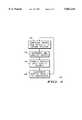
- FIG. 1shows a general view of a space-based remote sensing system according to a preferred embodiment of the present invention
- FIG. 2shows components of a satellite for remote sensing according to a preferred embodiment of the present invention
- FIG. 3shows components of a subscriber unit and/or ground station according to a preferred embodiment of the present invention.
- FIG. 4shows a flowchart of a method for compiling and distributing traffic reports according to a preferred embodiment of the present invention.
- a “satellite” as used throughout this descriptionmeans a manmade object or vehicle intended to orbit earth.
- a “satellite”comprises geostationary, low-earth and medium-earth orbiting satellites and/or combinations thereof.
- a “constellation”means a number of satellites arranged in orbits for providing specified coverage (e.g., radio communication, remote sensing, etc.) of a portion, portions or all of earth.
- a constellationtypically includes multiple rings (or planes) of satellites and may have an equal number of satellites in each plane, although this is not essential.
- FIG. 1shows a general view of remote sensing system 10 according to a preferred embodiment of the present invention.
- system 10comprises at least one satellite 20, any number of subscriber units 30 and at least one ground station 40.
- the present inventionis applicable to remote sensing systems 10 having at least one satellite 20 in low-earth, medium-earth or geosynchronous orbit.
- Satellite 20is preferably a satellite in low-earth orbit around earth.
- Satellite 20may be a single satellite or one of many satellites in a constellation of satellites orbiting earth, like the IRIDIUMO® system.
- Satellite 20communicates with other nearby or adjacent satellites 20 through cross-links.
- the present inventionis also applicable to remote sensing systems 10 having satellites 20 which orbit earth at any angle of inclination (e.g., polar, equatorial or another orbital pattern).
- the present inventionis applicable to systems 10 where full coverage of the earth is not achieved (i.e., where there are "holes” in the remote sensing coverage provided by the constellation) and to systems 10 where plural coverage of portions of the earth occur (i.e., more than one satellite is in view of a particular point on earth's surface).
- FIG. 2shows components of satellite 20 according to a preferred embodiment of the present invention.
- Satellite 20comprises at least the following components: camera 21, memory 22, transceiver 23, processor 24 and antenna 25.
- Antenna 25 of satellite 20is coupled to transceiver 23, while camera 21, memory 22, transceiver 23 and processor 24 are intercoupled to each other.
- camera 21is preferably manufactured by Optical Sciences Corporation and has a resolution of approximately 10 meters, other cameras or remote sensing devices may be used as well.
- camera 21may be a camera able to measure carbon monoxide levels, or the radiation from heat or a measurement of a degree of reflected light.
- Memory 22stores images or photographs taken by camera 21 and may store traffic analysis information sent by ground station 40.
- Transceiver 23is able to transmit or receive data or voice, including for example, a modem.
- Processor 24, via a software programcontrols the operation of satellite 20 and the other components of satellite 20.
- Transceiver 23transmits the images taken by camera 21 to antenna 25 where they are sent to subscriber units 30 or ground station 40. Transceiver 23 is also capable of receiving data from subscriber units 30 and/or ground station 40. Memory 22, transceiver 23, processor 24 and antenna 25 are well known to those of ordinary skill in the art.
- Subscriber units 30may be located anywhere on the surface of earth or in the atmosphere above earth. Remote sensing system 10 may accommodate any number of subscriber units 30. Subscriber units 30 are preferably communication devices capable of receiving voice and/or data (e.g., images, photographs, traffic reports) from satellites 20 and/or ground station 40. By way of example, subscriber units 30 may be a hand-held, portable radio adapted to receive transmissions from satellites 20, or they may be consoles mounted inside automobiles that are capable of receiving images from satellite 20 or ground station 40.
- voice and/or datae.g., images, photographs, traffic reports
- subscriber units 30physically transmit data to and receive data from satellites 20 is well known to those of ordinary skill in the art.
- subscriber units 30communicate with satellite 20 using a limited portion of the electromagnetic spectrum that is divided into numerous channels.
- the channelsare preferably combinations of L-Band and/or K-Band frequency channels but may encompass Frequency Division Multiple Access (FDMA) and/or Time Division Multiple Access (TDMA) and/or Code Division Multiple Access (CDMA) communication or any combination thereof.
- FDMAFrequency Division Multiple Access
- TDMATime Division Multiple Access
- CDMACode Division Multiple Access
- FIG. 3shows components of subscriber unit 30 (and ground station 40) according to a preferred embodiment of the present invention.
- subscriber unit 30comprises at least the following components: speaker/monitor 31, memory 32, transceiver 33, processor 34 and antenna 35.
- speaker/monitor 31There may be other components of subscriber unit 30 which are not shown but are well known to those of ordinary skill in the art, including for example, a keypad.
- processor 34there may be more than one of the components in subscriber units 30, such as multiple processors 34, for example.
- Antenna 35is coupled to transceiver 33, while speaker/monitor 31, memory 32, transceiver 33 and processor 34 are inter-coupled to each other.
- Speaker/monitor 31may be a speaker for receiving voice information, a monitor for displaying images or photographs, or both.
- Memory 32stores images taken by camera 21 of satellite 20 and may store traffic analysis information or images sent by ground station 40.
- Transceiver 33is able to transmit and receive voice or data, and may be a modem, for example.
- Processor 34via a software program, controls the operation of subscriber unit 30 and the other components of subscriber unit 30.
- Transceiver 33receives voice information or data (e.g., images) from antenna 35 sent by satellite 20 or ground station 40.
- Transceiver 33may also be capable of transmitting voice and/or data to satellite 20 or ground stations 40.
- Speaker/monitor 31, memory 32, transceiver 33, processor 34 and antenna 35are well known to those of ordinary skill in the art.
- Satellite 20communicates with and is controlled by at least one ground station 40.
- Ground station 40provides satellite control commands to satellite 20 so that it maintains its proper position in its orbit and performs other house-keeping tasks.
- Ground station 40is additionally responsible for receiving data, including images or photographs, from satellite 20 where they are analyzed and interpreted by computer(s) or human(s) to report on whatever the images are being utilized for. For example, the images used for traffic reporting may be downloaded from satellite 20 to ground station 40 where they are analyzed to determine which streets are crowded and which are less congested.
- FIG. 3shows components of ground station 40 according to a preferred embodiment of the present invention.
- ground station 40includes at least these components as well.
- ground station 40comprises at least speaker/monitor 31, memory 32, transceiver 33, processor 34 and antenna 35.
- speaker/monitor 31memory 32
- transceiver 33transceiver 33
- processor 34antenna 35
- Antenna 35is coupled to transceiver 33, while speaker/monitor 31, memory 32, transceiver 33 and processor 34 are inter-coupled to each other.
- Speaker/monitor 31may be a speaker for receiving voice information, a monitor for displaying image information, or both.
- monitor 31is capable of displaying the images sent by satellite 20.
- Memory 32stores images taken by camera 21 of satellite 20, or it may store traffic analyses information sent by ground station 40 through satellite 20, or it may store traffic analysis information or images sent by ground station 40.
- Processor 34via a software program, controls the operation of ground station 40 and the other components of ground station 40.
- Transceiver 33receives voice information or images from antenna 35 sent by satellite 20 or subscriber unit 30.
- Transceiver 33may also be capable of transmitting data and or images to satellite 20 or subscriber units 30.
- Speaker/monitor 31, memory 32, transceiver 33, processor 34 and antenna 35are well known to those of ordinary skill in the art.
- FIG. 4shows a flowchart of a method for generating traffic information or traffic reports according to a preferred embodiment of the present invention.
- method 100begins in step 102 by camera 21 of satellite 20 taking images, photographs or pictures (hereinafter images) of streets, roads, avenues and highways (collectively referred to as streets). These images may be taken in real-time or may occur at periodic intervals. Depending on the type of camera involved, the images may be in black and white or in color and may show the number of cars, a carbon monoxide level, a temperature reading, a radiation of heat, or a degree of reflected light. For large cities, there may be multiple images where each image shows a certain predetermined region of the city. These images may be stored in memory 22 of satellite 20, where they are eventually transmitted through transceiver 23 and antenna 25 to ground station 40, or in the alternative, to subscriber units 30.
- step 104 of FIG. 4the images are displayed and interpreted either by computer (using processor 34) or humans to analyze the status of traffic on major and minor streets and generate traffic report information.
- the imagesare either viewed on monitor 31 and interpreted by humans or processed by processor 34 to determine street congestion.
- U.S. Pat. Nos. 5,164,998 and 5,134,661 both to Reinschare examples of methods which perform image pattern analysis.
- Another conventional image processing algorithm or analysismay use baseline images or photographs of a street when it is empty and when the street is at specific degrees of traffic capacity (e.g., 10%, 25%, 50% and 75%, 95% of traffic capacity). By comparing the received images to these stored images, one can determine how busy the traffic is for a particular street.
- degrees of traffic capacitye.g. 10%, 25%, 50% and 75%, 95% of traffic capacity
- the information obtained from the analysisis compiled in step 106 of FIG. 4 into a traffic report in a variety of ways.
- One wayis to generate an alphabetized listing of streets and the current status of each street by using a color-coded scheme. For example, light traffic may be indicated by the color green, medium traffic by the color yellow, heavy traffic by the color red and a traffic accident or jam by the color black.
- this listcan be used to generate a traffic report for the streets in the list.
- the graphical representationmay be for example, a bar or line chart for each of the streets. The more congested the street is, the bigger the bar.
- the bar or line chartmay or may not be color-coded according to the scheme described above.
- the traffic reportis distributed in step 108 to subscriber units 30.
- the traffic reportcan be distributed or broadcast by ground station 40 to subscriber units 30 or by ground station 40 through satellite 20 to subscriber unit 30.
- a traffic reportcomprises color-coded images of a particular region and are downloaded to subscriber units 30, the users of subscriber units 40 can look at the streets and determine whether to avoid any street. The user can look at the map and determine the best route to take based on the streets having less congestion than other streets.
- subscriber unit 30may be programmable so that a user can select an origination point and a destination point.
- subscriber unit 30Based on the traffic report information downloaded from satellite 20 or ground station 40, subscriber unit 30 recommends a number of routes from the origination point to the destination point where traffic is less congested. In addition, subscriber unit 30 may provide an approximate travel time on each of the recommended routes so the user can select the best route.
- the streets taken by the usermay be programmed into subscriber unit 30.
- Subscriber unit 30checks the streets and gives a report to the user about the current traffic conditions on the street and which streets to avoid.
- the subscriber unit 30may provide alternative routes for streets experiencing high traffic demand and an approximate travel time for each of the recommended routes.
- Another way to distribute traffic informationis to have a dedicated traffic reporting radio station (that is similar to the continuous weather broadcast radio channel) where traffic conditions for a particular region are continuously updated at periodic intervals. For example, in a city having five regions, the first two minutes of a ten minute periodic interval may broadcast the conditions of the first region, followed by a two minute status update for streets in the each of the second, third and fourth regions, finally until the last two minutes updates user on the traffic conditions of the fifth region. The conditions for each particular region would thus be updated every ten minutes.
- the present inventionprovides a system and methods which overcome the deficiencies of conventional traffic reporting systems, including the limited viewing and latency by providing almost instantaneous traffic coverage. Accordingly, it is intended by the appended claims to cover all modifications of the invention which fall within the true spirit and scope of the invention.
- subscriber unit 30may also have the same capabilities as ground station 40 to perform image analysis and generate a traffic report.
- a traffic reportcan be generated for specific areas of a highway or street or a traffic report may comprise traffic conditions for segments of predetermined distances, such as every five miles, for example.
- the present inventionapplies to other applications where instantaneous reports are required.
- the system and methodis applicable to assisting police, fire and rescue in mapping the fastest route to the scene of an emergency, helping taxi drivers find alternative routes.
- the system and methodcan be used in flood reporting, pollution reporting, disaster assessment, forest ire spotting and location of fish for fishermen.
Landscapes
- Physics & Mathematics (AREA)
- General Physics & Mathematics (AREA)
- Engineering & Computer Science (AREA)
- Radar, Positioning & Navigation (AREA)
- Remote Sensing (AREA)
- Life Sciences & Earth Sciences (AREA)
- Atmospheric Sciences (AREA)
- Automation & Control Theory (AREA)
- Mathematical Physics (AREA)
- Chemical & Material Sciences (AREA)
- Analytical Chemistry (AREA)
- Traffic Control Systems (AREA)
Abstract
Description
This invention relates generally to remote sensing systems and methods and, in particular, to a space-based remote sensing system and methods for reporting on traffic conditions.
A significant portion of broadcast station programming (radio and television) may be devoted for reporting on traffic conditions. In larger cities, traffic reports are broadcast frequently throughout each day of the week. As much as ten percent of a typical morning radio station programming may be devoted to traffic reporting. Some broadcast stations use traffic reporting to distinguish themselves from other broadcast stations as a way to lure listeners or viewers.
Broadcast stations currently get their information from either a central traffic clearinghouse and/or flying aircraft. The aircraft are either fixed-wing planes or helicopters that fly over particular regions of a city. There are at least two problems inherent in traffic clearinghouses and aircraft reporting. First, clearinghouses and aircraft reporting only provide traffic conditions for selected highways and streets of a city. Thus, some streets or portions of a street having heavy traffic demand may go unnoticed by the aircraft and may not be reported because of the limited broadcast time available for traffic reports. Second, aircraft traffic reports become stale more often because it may not be updated frequently enough to provide a more accurate picture of the current traffic conditions. Stale traffic reports may result in drivers entering areas experiencing heavy traffic occurring in streets and intersections not covered by the aircraft or clearinghouses. These highly congested streets could be avoided if there was some way of notifying drivers of a better route. Accordingly, there is a significant need for a system and method that would supply current traffic conditions on some or all streets including highways within a city.
FIG. 1 shows a general view of a space-based remote sensing system according to a preferred embodiment of the present invention;
FIG. 2 shows components of a satellite for remote sensing according to a preferred embodiment of the present invention;
FIG. 3 shows components of a subscriber unit and/or ground station according to a preferred embodiment of the present invention; and
FIG. 4 shows a flowchart of a method for compiling and distributing traffic reports according to a preferred embodiment of the present invention.
A "satellite" as used throughout this description means a manmade object or vehicle intended to orbit earth. A "satellite" comprises geostationary, low-earth and medium-earth orbiting satellites and/or combinations thereof. A "constellation" means a number of satellites arranged in orbits for providing specified coverage (e.g., radio communication, remote sensing, etc.) of a portion, portions or all of earth. A constellation typically includes multiple rings (or planes) of satellites and may have an equal number of satellites in each plane, although this is not essential.
FIG. 1 shows a general view ofremote sensing system 10 according to a preferred embodiment of the present invention. Although FIG. 1 illustrates a highly simplified diagram ofremote sensing system 10,system 10 comprises at least onesatellite 20, any number ofsubscriber units 30 and at least oneground station 40.
The present invention is applicable toremote sensing systems 10 having at least onesatellite 20 in low-earth, medium-earth or geosynchronous orbit. Satellite 20 is preferably a satellite in low-earth orbit around earth. Satellite 20 may be a single satellite or one of many satellites in a constellation of satellites orbiting earth, like the IRIDIUMO® system.Satellite 20 communicates with other nearby oradjacent satellites 20 through cross-links. The present invention is also applicable toremote sensing systems 10 havingsatellites 20 which orbit earth at any angle of inclination (e.g., polar, equatorial or another orbital pattern). The present invention is applicable tosystems 10 where full coverage of the earth is not achieved (i.e., where there are "holes" in the remote sensing coverage provided by the constellation) and tosystems 10 where plural coverage of portions of the earth occur (i.e., more than one satellite is in view of a particular point on earth's surface).
FIG. 2 shows components ofsatellite 20 according to a preferred embodiment of the present invention.Satellite 20 comprises at least the following components:camera 21,memory 22,transceiver 23,processor 24 andantenna 25. There may be other components ofsatellite 20 that are not shown which are necessary for operating a satellite but are not important to the present invention. These other components are well known to those of ordinary skill in the art, including for example, solar arrays and fuel propulsion systems. Moreover, there may be more than one of the components insatellite 20, such asmultiple cameras 21 orprocessors 24, for example.
Howsubscriber units 30 physically transmit data to and receive data fromsatellites 20 is well known to those of ordinary skill in the art. In the preferred embodiment of the present invention,subscriber units 30 communicate withsatellite 20 using a limited portion of the electromagnetic spectrum that is divided into numerous channels. The channels are preferably combinations of L-Band and/or K-Band frequency channels but may encompass Frequency Division Multiple Access (FDMA) and/or Time Division Multiple Access (TDMA) and/or Code Division Multiple Access (CDMA) communication or any combination thereof. Other methods may be used as known to those of ordinary skill in the art.
FIG. 3 shows components of subscriber unit 30 (and ground station 40) according to a preferred embodiment of the present invention. As shown in FIG. 3,subscriber unit 30 comprises at least the following components: speaker/monitor 31,memory 32,transceiver 33,processor 34 andantenna 35. There may be other components ofsubscriber unit 30 which are not shown but are well known to those of ordinary skill in the art, including for example, a keypad. Moreover, there may be more than one of the components insubscriber units 30, such asmultiple processors 34, for example.
FIG. 3 shows components ofground station 40 according to a preferred embodiment of the present invention. As described above, althoughsubscriber unit 30 includes similar components shown in FIG. 3,ground station 40 includes at least these components as well. As shown in FIG. 3,ground station 40 comprises at least speaker/monitor 31,memory 32,transceiver 33,processor 34 andantenna 35. There may be other components ofground station 40 which are not shown but are well known to those of ordinary skill in the art. Moreover, there may be more than one of the components inground station 40, such asmultiple processors 34, for example.
FIG. 4 shows a flowchart of a method for generating traffic information or traffic reports according to a preferred embodiment of the present invention. As shown in FIG. 4,method 100 begins instep 102 bycamera 21 ofsatellite 20 taking images, photographs or pictures (hereinafter images) of streets, roads, avenues and highways (collectively referred to as streets). These images may be taken in real-time or may occur at periodic intervals. Depending on the type of camera involved, the images may be in black and white or in color and may show the number of cars, a carbon monoxide level, a temperature reading, a radiation of heat, or a degree of reflected light. For large cities, there may be multiple images where each image shows a certain predetermined region of the city. These images may be stored inmemory 22 ofsatellite 20, where they are eventually transmitted throughtransceiver 23 andantenna 25 toground station 40, or in the alternative, tosubscriber units 30.
Onceantenna 35 andtransceiver 33 ofground station 40 receive the images, they are subsequently stored inmemory 32 ofground station 40. According to step 104 of FIG. 4, the images are displayed and interpreted either by computer (using processor 34) or humans to analyze the status of traffic on major and minor streets and generate traffic report information. The images are either viewed onmonitor 31 and interpreted by humans or processed byprocessor 34 to determine street congestion. There are many conventional image processing algorithms that can be used to interpret street conditions and congestion. U.S. Pat. Nos. 5,164,998 and 5,134,661 both to Reinsch are examples of methods which perform image pattern analysis. Another conventional image processing algorithm or analysis may use baseline images or photographs of a street when it is empty and when the street is at specific degrees of traffic capacity (e.g., 10%, 25%, 50% and 75%, 95% of traffic capacity). By comparing the received images to these stored images, one can determine how busy the traffic is for a particular street.
The information obtained from the analysis is compiled instep 106 of FIG. 4 into a traffic report in a variety of ways. One way is to generate an alphabetized listing of streets and the current status of each street by using a color-coded scheme. For example, light traffic may be indicated by the color green, medium traffic by the color yellow, heavy traffic by the color red and a traffic accident or jam by the color black. By color-coding the name of the street with the color code representing the current traffic conditions, this list can be used to generate a traffic report for the streets in the list.
Another way is to generate a listing of streets and put a graphical representation of how crowded the street is. The graphical representation may be for example, a bar or line chart for each of the streets. The more congested the street is, the bigger the bar. The bar or line chart may or may not be color-coded according to the scheme described above.
Once the traffic conditions are analyzed instep 104 and compiled instep 106 of FIG. 4, the traffic report is distributed instep 108 tosubscriber units 30. Whatever form the traffic report is, it can be distributed or broadcast byground station 40 tosubscriber units 30 or byground station 40 throughsatellite 20 tosubscriber unit 30. If a traffic report comprises color-coded images of a particular region and are downloaded tosubscriber units 30, the users ofsubscriber units 40 can look at the streets and determine whether to avoid any street. The user can look at the map and determine the best route to take based on the streets having less congestion than other streets. Alternatively,subscriber unit 30 may be programmable so that a user can select an origination point and a destination point. Based on the traffic report information downloaded fromsatellite 20 orground station 40,subscriber unit 30 recommends a number of routes from the origination point to the destination point where traffic is less congested. In addition,subscriber unit 30 may provide an approximate travel time on each of the recommended routes so the user can select the best route.
Another feature is that the streets taken by the user may be programmed intosubscriber unit 30.Subscriber unit 30 checks the streets and gives a report to the user about the current traffic conditions on the street and which streets to avoid. Thesubscriber unit 30 may provide alternative routes for streets experiencing high traffic demand and an approximate travel time for each of the recommended routes.
Another way to distribute traffic information is to have a dedicated traffic reporting radio station (that is similar to the continuous weather broadcast radio channel) where traffic conditions for a particular region are continuously updated at periodic intervals. For example, in a city having five regions, the first two minutes of a ten minute periodic interval may broadcast the conditions of the first region, followed by a two minute status update for streets in the each of the second, third and fourth regions, finally until the last two minutes updates user on the traffic conditions of the fifth region. The conditions for each particular region would thus be updated every ten minutes.
It will be appreciated by those skilled in the art that the present invention provides a system and methods which overcome the deficiencies of conventional traffic reporting systems, including the limited viewing and latency by providing almost instantaneous traffic coverage. Accordingly, it is intended by the appended claims to cover all modifications of the invention which fall within the true spirit and scope of the invention. For example, instead ofground station 40 receiving, analyzing and compiling the results,subscriber unit 30 may also have the same capabilities asground station 40 to perform image analysis and generate a traffic report. Moreover, since a highway and a street may cover many miles, a traffic report can be generated for specific areas of a highway or street or a traffic report may comprise traffic conditions for segments of predetermined distances, such as every five miles, for example. The present invention applies to other applications where instantaneous reports are required. For example, the system and method is applicable to assisting police, fire and rescue in mapping the fastest route to the scene of an emergency, helping taxi drivers find alternative routes. Finally, the system and method can be used in flood reporting, pollution reporting, disaster assessment, forest ire spotting and location of fish for fishermen.
Claims (26)
1. A method for compiling and distributing traffic reports, comprising the steps of:
a) downloading images taken by a satellite to a ground station;
b) analyzing the images to determine traffic congestion and comparing the images to previously stored images to determine a percentage of traffic congestion;
c) compiling traffic reports from the analysis of traffic congestion performed in step (b); and
d) distributing the traffic reports to subscriber units.
2. A method as recited in claim 1, wherein step (a) comprises the steps of:
a1) the satellite taking the images using a camera;
a2) the satellite storing the images; and
a3) the satellite transmitting the images to the ground station.
3. A method as recited in claim 1, wherein step (b) comprises the step of executing an image processing algorithm to determine the traffic congestion.
4. A method as recited in claim 1, wherein step (b) comprises the step of executing an image processing algorithm to determine the traffic congestion for some of a plurality of streets shown in the images.
5. A method as recited in claim 1, wherein step (d) includes the step of directly transmitting the traffic reports to the subscriber units.
6. A method as recited in claim 1, wherein step (d) includes the step of transmitting the traffic reports to the satellite where the satellite transmits the traffic reports to the subscriber units.
7. A method for compiling and distributing traffic reports, comprising the steps of:
a) downloading images taken by a satellite to a ground station;
b) analyzing the images to determine traffic congestion and comparing the images to previously stored images to determine a percentage of traffic congestion;
c) compiling traffic reports from the analysis of traffic congestion performed in step (b) and compiling the analyses of traffic congestion into an alphabetized list of streets, each of the streets having a color-coded scheme representing a degree of congestion; and
d) distributing the traffic reports to subscriber units.
8. A method as recited in claim 7, wherein step (c) further comprises the steps of:
c1) using a color green to represent light traffic;
c2) using a color yellow to represent medium traffic congestion;
c3) using a color red to represent heavy traffic congestion; and
c4) using a color black to represent a traffic accident or jam.
9. A method for compiling and distributing traffic reports, comprising the steps of:
a) downloading images taken by a satellite to a ground station;
b) analyzing the images to determine traffic congestion and comparing the images to previously stored images to determine a percentage of traffic congestion;
c) compiling traffic reports from the analysis of traffic congestion performed in step (b) and compiling the analyses of traffic congestion into an alphabetized list of streets, each of the streets having a bar graph representing a degree of congestion; and
d) distributing the traffic reports to subscriber units.
10. A method as recited in claim 9, wherein the bar graphs are color-coded to represent different levels of traffic congestion.
11. A method for compiling and distributing results of image processing and analysis, comprising the steps of:
a) downloading images taken by a satellite to a ground station;
b) the ground station analyzing the images and comparing the images to previously stored images to determine a percentage of traffic congestion;
c) the ground station compiling reports from the analysis and the comparing of the images performed in step (b); and
d) the ground station distributing the reports to subscriber units.
12. A method for compiling and distributing traffic reports, comprising the steps of:
a) a satellite taking images of a region on earth;
b) the satellite downloading images satellite to a ground station;
c) the ground station analyzing the images to determine traffic congestion by using an image processing algorithm and by comparing the images to previously stored images to determine a percentage of traffic congestion;
d) the ground station compiling the traffic reports from results of the image processing algorithm; and
e) the distributing the traffic reports to subscriber units.
13. A method as recited in claim 12, wherein step (e) includes the step of transmitting the traffic reports to the satellite where the satellite transmits the traffic reports to the subscriber units.
14. A traffic reporting system for compiling and distributing traffic reports, comprising:
a satellite for taking and transmitting images;
a ground station for receiving and analyzing the images, for comparing the images to previously stored images to determine a percentage of traffic congestion and for compiling and transmitting the traffic reports from the analyzing and comparing; and
a plurality of subscriber units for receiving the traffic reports.
15. A traffic reporting system as recited in claim 14, wherein the satellite comprises:
a camera for taking the images;
memory coupled to the camera for storing the images; and
a transceiver coupled to the memory for transmitting the images.
16. A traffic reporting system as recited in claim 14, wherein the ground station comprises:
a transceiver for receiving the images and transmitting the traffic reports;
memory for storing the images and the traffic reports; and
a monitor for displaying the images.
17. A traffic reporting system as recited in claim 16, wherein the ground station further comprises a processor for executing an image processing algorithm to determine traffic congestion used for compiling the traffic reports.
18. A traffic reporting system as recited in claim 14, wherein each of the subscriber units comprise:
a transceiver for receiving the traffic reports;
a memory for storing the traffic reports; and
a monitor for displaying the traffic reports.
19. A ground station comprising:
a transceiver for receiving images taken by a satellite and transmitting traffic reports;
a processor coupled to the transceiver for executing an image processing algorithm to analyze the images, for comparing the images to previously stored images to determine a percentage of traffic congestion and for compiling the traffic reports;
memory coupled to the processor for storing the images and the traffic reports; and
a monitor for displaying the images and the traffic reports.
20. A subscriber unit comprising:
a transceiver for receiving traffic reports compiled, at least in part, by analyzing images taken by a satellite to determine traffic congestion and comparing the images to previously stored images to determine a percentage of traffic congestion;
a memory for storing the traffic reports; and
a monitor for displaying the traffic reports into an alphabetized list of streets, each of the streets having a color-coded scheme representing a degree of congestion.
21. A subscriber unit recited in claim 20, further comprising a processor coupled to the memory for determining best routes based on the traffic reports and selected origination and destination points.
22. A subscriber unit comprising:
a transceiver for receiving traffic reports compiled, at least in part, by analyzing images taken by a satellite to determine traffic congestion and comparing the images to previously stored images to determine a percentage of traffic congestion;
a memory for storing the traffic reports; and
a monitor for displaying the traffic reports into an alphabetized list of streets, each of the streets having a bar graph representing a degree of congestion.
23. A subscriber unit comprising:
a transceiver for receiving traffic reports compiled, at least in part, by analyzing images taken by a satellite to determine traffic congestion and comparing the images to previously stored images to determine a percentage of traffic congestion;
a memory for storing the traffic reports; and
a monitor for displaying the traffic reports into an alphabetized list of streets, each of the streets having a graphical representation of a degree of congestion.
24. A subscriber unit comprising:
a transceiver for receiving traffic reports compiled, at least in part, by analyzing images taken by a satellite to determine traffic congestion and comparing the images to previously stored images to determine a percentage of traffic congestion;
means for selecting an origination point and a destination point; and
a monitor for displaying at least one recommended route where traffic is less congested.
25. A subscriber unit recited in claim 24, wherein the monitor further comprises means for displaying an approximate travel time on each of the at least one recommended route.
26. A subscriber unit comprising:
a transceiver for receiving traffic reports compiled, at least in part, by analyzing images taken by a satellite to determine traffic congestion and comparing the images to previously stored images to determine a percentage of traffic congestion;
means for selecting at least one street; and
a monitor for displaying a current traffic condition on the selected at least one street and whether to avoid any of the at least one street.
Priority Applications (1)
| Application Number | Priority Date | Filing Date | Title |
|---|---|---|---|
| US08/502,039US5862244A (en) | 1995-07-13 | 1995-07-13 | Satellite traffic reporting system and methods |
Applications Claiming Priority (1)
| Application Number | Priority Date | Filing Date | Title |
|---|---|---|---|
| US08/502,039US5862244A (en) | 1995-07-13 | 1995-07-13 | Satellite traffic reporting system and methods |
Publications (1)
| Publication Number | Publication Date |
|---|---|
| US5862244Atrue US5862244A (en) | 1999-01-19 |
Family
ID=23996070
Family Applications (1)
| Application Number | Title | Priority Date | Filing Date |
|---|---|---|---|
| US08/502,039Expired - LifetimeUS5862244A (en) | 1995-07-13 | 1995-07-13 | Satellite traffic reporting system and methods |
Country Status (1)
| Country | Link |
|---|---|
| US (1) | US5862244A (en) |
Cited By (87)
| Publication number | Priority date | Publication date | Assignee | Title |
|---|---|---|---|---|
| EP1022923A2 (en) | 1999-01-21 | 2000-07-26 | DeTeMobil Deutsche Telekom MobilNet GmbH | Method for collecting and processing of telematic traffic data |
| US6253146B1 (en) | 1999-12-06 | 2001-06-26 | At&T Corp. | Network-based traffic congestion notification service |
| US20010028314A1 (en)* | 2000-03-30 | 2001-10-11 | Bernd Hessing | Method for transmitting a position of a traffic information, in particular a traffic obstruction |
| WO2001084082A1 (en)* | 2000-04-29 | 2001-11-08 | Robert Bosch Gmbh | Navigation method and device |
| EP1310930A1 (en)* | 2001-11-09 | 2003-05-14 | 3M Innovative Properties Company | Traffic management system and method with an incentive scheme |
| US20040249568A1 (en)* | 2003-04-11 | 2004-12-09 | Yoshinori Endo | Travel time calculating method and traffic information display method for a navigation device |
| US20050143903A1 (en)* | 2003-12-30 | 2005-06-30 | Jin Ho Park | Method for determining traffic conditions |
| US20050248469A1 (en)* | 1999-04-19 | 2005-11-10 | Dekock Bruce W | System for providing traffic information |
| US20050251329A1 (en)* | 2004-04-22 | 2005-11-10 | Aisin Aw Co., Ltd. | Navigation apparatus, navigation method, and navigation program |
| US20060074546A1 (en)* | 1999-04-19 | 2006-04-06 | Dekock Bruce W | System for providing traffic information |
| US7065194B1 (en)* | 2002-11-14 | 2006-06-20 | At&T Corp. | Real-time network traffic view |
| US20060158330A1 (en)* | 2002-03-05 | 2006-07-20 | Andre Gueziec | Traffic information dissemination |
| US20060168592A1 (en)* | 2004-12-14 | 2006-07-27 | Intrado Inc. | System and method for many-to-many information coordination and distribution |
| US20070005188A1 (en)* | 2000-06-07 | 2007-01-04 | Johnson William J | System and method for proactive content delivery by situational location |
| EP1730670A4 (en)* | 2004-02-27 | 2007-03-28 | Boeing Co | Multiple image data source information processing systems and methods |
| US20080010003A1 (en)* | 2003-05-20 | 2008-01-10 | Ildiko Hegedus | Method and system for collecting traffic information using thermal sensing |
| US20080167083A1 (en)* | 2007-01-07 | 2008-07-10 | Wyld Jeremy A | Method, Device, and Graphical User Interface for Location-Based Dialing |
| US20080227473A1 (en)* | 2005-04-04 | 2008-09-18 | X One, Inc. | Location sharing and tracking using mobile phones or other wireless devices |
| US20090005981A1 (en)* | 2007-06-28 | 2009-01-01 | Apple Inc. | Integration of Map Services and User Applications in a Mobile Device |
| US20090006336A1 (en)* | 2007-06-28 | 2009-01-01 | Apple Inc. | Location based media items |
| US20090005978A1 (en)* | 2007-06-28 | 2009-01-01 | Apple Inc. | Route Reference |
| US20090005077A1 (en)* | 2007-06-28 | 2009-01-01 | Apple Inc. | Location-Based Services |
| US20090005975A1 (en)* | 2007-06-28 | 2009-01-01 | Apple Inc. | Adaptive Mobile Device Navigation |
| US20090005964A1 (en)* | 2007-06-28 | 2009-01-01 | Apple Inc. | Intelligent Route Guidance |
| US20090005080A1 (en)* | 2007-06-28 | 2009-01-01 | Apple Inc. | Location-Aware Mobile Device |
| US20090031006A1 (en)* | 2000-06-07 | 2009-01-29 | Johnson William J | System and method for alerting a first mobile data processing system nearby a second mobile data processing system |
| US20090098857A1 (en)* | 2007-10-10 | 2009-04-16 | Dallas De Atley | Securely Locating a Device |
| DE102007052811A1 (en)* | 2007-11-06 | 2009-05-20 | Siemens Ag | System for data communication between communication participant as transmitter and receiving station as receiver, has communication path for transmission of traffic data, which has extraterrestrial satellite |
| US20090177385A1 (en)* | 2008-01-06 | 2009-07-09 | Apple Inc. | Graphical user interface for presenting location information |
| US20090189979A1 (en)* | 2008-01-29 | 2009-07-30 | Navteq North America, Llc | Method for Providing Images of Traffic Incidents |
| US20090189147A1 (en)* | 2004-01-14 | 2009-07-30 | Walter Fix | Organic transistor comprising a self-aligning gate electrode, and method for the production thereof |
| US20090281724A1 (en)* | 2008-05-12 | 2009-11-12 | Apple Inc. | Map service with network-based query for search |
| US20090286549A1 (en)* | 2008-05-16 | 2009-11-19 | Apple Inc. | Location Determination |
| US20090326815A1 (en)* | 2008-05-02 | 2009-12-31 | Apple Inc. | Position Fix Indicator |
| US20090325603A1 (en)* | 2008-06-30 | 2009-12-31 | Apple Inc. | Location sharing |
| US20100070758A1 (en)* | 2008-09-18 | 2010-03-18 | Apple Inc. | Group Formation Using Anonymous Broadcast Information |
| US20100120450A1 (en)* | 2008-11-13 | 2010-05-13 | Apple Inc. | Location Specific Content |
| US20100161370A1 (en)* | 2008-12-18 | 2010-06-24 | Motorola, Inc. | Pass through for improved response time |
| DE10123482B4 (en)* | 2001-05-15 | 2010-08-26 | Volkswagen Ag | Method and device for silent guidance of a motor vehicle |
| US20100225643A1 (en)* | 2009-03-04 | 2010-09-09 | Andre Gueziec | Controlling a Three-Dimensional Virtual Broadcast Presentation |
| CN101832779A (en)* | 2010-03-03 | 2010-09-15 | 北京大学 | Navigation method in complicated environment |
| US20100279675A1 (en)* | 2009-05-01 | 2010-11-04 | Apple Inc. | Remotely Locating and Commanding a Mobile Device |
| US20100312462A1 (en)* | 2009-03-04 | 2010-12-09 | Gueziec Andre | Touch Screen Based Interaction with Traffic Data |
| US20100333045A1 (en)* | 2009-03-04 | 2010-12-30 | Gueziec Andre | Gesture Based Interaction with Traffic Data |
| US7908080B2 (en) | 2004-12-31 | 2011-03-15 | Google Inc. | Transportation routing |
| US8060389B2 (en) | 2000-06-07 | 2011-11-15 | Apple Inc. | System and method for anonymous location based services |
| US8085914B1 (en) | 2002-11-14 | 2011-12-27 | At&T Intellectual Property Ii, L.P. | Real-time network traffic view |
| US8108144B2 (en) | 2007-06-28 | 2012-01-31 | Apple Inc. | Location based tracking |
| US8175802B2 (en) | 2007-06-28 | 2012-05-08 | Apple Inc. | Adaptive route guidance based on preferences |
| US8275352B2 (en) | 2007-06-28 | 2012-09-25 | Apple Inc. | Location-based emergency information |
| US8311526B2 (en) | 2007-06-28 | 2012-11-13 | Apple Inc. | Location-based categorical information services |
| US8660530B2 (en) | 2009-05-01 | 2014-02-25 | Apple Inc. | Remotely receiving and communicating commands to a mobile device for execution by the mobile device |
| US8660780B2 (en) | 2003-07-25 | 2014-02-25 | Pelmorex Canada Inc. | System and method for delivering departure notifications |
| US8666367B2 (en) | 2009-05-01 | 2014-03-04 | Apple Inc. | Remotely locating and commanding a mobile device |
| US8718910B2 (en) | 2010-11-14 | 2014-05-06 | Pelmorex Canada Inc. | Crowd sourced traffic reporting |
| US8725396B2 (en) | 2011-05-18 | 2014-05-13 | Pelmorex Canada Inc. | System for providing traffic data and driving efficiency data |
| US8774825B2 (en) | 2007-06-28 | 2014-07-08 | Apple Inc. | Integration of map services with user applications in a mobile device |
| US8781718B2 (en) | 2012-01-27 | 2014-07-15 | Pelmorex Canada Inc. | Estimating time travel distributions on signalized arterials |
| CN104021670A (en)* | 2014-03-27 | 2014-09-03 | 湖南工业大学 | Method for extracting vehicle queue state information in urban road network based on high-resolution remote-sensing image |
| US20140336913A1 (en)* | 2012-11-06 | 2014-11-13 | Apple Inc. | Routing Based on Detected Stops |
| US9024786B1 (en) | 2005-09-29 | 2015-05-05 | Baron Services, Inc. | System for providing environmental condition information to vehicles and related methods |
| CN104851297A (en)* | 2015-06-06 | 2015-08-19 | 刘剑 | Congestion grade analysis method based on duplex communication data |
| CN104851296A (en)* | 2015-06-06 | 2015-08-19 | 薛青 | Road congestion degree detection method based on remote sensing communication |
| CN104952247A (en)* | 2015-06-06 | 2015-09-30 | 刘剑 | Congestion level analysis platform based on dual communication data |
| CN105023432A (en)* | 2015-06-10 | 2015-11-04 | 郑勇 | Congestion Level Network Identification System |
| WO2015185594A1 (en)* | 2014-06-04 | 2015-12-10 | Cuende Infometrics, S.A. | System and method for measuring the real traffic flow of an area |
| US9230292B2 (en) | 2012-11-08 | 2016-01-05 | Uber Technologies, Inc. | Providing on-demand services through use of portable computing devices |
| CN105157710B (en)* | 2015-06-06 | 2016-09-07 | 烟台惠通网络技术有限公司 | Section congestion level detecting system based on remote sensing communication |
| CN106373397A (en)* | 2016-09-28 | 2017-02-01 | 哈尔滨工业大学 | Fuzzy neural network-based remote sensing image road traffic situation analysis method |
| US20170032669A1 (en)* | 2015-07-31 | 2017-02-02 | Fujitsu Limited | Apparatus and method for controlling traffic lights of a crossing |
| CN106448163A (en)* | 2016-09-30 | 2017-02-22 | 广东中星微电子有限公司 | Road monitoring method and road monitoring device |
| US9702709B2 (en) | 2007-06-28 | 2017-07-11 | Apple Inc. | Disfavored route progressions or locations |
| CN107463611A (en)* | 2017-06-28 | 2017-12-12 | 湖南统科技有限公司 | The sort management method and server of fire-fighting figure |
| US9959512B2 (en) | 2009-12-04 | 2018-05-01 | Uber Technologies, Inc. | System and method for operating a service to arrange transport amongst parties through use of mobile devices |
| US10176891B1 (en) | 2015-02-06 | 2019-01-08 | Brain Trust Innovations I, Llc | System, RFID chip, server and method for capturing vehicle data |
| US10180330B2 (en) | 2012-11-08 | 2019-01-15 | Uber Technologies, Inc. | Dynamically providing position information of a transit object to a computing device |
| US10223909B2 (en) | 2012-10-18 | 2019-03-05 | Uber Technologies, Inc. | Estimating time travel distributions on signalized arterials |
| CN109754606A (en)* | 2019-02-28 | 2019-05-14 | 山东浪潮云信息技术有限公司 | A method of based on taxi location prediction congestion in road situation |
| CN109923596A (en)* | 2016-10-31 | 2019-06-21 | 爱信艾达株式会社 | It is unable to passing road interval estimation system, and is unable to passing road interval estimation program |
| US11180025B2 (en) | 2005-11-17 | 2021-11-23 | Invently Automotive Inc. | Electric vehicle power management system |
| US11186175B2 (en) | 2005-11-17 | 2021-11-30 | Invently Automotive Inc. | Vehicle power management system |
| US11207980B2 (en) | 2005-11-17 | 2021-12-28 | Invently Automotive Inc. | Vehicle power management system responsive to traffic conditions |
| US11214144B2 (en) | 2005-11-17 | 2022-01-04 | Invently Automotive Inc. | Electric vehicle power management system |
| CN114399900A (en)* | 2021-12-31 | 2022-04-26 | 黑龙江工程学院 | Smart city traffic management system and method based on remote sensing technology |
| US11345236B2 (en) | 2005-11-17 | 2022-05-31 | Invently Automotive Inc. | Electric vehicle power management system |
| US11351863B2 (en) | 2005-11-17 | 2022-06-07 | Invently Automotive Inc. | Vehicle power management system |
| US20240246545A1 (en)* | 2005-06-01 | 2024-07-25 | Allstate Insurance Company | Motor vehicle operating data collection and analysis |
Citations (14)
| Publication number | Priority date | Publication date | Assignee | Title |
|---|---|---|---|---|
| US5132684A (en)* | 1991-02-11 | 1992-07-21 | Pecker Edwin A | Traffic information system |
| US5134661A (en)* | 1991-03-04 | 1992-07-28 | Reinsch Roger A | Method of capture and analysis of digitized image data |
| US5164998A (en)* | 1991-03-04 | 1992-11-17 | Reinsch Roger A | Apparatus and method for image pattern analysis |
| US5182555A (en)* | 1990-07-26 | 1993-01-26 | Farradyne Systems, Inc. | Cell messaging process for an in-vehicle traffic congestion information system |
| US5313200A (en)* | 1991-03-28 | 1994-05-17 | Nissan Motor Co., Ltd. | Road traffic congestion display system |
| US5353055A (en)* | 1991-04-16 | 1994-10-04 | Nec Corporation | Image pickup system with an image pickup device for control |
| US5379215A (en)* | 1991-02-25 | 1995-01-03 | Douglas P. Kruhoeffer | Method for creating a 3-D image of terrain and associated weather |
| US5390237A (en)* | 1991-09-27 | 1995-02-14 | The Weather Radio Network, Inc. | Weather information interface system |
| US5396429A (en)* | 1992-06-30 | 1995-03-07 | Hanchett; Byron L. | Traffic condition information system |
| US5428545A (en)* | 1993-01-11 | 1995-06-27 | Mitsubishi Denki Kabushiki Kaisha | Vehicle guiding system responsive to estimated congestion |
| US5432871A (en)* | 1993-08-04 | 1995-07-11 | Universal Systems & Technology, Inc. | Systems and methods for interactive image data acquisition and compression |
| US5504683A (en)* | 1989-11-21 | 1996-04-02 | Gurmu; Hailemichael | Traffic management system |
| US5509082A (en)* | 1991-05-30 | 1996-04-16 | Matsushita Electric Industrial Co., Ltd. | Vehicle movement measuring apparatus |
| US5590217A (en)* | 1991-04-08 | 1996-12-31 | Matsushita Electric Industrial Co., Ltd. | Vehicle activity measuring apparatus |
- 1995
- 1995-07-13USUS08/502,039patent/US5862244A/ennot_activeExpired - Lifetime
Patent Citations (14)
| Publication number | Priority date | Publication date | Assignee | Title |
|---|---|---|---|---|
| US5504683A (en)* | 1989-11-21 | 1996-04-02 | Gurmu; Hailemichael | Traffic management system |
| US5182555A (en)* | 1990-07-26 | 1993-01-26 | Farradyne Systems, Inc. | Cell messaging process for an in-vehicle traffic congestion information system |
| US5132684A (en)* | 1991-02-11 | 1992-07-21 | Pecker Edwin A | Traffic information system |
| US5379215A (en)* | 1991-02-25 | 1995-01-03 | Douglas P. Kruhoeffer | Method for creating a 3-D image of terrain and associated weather |
| US5164998A (en)* | 1991-03-04 | 1992-11-17 | Reinsch Roger A | Apparatus and method for image pattern analysis |
| US5134661A (en)* | 1991-03-04 | 1992-07-28 | Reinsch Roger A | Method of capture and analysis of digitized image data |
| US5313200A (en)* | 1991-03-28 | 1994-05-17 | Nissan Motor Co., Ltd. | Road traffic congestion display system |
| US5590217A (en)* | 1991-04-08 | 1996-12-31 | Matsushita Electric Industrial Co., Ltd. | Vehicle activity measuring apparatus |
| US5353055A (en)* | 1991-04-16 | 1994-10-04 | Nec Corporation | Image pickup system with an image pickup device for control |
| US5509082A (en)* | 1991-05-30 | 1996-04-16 | Matsushita Electric Industrial Co., Ltd. | Vehicle movement measuring apparatus |
| US5390237A (en)* | 1991-09-27 | 1995-02-14 | The Weather Radio Network, Inc. | Weather information interface system |
| US5396429A (en)* | 1992-06-30 | 1995-03-07 | Hanchett; Byron L. | Traffic condition information system |
| US5428545A (en)* | 1993-01-11 | 1995-06-27 | Mitsubishi Denki Kabushiki Kaisha | Vehicle guiding system responsive to estimated congestion |
| US5432871A (en)* | 1993-08-04 | 1995-07-11 | Universal Systems & Technology, Inc. | Systems and methods for interactive image data acquisition and compression |
Non-Patent Citations (6)
| Title |
|---|
| Becker, "Automatic Traffic Data Collection Using Aerial Video Images." 2nd Int. Conf. on Road Traffic Monitoring, pp. 79-83, Feb. 1989. |
| Becker, Automatic Traffic Data Collection Using Aerial Video Images. 2nd Int. Conf. on Road Traffic Monitoring, pp. 79 83, Feb. 1989.* |
| Blosseville, "TITAN: A Traffic Measurement System Using Image Processing Techniques," 2nd Int. Conf. on Road Traffic Monitoring, pp. 84-88, Feb. 1989. |
| Blosseville, TITAN: A Traffic Measurement System Using Image Processing Techniques, 2 nd Int. Conf. on Road Traffic Monitoring, pp. 84 88, Feb. 1989.* |
| Guillen et al. "Knowledge Based System For Traffic Monitoring and Incident and Congestion Detection, Using Image Processing and Computer Vision Data." 6th Int. Conf. on Road Traffic Monitoring and Control, pp. 148-152, Apr. 1992. |
| Guillen et al. Knowledge Based System For Traffic Monitoring and Incident and Congestion Detection, Using Image Processing and Computer Vision Data. 6th Int. Conf. on Road Traffic Monitoring and Control, pp. 148 152, Apr. 1992.* |
Cited By (250)
| Publication number | Priority date | Publication date | Assignee | Title |
|---|---|---|---|---|
| EP1022923A3 (en)* | 1999-01-21 | 2005-09-28 | T-Mobile Deutschland GmbH | Method for collecting and processing of telematic traffic data |
| EP1022923A2 (en) | 1999-01-21 | 2000-07-26 | DeTeMobil Deutsche Telekom MobilNet GmbH | Method for collecting and processing of telematic traffic data |
| US20060074546A1 (en)* | 1999-04-19 | 2006-04-06 | Dekock Bruce W | System for providing traffic information |
| US20060058941A1 (en)* | 1999-04-19 | 2006-03-16 | Dekock Bruce W | System for providing traffic information |
| US20050248469A1 (en)* | 1999-04-19 | 2005-11-10 | Dekock Bruce W | System for providing traffic information |
| US6253146B1 (en) | 1999-12-06 | 2001-06-26 | At&T Corp. | Network-based traffic congestion notification service |
| US20010028314A1 (en)* | 2000-03-30 | 2001-10-11 | Bernd Hessing | Method for transmitting a position of a traffic information, in particular a traffic obstruction |
| US6861960B2 (en)* | 2000-03-30 | 2005-03-01 | Robert Bosch Gmbh | Method for transmitting traffic information about a traffic obstruction |
| WO2001084082A1 (en)* | 2000-04-29 | 2001-11-08 | Robert Bosch Gmbh | Navigation method and device |
| US20020152018A1 (en)* | 2000-04-29 | 2002-10-17 | Ralf Duckeck | Navigation method and device |
| US8073565B2 (en) | 2000-06-07 | 2011-12-06 | Apple Inc. | System and method for alerting a first mobile data processing system nearby a second mobile data processing system |
| US20100131584A1 (en)* | 2000-06-07 | 2010-05-27 | Johnson William J | Mobile data processing system moving interest radius |
| US8031050B2 (en) | 2000-06-07 | 2011-10-04 | Apple Inc. | System and method for situational location relevant invocable speed reference |
| US8984059B2 (en) | 2000-06-07 | 2015-03-17 | Apple Inc. | Mobile data processing system moving interest radius |
| US8963686B2 (en) | 2000-06-07 | 2015-02-24 | Apple Inc. | System and method for situational location relevant invocable speed reference |
| US8489669B2 (en) | 2000-06-07 | 2013-07-16 | Apple Inc. | Mobile data processing system moving interest radius |
| US8538685B2 (en) | 2000-06-07 | 2013-09-17 | Apple Inc. | System and method for internet connected service providing heterogeneous mobile systems with situational location relevant content |
| US8930233B2 (en) | 2000-06-07 | 2015-01-06 | Apple Inc. | System and method for anonymous location based services |
| US20070005188A1 (en)* | 2000-06-07 | 2007-01-04 | Johnson William J | System and method for proactive content delivery by situational location |
| US8060389B2 (en) | 2000-06-07 | 2011-11-15 | Apple Inc. | System and method for anonymous location based services |
| US20090271271A1 (en)* | 2000-06-07 | 2009-10-29 | Johnson William J | System and Method for Situational Location Proactive Search |
| US9317867B2 (en) | 2000-06-07 | 2016-04-19 | Apple Inc. | System and method for situational location relevant invocable speed reference |
| US20070232326A1 (en)* | 2000-06-07 | 2007-10-04 | Johnson William J | System and method for administration of situational location relevant deliverable content |
| US20090031006A1 (en)* | 2000-06-07 | 2009-01-29 | Johnson William J | System and method for alerting a first mobile data processing system nearby a second mobile data processing system |
| US9100793B2 (en) | 2000-06-07 | 2015-08-04 | Apple Inc. | System and method for alerting a first mobile data processing system nearby a second mobile data processing system |
| DE10123482B4 (en)* | 2001-05-15 | 2010-08-26 | Volkswagen Ag | Method and device for silent guidance of a motor vehicle |
| WO2003042950A1 (en)* | 2001-11-09 | 2003-05-22 | 3M Innovative Properties Company | Traffic management system and method with an incentive scheme |
| EP1310930A1 (en)* | 2001-11-09 | 2003-05-14 | 3M Innovative Properties Company | Traffic management system and method with an incentive scheme |
| US8564455B2 (en) | 2002-03-05 | 2013-10-22 | Triangle Software Llc | Generating visual information associated with traffic |
| US7880642B2 (en)* | 2002-03-05 | 2011-02-01 | Triangle Software Llc | GPS-generated traffic information |
| US20080109153A1 (en)* | 2002-03-05 | 2008-05-08 | Andre Gueziec | GPS-Generated Traffic Information |
| US8958988B2 (en) | 2002-03-05 | 2015-02-17 | Pelmorex Canada Inc. | Method for choosing a traffic route |
| US8358222B2 (en) | 2002-03-05 | 2013-01-22 | Triangle Software, Llc | GPS-generated traffic information |
| US9070291B2 (en) | 2002-03-05 | 2015-06-30 | Pelmorex Canada Inc. | Method for predicting a travel time for a traffic route |
| US9082303B2 (en) | 2002-03-05 | 2015-07-14 | Pelmorex Canada Inc. | Generating visual information associated with traffic |
| US20130207817A1 (en)* | 2002-03-05 | 2013-08-15 | Andre Gueziec | GPS Generated Traffic Information |
| US8531312B2 (en) | 2002-03-05 | 2013-09-10 | Triangle Software Llc | Method for choosing a traffic route |
| US20060158330A1 (en)* | 2002-03-05 | 2006-07-20 | Andre Gueziec | Traffic information dissemination |
| US8786464B2 (en)* | 2002-03-05 | 2014-07-22 | Pelmorex Canada Inc. | GPS generated traffic information |
| US9640073B2 (en) | 2002-03-05 | 2017-05-02 | Pelmorex Canada Inc. | Generating visual information associated with traffic |
| US7557730B2 (en)* | 2002-03-05 | 2009-07-07 | Triangle Software Llc | GPS-generated traffic information |
| US9602977B2 (en) | 2002-03-05 | 2017-03-21 | Pelmorex Canada Inc. | GPS generated traffic information |
| US9489842B2 (en) | 2002-03-05 | 2016-11-08 | Pelmorex Canada Inc. | Method for choosing a traffic route |
| US20090309758A1 (en)* | 2002-03-05 | 2009-12-17 | Andre Gueziec | GPS-Generated Traffic Information |
| US9401088B2 (en) | 2002-03-05 | 2016-07-26 | Pelmorex Canada Inc. | Method for predicting a travel time for a traffic route |
| US7221287B2 (en)* | 2002-03-05 | 2007-05-22 | Triangle Software Llc | Three-dimensional traffic report |
| US9368029B2 (en) | 2002-03-05 | 2016-06-14 | Pelmorex Canada Inc. | GPS generated traffic information |
| US7065194B1 (en)* | 2002-11-14 | 2006-06-20 | At&T Corp. | Real-time network traffic view |
| US8085914B1 (en) | 2002-11-14 | 2011-12-27 | At&T Intellectual Property Ii, L.P. | Real-time network traffic view |
| US20040249568A1 (en)* | 2003-04-11 | 2004-12-09 | Yoshinori Endo | Travel time calculating method and traffic information display method for a navigation device |
| US7376509B2 (en)* | 2003-04-11 | 2008-05-20 | Xanavi Informatics Corporation | Travel time calculating method and traffic information display method for a navigation device |
| US7583818B2 (en)* | 2003-05-20 | 2009-09-01 | Navteq North America, Llc | Method and system for collecting traffic information using thermal sensing |
| US20080010003A1 (en)* | 2003-05-20 | 2008-01-10 | Ildiko Hegedus | Method and system for collecting traffic information using thermal sensing |
| US8660780B2 (en) | 2003-07-25 | 2014-02-25 | Pelmorex Canada Inc. | System and method for delivering departure notifications |
| US9644982B2 (en) | 2003-07-25 | 2017-05-09 | Pelmorex Canada Inc. | System and method for delivering departure notifications |
| US9127959B2 (en) | 2003-07-25 | 2015-09-08 | Pelmorex Canada Inc. | System and method for delivering departure notifications |
| US20050143903A1 (en)* | 2003-12-30 | 2005-06-30 | Jin Ho Park | Method for determining traffic conditions |
| US7248961B2 (en)* | 2003-12-30 | 2007-07-24 | Hyundai Motor Company | Method for determining traffic conditions |
| US20090189147A1 (en)* | 2004-01-14 | 2009-07-30 | Walter Fix | Organic transistor comprising a self-aligning gate electrode, and method for the production thereof |
| EP1730670A4 (en)* | 2004-02-27 | 2007-03-28 | Boeing Co | Multiple image data source information processing systems and methods |
| US20080109157A1 (en)* | 2004-04-22 | 2008-05-08 | Aisin Aw Co., Ltd. | Navigation apparatus, navigation method, and navigation program |
| US7328101B2 (en)* | 2004-04-22 | 2008-02-05 | Aisin Aw Co., Ltd. | Navigation apparatus, navigation method, and navigation program |
| US7634355B2 (en) | 2004-04-22 | 2009-12-15 | Aisin Aw Co., Ltd. | Navigation apparatus, navigation method, and navigation program |
| USRE42547E1 (en) | 2004-04-22 | 2011-07-12 | Aisin Aw Co., Ltd. | Navigation apparatus, navigation method, and navigation program |
| US20050251329A1 (en)* | 2004-04-22 | 2005-11-10 | Aisin Aw Co., Ltd. | Navigation apparatus, navigation method, and navigation program |
| US20060168592A1 (en)* | 2004-12-14 | 2006-07-27 | Intrado Inc. | System and method for many-to-many information coordination and distribution |
| US8606514B2 (en) | 2004-12-31 | 2013-12-10 | Google Inc. | Transportation routing |
| US7908080B2 (en) | 2004-12-31 | 2011-03-15 | Google Inc. | Transportation routing |
| US8798917B2 (en) | 2004-12-31 | 2014-08-05 | Google Inc. | Transportation routing |
| US9778055B2 (en) | 2004-12-31 | 2017-10-03 | Google Inc. | Transportation routing |
| US9945686B2 (en) | 2004-12-31 | 2018-04-17 | Google Llc | Transportation routing |
| US11092455B2 (en) | 2004-12-31 | 2021-08-17 | Google Llc | Transportation routing |
| US9709415B2 (en) | 2004-12-31 | 2017-07-18 | Google Inc. | Transportation routing |
| US11778415B2 (en) | 2005-04-04 | 2023-10-03 | Xone, Inc. | Location sharing application in association with services provision |
| US9467832B2 (en) | 2005-04-04 | 2016-10-11 | X One, Inc. | Methods and systems for temporarily sharing position data between mobile-device users |
| US9854402B1 (en) | 2005-04-04 | 2017-12-26 | X One, Inc. | Formation of wireless device location sharing group |
| US9749790B1 (en) | 2005-04-04 | 2017-08-29 | X One, Inc. | Rendez vous management using mobile phones or other mobile devices |
| US9736618B1 (en) | 2005-04-04 | 2017-08-15 | X One, Inc. | Techniques for sharing relative position between mobile devices |
| US9883360B1 (en) | 2005-04-04 | 2018-01-30 | X One, Inc. | Rendez vous management using mobile phones or other mobile devices |
| US9654921B1 (en) | 2005-04-04 | 2017-05-16 | X One, Inc. | Techniques for sharing position data between first and second devices |
| US9942705B1 (en) | 2005-04-04 | 2018-04-10 | X One, Inc. | Location sharing group for services provision |
| US9955298B1 (en) | 2005-04-04 | 2018-04-24 | X One, Inc. | Methods, systems and apparatuses for the formation and tracking of location sharing groups |
| US8385964B2 (en) | 2005-04-04 | 2013-02-26 | Xone, Inc. | Methods and apparatuses for geospatial-based sharing of information by multiple devices |
| US9967704B1 (en) | 2005-04-04 | 2018-05-08 | X One, Inc. | Location sharing group map management |
| US10149092B1 (en) | 2005-04-04 | 2018-12-04 | X One, Inc. | Location sharing service between GPS-enabled wireless devices, with shared target location exchange |
| US10165059B2 (en) | 2005-04-04 | 2018-12-25 | X One, Inc. | Methods, systems and apparatuses for the formation and tracking of location sharing groups |
| US10200811B1 (en) | 2005-04-04 | 2019-02-05 | X One, Inc. | Map presentation on cellular device showing positions of multiple other wireless device users |
| US8538458B2 (en) | 2005-04-04 | 2013-09-17 | X One, Inc. | Location sharing and tracking using mobile phones or other wireless devices |
| US10299071B2 (en) | 2005-04-04 | 2019-05-21 | X One, Inc. | Server-implemented methods and systems for sharing location amongst web-enabled cell phones |
| US10313826B2 (en) | 2005-04-04 | 2019-06-04 | X One, Inc. | Location sharing and map support in connection with services request |
| US10341809B2 (en) | 2005-04-04 | 2019-07-02 | X One, Inc. | Location sharing with facilitated meeting point definition |
| US9615204B1 (en) | 2005-04-04 | 2017-04-04 | X One, Inc. | Techniques for communication within closed groups of mobile devices |
| US10341808B2 (en) | 2005-04-04 | 2019-07-02 | X One, Inc. | Location sharing for commercial and proprietary content applications |
| US9584960B1 (en) | 2005-04-04 | 2017-02-28 | X One, Inc. | Rendez vous management using mobile phones or other mobile devices |
| US10750309B2 (en) | 2005-04-04 | 2020-08-18 | X One, Inc. | Ad hoc location sharing group establishment for wireless devices with designated meeting point |
| US10750311B2 (en) | 2005-04-04 | 2020-08-18 | X One, Inc. | Application-based tracking and mapping function in connection with vehicle-based services provision |
| US9854394B1 (en) | 2005-04-04 | 2017-12-26 | X One, Inc. | Ad hoc location sharing group between first and second cellular wireless devices |
| US10750310B2 (en) | 2005-04-04 | 2020-08-18 | X One, Inc. | Temporary location sharing group with event based termination |
| US8712441B2 (en) | 2005-04-04 | 2014-04-29 | Xone, Inc. | Methods and systems for temporarily sharing position data between mobile-device users |
| US10791414B2 (en) | 2005-04-04 | 2020-09-29 | X One, Inc. | Location sharing for commercial and proprietary content applications |
| US10856099B2 (en) | 2005-04-04 | 2020-12-01 | X One, Inc. | Application-based two-way tracking and mapping function with selected individuals |
| US9253616B1 (en) | 2005-04-04 | 2016-02-02 | X One, Inc. | Apparatus and method for obtaining content on a cellular wireless device based on proximity |
| US8750898B2 (en) | 2005-04-04 | 2014-06-10 | X One, Inc. | Methods and systems for annotating target locations |
| US9185522B1 (en) | 2005-04-04 | 2015-11-10 | X One, Inc. | Apparatus and method to transmit content to a cellular wireless device based on proximity to other wireless devices |
| US9167558B2 (en) | 2005-04-04 | 2015-10-20 | X One, Inc. | Methods and systems for sharing position data between subscribers involving multiple wireless providers |
| US9031581B1 (en) | 2005-04-04 | 2015-05-12 | X One, Inc. | Apparatus and method for obtaining content on a cellular wireless device based on proximity to other wireless devices |
| US20080227473A1 (en)* | 2005-04-04 | 2008-09-18 | X One, Inc. | Location sharing and tracking using mobile phones or other wireless devices |
| US8798645B2 (en) | 2005-04-04 | 2014-08-05 | X One, Inc. | Methods and systems for sharing position data and tracing paths between mobile-device users |
| US8798593B2 (en) | 2005-04-04 | 2014-08-05 | X One, Inc. | Location sharing and tracking using mobile phones or other wireless devices |
| US11356799B2 (en) | 2005-04-04 | 2022-06-07 | X One, Inc. | Fleet location sharing application in association with services provision |
| US8798647B1 (en) | 2005-04-04 | 2014-08-05 | X One, Inc. | Tracking proximity of services provider to services consumer |
| US8831635B2 (en) | 2005-04-04 | 2014-09-09 | X One, Inc. | Methods and apparatuses for transmission of an alert to multiple devices |
| US20240246545A1 (en)* | 2005-06-01 | 2024-07-25 | Allstate Insurance Company | Motor vehicle operating data collection and analysis |
| US9024786B1 (en) | 2005-09-29 | 2015-05-05 | Baron Services, Inc. | System for providing environmental condition information to vehicles and related methods |
| US11214144B2 (en) | 2005-11-17 | 2022-01-04 | Invently Automotive Inc. | Electric vehicle power management system |
| US11345236B2 (en) | 2005-11-17 | 2022-05-31 | Invently Automotive Inc. | Electric vehicle power management system |
| US11207980B2 (en) | 2005-11-17 | 2021-12-28 | Invently Automotive Inc. | Vehicle power management system responsive to traffic conditions |
| US11351863B2 (en) | 2005-11-17 | 2022-06-07 | Invently Automotive Inc. | Vehicle power management system |
| US11186175B2 (en) | 2005-11-17 | 2021-11-30 | Invently Automotive Inc. | Vehicle power management system |
| US11180025B2 (en) | 2005-11-17 | 2021-11-23 | Invently Automotive Inc. | Electric vehicle power management system |
| US20080167083A1 (en)* | 2007-01-07 | 2008-07-10 | Wyld Jeremy A | Method, Device, and Graphical User Interface for Location-Based Dialing |
| US9066199B2 (en) | 2007-06-28 | 2015-06-23 | Apple Inc. | Location-aware mobile device |
| US8311526B2 (en) | 2007-06-28 | 2012-11-13 | Apple Inc. | Location-based categorical information services |
| US10064158B2 (en) | 2007-06-28 | 2018-08-28 | Apple Inc. | Location aware mobile device |
| US8108144B2 (en) | 2007-06-28 | 2012-01-31 | Apple Inc. | Location based tracking |
| US8924144B2 (en) | 2007-06-28 | 2014-12-30 | Apple Inc. | Location based tracking |
| US8175802B2 (en) | 2007-06-28 | 2012-05-08 | Apple Inc. | Adaptive route guidance based on preferences |
| US12228411B2 (en) | 2007-06-28 | 2025-02-18 | Apple Inc. | Location based tracking |
| US9109904B2 (en) | 2007-06-28 | 2015-08-18 | Apple Inc. | Integration of map services and user applications in a mobile device |
| US12114284B2 (en) | 2007-06-28 | 2024-10-08 | Apple Inc. | Location-aware mobile device |
| US20090005981A1 (en)* | 2007-06-28 | 2009-01-01 | Apple Inc. | Integration of Map Services and User Applications in a Mobile Device |
| US9131342B2 (en) | 2007-06-28 | 2015-09-08 | Apple Inc. | Location-based categorical information services |
| US20090006336A1 (en)* | 2007-06-28 | 2009-01-01 | Apple Inc. | Location based media items |
| US11665665B2 (en) | 2007-06-28 | 2023-05-30 | Apple Inc. | Location-aware mobile device |
| US8774825B2 (en) | 2007-06-28 | 2014-07-08 | Apple Inc. | Integration of map services with user applications in a mobile device |
| US11419092B2 (en) | 2007-06-28 | 2022-08-16 | Apple Inc. | Location-aware mobile device |
| US9891055B2 (en) | 2007-06-28 | 2018-02-13 | Apple Inc. | Location based tracking |
| US8762056B2 (en) | 2007-06-28 | 2014-06-24 | Apple Inc. | Route reference |
| US20090005978A1 (en)* | 2007-06-28 | 2009-01-01 | Apple Inc. | Route Reference |
| US20090005077A1 (en)* | 2007-06-28 | 2009-01-01 | Apple Inc. | Location-Based Services |
| US8738039B2 (en) | 2007-06-28 | 2014-05-27 | Apple Inc. | Location-based categorical information services |
| US8204684B2 (en) | 2007-06-28 | 2012-06-19 | Apple Inc. | Adaptive mobile device navigation |
| US20090005975A1 (en)* | 2007-06-28 | 2009-01-01 | Apple Inc. | Adaptive Mobile Device Navigation |
| US11221221B2 (en) | 2007-06-28 | 2022-01-11 | Apple Inc. | Location based tracking |
| US20090005964A1 (en)* | 2007-06-28 | 2009-01-01 | Apple Inc. | Intelligent Route Guidance |
| US9310206B2 (en) | 2007-06-28 | 2016-04-12 | Apple Inc. | Location based tracking |
| US20090005080A1 (en)* | 2007-06-28 | 2009-01-01 | Apple Inc. | Location-Aware Mobile Device |
| US8275352B2 (en) | 2007-06-28 | 2012-09-25 | Apple Inc. | Location-based emergency information |
| US8290513B2 (en) | 2007-06-28 | 2012-10-16 | Apple Inc. | Location-based services |
| US8332402B2 (en) | 2007-06-28 | 2012-12-11 | Apple Inc. | Location based media items |
| US10952180B2 (en) | 2007-06-28 | 2021-03-16 | Apple Inc. | Location-aware mobile device |
| US9702709B2 (en) | 2007-06-28 | 2017-07-11 | Apple Inc. | Disfavored route progressions or locations |
| US8694026B2 (en) | 2007-06-28 | 2014-04-08 | Apple Inc. | Location based services |
| US9414198B2 (en) | 2007-06-28 | 2016-08-09 | Apple Inc. | Location-aware mobile device |
| US10412703B2 (en) | 2007-06-28 | 2019-09-10 | Apple Inc. | Location-aware mobile device |
| US8548735B2 (en) | 2007-06-28 | 2013-10-01 | Apple Inc. | Location based tracking |
| US10458800B2 (en) | 2007-06-28 | 2019-10-29 | Apple Inc. | Disfavored route progressions or locations |
| US9578621B2 (en) | 2007-06-28 | 2017-02-21 | Apple Inc. | Location aware mobile device |
| US10508921B2 (en) | 2007-06-28 | 2019-12-17 | Apple Inc. | Location based tracking |
| US8977294B2 (en) | 2007-10-10 | 2015-03-10 | Apple Inc. | Securely locating a device |
| US20090098857A1 (en)* | 2007-10-10 | 2009-04-16 | Dallas De Atley | Securely Locating a Device |
| DE102007052811A1 (en)* | 2007-11-06 | 2009-05-20 | Siemens Ag | System for data communication between communication participant as transmitter and receiving station as receiver, has communication path for transmission of traffic data, which has extraterrestrial satellite |
| US20090177385A1 (en)* | 2008-01-06 | 2009-07-09 | Apple Inc. | Graphical user interface for presenting location information |
| US8355862B2 (en) | 2008-01-06 | 2013-01-15 | Apple Inc. | Graphical user interface for presenting location information |
| US20090189979A1 (en)* | 2008-01-29 | 2009-07-30 | Navteq North America, Llc | Method for Providing Images of Traffic Incidents |
| US9183744B2 (en)* | 2008-01-29 | 2015-11-10 | Here Global B.V. | Method for providing images of traffic incidents |
| US20090326815A1 (en)* | 2008-05-02 | 2009-12-31 | Apple Inc. | Position Fix Indicator |
| US20090281724A1 (en)* | 2008-05-12 | 2009-11-12 | Apple Inc. | Map service with network-based query for search |
| US9702721B2 (en) | 2008-05-12 | 2017-07-11 | Apple Inc. | Map service with network-based query for search |
| US9250092B2 (en) | 2008-05-12 | 2016-02-02 | Apple Inc. | Map service with network-based query for search |
| US20090286549A1 (en)* | 2008-05-16 | 2009-11-19 | Apple Inc. | Location Determination |
| US8644843B2 (en) | 2008-05-16 | 2014-02-04 | Apple Inc. | Location determination |
| US10841739B2 (en) | 2008-06-30 | 2020-11-17 | Apple Inc. | Location sharing |
| US10368199B2 (en) | 2008-06-30 | 2019-07-30 | Apple Inc. | Location sharing |
| US20090325603A1 (en)* | 2008-06-30 | 2009-12-31 | Apple Inc. | Location sharing |
| US8369867B2 (en) | 2008-06-30 | 2013-02-05 | Apple Inc. | Location sharing |
| US8359643B2 (en) | 2008-09-18 | 2013-01-22 | Apple Inc. | Group formation using anonymous broadcast information |
| US20100070758A1 (en)* | 2008-09-18 | 2010-03-18 | Apple Inc. | Group Formation Using Anonymous Broadcast Information |
| US20100120450A1 (en)* | 2008-11-13 | 2010-05-13 | Apple Inc. | Location Specific Content |
| US8260320B2 (en) | 2008-11-13 | 2012-09-04 | Apple Inc. | Location specific content |
| US8095410B2 (en)* | 2008-12-18 | 2012-01-10 | Motorola Solutions, Inc. | Pass through for improved response time |
| US20100161370A1 (en)* | 2008-12-18 | 2010-06-24 | Motorola, Inc. | Pass through for improved response time |
| US8619072B2 (en) | 2009-03-04 | 2013-12-31 | Triangle Software Llc | Controlling a three-dimensional virtual broadcast presentation |
| US20100312462A1 (en)* | 2009-03-04 | 2010-12-09 | Gueziec Andre | Touch Screen Based Interaction with Traffic Data |
| US9448690B2 (en) | 2009-03-04 | 2016-09-20 | Pelmorex Canada Inc. | Controlling a three-dimensional virtual broadcast presentation |
| US10289264B2 (en) | 2009-03-04 | 2019-05-14 | Uber Technologies, Inc. | Controlling a three-dimensional virtual broadcast presentation |
| US8982116B2 (en) | 2009-03-04 | 2015-03-17 | Pelmorex Canada Inc. | Touch screen based interaction with traffic data |
| US20100225643A1 (en)* | 2009-03-04 | 2010-09-09 | Andre Gueziec | Controlling a Three-Dimensional Virtual Broadcast Presentation |
| US20100333045A1 (en)* | 2009-03-04 | 2010-12-30 | Gueziec Andre | Gesture Based Interaction with Traffic Data |
| US9046924B2 (en) | 2009-03-04 | 2015-06-02 | Pelmorex Canada Inc. | Gesture based interaction with traffic data |
| US8670748B2 (en) | 2009-05-01 | 2014-03-11 | Apple Inc. | Remotely locating and commanding a mobile device |
| US9979776B2 (en) | 2009-05-01 | 2018-05-22 | Apple Inc. | Remotely locating and commanding a mobile device |
| US12250262B2 (en) | 2009-05-01 | 2025-03-11 | Apple Inc. | Remotely locating and commanding a mobile device |
| US20100279675A1 (en)* | 2009-05-01 | 2010-11-04 | Apple Inc. | Remotely Locating and Commanding a Mobile Device |
| US8666367B2 (en) | 2009-05-01 | 2014-03-04 | Apple Inc. | Remotely locating and commanding a mobile device |
| US8660530B2 (en) | 2009-05-01 | 2014-02-25 | Apple Inc. | Remotely receiving and communicating commands to a mobile device for execution by the mobile device |
| US9959512B2 (en) | 2009-12-04 | 2018-05-01 | Uber Technologies, Inc. | System and method for operating a service to arrange transport amongst parties through use of mobile devices |
| US12131273B2 (en) | 2009-12-04 | 2024-10-29 | Uber Technologies, Inc. | System and method for facilitating a transport service for drivers and users of a geographic region |
| US11068811B2 (en) | 2009-12-04 | 2021-07-20 | Uber Technologies, Inc. | System and method for operating a service to arrange transport amongst parties through use of mobile devices |
| US11188955B2 (en) | 2009-12-04 | 2021-11-30 | Uber Technologies, Inc. | Providing on-demand services through use of portable computing devices |
| CN101832779A (en)* | 2010-03-03 | 2010-09-15 | 北京大学 | Navigation method in complicated environment |
| US8718910B2 (en) | 2010-11-14 | 2014-05-06 | Pelmorex Canada Inc. | Crowd sourced traffic reporting |
| US9390620B2 (en) | 2011-05-18 | 2016-07-12 | Pelmorex Canada Inc. | System for providing traffic data and driving efficiency data |
| US8725396B2 (en) | 2011-05-18 | 2014-05-13 | Pelmorex Canada Inc. | System for providing traffic data and driving efficiency data |
| US9547984B2 (en) | 2011-05-18 | 2017-01-17 | Pelmorex Canada Inc. | System for providing traffic data and driving efficiency data |
| US8781718B2 (en) | 2012-01-27 | 2014-07-15 | Pelmorex Canada Inc. | Estimating time travel distributions on signalized arterials |
| US9293039B2 (en) | 2012-01-27 | 2016-03-22 | Pelmorex Canada Inc. | Estimating time travel distributions on signalized arterials |
| US10223909B2 (en) | 2012-10-18 | 2019-03-05 | Uber Technologies, Inc. | Estimating time travel distributions on signalized arterials |
| US10971000B2 (en) | 2012-10-18 | 2021-04-06 | Uber Technologies, Inc. | Estimating time travel distributions on signalized arterials |
| US12111171B2 (en) | 2012-11-06 | 2024-10-08 | Apple Inc. | Routing based on detected stops |
| US9691280B2 (en) | 2012-11-06 | 2017-06-27 | Apple Inc. | Routing based on detected stops |
| US20140336913A1 (en)* | 2012-11-06 | 2014-11-13 | Apple Inc. | Routing Based on Detected Stops |
| US10921149B2 (en) | 2012-11-06 | 2021-02-16 | Apple Inc. | Routing based on detected stops |
| US9250091B2 (en)* | 2012-11-06 | 2016-02-02 | Apple Inc. | Routing based on detected stops |
| US11686592B2 (en) | 2012-11-06 | 2023-06-27 | Apple Inc. | Routing based on detected stops |
| US9958284B2 (en) | 2012-11-06 | 2018-05-01 | Apple Inc. | Routing based on detected stops |
| US10495475B2 (en) | 2012-11-06 | 2019-12-03 | Apple Inc. | Routing based on detected stops |
| US10417673B2 (en) | 2012-11-08 | 2019-09-17 | Uber Technologies, Inc. | Providing on-demand services through use of portable computing devices |
| US9230292B2 (en) | 2012-11-08 | 2016-01-05 | Uber Technologies, Inc. | Providing on-demand services through use of portable computing devices |
| US10935382B2 (en) | 2012-11-08 | 2021-03-02 | Uber Technologies, Inc. | Dynamically providing position information of a transit object to a computing device |
| US10180330B2 (en) | 2012-11-08 | 2019-01-15 | Uber Technologies, Inc. | Dynamically providing position information of a transit object to a computing device |
| US11371852B2 (en) | 2012-11-08 | 2022-06-28 | Uber Technologies, Inc. | Dynamically providing position information of a transit object to a computing device |
| CN104021670A (en)* | 2014-03-27 | 2014-09-03 | 湖南工业大学 | Method for extracting vehicle queue state information in urban road network based on high-resolution remote-sensing image |
| WO2015185594A1 (en)* | 2014-06-04 | 2015-12-10 | Cuende Infometrics, S.A. | System and method for measuring the real traffic flow of an area |
| US10482377B1 (en) | 2015-02-06 | 2019-11-19 | Brain Trust Innovations I, Llc | System, RFID chip, server and method for capturing vehicle data |
| US10176891B1 (en) | 2015-02-06 | 2019-01-08 | Brain Trust Innovations I, Llc | System, RFID chip, server and method for capturing vehicle data |
| US12217841B1 (en) | 2015-02-06 | 2025-02-04 | Brain Trust Innovations I, Llc | System, RFID chip, server and method for capturing vehicle data |
| US11756660B1 (en) | 2015-02-06 | 2023-09-12 | Brain Trust Innovations I, Llc | System, RFID chip, server and method for capturing vehicle data |
| US10628739B1 (en) | 2015-02-06 | 2020-04-21 | Brain Trust Innovations I, Llc | System, RFID chip, server and method for capturing vehicle data |
| CN105513344A (en)* | 2015-06-06 | 2016-04-20 | 刘剑 | Congestion level analysis platform based on double communication data |
| CN105513345A (en)* | 2015-06-06 | 2016-04-20 | 刘剑 | Congestion level analysis platform based on double communication data |
| CN104952247B (en)* | 2015-06-06 | 2016-08-24 | 河南农业大学 | Congestion level analysis platform based on dual communication data |
| CN104851297A (en)* | 2015-06-06 | 2015-08-19 | 刘剑 | Congestion grade analysis method based on duplex communication data |
| CN105157710B (en)* | 2015-06-06 | 2016-09-07 | 烟台惠通网络技术有限公司 | Section congestion level detecting system based on remote sensing communication |
| CN104851296A (en)* | 2015-06-06 | 2015-08-19 | 薛青 | Road congestion degree detection method based on remote sensing communication |
| CN104952247A (en)* | 2015-06-06 | 2015-09-30 | 刘剑 | Congestion level analysis platform based on dual communication data |
| CN105427595A (en)* | 2015-06-10 | 2016-03-23 | 郑勇 | Congestion level network identification system |
| CN105023432B (en)* | 2015-06-10 | 2016-08-24 | 龚麟 | Congestion Level Network Identification System |
| CN105023432A (en)* | 2015-06-10 | 2015-11-04 | 郑勇 | Congestion Level Network Identification System |
| CN105513343A (en)* | 2015-06-10 | 2016-04-20 | 郑勇 | Congestion level network identification system |
| US20170032669A1 (en)* | 2015-07-31 | 2017-02-02 | Fujitsu Limited | Apparatus and method for controlling traffic lights of a crossing |
| CN106373397B (en)* | 2016-09-28 | 2018-10-02 | 哈尔滨工业大学 | Remote sensing images road situation analysis method based on fuzzy neural network |
| CN106373397A (en)* | 2016-09-28 | 2017-02-01 | 哈尔滨工业大学 | Fuzzy neural network-based remote sensing image road traffic situation analysis method |
| CN106448163A (en)* | 2016-09-30 | 2017-02-22 | 广东中星微电子有限公司 | Road monitoring method and road monitoring device |
| CN109923596A (en)* | 2016-10-31 | 2019-06-21 | 爱信艾达株式会社 | It is unable to passing road interval estimation system, and is unable to passing road interval estimation program |
| CN107463611A (en)* | 2017-06-28 | 2017-12-12 | 湖南统科技有限公司 | The sort management method and server of fire-fighting figure |
| CN109754606B (en)* | 2019-02-28 | 2021-08-31 | 浪潮卓数大数据产业发展有限公司 | Method for predicting road congestion condition based on taxi positioning |
| CN109754606A (en)* | 2019-02-28 | 2019-05-14 | 山东浪潮云信息技术有限公司 | A method of based on taxi location prediction congestion in road situation |
| CN114399900A (en)* | 2021-12-31 | 2022-04-26 | 黑龙江工程学院 | Smart city traffic management system and method based on remote sensing technology |
| CN114399900B (en)* | 2021-12-31 | 2023-03-21 | 黑龙江工程学院 | A smart city traffic management system and method based on remote sensing technology |
Similar Documents
| Publication | Publication Date | Title |
|---|---|---|
| US5862244A (en) | Satellite traffic reporting system and methods | |
| US9885782B2 (en) | Vehicle operator and/or occupant information apparatus and method | |
| US20020041328A1 (en) | Direct broadcast imaging satellite system apparatus and method for providing real-time, continuous monitoring of earth from geostationary earth orbit and related services | |
| EP0710941B1 (en) | Navigation system for an automotive vehicle | |
| US7123169B2 (en) | Method and apparatus for collaborative aggregate situation awareness | |
| US6333703B1 (en) | Automated traffic mapping using sampling and analysis | |
| US9253453B2 (en) | Automatic video surveillance system and method | |
| US6150961A (en) | Automated traffic mapping | |
| US11138787B2 (en) | Efficient transfer of dynamic 3D world model data | |
| EP0899703B1 (en) | A navigational system | |
| US6240369B1 (en) | Transmitting location-specific weather-related data to terminals within a plurality of regions | |
| US7349768B2 (en) | Evacuation route planning tool | |
| US6285317B1 (en) | Navigation system with three-dimensional display | |
| EP1717556A2 (en) | AGTM airborne surveillance | |
| US20060241855A1 (en) | Dynamic routing tool | |
| US20060155462A1 (en) | Computer product having distribution map data, distribution map data creation method, distrubution map data creation device, and terminal device | |
| WO2001005041A9 (en) | Direct broadcast satellite imaging system providing real-time, continuous monitoring of earth from geostationary earth orbit | |
| JP3718579B2 (en) | Video surveillance system | |
| US7583818B2 (en) | Method and system for collecting traffic information using thermal sensing | |
| JP3159204B2 (en) | Mobile data communication system | |
| RU2258618C1 (en) | System for searching and intercepting high-jacked vehicles | |
| PT1022923E (en) | Method for collecting and processing of telematic traffic data | |
| JP2994961B2 (en) | Traffic information display device | |
| TANZI et al. | A real-time GIS for accident prevention on toll motorways | |
| Scorer | An overview of AVL technologies and application |
Legal Events
| Date | Code | Title | Description |
|---|---|---|---|
| AS | Assignment | Owner name:MOTOROLA, INC., ILLINOIS Free format text:ASSIGNMENT OF ASSIGNORS INTEREST;ASSIGNORS:KLEINER, NORBERT;EMMONS, THOMAS PETER, JR.;HOMEYER, DAVID CHARLES;REEL/FRAME:007604/0964 Effective date:19950706 | |
| STCF | Information on status: patent grant | Free format text:PATENTED CASE | |
| FPAY | Fee payment | Year of fee payment:4 | |
| FPAY | Fee payment | Year of fee payment:8 | |
| AS | Assignment | Owner name:TORSAL TECHNOLOGY GROUP LTD. LLC, DELAWARE Free format text:ASSIGNMENT OF ASSIGNORS INTEREST;ASSIGNOR:MOTOROLA, INC.;REEL/FRAME:021527/0213 Effective date:20080620 | |
| FPAY | Fee payment | Year of fee payment:12 | |
| AS | Assignment | Owner name:CDC PROPRIETE INTELLECTUELLE, FRANCE Free format text:ASSIGNMENT OF ASSIGNORS INTEREST;ASSIGNOR:TORSAL TECHNOLOGY GROUP LTD. LLC;REEL/FRAME:025608/0043 Effective date:20101103 |