US10755585B2 - Unmanned aerial vehicle authorization and geofence envelope determination - Google Patents
Unmanned aerial vehicle authorization and geofence envelope determinationDownload PDFInfo
- Publication number
- US10755585B2 US10755585B2US15/431,057US201715431057AUS10755585B2US 10755585 B2US10755585 B2US 10755585B2US 201715431057 AUS201715431057 AUS 201715431057AUS 10755585 B2US10755585 B2US 10755585B2
- Authority
- US
- United States
- Prior art keywords
- uav
- flight path
- flight
- information
- alternative
- Prior art date
- Legal status (The legal status is an assumption and is not a legal conclusion. Google has not performed a legal analysis and makes no representation as to the accuracy of the status listed.)
- Active
Links
Images


Classifications
- G—PHYSICS
- G08—SIGNALLING
- G08G—TRAFFIC CONTROL SYSTEMS
- G08G5/00—Traffic control systems for aircraft
- G08G5/30—Flight plan management
- G08G5/34—Flight plan management for flight plan modification
- G08G5/0039—
- B—PERFORMING OPERATIONS; TRANSPORTING
- B64—AIRCRAFT; AVIATION; COSMONAUTICS
- B64C—AEROPLANES; HELICOPTERS
- B64C39/00—Aircraft not otherwise provided for
- B64C39/02—Aircraft not otherwise provided for characterised by special use
- B64C39/024—Aircraft not otherwise provided for characterised by special use of the remote controlled vehicle type, i.e. RPV
- G—PHYSICS
- G05—CONTROLLING; REGULATING
- G05D—SYSTEMS FOR CONTROLLING OR REGULATING NON-ELECTRIC VARIABLES
- G05D1/00—Control of position, course, altitude or attitude of land, water, air or space vehicles, e.g. using automatic pilots
- G05D1/0011—Control of position, course, altitude or attitude of land, water, air or space vehicles, e.g. using automatic pilots associated with a remote control arrangement
- G05D1/0022—Control of position, course, altitude or attitude of land, water, air or space vehicles, e.g. using automatic pilots associated with a remote control arrangement characterised by the communication link
- G—PHYSICS
- G05—CONTROLLING; REGULATING
- G05D—SYSTEMS FOR CONTROLLING OR REGULATING NON-ELECTRIC VARIABLES
- G05D1/00—Control of position, course, altitude or attitude of land, water, air or space vehicles, e.g. using automatic pilots
- G05D1/0011—Control of position, course, altitude or attitude of land, water, air or space vehicles, e.g. using automatic pilots associated with a remote control arrangement
- G05D1/0027—Control of position, course, altitude or attitude of land, water, air or space vehicles, e.g. using automatic pilots associated with a remote control arrangement involving a plurality of vehicles, e.g. fleet or convoy travelling
- G—PHYSICS
- G05—CONTROLLING; REGULATING
- G05D—SYSTEMS FOR CONTROLLING OR REGULATING NON-ELECTRIC VARIABLES
- G05D1/00—Control of position, course, altitude or attitude of land, water, air or space vehicles, e.g. using automatic pilots
- G05D1/02—Control of position or course in two dimensions
- G05D1/0202—Control of position or course in two dimensions specially adapted to aircraft
- G—PHYSICS
- G05—CONTROLLING; REGULATING
- G05D—SYSTEMS FOR CONTROLLING OR REGULATING NON-ELECTRIC VARIABLES
- G05D1/00—Control of position, course, altitude or attitude of land, water, air or space vehicles, e.g. using automatic pilots
- G05D1/10—Simultaneous control of position or course in three dimensions
- G05D1/101—Simultaneous control of position or course in three dimensions specially adapted for aircraft
- G—PHYSICS
- G05—CONTROLLING; REGULATING
- G05D—SYSTEMS FOR CONTROLLING OR REGULATING NON-ELECTRIC VARIABLES
- G05D1/00—Control of position, course, altitude or attitude of land, water, air or space vehicles, e.g. using automatic pilots
- G05D1/20—Control system inputs
- G05D1/22—Command input arrangements
- G05D1/221—Remote-control arrangements
- G05D1/222—Remote-control arrangements operated by humans
- G05D1/223—Command input arrangements on the remote controller, e.g. joysticks or touch screens
- G—PHYSICS
- G05—CONTROLLING; REGULATING
- G05D—SYSTEMS FOR CONTROLLING OR REGULATING NON-ELECTRIC VARIABLES
- G05D1/00—Control of position, course, altitude or attitude of land, water, air or space vehicles, e.g. using automatic pilots
- G05D1/20—Control system inputs
- G05D1/22—Command input arrangements
- G05D1/221—Remote-control arrangements
- G05D1/226—Communication links with the remote-control arrangements
- G—PHYSICS
- G05—CONTROLLING; REGULATING
- G05D—SYSTEMS FOR CONTROLLING OR REGULATING NON-ELECTRIC VARIABLES
- G05D1/00—Control of position, course, altitude or attitude of land, water, air or space vehicles, e.g. using automatic pilots
- G05D1/40—Control within particular dimensions
- G05D1/46—Control of position or course in three dimensions
- G—PHYSICS
- G05—CONTROLLING; REGULATING
- G05D—SYSTEMS FOR CONTROLLING OR REGULATING NON-ELECTRIC VARIABLES
- G05D1/00—Control of position, course, altitude or attitude of land, water, air or space vehicles, e.g. using automatic pilots
- G05D1/60—Intended control result
- G05D1/69—Coordinated control of the position or course of two or more vehicles
- G05D1/692—Coordinated control of the position or course of two or more vehicles involving a plurality of disparate vehicles
- G—PHYSICS
- G07—CHECKING-DEVICES
- G07C—TIME OR ATTENDANCE REGISTERS; REGISTERING OR INDICATING THE WORKING OF MACHINES; GENERATING RANDOM NUMBERS; VOTING OR LOTTERY APPARATUS; ARRANGEMENTS, SYSTEMS OR APPARATUS FOR CHECKING NOT PROVIDED FOR ELSEWHERE
- G07C5/00—Registering or indicating the working of vehicles
- G07C5/004—Indicating the operating range of the engine
- G—PHYSICS
- G07—CHECKING-DEVICES
- G07C—TIME OR ATTENDANCE REGISTERS; REGISTERING OR INDICATING THE WORKING OF MACHINES; GENERATING RANDOM NUMBERS; VOTING OR LOTTERY APPARATUS; ARRANGEMENTS, SYSTEMS OR APPARATUS FOR CHECKING NOT PROVIDED FOR ELSEWHERE
- G07C5/00—Registering or indicating the working of vehicles
- G07C5/008—Registering or indicating the working of vehicles communicating information to a remotely located station
- G—PHYSICS
- G07—CHECKING-DEVICES
- G07C—TIME OR ATTENDANCE REGISTERS; REGISTERING OR INDICATING THE WORKING OF MACHINES; GENERATING RANDOM NUMBERS; VOTING OR LOTTERY APPARATUS; ARRANGEMENTS, SYSTEMS OR APPARATUS FOR CHECKING NOT PROVIDED FOR ELSEWHERE
- G07C5/00—Registering or indicating the working of vehicles
- G07C5/02—Registering or indicating driving, working, idle, or waiting time only
- G—PHYSICS
- G07—CHECKING-DEVICES
- G07C—TIME OR ATTENDANCE REGISTERS; REGISTERING OR INDICATING THE WORKING OF MACHINES; GENERATING RANDOM NUMBERS; VOTING OR LOTTERY APPARATUS; ARRANGEMENTS, SYSTEMS OR APPARATUS FOR CHECKING NOT PROVIDED FOR ELSEWHERE
- G07C5/00—Registering or indicating the working of vehicles
- G07C5/08—Registering or indicating performance data other than driving, working, idle, or waiting time, with or without registering driving, working, idle or waiting time
- G07C5/0808—Diagnosing performance data
- G—PHYSICS
- G07—CHECKING-DEVICES
- G07C—TIME OR ATTENDANCE REGISTERS; REGISTERING OR INDICATING THE WORKING OF MACHINES; GENERATING RANDOM NUMBERS; VOTING OR LOTTERY APPARATUS; ARRANGEMENTS, SYSTEMS OR APPARATUS FOR CHECKING NOT PROVIDED FOR ELSEWHERE
- G07C5/00—Registering or indicating the working of vehicles
- G07C5/08—Registering or indicating performance data other than driving, working, idle, or waiting time, with or without registering driving, working, idle or waiting time
- G07C5/0816—Indicating performance data, e.g. occurrence of a malfunction
- G08G5/0026—
- G08G5/0056—
- G08G5/006—
- G08G5/0069—
- G08G5/0091—
- G—PHYSICS
- G08—SIGNALLING
- G08G—TRAFFIC CONTROL SYSTEMS
- G08G5/00—Traffic control systems for aircraft
- G08G5/20—Arrangements for acquiring, generating, sharing or displaying traffic information
- G08G5/22—Arrangements for acquiring, generating, sharing or displaying traffic information located on the ground
- G—PHYSICS
- G08—SIGNALLING
- G08G—TRAFFIC CONTROL SYSTEMS
- G08G5/00—Traffic control systems for aircraft
- G08G5/50—Navigation or guidance aids
- G08G5/55—Navigation or guidance aids for a single aircraft
- G—PHYSICS
- G08—SIGNALLING
- G08G—TRAFFIC CONTROL SYSTEMS
- G08G5/00—Traffic control systems for aircraft
- G08G5/50—Navigation or guidance aids
- G08G5/57—Navigation or guidance aids for unmanned aircraft
- G—PHYSICS
- G08—SIGNALLING
- G08G—TRAFFIC CONTROL SYSTEMS
- G08G5/00—Traffic control systems for aircraft
- G08G5/50—Navigation or guidance aids
- G08G5/58—Navigation or guidance aids for emergency situations, e.g. hijacking or bird strikes
- G—PHYSICS
- G08—SIGNALLING
- G08G—TRAFFIC CONTROL SYSTEMS
- G08G5/00—Traffic control systems for aircraft
- G08G5/50—Navigation or guidance aids
- G08G5/59—Navigation or guidance aids in accordance with predefined flight zones, e.g. to avoid prohibited zones
- G—PHYSICS
- G08—SIGNALLING
- G08G—TRAFFIC CONTROL SYSTEMS
- G08G5/00—Traffic control systems for aircraft
- G08G5/70—Arrangements for monitoring traffic-related situations or conditions
- G08G5/76—Arrangements for monitoring traffic-related situations or conditions for monitoring atmospheric conditions
- H—ELECTRICITY
- H04—ELECTRIC COMMUNICATION TECHNIQUE
- H04L—TRANSMISSION OF DIGITAL INFORMATION, e.g. TELEGRAPHIC COMMUNICATION
- H04L67/00—Network arrangements or protocols for supporting network services or applications
- H04L67/01—Protocols
- H04L67/12—Protocols specially adapted for proprietary or special-purpose networking environments, e.g. medical networks, sensor networks, networks in vehicles or remote metering networks
- H—ELECTRICITY
- H04—ELECTRIC COMMUNICATION TECHNIQUE
- H04W—WIRELESS COMMUNICATION NETWORKS
- H04W12/00—Security arrangements; Authentication; Protecting privacy or anonymity
- H04W12/06—Authentication
- H—ELECTRICITY
- H04—ELECTRIC COMMUNICATION TECHNIQUE
- H04W—WIRELESS COMMUNICATION NETWORKS
- H04W4/00—Services specially adapted for wireless communication networks; Facilities therefor
- H04W4/02—Services making use of location information
- H04W4/021—Services related to particular areas, e.g. point of interest [POI] services, venue services or geofences
- H—ELECTRICITY
- H04—ELECTRIC COMMUNICATION TECHNIQUE
- H04W—WIRELESS COMMUNICATION NETWORKS
- H04W4/00—Services specially adapted for wireless communication networks; Facilities therefor
- H04W4/02—Services making use of location information
- H04W4/029—Location-based management or tracking services
- H—ELECTRICITY
- H04—ELECTRIC COMMUNICATION TECHNIQUE
- H04W—WIRELESS COMMUNICATION NETWORKS
- H04W48/00—Access restriction; Network selection; Access point selection
- H04W48/02—Access restriction performed under specific conditions
- B64C2201/141—
- B64C2201/146—
- B—PERFORMING OPERATIONS; TRANSPORTING
- B64—AIRCRAFT; AVIATION; COSMONAUTICS
- B64U—UNMANNED AERIAL VEHICLES [UAV]; EQUIPMENT THEREFOR
- B64U2101/00—UAVs specially adapted for particular uses or applications
- B64U2101/30—UAVs specially adapted for particular uses or applications for imaging, photography or videography
- B64U2101/32—UAVs specially adapted for particular uses or applications for imaging, photography or videography for cartography or topography
- B—PERFORMING OPERATIONS; TRANSPORTING
- B64—AIRCRAFT; AVIATION; COSMONAUTICS
- B64U—UNMANNED AERIAL VEHICLES [UAV]; EQUIPMENT THEREFOR
- B64U2201/00—UAVs characterised by their flight controls
- B64U2201/10—UAVs characterised by their flight controls autonomous, i.e. by navigating independently from ground or air stations, e.g. by using inertial navigation systems [INS]
- B—PERFORMING OPERATIONS; TRANSPORTING
- B64—AIRCRAFT; AVIATION; COSMONAUTICS
- B64U—UNMANNED AERIAL VEHICLES [UAV]; EQUIPMENT THEREFOR
- B64U2201/00—UAVs characterised by their flight controls
- B64U2201/20—Remote controls
- G—PHYSICS
- G01—MEASURING; TESTING
- G01S—RADIO DIRECTION-FINDING; RADIO NAVIGATION; DETERMINING DISTANCE OR VELOCITY BY USE OF RADIO WAVES; LOCATING OR PRESENCE-DETECTING BY USE OF THE REFLECTION OR RERADIATION OF RADIO WAVES; ANALOGOUS ARRANGEMENTS USING OTHER WAVES
- G01S1/00—Beacons or beacon systems transmitting signals having a characteristic or characteristics capable of being detected by non-directional receivers and defining directions, positions, or position lines fixed relatively to the beacon transmitters; Receivers co-operating therewith
- G—PHYSICS
- G01—MEASURING; TESTING
- G01S—RADIO DIRECTION-FINDING; RADIO NAVIGATION; DETERMINING DISTANCE OR VELOCITY BY USE OF RADIO WAVES; LOCATING OR PRESENCE-DETECTING BY USE OF THE REFLECTION OR RERADIATION OF RADIO WAVES; ANALOGOUS ARRANGEMENTS USING OTHER WAVES
- G01S19/00—Satellite radio beacon positioning systems; Determining position, velocity or attitude using signals transmitted by such systems
- G01S19/01—Satellite radio beacon positioning systems transmitting time-stamped messages, e.g. GPS [Global Positioning System], GLONASS [Global Orbiting Navigation Satellite System] or GALILEO
- G01S19/13—Receivers
- G01S19/14—Receivers specially adapted for specific applications
- G06F19/00—
- H04W4/046—
Definitions
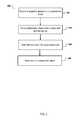
- FIG. 4illustrates an example process for generating an authorization request report.
- the report generation engine 120can receive information identifying a flight operation, e.g., specific UAV, specific operators, specific components, flight path including whether the flight will occur over populated areas, and so on.
- the report generation engine 120can then obtain risk assessment information associated with the flight operation, e.g., as described above, and include the risk assessment in the authorization request report 122 .
- the report generation engine 120can include risk assessment information identifying each pilot's license information, number of UAV flights in a particular time period, whether they previously breached flight authorization, their record performing contingency plans, and so on.
- the systemdetermines whether the geofence envelope has been allocated, or interferes with another geofence envelope (block 604 ). As described above, with reference to FIG. 5 , the system stores information describing UAVs in flight, including geofence envelopes that have been previously approved and allocated by the system, or an outside system in communication with the system.
- the UAVdetermines an estimate of prevailing wind speed and direction (block 706 ).
- the UAVcan determine estimates of wind speed and direction through use of an online estimator.
- the UAVcan communicate with an outside system, e.g., a ground or satellite datalink, or a weather center, and obtains information identifying real-time wind conditions.
- an outside systeme.g., a ground or satellite datalink, or a weather center
Landscapes
- Engineering & Computer Science (AREA)
- Physics & Mathematics (AREA)
- General Physics & Mathematics (AREA)
- Aviation & Aerospace Engineering (AREA)
- Radar, Positioning & Navigation (AREA)
- Remote Sensing (AREA)
- Automation & Control Theory (AREA)
- Computer Networks & Wireless Communication (AREA)
- Signal Processing (AREA)
- Computer Security & Cryptography (AREA)
- Health & Medical Sciences (AREA)
- Computing Systems (AREA)
- General Health & Medical Sciences (AREA)
- Medical Informatics (AREA)
- Traffic Control Systems (AREA)
- Life Sciences & Earth Sciences (AREA)
- Atmospheric Sciences (AREA)
- Business, Economics & Management (AREA)
- Emergency Management (AREA)
- Management, Administration, Business Operations System, And Electronic Commerce (AREA)
Abstract
Description
Claims (30)
Priority Applications (4)
| Application Number | Priority Date | Filing Date | Title |
|---|---|---|---|
| US15/431,057US10755585B2 (en) | 2014-05-12 | 2017-02-13 | Unmanned aerial vehicle authorization and geofence envelope determination |
| US17/001,576US11610495B2 (en) | 2014-05-12 | 2020-08-24 | Unmanned aerial vehicle authorization and geofence envelope determination |
| US18/172,827US12230149B2 (en) | 2014-05-12 | 2023-02-22 | Unmanned aerial vehicle authorization and geofence envelope determination |
| US19/021,836US20250232682A1 (en) | 2014-05-12 | 2025-01-15 | Unmanned Aerial Vehicle Authorization And Geofence Envelope Determination |
Applications Claiming Priority (5)
| Application Number | Priority Date | Filing Date | Title |
|---|---|---|---|
| US201461991826P | 2014-05-12 | 2014-05-12 | |
| US14/709,324US9256225B2 (en) | 2014-05-12 | 2015-05-11 | Unmanned aerial vehicle authorization and geofence envelope determination |
| US15/004,411US9406237B2 (en) | 2014-05-12 | 2016-01-22 | Unmanned aerial vehicle authorization and geofence envelope determination |
| US15/158,009US9607522B2 (en) | 2014-05-12 | 2016-05-18 | Unmanned aerial vehicle authorization and geofence envelope determination |
| US15/431,057US10755585B2 (en) | 2014-05-12 | 2017-02-13 | Unmanned aerial vehicle authorization and geofence envelope determination |
Related Parent Applications (1)
| Application Number | Title | Priority Date | Filing Date |
|---|---|---|---|
| US15/158,009ContinuationUS9607522B2 (en) | 2014-05-12 | 2016-05-18 | Unmanned aerial vehicle authorization and geofence envelope determination |
Related Child Applications (1)
| Application Number | Title | Priority Date | Filing Date |
|---|---|---|---|
| US17/001,576ContinuationUS11610495B2 (en) | 2014-05-12 | 2020-08-24 | Unmanned aerial vehicle authorization and geofence envelope determination |
Publications (2)
| Publication Number | Publication Date |
|---|---|
| US20170154535A1 US20170154535A1 (en) | 2017-06-01 |
| US10755585B2true US10755585B2 (en) | 2020-08-25 |
Family
ID=54367797
Family Applications (9)
| Application Number | Title | Priority Date | Filing Date |
|---|---|---|---|
| US14/709,364Active - ReinstatedUS9256994B2 (en) | 2014-05-12 | 2015-05-11 | Unmanned aerial vehicle authorization and geofence envelope determination |
| US14/709,360ActiveUS9311760B2 (en) | 2014-05-12 | 2015-05-11 | Unmanned aerial vehicle authorization and geofence envelope determination |
| US14/709,324Active - ReinstatedUS9256225B2 (en) | 2014-05-12 | 2015-05-11 | Unmanned aerial vehicle authorization and geofence envelope determination |
| US15/004,411ActiveUS9406237B2 (en) | 2014-05-12 | 2016-01-22 | Unmanned aerial vehicle authorization and geofence envelope determination |
| US15/158,009ActiveUS9607522B2 (en) | 2014-05-12 | 2016-05-18 | Unmanned aerial vehicle authorization and geofence envelope determination |
| US15/431,057ActiveUS10755585B2 (en) | 2014-05-12 | 2017-02-13 | Unmanned aerial vehicle authorization and geofence envelope determination |
| US17/001,576Active2036-03-12US11610495B2 (en) | 2014-05-12 | 2020-08-24 | Unmanned aerial vehicle authorization and geofence envelope determination |
| US18/172,827ActiveUS12230149B2 (en) | 2014-05-12 | 2023-02-22 | Unmanned aerial vehicle authorization and geofence envelope determination |
| US19/021,836PendingUS20250232682A1 (en) | 2014-05-12 | 2025-01-15 | Unmanned Aerial Vehicle Authorization And Geofence Envelope Determination |
Family Applications Before (5)
| Application Number | Title | Priority Date | Filing Date |
|---|---|---|---|
| US14/709,364Active - ReinstatedUS9256994B2 (en) | 2014-05-12 | 2015-05-11 | Unmanned aerial vehicle authorization and geofence envelope determination |
| US14/709,360ActiveUS9311760B2 (en) | 2014-05-12 | 2015-05-11 | Unmanned aerial vehicle authorization and geofence envelope determination |
| US14/709,324Active - ReinstatedUS9256225B2 (en) | 2014-05-12 | 2015-05-11 | Unmanned aerial vehicle authorization and geofence envelope determination |
| US15/004,411ActiveUS9406237B2 (en) | 2014-05-12 | 2016-01-22 | Unmanned aerial vehicle authorization and geofence envelope determination |
| US15/158,009ActiveUS9607522B2 (en) | 2014-05-12 | 2016-05-18 | Unmanned aerial vehicle authorization and geofence envelope determination |
Family Applications After (3)
| Application Number | Title | Priority Date | Filing Date |
|---|---|---|---|
| US17/001,576Active2036-03-12US11610495B2 (en) | 2014-05-12 | 2020-08-24 | Unmanned aerial vehicle authorization and geofence envelope determination |
| US18/172,827ActiveUS12230149B2 (en) | 2014-05-12 | 2023-02-22 | Unmanned aerial vehicle authorization and geofence envelope determination |
| US19/021,836PendingUS20250232682A1 (en) | 2014-05-12 | 2025-01-15 | Unmanned Aerial Vehicle Authorization And Geofence Envelope Determination |
Country Status (2)
| Country | Link |
|---|---|
| US (9) | US9256994B2 (en) |
| WO (1) | WO2015175440A1 (en) |
Cited By (1)
| Publication number | Priority date | Publication date | Assignee | Title |
|---|---|---|---|---|
| US11610495B2 (en)* | 2014-05-12 | 2023-03-21 | Skydio, Inc. | Unmanned aerial vehicle authorization and geofence envelope determination |
Families Citing this family (207)
| Publication number | Priority date | Publication date | Assignee | Title |
|---|---|---|---|---|
| US8271106B2 (en) | 2009-04-17 | 2012-09-18 | Hospira, Inc. | System and method for configuring a rule set for medical event management and responses |
| CA2852271A1 (en) | 2011-10-21 | 2013-04-25 | Hospira, Inc. | Medical device update system |
| US9384668B2 (en) | 2012-05-09 | 2016-07-05 | Singularity University | Transportation using network of unmanned aerial vehicles |
| WO2014138446A1 (en) | 2013-03-06 | 2014-09-12 | Hospira,Inc. | Medical device communication method |
| US9662436B2 (en) | 2013-09-20 | 2017-05-30 | Icu Medical, Inc. | Fail-safe drug infusion therapy system |
| AU2015204838B2 (en) | 2014-01-10 | 2020-01-02 | Pictometry International Corp. | Unmanned aircraft structure evaluation system and method |
| US10121015B2 (en)* | 2014-02-21 | 2018-11-06 | Lens Ventures, Llc | Management of data privacy and security in a pervasive computing environment |
| EP3138032B1 (en) | 2014-04-30 | 2024-07-24 | ICU Medical, Inc. | Patient care system with conditional alarm forwarding |
| US9310221B1 (en) | 2014-05-12 | 2016-04-12 | Unmanned Innovation, Inc. | Distributed unmanned aerial vehicle architecture |
| US10380900B2 (en)* | 2014-05-20 | 2019-08-13 | Verizon Patent And Licensing Inc. | Information collection and component/software upgrades for unmanned aerial vehicles |
| US9671790B2 (en)* | 2014-05-20 | 2017-06-06 | Verizon Patent And Licensing Inc. | Scheduling of unmanned aerial vehicles for mission performance |
| US9881022B2 (en) | 2014-05-20 | 2018-01-30 | Verizon Patent And Licensing Inc. | Selection of networks for communicating with unmanned aerial vehicles |
| US9412279B2 (en)* | 2014-05-20 | 2016-08-09 | Verizon Patent And Licensing Inc. | Unmanned aerial vehicle network-based recharging |
| US9495877B2 (en)* | 2014-05-27 | 2016-11-15 | The Boeing Company | Airspace deconfliction system and method |
| WO2016041110A1 (en)* | 2014-09-15 | 2016-03-24 | 深圳市大疆创新科技有限公司 | Flight control method of aircrafts and device related thereto |
| US9539383B2 (en) | 2014-09-15 | 2017-01-10 | Hospira, Inc. | System and method that matches delayed infusion auto-programs with manually entered infusion programs and analyzes differences therein |
| WO2016049906A1 (en)* | 2014-09-30 | 2016-04-07 | 深圳市大疆创新科技有限公司 | Flight instructing method and device and aircraft |
| US9689976B2 (en) | 2014-12-19 | 2017-06-27 | Xidrone Systems, Inc. | Deterent for unmanned aerial systems |
| US9715009B1 (en) | 2014-12-19 | 2017-07-25 | Xidrone Systems, Inc. | Deterent for unmanned aerial systems |
| US10366616B2 (en)* | 2015-01-09 | 2019-07-30 | Botlink, Llc | System and method of collision avoidance in unmanned aerial vehicles |
| US10043397B2 (en)* | 2015-02-01 | 2018-08-07 | Clear Ag, Inc. | Mission prioritization and work order arrangement for unmanned aerial vehicles and remotely-piloted vehicles |
| US20160307447A1 (en) | 2015-02-13 | 2016-10-20 | Unmanned Innovation, Inc. | Unmanned aerial vehicle remote flight planning system |
| US11768508B2 (en) | 2015-02-13 | 2023-09-26 | Skydio, Inc. | Unmanned aerial vehicle sensor activation and correlation system |
| US20160246297A1 (en)* | 2015-02-24 | 2016-08-25 | Siemens Corporation | Cloud-based control system for unmanned aerial vehicles |
| US10587639B2 (en)* | 2015-03-10 | 2020-03-10 | Ca, Inc. | Assessing trust of components in systems |
| US9663226B2 (en) | 2015-03-27 | 2017-05-30 | Amazon Technologies, Inc. | Influencing acceptance of messages in unmanned vehicles |
| US9714088B2 (en)* | 2015-03-27 | 2017-07-25 | Amazon Technologies, Inc. | Unmanned vehicle rollback |
| US9930027B2 (en) | 2015-03-27 | 2018-03-27 | Amazon Technologies, Inc. | Authenticated messages between unmanned vehicles |
| US9912655B2 (en) | 2015-03-27 | 2018-03-06 | Amazon Technologies, Inc. | Unmanned vehicle message exchange |
| CN107409051B (en) | 2015-03-31 | 2021-02-26 | 深圳市大疆创新科技有限公司 | Authentication system and method for generating flight controls |
| JP6459014B2 (en) | 2015-03-31 | 2019-01-30 | エスゼット ディージェイアイ テクノロジー カンパニー リミテッドSz Dji Technology Co.,Ltd | Geo-fencing device |
| ES2722325T3 (en)* | 2015-05-18 | 2019-08-09 | Boeing Co | Flight termination system and method for air vehicles |
| JP6523069B2 (en)* | 2015-06-17 | 2019-05-29 | 株式会社スカイスコープソリューションズ | Autonomous moving body management device, autonomous moving body management system, autonomous moving body management method, and program |
| EP3415868A3 (en)* | 2015-07-14 | 2018-12-26 | The Boeing Company | Method and system for autonomous generation of shortest lateral paths for unmanned aerial systems |
| US9545995B1 (en)* | 2015-07-14 | 2017-01-17 | Qualcomm Incorporated | Control normalization for unmanned autonomous systems |
| US9734723B1 (en)* | 2015-07-15 | 2017-08-15 | Exelis Inc. | Process and system to register and regulate unmanned aerial vehicle operations |
| WO2017013842A1 (en)* | 2015-07-17 | 2017-01-26 | パナソニック インテレクチュアル プロパティ コーポレーション オブ アメリカ | Unmanned flight vehicle, flight control method, and flight control program |
| JP6657030B2 (en)* | 2015-07-17 | 2020-03-04 | パナソニック インテレクチュアル プロパティ コーポレーション オブ アメリカPanasonic Intellectual Property Corporation of America | Unmanned aerial vehicle, flight control method, flight basic program and forced movement program |
| JP6709690B2 (en)* | 2015-07-17 | 2020-06-17 | パナソニック インテレクチュアル プロパティ コーポレーション オブ アメリカPanasonic Intellectual Property Corporation of America | Unmanned aerial vehicle, flight control method and flight control program |
| US9922282B2 (en)* | 2015-07-21 | 2018-03-20 | Limitless Computing, Inc. | Automated readiness evaluation system (ARES) for use with an unmanned aircraft system (UAS) |
| US10586464B2 (en) | 2015-07-29 | 2020-03-10 | Warren F. LeBlanc | Unmanned aerial vehicles |
| US9738399B2 (en)* | 2015-07-29 | 2017-08-22 | Hon Hai Precision Industry Co., Ltd. | Unmanned aerial vehicle control method and unmanned aerial vehicle using same |
| US9964966B1 (en)* | 2015-09-28 | 2018-05-08 | Amazon Technologies, Inc. | Controlling mechanical vibrations |
| CN108353081B (en) | 2015-09-28 | 2021-01-19 | 13部门有限公司 | Device and method for detecting and confronting remote-controlled vehicle and storage medium |
| US9892464B2 (en) | 2015-10-08 | 2018-02-13 | Blackbird Holdings, LLC | System and method of real time detection of aerial vehicle flight patterns and insurance policy updates |
| US10703494B2 (en)* | 2015-10-14 | 2020-07-07 | Flirtey Holdings, Inc. | Parachute control system for an unmanned aerial vehicle |
| US10618655B2 (en) | 2015-10-14 | 2020-04-14 | Flirtey Holdings, Inc. | Package delivery mechanism in an unmanned aerial vehicle |
| US10083614B2 (en) | 2015-10-22 | 2018-09-25 | Drone Traffic, Llc | Drone alerting and reporting system |
| EP3374263A4 (en)* | 2015-11-10 | 2019-05-08 | Matternet, Inc. | METHODS AND TRANSPORT SYSTEMS USING PILOT-FREE AIR VEHICLES |
| US10540901B2 (en) | 2015-11-23 | 2020-01-21 | Kespry Inc. | Autonomous mission action alteration |
| GB2557556A (en)* | 2015-11-25 | 2018-06-20 | Walmart Apollo Llc | Unmanned aerial delivery to secure location |
| US9928748B2 (en) | 2015-11-25 | 2018-03-27 | International Business Machines Corporation | Dynamic geo-fence for drone |
| US10409292B2 (en)* | 2015-12-10 | 2019-09-10 | Panasonic Intellectual Property Corporation Of America | Movement control method, autonomous mobile robot, and recording medium storing program |
| US11022407B2 (en)* | 2015-12-15 | 2021-06-01 | Tradewinds Technology, Llc | UAV defense system |
| US9513635B1 (en) | 2015-12-30 | 2016-12-06 | Unmanned Innovation, Inc. | Unmanned aerial vehicle inspection system |
| US9740200B2 (en) | 2015-12-30 | 2017-08-22 | Unmanned Innovation, Inc. | Unmanned aerial vehicle inspection system |
| US9609288B1 (en) | 2015-12-31 | 2017-03-28 | Unmanned Innovation, Inc. | Unmanned aerial vehicle rooftop inspection system |
| WO2017120618A1 (en)* | 2016-01-06 | 2017-07-13 | Russell David Wayne | System and method for autonomous vehicle air traffic control |
| AU2017206097B2 (en) | 2016-01-08 | 2021-07-08 | Pictometry International Corp. | Systems and methods for taking, processing, retrieving, and displaying images from unmanned aerial vehicles |
| WO2017127596A1 (en)* | 2016-01-22 | 2017-07-27 | Russell David Wayne | System and method for safe positive control electronic processing for autonomous vehicles |
| CN107024927B (en)* | 2016-02-01 | 2021-02-12 | 上海无线通信研究中心 | Automatic driving system and method |
| WO2017136776A1 (en)* | 2016-02-05 | 2017-08-10 | Vantage Robotics, Llc | Durable modular unmanned aerial vehicle |
| US20180025649A1 (en) | 2016-02-08 | 2018-01-25 | Unmanned Innovation Inc. | Unmanned aerial vehicle privacy controls |
| US12254779B2 (en) | 2016-02-08 | 2025-03-18 | Skydio, Inc. | Unmanned aerial vehicle privacy controls |
| WO2017139344A1 (en)* | 2016-02-12 | 2017-08-17 | Wal-Mart Stores, Inc. | Systems and methods to allocate unmanned aircraft systems |
| CN105652884A (en)* | 2016-02-15 | 2016-06-08 | 英华达(上海)科技有限公司 | Unmanned aerial vehicle flying method and unmanned aerial vehicle flying system |
| US10853756B2 (en)* | 2016-03-02 | 2020-12-01 | International Business Machines Corporation | Vehicle identification and interception |
| US9592912B1 (en) | 2016-03-08 | 2017-03-14 | Unmanned Innovation, Inc. | Ground control point assignment and determination system |
| JP2017177912A (en)* | 2016-03-29 | 2017-10-05 | 株式会社ソーラーポート | Battery charging system |
| DE112016006519T5 (en)* | 2016-03-29 | 2018-11-22 | Ford Global Technologies, Llc | Real-time communication with mobile infrastructure |
| US9658619B1 (en) | 2016-03-31 | 2017-05-23 | Unmanned Innovation, Inc. | Unmanned aerial vehicle modular command priority determination and filtering system |
| US20170316510A1 (en)* | 2016-04-14 | 2017-11-02 | Verifly Technology, Limited | System and method for analyzing drone flight risk |
| US11762384B2 (en)* | 2016-04-24 | 2023-09-19 | Flytrex Aviation Ltd. | System and method for dynamically arming a failsafe on a delivery drone |
| US12007764B2 (en) | 2016-04-24 | 2024-06-11 | Flytrex Aviation Ltd. | System and method for aerial traffic management of unmanned aerial vehicles |
| CN107368084A (en)* | 2016-05-11 | 2017-11-21 | 松下电器(美国)知识产权公司 | Flight control method and unmanned vehicle |
| WO2017196213A1 (en) | 2016-05-11 | 2017-11-16 | Telefonaktiebolaget Lm Ericsson (Publ) | Remote control of an unmanned aerial vehicle |
| US11029352B2 (en) | 2016-05-18 | 2021-06-08 | Skydio, Inc. | Unmanned aerial vehicle electromagnetic avoidance and utilization system |
| CN109074040A (en) | 2016-05-30 | 2018-12-21 | 深圳市大疆创新科技有限公司 | Flight restriction based on operating parameter |
| US11242143B2 (en) | 2016-06-13 | 2022-02-08 | Skydio, Inc. | Unmanned aerial vehicle beyond visual line of sight control |
| WO2017214863A1 (en)* | 2016-06-14 | 2017-12-21 | SZ DJI Technology Co., Ltd. | Data distribution from a movable object |
| US9942721B2 (en) | 2016-07-11 | 2018-04-10 | At&T Intellectual Property I, L.P. | Aerial profiling of communication networks |
| US9947233B2 (en) | 2016-07-12 | 2018-04-17 | At&T Intellectual Property I, L.P. | Method and system to improve safety concerning drones |
| WO2018017412A1 (en)* | 2016-07-18 | 2018-01-25 | GeoFrenzy, Inc. | Systems and methods for defining and implementing rules for three dimensional geofences |
| KR101917860B1 (en)* | 2016-07-28 | 2018-11-12 | 주식회사 빅스 | Method for optimal path search of drone, optimal path searching server and system |
| JP2018030407A (en)* | 2016-08-23 | 2018-03-01 | 株式会社日立製作所 | Transportation system and transportation method |
| US10163357B2 (en)* | 2016-08-24 | 2018-12-25 | Qualcomm Incorporated | Navigation assistance data and route planning for drones |
| US11100589B1 (en) | 2016-09-02 | 2021-08-24 | State Farm Mutual Automobile Insurance Company | Systems and methods for analyzing unmanned aerial missions |
| CA3035758A1 (en) | 2016-09-09 | 2018-03-29 | Walmart Apollo, Llc | Geographic area monitoring systems and methods utilizing computational sharing across multiple unmanned vehicles |
| CA3035762A1 (en)* | 2016-09-09 | 2018-03-15 | Walmart Apollo, Llc | Geographic area monitoring systems and methods that balance power usage between multiple unmanned vehicles |
| CA3035546A1 (en) | 2016-09-09 | 2018-03-15 | Walmart Apollo, Llc | Systems and methods to interchangeably couple tool systems with unmanned vehicles |
| GB2568191A (en) | 2016-09-09 | 2019-05-08 | Walmart Apollo Llc | Geographic area monitoring systems and methods through interchanging tool systems between unmanned vehicles |
| US10650621B1 (en) | 2016-09-13 | 2020-05-12 | Iocurrents, Inc. | Interfacing with a vehicular controller area network |
| US10650285B1 (en)* | 2016-09-23 | 2020-05-12 | Aon Benfield Inc. | Platform, systems, and methods for identifying property characteristics and property feature conditions through aerial imagery analysis |
| US10529029B2 (en)* | 2016-09-23 | 2020-01-07 | Aon Benfield Inc. | Platform, systems, and methods for identifying property characteristics and property feature maintenance through aerial imagery analysis |
| JP6776083B2 (en)* | 2016-09-29 | 2020-10-28 | セコム株式会社 | Flying robot control system and flying robot |
| US10410320B2 (en) | 2016-09-30 | 2019-09-10 | Sony Interactive Entertainment Inc. | Course profiling and sharing |
| US10850838B2 (en) | 2016-09-30 | 2020-12-01 | Sony Interactive Entertainment Inc. | UAV battery form factor and insertion/ejection methodologies |
| US11125561B2 (en) | 2016-09-30 | 2021-09-21 | Sony Interactive Entertainment Inc. | Steering assist |
| US10210905B2 (en) | 2016-09-30 | 2019-02-19 | Sony Interactive Entertainment Inc. | Remote controlled object macro and autopilot system |
| US10377484B2 (en) | 2016-09-30 | 2019-08-13 | Sony Interactive Entertainment Inc. | UAV positional anchors |
| US10679511B2 (en) | 2016-09-30 | 2020-06-09 | Sony Interactive Entertainment Inc. | Collision detection and avoidance |
| US10357709B2 (en) | 2016-09-30 | 2019-07-23 | Sony Interactive Entertainment Inc. | Unmanned aerial vehicle movement via environmental airflow |
| US10336469B2 (en) | 2016-09-30 | 2019-07-02 | Sony Interactive Entertainment Inc. | Unmanned aerial vehicle movement via environmental interactions |
| WO2018067327A1 (en) | 2016-10-04 | 2018-04-12 | Wal-Mart Stores, Inc. | Landing pad receptacle for package delivery and receipt |
| KR101941643B1 (en)* | 2016-10-06 | 2019-01-23 | 동국대학교 산학협력단 | System and method for control of multi drone |
| US11106988B2 (en)* | 2016-10-06 | 2021-08-31 | Gopro, Inc. | Systems and methods for determining predicted risk for a flight path of an unmanned aerial vehicle |
| CN106528513B (en)* | 2016-10-18 | 2021-04-06 | 广州极飞科技有限公司 | Operation report generation method and device based on unmanned aerial vehicle operation |
| US10573188B2 (en)* | 2016-10-23 | 2020-02-25 | Gopro, Inc. | Virtual wall mapping for aerial vehicle navigation |
| US10710710B2 (en)* | 2016-10-27 | 2020-07-14 | International Business Machines Corporation | Unmanned aerial vehicle (UAV) compliance using standard protocol requirements and components to enable identifying and controlling rogue UAVS |
| US10466696B2 (en) | 2016-10-27 | 2019-11-05 | International Business Machines Corporation | Methods and systems for managing drones in regulated spaces |
| AU2017355761A1 (en)* | 2016-11-04 | 2019-04-11 | Sony Corporation | Circuit, base station, method, and recording medium |
| CN106506271A (en)* | 2016-11-04 | 2017-03-15 | 北京锦鸿希电信息技术股份有限公司 | Data communications method and device |
| US11068837B2 (en)* | 2016-11-21 | 2021-07-20 | International Business Machines Corporation | System and method of securely sending and receiving packages via drones |
| WO2018106235A1 (en) | 2016-12-07 | 2018-06-14 | Intel Corporation | Methods and apparatus for reducing energy consumed by drones during flight |
| KR102663615B1 (en)* | 2016-12-09 | 2024-05-08 | 삼성전자 주식회사 | Am unmanned aerial vehicle and Method for re-setting Geofence region of the same using an electronic appatatus |
| JP2018097578A (en)* | 2016-12-13 | 2018-06-21 | Kddi株式会社 | Flight device, flight controller and flight control method |
| US20180165968A1 (en)* | 2016-12-13 | 2018-06-14 | The Boeing Company | Flight plan analysis systems and methods for unmanned aerial vehicles |
| EP3347270B1 (en)* | 2016-12-23 | 2019-10-23 | Telefonaktiebolaget LM Ericsson (publ) | Unmanned aerial vehicle in controlled airspace |
| US10531994B2 (en) | 2017-01-30 | 2020-01-14 | SkyRyse, Inc. | Safety system for aerial vehicles and method of operation |
| US9849044B1 (en) | 2017-01-30 | 2017-12-26 | SkyRyse, Inc. | Vehicle system and method for providing services |
| EP3583675B1 (en)* | 2017-02-17 | 2021-04-07 | Verity AG | A system having a plurality of unmanned aerial vehicles and a method of controlling a plurality of unmanned aerial vehicles |
| US10560844B2 (en)* | 2017-03-15 | 2020-02-11 | International Business Machines Corporation | Authentication of users for securing remote controlled devices |
| US10455520B2 (en) | 2017-03-30 | 2019-10-22 | At&T Intellectual Property I, L.P. | Altitude based device management in a wireless communications system |
| WO2018218507A1 (en)* | 2017-05-31 | 2018-12-06 | SZ DJI Technology Co., Ltd. | Information broadcasting method and system |
| US10977880B2 (en)* | 2017-05-31 | 2021-04-13 | General Electric Company | Hover time remaining for an aircraft |
| WO2018223031A1 (en) | 2017-06-02 | 2018-12-06 | Flirtey Holdings Inc. | Package delivery mechanism |
| US10389432B2 (en) | 2017-06-22 | 2019-08-20 | At&T Intellectual Property I, L.P. | Maintaining network connectivity of aerial devices during unmanned flight |
| US10969777B2 (en)* | 2017-06-23 | 2021-04-06 | Qualcomm Incorporated | Local drone identification verification |
| CN107202581A (en)* | 2017-07-06 | 2017-09-26 | 杨顺伟 | Unmanned plane low battery is maked a return voyage method and device |
| WO2019023322A1 (en) | 2017-07-27 | 2019-01-31 | SkyRyse, Inc. | System and method for situational awareness, vehicle control, and/or contingency planning |
| WO2019023465A1 (en)* | 2017-07-28 | 2019-01-31 | Loon Llc | Systems and methods for controlling aerial vehicles |
| US20190043134A1 (en)* | 2017-08-02 | 2019-02-07 | Matthew R. White | System and method of quoting aviation insurance from multiple insurance vendors |
| IT201700092580A1 (en)* | 2017-08-09 | 2019-02-09 | Abzero Srls | Drone structure for the transport of temperature controlled material |
| US10558219B2 (en)* | 2017-09-21 | 2020-02-11 | Loon Llc | Systems and methods for controlling an aerial vehicle using lateral propulsion and vertical movement |
| US10698422B2 (en) | 2017-10-04 | 2020-06-30 | Here Global B.V. | Link level wind factor computation for efficient drone routing using 3D city map data |
| US11032022B1 (en) | 2017-10-11 | 2021-06-08 | Genghiscomm Holdings, LLC | Detection, analysis, and countermeasures for automated and remote-controlled devices |
| GB2562813B (en)* | 2017-10-16 | 2019-04-24 | Matthew Russell Iain | Detecting and identifying unmanned aerial vehicles |
| WO2019089052A1 (en) | 2017-11-06 | 2019-05-09 | Ford Global Technologies, Llc | Method and apparatus for economical refueling of drones |
| US11281992B2 (en)* | 2017-11-28 | 2022-03-22 | International Business Machines Corporation | Predicting geofence performance for optimized location based services |
| US10907940B1 (en) | 2017-12-12 | 2021-02-02 | Xidrone Systems, Inc. | Deterrent for unmanned aerial systems using data mining and/or machine learning for improved target detection and classification |
| US10547454B2 (en) | 2017-12-27 | 2020-01-28 | International Business Machines Corporation | Managing in-flight transfer of parcels using blockchain authentication |
| US10899465B2 (en)* | 2018-01-05 | 2021-01-26 | Gopro, Inc. | Motor control optimizations for unmanned aerial vehicles |
| US10607406B2 (en)* | 2018-01-25 | 2020-03-31 | General Electric Company | Automated and adaptive three-dimensional robotic site surveying |
| CN108347482B (en)* | 2018-02-06 | 2021-10-08 | 阿里巴巴(中国)有限公司 | Information acquisition method and device |
| EP3750140A4 (en)* | 2018-02-09 | 2021-05-19 | Skydio Inc. | Aerial vehicle smart landing |
| US10996683B2 (en) | 2018-02-09 | 2021-05-04 | Skydio, Inc. | Aerial vehicle touchdown detection |
| JP6726222B2 (en) | 2018-03-07 | 2020-07-22 | 株式会社Subaru | Flight control system |
| US11067403B2 (en)* | 2018-07-05 | 2021-07-20 | GM Global Technology Operations LLC | Vehicle energy usage tracking |
| ES2985889T3 (en) | 2018-07-17 | 2024-11-07 | Icu Medical Inc | Updating infusion pump drug libraries and operational software in a networked environment |
| CA3106519A1 (en) | 2018-07-17 | 2020-01-23 | Icu Medical, Inc. | Systems and methods for facilitating clinical messaging in a network environment |
| US10438495B1 (en) | 2018-08-23 | 2019-10-08 | Kitty Hawk Corporation | Mutually exclusive three dimensional flying spaces |
| US10446041B1 (en)* | 2018-08-23 | 2019-10-15 | Kitty Hawk Corporation | User interfaces for mutually exclusive three dimensional flying spaces |
| GB2576787B (en)* | 2018-09-03 | 2022-05-11 | Ge Aviat Systems Ltd | Measuring weight and balance and optimizing center of gravity |
| CN109460071B (en)* | 2018-09-14 | 2021-10-29 | 中国人民解放军国防科技大学 | A Compensation Method for Spacecraft Orbit Dynamic Anomaly |
| US11206254B2 (en) | 2018-11-15 | 2021-12-21 | Intertrust Technologies Corporation | Unmanned vehicle management systems and methods |
| US20200154695A1 (en) | 2018-11-16 | 2020-05-21 | BirdBrAin Inc. | Methods and systems for automatically relocating a pest deterrent system |
| US11587366B1 (en) | 2018-11-20 | 2023-02-21 | State Farm Mutual Automobile Insurance Company | Systems and methods for selecting locations to validate automated vehicle data transmission |
| WO2020106984A1 (en) | 2018-11-21 | 2020-05-28 | Eagle View Technologies, Inc. | Navigating unmanned aircraft using pitch |
| FR3090090B1 (en)* | 2018-12-17 | 2021-01-08 | Airbus Operations Sas | Method and device for generating an optimal vertical trajectory intended to be followed by an aircraft |
| US11119494B2 (en)* | 2019-01-07 | 2021-09-14 | Wing Aviation Llc | Using machine learning techniques to estimate available energy for vehicles |
| US11150646B2 (en) | 2019-01-22 | 2021-10-19 | Here Global B.V. | Delivery with swarming aerial vehicles |
| US11215630B2 (en) | 2019-01-22 | 2022-01-04 | Here Global B.V. | Airflow modeling from aerial vehicle pose |
| US11217104B2 (en) | 2019-01-22 | 2022-01-04 | Here Global B.V. | Airflow modeling for route optimization |
| US11004349B2 (en)* | 2019-02-11 | 2021-05-11 | Rockwell Collins, Inc. | Landing alert system |
| WO2020170332A1 (en)* | 2019-02-19 | 2020-08-27 | 賢一 金子 | Unmanned flying device, management device, and flight management method |
| KR102857891B1 (en)* | 2019-03-29 | 2025-09-09 | 배 시스템즈 피엘시 | System and method for classifying vehicle behavior |
| JP2019117211A (en)* | 2019-04-10 | 2019-07-18 | Kddi株式会社 | Determination device, determination method, and program |
| CN109949618B (en)* | 2019-04-19 | 2021-03-30 | 北方天途航空技术发展(北京)有限公司 | Unmanned aerial vehicle site monitoring management method and system |
| CA3138528A1 (en)* | 2019-05-08 | 2020-11-12 | Icu Medical, Inc. | Threshold signature based medical device management |
| KR20220013030A (en)* | 2019-05-24 | 2022-02-04 | 에이캐럿큐브드 바이 에어버스 엘엘씨 | Risk Assessment for Unmanned Aerial Vehicles |
| CN112017058A (en)* | 2019-05-30 | 2020-12-01 | 深圳市聚蜂智能科技有限公司 | A kind of insurance loss assessment method, device, computer equipment and storage medium |
| CN112052918B (en)* | 2019-06-05 | 2022-05-10 | 华为技术有限公司 | A kind of unmanned aerial vehicle identification module and storage method |
| JP2022534811A (en)* | 2019-06-07 | 2022-08-03 | ジョビー エレベート, インコーポレイテッド | Routing based on vehicle characteristics |
| US11328612B2 (en) | 2019-08-14 | 2022-05-10 | Lane Dalan | System, method, and apparatus for drone positioning control |
| KR102359091B1 (en)* | 2019-12-03 | 2022-02-08 | 에스아이오티 주식회사 | Maintenance service system for drone |
| WO2021194569A2 (en)* | 2019-12-04 | 2021-09-30 | Ge Aviation Systems Llc | Systems and methods for providing a trajectory planning engine for unmanned aircraft |
| WO2021255870A1 (en)* | 2020-06-17 | 2021-12-23 | 日本電気株式会社 | Delivery route creation method |
| EP3940672A1 (en)* | 2020-07-15 | 2022-01-19 | Advanced Laboratory on Embedded Systems S.r.l. | Assurance module |
| CN111782755B (en)* | 2020-07-20 | 2021-05-25 | 中国人民解放军国防科技大学 | Target traveling intention recognition method and device based on virtual grid dictionary |
| EP4208798A4 (en) | 2020-09-05 | 2024-10-09 | ICU Medical, Inc. | Identity-based secure medical device communications |
| US20220084420A1 (en)* | 2020-09-14 | 2022-03-17 | Ge Aviation Systems Llc | Virtual hazard survey and risk based dynamic flight planning |
| US11995992B2 (en) | 2020-09-15 | 2024-05-28 | Tradewinds Technology, Llc | Artificially intelligent skyway |
| US11119485B1 (en)* | 2020-10-07 | 2021-09-14 | Accenture Global Solutions Limited | Drone operational advisory engine |
| WO2022091229A1 (en)* | 2020-10-27 | 2022-05-05 | Aaron Sanjaya Benedek | Flight management apparatus, flying object, flight management system, flight management method, flight control method and program |
| CN114830070A (en)* | 2020-12-25 | 2022-07-29 | 深圳市大疆创新科技有限公司 | Flight guidance method, motor calibration method, display device and readable storage medium |
| JP7044910B1 (en)* | 2021-01-21 | 2022-03-30 | Kddi株式会社 | Flight management system and flight management method |
| WO2022165311A1 (en)* | 2021-01-29 | 2022-08-04 | Digital Aerolus, Inc. | Geometric control envelope system and method for limiting commands to actuator mapping function |
| CN116710943A (en)* | 2021-03-17 | 2023-09-05 | 深圳市大疆创新科技有限公司 | Unmanned aerial vehicle scheduling method, server, base station, system and readable storage medium |
| US11816997B2 (en)* | 2021-04-29 | 2023-11-14 | Ge Aviation Systems Llc | Demand driven crowdsourcing for UAV sensor |
| JP7094421B1 (en)* | 2021-05-17 | 2022-07-01 | 楽天グループ株式会社 | Unmanned aerial vehicle control systems, control methods, and programs |
| US12146946B2 (en)* | 2021-06-21 | 2024-11-19 | Qualcomm Incorporated | UE flight path reporting |
| US11977397B2 (en)* | 2021-07-06 | 2024-05-07 | Lockheed Martin Corporation | Mission-adaptable procedures for aircraft |
| US11380208B1 (en)* | 2021-07-13 | 2022-07-05 | Beta Air, Llc | System and method for automated air traffic control |
| US11789441B2 (en) | 2021-09-15 | 2023-10-17 | Beta Air, Llc | System and method for defining boundaries of a simulation of an electric aircraft |
| US12371184B2 (en)* | 2022-01-03 | 2025-07-29 | Honeywell International Inc. | Systems and methods for presenting a qualitative risk assessment for an aircraft to perform a flight procedure |
| WO2023168185A1 (en)* | 2022-03-03 | 2023-09-07 | Skygrid, Llc | Automated preflight evaluation of an unmanned aerial vehicle configuration |
| CN115273541B (en)* | 2022-06-21 | 2023-08-15 | 深蓝汽车科技有限公司 | Safety improvement method and system for L2-level automatic driving system |
| US12145753B2 (en)* | 2022-08-09 | 2024-11-19 | Pete Bitar | Compact and lightweight drone delivery device called an ArcSpear electric jet drone system having an electric ducted air propulsion system and being relatively difficult to track in flight |
| JP2024024235A (en)* | 2022-08-09 | 2024-02-22 | 株式会社日立製作所 | Information processing system and information processing method |
| CN115602001A (en)* | 2022-09-29 | 2023-01-13 | 亿航智能设备(广州)有限公司(Cn) | Unmanned aerial vehicle management method, system and medium based on big data identification |
| WO2024173338A1 (en)* | 2023-02-14 | 2024-08-22 | Interdigital Patent Holdings, Inc. | Preconfigured fallback waypoint/flight path |
| WO2024173317A1 (en) | 2023-02-14 | 2024-08-22 | Interdigital Patent Holdings, Inc. | Conditional trigger for flight path update indication |
| WO2024173330A1 (en) | 2023-02-14 | 2024-08-22 | Interdigital Patent Holdings, Inc. | Explicit request for flight path status |
| US20250037589A1 (en)* | 2023-07-24 | 2025-01-30 | Honeywell International Inc. | Autonomous protected flight zones during emergency operations of aerial vehicles |
| TW202507452A (en)* | 2023-08-02 | 2025-02-16 | 緯創資通股份有限公司 | Method, apparatus and non-transitory computer-readable storage medium for route planning for aerial vehicle |
| CN116861270B (en)* | 2023-09-04 | 2023-11-28 | 中南大学 | Unmanned aerial vehicle system level health assessment method and system |
| CN119322456B (en)* | 2024-12-17 | 2025-06-17 | 深圳市城市交通规划设计研究中心股份有限公司 | Road inspection method and system based on drone |
Citations (154)
| Publication number | Priority date | Publication date | Assignee | Title |
|---|---|---|---|---|
| JPH06195125A (en) | 1992-12-14 | 1994-07-15 | Nec Corp | Flying controller for flying body |
| US5445911A (en) | 1993-07-28 | 1995-08-29 | Hewlett-Packard Company | Chelating positive charge director for liquid electrographic toner |
| JPH0848297A (en) | 1994-08-05 | 1996-02-20 | Japan Aviation Electron Ind Ltd | Unmanned helicopter remote flight control system |
| US5550736A (en) | 1993-04-27 | 1996-08-27 | Honeywell Inc. | Fail-operational fault tolerant flight critical computer architecture and monitoring method |
| EP0758972A1 (en) | 1994-05-09 | 1997-02-26 | United Technologies Corporation | An unmanned vtol ground surveillance vehicle |
| US6122572A (en) | 1995-05-08 | 2000-09-19 | State Of Israel | Autonomous command and control unit for mobile platform |
| US6176451B1 (en) | 1998-09-21 | 2001-01-23 | Lockheed Martin Corporation | Utilizing high altitude long endurance unmanned airborne vehicle technology for airborne space lift range support |
| US6289467B1 (en) | 1998-05-08 | 2001-09-11 | Sun Microsystems, Inc. | Installation of processor and power supply modules in a multiprocessor system |
| US20020161489A1 (en) | 2001-04-27 | 2002-10-31 | Lockheed Martin Corporation | Automatic flight envelope protection for uninhabited air vehicles |
| US6497388B1 (en) | 2001-08-31 | 2002-12-24 | The Boeing Company | Common flight deck module for family of commercial aircraft |
| US6522867B1 (en) | 1995-11-14 | 2003-02-18 | Harris Corporation | Wireless, frequency-agile spread spectrum ground link-based aircraft data communication system with wireless unit in communication therewith |
| US20030060938A1 (en) | 2001-09-25 | 2003-03-27 | Lojack Corporation | Method of and apparatus for dynamically GoeFencing movable vehicle and other equipment and the like |
| US20030065428A1 (en) | 2001-10-01 | 2003-04-03 | Ehud Mendelson | Integrated aircraft early warning system, method for analyzing early warning data, and method for providing early warnings |
| US20030093187A1 (en) | 2001-10-01 | 2003-05-15 | Kline & Walker, Llc | PFN/TRAC systemTM FAA upgrades for accountable remote and robotics control to stop the unauthorized use of aircraft and to improve equipment management and public safety in transportation |
| US6665594B1 (en) | 2001-12-13 | 2003-12-16 | The United States Of America As Represented By The Secretary Of The Navy | Plug and play modular mission payloads |
| US20040036630A1 (en) | 2002-08-22 | 2004-02-26 | Jamieson James R. | Advanced warning ice detection system for aircraft |
| US20040068351A1 (en) | 2002-04-22 | 2004-04-08 | Neal Solomon | System, methods and apparatus for integrating behavior-based approach into hybrid control model for use with mobile robotic vehicles |
| US6754566B2 (en) | 2002-06-26 | 2004-06-22 | The Boeing Company | System and method allowing for an integrated flight loads balancing process |
| US20040162638A1 (en) | 2002-08-21 | 2004-08-19 | Neal Solomon | System, method and apparatus for organizing groups of self-configurable mobile robotic agents in a multi-robotic system |
| US6804607B1 (en) | 2001-04-17 | 2004-10-12 | Derek Wood | Collision avoidance system and method utilizing variable surveillance envelope |
| US20050004723A1 (en)* | 2003-06-20 | 2005-01-06 | Geneva Aerospace | Vehicle control system including related methods and components |
| US6868314B1 (en)* | 2001-06-27 | 2005-03-15 | Bentley D. Frink | Unmanned aerial vehicle apparatus, system and method for retrieving data |
| US20050060213A1 (en) | 2003-09-12 | 2005-03-17 | Raytheon Company | Web-based risk management tool and method |
| US6873886B1 (en) | 2002-11-27 | 2005-03-29 | The United States Of America As Represented By The Secretary Of The Navy | Modular mission payload control software |
| US20050156715A1 (en) | 2004-01-16 | 2005-07-21 | Jie Zou | Method and system for interfacing with mobile telemetry devices |
| US20050159883A1 (en) | 2004-01-16 | 2005-07-21 | Worldcom, Inc. | Method and system for tracked device location and route adherence via geofencing |
| US20050195096A1 (en)* | 2004-03-05 | 2005-09-08 | Ward Derek K. | Rapid mobility analysis and vehicular route planning from overhead imagery |
| EP1677172A2 (en) | 2004-12-29 | 2006-07-05 | General Electric Company | Method and apparatus for in-situ detection and isolation of aircraft engine faults |
| US20060155425A1 (en) | 2000-08-11 | 2006-07-13 | Peter Howlett | Maintenance system for an equipment set |
| US20060167597A1 (en) | 2005-01-24 | 2006-07-27 | Bodin William K | Enabling services on a UAV |
| US7093798B2 (en) | 2004-01-30 | 2006-08-22 | The Boeing Company | Transformable airplane |
| US7127334B2 (en) | 2002-12-03 | 2006-10-24 | Frink Bentley D | System and methods for preventing the unauthorized use of aircraft |
| US20060262781A1 (en) | 2005-05-18 | 2006-11-23 | Edoardo Campini | Data transport module |
| US20060270421A1 (en) | 2005-05-27 | 2006-11-30 | Alan Phillips | Location-based services |
| US20070069083A1 (en) | 2005-06-20 | 2007-03-29 | United States Of America As Represented By The Administrator Of The National Aeronautics And Spac | Self-Contained Avionics Sensing And Flight Control System For Small Unmanned Aerial Vehicle |
| US20070100538A1 (en) | 2005-10-31 | 2007-05-03 | Honeywell International Inc. | System and method for performing 4-dimensional navigation |
| US20070112475A1 (en) | 2005-11-17 | 2007-05-17 | Motility Systems, Inc. | Power management systems and devices |
| US20070138345A1 (en) | 2005-10-17 | 2007-06-21 | Shuster Gary S | Method and System For Aviation Navigation |
| US20070162669A1 (en) | 2006-01-09 | 2007-07-12 | Martin Wayne W | Remote sensor with modular bus adapter |
| US20070266192A1 (en) | 2006-05-12 | 2007-11-15 | Edoardo Campini | Enabling ports on a module received in a slot in a chassis |
| US20080007928A1 (en) | 2006-07-07 | 2008-01-10 | Yassir Salama | Reconfigurable data processing system |
| US20080077299A1 (en) | 2006-09-25 | 2008-03-27 | Arshad M Javaid | Work vehicle access monitoring and control system |
| US20080094256A1 (en) | 2006-10-24 | 2008-04-24 | Webtech Wireless Inc. | Dynamically configurable wireless device |
| US20080174448A1 (en) | 2006-10-31 | 2008-07-24 | Edison Hudson | Modular Controller |
| US20080178463A1 (en) | 2002-07-03 | 2008-07-31 | Sony Corporation | Modular board device, high frequency module, and method of manufacturing the same |
| US20080186165A1 (en) | 2007-02-01 | 2008-08-07 | Bertagna Patrick E | System and method for monitoring the location of a tracking device |
| US7418320B1 (en) | 2005-01-24 | 2008-08-26 | International Business Machines Corporation | Navigating a UAV having an on-board digital camera to capture desired geographic area |
| US20080210809A1 (en) | 2006-07-20 | 2008-09-04 | Arlton Paul E | Electrical system for unmanned vehicles |
| US20080255711A1 (en) | 2006-09-06 | 2008-10-16 | Matos Jeffrey A | Systems and methods for detecting and managing the unauthorized use of a unmanned aircraft |
| US20090087029A1 (en) | 2007-08-22 | 2009-04-02 | American Gnc Corporation | 4D GIS based virtual reality for moving target prediction |
| US20090088972A1 (en) | 2007-09-28 | 2009-04-02 | The Boeing Company | Vehicle-based automatic traffic conflict and collision avoidance |
| US20090114764A1 (en) | 2006-09-22 | 2009-05-07 | Bell Helicopter Textron Inc. | Automatic conversion system for tiltrotor aircraft |
| US20090150070A1 (en) | 2004-12-14 | 2009-06-11 | International Business Machines Corporation | Method and system for performing programmatic actions based upon vehicle appropximate locations |
| US20090219393A1 (en) | 2008-02-29 | 2009-09-03 | The Boeing Company | Traffic and security monitoring system and method |
| US20090312032A1 (en) | 2008-06-13 | 2009-12-17 | Qualcomm Incorporated | Optimizing Battery Life and Network Resources During Position Location Tracking Scenario |
| US20100004798A1 (en) | 2005-01-25 | 2010-01-07 | William Kress Bodin | Navigating a UAV to a next waypoint |
| US20100017114A1 (en)* | 2007-05-24 | 2010-01-21 | Honeywell International Inc. | Flight Path Planning to Reduce Detection of an Unmanned Aerial Vehicle |
| US20100042940A1 (en) | 2008-08-14 | 2010-02-18 | Caterpillar Inc. | Geofence system with integrated user interface |
| EP2156216A1 (en) | 2007-06-13 | 2010-02-24 | Elbit Systems of America, LLC | Integrated weapons pod |
| US20100049987A1 (en) | 2006-12-19 | 2010-02-25 | Telecom Italia S.P.A | Method and arrangement for secure user authentication based on a biometric data detection device |
| US20100084513A1 (en) | 2008-09-09 | 2010-04-08 | Aeryon Labs Inc. | Method and system for directing unmanned vehicles |
| US20100100269A1 (en) | 2008-10-20 | 2010-04-22 | Honeywell International Inc. | Systems and Methods for Unmanned Aerial Vehicle Navigation |
| US20100131121A1 (en) | 2008-11-25 | 2010-05-27 | Honeywell International, Inc. | System and methods for unmanned aerial vehicle navigation |
| US20100145556A1 (en) | 2008-12-09 | 2010-06-10 | Honeywell International Inc. | Modular software architecture for an unmanned aerial vehicle |
| US20100155611A1 (en) | 2008-12-19 | 2010-06-24 | Spansion Llc | Radiation-detecting structures |
| US20100168937A1 (en) | 2005-08-09 | 2010-07-01 | Eads Deutschland Gmbh | Method for Flight Control of a Plurality of Aircraft Flying in Formation |
| US20100163621A1 (en) | 2006-01-11 | 2010-07-01 | Carmel-Haifa University Economic Corporation Ltd. | Uav decision and control system |
| US7762496B2 (en) | 2005-12-02 | 2010-07-27 | The Boeing Company | Overhead flight crew rest |
| EP2212199A1 (en) | 2007-11-21 | 2010-08-04 | QinetiQ Limited | Aircraft |
| US20100198514A1 (en) | 2009-02-02 | 2010-08-05 | Carlos Thomas Miralles | Multimode unmanned aerial vehicle |
| US20100201806A1 (en) | 2007-10-23 | 2010-08-12 | Gii Acquisition, Llc Dba General Inspection, Llc | Method and system for automatically inspecting parts and for automatically generating calibration data for use in inspecting parts |
| US20100235032A1 (en) | 2009-03-12 | 2010-09-16 | Electronics And Telecommunications Research Institute | Unmanned transport apparatus and operating method thereof |
| US20110022770A1 (en) | 2002-10-22 | 2011-01-27 | Sullivan Jason A | Systems and methods for providing a dynamically modular processing unit |
| US7938362B2 (en) | 2006-02-21 | 2011-05-10 | The Boeing Company | Airplane floor assembly |
| US20110130636A1 (en) | 2009-08-27 | 2011-06-02 | Daniel Simon R | Systems, Methods and Devices for the Rapid Assessment and Deployment of Appropriate Modular Aid Solutions in Response to Disasters. |
| US20110133888A1 (en) | 2009-08-17 | 2011-06-09 | Timothy Dirk Stevens | Contextually aware monitoring of assets |
| US20110178811A1 (en) | 2010-01-19 | 2011-07-21 | Telenav, Inc. | Navigation system with geofence validation and method of operation thereof |
| US20110196564A1 (en) | 2006-02-10 | 2011-08-11 | Coulmeau Francois | Autonomous flight method |
| US8000689B2 (en) | 2007-03-02 | 2011-08-16 | Aegis Mobility, Inc. | System and methods for monitoring the context associated with a mobile communication device |
| US20110258021A1 (en) | 2010-04-19 | 2011-10-20 | Mumaw Randall Jay | Human reliability assessment tool supporting safety issue analysis and management |
| US20110264834A1 (en) | 2010-04-27 | 2011-10-27 | Honeywell International Inc. | Re-configurable multipurpose digital interface |
| US8073578B1 (en) | 2008-09-18 | 2011-12-06 | Rockwell Collins, Inc. | Method and system for the cursor-aided manipulation of flight plans in two and three dimensional displays |
| US20110301784A1 (en) | 2009-08-26 | 2011-12-08 | John Robert Oakley | Helicopter |
| US20110320068A1 (en) | 2010-06-24 | 2011-12-29 | Hon Hai Precision Industry Co., Ltd. | Electronic device and method for controlling unmanned aerial vehicle using the same |
| US8100362B2 (en) | 2006-01-30 | 2012-01-24 | Airbus France | Cockpit and aircraft including such cockpit |
| US20120022719A1 (en) | 2006-09-06 | 2012-01-26 | Matos Jeffrey A | Systems and methods for detecting and managing the unauthorized use of an unmanned aircraft |
| US8111154B1 (en) | 2009-09-14 | 2012-02-07 | Symantec Corporation | Systems and methods for monitoring a mobile-computing device using geo-location information |
| US20120035787A1 (en) | 2010-08-06 | 2012-02-09 | Dunkelberger Troy T | Layered architecture for customer payload systems |
| US20120044710A1 (en) | 2010-08-17 | 2012-02-23 | Jones Kenneth R | Aerially Deployed Illumination System |
| US20120092208A1 (en) | 2010-10-18 | 2012-04-19 | Lemire Robert A | Systems and methods for collision avoidance in unmanned aerial vehicles |
| US20120104517A1 (en) | 2010-11-01 | 2012-05-03 | Siliconware Precision Industries Co., Ltd. | Package structure with micro-electromechanical element and manufacturing method thereof |
| US8213957B2 (en) | 2009-04-22 | 2012-07-03 | Trueposition, Inc. | Network autonomous wireless location system |
| US8223012B1 (en) | 2005-12-23 | 2012-07-17 | Geofence Data Access Controls Llc | System and method for conveying object location information |
| US20120209457A1 (en) | 2007-09-28 | 2012-08-16 | The Boeing Company | Aircraft Traffic Separation System |
| US8256715B2 (en) | 2008-11-18 | 2012-09-04 | Mavg, Llc | Devices, systems and methods for modular payload integration for unmanned aerial vehicles |
| US20120233447A1 (en) | 2011-03-10 | 2012-09-13 | Raytheon Company | Systems and Methods Providing Data Module and Processing Platform Integration |
| US20120232722A1 (en) | 2009-11-25 | 2012-09-13 | Fisher Christopher E | Automatic Configuration Control of a Device |
| US20120253555A1 (en) | 2011-03-28 | 2012-10-04 | Honeywell International Inc. | Methods and systems for translating an emergency system alert signal to an automated flight system maneuver |
| US8284748B2 (en) | 2010-07-07 | 2012-10-09 | Apple Inc. | Ad hoc formation and tracking of location-sharing groups |
| US8306737B2 (en) | 2010-03-24 | 2012-11-06 | Telenav, Inc. | Navigation system with route planning and method of operation thereof |
| US8308108B2 (en) | 2008-07-01 | 2012-11-13 | Airbus Operations Sas | Fuselage arrangement for airplane |
| US20120296499A1 (en) | 2011-05-20 | 2012-11-22 | Eurocopter | Device and a method for constructing a flight path in order to reach a destination |
| US20120299751A1 (en) | 2011-05-24 | 2012-11-29 | Anthony Verna | Unmanned vehicle civil communications systems and methods |
| US20120320203A1 (en) | 2011-06-17 | 2012-12-20 | Cheng Chien Liu | Unmanned aerial vehicle image processing system and method |
| US20120319815A1 (en) | 2011-06-14 | 2012-12-20 | Ark Ideaz, Inc. | Authentication systems and methods |
| US8352097B2 (en) | 2009-09-23 | 2013-01-08 | Adaptive Materials, Inc. | Method for managing power boost in a fuel cell powered aerial vehicle |
| US20130009013A1 (en) | 2010-04-13 | 2013-01-10 | Eugene Bourakov | Parafoil electronic control unit having wireless connectivity |
| US8360362B2 (en) | 2006-02-21 | 2013-01-29 | The Boeing Company | Aircraft floor and method of assembly |
| US8412166B2 (en) | 2009-09-22 | 2013-04-02 | Telenav, Inc. | Location based system with contextual locator and method of operation thereof |
| US20130085669A1 (en) | 2011-09-30 | 2013-04-04 | The Boeing Company | Systems and Methods for Processing Flight Information |
| US20130099048A1 (en) | 2010-04-22 | 2013-04-25 | Aerovironment, Inc. | Unmanned Aerial Vehicle and Method of Operation |
| US8515609B2 (en) | 2009-07-06 | 2013-08-20 | Honeywell International Inc. | Flight technical control management for an unmanned aerial vehicle |
| US8531293B2 (en) | 2009-12-23 | 2013-09-10 | Lockheed Martin Corporation | Predictive geofence crossing |
| WO2013163746A1 (en) | 2012-05-04 | 2013-11-07 | Aeryon Labs Inc. | System and method for controlling unmanned aerial vehicles |
| US20130317669A1 (en) | 2012-05-24 | 2013-11-28 | The Boeing Company | Acoustic Ranging System Using Atmospheric Dispersion |
| US20140018979A1 (en) | 2012-07-13 | 2014-01-16 | Honeywell International Inc. | Autonomous airspace flight planning and virtual airspace containment system |
| US20140025229A1 (en) | 2012-07-17 | 2014-01-23 | Elwha LLC, a limited liability company of the State of Delaware | Unmanned device interaction methods and systems |
| US20140032034A1 (en) | 2012-05-09 | 2014-01-30 | Singularity University | Transportation using network of unmanned aerial vehicles |
| US8655593B1 (en) | 2013-03-12 | 2014-02-18 | United Parcel Service Of America, Inc. | Concepts for defining travel paths in parking areas |
| US20140142787A1 (en)* | 2012-11-16 | 2014-05-22 | The Boeing Company | Determination of Flight Path for Unmanned Aircraft in Event of In-Flight Contingency |
| US8751144B2 (en) | 2010-11-08 | 2014-06-10 | Industrial Technology Research Institute | Automatic navigation method and automatic navigation system |
| US20140163852A1 (en) | 2011-07-27 | 2014-06-12 | Sisvel Technology S.R.L. | Method for allowing missions of unmanned aerial vehicles, in particular in non-segregated air spaces |
| US20140172194A1 (en) | 2012-12-19 | 2014-06-19 | Elwha LLC, a limited liability corporation of the State of Delaware | Base station multi-vehicle coordination |
| US20140212986A1 (en) | 2010-02-12 | 2014-07-31 | Fluidion Sas | Passive Micro-vessel and Sensor |
| US20140222248A1 (en) | 2012-12-19 | 2014-08-07 | Elwha LLC, a limited liability corporation of the State of Delaware | Unoccupied flying vehicle (ufv) coordination |
| US20140227548A1 (en)* | 2012-06-27 | 2014-08-14 | James J. Myrick | Nanoparticles, Compositions, Manufacture and Applications |
| US20140244078A1 (en) | 2011-08-16 | 2014-08-28 | Jonathan Downey | Modular flight management system incorporating an autopilot |
| US8825225B1 (en) | 2013-02-15 | 2014-09-02 | Disney Enterprises, Inc. | Aerial display system with floating projection screens |
| US20140249744A1 (en)* | 2011-11-08 | 2014-09-04 | Saab Ab | Route planning system and method for minimizing exposure to threats |
| US20140249693A1 (en) | 2013-02-15 | 2014-09-04 | Disney Enterprises, Inc. | Controlling unmanned aerial vehicles as a flock to synchronize flight in aerial displays |
| US20140249692A1 (en) | 2012-12-19 | 2014-09-04 | Elwha LLC, a limited liability corporation of the State of Delaware | Unoccupied flying vehicle (ufv) inter-vehicle communication for hazard handling |
| US20140277834A1 (en) | 2012-12-19 | 2014-09-18 | Elwha LLC, a limited liability corporation of the State of Delaware | Inter-vehicle flight attribute communication for an unoccupied flying vehicle (ufv) |
| US20140303884A1 (en) | 2012-12-19 | 2014-10-09 | Elwha LLC, a limited liability corporation of the State of Delaware | Automated hazard handling routine activation |
| US8862285B2 (en) | 2013-02-15 | 2014-10-14 | Disney Enterprises, Inc. | Aerial display system with floating pixels |
| US8874283B1 (en) | 2012-12-04 | 2014-10-28 | United Dynamics Advanced Technologies Corporation | Drone for inspection of enclosed space and method thereof |
| US20140319272A1 (en) | 2013-04-29 | 2014-10-30 | The Boeing Company | Device and method for use with unmanned aerial vehicles |
| US20140325644A1 (en) | 2013-04-29 | 2014-10-30 | Sri International | Operating system-independent integrity verification |
| US8876571B2 (en) | 2013-02-15 | 2014-11-04 | Disney Enterprises, Inc. | Aerial display system with marionettes articulated and supported by airborne devices |
| US8880241B2 (en) | 2013-02-20 | 2014-11-04 | Farrokh Mohamadi | Vertical takeoff and landing (VTOL) small unmanned aerial system for monitoring oil and gas pipelines |
| US8903568B1 (en) | 2013-07-31 | 2014-12-02 | SZ DJI Technology Co., Ltd | Remote control method and terminal |
| US8938160B2 (en) | 2011-09-09 | 2015-01-20 | SZ DJI Technology Co., Ltd | Stabilizing platform |
| US8941489B2 (en) | 2011-10-20 | 2015-01-27 | Qualcomm Incorporated | Method and/or apparatus for geofence management |
| US8965598B2 (en) | 2010-09-30 | 2015-02-24 | Empire Technology Development Llc | Automatic flight control for UAV based solid modeling |
| US20150115108A1 (en) | 2013-10-28 | 2015-04-30 | The Boeing Company | Aircraft Electric Motor System |
| US9043106B2 (en) | 2010-10-04 | 2015-05-26 | W. Morrison Consulting Group, Inc. | Vehicle control system and methods |
| US9066464B2 (en) | 2011-03-10 | 2015-06-30 | Agco Corporation | Moving geofence for machine tracking in agriculture |
| US20150225081A1 (en) | 2013-10-21 | 2015-08-13 | Kespry, Inc. | Systems and methods for execution of recovery actions on an unmanned aerial vehicle |
| US20150323930A1 (en) | 2014-05-12 | 2015-11-12 | Unmanned Innovation, Inc. | Unmanned aerial vehicle authorization and geofence envelope determination |
| US20150336671A1 (en) | 2014-05-20 | 2015-11-26 | Infatics, Inc. (DBA DroneDeploy) | Method for adaptive mission execution on an unmanned aerial vehicle |
| US20150344148A1 (en)* | 2014-05-30 | 2015-12-03 | The Boeing Company | Visual Fuel Predictor System |
| US20150379874A1 (en) | 2014-05-20 | 2015-12-31 | Verizon Patent And Licensing Inc. | Dynamic selection of unmanned aerial vehicles |
| US9273981B1 (en) | 2014-05-12 | 2016-03-01 | Unmanned Innovation, Inc. | Distributed unmanned aerial vehicle architecture |
| US20160125746A1 (en) | 2014-05-10 | 2016-05-05 | Aurora Flight Sciences Corporation | Dynamic collision-avoidance system and method |
| US20170178352A1 (en) | 2015-12-18 | 2017-06-22 | Iris Automation, Inc. | Systems and methods for generating a 3d world model using velocity data of a vehicle |
Family Cites Families (4)
| Publication number | Priority date | Publication date | Assignee | Title |
|---|---|---|---|---|
| US9760087B2 (en)* | 2015-01-16 | 2017-09-12 | International Business Machines Corporation | Distributed, unmanned aerial vehicle package transport network |
| US20160307447A1 (en)* | 2015-02-13 | 2016-10-20 | Unmanned Innovation, Inc. | Unmanned aerial vehicle remote flight planning system |
| US10162353B2 (en)* | 2015-03-03 | 2018-12-25 | PreNav, Inc. | Scanning environments and tracking unmanned aerial vehicles |
| US9508263B1 (en)* | 2015-10-20 | 2016-11-29 | Skycatch, Inc. | Generating a mission plan for capturing aerial images with an unmanned aerial vehicle |
- 2015
- 2015-05-11USUS14/709,364patent/US9256994B2/enactiveActive - Reinstated
- 2015-05-11WOPCT/US2015/030229patent/WO2015175440A1/enactiveApplication Filing
- 2015-05-11USUS14/709,360patent/US9311760B2/enactiveActive
- 2015-05-11USUS14/709,324patent/US9256225B2/enactiveActive - Reinstated
- 2016
- 2016-01-22USUS15/004,411patent/US9406237B2/enactiveActive
- 2016-05-18USUS15/158,009patent/US9607522B2/enactiveActive
- 2017
- 2017-02-13USUS15/431,057patent/US10755585B2/enactiveActive
- 2020
- 2020-08-24USUS17/001,576patent/US11610495B2/enactiveActive
- 2023
- 2023-02-22USUS18/172,827patent/US12230149B2/enactiveActive
- 2025
- 2025-01-15USUS19/021,836patent/US20250232682A1/enactivePending
Patent Citations (172)
| Publication number | Priority date | Publication date | Assignee | Title |
|---|---|---|---|---|
| JPH06195125A (en) | 1992-12-14 | 1994-07-15 | Nec Corp | Flying controller for flying body |
| US5550736A (en) | 1993-04-27 | 1996-08-27 | Honeywell Inc. | Fail-operational fault tolerant flight critical computer architecture and monitoring method |
| US5445911A (en) | 1993-07-28 | 1995-08-29 | Hewlett-Packard Company | Chelating positive charge director for liquid electrographic toner |
| EP0758972A1 (en) | 1994-05-09 | 1997-02-26 | United Technologies Corporation | An unmanned vtol ground surveillance vehicle |
| JPH0848297A (en) | 1994-08-05 | 1996-02-20 | Japan Aviation Electron Ind Ltd | Unmanned helicopter remote flight control system |
| US6122572A (en) | 1995-05-08 | 2000-09-19 | State Of Israel | Autonomous command and control unit for mobile platform |
| US6522867B1 (en) | 1995-11-14 | 2003-02-18 | Harris Corporation | Wireless, frequency-agile spread spectrum ground link-based aircraft data communication system with wireless unit in communication therewith |
| US6289467B1 (en) | 1998-05-08 | 2001-09-11 | Sun Microsystems, Inc. | Installation of processor and power supply modules in a multiprocessor system |
| US6176451B1 (en) | 1998-09-21 | 2001-01-23 | Lockheed Martin Corporation | Utilizing high altitude long endurance unmanned airborne vehicle technology for airborne space lift range support |
| US20060155425A1 (en) | 2000-08-11 | 2006-07-13 | Peter Howlett | Maintenance system for an equipment set |
| US6804607B1 (en) | 2001-04-17 | 2004-10-12 | Derek Wood | Collision avoidance system and method utilizing variable surveillance envelope |
| US20020161489A1 (en) | 2001-04-27 | 2002-10-31 | Lockheed Martin Corporation | Automatic flight envelope protection for uninhabited air vehicles |
| US6868314B1 (en)* | 2001-06-27 | 2005-03-15 | Bentley D. Frink | Unmanned aerial vehicle apparatus, system and method for retrieving data |
| US6497388B1 (en) | 2001-08-31 | 2002-12-24 | The Boeing Company | Common flight deck module for family of commercial aircraft |
| US20030060938A1 (en) | 2001-09-25 | 2003-03-27 | Lojack Corporation | Method of and apparatus for dynamically GoeFencing movable vehicle and other equipment and the like |
| US6665613B2 (en) | 2001-09-25 | 2003-12-16 | Lojack Corporation | Method of and apparatus for dynamically GoeFencing movable vehicle and other equipment and the like |
| US20030065428A1 (en) | 2001-10-01 | 2003-04-03 | Ehud Mendelson | Integrated aircraft early warning system, method for analyzing early warning data, and method for providing early warnings |
| US20030093187A1 (en) | 2001-10-01 | 2003-05-15 | Kline & Walker, Llc | PFN/TRAC systemTM FAA upgrades for accountable remote and robotics control to stop the unauthorized use of aircraft and to improve equipment management and public safety in transportation |
| US6665594B1 (en) | 2001-12-13 | 2003-12-16 | The United States Of America As Represented By The Secretary Of The Navy | Plug and play modular mission payloads |
| US20040068351A1 (en) | 2002-04-22 | 2004-04-08 | Neal Solomon | System, methods and apparatus for integrating behavior-based approach into hybrid control model for use with mobile robotic vehicles |
| US6754566B2 (en) | 2002-06-26 | 2004-06-22 | The Boeing Company | System and method allowing for an integrated flight loads balancing process |
| US20080178463A1 (en) | 2002-07-03 | 2008-07-31 | Sony Corporation | Modular board device, high frequency module, and method of manufacturing the same |
| US20040162638A1 (en) | 2002-08-21 | 2004-08-19 | Neal Solomon | System, method and apparatus for organizing groups of self-configurable mobile robotic agents in a multi-robotic system |
| US20040036630A1 (en) | 2002-08-22 | 2004-02-26 | Jamieson James R. | Advanced warning ice detection system for aircraft |
| US20110022770A1 (en) | 2002-10-22 | 2011-01-27 | Sullivan Jason A | Systems and methods for providing a dynamically modular processing unit |
| US6873886B1 (en) | 2002-11-27 | 2005-03-29 | The United States Of America As Represented By The Secretary Of The Navy | Modular mission payload control software |
| US7127334B2 (en) | 2002-12-03 | 2006-10-24 | Frink Bentley D | System and methods for preventing the unauthorized use of aircraft |
| US20050004723A1 (en)* | 2003-06-20 | 2005-01-06 | Geneva Aerospace | Vehicle control system including related methods and components |
| US8082074B2 (en) | 2003-06-20 | 2011-12-20 | L-3 Unmanned Systems Inc. | Vehicle control system including related methods and components |
| US20130345920A1 (en) | 2003-06-20 | 2013-12-26 | L-3 Unmanned Systems, Inc. | Autonomous control of unmanned aerial vehicles |
| US20110130913A1 (en) | 2003-06-20 | 2011-06-02 | Geneva Aerospace | Unmanned aerial vehicle control systems |
| US20050060213A1 (en) | 2003-09-12 | 2005-03-17 | Raytheon Company | Web-based risk management tool and method |
| US20050159883A1 (en) | 2004-01-16 | 2005-07-21 | Worldcom, Inc. | Method and system for tracked device location and route adherence via geofencing |
| US20050156715A1 (en) | 2004-01-16 | 2005-07-21 | Jie Zou | Method and system for interfacing with mobile telemetry devices |
| US7093798B2 (en) | 2004-01-30 | 2006-08-22 | The Boeing Company | Transformable airplane |
| US20050195096A1 (en)* | 2004-03-05 | 2005-09-08 | Ward Derek K. | Rapid mobility analysis and vehicular route planning from overhead imagery |
| US7912630B2 (en) | 2004-12-14 | 2011-03-22 | International Business Machines Corporation | Method and system for performing programmatic actions based upon vehicle approximate locations |
| US20090150070A1 (en) | 2004-12-14 | 2009-06-11 | International Business Machines Corporation | Method and system for performing programmatic actions based upon vehicle appropximate locations |
| EP1677172A2 (en) | 2004-12-29 | 2006-07-05 | General Electric Company | Method and apparatus for in-situ detection and isolation of aircraft engine faults |
| US7418320B1 (en) | 2005-01-24 | 2008-08-26 | International Business Machines Corporation | Navigating a UAV having an on-board digital camera to capture desired geographic area |
| US20060167597A1 (en) | 2005-01-24 | 2006-07-27 | Bodin William K | Enabling services on a UAV |
| US20100004798A1 (en) | 2005-01-25 | 2010-01-07 | William Kress Bodin | Navigating a UAV to a next waypoint |
| US20060262781A1 (en) | 2005-05-18 | 2006-11-23 | Edoardo Campini | Data transport module |
| US20060270421A1 (en) | 2005-05-27 | 2006-11-30 | Alan Phillips | Location-based services |
| US20070069083A1 (en) | 2005-06-20 | 2007-03-29 | United States Of America As Represented By The Administrator Of The National Aeronautics And Spac | Self-Contained Avionics Sensing And Flight Control System For Small Unmanned Aerial Vehicle |
| US20100168937A1 (en) | 2005-08-09 | 2010-07-01 | Eads Deutschland Gmbh | Method for Flight Control of a Plurality of Aircraft Flying in Formation |
| US20070138345A1 (en) | 2005-10-17 | 2007-06-21 | Shuster Gary S | Method and System For Aviation Navigation |
| US20070100538A1 (en) | 2005-10-31 | 2007-05-03 | Honeywell International Inc. | System and method for performing 4-dimensional navigation |
| US20070112475A1 (en) | 2005-11-17 | 2007-05-17 | Motility Systems, Inc. | Power management systems and devices |
| US7762496B2 (en) | 2005-12-02 | 2010-07-27 | The Boeing Company | Overhead flight crew rest |
| US8223012B1 (en) | 2005-12-23 | 2012-07-17 | Geofence Data Access Controls Llc | System and method for conveying object location information |
| US20070162669A1 (en) | 2006-01-09 | 2007-07-12 | Martin Wayne W | Remote sensor with modular bus adapter |
| US20100163621A1 (en) | 2006-01-11 | 2010-07-01 | Carmel-Haifa University Economic Corporation Ltd. | Uav decision and control system |
| US8100362B2 (en) | 2006-01-30 | 2012-01-24 | Airbus France | Cockpit and aircraft including such cockpit |
| US20110196564A1 (en) | 2006-02-10 | 2011-08-11 | Coulmeau Francois | Autonomous flight method |
| US8360362B2 (en) | 2006-02-21 | 2013-01-29 | The Boeing Company | Aircraft floor and method of assembly |
| US7938362B2 (en) | 2006-02-21 | 2011-05-10 | The Boeing Company | Airplane floor assembly |
| US20070266192A1 (en) | 2006-05-12 | 2007-11-15 | Edoardo Campini | Enabling ports on a module received in a slot in a chassis |
| US20080007928A1 (en) | 2006-07-07 | 2008-01-10 | Yassir Salama | Reconfigurable data processing system |
| US20080210809A1 (en) | 2006-07-20 | 2008-09-04 | Arlton Paul E | Electrical system for unmanned vehicles |
| US20120022719A1 (en) | 2006-09-06 | 2012-01-26 | Matos Jeffrey A | Systems and methods for detecting and managing the unauthorized use of an unmanned aircraft |
| US20080255711A1 (en) | 2006-09-06 | 2008-10-16 | Matos Jeffrey A | Systems and methods for detecting and managing the unauthorized use of a unmanned aircraft |
| US20090114764A1 (en) | 2006-09-22 | 2009-05-07 | Bell Helicopter Textron Inc. | Automatic conversion system for tiltrotor aircraft |
| US20080077299A1 (en) | 2006-09-25 | 2008-03-27 | Arshad M Javaid | Work vehicle access monitoring and control system |
| US20080094256A1 (en) | 2006-10-24 | 2008-04-24 | Webtech Wireless Inc. | Dynamically configurable wireless device |
| US20080174448A1 (en) | 2006-10-31 | 2008-07-24 | Edison Hudson | Modular Controller |
| US20100049987A1 (en) | 2006-12-19 | 2010-02-25 | Telecom Italia S.P.A | Method and arrangement for secure user authentication based on a biometric data detection device |
| US20080186165A1 (en) | 2007-02-01 | 2008-08-07 | Bertagna Patrick E | System and method for monitoring the location of a tracking device |
| US8000689B2 (en) | 2007-03-02 | 2011-08-16 | Aegis Mobility, Inc. | System and methods for monitoring the context associated with a mobile communication device |
| US20100017114A1 (en)* | 2007-05-24 | 2010-01-21 | Honeywell International Inc. | Flight Path Planning to Reduce Detection of an Unmanned Aerial Vehicle |
| EP2156216A1 (en) | 2007-06-13 | 2010-02-24 | Elbit Systems of America, LLC | Integrated weapons pod |
| US20090087029A1 (en) | 2007-08-22 | 2009-04-02 | American Gnc Corporation | 4D GIS based virtual reality for moving target prediction |
| US20090088972A1 (en) | 2007-09-28 | 2009-04-02 | The Boeing Company | Vehicle-based automatic traffic conflict and collision avoidance |
| US20120209457A1 (en) | 2007-09-28 | 2012-08-16 | The Boeing Company | Aircraft Traffic Separation System |
| US20100201806A1 (en) | 2007-10-23 | 2010-08-12 | Gii Acquisition, Llc Dba General Inspection, Llc | Method and system for automatically inspecting parts and for automatically generating calibration data for use in inspecting parts |
| EP2212199A1 (en) | 2007-11-21 | 2010-08-04 | QinetiQ Limited | Aircraft |
| US20090219393A1 (en) | 2008-02-29 | 2009-09-03 | The Boeing Company | Traffic and security monitoring system and method |
| US20090312032A1 (en) | 2008-06-13 | 2009-12-17 | Qualcomm Incorporated | Optimizing Battery Life and Network Resources During Position Location Tracking Scenario |
| US8308108B2 (en) | 2008-07-01 | 2012-11-13 | Airbus Operations Sas | Fuselage arrangement for airplane |
| US20100042940A1 (en) | 2008-08-14 | 2010-02-18 | Caterpillar Inc. | Geofence system with integrated user interface |
| US20100084513A1 (en) | 2008-09-09 | 2010-04-08 | Aeryon Labs Inc. | Method and system for directing unmanned vehicles |
| US8073578B1 (en) | 2008-09-18 | 2011-12-06 | Rockwell Collins, Inc. | Method and system for the cursor-aided manipulation of flight plans in two and three dimensional displays |
| US20100100269A1 (en) | 2008-10-20 | 2010-04-22 | Honeywell International Inc. | Systems and Methods for Unmanned Aerial Vehicle Navigation |
| US8256715B2 (en) | 2008-11-18 | 2012-09-04 | Mavg, Llc | Devices, systems and methods for modular payload integration for unmanned aerial vehicles |
| US20100131121A1 (en) | 2008-11-25 | 2010-05-27 | Honeywell International, Inc. | System and methods for unmanned aerial vehicle navigation |
| US20100145556A1 (en) | 2008-12-09 | 2010-06-10 | Honeywell International Inc. | Modular software architecture for an unmanned aerial vehicle |
| US8260479B2 (en) | 2008-12-09 | 2012-09-04 | Honeywell International Inc. | Modular software architecture for an unmanned aerial vehicle |
| US20100155611A1 (en) | 2008-12-19 | 2010-06-24 | Spansion Llc | Radiation-detecting structures |
| US20160025457A1 (en) | 2009-02-02 | 2016-01-28 | Aerovironment, Inc. | Multimode unmanned aerial vehicle |
| US20100198514A1 (en) | 2009-02-02 | 2010-08-05 | Carlos Thomas Miralles | Multimode unmanned aerial vehicle |
| US20100235032A1 (en) | 2009-03-12 | 2010-09-16 | Electronics And Telecommunications Research Institute | Unmanned transport apparatus and operating method thereof |
| US8213957B2 (en) | 2009-04-22 | 2012-07-03 | Trueposition, Inc. | Network autonomous wireless location system |
| US8515609B2 (en) | 2009-07-06 | 2013-08-20 | Honeywell International Inc. | Flight technical control management for an unmanned aerial vehicle |
| US8600602B1 (en) | 2009-07-06 | 2013-12-03 | Honeywell International Inc. | Flight technical control management for an unmanned aerial vehicle |
| US20110133888A1 (en) | 2009-08-17 | 2011-06-09 | Timothy Dirk Stevens | Contextually aware monitoring of assets |
| US20110301784A1 (en) | 2009-08-26 | 2011-12-08 | John Robert Oakley | Helicopter |
| US20110130636A1 (en) | 2009-08-27 | 2011-06-02 | Daniel Simon R | Systems, Methods and Devices for the Rapid Assessment and Deployment of Appropriate Modular Aid Solutions in Response to Disasters. |
| US8111154B1 (en) | 2009-09-14 | 2012-02-07 | Symantec Corporation | Systems and methods for monitoring a mobile-computing device using geo-location information |
| US8412166B2 (en) | 2009-09-22 | 2013-04-02 | Telenav, Inc. | Location based system with contextual locator and method of operation thereof |
| US8352097B2 (en) | 2009-09-23 | 2013-01-08 | Adaptive Materials, Inc. | Method for managing power boost in a fuel cell powered aerial vehicle |
| US20120232722A1 (en) | 2009-11-25 | 2012-09-13 | Fisher Christopher E | Automatic Configuration Control of a Device |
| US8531293B2 (en) | 2009-12-23 | 2013-09-10 | Lockheed Martin Corporation | Predictive geofence crossing |
| US20110178811A1 (en) | 2010-01-19 | 2011-07-21 | Telenav, Inc. | Navigation system with geofence validation and method of operation thereof |
| US20140212986A1 (en) | 2010-02-12 | 2014-07-31 | Fluidion Sas | Passive Micro-vessel and Sensor |
| US8306737B2 (en) | 2010-03-24 | 2012-11-06 | Telenav, Inc. | Navigation system with route planning and method of operation thereof |
| US20130009013A1 (en) | 2010-04-13 | 2013-01-10 | Eugene Bourakov | Parafoil electronic control unit having wireless connectivity |
| US20110258021A1 (en) | 2010-04-19 | 2011-10-20 | Mumaw Randall Jay | Human reliability assessment tool supporting safety issue analysis and management |
| US20130099048A1 (en) | 2010-04-22 | 2013-04-25 | Aerovironment, Inc. | Unmanned Aerial Vehicle and Method of Operation |
| US20110264834A1 (en) | 2010-04-27 | 2011-10-27 | Honeywell International Inc. | Re-configurable multipurpose digital interface |
| US20110320068A1 (en) | 2010-06-24 | 2011-12-29 | Hon Hai Precision Industry Co., Ltd. | Electronic device and method for controlling unmanned aerial vehicle using the same |
| US8284748B2 (en) | 2010-07-07 | 2012-10-09 | Apple Inc. | Ad hoc formation and tracking of location-sharing groups |
| US20120035787A1 (en) | 2010-08-06 | 2012-02-09 | Dunkelberger Troy T | Layered architecture for customer payload systems |
| US20120044710A1 (en) | 2010-08-17 | 2012-02-23 | Jones Kenneth R | Aerially Deployed Illumination System |
| US8965598B2 (en) | 2010-09-30 | 2015-02-24 | Empire Technology Development Llc | Automatic flight control for UAV based solid modeling |
| US9043106B2 (en) | 2010-10-04 | 2015-05-26 | W. Morrison Consulting Group, Inc. | Vehicle control system and methods |
| US20120092208A1 (en) | 2010-10-18 | 2012-04-19 | Lemire Robert A | Systems and methods for collision avoidance in unmanned aerial vehicles |
| US20120104517A1 (en) | 2010-11-01 | 2012-05-03 | Siliconware Precision Industries Co., Ltd. | Package structure with micro-electromechanical element and manufacturing method thereof |
| US8751144B2 (en) | 2010-11-08 | 2014-06-10 | Industrial Technology Research Institute | Automatic navigation method and automatic navigation system |
| US9066464B2 (en) | 2011-03-10 | 2015-06-30 | Agco Corporation | Moving geofence for machine tracking in agriculture |
| US20120233447A1 (en) | 2011-03-10 | 2012-09-13 | Raytheon Company | Systems and Methods Providing Data Module and Processing Platform Integration |
| US20120253555A1 (en) | 2011-03-28 | 2012-10-04 | Honeywell International Inc. | Methods and systems for translating an emergency system alert signal to an automated flight system maneuver |
| US20120296499A1 (en) | 2011-05-20 | 2012-11-22 | Eurocopter | Device and a method for constructing a flight path in order to reach a destination |
| US20120299751A1 (en) | 2011-05-24 | 2012-11-29 | Anthony Verna | Unmanned vehicle civil communications systems and methods |
| US20120319815A1 (en) | 2011-06-14 | 2012-12-20 | Ark Ideaz, Inc. | Authentication systems and methods |
| US20120320203A1 (en) | 2011-06-17 | 2012-12-20 | Cheng Chien Liu | Unmanned aerial vehicle image processing system and method |
| US20140163852A1 (en) | 2011-07-27 | 2014-06-12 | Sisvel Technology S.R.L. | Method for allowing missions of unmanned aerial vehicles, in particular in non-segregated air spaces |
| US20140244078A1 (en) | 2011-08-16 | 2014-08-28 | Jonathan Downey | Modular flight management system incorporating an autopilot |
| US8938160B2 (en) | 2011-09-09 | 2015-01-20 | SZ DJI Technology Co., Ltd | Stabilizing platform |
| US20130085669A1 (en) | 2011-09-30 | 2013-04-04 | The Boeing Company | Systems and Methods for Processing Flight Information |
| US8941489B2 (en) | 2011-10-20 | 2015-01-27 | Qualcomm Incorporated | Method and/or apparatus for geofence management |
| US20140249744A1 (en)* | 2011-11-08 | 2014-09-04 | Saab Ab | Route planning system and method for minimizing exposure to threats |
| US20150142211A1 (en)* | 2012-05-04 | 2015-05-21 | Aeryon Labs Inc. | System and method for controlling unmanned aerial vehicles |
| WO2013163746A1 (en) | 2012-05-04 | 2013-11-07 | Aeryon Labs Inc. | System and method for controlling unmanned aerial vehicles |
| US20140032034A1 (en) | 2012-05-09 | 2014-01-30 | Singularity University | Transportation using network of unmanned aerial vehicles |
| US20130317669A1 (en) | 2012-05-24 | 2013-11-28 | The Boeing Company | Acoustic Ranging System Using Atmospheric Dispersion |
| US20140227548A1 (en)* | 2012-06-27 | 2014-08-14 | James J. Myrick | Nanoparticles, Compositions, Manufacture and Applications |
| US20140018979A1 (en) | 2012-07-13 | 2014-01-16 | Honeywell International Inc. | Autonomous airspace flight planning and virtual airspace containment system |
| US20140025229A1 (en) | 2012-07-17 | 2014-01-23 | Elwha LLC, a limited liability company of the State of Delaware | Unmanned device interaction methods and systems |
| US20140142787A1 (en)* | 2012-11-16 | 2014-05-22 | The Boeing Company | Determination of Flight Path for Unmanned Aircraft in Event of In-Flight Contingency |
| US8874283B1 (en) | 2012-12-04 | 2014-10-28 | United Dynamics Advanced Technologies Corporation | Drone for inspection of enclosed space and method thereof |
| US20140303884A1 (en) | 2012-12-19 | 2014-10-09 | Elwha LLC, a limited liability corporation of the State of Delaware | Automated hazard handling routine activation |
| US20140277834A1 (en) | 2012-12-19 | 2014-09-18 | Elwha LLC, a limited liability corporation of the State of Delaware | Inter-vehicle flight attribute communication for an unoccupied flying vehicle (ufv) |
| US20140249692A1 (en) | 2012-12-19 | 2014-09-04 | Elwha LLC, a limited liability corporation of the State of Delaware | Unoccupied flying vehicle (ufv) inter-vehicle communication for hazard handling |
| US20140222248A1 (en) | 2012-12-19 | 2014-08-07 | Elwha LLC, a limited liability corporation of the State of Delaware | Unoccupied flying vehicle (ufv) coordination |
| US20140172194A1 (en) | 2012-12-19 | 2014-06-19 | Elwha LLC, a limited liability corporation of the State of Delaware | Base station multi-vehicle coordination |
| US8862285B2 (en) | 2013-02-15 | 2014-10-14 | Disney Enterprises, Inc. | Aerial display system with floating pixels |
| US8876571B2 (en) | 2013-02-15 | 2014-11-04 | Disney Enterprises, Inc. | Aerial display system with marionettes articulated and supported by airborne devices |
| US20140249693A1 (en) | 2013-02-15 | 2014-09-04 | Disney Enterprises, Inc. | Controlling unmanned aerial vehicles as a flock to synchronize flight in aerial displays |
| US8825225B1 (en) | 2013-02-15 | 2014-09-02 | Disney Enterprises, Inc. | Aerial display system with floating projection screens |
| US8880241B2 (en) | 2013-02-20 | 2014-11-04 | Farrokh Mohamadi | Vertical takeoff and landing (VTOL) small unmanned aerial system for monitoring oil and gas pipelines |
| US8655593B1 (en) | 2013-03-12 | 2014-02-18 | United Parcel Service Of America, Inc. | Concepts for defining travel paths in parking areas |
| US20140325644A1 (en) | 2013-04-29 | 2014-10-30 | Sri International | Operating system-independent integrity verification |
| US20140319272A1 (en) | 2013-04-29 | 2014-10-30 | The Boeing Company | Device and method for use with unmanned aerial vehicles |
| US8903568B1 (en) | 2013-07-31 | 2014-12-02 | SZ DJI Technology Co., Ltd | Remote control method and terminal |
| US20150225081A1 (en) | 2013-10-21 | 2015-08-13 | Kespry, Inc. | Systems and methods for execution of recovery actions on an unmanned aerial vehicle |
| US20150115108A1 (en) | 2013-10-28 | 2015-04-30 | The Boeing Company | Aircraft Electric Motor System |
| US20160125746A1 (en) | 2014-05-10 | 2016-05-05 | Aurora Flight Sciences Corporation | Dynamic collision-avoidance system and method |
| US20150323930A1 (en) | 2014-05-12 | 2015-11-12 | Unmanned Innovation, Inc. | Unmanned aerial vehicle authorization and geofence envelope determination |
| US9310221B1 (en) | 2014-05-12 | 2016-04-12 | Unmanned Innovation, Inc. | Distributed unmanned aerial vehicle architecture |
| US9607522B2 (en) | 2014-05-12 | 2017-03-28 | Unmanned Innovation, Inc. | Unmanned aerial vehicle authorization and geofence envelope determination |
| US9256225B2 (en) | 2014-05-12 | 2016-02-09 | Unmanned Innovation, Inc. | Unmanned aerial vehicle authorization and geofence envelope determination |
| US9256994B2 (en) | 2014-05-12 | 2016-02-09 | Unmanned Innovation, Inc. | Unmanned aerial vehicle authorization and geofence envelope determination |
| US9273981B1 (en) | 2014-05-12 | 2016-03-01 | Unmanned Innovation, Inc. | Distributed unmanned aerial vehicle architecture |
| US9311760B2 (en) | 2014-05-12 | 2016-04-12 | Unmanned Innovation, Inc. | Unmanned aerial vehicle authorization and geofence envelope determination |
| US20160285774A1 (en) | 2014-05-12 | 2016-09-29 | Unmanned Innovation, Inc. | Distributed unmanned aerial vehicle architecture |
| US9403593B2 (en) | 2014-05-12 | 2016-08-02 | Unmanned Innovation, Inc. | Distributed unmanned aerial vehicle architecture |
| US9340283B1 (en) | 2014-05-12 | 2016-05-17 | Unmanned Innovation, Inc. | Distributed unmanned aerial vehicle architecture |
| US9406237B2 (en) | 2014-05-12 | 2016-08-02 | Unmanned Innovation, Inc. | Unmanned aerial vehicle authorization and geofence envelope determination |
| US20150336671A1 (en) | 2014-05-20 | 2015-11-26 | Infatics, Inc. (DBA DroneDeploy) | Method for adaptive mission execution on an unmanned aerial vehicle |
| US20150379874A1 (en) | 2014-05-20 | 2015-12-31 | Verizon Patent And Licensing Inc. | Dynamic selection of unmanned aerial vehicles |
| US20150344148A1 (en)* | 2014-05-30 | 2015-12-03 | The Boeing Company | Visual Fuel Predictor System |
| US20170178352A1 (en) | 2015-12-18 | 2017-06-22 | Iris Automation, Inc. | Systems and methods for generating a 3d world model using velocity data of a vehicle |
Non-Patent Citations (4)
| Title |
|---|
| Extended European Search Report dated Jul. 30, 2015, regarding Application No. EP 12 83 9320, 5 pages. |
| International Search Report and Written Opinion dated Mar. 4, 2016 for International Application No. PCT/US2015/030231. |
| International Search Report and Written Opinion dated May 30, 2013 for International Application No. PCT/US2013/051227. |
| International Search Report and Written Opinion of the International Searching Authority for International Application No. PCT/US2015/030229, dated Aug. 24, 2015, in 11 pages. |
Cited By (2)
| Publication number | Priority date | Publication date | Assignee | Title |
|---|---|---|---|---|
| US11610495B2 (en)* | 2014-05-12 | 2023-03-21 | Skydio, Inc. | Unmanned aerial vehicle authorization and geofence envelope determination |
| US12230149B2 (en) | 2014-05-12 | 2025-02-18 | Skydio, Inc. | Unmanned aerial vehicle authorization and geofence envelope determination |
Also Published As
| Publication number | Publication date |
|---|---|
| US9406237B2 (en) | 2016-08-02 |
| US9256225B2 (en) | 2016-02-09 |
| US20160260332A1 (en) | 2016-09-08 |
| US12230149B2 (en) | 2025-02-18 |
| US20150325064A1 (en) | 2015-11-12 |
| US11610495B2 (en) | 2023-03-21 |
| US20230334993A1 (en) | 2023-10-19 |
| WO2015175440A1 (en) | 2015-11-19 |
| US20210049916A1 (en) | 2021-02-18 |
| US9607522B2 (en) | 2017-03-28 |
| US20150323931A1 (en) | 2015-11-12 |
| US9311760B2 (en) | 2016-04-12 |
| US20160140852A1 (en) | 2016-05-19 |
| US9256994B2 (en) | 2016-02-09 |
| US20250232682A1 (en) | 2025-07-17 |
| US20170154535A1 (en) | 2017-06-01 |
| US20150323930A1 (en) | 2015-11-12 |
Similar Documents
| Publication | Publication Date | Title |
|---|---|---|
| US12230149B2 (en) | Unmanned aerial vehicle authorization and geofence envelope determination | |
| US12397675B2 (en) | Unmanned aerial vehicle remote flight planning system | |
| US20220005361A1 (en) | Fleet management of unmanned aerial vehicles and flight authorization system | |
| US11482117B2 (en) | Risk assessment for unmanned aerial vehicles | |
| US20220351628A1 (en) | Automated mission planning and execution for an unmanned aerial vehicle | |
| US20240133693A1 (en) | Route planning for unmanned aerial vehicles | |
| Young et al. | Architecture and information requirements to assess and predict flight safety risks during highly autonomous urban flight operations | |
| US20210065560A1 (en) | Utilizing visualization for managing an unmanned aerial vehicle | |
| US20220392352A1 (en) | Unmanned aerial vehicle module management | |
| US12420814B2 (en) | Cloud-based vehicle monitoring platform | |
| EP4439498B1 (en) | Cloud-based vehicle monitoring platform | |
| US20250252855A1 (en) | System for vehicle energy visualization | |
| US20240078918A1 (en) | Fulfilling a request associated with operational aspects of an unmanned aerial vehicle mission | |
| Larin et al. | Method for Correcting Unreliable Readings of a GNSS Receiver When Using a Cost-Efficient Autopilot |
Legal Events
| Date | Code | Title | Description |
|---|---|---|---|
| AS | Assignment | Owner name:UNMANNED INNOVATION, INC., CALIFORNIA Free format text:ASSIGNMENT OF ASSIGNORS INTEREST;ASSIGNORS:DOWNEY, JONATHAN;MICHINI, BERNARD J.;MOSTER, JOSEPH;AND OTHERS;SIGNING DATES FROM 20150522 TO 20150526;REEL/FRAME:041242/0724 | |
| AS | Assignment | Owner name:KNOBBE, MARTENS, OLSON & BEAR, LLP, CALIFORNIA Free format text:SECURITY INTEREST;ASSIGNOR:UNMANNED INNOVATION, INC.;REEL/FRAME:048681/0001 Effective date:20180917 | |
| STCB | Information on status: application discontinuation | Free format text:ABANDONED -- FAILURE TO PAY ISSUE FEE | |
| AS | Assignment | Owner name:SKYDIO, INC., CALIFORNIA Free format text:ASSIGNMENT OF ASSIGNORS INTEREST;ASSIGNOR:AIRWARE, LLC;REEL/FRAME:053144/0633 Effective date:20200626 Owner name:AIRWARE, LLC, CALIFORNIA Free format text:ASSIGNMENT OF ASSIGNORS INTEREST;ASSIGNOR:UNMMANED INNOVATION, INC.;REEL/FRAME:053144/0591 Effective date:20190411 | |
| AS | Assignment | Owner name:AIRWARE, LLC, CALIFORNIA Free format text:CORRECTIVE ASSIGNMENT TO CORRECT THE THE CONVEYING PARTY DATA WAS ERRONEOUSLY ENTER AS UNMMANED INNOVATIONS, INC. IT SHOULD READ UNMANNED INNOVATIONS, INC PREVIOUSLY RECORDED AT REEL: 053144 FRAME: 0591. ASSIGNOR(S) HEREBY CONFIRMS THE ASSIGNMENT;ASSIGNOR:UNMANNED INNOVATION, INC.;REEL/FRAME:053210/0586 Effective date:20190411 | |
| AS | Assignment | Owner name:AIRWARE, LLC, CALIFORNIA Free format text:RELEASE BY SECURED PARTY;ASSIGNOR:KNOBBE, MARTENS, OLSON & BEAR, LLC;REEL/FRAME:053234/0634 Effective date:20200504 | |
| STPP | Information on status: patent application and granting procedure in general | Free format text:PUBLICATIONS -- ISSUE FEE PAYMENT VERIFIED | |
| STCF | Information on status: patent grant | Free format text:PATENTED CASE | |
| AS | Assignment | Owner name:UNMANNED INNOVATION, INC., CALIFORNIA Free format text:RELEASE BY SECURED PARTY;ASSIGNOR:KNOBBE, MARTENS, OLSON & BEAR, LLP;REEL/FRAME:053739/0789 Effective date:20200713 | |
| AS | Assignment | Owner name:SILICON VALLEY BANK, CALIFORNIA Free format text:SECURITY INTEREST;ASSIGNOR:SKYDIO, INC.;REEL/FRAME:058053/0768 Effective date:20211108 | |
| AS | Assignment | Owner name:HERCULES CAPITAL, INC., AS COLLATERAL AND ADMINISTRATIVE AGENT, CALIFORNIA Free format text:INTELLECTUAL PROPERTY SECURITY AGREEMENT;ASSIGNOR:SKYDIO, INC.;REEL/FRAME:058081/0677 Effective date:20211108 | |
| FEPP | Fee payment procedure | Free format text:ENTITY STATUS SET TO UNDISCOUNTED (ORIGINAL EVENT CODE: BIG.); ENTITY STATUS OF PATENT OWNER: LARGE ENTITY | |
| MAFP | Maintenance fee payment | Free format text:PAYMENT OF MAINTENANCE FEE, 4TH YEAR, LARGE ENTITY (ORIGINAL EVENT CODE: M1551); ENTITY STATUS OF PATENT OWNER: LARGE ENTITY Year of fee payment:4 | |
| AS | Assignment | Owner name:SKYDIO, INC., CALIFORNIA Free format text:RELEASE BY SECURED PARTY;ASSIGNOR:SILICON VALLEY BANK, A DIVISION OF FIRST-CITIZENS BANK & TRUST COMPANY;REEL/FRAME:072107/0066 Effective date:20241212 Owner name:SKYDIO, INC., CALIFORNIA Free format text:RELEASE BY SECURED PARTY;ASSIGNOR:HERCULES CAPITAL, INC.;REEL/FRAME:072128/0698 Effective date:20241211 |