DE102017200234A1 - Method and apparatus for referencing a local trajectory in a global coordinate system - Google Patents
Method and apparatus for referencing a local trajectory in a global coordinate systemDownload PDFInfo
- Publication number
- DE102017200234A1 DE102017200234A1DE102017200234.4ADE102017200234ADE102017200234A1DE 102017200234 A1DE102017200234 A1DE 102017200234A1DE 102017200234 ADE102017200234 ADE 102017200234ADE 102017200234 A1DE102017200234 A1DE 102017200234A1
- Authority
- DE
- Germany
- Prior art keywords
- global
- local
- trajectory
- positions
- coordinate system
- Prior art date
- Legal status (The legal status is an assumption and is not a legal conclusion. Google has not performed a legal analysis and makes no representation as to the accuracy of the status listed.)
- Pending
Links
- 238000000034methodMethods0.000titleclaimsabstractdescription30
- 238000006073displacement reactionMethods0.000claimsabstractdescription51
- 230000001131transforming effectEffects0.000claimsabstractdescription5
- 230000007717exclusionEffects0.000claimsdescription20
- 230000008859changeEffects0.000claimsdescription14
- 230000009466transformationEffects0.000claimsdescription9
- 238000001514detection methodMethods0.000description5
- 206010012239DelusionDiseases0.000description3
- 230000008901benefitEffects0.000description3
- 231100000868delusionToxicity0.000description3
- 230000006978adaptationEffects0.000description2
- 230000006870functionEffects0.000description2
- 230000008569processEffects0.000description2
- BUHVIAUBTBOHAG-FOYDDCNASA-N(2r,3r,4s,5r)-2-[6-[[2-(3,5-dimethoxyphenyl)-2-(2-methylphenyl)ethyl]amino]purin-9-yl]-5-(hydroxymethyl)oxolane-3,4-diolChemical compoundCOC1=CC(OC)=CC(C(CNC=2C=3N=CN(C=3N=CN=2)[C@H]2[C@@H]([C@H](O)[C@@H](CO)O2)O)C=2C(=CC=CC=2)C)=C1BUHVIAUBTBOHAG-FOYDDCNASA-N0.000description1
- 238000012935AveragingMethods0.000description1
- 230000001133accelerationEffects0.000description1
- 230000001419dependent effectEffects0.000description1
- 238000009499grossingMethods0.000description1
- 238000013507mappingMethods0.000description1
- 230000001360synchronised effectEffects0.000description1
Images
Classifications
- G—PHYSICS
- G01—MEASURING; TESTING
- G01C—MEASURING DISTANCES, LEVELS OR BEARINGS; SURVEYING; NAVIGATION; GYROSCOPIC INSTRUMENTS; PHOTOGRAMMETRY OR VIDEOGRAMMETRY
- G01C21/00—Navigation; Navigational instruments not provided for in groups G01C1/00 - G01C19/00
- G01C21/20—Instruments for performing navigational calculations
- G—PHYSICS
- G01—MEASURING; TESTING
- G01C—MEASURING DISTANCES, LEVELS OR BEARINGS; SURVEYING; NAVIGATION; GYROSCOPIC INSTRUMENTS; PHOTOGRAMMETRY OR VIDEOGRAMMETRY
- G01C21/00—Navigation; Navigational instruments not provided for in groups G01C1/00 - G01C19/00
- G01C21/26—Navigation; Navigational instruments not provided for in groups G01C1/00 - G01C19/00 specially adapted for navigation in a road network
- G01C21/28—Navigation; Navigational instruments not provided for in groups G01C1/00 - G01C19/00 specially adapted for navigation in a road network with correlation of data from several navigational instruments
- G01C21/30—Map- or contour-matching
- G—PHYSICS
- G01—MEASURING; TESTING
- G01S—RADIO DIRECTION-FINDING; RADIO NAVIGATION; DETERMINING DISTANCE OR VELOCITY BY USE OF RADIO WAVES; LOCATING OR PRESENCE-DETECTING BY USE OF THE REFLECTION OR RERADIATION OF RADIO WAVES; ANALOGOUS ARRANGEMENTS USING OTHER WAVES
- G01S19/00—Satellite radio beacon positioning systems; Determining position, velocity or attitude using signals transmitted by such systems
- G01S19/38—Determining a navigation solution using signals transmitted by a satellite radio beacon positioning system
- G01S19/39—Determining a navigation solution using signals transmitted by a satellite radio beacon positioning system the satellite radio beacon positioning system transmitting time-stamped messages, e.g. GPS [Global Positioning System], GLONASS [Global Orbiting Navigation Satellite System] or GALILEO
- G01S19/42—Determining position
- G01S19/48—Determining position by combining or switching between position solutions derived from the satellite radio beacon positioning system and position solutions derived from a further system
Landscapes
- Engineering & Computer Science (AREA)
- Radar, Positioning & Navigation (AREA)
- Remote Sensing (AREA)
- Physics & Mathematics (AREA)
- General Physics & Mathematics (AREA)
- Automation & Control Theory (AREA)
- Computer Networks & Wireless Communication (AREA)
- Navigation (AREA)
Abstract
Translated fromGermanDescription
Translated fromGermanDie Erfindung betrifft ein Verfahren und eine Vorrichtung zum Referenzieren einer lokalen Trajektorie in einem globalen Koordinatensystem. Ferner betrifft die Erfindung ein Kraftfahrzeug mit einer solchen Vorrichtung.The invention relates to a method and a device for referencing a local trajectory in a global coordinate system. Furthermore, the invention relates to a motor vehicle with such a device.
Moderne Kraftfahrzeuge weisen eine Vielzahl von Assistenzsystemen auf. Hierbei sind schon seit mehreren Jahren Navigationssysteme im Einsatz, welche mittels eines globalen Satellitennavigationssystems eine globale Position bestimmen können. Auf Grund von Störungen und Fehlern bei der Signalausbreitung können die bestimmten globalen Positionen jedoch von der realen Position abweichen. Um eine solche Abweichung zu korrigieren sind Anpassungsverfahren bekannt, welche eine bestimmte globale Position auf ein bekanntes Straßennetz anpassen, indem die bestimmte globale Position auf die nächste plausible Position in dem Straßennetz verschoben wird (Kartenanpassung, engl. map matching). Hierbei kommen insbesondere optimierende Verfahren wie Ausgleichrechnungen (engl. curve fitting) usw. zum Einsatz. Ein solches Verfahren ist beispielsweise aus der
Ferner existieren Assistenzsysteme zur Umfelderfassung, beispielsweise mittels einer Kamera, eines Radars oder mehrerer Ultraschallsensoren. Diese Assistenzsysteme arbeiten mit lokalen Koordinaten, welche in einem lokalen Koordinatensystem lediglich einen relativen Bezug zueinander aufweisen.Furthermore, there are assistance systems for environment detection, for example by means of a camera, a radar or a plurality of ultrasonic sensors. These assistance systems work with local coordinates, which have only a relative relationship to one another in a local coordinate system.
Es existieren somit sowohl ein globales Koordinatensystem als auch lokale Koordinatensysteme, welche in Beziehung zueinander gebracht werden müssen. Dies heißt, in dem lokalen Koordinatensystem bestimmte Positionen müssen auf das globale Koordinatensystem referenziert werden, damit diese in globalen Koordinaten weiterverarbeitet und aufbereitet werden können.Thus, there exists both a global coordinate system and local coordinate systems that need to be related. This means that certain positions in the local coordinate system must be referenced to the global coordinate system so that they can be further processed and processed in global coordinates.
Der Erfindung liegt das technische Problem zu Grunde, ein Verfahren und eine Vorrichtung zum Referenzieren einer lokalen Trajektorie in einem globalen Koordinatensystem zu schaffen, bei denen das Referenzieren verbessert durchgeführt wird.The invention is based on the technical problem of providing a method and a device for referencing a local trajectory in a global coordinate system in which the referencing is performed in an improved manner.
Die technische Aufgabe wird erfindungsgemäß durch ein Verfahren mit den Merkmalen des Patentanspruchs 1 und eine Vorrichtung mit den Merkmalen des Patentanspruchs 11 gelöst. Vorteilhafte Ausgestaltungen der Erfindung ergeben sich aus den Unteransprüchen.The technical problem is solved by a method with the features of
Insbesondere wird ein Verfahren zum Referenzieren einer lokalen Trajektorie in einem globalen Koordinatensystem zur Verfügung gestellt, wobei die lokale Trajektorie geordnete lokale Positionen in einem lokalen Koordinatensystem umfasst, umfassend die folgenden Schritte: Empfangen mindestens einer auf ein globales Koordinatensystem bezogenen globalen Position einer mit der lokalen Trajektorie korrespondierenden globalen Trajektorie mittels einer Empfangseinrichtung, Bestimmen einer Güte für die mindestens eine globale Position mittels einer Gütebestimmungseinrichtung, Auswählen mindestens einer Ankerposition aus der mindestens einen globalen Position auf Grundlage der bestimmten Güte mittels einer Auswahleinrichtung, Ermitteln eines Verschiebungsvektors zwischen der lokalen Trajektorie und der globalen Trajektorie an der mindestens einen Ankerposition mittels einer Verschiebungsermittlungseinrichtung, Transformieren der lokalen Positionen der lokalen Trajektorie in das globale Koordinatensystem auf Grundlage des Verschiebungsvektors an der mindestens einen Ankerposition mittels einer Transformationseinrichtung, Ausgeben der in das globale Koordinatensystem transformierten lokalen Positionen der lokalen Trajektorie mittels einer Ausgabeeinrichtung.In particular, there is provided a method for referencing a local trajectory in a global coordinate system, wherein the local trajectory comprises ordered local positions in a local coordinate system, comprising the steps of: receiving at least one global coordinate system related global position with the local trajectory corresponding global trajectory by means of a receiving device, determining a quality for the at least one global position by means of a quality determining means, selecting at least one anchor position from the at least one global position based on the determined quality by means of a selector, determining a displacement vector between the local trajectory and the global trajectory at the at least one anchor position by means of a displacement determining device, transforming the local positions of the local trajectory into the global Koo ration system on the basis of the displacement vector at the at least one anchor position by means of a transformation device, outputting the local positions of the local trajectory transformed into the global coordinate system by means of an output device.
Ferner wird eine Vorrichtung zum Referenzieren einer lokalen Trajektorie in einem globalen Koordinatensystem geschaffen, wobei die lokale Trajektorie geordnete lokale Positionen in einem lokalen Koordinatensystem umfasst, umfassend eine Empfangseinrichtung zum Empfangen mindestens einer auf ein globales Koordinatensystem bezogenen globalen Position einer mit der lokalen Trajektorie korrespondierenden globalen Trajektorie, eine Gütebestimmungseinrichtung zum Bestimmen einer Güte für die mindestens eine globale Position, eine Auswahleinrichtung zum Auswählen mindestens einer Ankerposition aus der mindestens einen globalen Position auf Grundlage der bestimmten Güte, eine Verschiebungsermittlungseinrichtung zum Ermitteln eines Verschiebungsvektors zwischen der lokalen Trajektorie und der globalen Trajektorie an der mindestens einen Ankerposition, eine Transformationseinrichtung zum Transformieren der lokalen Positionen der lokalen Trajektorie in das globale Koordinatensystem auf Grundlage des Verschiebungsvektors an der mindestens einen Ankerposition, und eine Ausgabeeinrichtung zum Ausgeben der in das globale Koordinatensystem transformierten lokalen Positionen.Furthermore, an apparatus for referencing a local trajectory in a global coordinate system is provided, the local trajectory comprising ordered local positions in a local coordinate system, comprising receiving means for receiving at least one global coordinate system related global position of a global trajectory corresponding to the local trajectory a quality determination means for determining a quality for the at least one global position, a selection means for selecting at least one anchor position from the at least one global position based on the determined quality, displacement determining means for determining a displacement vector between the local trajectory and the global trajectory at the at least an anchor position, a transformation means for transforming the local positions of the local trajectory into the global coordinate system based on position of the displacement vector at the at least one anchor position, and an output device for outputting the local positions transformed into the global coordinate system.
In einem weiteren Aspekt der Erfindung wird ein Kraftfahrzeug geschaffen, wobei das Kraftfahrzeug eine erfindungsgemäße Vorrichtung aufweist.In a further aspect of the invention, a motor vehicle is provided, wherein the motor vehicle has a device according to the invention.
Die Grundidee der Erfindung ist, für mindestens eine globale Position einer globalen Trajektorie eine Güte zu bestimmen und auf Grundlage der bestimmten Güte eine Ankerposition auszuwählen. Bevorzugt wird für jede globale Position der globalen Trajektorie eine Güte bestimmt. An die ausgewählte Ankerposition wird die lokale Trajektorie dann „angeheftet“, indem ein Verschiebungsvektor bestimmt wird und die lokalen Koordinaten mittels des Verschiebungsvektors in die globalen Koordinaten transformiert werden. Die lokale Trajektorie steht dann im globalen Koordinatensystem zur Verfügung und kann entsprechend weiterverarbeitet werden.The basic idea of the invention is to determine a quality for at least one global position of a global trajectory and to select an anchor position based on the determined quality. Preferably, a quality is determined for each global position of the global trajectory. To the Selected anchor position, the local trajectory is then "pinned" by a displacement vector is determined and the local coordinates are transformed by means of the displacement vector in the global coordinates. The local trajectory is then available in the global coordinate system and can be further processed accordingly.
Ein Verschiebungsvektor soll sowohl eine Verschiebung bezüglich einer zweidimensionalen Position, z.B. in x- und y-Koordinaten, als auch eine Ausrichtung, z.B. ausgedrückt als Winkel Phi, umfassen. Die Ausrichtung wird hierbei beispielsweise anhand von einander benachbarten Positionen auf den globalen bzw. lokalen Trajektorien bestimmt, wenn deren Abfolgereihenfolge bekannt ist. Ferner kann der Verschiebungsvektor auch Unsicherheiten in Bezug auf die zweidimensionale Position als auch in Bezug auf die Ausrichtung umfassen.A displacement vector is intended to be both a displacement with respect to a two-dimensional position, e.g. in x and y coordinates, as well as an orientation, e.g. expressed as angle Phi. The alignment is in this case determined, for example, based on mutually adjacent positions on the global or local trajectories, if their order of succession is known. Furthermore, the displacement vector may also include uncertainties with respect to the two-dimensional position as well as with respect to the orientation.
Eine lokale Trajektorie kann beispielsweise mittels odometrischer Sensoren ermittelt und bereitgestellt werden. Ein solcher odometrischer Sensor kann beispielsweise eine Rad-Odometrie und/oder einer Kamera-Odometrie sein.A local trajectory can be determined and provided, for example, by means of odometric sensors. Such an odometric sensor may be, for example, a wheel odometry and / or a camera odometry.
Eine globale Trajektorie wird beispielsweise mittels eines globalen Satellitennavigationssystems bereitgestellt. Ein solches globales Satellitennavigationssystem kann beispielsweise das Global Positioning System (NAVSTAR GPS), Galileo, GLONASS, Beidou etc. sein.A global trajectory is provided, for example, by means of a global satellite navigation system. Such a global navigation satellite system may be, for example, the Global Positioning System (NAVSTAR GPS), Galileo, GLONASS, Beidou, etc.
Als Güte kann beispielsweise eine von globalen Satellitennavigationssystemen üblicherweise bestimmte und als Wert bereitgestellte Verringerung der Genauigkeit (engl. Delusion of Precision, DOP) sein. Die bestimmten Werte liefern eine Aussage darüber, wie genau eine Positionsbestimmung ist.By way of example, goodness may be, for example, a Delusion of Precision (DOP) typically determined and provided as value by global satellite navigation systems. The determined values provide a statement about how accurate a position determination is.
Das beschriebene Verfahren und die beschriebene Vorrichtung sollen insbesondere in einem Kraftfahrzeug eingesetzt werden, welches in der Lage ist, automatisiert oder teilautomatisiert eine lokale Trajektorie abzufahren. Beispielsweise stellen entsprechend hierfür ausgebildete Umfelderfassungseinrichtungen eine lokale Trajektorie für eine automatisierte oder teilautomatisierte Fahrt bereit. Eine solche lokale Trajektorie kann beispielsweise eine Einfahrt auf ein Grundstück und in eine Garage in eine Parkposition abbilden. Parallel hierzu wird eine globale Trajektorie in globalen Koordinaten bereitgestellt. Die lokale Trajektorie und die globale Trajektorie sind miteinander synchronisiert, beispielsweise über entsprechenden Abgleich von Zeitstempeln auf einer gemeinsamen Zeitbasis. Das Kraftfahrzeug wird mittels der Umfelderfassungseinrichtung in der Lage sein, lediglich auf Grundlage der lokalen Trajektorie mit den lokalen Positionen die Einfahrt auf das Grundstück und die Garage automatisiert oder teilautomatisiert durchzuführen, jedoch muss das beschriebene Verfahren in der beschriebenen Vorrichtung durchgeführt werden, bevor die Möglichkeit besteht, die lokale Trajektorie in globalen Koordinaten weiterzuverarbeiten.The method described and the device described are intended to be used in particular in a motor vehicle which is capable of automatically or partially automated driving off a local trajectory. By way of example, surroundings detection devices designed for this purpose provide a local trajectory for an automated or partially automated drive. Such a local trajectory can map, for example, an entrance onto a property and into a garage in a parking position. In parallel, a global trajectory is provided in global coordinates. The local trajectory and the global trajectory are synchronized with each other, for example via corresponding matching of time stamps on a common time base. The motor vehicle will be able, by means of the surroundings detection device, to carry out the entry to the property and the garage automatically or semi-automatically based only on the local trajectory, but the method described must be carried out in the device described before the possibility exists to process the local trajectory in global coordinates.
In einer Ausführungsform ist vorgesehen, dass das Bestimmen der Güte folgende Schritte umfasst: Empfangen mindestens einer mit der mindestens einen globalen Position korrespondierenden kartenangepassten globalen Position mittels der Empfangseinrichtung, wobei die Güte für die mindestens eine globale Position auf Grundlage eines Vergleichs der mindestens einen globalen Position mit der korrespondierenden kartenangepassten globalen Position bestimmt wird. Hierbei wird beispielsweise eine globale Trajektorie erst kartenangepasst, das heißt die einzelnen globalen Positionen werden entsprechend auf eine bekannte Straßenkarte angepasst (Map Matching). Die kartenangepasste Trajektorie wird anschließend mit der ursprünglichen (nicht kartenangepassten) globalen Trajektorie verglichen. Für jede der globalen Positionen wird dann eine Abweichung berechnet, welche ein Maß für die Güte der jeweiligen globalen Position ist. Fallen beispielsweise eine globale Position und eine zugehörige kartenangepasste globale Position exakt zusammen, so resultiert dies in einer maximalen Güte. Je weiter die globale Position von der zugehörigen kartenangepassten globalen Position entfernt ist, desto geringer ist die bestimmte Güte. Auf Grundlage der bestimmten Güte(n) wird nun eine Ankerposition ausgewählt. Hierbei wird beispielsweise die globale (kartenangepasste) Position als Ankerposition ausgewählt, welche die höchste Güte aufweist. Es kann jedoch auch vorgesehen sein, dass als Ankerposition eine globale Position ausgewählt wird, deren Nachbarpositionen alle eine bestimmte Mindestgüte aufweisen müssen.In one embodiment it is provided that the determination of the quality comprises the following steps: receiving at least one card-adapted global position corresponding to the at least one global position by means of the receiving device, wherein the quality for the at least one global position is based on a comparison of the at least one global position with the corresponding card-matched global position. In this case, for example, a global trajectory is first adapted to the map, that is to say the individual global positions are correspondingly adapted to a known road map (map matching). The map-fitted trajectory is then compared to the original (not map-fitted) global trajectory. For each of the global positions, a deviation is then calculated, which is a measure of the quality of the respective global position. For example, if a global position and an associated map-matched global position coincide exactly, this results in a maximum goodness. The farther the global position is from the associated map-fitted global position, the lower the certain quality. Based on the specific grade (s), an anchor position is now selected. In this case, for example, the global (map-adapted) position is selected as the anchor position which has the highest quality. However, it can also be provided that a global position is selected as the anchor position, whose neighboring positions must all have a certain minimum quality.
Ferner kann auch vorgesehen sein, dass mehrere Ankerpositionen ausgewählt werden und ein Verschiebungsvektor auf Grundlage der mehreren ausgewählten Ankerpositionen bestimmt wird. Die jeweiligen Einträge des Verschiebungsvektors, also die Verschiebung der Positionen und die Verschiebung der Ausrichtung, werden dann auf Grundlage der gemittelten Abweichungen an den mehreren Ankerpositionen bestimmt.Furthermore, it can also be provided that a plurality of anchor positions are selected and a displacement vector is determined based on the plurality of selected anchor positions. The respective entries of the displacement vector, ie the displacement of the positions and the shift of the orientation, are then determined on the basis of the averaged deviations at the multiple anchor positions.
In einer weiteren Ausführungsform ist vorgesehen, dass vor dem Ermitteln des Verschiebungsvektors mindestens eine der lokalen Positionen der lokalen Trajektorie und/oder mindestens eine der globalen Positionen der korrespondierenden globalen Trajektorie in Abhängigkeit mindestens eines Ausschlusskriteriums verändert oder verworfen wird. Dies hat den Vorteil, dass lokale und/oder globale Positionen, welche als unplausibel erachtet werden, beim Ermitteln des Verschiebungsvektors nicht berücksichtigt werden und somit nicht zu einer Verschlechterung des Ergebnisses führen. Hierbei werden beispielsweise Ausreißer als unplausibel erachtet. Solche Ausreißer treten beispielsweise in Form eines Positionssprungs auf, das heißt bei einer ansonsten gerade verlaufenden Trajektorie liegt eine einzelne Position beispielsweise weit entfernt von den übrigen Positionen. Ein solche Position würde dann verworfen werden. Die an die verworfene Position angrenzenden Positionen können anschließend miteinander verbunden werden. Verworfene globale Positionen werden dann beispielsweise beim Bestimmen der Güte nicht mehr berücksichtigt.In a further embodiment it is provided that, before the displacement vector is determined, at least one of the local positions of the local trajectory and / or at least one of the global positions of the corresponding global trajectory is changed or rejected as a function of at least one exclusion criterion. This has the advantage that local and / or global positions, which are regarded as implausible, are not taken into account when determining the displacement vector and thus not at all Worsening of the result. For example, outliers are considered implausible. Such outliers occur, for example, in the form of a position jump, that is to say, in the case of an otherwise straight trajectory, a single position is, for example, far away from the remaining positions. Such a position would then be discarded. The positions adjacent to the discarded position may then be connected together. Discarded global positions are then no longer considered when determining the quality, for example.
In einer weiteren Ausführungsform ist vorgesehen, dass ein Ausschlusskriterium ist, dass lokale Positionen der lokalen Trajektorie oder globale Positionen der globalen Trajektorie jeweils einen Abstand zueinander aufweisen, der einen Minimalabstandsschwellwert unterschreitet oder einen Maximalabstandwert überschreitet. Hierbei wird als Zusatzwissen beispielsweise eine in der globalen Trajektorie abgebildete Geschwindigkeit und/oder Beschleunigung verwendet, um eine Abfolge und Positionen von globalen Positionen zu plausibilisieren. Dieses Ausschlusskriterium sorgt dafür, dass beispielsweise nahe beieinander liegende Positionen, welche um eine bestimmte Position herum gestreut sind, beispielsweise im Kreise verlaufen etc., jedoch zu einer an den entsprechenden Positionen mit einer bestimmten Geschwindigkeit geradeaus verlaufenden Trajektorie gehören, erkannt werden und entsprechend verworfen werden. Ebenso sorgt das Ausschlusskriterium dafür, dass zu weit auseinander liegende globale Positionen beim Bestimmen der Güte bzw. beim Ermitteln des Verschiebungsvektors nicht berücksichtigt werden. Dies führt zu einer verbesserten Auswahl der Ankerposition und somit zu einem verbesserten Referenzieren der lokalen Trajektorie.In a further embodiment it is provided that an exclusion criterion is that local positions of the local trajectory or global positions of the global trajectory each have a distance from one another that falls below a minimum distance threshold value or exceeds a maximum distance value. In this case, for example, a velocity and / or acceleration mapped in the global trajectory is used as additional knowledge in order to make plausible a sequence and positions of global positions. This exclusion criterion ensures that, for example, positions lying close to one another, which are scattered around a certain position, for example running in circles, etc. but belonging to a trajectory running straight ahead at the corresponding positions at a specific speed, are detected and correspondingly discarded , Likewise, the exclusion criterion ensures that global positions that are too far apart are not taken into account when determining the quality or when determining the displacement vector. This leads to an improved selection of the anchor position and thus to an improved referencing of the local trajectory.
In einer weiteren Ausführungsform ist vorgesehen, dass ein Ausschlusskriterium ist, dass eine globale oder lokale Position eine Unsicherheit aufweist, die einen Unsicherheitsschwellwert überschreitet. Eine solche Unsicherheit wird beispielsweise auf Grundlage der von einem Satellitennavigationssystem bereitgestellten Delusion of Precision-Werte für globale Positionen bestimmt.In a further embodiment, it is provided that an exclusion criterion is that a global or local position has an uncertainty that exceeds an uncertainty threshold. Such uncertainty is determined, for example, based on the global positioning delusion of precision provided by a satellite navigation system.
In einer weiteren Ausführungsform ist vorgesehen, dass ein Ausschlusskriterium ist, dass eine Änderung zwischen benachbarten globalen Positionen oder lokalen Positionen einen Änderungsschwellwert überschreitet. Mittels eines solchen Änderungsschwellwertes können Ausreißer entdeckt werden, da bei einer in der Regel zumindest lokal näherungsweise konstanten Geschwindigkeit auf einer Trajektorie eine Änderung oberhalb des Änderungsschwellwertes nicht möglich ist. Hierbei kann insbesondere vorgesehen sein, dass der Änderungsschwellwert in Abhängigkeit einer Geschwindigkeit, welche beim Abfahren der Trajektorie an der entsprechenden Position durchlaufen wird, definiert wird.In a further embodiment it is provided that an exclusion criterion is that a change between adjacent global positions or local positions exceeds a change threshold value. Outliers can be detected by means of such a change threshold, since a change above the change threshold is not possible on a trajectory at a speed which is generally approximately constant at least locally. In this case, provision may be made, in particular, for the change threshold value to be defined as a function of a speed which is traversed when the trajectory is traversed at the corresponding position.
In einer weiteren Ausführungsform ist vorgesehen, dass ein Ausschlusskriterium ist, dass eine mit einer globalen Position korrespondierende Genauigkeit und/oder Güte und/oder eine Änderung der Genauigkeit und/oder Güte unterhalb oder oberhalb eines vorgegebenen Schwellwertes liegt. Hierüber können Fehler bei der Gütebestimmung entdeckt werden. Wird die Güte für einzelne globale Positionen beispielsweise über einen Delusion of Precision-Wert bestimmt, so können Reflexionen des Signals des globalen Satellitennavigationssystems, beispielsweise an Häuserwänden innerhalb von Häuserschluchten einer Stadt, dazu führen, dass der Delusion of Precision-Wert zwar eine hervorragende Signalqualität und Qualität der bestimmten Position suggeriert, die bestimmte globale Position aber nicht mit der realen globalen Position übereinstimmt, da die Reflexionen zu einer Verfälschung und einer fehlerhaften Positionsbestimmung geführt haben. Sprünge in der Güte, welche oberhalb oder unterhalb von vorgegebenen Schwellwerten liegen, lassen sich erkennen und die entsprechenden globalen Positionen werden beim Ermitteln des Verschiebungsvektors entsprechend nicht berücksichtigt.In a further embodiment, it is provided that an exclusion criterion is that an accuracy and / or quality that corresponds to a global position and / or a change in accuracy and / or quality is below or above a predetermined threshold value. This can be used to detect errors in the determination of quality. If the quality for individual global positions is determined, for example, via a Delusion of Precision value, then reflections of the signal of the global navigation satellite system, for example on house walls within urban city canyons, can lead to a Delqual of Precision signal quality and excellent Quality of the particular position suggests, but the particular global position does not match the real global position, since the reflections have led to a falsification and a faulty position determination. Jumps in the quality which are above or below predetermined threshold values can be identified and the corresponding global positions are correspondingly not taken into account when determining the displacement vector.
In einer weiteren Ausführungsform ist vorgesehen, dass eine Unsicherheit des Verschiebungsvektors und/oder eine Unsicherheit der lokalen Trajektorie geschätzt wird und die geschätzte Unsicherheit dem Verschiebungsvektor bzw. der lokalen Trajektorie zugeordnet wird. Hierdurch kann eine vorliegende Unsicherheit auch im Verschiebungsvektor und/oder der lokalen Trajektorie, insbesondere bei einer Weiterverarbeitung, berücksichtigt werden. Dies kann beispielsweise von Nutzen sein, wenn die lokale Trajektorie vollständig oder teilweise in unplausiblen Bereichen (z.B. innerhalb von Gebäuden etc.) einer globalen Straßenkarte liegt. Sind die entsprechenden Positionen der lokalen Trajektorie in der globalen Straßenkarte mit einer Unsicherheit markiert, so können solche Positionen korrigiert werden, wohingegen Positionen, welche eine geringere Unsicherheit aufweisen, nicht korrigiert werden.In a further embodiment, it is provided that an uncertainty of the displacement vector and / or an uncertainty of the local trajectory is estimated and the estimated uncertainty is assigned to the displacement vector or the local trajectory. In this way, a present uncertainty can also be taken into account in the displacement vector and / or the local trajectory, in particular during further processing. This may be useful, for example, if the local trajectory lies wholly or partially in implausible areas (e.g., within buildings, etc.) of a global road map. If the corresponding positions of the local trajectory in the global road map are marked with an uncertainty, then such positions can be corrected, whereas positions which have a lower uncertainty can not be corrected.
In einer weiteren Ausführungsform ist vorgesehen, dass die für die mindestens eine globale Position bestimmte Güte beim Ermitteln des Verschiebungsvektors als Gewichtung berücksichtigt wird. Dies ist insbesondere von Vorteil, wenn mehrere Ankerpositionen vorgesehen sind. Die mehreren Ankerpositionen werden dann in einer Rangfolge, welche die Rangfolge der jeweils bestimmten Güten abbildet, gewichtet und beim Ermitteln des Verschiebungsvektors jeweils mit dieser Gewichtung berücksichtigt.In a further embodiment, it is provided that the quality determined for the at least one global position is taken into account as a weighting in determining the displacement vector. This is particularly advantageous if several anchor positions are provided. The multiple anchor positions are then weighted in a ranking which maps the ranking of the respective determined grades and taken into account in each case with this weighting when determining the displacement vector.
In einer weiteren Ausführungsform ist vorgesehen, dass die ausgegebenen transformierten lokalen Positionen mittels einer Anzeigeeinrichtung in einer globalen Karte innerhalb des globalen Koordinatensystems angezeigt werden. Auf diese Weise lassen sich die transformierten lokalen Positionen der (transformierten) lokalen Trajektorie direkt in einer globalen Karte darstellen. Wird das Verfahren beispielsweise in der entsprechenden Vorrichtung in einem Kraftfahrzeug angewandt, so können einem Fahrer des Kraftfahrzeugs wertvolle Informationen darüber gegeben werden, wo eine lokale Trajektorie in einer globalen Karte bzw. einem globalen Koordinatensystem zu verorten ist. Ein Szenario sieht hierbei beispielsweise wie folgt aus: Ein Fahrer hat im Rahmen einer Lernfahrt eine lokale Trajektorie mittels einer Umfelderfassungseinrichtung angelernt. Das Kraftfahrzeug verfügt über ein Assistenzsystem, welches eine automatisierte oder teilautomatisierte Fahrt entlang einer solchen angelernten lokalen Trajektorie ermöglicht. Beim Anlernen der lokalen Trajektorie wird zusätzlich auch eine globale Trajektorie erfasst, welche über eine gemeinsame Zeitbasis mit der lokalen Trajektorie korrespondiert. Mittels des beschriebenen Verfahrens wird die lokale Trajektorie auf das globale Koordinatensystem referenziert, so dass die lokale Trajektorie in dem globalen Koordinatensystem bzw. in der globalen Karte abgebildet werden kann. Erkennt das Assistenzsystem nun, dass das Kraftfahrzeug sich in der Nähe einer transformierten lokalen Position einer (transformierten) lokalen Trajektorie befindet, so wird die lokale Trajektorie dem Fahrer auf der Anzeigeeinrichtung in der globalen Karte angezeigt. Der Fahrer erhält hierüber eine sehr viel bessere Orientierungsmöglichkeit und Informationen darüber, an welchen Positionen lokale Trajektorien für eine automatisierte oder teilautomatisierte Fahrt zur Verfügung stehen.In a further embodiment it is provided that the output transformed local positions are displayed by means of a display device in a global map within the global coordinate system. In this way, the transformed local positions of the (transformed) local trajectory can be represented directly in a global map. If the method is used for example in the corresponding device in a motor vehicle, then a driver of the motor vehicle can be given valuable information about where a local trajectory is to be located in a global map or a global coordinate system. In this case, a scenario looks like this, for example: A driver has learned a local trajectory by means of an environment detection device during a learning journey. The motor vehicle has an assistance system which enables an automated or semi-automated drive along such a trained local trajectory. When learning the local trajectory, a global trajectory is additionally detected, which corresponds to the local trajectory via a common time base. By means of the method described, the local trajectory is referenced to the global coordinate system so that the local trajectory can be mapped in the global coordinate system or in the global map. If the assistance system now recognizes that the motor vehicle is in the vicinity of a transformed local position of a (transformed) local trajectory, the local trajectory is displayed to the driver on the display device in the global map. The driver receives a much better orientation possibility and information on which positions local trajectories are available for an automated or semi-automated journey.
Es kann vorgesehen sein, dass zum Aufbereiten der globalen und/oder der lokalen Trajektorie bzw. der zugehörigen Positionen Filter verwendet werden. Dies können beispielsweise Mittelwertbilder (adjacent averaging) oder Fourier-Filter sein, welche zu einer Glättung der Trajektorien führen.It can be provided that filters are used for processing the global and / or the local trajectory or the associated positions. These may be, for example, adjacent averaging or Fourier filters, which lead to a smoothing of the trajectories.
Die einzelnen Ausführungsformen des Verfahrens lassen sich entsprechend in der Vorrichtung umsetzen. Die Vorteile entsprechender Ausführungsformen der Vorrichtung sind hierbei die gleichen wie entsprechende Ausführungsformen des Verfahrens.The individual embodiments of the method can be implemented accordingly in the device. The advantages of corresponding embodiments of the device are in this case the same as corresponding embodiments of the method.
Teile der Vorrichtung können einzeln oder zusammengefasst als eine Kombination von Hardware und Software ausgebildet sein, beispielsweise als Programmcode, der auf einem Mikrocontroller oder Mikroprozessor ausgeführt wird.Parts of the device may be formed individually or in a group as a combination of hardware and software, for example as program code executed on a microcontroller or microprocessor.
Nachfolgend wird die Erfindung anhand bevorzugter Ausführungsbeispiele unter Bezugnahme auf die Figuren näher erläutert. Hierbei zeigen:
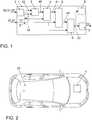
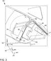
1 eine schematische Darstellung einer Ausführungsform der Vorrichtung zum Referenzieren einer lokalen Trajektorie in einem globalen Koordinatensystem;2 eine schematische Darstellung eines Kraftfahrzeugs, welches eine Vorrichtung gemäß einer der in1 beschriebenen Ausführungsformen aufweist;3 eine schematische Darstellung einer transformierten lokalen Trajektorie, einer hiermit korrespondierenden globalen Trajektorie und einer zugehörigen kartenangepassten globalen Trajektorie zur Verdeutlichung des Verfahrens.
1 a schematic representation of an embodiment of the device for referencing a local trajectory in a global coordinate system;2 a schematic representation of a motor vehicle, which is a device according to one of in. In1 having described embodiments;3 a schematic representation of a transformed local trajectory, a corresponding thereto global trajectory and an associated map-adapted global trajectory to illustrate the method.
In
Die Empfangseinrichtung
Die mindestens eine globale Position
Die Ausgabeeinrichtung
In einer Ausführungsform der Vorrichtung
In einer Ausführungsform weist die Vorrichtung
In einer weiteren Ausführungsform weist die Vorrichtung
Es kann hierbei vorgesehen sein, dass ein Ausschlusskriterium ist, dass lokale Positionen
Es kann ferner alternativ oder zusätzlich vorgesehen sein, dass ein Ausschlusskriterium
Alternativ oder zusätzlich kann ferner vorgesehen sein, dass ein Ausschlusskriterium
Ferner kann alternativ oder zusätzlich vorgesehen sein, dass ein Ausschlusskriterium
Alternativ oder zusätzlich kann auch vorgesehen sein, dass eine Unsicherheit des Verschiebungsvektors
In weiteren Ausführungsformen ist vorgesehen, dass die für die mindestens eine globale Position
Man erkennt deutlich, dass die globalen Positionen der globalen Trajektorie
Die zugehörige kartenangepasste globale Trajektorie
Im beschriebenen Verfahren wird eine Güte für jede der globalen Positionen der globalen Trajektorie
Auf Grundlage der für die globalen Positionen der globalen Trajektorie
Die
Es wird angemerkt, dass sämtliche globalen Positionen der globalen Trajektorie
BezugszeichenlisteLIST OF REFERENCE NUMBERS
- 11
- Vorrichtungcontraption
- 22
- Empfangseinrichtungreceiver
- 33
- GütebestimmungseinrichtungQuality determiner
- 44
- Auswahleinrichtungselector
- 55
- VerschiebungsermittlungseinrichtungDisplacement detection device
- 66
- Transformationseinrichtungtransformation means
- 77
- Ausgabeeinrichtungoutput device
- 88th
- Anzeigeeinrichtungdisplay
- 99
- Bearbeitungseinrichtungprocessing device
- 1010
- Ausschlusskriteriumexclusion criterion
- 2020
- lokale Trajektorielocal trajectory
- 2121
- lokale Position(en)local position (s)
- 2222
- transformierte lokale Position(en)transformed local position (s)
- 2323
- lokales Koordinatensystemlocal coordinate system
- 3030
- globale Trajektorieglobal trajectory
- 3131
- globale Positionglobal position
- 3232
- kartenangepasste globale Positioncard-adjusted global position
- 3333
- kartenangepasste globale Trajektoriemap-adapted global trajectory
- 4040
- Gütequality
- 4141
- Ankerpositionanchor position
- 4242
- Verschiebungsvektordisplacement vector
- 5050
- Kraftfahrzeugmotor vehicle
- 6060
- Straßenkarteroad map
- 6161
- StraßeStreet
- 6262
- StraßeStreet
- 6363
- linker Teilleft part
- 64 64
- rechter Teilright part
- 6565
- globales Koordinatensystemglobal coordinate system
- 6666
- Anfangsbereichinitial region
ZITATE ENTHALTEN IN DER BESCHREIBUNG QUOTES INCLUDE IN THE DESCRIPTION
Diese Liste der vom Anmelder aufgeführten Dokumente wurde automatisiert erzeugt und ist ausschließlich zur besseren Information des Lesers aufgenommen. Die Liste ist nicht Bestandteil der deutschen Patent- bzw. Gebrauchsmusteranmeldung. Das DPMA übernimmt keinerlei Haftung für etwaige Fehler oder Auslassungen.This list of the documents listed by the applicant has been generated automatically and is included solely for the better information of the reader. The list is not part of the German patent or utility model application. The DPMA assumes no liability for any errors or omissions.
Zitierte PatentliteraturCited patent literature
- DE 102012024171 A1 [0002]DE 102012024171 A1 [0002]
Claims (13)
Translated fromGermanPriority Applications (1)
| Application Number | Priority Date | Filing Date | Title |
|---|---|---|---|
| DE102017200234.4ADE102017200234A1 (en) | 2017-01-10 | 2017-01-10 | Method and apparatus for referencing a local trajectory in a global coordinate system |
Applications Claiming Priority (1)
| Application Number | Priority Date | Filing Date | Title |
|---|---|---|---|
| DE102017200234.4ADE102017200234A1 (en) | 2017-01-10 | 2017-01-10 | Method and apparatus for referencing a local trajectory in a global coordinate system |
Publications (1)
| Publication Number | Publication Date |
|---|---|
| DE102017200234A1true DE102017200234A1 (en) | 2018-07-12 |
Family
ID=62636570
Family Applications (1)
| Application Number | Title | Priority Date | Filing Date |
|---|---|---|---|
| DE102017200234.4APendingDE102017200234A1 (en) | 2017-01-10 | 2017-01-10 | Method and apparatus for referencing a local trajectory in a global coordinate system |
Country Status (1)
| Country | Link |
|---|---|
| DE (1) | DE102017200234A1 (en) |
Cited By (5)
| Publication number | Priority date | Publication date | Assignee | Title |
|---|---|---|---|---|
| EP3739511A1 (en)* | 2019-05-14 | 2020-11-18 | Volkswagen Ag | Method for embedding local sensor data in a map |
| EP3865915A1 (en)* | 2020-02-12 | 2021-08-18 | Elektrobit Automotive GmbH | Position estimation in different coordinate systems |
| CN114430524A (en)* | 2021-12-30 | 2022-05-03 | 杭州海康威视数字技术股份有限公司 | Ultra-wideband base station calibration method and device and electronic equipment |
| DE102021206413A1 (en) | 2021-06-22 | 2022-12-22 | Volkswagen Aktiengesellschaft | Method for determining a currently drivable trajectory for an at least partially assisted motor vehicle, and assistance system |
| CN117341679A (en)* | 2023-09-28 | 2024-01-05 | 上海迅猛龙汽车电子有限公司 | Method, device, equipment and storage medium for memorizing parking map |
Citations (4)
| Publication number | Priority date | Publication date | Assignee | Title |
|---|---|---|---|---|
| US20090262974A1 (en)* | 2008-04-18 | 2009-10-22 | Erik Lithopoulos | System and method for obtaining georeferenced mapping data |
| US20120130632A1 (en)* | 2007-08-06 | 2012-05-24 | Amrit Bandyopadhyay | System and method for locating, tracking, and/or monitoring the status of personnel and/or assets both indoors and outdoors |
| DE102012024171A1 (en) | 2011-12-08 | 2013-06-13 | Csr Technology Inc. | Mini Card Tuning for Navigation Systems |
| DE112012003467T5 (en)* | 2011-08-24 | 2014-05-22 | Denso Corporation | Lane storage device |
- 2017
- 2017-01-10DEDE102017200234.4Apatent/DE102017200234A1/enactivePending
Patent Citations (4)
| Publication number | Priority date | Publication date | Assignee | Title |
|---|---|---|---|---|
| US20120130632A1 (en)* | 2007-08-06 | 2012-05-24 | Amrit Bandyopadhyay | System and method for locating, tracking, and/or monitoring the status of personnel and/or assets both indoors and outdoors |
| US20090262974A1 (en)* | 2008-04-18 | 2009-10-22 | Erik Lithopoulos | System and method for obtaining georeferenced mapping data |
| DE112012003467T5 (en)* | 2011-08-24 | 2014-05-22 | Denso Corporation | Lane storage device |
| DE102012024171A1 (en) | 2011-12-08 | 2013-06-13 | Csr Technology Inc. | Mini Card Tuning for Navigation Systems |
Non-Patent Citations (2)
| Title |
|---|
| ROH: Accurate Mobile Urban Mapping via Digital Map-Based SLAM. In: Sensors, Volume 16, August 2016, page 1315.* |
| TAYLOR: GPS accuracy estimation using map matching techniques: Applied to vehicle positioning and odometer calibration. In: Computers, Environment and Urban Systems, Volume 30, Issue 6, November 2006, Pages 757-772.* |
Cited By (7)
| Publication number | Priority date | Publication date | Assignee | Title |
|---|---|---|---|---|
| EP3739511A1 (en)* | 2019-05-14 | 2020-11-18 | Volkswagen Ag | Method for embedding local sensor data in a map |
| EP3865915A1 (en)* | 2020-02-12 | 2021-08-18 | Elektrobit Automotive GmbH | Position estimation in different coordinate systems |
| DE102021206413A1 (en) | 2021-06-22 | 2022-12-22 | Volkswagen Aktiengesellschaft | Method for determining a currently drivable trajectory for an at least partially assisted motor vehicle, and assistance system |
| EP4108545A1 (en) | 2021-06-22 | 2022-12-28 | Volkswagen Ag | Method for determining a current trajectory for an at least partially assisted vehicle, and assistance system |
| CN114430524A (en)* | 2021-12-30 | 2022-05-03 | 杭州海康威视数字技术股份有限公司 | Ultra-wideband base station calibration method and device and electronic equipment |
| CN114430524B (en)* | 2021-12-30 | 2023-09-01 | 杭州海康威视数字技术股份有限公司 | Calibration method and device of ultra-wideband base station and electronic equipment |
| CN117341679A (en)* | 2023-09-28 | 2024-01-05 | 上海迅猛龙汽车电子有限公司 | Method, device, equipment and storage medium for memorizing parking map |
Similar Documents
| Publication | Publication Date | Title |
|---|---|---|
| DE102015111535B4 (en) | Algorithm for precise curvature estimation for the path planning of autonomous vehicles | |
| DE102015207804B4 (en) | Method for detecting parking areas and / or open spaces | |
| EP3380810B1 (en) | Method, device, map processing device and system for precise localization of a vehicle in its surroundings | |
| DE102017200234A1 (en) | Method and apparatus for referencing a local trajectory in a global coordinate system | |
| DE102014215570B4 (en) | Vehicle navigation system | |
| DE102016209232B4 (en) | Method, device and computer-readable storage medium with instructions for determining the lateral position of a vehicle relative to the lanes of a roadway | |
| DE102010007091A1 (en) | Method for determining the position of a motor vehicle | |
| DE102016205436A1 (en) | Method and system for creating a digital map | |
| DE102016100401A1 (en) | Method for determining a misalignment of an object sensor | |
| DE102016213782A1 (en) | A method, apparatus and computer readable storage medium having instructions for determining the lateral position of a vehicle relative to the lanes of a lane | |
| EP3465264A1 (en) | Method for detecting at least one parking space for a vehicle | |
| EP3292423A1 (en) | Diagnostic method for a vision sensor of a vehicle and vehicle having a vision sensor | |
| DE102020118629B4 (en) | Computer-implemented method for determining the validity of an estimated position of a vehicle | |
| DE102009000401A1 (en) | Motor vehicle driver assistance system, especially for parking, has an ultrasonic and an optic system to register an object in relation to the vehicle to prevent a collision | |
| DE102013016596A1 (en) | Method for operating driver assistance system for motor vehicle, involves detecting current driving operation related parameters, and weighing current driving operation related parameters in probability distribution calculation | |
| DE102017216238A1 (en) | Method for determining a position of a motor vehicle in an environment and control device for a motor vehicle and computing device for operating on a data network | |
| DE102007034196A1 (en) | Method and device for track detection with a driver assistance system | |
| DE112020002267T5 (en) | anomaly diagnostic device | |
| DE102014212866A1 (en) | Method for determining a parking space from a number of measuring points | |
| DE102021204372A1 (en) | Orientation-based position determination of rail vehicles | |
| DE102016003261A1 (en) | Method for self-localization of a vehicle in a vehicle environment | |
| DE102014212336A1 (en) | Method for processing measurement data of a vehicle for determining the beginning of a parking space search and computer program product | |
| DE102016213783A1 (en) | A method, apparatus and computer readable storage medium having instructions for determining the lateral position of a vehicle relative to the lanes of a lane | |
| DE102019132967A1 (en) | Method and device for determining a lane hypothesis | |
| DE102018211326A1 (en) | Method and device for determining a position of a vehicle |
Legal Events
| Date | Code | Title | Description |
|---|---|---|---|
| R012 | Request for examination validly filed | ||
| R016 | Response to examination communication | ||
| R016 | Response to examination communication |