CN116007638A - Vehicle trajectory map matching method, device, electronic equipment and vehicle - Google Patents
Vehicle trajectory map matching method, device, electronic equipment and vehicleDownload PDFInfo
- Publication number
- CN116007638A CN116007638ACN202310298234.8ACN202310298234ACN116007638ACN 116007638 ACN116007638 ACN 116007638ACN 202310298234 ACN202310298234 ACN 202310298234ACN 116007638 ACN116007638 ACN 116007638A
- Authority
- CN
- China
- Prior art keywords
- probability value
- target
- observation probability
- target candidate
- road
- Prior art date
- Legal status (The legal status is an assumption and is not a legal conclusion. Google has not performed a legal analysis and makes no representation as to the accuracy of the status listed.)
- Granted
Links
Images


Landscapes
- Navigation (AREA)
- Traffic Control Systems (AREA)
- Image Analysis (AREA)
Abstract
Description
Translated fromChinese技术领域Technical Field
本申请涉及车辆技术领域,尤其涉及一种车辆轨迹地图匹配方法、装置、电子设备及车辆。The present application relates to the field of vehicle technology, and in particular to a vehicle trajectory map matching method, device, electronic equipment and vehicle.
背景技术Background Art
地图匹配(Map Matching)定位技术是指将自动驾驶汽车行驶轨迹的传感器采样数据序列(如经纬度等)与地图路网匹配的过程。地图匹配定位技术将汽车定位信息与地图提供的道路位置信息进行比较,并采用适当算法确定汽车当前的行驶路段,校正定位误差,并为自动驾驶路径规划提供可靠依据。Map matching positioning technology refers to the process of matching the sensor sampling data sequence (such as longitude and latitude) of the driving trajectory of the autonomous vehicle with the map road network. Map matching positioning technology compares the vehicle positioning information with the road location information provided by the map, and uses appropriate algorithms to determine the current driving section of the vehicle, correct positioning errors, and provide a reliable basis for autonomous driving path planning.
相关技术中,将车辆行使轨迹中采样到的全球定位系统 (Global PositioningSystem,GPS)信号作为观测序列,将地图里的各个候选路段作为状态,并假设GPS信号噪声符合高斯分布以此来定义候选路段的观测概率,根据观测概率和状态转移概率建立出隐式马尔科夫模型进行地图匹配。然而,仅用GPS信号作为观测信号,导致地图匹配结果受GPS信号噪声影响较大,地图匹配定位的鲁棒性较差。In the related art, the Global Positioning System (GPS) signal sampled from the vehicle's driving trajectory is used as the observation sequence, and each candidate road section in the map is used as the state. It is assumed that the GPS signal noise conforms to the Gaussian distribution to define the observation probability of the candidate road section, and a hidden Markov model is established based on the observation probability and the state transition probability for map matching. However, using only the GPS signal as the observation signal causes the map matching result to be greatly affected by the GPS signal noise, and the robustness of the map matching positioning is poor.
发明内容Summary of the invention
本申请提供了一种车辆轨迹地图匹配方法、装置、电子设备及车辆。The present application provides a vehicle trajectory map matching method, device, electronic equipment and vehicle.
根据本申请的第一方面,提供了一种车辆轨迹地图匹配方法,所述方法包括:According to a first aspect of the present application, a vehicle trajectory map matching method is provided, the method comprising:
获取地图数据中车辆的目标轨迹点对应的多个候选路段,并获取所述目标轨迹点对应的图像数据的语义信息,所述图像数据为所述车辆的车载摄像头拍摄的图像数据,所述语义信息用于指示所述车载摄像头观测到的道路元素;Acquire multiple candidate road sections corresponding to target trajectory points of the vehicle in map data, and acquire semantic information of image data corresponding to the target trajectory points, wherein the image data is image data captured by a vehicle-mounted camera of the vehicle, and the semantic information is used to indicate road elements observed by the vehicle-mounted camera;
确定目标候选路段对应的空间位置观测概率值,并确定所述语义信息指示的道路元素的道路元素观测概率值,所述目标候选路段为所述多个候选路段中的任意一个候选路段,所述空间位置观测概率值用于指示在空间位置维度上所述目标轨迹点位于所述目标候选路段的概率值,所述道路元素观测概率值用于指示在道路元素维度上所述目标轨迹点位于所述目标候选路段的概率值;Determine a spatial position observation probability value corresponding to a target candidate road section, and determine a road element observation probability value of a road element indicated by the semantic information, wherein the target candidate road section is any one of the multiple candidate road sections, the spatial position observation probability value is used to indicate a probability value that the target trajectory point is located in the target candidate road section in the spatial position dimension, and the road element observation probability value is used to indicate a probability value that the target trajectory point is located in the target candidate road section in the road element dimension;
基于所述目标候选路段对应的空间位置观测概率值及所述道路元素观测概率值确定所述目标候选路段对应的总观测概率值;Determine a total observation probability value corresponding to the target candidate road section based on the spatial position observation probability value corresponding to the target candidate road section and the road element observation probability value;
基于所述目标候选路段对应的总观测概率值确定车辆轨迹的地图匹配结果。A map matching result of the vehicle trajectory is determined based on the total observed probability value corresponding to the target candidate road section.
根据本申请的第二方面,提供了一种车辆轨迹地图匹配装置,所述装置包括:According to a second aspect of the present application, a vehicle trajectory map matching device is provided, the device comprising:
获取模块,用于获取地图数据中车辆的目标轨迹点对应的多个候选路段,并获取所述目标轨迹点对应的图像数据的语义信息,所述图像数据为所述车辆的车载摄像头拍摄的图像数据,所述语义信息用于指示所述车载摄像头观测到的道路元素;an acquisition module, used to acquire multiple candidate road sections corresponding to a target trajectory point of a vehicle in map data, and to acquire semantic information of image data corresponding to the target trajectory point, wherein the image data is image data taken by an onboard camera of the vehicle, and the semantic information is used to indicate road elements observed by the onboard camera;
第一确定模块,用于确定目标候选路段对应的空间位置观测概率值,并确定所述语义信息指示的道路元素的道路元素观测概率值,所述目标候选路段为所述多个候选路段中的任意一个候选路段,所述空间位置观测概率值用于指示在空间位置维度上所述目标轨迹点位于所述目标候选路段的概率值,所述道路元素观测概率值用于指示在道路元素维度上所述目标轨迹点位于所述目标候选路段的概率值;A first determination module is used to determine a spatial position observation probability value corresponding to a target candidate road section, and to determine a road element observation probability value of a road element indicated by the semantic information, wherein the target candidate road section is any one of the multiple candidate road sections, the spatial position observation probability value is used to indicate a probability value that the target trajectory point is located in the target candidate road section in a spatial position dimension, and the road element observation probability value is used to indicate a probability value that the target trajectory point is located in the target candidate road section in a road element dimension;
第二确定模块,用于基于所述目标候选路段对应的空间位置观测概率值及所述道路元素观测概率值确定所述目标候选路段对应的总观测概率值;A second determination module is used to determine a total observation probability value corresponding to the target candidate road section based on the spatial position observation probability value corresponding to the target candidate road section and the road element observation probability value;
第三确定模块,用于基于所述目标候选路段对应的总观测概率值确定车辆轨迹的地图匹配结果。The third determination module is used to determine the map matching result of the vehicle trajectory based on the total observation probability value corresponding to the target candidate road section.
根据本申请的第三方面,提供了一种电子设备,包括:According to a third aspect of the present application, an electronic device is provided, including:
至少一个处理器;以及at least one processor; and
与所述至少一个处理器通信连接的存储器;其中,a memory communicatively connected to the at least one processor; wherein,
所述存储器存储有可被所述至少一个处理器执行的指令,所述指令被所述至少一个处理器执行,以使所述至少一个处理器能够执行本申请的第一方面所述的方法。The memory stores instructions that can be executed by the at least one processor, and the instructions are executed by the at least one processor to enable the at least one processor to perform the method described in the first aspect of the present application.
根据本申请的第四方面,提供了一种存储有计算机指令的非瞬时计算机可读存储介质,其中,所述计算机指令用于使所述计算机执行本申请的第一方面所述的方法。According to a fourth aspect of the present application, a non-transitory computer-readable storage medium storing computer instructions is provided, wherein the computer instructions are used to enable the computer to execute the method described in the first aspect of the present application.
根据本申请的第五方面,提供了一种计算机程序产品,包括计算机程序,所述计算机程序在被处理器执行时实现本申请的第一方面所述的方法。According to a fifth aspect of the present application, a computer program product is provided, comprising a computer program, wherein the computer program implements the method described in the first aspect of the present application when executed by a processor.
根据本申请的第六方面,提供了一种车辆,被配置为执行本申请的第一方面所述的方法。According to a sixth aspect of the present application, a vehicle is provided, which is configured to execute the method described in the first aspect of the present application.
在本申请实施例中,获取地图数据中车辆的目标轨迹点对应的多个候选路段,并获取所述目标轨迹点对应的图像数据的语义信息;确定目标候选路段对应的空间位置观测概率值,并确定所述语义信息指示的道路元素的道路元素观测概率值;基于所述目标候选路段对应的空间位置观测概率值及所述道路元素观测概率值确定所述目标候选路段对应的总观测概率值;基于所述目标候选路段对应的总观测概率值确定车辆轨迹的地图匹配结果。这样,通过将车辆的车载摄像头拍摄的图像数据的语义信息结合空间位置观测概率值确定各个候选路段对应的总观测概率值,能够提高地图匹配定位的鲁棒性,且能够提高地图匹配定位的准确性。In an embodiment of the present application, multiple candidate road sections corresponding to the target trajectory point of the vehicle in the map data are obtained, and the semantic information of the image data corresponding to the target trajectory point is obtained; the spatial position observation probability value corresponding to the target candidate road section is determined, and the road element observation probability value of the road element indicated by the semantic information is determined; the total observation probability value corresponding to the target candidate road section is determined based on the spatial position observation probability value corresponding to the target candidate road section and the road element observation probability value; the map matching result of the vehicle trajectory is determined based on the total observation probability value corresponding to the target candidate road section. In this way, by combining the semantic information of the image data captured by the vehicle's on-board camera with the spatial position observation probability value to determine the total observation probability value corresponding to each candidate road section, the robustness of map matching positioning can be improved, and the accuracy of map matching positioning can be improved.
附图说明BRIEF DESCRIPTION OF THE DRAWINGS
图1是本申请实施例提供的一种车辆轨迹地图匹配方法的流程示意图;FIG1 is a flow chart of a vehicle trajectory map matching method provided in an embodiment of the present application;
图2是本申请实施例提供的一种地图示意图;FIG2 is a schematic diagram of a map provided in an embodiment of the present application;
图3是本申请实施例提供的一种车辆轨迹地图匹配装置的结构示意图;FIG3 is a schematic diagram of the structure of a vehicle trajectory map matching device provided in an embodiment of the present application;
图4是本申请实施例提供的一种电子设备的结构示意图;FIG4 is a schematic diagram of the structure of an electronic device provided in an embodiment of the present application;
图5是本申请实施例提供的一种车辆的结构示意图。FIG5 is a schematic diagram of the structure of a vehicle provided in an embodiment of the present application.
具体实施方式DETAILED DESCRIPTION
以下结合附图对本申请的示范性实施例做出说明,其中包括本申请实施例的各种细节以助于理解,应当将它们认为仅仅是示范性的。因此,本领域普通技术人员应当认识到,可以对这里描述的实施例做出各种改变和修改,而不会背离本申请的范围和精神。同样,为了清楚和简明,以下的描述中省略了对公知功能和结构的描述。The following is a description of exemplary embodiments of the present application in conjunction with the accompanying drawings, including various details of the embodiments of the present application to facilitate understanding, which should be considered as merely exemplary. Therefore, it should be recognized by those of ordinary skill in the art that various changes and modifications can be made to the embodiments described herein without departing from the scope and spirit of the present application. Similarly, for the sake of clarity and conciseness, the description of well-known functions and structures is omitted in the following description.
请参见图1,图1是本申请实施例提供的一种车辆轨迹地图匹配方法的流程图。本申请实施例的车辆轨迹地图匹配方法可以由车辆执行,具体可以由车辆的车机执行,也可以由车辆的相关控制器执行,例如专用于车辆控制的控制器执行,具体可根据实际情况确定。为方便理解,本申请实施例中以车机执行为例,对该车辆轨迹地图匹配方法进行说明,并不作具体限定。Please refer to Figure 1, which is a flow chart of a vehicle trajectory map matching method provided in an embodiment of the present application. The vehicle trajectory map matching method in the embodiment of the present application can be executed by the vehicle, specifically by the vehicle's on-board computer, or by a relevant controller of the vehicle, such as a controller dedicated to vehicle control, which can be determined according to actual conditions. For ease of understanding, the vehicle trajectory map matching method is described in the embodiment of the present application by taking the on-board computer execution as an example, and is not specifically limited.
如图1所示,车辆轨迹地图匹配方法包括以下步骤:As shown in Figure 1, the vehicle trajectory map matching method includes the following steps:
步骤101、获取地图数据中车辆的目标轨迹点对应的多个候选路段,并获取所述目标轨迹点对应的图像数据的语义信息,所述图像数据为所述车辆的车载摄像头拍摄的图像数据,所述语义信息用于指示所述车载摄像头观测到的道路元素。
其中,该地图数据可以为标准地图的地图数据,或者可以为高精地图的地图数据,或者可以为其他类型的地图的地图数据,本实施例对此不进行限定。地图可以是以节点和边的方式存储的有向图,每条边表示一个路段。车辆的目标轨迹点可以为车辆行使轨迹上的任意一个点。车辆的每个GPS信号可以对应一个车辆轨迹点,目标轨迹点可以是车辆的任意一个GPS信号对应的车辆轨迹点。The map data may be map data of a standard map, or may be map data of a high-precision map, or may be map data of other types of maps, which is not limited in this embodiment. The map may be a directed graph stored in the form of nodes and edges, each edge representing a road section. The target trajectory point of the vehicle may be any point on the vehicle's driving trajectory. Each GPS signal of the vehicle may correspond to a vehicle trajectory point, and the target trajectory point may be a vehicle trajectory point corresponding to any GPS signal of the vehicle.
一种实施方式中,对于目标轨迹点,以目标轨迹点为中心,以一定范围为半径,在地图中查询该范围内的所有路段作为目标轨迹点对应的多个候选路段。该一定范围可以为预设范围,例如200米内,或者500米内,或者1000米内,等等,本实施例对此不进行限定。In one implementation, for a target trajectory point, with the target trajectory point as the center and a certain range as the radius, all road sections within the range are queried in the map as multiple candidate road sections corresponding to the target trajectory point. The certain range may be a preset range, such as within 200 meters, or within 500 meters, or within 1000 meters, etc., which is not limited in this embodiment.
相关技术中,基于隐式马尔科夫模型(HMM模型)的地图匹配技术中,将车辆行使轨迹中采样到的GPS信号作为观测序列,将地图里的各个候选路段作为状态,并假设GPS信号噪声符合高斯分布以此来定义候选路段的观测概率。该技术通过数据统计分析指出两个候选路段的状态转移概率符合该两个采样点的GPS距离与其候选路段距离之间的差值的指数分布。再根据观测概率和状态转移概率建立出隐式马尔科夫模型,通过维特比算法来计算出在当前观测序列下概率最大的状态序列,作为最可能的车辆行使轨迹。In the related technology, in the map matching technology based on the hidden Markov model (HMM model), the GPS signal sampled from the vehicle's driving trajectory is used as the observation sequence, and each candidate road section in the map is used as the state, and the GPS signal noise is assumed to conform to the Gaussian distribution to define the observation probability of the candidate road section. This technology points out through data statistical analysis that the state transition probability of two candidate road sections conforms to the exponential distribution of the difference between the GPS distance of the two sampling points and the distance of the candidate road section. Then, a hidden Markov model is established based on the observation probability and the state transition probability, and the Viterbi algorithm is used to calculate the state sequence with the highest probability under the current observation sequence as the most likely vehicle driving trajectory.
本申请实施例中,将车载图像中观测到的语义信息与GPS信号相结合得到更合理的观测概率,能够提高地图匹配的准确性和鲁棒性。In the embodiment of the present application, the semantic information observed in the vehicle-mounted image is combined with the GPS signal to obtain a more reasonable observation probability, which can improve the accuracy and robustness of map matching.
另外,可以通过神经网络模型对车载摄像头拍摄的图像数据进行识别得到语义信息。示例地,可以通过卷积神经网络对车载摄像头拍摄的图像数据进行识别得到语义信息。该语义信息可以用于指示车道线、道路边线、地面箭头线、斑马线及交通信号灯等。In addition, semantic information can be obtained by recognizing image data captured by the vehicle camera through a neural network model. For example, semantic information can be obtained by recognizing image data captured by the vehicle camera through a convolutional neural network. The semantic information can be used to indicate lane lines, road sidelines, ground arrow lines, zebra crossings, traffic lights, etc.
步骤102、确定目标候选路段对应的空间位置观测概率值,并确定所述语义信息指示的道路元素的道路元素观测概率值,所述目标候选路段为所述多个候选路段中的任意一个候选路段,所述空间位置观测概率值用于指示在空间位置维度上所述目标轨迹点位于所述目标候选路段的概率值,所述道路元素观测概率值用于指示在道路元素维度上所述目标轨迹点位于所述目标候选路段的概率值。Step 102: determine the spatial position observation probability value corresponding to the target candidate road section, and determine the road element observation probability value of the road element indicated by the semantic information, the target candidate road section is any one of the multiple candidate road sections, the spatial position observation probability value is used to indicate the probability value of the target trajectory point being located in the target candidate road section in the spatial position dimension, and the road element observation probability value is used to indicate the probability value of the target trajectory point being located in the target candidate road section in the road element dimension.
其中,目标候选路段对应的空间位置观测概率值,可以是,目标候选路段相对于目标轨迹点的空间位置观测概率值。所述语义信息指示的道路元素的道路元素观测概率值可以是目标候选路段相对于目标轨迹点的道路元素观测概率值。The spatial position observation probability value corresponding to the target candidate road section may be the spatial position observation probability value of the target candidate road section relative to the target trajectory point. The road element observation probability value of the road element indicated by the semantic information may be the road element observation probability value of the target candidate road section relative to the target trajectory point.
另外,可以确定目标候选路段对应的距离观测概率值,所述距离观测概率值用于指示在最短距离维度上所述目标轨迹点位于所述目标候选路段的概率值,所述最短距离为所述目标轨迹点至所述目标候选路段的最短距离;可以基于所述目标候选路段对应的距离观测概率值确定目标候选路段对应的空间位置观测概率值。In addition, the distance observation probability value corresponding to the target candidate section can be determined, and the distance observation probability value is used to indicate the probability value that the target trajectory point is located at the target candidate section in the shortest distance dimension, and the shortest distance is the shortest distance from the target trajectory point to the target candidate section; the spatial position observation probability value corresponding to the target candidate section can be determined based on the distance observation probability value corresponding to the target candidate section.
步骤103、基于所述目标候选路段对应的空间位置观测概率值及所述道路元素观测概率值确定所述目标候选路段对应的总观测概率值。Step 103: Determine a total observation probability value corresponding to the target candidate road section based on the spatial position observation probability value corresponding to the target candidate road section and the road element observation probability value.
其中,所述基于所述目标候选路段对应的空间位置观测概率值及所述道路元素观测概率值确定所述目标候选路段对应的总观测概率值,可以包括:在匹配高精地图的情况下,基于所述目标候选路段对应的空间位置观测概率值及所述道路元素观测概率值确定所述目标候选路段对应的总观测概率值;所述方法还可以包括:在匹配标准地图的情况下,基于所述目标候选路段对应的空间位置观测概率值确定所述目标候选路段对应的总观测概率值。Among them, determining the total observation probability value corresponding to the target candidate road section based on the spatial position observation probability value corresponding to the target candidate road section and the road element observation probability value may include: in the case of matching a high-precision map, determining the total observation probability value corresponding to the target candidate road section based on the spatial position observation probability value corresponding to the target candidate road section and the road element observation probability value; the method may also include: in the case of matching a standard map, determining the total observation probability value corresponding to the target candidate road section based on the spatial position observation probability value corresponding to the target candidate road section.
步骤104、基于所述目标候选路段对应的总观测概率值确定车辆轨迹的地图匹配结果。Step 104: Determine a map matching result of the vehicle trajectory based on the total observed probability value corresponding to the target candidate road section.
其中,可以基于所述目标候选路段对应的总观测概率值及目标候选点对应的状态转移概率值采用维特比算法确定所述目标轨迹点位于所述目标候选路段的最大概率值,所述目标候选点为所述目标候选路段上距离所述目标轨迹点最近的点,基于所述多个候选路段对应的所述最大概率值确定车辆轨迹的地图匹配结果;或者,可以基于所述目标候选路段对应的总观测概率值及目标候选点对应的状态转移概率值采用维特比算法确定所述目标轨迹点位于所述目标候选路段的最大概率值,所述目标候选点为所述目标候选路段上距离所述目标轨迹点最近的点,在所述多个候选路段对应的所述最大概率值均小于第三预设值的情况下,对所述多个候选路段对应的所述最大概率值进行归一化处理,基于归一化处理后的所述多个候选路段对应的所述最大概率值确定车辆轨迹的地图匹配结果。Among them, the Viterbi algorithm can be used to determine the maximum probability value of the target trajectory point being located in the target candidate section based on the total observation probability value corresponding to the target candidate section and the state transition probability value corresponding to the target candidate point, the target candidate point is the point on the target candidate section that is closest to the target trajectory point, and the map matching result of the vehicle trajectory is determined based on the maximum probability values corresponding to the multiple candidate sections; or, the Viterbi algorithm can be used to determine the maximum probability value of the target trajectory point being located in the target candidate section based on the total observation probability value corresponding to the target candidate section and the state transition probability value corresponding to the target candidate point, the target candidate point is the point on the target candidate section that is closest to the target trajectory point, and when the maximum probability values corresponding to the multiple candidate sections are all less than the third preset value, the maximum probability values corresponding to the multiple candidate sections are normalized, and the map matching result of the vehicle trajectory is determined based on the maximum probability values corresponding to the multiple candidate sections after the normalization.
在本申请实施例中,获取地图数据中车辆的目标轨迹点对应的多个候选路段,并获取所述目标轨迹点对应的图像数据的语义信息;确定目标候选路段对应的空间位置观测概率值,并确定所述语义信息指示的道路元素的道路元素观测概率值;基于所述目标候选路段对应的空间位置观测概率值及所述道路元素观测概率值确定所述目标候选路段对应的总观测概率值;基于所述目标候选路段对应的总观测概率值确定车辆轨迹的地图匹配结果。这样,通过将车辆的车载摄像头拍摄的图像数据的语义信息结合空间位置观测概率值确定各个候选路段对应的总观测概率值,能够提高地图匹配定位的鲁棒性,且能够提高地图匹配定位的准确性。In an embodiment of the present application, multiple candidate road sections corresponding to the target trajectory point of the vehicle in the map data are obtained, and the semantic information of the image data corresponding to the target trajectory point is obtained; the spatial position observation probability value corresponding to the target candidate road section is determined, and the road element observation probability value of the road element indicated by the semantic information is determined; the total observation probability value corresponding to the target candidate road section is determined based on the spatial position observation probability value corresponding to the target candidate road section and the road element observation probability value; the map matching result of the vehicle trajectory is determined based on the total observation probability value corresponding to the target candidate road section. In this way, by combining the semantic information of the image data captured by the vehicle's on-board camera with the spatial position observation probability value to determine the total observation probability value corresponding to each candidate road section, the robustness of map matching positioning can be improved, and the accuracy of map matching positioning can be improved.
可选地,在匹配高精地图的情况下,所述目标候选路段对应的总观测概率值基于所述目标候选路段对应的空间位置观测概率值及所述道路元素观测概率值的乘积确定;Optionally, in the case of matching a high-precision map, the total observation probability value corresponding to the target candidate road section is determined based on the product of the spatial position observation probability value corresponding to the target candidate road section and the road element observation probability value;
和/或and/or
在匹配标准地图的情况下,所述目标候选路段对应的总观测概率值为所述目标候选路段对应的空间位置观测概率值。In the case of matching a standard map, the total observed probability value corresponding to the target candidate road section is the spatial position observed probability value corresponding to the target candidate road section.
其中,所述语义信息指示的道路元素可以包括多个道路元素。所述道路元素观测概率值可以包括所述多个道路元素的道路元素观测概率值。在匹配高精地图的情况下,所述目标候选路段对应的总观测概率值可以为所述多个道路元素的道路元素观测概率值与所述目标候选路段对应的空间位置观测概率值的乘积;或者,所述目标候选路段对应的总观测概率值可以为所述多个道路元素的道路元素观测概率值、所述目标候选路段对应的空间位置观测概率值及预设系数的乘积。Among them, the road elements indicated by the semantic information may include multiple road elements. The road element observation probability value may include the road element observation probability values of the multiple road elements. In the case of matching a high-precision map, the total observation probability value corresponding to the target candidate road section may be the product of the road element observation probability values of the multiple road elements and the spatial position observation probability value corresponding to the target candidate road section; or, the total observation probability value corresponding to the target candidate road section may be the product of the road element observation probability values of the multiple road elements, the spatial position observation probability value corresponding to the target candidate road section and a preset coefficient.
一种实施方式中,所述道路元素包括车道线,地面导向标识及交通信号灯。所述多个道路元素的道路元素观测概率值包括车道线观测概率值,地面导向标识观测概率值及交通信号灯观测概率值。所述目标候选路段对应的总观测概率值可以为:第一乘积、第二乘积、第三乘积与第四乘积的乘积,第一乘积为第一系数与目标候选路段对应的空间位置观测概率值的乘积,第二乘积为第二系数与车道线观测概率值的乘积,第三乘积为第三系数与地面导向标识观测概率值的乘积,第四乘积为第四系数与交通信号灯观测概率值的乘积。第一系数、第二系数、第三系数和第四系数的和值可以为1。In one embodiment, the road elements include lane lines, ground guide signs and traffic lights. The road element observation probability values of the multiple road elements include lane line observation probability values, ground guide sign observation probability values and traffic light observation probability values. The total observation probability value corresponding to the target candidate road section can be: the product of the first product, the second product, the third product and the fourth product, the first product is the product of the first coefficient and the spatial position observation probability value corresponding to the target candidate road section, the second product is the product of the second coefficient and the lane line observation probability value, the third product is the product of the third coefficient and the ground guide sign observation probability value, and the fourth product is the product of the fourth coefficient and the traffic light observation probability value. The sum of the first coefficient, the second coefficient, the third coefficient and the fourth coefficient can be 1.
该实施方式中,在匹配高精地图的情况下,所述目标候选路段对应的总观测概率值基于所述目标候选路段对应的空间位置观测概率值及所述道路元素观测概率值的乘积确定;和/或在匹配标准地图的情况下,所述目标候选路段对应的总观测概率值为所述目标候选路段对应的空间位置观测概率值。这样,能够区分匹配对象为高精地图或标准地图确定各个候选路段对应的空间位置观测概率值,使得本申请实施例的车辆轨迹地图匹配方法能够不仅适用于标准地图,还适用于高精地图。In this implementation, in the case of matching a high-precision map, the total observation probability value corresponding to the target candidate road section is determined based on the product of the spatial position observation probability value corresponding to the target candidate road section and the road element observation probability value; and/or in the case of matching a standard map, the total observation probability value corresponding to the target candidate road section is the spatial position observation probability value corresponding to the target candidate road section. In this way, it is possible to distinguish whether the matching object is a high-precision map or a standard map to determine the spatial position observation probability value corresponding to each candidate road section, so that the vehicle trajectory map matching method of the embodiment of the present application can be applied not only to standard maps, but also to high-precision maps.
可选地,所述语义信息指示的道路元素包括目标道路元素,所述确定所述语义信息指示的道路元素的道路元素观测概率值,包括:Optionally, the road element indicated by the semantic information includes a target road element, and determining the road element observation probability value of the road element indicated by the semantic information includes:
确定第一值,所述第一值为第一最小值与第一最大值之间的比值,所述第一最小值为第一数量值与第二数量值中的最小值,所述第一最大值为第一数量值与第二数量值中的最大值,所述第一数量值为所述车载摄像头观测到的所述目标道路元素的数量值,所述第二数量值为所述目标候选路段上所述目标道路元素的数量值;Determine a first value, where the first value is a ratio between a first minimum value and a first maximum value, the first minimum value is a minimum value between a first quantity value and a second quantity value, the first maximum value is a maximum value between the first quantity value and the second quantity value, the first quantity value is a quantity value of the target road elements observed by the vehicle-mounted camera, and the second quantity value is a quantity value of the target road elements on the target candidate road section;
确定第二值,其中,在第一类型信息指示的道路元素类型与第二类型信息指示的道路元素类型相同的情况下,所述第二值为第一预设值,在所述第一类型信息指示的道路元素类型与所述第二类型信息指示的道路元素类型不相同的情况下,所述第二值为第二预设值,所述第一预设值大于所述第二预设值,所述第一类型信息为所述车载摄像头观测到的所述目标道路元素的类型信息,所述第二类型信息为所述目标候选路段上所述目标道路元素的类型信息;Determine a second value, wherein, when the road element type indicated by the first type information is the same as the road element type indicated by the second type information, the second value is a first preset value, and when the road element type indicated by the first type information is different from the road element type indicated by the second type information, the second value is a second preset value, the first preset value is greater than the second preset value, the first type information is the type information of the target road element observed by the vehicle-mounted camera, and the second type information is the type information of the target road element on the target candidate road section;
基于所述第一值和所述第二值确定所述目标道路元素的道路元素观测概率值。A road element observation probability value of the target road element is determined based on the first value and the second value.
其中,若车载图像指示无目标道路元素,且候选路段上无目标道路元素,则可以将目标道路元素的道路元素观测概率值置为1;若车载图像指示存在目标道路元素,或候选路段上存在目标道路元素,则可以基于所述第一值和所述第二值确定所述目标道路元素的道路元素观测概率值。Among them, if the on-board image indicates that there is no target road element and there is no target road element on the candidate road section, the road element observation probability value of the target road element can be set to 1; if the on-board image indicates that there is a target road element, or there is a target road element on the candidate road section, the road element observation probability value of the target road element can be determined based on the first value and the second value.
另外,所述目标道路元素的道路元素观测概率值可以为所述第一值和所述第二值的乘积,或者所述目标道路元素的道路元素观测概率值可以为所述第一值和所述第二值的乘积与预设系数的乘积,该预设系数可以根据地图匹配的实际需求设置。In addition, the road element observation probability value of the target road element can be the product of the first value and the second value, or the road element observation probability value of the target road element can be the product of the first value and the second value and a preset coefficient, and the preset coefficient can be set according to the actual needs of map matching.
另外,目标道路元素可以为车道线,地面导向标识,或者交通信号灯。示例地,目标道路元素可以为车道线,第一数量值可以为所述车载摄像头观测到的车道线数量,第二数量值可以为目标候选路段上的车道线数量,第一类型信息可以为所述车载摄像头观测到的车道线类型信息,所述第二类型信息可以为所述目标候选路段上的车道线的类型信息;示例地,目标道路元素可以为地面导向标识,第一数量值可以为所述车载摄像头观测到的地面导向标识数量,第二数量值可以为目标候选路段上的地面导向标识数量,第一类型信息可以为所述车载摄像头观测到的地面导向标识的类型信息,所述第二类型信息可以为所述目标候选路段上的地面导向标识的类型信息;示例地,目标道路元素可以为交通信号灯,第一数量值可以为所述车载摄像头观测到的交通信号灯数量,第二数量值可以为目标候选路段上的交通信号灯数量,第一类型信息可以为所述车载摄像头观测到的交通信号灯的类型信息,所述第二类型信息可以为所述目标候选路段上的交通信号灯的类型信息。In addition, the target road element may be a lane line, a ground guide sign, or a traffic light. For example, the target road element may be a lane line, the first quantity value may be the number of lane lines observed by the vehicle camera, the second quantity value may be the number of lane lines on the target candidate road section, the first type of information may be the type information of the lane line observed by the vehicle camera, and the second type of information may be the type information of the lane line on the target candidate road section; for example, the target road element may be a ground guide sign, the first quantity value may be the number of ground guide signs observed by the vehicle camera, the second quantity value may be the number of ground guide signs on the target candidate road section, the first type of information may be the type information of the ground guide signs observed by the vehicle camera, and the second type of information may be the type information of the ground guide signs on the target candidate road section; for example, the target road element may be a traffic light, the first quantity value may be the number of traffic lights observed by the vehicle camera, the second quantity value may be the number of traffic lights on the target candidate road section, the first type of information may be the type information of the traffic lights observed by the vehicle camera, and the second type of information may be the type information of the traffic lights on the target candidate road section.
该实施方式中,通过车载摄像头观测到的所述目标道路元素的数量值及所述目标候选路段上所述目标道路元素的数量值,以及车载摄像头观测到的所述目标道路元素的类型信息及目标候选路段上所述目标道路元素的类型信息共同确定目标道路元素的道路元素观测概率值,能够较为准确地确定在道路元素维度上所述目标轨迹点位于所述目标候选路段的概率。In this implementation, the road element observation probability value of the target road element is determined jointly by the number value of the target road elements observed by the vehicle-mounted camera and the number value of the target road elements on the target candidate section, as well as the type information of the target road elements observed by the vehicle-mounted camera and the type information of the target road elements on the target candidate section. The probability that the target trajectory point is located in the target candidate section in the road element dimension can be determined more accurately.
可选地,所述道路元素包括如下至少一项:Optionally, the road element includes at least one of the following:
车道线,地面导向标识,交通信号灯。Lane lines, ground guide signs, and traffic lights.
其中,地面导向标识可以包括地面箭头线或其他可用于地面导向的标识。Among them, the ground guidance signs may include ground arrow lines or other signs that can be used for ground guidance.
该实施方式中,道路元素包括如下至少一项:车道线标识,地面导向标识,交通信号灯。由于车道线标识,地面导向标识及交通信号灯均能够较好地体现道路特征,从而结合道路元素进行地图匹配,能够提高地图匹配定位的鲁棒性,且能够提高地图匹配定位的准确性。In this embodiment, the road elements include at least one of the following: lane markings, ground guide markings, and traffic lights. Since lane markings, ground guide markings, and traffic lights can all better reflect road features, combining road elements for map matching can improve the robustness of map matching positioning and can improve the accuracy of map matching positioning.
可选地,所述确定目标候选路段对应的空间位置观测概率值,包括:Optionally, determining the spatial position observation probability value corresponding to the target candidate road section includes:
确定目标候选路段对应的距离观测概率值,所述距离观测概率值用于指示在最短距离维度上所述目标轨迹点位于所述目标候选路段的概率值,所述最短距离为所述目标轨迹点至所述目标候选路段的最短距离;Determine a distance observation probability value corresponding to a target candidate section, wherein the distance observation probability value is used to indicate a probability value that the target trajectory point is located at the target candidate section in the shortest distance dimension, and the shortest distance is the shortest distance from the target trajectory point to the target candidate section;
基于所述目标候选路段对应的距离观测概率值确定目标候选路段对应的空间位置观测概率值。The spatial position observation probability value corresponding to the target candidate road section is determined based on the distance observation probability value corresponding to the target candidate road section.
其中,目标候选路段对应的距离观测概率值可以为目标候选路段相对于目标轨迹点的距离观测概率值。目标候选路段对应的空间位置观测概率值可以为目标候选路段对应的距离观测概率值;或者,在基于所述车载摄像头拍摄的图像数据预测所述目标轨迹点位于第一候选路段或第二候选路段的情况下,基于目标候选路段为第一候选路段或第二候选路段,及目标候选路段对应的距离观测概率值确定目标候选路段对应的空间位置观测概率值;在基于所述车载摄像头拍摄的图像数据确定所述车辆的行驶路段为主路或辅路的情况下,基于目标候选路段为主路或辅路,及目标候选路段对应的距离观测概率值确定目标候选路段对应的空间位置观测概率值;在基于所述车载摄像头拍摄的图像数据预测所述目标轨迹点不是位于第一候选路段或第二候选路段,且基于所述车载摄像头拍摄的图像数据确定所述车辆的行驶路段不为主路或辅路的情况下,目标候选路段对应的空间位置观测概率值可以为目标候选路段对应的距离观测概率值。所述第一候选路段为在所述车辆的行驶方向上位于交叉路口之前的候选路段,所述第二候选路段为在所述车辆的行驶方向上位于交叉路口之后的候选路段。Among them, the distance observation probability value corresponding to the target candidate section can be the distance observation probability value of the target candidate section relative to the target trajectory point. The spatial position observation probability value corresponding to the target candidate section can be the distance observation probability value corresponding to the target candidate section; or, in the case where the target trajectory point is predicted to be located at the first candidate section or the second candidate section based on the image data captured by the vehicle-mounted camera, the spatial position observation probability value corresponding to the target candidate section is determined based on the target candidate section being the first candidate section or the second candidate section, and the distance observation probability value corresponding to the target candidate section; in the case where the driving section of the vehicle is determined to be a main road or a secondary road based on the image data captured by the vehicle-mounted camera, the spatial position observation probability value corresponding to the target candidate section is determined based on the target candidate section being the main road or the secondary road, and the distance observation probability value corresponding to the target candidate section; in the case where the target trajectory point is predicted not to be located at the first candidate section or the second candidate section based on the image data captured by the vehicle-mounted camera, and the driving section of the vehicle is determined not to be a main road or a secondary road based on the image data captured by the vehicle-mounted camera, the spatial position observation probability value corresponding to the target candidate section can be the distance observation probability value corresponding to the target candidate section. The first candidate road section is a candidate road section located before the intersection in the traveling direction of the vehicle, and the second candidate road section is a candidate road section located after the intersection in the traveling direction of the vehicle.
一种实施方式中,可以认为车辆轨迹点与其候选路段上的候选点之间的距离服从高斯分布,候选点为候选路段上距离目标轨迹点最近的点,候选路段对应的距离观测概率值可以是候选路段相对于目标轨迹点的距离观测概率,候选路段对应的距离观测概率值可以如下计算:
其中,


该实施方式中,确定目标候选路段对应的距离观测概率值,基于所述目标候选路段对应的距离观测概率值确定目标候选路段对应的空间位置观测概率值,从而能够基于空间位置观测概率值确定各个候选路段对应的总观测概率值。In this implementation, the distance observation probability value corresponding to the target candidate section is determined, and the spatial position observation probability value corresponding to the target candidate section is determined based on the distance observation probability value corresponding to the target candidate section, so that the total observation probability value corresponding to each candidate section can be determined based on the spatial position observation probability value.
可选地,在基于所述车载摄像头拍摄的图像数据预测所述目标轨迹点位于第一候选路段的情况下,若所述目标候选路段为所述第一候选路段,则所述目标候选路段对应的空间位置观测概率值为第一权重与所述目标候选路段对应的距离观测概率值的乘积;若所述目标候选路段为第二候选路段,则所述目标候选路段对应的空间位置观测概率值为第二权重与所述目标候选路段对应的距离观测概率值的乘积;Optionally, in the case where the target trajectory point is predicted to be located at the first candidate section based on the image data captured by the vehicle-mounted camera, if the target candidate section is the first candidate section, the spatial position observation probability value corresponding to the target candidate section is the product of the first weight and the distance observation probability value corresponding to the target candidate section; if the target candidate section is the second candidate section, the spatial position observation probability value corresponding to the target candidate section is the product of the second weight and the distance observation probability value corresponding to the target candidate section;
和/或and/or
在基于所述车载摄像头拍摄的图像数据预测所述目标轨迹点位于第二候选路段的情况下,若所述目标候选路段为第一候选路段,则所述目标候选路段对应的空间位置观测概率值为所述第二权重与所述目标候选路段对应的距离观测概率值的乘积;若所述目标候选路段为所述第二候选路段,则所述目标候选路段对应的空间位置观测概率值为所述第一权重与所述目标候选路段对应的距离观测概率值的乘积;In the case where it is predicted that the target trajectory point is located at the second candidate section based on the image data taken by the vehicle-mounted camera, if the target candidate section is the first candidate section, the spatial position observation probability value corresponding to the target candidate section is the product of the second weight and the distance observation probability value corresponding to the target candidate section; if the target candidate section is the second candidate section, the spatial position observation probability value corresponding to the target candidate section is the product of the first weight and the distance observation probability value corresponding to the target candidate section;
其中,所述第一候选路段为在所述车辆的行驶方向上位于交叉路口之前的候选路段,所述第二候选路段为在所述车辆的行驶方向上位于交叉路口之后的候选路段,所述第一权重大于所述第二权重。The first candidate road section is a candidate road section located before the intersection in the driving direction of the vehicle, the second candidate road section is a candidate road section located after the intersection in the driving direction of the vehicle, and the first weight is greater than the second weight.
其中,可以在目标轨迹点与交叉路口之间的距离小于预设距离,且基于所述车载摄像头拍摄的图像数据判断斑马线位于车辆前方的情况下,预测所述目标轨迹点位于第一候选路段,该预设距离可以根据实际情况设置,示例地,可以设置为1米,3米或5米;在目标轨迹点与交叉路口之间的距离小于预设距离,且基于所述车载摄像头拍摄的图像数据判断斑马线位于车辆后方或不存在斑马线的情况下,预测所述目标轨迹点位于第二候选路段。Among them, when the distance between the target trajectory point and the intersection is less than a preset distance, and the zebra crossing is judged to be located in front of the vehicle based on the image data taken by the on-board camera, it is predicted that the target trajectory point is located in the first candidate section. The preset distance can be set according to actual conditions. For example, it can be set to 1 meter, 3 meters or 5 meters; when the distance between the target trajectory point and the intersection is less than a preset distance, and the zebra crossing is judged to be located behind the vehicle or there is no zebra crossing based on the image data taken by the on-board camera, it is predicted that the target trajectory point is located in the second candidate section.
另外,第一权重和第二权重的和值可以为1。示例地,第一权重可以设置为0.9,第二权重可以设置为0.1;或者第一权重可以设置为0.8,第二权重可以设置为0.2;第一权重可以设置为0.7,第二权重可以设置为0.3;等等,本实施例对第一权重和第二权重的具体取值不进行限定。In addition, the sum of the first weight and the second weight may be 1. For example, the first weight may be set to 0.9, and the second weight may be set to 0.1; or the first weight may be set to 0.8, and the second weight may be set to 0.2; the first weight may be set to 0.7, and the second weight may be set to 0.3; and so on. This embodiment does not limit the specific values of the first weight and the second weight.
该实施方式中,基于所述车载摄像头拍摄的图像数据预测所述目标轨迹点位于第一候选路段或第二候选路段,基于不同的预测结果以及候选路段是在所述车辆的行驶方向上位于交叉路口之前的候选路段或是在所述车辆的行驶方向上位于交叉路口之后的候选路段,确定各个候选路段对应的空间位置观测概率值,能够结合车辆的车载摄像头拍摄的图像数据较为准确地确定各个候选路段对应的空间位置观测概率值。In this implementation, based on the image data captured by the vehicle-mounted camera, it is predicted that the target trajectory point is located at the first candidate section or the second candidate section. Based on different prediction results and whether the candidate section is a candidate section located before the intersection in the driving direction of the vehicle or a candidate section located after the intersection in the driving direction of the vehicle, the spatial position observation probability value corresponding to each candidate section is determined. The spatial position observation probability value corresponding to each candidate section can be determined more accurately in combination with the image data captured by the vehicle-mounted camera.
可选地,在基于所述车载摄像头拍摄的图像数据确定所述车辆的行驶路段为主路的情况下,若所述目标候选路段为主路,则所述目标候选路段对应的空间位置观测概率值为第三权重与所述目标候选路段对应的距离观测概率值的乘积;若所述目标候选路段为辅路,则所述目标候选路段对应的空间位置观测概率值为第四权重与所述目标候选路段对应的距离观测概率值的乘积;Optionally, in the case where it is determined that the driving section of the vehicle is a main road based on the image data taken by the on-board camera, if the target candidate section is a main road, the spatial position observation probability value corresponding to the target candidate section is the product of the third weight and the distance observation probability value corresponding to the target candidate section; if the target candidate section is a secondary road, the spatial position observation probability value corresponding to the target candidate section is the product of the fourth weight and the distance observation probability value corresponding to the target candidate section;
和/或and/or
在基于所述车载摄像头拍摄的图像数据确定所述车辆的行驶路段为辅路的情况下,若所述目标候选路段为主路,则所述目标候选路段对应的空间位置观测概率值为所述第四权重与所述目标候选路段对应的距离观测概率值的乘积;若所述目标候选路段为辅路,则所述目标候选路段对应的空间位置观测概率值为所述第三权重与所述目标候选路段对应的距离观测概率值的乘积;In the case where it is determined based on the image data captured by the on-board camera that the driving section of the vehicle is a secondary road, if the target candidate section is a main road, the spatial position observation probability value corresponding to the target candidate section is the product of the fourth weight and the distance observation probability value corresponding to the target candidate section; if the target candidate section is a secondary road, the spatial position observation probability value corresponding to the target candidate section is the product of the third weight and the distance observation probability value corresponding to the target candidate section;
其中,所述第三权重大于所述第四权重。Wherein, the third weight is greater than the fourth weight.
其中,可以在目标轨迹点与主路或辅路之间的距离小于预设距离的情况下,基于所述车载摄像头拍摄的图像数据预测车辆的行驶路段为主路或辅路,该预设距离可以根据实际情况设置,示例地,可以设置为1米,3米或5米。可以根据车载摄像头拍摄的图像数据中的道路宽度或道路标识等预测车辆的行驶路段为主路或辅路。Wherein, when the distance between the target trajectory point and the main road or the secondary road is less than a preset distance, the vehicle's driving section can be predicted to be the main road or the secondary road based on the image data captured by the vehicle-mounted camera. The preset distance can be set according to actual conditions, for example, it can be set to 1 meter, 3 meters or 5 meters. The vehicle's driving section can be predicted to be the main road or the secondary road based on the road width or road signs in the image data captured by the vehicle-mounted camera.
另外,第三权重和第四权重的和值可以为1。示例地,第三权重可以设置为0.9,第四权重可以设置为0.1;或者第三权重可以设置为0.8,第四权重可以设置为0.2;第三权重可以设置为0.7,第四权重可以设置为0.3;等等,本实施例对第三权重和第四权重的具体取值不进行限定。In addition, the sum of the third weight and the fourth weight may be 1. For example, the third weight may be set to 0.9, and the fourth weight may be set to 0.1; or the third weight may be set to 0.8, and the fourth weight may be set to 0.2; the third weight may be set to 0.7, and the fourth weight may be set to 0.3; and so on. This embodiment does not limit the specific values of the third weight and the fourth weight.
该实施方式中,基于车载摄像头拍摄的图像数据确定所述车辆的行驶路段为主路或辅路,基于确定结果以及候选路段为主路或辅路确定各个候选路段对应的空间位置观测概率值,能够结合车辆的车载摄像头拍摄的图像数据较为准确地确定各个候选路段对应的空间位置观测概率值。In this embodiment, the driving section of the vehicle is determined to be a main road or a secondary road based on the image data taken by the on-board camera, and the spatial position observation probability value corresponding to each candidate section is determined based on the determination result and whether the candidate section is a main road or a secondary road. The spatial position observation probability value corresponding to each candidate section can be determined more accurately in combination with the image data taken by the on-board camera of the vehicle.
可选地,所述基于所述目标候选路段对应的总观测概率值确定车辆轨迹的地图匹配结果,包括:Optionally, determining a map matching result of a vehicle trajectory based on a total observed probability value corresponding to the target candidate road section includes:
基于所述目标候选路段对应的总观测概率值及目标候选点对应的状态转移概率值采用维特比算法确定所述目标轨迹点位于所述目标候选路段的最大概率值,所述目标候选点为所述目标候选路段上距离所述目标轨迹点最近的点;Based on the total observation probability value corresponding to the target candidate section and the state transition probability value corresponding to the target candidate point, the Viterbi algorithm is used to determine the maximum probability value of the target trajectory point being located on the target candidate section, and the target candidate point is the point on the target candidate section that is closest to the target trajectory point;
在所述多个候选路段对应的所述最大概率值均小于第三预设值的情况下,对所述多个候选路段对应的所述最大概率值进行归一化处理;In a case where the maximum probability values corresponding to the multiple candidate road sections are all less than a third preset value, normalizing the maximum probability values corresponding to the multiple candidate road sections;
基于归一化处理后的所述多个候选路段对应的所述最大概率值确定车辆轨迹的地图匹配结果。A map matching result of the vehicle trajectory is determined based on the maximum probability values corresponding to the multiple candidate road sections after normalization.
需要说明的是,维特比算法通过不断的累乘观测概率和状态转移概率并选取最大概率,而由于观测概率和状态转移概率都是小于1的值,当车辆轨迹点较多时,会导致随着状态转移过程累乘概率值无限趋近于0,而受限于PC端浮点数的精度问题,无限趋近于0的概率值都会变成0去存储,进而无法区分最大概率值。该实施方式中在累乘到某一个轨迹点的候选路段时,如果此时所有候选路段中的最大概率小于1e-10,则将此时该轨迹点的所有候选路段的概率值进行归一化处理,然后继续进行状态转移求解,最后将累乘概率最大的车辆候选路径作为车辆轨迹地图匹配的结果。It should be noted that the Viterbi algorithm continuously accumulates the observation probability and the state transition probability and selects the maximum probability. Since the observation probability and the state transition probability are both less than 1, when there are many vehicle trajectory points, the accumulated probability value will infinitely approach 0 during the state transition process. However, due to the precision of floating-point numbers on the PC side, the probability values that are infinitely close to 0 will be stored as 0, and the maximum probability value cannot be distinguished. In this implementation, when the candidate sections of a certain trajectory point are accumulated, if the maximum probability of all candidate sections at this time is less than 1e-10, the probability values of all candidate sections of the trajectory point at this time are normalized, and then the state transition solution is continued. Finally, the vehicle candidate path with the largest accumulated probability is used as the result of vehicle trajectory map matching.
该实施方式中,在所述多个候选路段对应的所述最大概率值均小于第三预设值的情况下,对所述多个候选路段对应的所述最大概率值进行归一化处理,基于归一化处理后的所述多个候选路段对应的所述最大概率值确定车辆轨迹的地图匹配结果,从而实现对维特比(Viterbi)算法进行改进,通过将累乘概率值进行归一化处理策略,使其可以避免累乘概率值无限趋近于零的情况,从而可以进一步提高地图匹配定位的准确性。In this implementation, when the maximum probability values corresponding to the multiple candidate road sections are all less than the third preset value, the maximum probability values corresponding to the multiple candidate road sections are normalized, and the map matching result of the vehicle trajectory is determined based on the maximum probability values corresponding to the multiple candidate road sections after the normalization, thereby improving the Viterbi algorithm. By adopting a normalization strategy for the accumulated probability value, it is possible to avoid the situation where the accumulated probability value infinitely approaches zero, thereby further improving the accuracy of map matching positioning.
作为一种具体的实施例,车辆轨迹地图匹配方法包括如下步骤:As a specific embodiment, the vehicle trajectory map matching method includes the following steps:
(1):根据现有的地图和车辆行使轨迹,获取地图中轨迹点对应的候选路段信息,并通过卷积神经网络获取车载摄像头拍摄的图像上的语义信息。具体可细分为以下几个步骤:(1): Based on the existing map and vehicle trajectory, obtain the candidate road section information corresponding to the trajectory point in the map, and obtain the semantic information of the image taken by the vehicle camera through the convolutional neural network. It can be broken down into the following steps:
(1.1):准备地图数据;(1.1): Prepare map data;
假定地图是以节点和边的方式存储的有向图,每条边表示一个路段。Assume that the map is a directed graph stored in the form of nodes and edges, and each edge represents a road segment.
(1.2):获取轨迹点对应的候选路段;(1.2): Get the candidate road sections corresponding to the trajectory points;
车辆每个GPS信号对应一个车辆原始轨迹点


(1.3):获取车载摄像头拍摄的图像的语义信息;(1.3): Obtain the semantic information of the image taken by the vehicle camera;
车载摄像头拍摄的图像可以简述为车载图像。车辆在每个轨迹点上均有相对应的车载图像,通过卷积神经网络对车载图像进行识别,可识别得到车载图像的语义信息,该语义信息可以用于指示车道线、道路边线、地面箭头线、斑马线及交通信号灯等,识别得到的语义信息可作为该车载图像的观测信息。The images taken by the vehicle camera can be simply described as vehicle images. The vehicle has a corresponding vehicle image at each trajectory point. The vehicle image is recognized by the convolutional neural network to obtain the semantic information of the vehicle image. The semantic information can be used to indicate lane lines, road edges, ground arrow lines, zebra crossings, traffic lights, etc. The recognized semantic information can be used as the observation information of the vehicle image.
(2):根据车载图像上观测到的语义信息和车辆GPS信号计算观测概率以及状态转移概率,并根据地图为标准地图或高精地图分别执行不同的观测概率计算。具体的,计算观测概率;判断地图是否是高精地图;若是,则分别计算车道线观测概率、地面箭头线观测概率及交通信号灯观测概率,再计算空间位置观测概率;若否,则直接计算空间位置观测概率。可细分为以下几个步骤:(2): Calculate the observation probability and state transition probability based on the semantic information observed on the vehicle image and the vehicle GPS signal, and perform different observation probability calculations based on whether the map is a standard map or a high-precision map. Specifically, calculate the observation probability; determine whether the map is a high-precision map; if so, calculate the lane line observation probability, the ground arrow line observation probability, and the traffic light observation probability respectively, and then calculate the spatial position observation probability; if not, directly calculate the spatial position observation probability. It can be divided into the following steps:
(2.1):假如地图是标准地图,每条路段仅对应存储有空间位置信息, 则具体计算步骤如下:(2.1): If the map is a standard map, each road segment only stores spatial location information, then the specific calculation steps are as follows:
(2.1.1):计算候选路段相对于车辆轨迹点的空间位置观测概率;(2.1.1): Calculate the spatial position observation probability of the candidate road segment relative to the vehicle trajectory point;
假设车辆轨迹点与其候选路段上的候选点之间的距离服从高斯分布,则候选路段相对于车辆轨迹点的距离观测概率计算如下:Assuming that the distance between the vehicle trajectory point and the candidate point on its candidate road segment follows a Gaussian distribution, the distance observation probability of the candidate road segment relative to the vehicle trajectory point is calculated as follows:

其中,


另外,如下两种情况下计算候选路段相对于车辆轨迹点的空间位置观测概率的方式如下:In addition, the spatial position observation probability of the candidate road segment relative to the vehicle trajectory point is calculated in the following two cases:
情况1:若车辆的某个轨迹点是在一个路口附近,示例地,如图2中的轨迹点


若车辆的某个轨迹点是在一个路口附近,且通过车载图像未观测到路口处的斑马线是位于车辆前方,则可以认为该轨迹点大概率是位于已过路口的候选路段上,空间位置观测概率计算如下:If a certain trajectory point of the vehicle is near an intersection, and the zebra crossing at the intersection is not observed to be located in front of the vehicle through the vehicle-mounted image, it can be considered that the trajectory point is most likely located on a candidate section of the intersection that has passed. The spatial position observation probability is calculated as follows:

其中,


情况2:若车辆的某个轨迹点附近有主路和辅路,如图2中轨迹点

若根据观测信息判断为辅路,则空间位置观测概率计算如下:If it is judged as a secondary road based on the observation information, the spatial position observation probability is calculated as follows:

其中,


需要说明的是,若车辆轨迹点不属于情况1和情况2,则候选路段相对于车辆轨迹点的空间位置观测概率等于其距离观测概率:It should be noted that if the vehicle trajectory point does not belong to case 1 and case 2, the spatial position observation probability of the candidate road segment relative to the vehicle trajectory point is equal to its distance observation probability:

其中,

(2.1.2):计算候选点之间的状态转移概率;(2.1.2): Calculate the state transition probability between candidate points;
候选点


其中,


(2.2):若地图是高精地图,每条路段不仅对应存储有空间位置信息,还存储有该路段上的语义信息,例如用于指示车道线、地面箭头线、交通信号灯等的语义信息,则在如步骤(2.1)中计算候选路段相对于车辆轨迹点的空间位置观测概率和候选点之间的状态转移概率之外,还将车载图像的语义信息与其候选路段的语义信息进行对比并计算出各个语义元素的观测概率。具体可细分为以下几个步骤:(2.2): If the map is a high-precision map, each road segment not only stores spatial location information, but also stores semantic information on the road segment, such as semantic information used to indicate lane lines, ground arrow lines, traffic lights, etc. In addition to calculating the spatial location observation probability of the candidate road segment relative to the vehicle trajectory point and the state transition probability between the candidate points in step (2.1), the semantic information of the vehicle image is compared with the semantic information of its candidate road segment and the observation probability of each semantic element is calculated. It can be broken down into the following steps:
(2.2.1):计算车辆轨迹点的车道线观测概率;(2.2.1): Calculate the lane line observation probability of the vehicle trajectory point;
若车载图像指示无车道线,且候选路段上无车道线,则可以将车道线观测概率置为1 (


其中,


(2.2.2):计算车辆轨迹点的交通信号灯观测概率;(2.2.2): Calculate the traffic light observation probability of the vehicle trajectory point;
若车载图像指示无交通信号灯,且候选路段上无交通信号灯,则可以将交通信号灯观测概率置为1 (


其中,


(2.2.3):计算车辆轨迹点的地面箭头线观测概率;(2.2.3): Calculate the ground arrow line observation probability of the vehicle trajectory point;
若车载图像指示无地面箭头线,且候选路段上无地面箭头线,则可以将地面箭头线观测概率置为1 (


其中,


(3):建立总的观测概率矩阵,并通过改进维特比算法求解出最可能的车辆候选轨迹。具体可细分为以下几个步骤:(3): Establish the total observation probability matrix and solve the most likely candidate vehicle trajectory through the improved Viterbi algorithm. This can be broken down into the following steps:
(3.1):计算候选路段的总观测概率;(3.1): Calculate the total observation probability of candidate road segments;
针对标准地图,轨迹点

针对高精地图,每个候选路段的总观测概率为步骤(2.2)中各个观测概率(车道线观测概率、交通信号灯观测概率及地面箭头线观测概率)与其空间位置观测概率的乘积,计算公式如下:For high-precision maps, the total observation probability of each candidate road section is the product of each observation probability in step (2.2) (lane line observation probability, traffic light observation probability and ground arrow line observation probability) and its spatial position observation probability. The calculation formula is as follows:

其中


(3.2):总状态转移概率计算如步骤(2.12)中的
(3.3):通过改进维特比(Viterbi)算法求解最可能的车辆候选轨迹;(3.3): Solve the most likely candidate vehicle trajectory by improving the Viterbi algorithm;
其中,维特比算法是一种动态规划算法,该算法的状态转移方程如下:Among them, the Viterbi algorithm is a dynamic programming algorithm, and the state transfer equation of the algorithm is as follows:


其中,N为候选路段的个数,


在本申请实施例中,准备地图数据;遍历所有车辆轨迹点,对于每一个车辆轨迹点,获取地图里对应的候选路段;计算候选路段的状态转移概率,并针对每一个(轨迹点,候选路段)匹配对,计算其观测概率;通过改进的维特比算法求解最可能的车辆候选轨迹,能够提高地图匹配定位的准确性和鲁棒性。In an embodiment of the present application, map data is prepared; all vehicle trajectory points are traversed, and for each vehicle trajectory point, the corresponding candidate road section in the map is obtained; the state transition probability of the candidate road section is calculated, and for each (trajectory point, candidate road section) matching pair, its observation probability is calculated; the most likely vehicle candidate trajectory is solved by the improved Viterbi algorithm, which can improve the accuracy and robustness of map matching positioning.
本申请实施例中,将GPS信号数据和车载图像中的语义信息一起融合进HMM模型的观测概率的计算里,并且针对标准地图和高精地图分别提出了不同的观测概率的计算方式,能够提高地图匹配定位的准确性和鲁棒性。In an embodiment of the present application, the GPS signal data and the semantic information in the vehicle-mounted image are integrated into the calculation of the observation probability of the HMM model, and different methods of calculating the observation probability are proposed for standard maps and high-precision maps, respectively, which can improve the accuracy and robustness of map matching positioning.
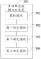
参见图3,图3是本申请实施例提供的车辆轨迹地图匹配装置的结构图。See Figure 3, which is a structural diagram of the vehicle trajectory map matching device provided in an embodiment of the present application.
如图3所示,车辆轨迹地图匹配装置300包括:As shown in FIG3 , the vehicle trajectory
获取模块301,用于获取地图数据中车辆的目标轨迹点对应的多个候选路段,并获取所述目标轨迹点对应的图像数据的语义信息,所述图像数据为所述车辆的车载摄像头拍摄的图像数据,所述语义信息用于指示所述车载摄像头观测到的道路元素;An
第一确定模块302,用于确定目标候选路段对应的空间位置观测概率值,并确定所述语义信息指示的道路元素的道路元素观测概率值,所述目标候选路段为所述多个候选路段中的任意一个候选路段,所述空间位置观测概率值用于指示在空间位置维度上所述目标轨迹点位于所述目标候选路段的概率值,所述道路元素观测概率值用于指示在道路元素维度上所述目标轨迹点位于所述目标候选路段的概率值;A
第二确定模块303,用于基于所述目标候选路段对应的空间位置观测概率值及所述道路元素观测概率值确定所述目标候选路段对应的总观测概率值;A second determination module 303 is used to determine a total observation probability value corresponding to the target candidate road section based on the spatial position observation probability value corresponding to the target candidate road section and the road element observation probability value;
第三确定模块304,用于基于所述目标候选路段对应的总观测概率值确定车辆轨迹的地图匹配结果。The
可选地,在匹配高精地图的情况下,所述目标候选路段对应的总观测概率值基于所述目标候选路段对应的空间位置观测概率值及所述道路元素观测概率值的乘积确定;Optionally, in the case of matching a high-precision map, the total observation probability value corresponding to the target candidate road section is determined based on the product of the spatial position observation probability value corresponding to the target candidate road section and the road element observation probability value;
和/或and/or
在匹配标准地图的情况下,所述目标候选路段对应的总观测概率值为所述目标候选路段对应的空间位置观测概率值。In the case of matching a standard map, the total observed probability value corresponding to the target candidate road section is the spatial position observed probability value corresponding to the target candidate road section.
可选地,所述语义信息指示的道路元素包括目标道路元素,所述第一确定模块具体用于:Optionally, the road element indicated by the semantic information includes a target road element, and the first determining module is specifically configured to:
确定第一值,所述第一值为第一最小值与第一最大值之间的比值,所述第一最小值为第一数量值与第二数量值中的最小值,所述第一最大值为第一数量值与第二数量值中的最大值,所述第一数量值为所述车载摄像头观测到的所述目标道路元素的数量值,所述第二数量值为所述目标候选路段上所述目标道路元素的数量值;Determine a first value, where the first value is a ratio between a first minimum value and a first maximum value, the first minimum value is a minimum value between a first quantity value and a second quantity value, the first maximum value is a maximum value between the first quantity value and the second quantity value, the first quantity value is a quantity value of the target road elements observed by the vehicle-mounted camera, and the second quantity value is a quantity value of the target road elements on the target candidate road section;
确定第二值,其中,在第一类型信息指示的道路元素类型与第二类型信息指示的道路元素类型相同的情况下,所述第二值为第一预设值,在所述第一类型信息指示的道路元素类型与所述第二类型信息指示的道路元素类型不相同的情况下,所述第二值为第二预设值,所述第一预设值大于所述第二预设值,所述第一类型信息为所述车载摄像头观测到的所述目标道路元素的类型信息,所述第二类型信息为所述目标候选路段上所述目标道路元素的类型信息;Determine a second value, wherein, when the road element type indicated by the first type information is the same as the road element type indicated by the second type information, the second value is a first preset value, and when the road element type indicated by the first type information is different from the road element type indicated by the second type information, the second value is a second preset value, the first preset value is greater than the second preset value, the first type information is the type information of the target road element observed by the vehicle-mounted camera, and the second type information is the type information of the target road element on the target candidate road section;
基于所述第一值和所述第二值确定所述目标道路元素的道路元素观测概率值。A road element observation probability value of the target road element is determined based on the first value and the second value.
可选地,所述道路元素包括如下至少一项:Optionally, the road element includes at least one of the following:
车道线,地面导向标识,交通信号灯。Lane lines, ground guide signs, and traffic lights.
可选地,所述第一确定模块具体用于:Optionally, the first determining module is specifically configured to:
确定目标候选路段对应的距离观测概率值,所述距离观测概率值用于指示在最短距离维度上所述目标轨迹点位于所述目标候选路段的概率值,所述最短距离为所述目标轨迹点至所述目标候选路段的最短距离;Determine a distance observation probability value corresponding to a target candidate section, wherein the distance observation probability value is used to indicate a probability value that the target trajectory point is located at the target candidate section in the shortest distance dimension, and the shortest distance is the shortest distance from the target trajectory point to the target candidate section;
基于所述目标候选路段对应的距离观测概率值确定目标候选路段对应的空间位置观测概率值。The spatial position observation probability value corresponding to the target candidate road section is determined based on the distance observation probability value corresponding to the target candidate road section.
可选地,在基于所述车载摄像头拍摄的图像数据预测所述目标轨迹点位于第一候选路段的情况下,若所述目标候选路段为所述第一候选路段,则所述目标候选路段对应的空间位置观测概率值为第一权重与所述目标候选路段对应的距离观测概率值的乘积;若所述目标候选路段为第二候选路段,则所述目标候选路段对应的空间位置观测概率值为第二权重与所述目标候选路段对应的距离观测概率值的乘积;Optionally, in the case where the target trajectory point is predicted to be located at the first candidate section based on the image data captured by the vehicle-mounted camera, if the target candidate section is the first candidate section, the spatial position observation probability value corresponding to the target candidate section is the product of the first weight and the distance observation probability value corresponding to the target candidate section; if the target candidate section is the second candidate section, the spatial position observation probability value corresponding to the target candidate section is the product of the second weight and the distance observation probability value corresponding to the target candidate section;
和/或and/or
在基于所述车载摄像头拍摄的图像数据预测所述目标轨迹点位于第二候选路段的情况下,若所述目标候选路段为第一候选路段,则所述目标候选路段对应的空间位置观测概率值为所述第二权重与所述目标候选路段对应的距离观测概率值的乘积;若所述目标候选路段为所述第二候选路段,则所述目标候选路段对应的空间位置观测概率值为所述第一权重与所述目标候选路段对应的距离观测概率值的乘积;In the case where it is predicted that the target trajectory point is located at the second candidate section based on the image data taken by the vehicle-mounted camera, if the target candidate section is the first candidate section, the spatial position observation probability value corresponding to the target candidate section is the product of the second weight and the distance observation probability value corresponding to the target candidate section; if the target candidate section is the second candidate section, the spatial position observation probability value corresponding to the target candidate section is the product of the first weight and the distance observation probability value corresponding to the target candidate section;
其中,所述第一候选路段为在所述车辆的行驶方向上位于交叉路口之前的候选路段,所述第二候选路段为在所述车辆的行驶方向上位于交叉路口之后的候选路段,所述第一权重大于所述第二权重。The first candidate road section is a candidate road section located before the intersection in the driving direction of the vehicle, the second candidate road section is a candidate road section located after the intersection in the driving direction of the vehicle, and the first weight is greater than the second weight.
可选地,在基于所述车载摄像头拍摄的图像数据确定所述车辆的行驶路段为主路的情况下,若所述目标候选路段为主路,则所述目标候选路段对应的空间位置观测概率值为第三权重与所述目标候选路段对应的距离观测概率值的乘积;若所述目标候选路段为辅路,则所述目标候选路段对应的空间位置观测概率值为第四权重与所述目标候选路段对应的距离观测概率值的乘积;Optionally, in the case where it is determined that the driving section of the vehicle is a main road based on the image data taken by the on-board camera, if the target candidate section is a main road, the spatial position observation probability value corresponding to the target candidate section is the product of the third weight and the distance observation probability value corresponding to the target candidate section; if the target candidate section is a secondary road, the spatial position observation probability value corresponding to the target candidate section is the product of the fourth weight and the distance observation probability value corresponding to the target candidate section;
和/或and/or
在基于所述车载摄像头拍摄的图像数据确定所述车辆的行驶路段为辅路的情况下,若所述目标候选路段为主路,则所述目标候选路段对应的空间位置观测概率值为所述第四权重与所述目标候选路段对应的距离观测概率值的乘积;若所述目标候选路段为辅路,则所述目标候选路段对应的空间位置观测概率值为所述第三权重与所述目标候选路段对应的距离观测概率值的乘积;In the case where it is determined based on the image data captured by the on-board camera that the driving section of the vehicle is a secondary road, if the target candidate section is a main road, the spatial position observation probability value corresponding to the target candidate section is the product of the fourth weight and the distance observation probability value corresponding to the target candidate section; if the target candidate section is a secondary road, the spatial position observation probability value corresponding to the target candidate section is the product of the third weight and the distance observation probability value corresponding to the target candidate section;
其中,所述第三权重大于所述第四权重。Wherein, the third weight is greater than the fourth weight.
可选地,所述第三确定模块具体用于:Optionally, the third determining module is specifically configured to:
基于所述目标候选路段对应的总观测概率值及目标候选点对应的状态转移概率值采用维特比算法确定所述目标轨迹点位于所述目标候选路段的最大概率值,所述目标候选点为所述目标候选路段上距离所述目标轨迹点最近的点;Based on the total observation probability value corresponding to the target candidate section and the state transition probability value corresponding to the target candidate point, the Viterbi algorithm is used to determine the maximum probability value of the target trajectory point being located on the target candidate section, and the target candidate point is the point on the target candidate section that is closest to the target trajectory point;
在所述多个候选路段对应的所述最大概率值均小于第三预设值的情况下,对所述多个候选路段对应的所述最大概率值进行归一化处理;In a case where the maximum probability values corresponding to the multiple candidate road sections are all less than a third preset value, normalizing the maximum probability values corresponding to the multiple candidate road sections;
基于归一化处理后的所述多个候选路段对应的所述最大概率值确定车辆轨迹的地图匹配结果。A map matching result of the vehicle trajectory is determined based on the maximum probability values corresponding to the multiple candidate road sections after normalization.
车辆轨迹地图匹配装置300能够实现上述方法实施例的各个过程,以及达到相同的有益效果,为避免重复,这里不再赘述。The vehicle trajectory
本申请的技术方案中,所涉及的用户个人信息的获取,存储和应用等,均符合相关法律法规的规定,且不违背公序良俗。In the technical solution of this application, the acquisition, storage and application of user personal information involved are in compliance with the provisions of relevant laws and regulations and do not violate public order and good morals.
根据本申请的实施例,本申请还提供了一种电子设备、一种可读存储介质和一种计算机程序产品。According to an embodiment of the present application, the present application also provides an electronic device, a readable storage medium and a computer program product.
图4示出了可以用来实施本申请的实施例的示例电子设备400的示意性框图。电子设备旨在表示各种形式的数字计算机,诸如,膝上型计算机、台式计算机、工作台、个人数字助理、服务器、刀片式服务器、大型计算机、和其它适合的计算机。电子设备还可以表示各种形式的移动装置,诸如,个人数字处理、蜂窝电话、智能电话、可穿戴设备和其它类似的计算装置。本文所示的部件、它们的连接和关系、以及它们的功能仅仅作为示例,并且不意在限制本文中描述的和/或者要求的本申请的实现。Fig. 4 shows a schematic block diagram of an example
如图4所示,电子设备400包括计算单元401,其可以根据存储在只读存储器(ROM)402中的计算机程序或者从存储单元408加载到随机访问存储器(RAM)403中的计算机程序,来执行各种适当的动作和处理。在RAM 403中,还可存储电子设备400操作所需的各种程序和数据。计算单元401、ROM 402以及RAM 403通过总线404彼此相连。输入/输出(I/O)接口405也连接至总线404。As shown in FIG4 , the
电子设备400中的多个部件连接至I/O接口405,包括:输入单元406,例如键盘、鼠标等;输出单元407,例如各种类型的显示器、扬声器等;存储单元408,例如磁盘、光盘等;以及通信单元409,例如网卡、调制解调器、无线通信收发机等。通信单元409允许电子设备400通过诸如因特网的计算机网络和/或各种电信网络与其他设备交换信息/数据。Multiple components in the
计算单元401可以是各种具有处理和计算能力的通用和/或专用处理组件。计算单元401的一些示例包括但不限于中央处理单元(CPU)、图形处理单元(GPU)、各种专用的人工智能(AI)计算芯片、各种运行机器学习模型算法的计算单元、数字信号处理器(DSP)、以及任何适当的处理器、控制器、微控制器等。计算单元401执行上文所描述的各个方法和处理,例如车辆轨迹地图匹配方法。例如,在一些实施例中,车辆轨迹地图匹配方法可被实现为计算机软件程序,其被有形地包含于机器可读介质,例如存储单元408。在一些实施例中,计算机程序的部分或者全部可以经由ROM 402和/或通信单元409而被载入和/或安装到电子设备400上。当计算机程序加载到RAM 403并由计算单元401执行时,可以执行上文描述的车辆轨迹地图匹配方法的一个或多个步骤。备选地,在其他实施例中,计算单元401可以通过其他任何适当的方式(例如,借助于固件)而被配置为执行车辆轨迹地图匹配方法。The
本文中以上描述的系统和技术的各种实施方式可以在数字电子电路系统、集成电路系统、现场可编程门阵列(FPGA)、专用集成电路(ASIC)、专用标准产品(ASSP)、芯片上系统的系统(SOC)、复杂可编程逻辑设备(CPLD)、计算机硬件、固件、软件、和/或它们的组合中实现。这些各种实施方式可以包括:实施在一个或者多个计算机程序中,该一个或者多个计算机程序可在包括至少一个可编程处理器的可编程系统上执行和/或解释,该可编程处理器可以是专用或者通用可编程处理器,可以从存储系统、至少一个输入装置、和至少一个输出装置接收数据和指令,并且将数据和指令传输至该存储系统、该至少一个输入装置、和该至少一个输出装置。Various implementations of the systems and techniques described above herein can be implemented in digital electronic circuit systems, integrated circuit systems, field programmable gate arrays (FPGAs), application specific integrated circuits (ASICs), application specific standard products (ASSPs), systems on chips (SOCs), complex programmable logic devices (CPLDs), computer hardware, firmware, software, and/or combinations thereof. These various implementations can include: being implemented in one or more computer programs that can be executed and/or interpreted on a programmable system including at least one programmable processor, which can be a special purpose or general purpose programmable processor that can receive data and instructions from a storage system, at least one input device, and at least one output device, and transmit data and instructions to the storage system, the at least one input device, and the at least one output device.
用于实施本申请的方法的程序代码可以采用一个或多个编程语言的任何组合来编写。这些程序代码可以提供给通用计算机、专用计算机或其他可编程数据处理装置的处理器或控制器,使得程序代码当由处理器或控制器执行时使流程图和/或框图中所规定的功能/操作被实施。程序代码可以完全在机器上执行、部分地在机器上执行,作为独立软件包部分地在机器上执行且部分地在远程机器上执行或完全在远程机器或服务器上执行。The program code for implementing the method of the present application can be written in any combination of one or more programming languages. These program codes can be provided to a processor or controller of a general-purpose computer, a special-purpose computer, or other programmable data processing device, so that the program code, when executed by the processor or controller, enables the functions/operations specified in the flow chart and/or block diagram to be implemented. The program code can be executed entirely on the machine, partially on the machine, partially on the machine as a stand-alone software package and partially on a remote machine, or entirely on a remote machine or server.
在本申请的上下文中,机器可读介质可以是有形的介质,其可以包含或存储以供指令执行系统、装置或设备使用或与指令执行系统、装置或设备结合地使用的程序。机器可读介质可以是机器可读信号介质或机器可读存储介质。机器可读介质可以包括但不限于电子的、磁性的、光学的、电磁的、红外的、或半导体系统、装置或设备,或者上述内容的任何合适组合。机器可读存储介质的更具体示例会包括基于一个或多个线的电气连接、便携式计算机盘、硬盘、随机存取存储器(RAM)、只读存储器(ROM)、可擦除可编程只读存储器(EPROM或快闪存储器)、光纤、便捷式紧凑盘只读存储器(CD-ROM)、光学储存设备、磁储存设备、或上述内容的任何合适组合。In the context of the present application, a machine-readable medium may be a tangible medium that may contain or store a program for use by or in conjunction with an instruction execution system, device, or equipment. A machine-readable medium may be a machine-readable signal medium or a machine-readable storage medium. A machine-readable medium may include, but is not limited to, an electronic, magnetic, optical, electromagnetic, infrared, or semiconductor system, device, or equipment, or any suitable combination of the foregoing. A more specific example of a machine-readable storage medium may include an electrical connection based on one or more lines, a portable computer disk, a hard disk, a random access memory (RAM), a read-only memory (ROM), an erasable programmable read-only memory (EPROM or flash memory), an optical fiber, a portable compact disk read-only memory (CD-ROM), an optical storage device, a magnetic storage device, or any suitable combination of the foregoing.
为了提供与用户的交互,可以在计算机上实施此处描述的系统和技术,该计算机具有:用于向用户显示信息的显示装置(例如,CRT(阴极射线管)或者LCD(液晶显示器)监视器);以及键盘和指向装置(例如,鼠标或者轨迹球),用户可以通过该键盘和该指向装置来将输入提供给计算机。其它种类的装置还可以用于提供与用户的交互;例如,提供给用户的反馈可以是任何形式的传感反馈(例如,视觉反馈、听觉反馈、或者触觉反馈);并且可以用任何形式(包括声输入、语音输入或者、触觉输入)来接收来自用户的输入。To provide interaction with a user, the systems and techniques described herein can be implemented on a computer having: a display device (e.g., a CRT (cathode ray tube) or LCD (liquid crystal display) monitor) for displaying information to the user; and a keyboard and pointing device (e.g., a mouse or trackball) through which the user can provide input to the computer. Other types of devices can also be used to provide interaction with the user; for example, the feedback provided to the user can be any form of sensory feedback (e.g., visual feedback, auditory feedback, or tactile feedback); and input from the user can be received in any form (including acoustic input, voice input, or tactile input).
可以将此处描述的系统和技术实施在包括后台部件的计算系统(例如,作为数据服务器)、或者包括中间件部件的计算系统(例如,应用服务器)、或者包括前端部件的计算系统(例如,具有图形用户界面或者网络浏览器的用户计算机,用户可以通过该图形用户界面或者该网络浏览器来与此处描述的系统和技术的实施方式交互)、或者包括这种后台部件、中间件部件、或者前端部件的任何组合的计算系统中。可以通过任何形式或者介质的数字数据通信(例如,通信网络)来将系统的部件相互连接。通信网络的示例包括:局域网(LAN)、广域网(WAN)和互联网。The systems and techniques described herein may be implemented in a computing system that includes back-end components (e.g., as a data server), or a computing system that includes middleware components (e.g., an application server), or a computing system that includes front-end components (e.g., a user computer with a graphical user interface or a web browser through which a user can interact with implementations of the systems and techniques described herein), or a computing system that includes any combination of such back-end components, middleware components, or front-end components. The components of the system may be interconnected by any form or medium of digital data communication (e.g., a communication network). Examples of communication networks include: a local area network (LAN), a wide area network (WAN), and the Internet.
计算机系统可以包括客户端和服务器。客户端和服务器一般远离彼此并且通常通过通信网络进行交互。通过在相应的计算机上运行并且彼此具有客户端-服务器关系的计算机程序来产生客户端和服务器的关系。服务器可以是云服务器,也可以为分布式系统的服务器,或者是结合了区块链的服务器。A computer system may include a client and a server. The client and the server are generally remote from each other and usually interact through a communication network. The relationship of client and server is generated by computer programs running on respective computers and having a client-server relationship with each other. The server may be a cloud server, a server of a distributed system, or a server combined with a blockchain.
应该理解,可以使用上面所示的各种形式的流程,重新排序、增加或删除步骤。例如,本公开中记载的各步骤可以并行地执行也可以顺序地执行也可以不同的次序执行,只要能够实现本申请公开的技术方案所期望的结果,本文在此不进行限制。It should be understood that the various forms of processes shown above can be used to reorder, add or delete steps. For example, the steps recorded in this disclosure can be executed in parallel, sequentially or in different orders, as long as the desired results of the technical solution disclosed in this application can be achieved, and this document is not limited here.
根据本申请的实施例,本申请还提供了一种车辆,其被配置为执行本申请实施例提供的车辆轨迹地图匹配方法,可选地,如图5所示,该车辆500可以包括计算单元501、ROM502、RAM503、总线504、I/O接口505、输入单元506、输出单元507、存储单元508和通信单元509。上述各部分的具体实施方式可以参照上述实施例中对电子设备的各部分的说明,为避免重复,在此不再赘述。According to an embodiment of the present application, the present application further provides a vehicle, which is configured to execute the vehicle trajectory map matching method provided in the embodiment of the present application. Optionally, as shown in FIG5 , the
上述具体实施方式,并不构成对本申请保护范围的限制。本领域技术人员应该明白的是,根据设计要求和其他因素,可以进行各种修改、组合、子组合和替代。任何在本申请的精神和原则之内所作的修改、等同替换和改进等,均应包含在本申请保护范围之内。The above specific implementations do not constitute a limitation on the protection scope of this application. It should be understood by those skilled in the art that various modifications, combinations, sub-combinations and substitutions can be made according to design requirements and other factors. Any modifications, equivalent substitutions and improvements made within the spirit and principles of this application should be included in the protection scope of this application.
Claims (12)
Priority Applications (1)
| Application Number | Priority Date | Filing Date | Title |
|---|---|---|---|
| CN202310298234.8ACN116007638B (en) | 2023-03-24 | 2023-03-24 | Vehicle track map matching method and device, electronic equipment and vehicle |
Applications Claiming Priority (1)
| Application Number | Priority Date | Filing Date | Title |
|---|---|---|---|
| CN202310298234.8ACN116007638B (en) | 2023-03-24 | 2023-03-24 | Vehicle track map matching method and device, electronic equipment and vehicle |
Publications (2)
| Publication Number | Publication Date |
|---|---|
| CN116007638Atrue CN116007638A (en) | 2023-04-25 |
| CN116007638B CN116007638B (en) | 2023-05-30 |
Family
ID=86035872
Family Applications (1)
| Application Number | Title | Priority Date | Filing Date |
|---|---|---|---|
| CN202310298234.8AActiveCN116007638B (en) | 2023-03-24 | 2023-03-24 | Vehicle track map matching method and device, electronic equipment and vehicle |
Country Status (1)
| Country | Link |
|---|---|
| CN (1) | CN116007638B (en) |
Cited By (2)
| Publication number | Priority date | Publication date | Assignee | Title |
|---|---|---|---|---|
| CN117808873A (en)* | 2024-03-01 | 2024-04-02 | 腾讯科技(深圳)有限公司 | Redundant road detection method, device, electronic equipment and storage medium |
| CN119003673A (en)* | 2024-08-06 | 2024-11-22 | 智联万维科技有限公司 | Dynamic high space-time resolution noise map implementation method |
Citations (8)
| Publication number | Priority date | Publication date | Assignee | Title |
|---|---|---|---|---|
| CN105444769A (en)* | 2015-11-26 | 2016-03-30 | 北京百度网讯科技有限公司 | Map matching method and device |
| WO2020107441A1 (en)* | 2018-11-28 | 2020-06-04 | Beijing Didi Infinity Technology And Development Co., Ltd. | Artificial intelligent systems and methods for map matching |
| CN112884837A (en)* | 2021-03-16 | 2021-06-01 | 百度在线网络技术(北京)有限公司 | Road positioning method, device, equipment and storage medium |
| CN113191550A (en)* | 2021-04-29 | 2021-07-30 | 北京百度网讯科技有限公司 | Map matching method and device |
| CN113916242A (en)* | 2021-12-14 | 2022-01-11 | 腾讯科技(深圳)有限公司 | Lane positioning method and device, storage medium and electronic equipment |
| CN114563005A (en)* | 2022-03-01 | 2022-05-31 | 小米汽车科技有限公司 | Road positioning method, device, equipment, vehicle and storage medium |
| CN114964272A (en)* | 2022-05-07 | 2022-08-30 | 武汉大学 | A vehicle trajectory map matching method fused with vehicle image semantics |
| CN115585816A (en)* | 2022-11-23 | 2023-01-10 | 北京百度网讯科技有限公司 | Lane-level map matching method and device |
- 2023
- 2023-03-24CNCN202310298234.8Apatent/CN116007638B/enactiveActive
Patent Citations (8)
| Publication number | Priority date | Publication date | Assignee | Title |
|---|---|---|---|---|
| CN105444769A (en)* | 2015-11-26 | 2016-03-30 | 北京百度网讯科技有限公司 | Map matching method and device |
| WO2020107441A1 (en)* | 2018-11-28 | 2020-06-04 | Beijing Didi Infinity Technology And Development Co., Ltd. | Artificial intelligent systems and methods for map matching |
| CN112884837A (en)* | 2021-03-16 | 2021-06-01 | 百度在线网络技术(北京)有限公司 | Road positioning method, device, equipment and storage medium |
| CN113191550A (en)* | 2021-04-29 | 2021-07-30 | 北京百度网讯科技有限公司 | Map matching method and device |
| CN113916242A (en)* | 2021-12-14 | 2022-01-11 | 腾讯科技(深圳)有限公司 | Lane positioning method and device, storage medium and electronic equipment |
| CN114563005A (en)* | 2022-03-01 | 2022-05-31 | 小米汽车科技有限公司 | Road positioning method, device, equipment, vehicle and storage medium |
| CN114964272A (en)* | 2022-05-07 | 2022-08-30 | 武汉大学 | A vehicle trajectory map matching method fused with vehicle image semantics |
| CN115585816A (en)* | 2022-11-23 | 2023-01-10 | 北京百度网讯科技有限公司 | Lane-level map matching method and device |
Non-Patent Citations (2)
| Title |
|---|
| JANNIK QUEHL等: "An Approach to Vehicle Trajectory Prediction Using Automatically Generated Traffic Maps", 《2018 IEEE INTELLIGENT VEHICLES SYMPOSIUM (IV)》, pages 544 - 549* |
| 高文超等: "路网匹配算法综述", 《软件学报》, no. 2, pages 225* |
Cited By (4)
| Publication number | Priority date | Publication date | Assignee | Title |
|---|---|---|---|---|
| CN117808873A (en)* | 2024-03-01 | 2024-04-02 | 腾讯科技(深圳)有限公司 | Redundant road detection method, device, electronic equipment and storage medium |
| CN117808873B (en)* | 2024-03-01 | 2024-05-14 | 腾讯科技(深圳)有限公司 | Redundant road detection method, device, electronic equipment and storage medium |
| CN119003673A (en)* | 2024-08-06 | 2024-11-22 | 智联万维科技有限公司 | Dynamic high space-time resolution noise map implementation method |
| CN119003673B (en)* | 2024-08-06 | 2025-02-25 | 智联万维科技有限公司 | A method for realizing dynamic high spatiotemporal resolution noise map |
Also Published As
| Publication number | Publication date |
|---|---|
| CN116007638B (en) | 2023-05-30 |
Similar Documents
| Publication | Publication Date | Title |
|---|---|---|
| CN116007638B (en) | Vehicle track map matching method and device, electronic equipment and vehicle | |
| US10332389B2 (en) | Extrapolating speed limits within road graphs | |
| CN114626169B (en) | Traffic network optimization method, device, equipment, readable storage medium and product | |
| WO2022222401A1 (en) | Valet parking method and apparatus, and device and autonomous driving vehicle | |
| CN114170797B (en) | Method, device, equipment, medium and product for identifying traffic-restricted intersections | |
| CN112883236B (en) | A map updating method, device, electronic equipment and storage medium | |
| EP4235103A1 (en) | Map matching method, apparatus and electronic device | |
| EP4012344A2 (en) | Method and apparatus for generating route information, device, medium and product | |
| CN114179805B (en) | Driving direction determining method, device, equipment and storage medium | |
| CN110542428B (en) | Driving route quality evaluation method and device | |
| CN112926630B (en) | Route planning methods, devices, electronic devices and computer-readable media | |
| CN114707060A (en) | Navigation route recommendation method, location-based service provision method and program product | |
| CN113806387A (en) | Model training method, high-precision map change detection method, device and electronic device | |
| CN114111814B (en) | High-precision map data processing method and device, electronic equipment and storage medium | |
| CN115760827A (en) | Detection method, device, equipment and storage medium of point cloud data | |
| CN113361379B (en) | Method and device for generating target detection system and detecting target | |
| CN114488237A (en) | Positioning method, device, electronic device and intelligent driving method | |
| CN112906946B (en) | Road information prompting method, device, equipment, storage medium and program product | |
| CN115512336B (en) | Vehicle positioning method and device based on street lamp light source and electronic equipment | |
| CN112735130B (en) | Traffic data processing method and device, electronic equipment and medium | |
| CN117128950A (en) | Point cloud map construction method, device, electronic equipment and storage medium | |
| CN114659537A (en) | Navigation starting point road determination method, device, device and storage medium | |
| CN115206102A (en) | Method, apparatus, electronic device, and medium for determining traffic path | |
| CN114218344A (en) | Map data updating method, apparatus, device, storage medium, and program product | |
| CN115507866B (en) | Map data processing method and device, electronic equipment and medium |
Legal Events
| Date | Code | Title | Description |
|---|---|---|---|
| PB01 | Publication | ||
| PB01 | Publication | ||
| SE01 | Entry into force of request for substantive examination | ||
| SE01 | Entry into force of request for substantive examination | ||
| GR01 | Patent grant | ||
| GR01 | Patent grant |