CN114828214B - An Information Fusion Maritime Search and Rescue Wireless Sensor Network Positioning Method - Google Patents
An Information Fusion Maritime Search and Rescue Wireless Sensor Network Positioning MethodDownload PDFInfo
- Publication number
- CN114828214B CN114828214BCN202210536968.0ACN202210536968ACN114828214BCN 114828214 BCN114828214 BCN 114828214BCN 202210536968 ACN202210536968 ACN 202210536968ACN 114828214 BCN114828214 BCN 114828214B
- Authority
- CN
- China
- Prior art keywords
- ranging
- solution
- constraint
- namely
- sensor network
- Prior art date
- Legal status (The legal status is an assumption and is not a legal conclusion. Google has not performed a legal analysis and makes no representation as to the accuracy of the status listed.)
- Active
Links
- 238000000034methodMethods0.000titleabstractdescription28
- 230000004927fusionEffects0.000titleabstractdescription7
- 238000012544monitoring processMethods0.000abstractdescription11
- 238000005516engineering processMethods0.000abstractdescription7
- 238000005457optimizationMethods0.000abstractdescription4
- 230000005540biological transmissionEffects0.000description6
- 230000000295complement effectEffects0.000description4
- 230000000873masking effectEffects0.000description4
- 238000004088simulationMethods0.000description4
- 230000000694effectsEffects0.000description3
- 230000008569processEffects0.000description3
- 101100012902Saccharomyces cerevisiae (strain ATCC 204508 / S288c) FIG2 geneProteins0.000description2
- 238000012937correctionMethods0.000description2
- 125000004122cyclic groupChemical group0.000description2
- 230000007423decreaseEffects0.000description2
- 230000007547defectEffects0.000description2
- 238000010586diagramMethods0.000description2
- 239000011159matrix materialSubstances0.000description2
- 230000008054signal transmissionEffects0.000description2
- 206010039203Road traffic accidentDiseases0.000description1
- 101100233916Saccharomyces cerevisiae (strain ATCC 204508 / S288c) KAR5 geneProteins0.000description1
- 230000004888barrier functionEffects0.000description1
- 230000008859changeEffects0.000description1
- 238000004891communicationMethods0.000description1
- 230000003247decreasing effectEffects0.000description1
- 238000011161developmentMethods0.000description1
- 230000009429distressEffects0.000description1
- 238000011156evaluationMethods0.000description1
- 230000004807localizationEffects0.000description1
- 238000012986modificationMethods0.000description1
- 230000004048modificationEffects0.000description1
- 238000005295random walkMethods0.000description1
- 238000006467substitution reactionMethods0.000description1
- 230000017105transpositionEffects0.000description1
- XLYOFNOQVPJJNP-UHFFFAOYSA-NwaterSubstancesOXLYOFNOQVPJJNP-UHFFFAOYSA-N0.000description1
Images


Classifications
- H—ELECTRICITY
- H04—ELECTRIC COMMUNICATION TECHNIQUE
- H04W—WIRELESS COMMUNICATION NETWORKS
- H04W64/00—Locating users or terminals or network equipment for network management purposes, e.g. mobility management
- G—PHYSICS
- G01—MEASURING; TESTING
- G01S—RADIO DIRECTION-FINDING; RADIO NAVIGATION; DETERMINING DISTANCE OR VELOCITY BY USE OF RADIO WAVES; LOCATING OR PRESENCE-DETECTING BY USE OF THE REFLECTION OR RERADIATION OF RADIO WAVES; ANALOGOUS ARRANGEMENTS USING OTHER WAVES
- G01S11/00—Systems for determining distance or velocity not using reflection or reradiation
- G01S11/02—Systems for determining distance or velocity not using reflection or reradiation using radio waves
- G01S11/06—Systems for determining distance or velocity not using reflection or reradiation using radio waves using intensity measurements
- G—PHYSICS
- G01—MEASURING; TESTING
- G01S—RADIO DIRECTION-FINDING; RADIO NAVIGATION; DETERMINING DISTANCE OR VELOCITY BY USE OF RADIO WAVES; LOCATING OR PRESENCE-DETECTING BY USE OF THE REFLECTION OR RERADIATION OF RADIO WAVES; ANALOGOUS ARRANGEMENTS USING OTHER WAVES
- G01S5/00—Position-fixing by co-ordinating two or more direction or position line determinations; Position-fixing by co-ordinating two or more distance determinations
- G01S5/18—Position-fixing by co-ordinating two or more direction or position line determinations; Position-fixing by co-ordinating two or more distance determinations using ultrasonic, sonic, or infrasonic waves
- G01S5/26—Position of receiver fixed by co-ordinating a plurality of position lines defined by path-difference measurements
- H—ELECTRICITY
- H04—ELECTRIC COMMUNICATION TECHNIQUE
- H04W—WIRELESS COMMUNICATION NETWORKS
- H04W84/00—Network topologies
- H04W84/18—Self-organising networks, e.g. ad-hoc networks or sensor networks
- Y—GENERAL TAGGING OF NEW TECHNOLOGICAL DEVELOPMENTS; GENERAL TAGGING OF CROSS-SECTIONAL TECHNOLOGIES SPANNING OVER SEVERAL SECTIONS OF THE IPC; TECHNICAL SUBJECTS COVERED BY FORMER USPC CROSS-REFERENCE ART COLLECTIONS [XRACs] AND DIGESTS
- Y02—TECHNOLOGIES OR APPLICATIONS FOR MITIGATION OR ADAPTATION AGAINST CLIMATE CHANGE
- Y02D—CLIMATE CHANGE MITIGATION TECHNOLOGIES IN INFORMATION AND COMMUNICATION TECHNOLOGIES [ICT], I.E. INFORMATION AND COMMUNICATION TECHNOLOGIES AIMING AT THE REDUCTION OF THEIR OWN ENERGY USE
- Y02D30/00—Reducing energy consumption in communication networks
- Y02D30/70—Reducing energy consumption in communication networks in wireless communication networks
Landscapes
- Engineering & Computer Science (AREA)
- Physics & Mathematics (AREA)
- General Physics & Mathematics (AREA)
- Radar, Positioning & Navigation (AREA)
- Remote Sensing (AREA)
- Computer Networks & Wireless Communication (AREA)
- Signal Processing (AREA)
- Position Fixing By Use Of Radio Waves (AREA)
Abstract
Description
Translated fromChinese技术领域Technical Field
本发明涉及海洋无线传感网节点定位技术领域,具体涉及一种信息融合的海上搜救无线传感网定位方法。The invention relates to the technical field of marine wireless sensor network node positioning, and in particular to an information fusion marine search and rescue wireless sensor network positioning method.
背景技术Background Art
作为海洋经济的重要组成部分,海上交通运输业的发展至关重要。为保障海上运输的安全,相关部门制定了一系列措施来防止事故的发生,特别是针对人为因素导致的海上交通事故。然而,海上环境复杂多变,极端气候的出现威胁着海上运输的安全,如长江之星邮轮事故。当极端气候导致海难事故发生时,如何尽可能地减少生命财产安全的损失是非常关键的一环。作为保障海上人命安全的最后一道屏障,海上搜救(Marine Search andRescue,MSR)能够通过多方位、多部门一体化地协同合作,较大程度地减少生命及财产损失。现阶段针对海上搜救主要通过遥感图像亦或是根据风流等速度尽可能缩小搜救范围,以便实施救援。然而该方式耗时长,且误差大,很大程度上可能错过救援的黄金时期。为改善这一缺陷,利用无线传感网(Wireless Sensor Networks,WSNs)良好的自组织性、可扩展性以及自适应性,可以较高地提升搜救成功率以及效率。As an important part of the marine economy, the development of the maritime transportation industry is of vital importance. In order to ensure the safety of maritime transportation, relevant departments have formulated a series of measures to prevent accidents, especially maritime traffic accidents caused by human factors. However, the marine environment is complex and changeable, and the emergence of extreme climate threatens the safety of maritime transportation, such as the Yangtze River Star Cruise accident. When extreme climate causes a maritime accident, how to minimize the loss of life and property safety is a very critical link. As the last barrier to ensure the safety of human life at sea, Marine Search and Rescue (MSR) can reduce the loss of life and property to a great extent through multi-faceted and multi-departmental integrated cooperation. At present, the main method for maritime search and rescue is to narrow the search and rescue range as much as possible according to remote sensing images or wind speed, so as to implement rescue. However, this method is time-consuming and has large errors, and may miss the golden period of rescue to a large extent. To improve this defect, the good self-organization, scalability and adaptability of wireless sensor networks (WSNs) can be used to greatly improve the success rate and efficiency of search and rescue.
然而,如何在海上搜救传感网中精确、高效地定位救援目标是一个挑战。一方面海上高度动态的环境,救援目标会随着风流等移动,使得定位较为困难,且定位效率低;另一方面,海上高延时、低带宽的通信信道使得定位精度较差,再加上海浪遮蔽效应及多径效应等产生的非线性非高斯噪声,进一步增大了定位误差。此外,仅依靠单一的测距技术,如接收信号强度值(Received Signal Strength,RSS),其误差会因技术固有的缺陷随着搜救范围的增大而增大。现有存在的定位技术针对海上搜救无线传感网上述三个问题没有很好的解决方案,不能很好地兼顾定位的精度以及效率,无法做到实时、高效且精确定位待救援目标。However, how to accurately and efficiently locate the rescue target in the maritime search and rescue sensor network is a challenge. On the one hand, the highly dynamic environment at sea, the rescue target will move with the wind current, etc., making positioning more difficult and the positioning efficiency low; on the other hand, the high-latency, low-bandwidth communication channel at sea makes the positioning accuracy poor, coupled with the nonlinear non-Gaussian noise generated by the wave shielding effect and multipath effect, further increases the positioning error. In addition, relying only on a single ranging technology, such as the received signal strength value (RSS), its error will increase as the search and rescue range increases due to the inherent defects of the technology. The existing positioning technology does not have a good solution to the above three problems of the maritime search and rescue wireless sensor network, and cannot take into account the positioning accuracy and efficiency well, and cannot achieve real-time, efficient and accurate positioning of the rescue target.
发明内容Summary of the invention
本发明的目的在于提供一种信息融合的海上搜救无线传感网定位方法,以解决仅依靠单一测距手段的海上无线传感网定位技术因监测区域面积增大、噪声增加而导致的定位精度下降问题。该方法适应于高动态的海洋环境,且能在较大范围的监测区域,较高的海浪遮蔽噪声下保持较好的定位性能。The purpose of the present invention is to provide an information-fused maritime search and rescue wireless sensor network positioning method to solve the problem of reduced positioning accuracy caused by the increase in monitoring area and noise in the maritime wireless sensor network positioning technology that relies only on a single ranging method. The method is suitable for highly dynamic marine environments and can maintain good positioning performance in a large monitoring area and under high wave shielding noise.
为了达到上述目的,本发明通过以下技术方案实现:In order to achieve the above object, the present invention is implemented by the following technical solutions:
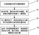
一种基于信息融合的海上搜救无线传感网定位方法,其特征是,包含以下步骤:A method for positioning a maritime search and rescue wireless sensor network based on information fusion, characterized in that it comprises the following steps:
S1、考虑海浪遮蔽噪声,分别构建RSS和TOA测距模型;S1. Considering the sea wave shielding noise, the RSS and TOA ranging models are constructed respectively;
S2、根据约束,融合RSS和TOA多源测距信息,构造混合测距约束最小二乘框架;S2, according to the constraints, the multi-source ranging information of RSS and TOA is integrated to construct a hybrid ranging constrained least squares framework;
S3、引入缓冲因子,利用一种改进块主元旋转的方法,通过循环交替可行解索引获取目标位置初始解;S3, introduce a buffer factor, use an improved block pivot rotation method, and obtain the initial solution of the target position by cyclically alternating feasible solution indexes;
S4、基于泰勒级数一阶展开式,推导得到一种线性再优化方法,对S3中得到的初始解进行误差修正,进而得到位置更为精确的解。S4. Based on the first-order expansion of Taylor series, a linear re-optimization method is derived to correct the error of the initial solution obtained in S3, thereby obtaining a more accurate solution.
步骤S1所述构建RSS和TOA测距模型,具体包含:Step S1 of constructing the RSS and TOA ranging model specifically includes:
S11、若网络中有N个锚节点,在t时刻第i个锚节点的位置可表示为


一个由无线电信号传播的信号强度信息来测距的模型就构建出来,即RSS测距模型;其中,


S12、同样地,锚节点还可收到来自目标的到达时间信息,可表示为:S12. Similarly, the anchor node can also receive arrival time information from the target, which can be expressed as:

一个由信号传播时间来测距的模型就构建出来,即TOA模型;其中

步骤S2所述融合RSS测距模型和TOA测距模型中的多源测距信息,构造混合测距约束最小二乘框架,具体包含:Step S2 integrates the multi-source ranging information in the RSS ranging model and the TOA ranging model to construct a hybrid ranging constrained least squares framework, which specifically includes:
S21、根据S11所得表达式(1a)进行移项变换可得:S21, according to the expression (1a) obtained in S11, we can obtain:

其中,
S22、对S21得到的式(2)进行线性展开,可得:S22. Linearly expand the formula (2) obtained in S21 to obtain:

S23、考虑约束


S24、对S23得到的式(4)进行平方展开,可得:S24. Square expansion of formula (4) obtained in S23 yields:

S25、另

其中,
步骤S3所述引入缓冲因子,利用一种块主元旋转的方法,通过循环交替可行解索引获取目标位置初始解,具体包含:In step S3, a buffer factor is introduced, and a block pivot rotation method is used to obtain an initial solution of the target position by cyclically alternating feasible solution indices, which specifically includes:
S31、将待求变量索引分为两个集合,即κ和


S32、根据式(8)和式(9)计算得到互补基解


S33、当互补基解不满足约束时,定义集合Γ使其满足:S33. When the complementary basis solution does not satisfy the constraint, define the set Γ so that it satisfies:

S34、对于j∈Γ,变量ξj为非可行解。根据式(11)规则进一步更新κ和

其中,R为非空子集且
S35、当更新规则陷入循环或无法找寻对应解时,利用式(12)作为候补更新规则找寻可行解,即:S35. When the update rule falls into a loop or cannot find a corresponding solution, use formula (12) as a candidate update rule to find a feasible solution, that is:
R={j:j=max{j∈Γ}}.(12)R = {j:j = max{j∈Γ}}.(12)
S36、在更新过程中,引入缓冲因子
S37、依据S32至S36进行循环更新,直到所有待求变量解均为可行解。S37, perform cyclic updates according to S32 to S36 until all the solutions to the variables to be determined are feasible solutions.
步骤S4所述基于泰勒级数一阶展开式,推导得到一种线性再优化方法,对S3中得到的初始解进行误差修正,进而得到位置更为精确的解。具体包含:In step S4, based on the first-order expansion of Taylor series, a linear re-optimization method is derived to correct the error of the initial solution obtained in S3, thereby obtaining a more accurate position solution. Specifically, it includes:
S41、根据S36求得的初始解

S42、利用一阶泰勒级数展开公式,对


其中,
S43、结合式S41与S42步骤得到函数,损失函数进一步可表示为:S43, combining steps S41 and S42 to obtain the function, the loss function can be further expressed as:

S44、通过S43得到表达式,对

S45、令S44得到表达式为0,可得到误差,随后进行误差校正操作,可得:S45, let the expression obtained in S44 be 0, the error can be obtained, and then the error correction operation is performed to obtain:

本发明与现有技术相比具有以下优点:该方法适应于高动态的海洋环境,且能在较大范围的监测区域,较高的海浪遮蔽噪声下保持较好的定位性能,解决了仅依靠单一测距手段的海上无线传感网定位技术因监测区域面积增大、噪声增加而导致的定位精度下降问题。Compared with the prior art, the present invention has the following advantages: the method is suitable for highly dynamic marine environments, and can maintain good positioning performance in a larger monitoring area and under higher wave shielding noise, solving the problem of decreased positioning accuracy caused by the increase in monitoring area and noise in the marine wireless sensor network positioning technology that relies only on a single ranging method.
附图说明BRIEF DESCRIPTION OF THE DRAWINGS
图1为海上搜救无线传感网系统结构图。Figure 1 is a structural diagram of the maritime search and rescue wireless sensor network system.
图2为本发明一种信息融合的海上搜救传感网定位方法流程图。FIG2 is a flow chart of an information fusion maritime search and rescue sensor network positioning method according to the present invention.
图3为本发明的改进块主元旋转定位方法伪代码。FIG3 is a pseudo code of the improved block pivot rotation positioning method of the present invention.
图4(a)、图4(b)为本发明不同监测区域的定位性能。FIG. 4( a ) and FIG. 4( b ) show the positioning performance of different monitoring areas of the present invention.
图5(a)、图5(b)为本发明不同噪声的定位性能。FIG. 5( a ) and FIG. 5( b ) show the positioning performance of the present invention under different noises.
具体实施方式DETAILED DESCRIPTION
以下结合附图,通过详细说明一个较佳的具体实施案例,对本发明做进一步阐述。The present invention is further described below by describing a preferred specific implementation example in detail in conjunction with the accompanying drawings.
图1表示海上搜救传感网结构框图,当船舶遇险时,待救援目标(图1中直径较大圆点)携带者具有相关节点装置的救生衣,救援直升飞机到相关海域布洒带有GPS或北斗信号、即能够实时获取位置的锚节点(图1中较小直径圆点),锚节点与待救援目标身上的节点(目标节点)通过Zigbee协议构成无线传感网络,随后搜索救援目标的问题变为网络节点的定位问题。当获取了待救援目标的位置后,锚节点将相关信息传给救援船以及卫星,卫星再通过信号及网络传给陆地上的相关部门,以便实施具体施救方案。Figure 1 shows the structure diagram of the maritime search and rescue sensor network. When a ship is in distress, the target to be rescued (the larger diameter dot in Figure 1) carries a life jacket with a relevant node device. The rescue helicopter goes to the relevant sea area to spread anchor nodes (smaller diameter dots in Figure 1) with GPS or Beidou signals, which can obtain the position in real time. The anchor nodes and the nodes on the target to be rescued (target nodes) form a wireless sensor network through the Zigbee protocol. Then the problem of searching for the rescue target becomes the problem of locating the network nodes. After obtaining the location of the target to be rescued, the anchor node transmits the relevant information to the rescue ship and satellite, and the satellite then transmits it to the relevant departments on land through signals and networks to implement specific rescue plans.
假设网络中有N个锚节点,在t时刻第i个锚节点的位置可表示为

如图2所示,为定位目标,本发明提出一种信息融合的海上搜救无线传感网定位方法(Lightweight Computational Localization Technology using InformationFusing,LCCT-IF),具体包含:As shown in FIG2 , in order to locate the target, the present invention proposes a method for locating a maritime search and rescue wireless sensor network using information fusion (Lightweight Computational Localization Technology using Information Fusing, LCCT-IF), which specifically includes:
S1、考虑海浪遮蔽噪声,分别构建RSS和TOA测距模型;S1. Considering the sea wave shielding noise, the RSS and TOA ranging models are constructed respectively;
S2、根据约束,融合RSS测距模型和TOA测距模型中的多源测距信息,构造混合测距约束最小二乘框架;S2, according to the constraints, the multi-source ranging information in the RSS ranging model and the TOA ranging model is integrated to construct a hybrid ranging constrained least squares framework;
S3、引入缓冲因子,利用一种改进块主元旋转的方法,通过循环交替可行解索引获取目标位置初始解;S3, introduce a buffer factor, use an improved block pivot rotation method, and obtain the initial solution of the target position by cyclically alternating feasible solution indexes;
S4、基于泰勒级数一阶展开式,推导得到一种线性再优化方法,对S3中得到的初始解进行误差修正,进而得到位置更为精确的解。S4. Based on the first-order expansion of Taylor series, a linear re-optimization method is derived to correct the error of the initial solution obtained in S3, thereby obtaining a more accurate solution.
本实施案例中,所述的步骤S1具体包含:In this implementation case, the step S1 specifically includes:
S11、收到的RSS信息,即RSS测距模型可表示为:S11, the received RSS information, that is, the RSS ranging model can be expressed as:

其中,


S12、同样地,锚节点还可收到来自目标的到达时间(Time of Arrival,TOA)信息,即TOA测距模型可表示为:S12. Similarly, the anchor node can also receive the arrival time (TOA) information from the target, that is, the TOA ranging model can be expressed as:

其中

所述的步骤S2具体包含:The step S2 specifically comprises:
S21、根据S11所得表达式(1a)进行移项变换可得:S21, according to the expression (1a) obtained in S11, we can obtain:

其中,
S22、对S21得到的式(2)进行线性展开,可得:S22. Linearly expand the formula (2) obtained in S21 to obtain:

S23、考虑约束


S24、对S23得到的式(4)进行平方展开,可得:S24. Square expansion of formula (4) obtained in S23 yields:

S25、另

其中,
所述的步骤S3具体包含:The step S3 specifically comprises:
S31、将待求变量索引分为两个集合,即κ和


S32、根据式(8)和式(9)计算得到互补基解


S33、当互补基解不满足约束时,定义集合Γ使其满足:S33. When the complementary basis solution does not satisfy the constraint, define the set Γ so that it satisfies:

S34、对于j∈Γ,变量ξj为非可行解。根据式(11)规则进一步更新κ和

其中,R为非空子集且
S35、当更新规则陷入循环或无法找寻对应解时,利用式(12)作为候补更新规则找寻可行解,即:S35. When the update rule falls into a loop or cannot find a corresponding solution, use formula (12) as a candidate update rule to find a feasible solution, that is:
R={j:j=max{j∈Γ}}.(12)R = {j:j = max{j∈Γ}}.(12)
S36、在更新过程中,引入缓冲因子
S37、依据S32至S36进行循环更新,直到所有待求变量解均为可行解。S37, perform cyclic updates according to S32 to S36 until all the solutions to the variables to be determined are feasible solutions.
详细的基于块主元旋转方法伪代码如图3所示。The detailed pseudo code of the block pivot rotation method is shown in Figure 3.
所述的步骤S4具体包含:The step S4 specifically comprises:
S41、根据S36求得的初始解

S42、利用一阶泰勒级数展开公式,对


其中,
S43、结合式S41与S42步骤得到函数,损失函数进一步可表示为:S43, combining steps S41 and S42 to obtain the function, the loss function can be further expressed as:

S44、通过S43得到表达式,对

S45、令S44得到表达式为0,可得到误差,随后进行误差校正操作,可得:S45, let the expression obtained in S44 be 0, the error can be obtained, and then the error correction operation is performed to obtain:

为验证本发明提供算法LCCT-IF在发生海难事故时定位的有效性,在MatlabR2021b进行仿真实验,利用随机游走模型模拟海洋高度的动态性,使得每一时刻所有目标及锚节点位置在变化,通过对比不同信息融合定位算法,如权值最小二乘法(WLS)、平方距离权值最小二乘法(SRWLS)、线性最小二乘法(LLS)、半正定规划算法(SDP),以均方根误差为评价标准,即式(19),在不同条件下进行仿真实验。In order to verify the effectiveness of the algorithm LCCT-IF provided by the present invention in positioning when a maritime accident occurs, a simulation experiment was carried out in MatlabR2021b. The random walk model was used to simulate the dynamics of the ocean height, so that the positions of all targets and anchor nodes were changing at each moment. By comparing different information fusion positioning algorithms, such as weighted least squares (WLS), squared distance weighted least squares (SRWLS), linear least squares (LLS), and semi-definite programming (SDP), the root mean square error was used as the evaluation criterion, that is, formula (19), and simulation experiments were carried out under different conditions.

其中,xt表示真实位置;
图4为不同监测区域大小的定位性能。受到海上风流等的影响,落水目标会随着时间的流逝而呈现动态影响,因此监测区域的面积亦会呈现动态变化过程。设置监测区域边长为变量,其他相关参数为:

图5为不同噪声的定位性能。由于海上环境复杂多变,因此其信道条件较为复杂。为此,需要验证在不同噪声情况下的定位精度。仿真在区域边长为100m的正方形监测区域进行,相关参数具体设置如下:N=8,αt=3.5,
尽管本发明的内容已经通过上述优选实施例作了详细介绍,但应当认识到上述的描述不应被认为是对本发明的限制。在本领域技术人员阅读了上述内容后,对于本发明的多种修改和替代都将是显而易见的。因此,本发明的保护范围应由所附的权利要求来限定。Although the content of the present invention has been described in detail through the above preferred embodiments, it should be appreciated that the above description should not be considered as a limitation of the present invention. After reading the above content, it will be apparent to those skilled in the art that various modifications and substitutions of the present invention will occur. Therefore, the protection scope of the present invention should be limited by the appended claims.
Claims (5)


Priority Applications (2)
| Application Number | Priority Date | Filing Date | Title |
|---|---|---|---|
| CN202210536968.0ACN114828214B (en) | 2022-05-17 | 2022-05-17 | An Information Fusion Maritime Search and Rescue Wireless Sensor Network Positioning Method |
| PCT/CN2023/084273WO2023221656A1 (en) | 2022-05-17 | 2023-03-28 | Information fusion-based wireless sensor network positioning method for marine search and rescue |
Applications Claiming Priority (1)
| Application Number | Priority Date | Filing Date | Title |
|---|---|---|---|
| CN202210536968.0ACN114828214B (en) | 2022-05-17 | 2022-05-17 | An Information Fusion Maritime Search and Rescue Wireless Sensor Network Positioning Method |
Publications (2)
| Publication Number | Publication Date |
|---|---|
| CN114828214A CN114828214A (en) | 2022-07-29 |
| CN114828214Btrue CN114828214B (en) | 2023-04-21 |
Family
ID=82515910
Family Applications (1)
| Application Number | Title | Priority Date | Filing Date |
|---|---|---|---|
| CN202210536968.0AActiveCN114828214B (en) | 2022-05-17 | 2022-05-17 | An Information Fusion Maritime Search and Rescue Wireless Sensor Network Positioning Method |
Country Status (2)
| Country | Link |
|---|---|
| CN (1) | CN114828214B (en) |
| WO (1) | WO2023221656A1 (en) |
Families Citing this family (7)
| Publication number | Priority date | Publication date | Assignee | Title |
|---|---|---|---|---|
| CN114828214B (en)* | 2022-05-17 | 2023-04-21 | 上海船舶运输科学研究所有限公司 | An Information Fusion Maritime Search and Rescue Wireless Sensor Network Positioning Method |
| CN115792799A (en)* | 2022-11-30 | 2023-03-14 | 上海船舶运输科学研究所有限公司 | Method and system for ship model trajectory surveying and mapping |
| CN116647817A (en)* | 2023-06-19 | 2023-08-25 | 上海海事大学 | Marine ecological environment monitoring wireless sensor network node positioning method |
| CN117591795B (en)* | 2024-01-18 | 2024-04-05 | 中国电子科技集团公司第二十八研究所 | A method for estimating the success rate of large-scale search and rescue at sea involving multiple aircraft types |
| CN117975769B (en)* | 2024-03-29 | 2024-06-07 | 交通运输部水运科学研究所 | Intelligent navigation safety management method and system based on multi-source data fusion |
| CN118433850B (en)* | 2024-04-11 | 2025-03-07 | 重庆大学 | Beacon-free indoor 5G base station high-precision inter-station synchronization method |
| CN119758397B (en)* | 2024-12-23 | 2025-06-17 | 西安工程大学 | Anti-difference ranging method for aviation search and rescue equipment based on track constraint |
Citations (1)
| Publication number | Priority date | Publication date | Assignee | Title |
|---|---|---|---|---|
| CN103889057A (en)* | 2014-04-18 | 2014-06-25 | 上海海事大学 | Wireless sensor network search-and-rescue target location method based on maritime environment self-adaptation RSST distance measurement |
Family Cites Families (11)
| Publication number | Priority date | Publication date | Assignee | Title |
|---|---|---|---|---|
| CN101526601B (en)* | 2008-03-04 | 2013-02-13 | 日电(中国)有限公司 | Self-adaptive localization method, equipment and system adopting TOA and RSS fusion mode |
| CN106405533B (en)* | 2016-08-30 | 2019-03-29 | 西安电子科技大学 | Radar target combined synchronization and localization method based on constraint weighted least-squares |
| CN110662163A (en)* | 2019-08-23 | 2020-01-07 | 宁波大学 | A cooperative localization method for 3D wireless sensor network based on RSS and AOA |
| CN110596688B (en)* | 2019-08-29 | 2021-06-08 | 电子科技大学 | A high-precision positioning method and device in a distributed MIMO radar system |
| US11395149B2 (en)* | 2020-05-01 | 2022-07-19 | Digital Global Systems, Inc. | System, method, and apparatus for providing dynamic, prioritized spectrum management and utilization |
| EP3919869B1 (en)* | 2020-06-04 | 2023-08-02 | Stichting Nationaal Lucht- en Ruimtevaart Laboratorium | Method for determining a position error correction on a static pressure measurement at an aircraft |
| CN112444776A (en)* | 2020-10-21 | 2021-03-05 | 山东大学 | High-precision positioning method for unmanned aerial vehicle based on TDOA and FDOA |
| CN112986906B (en)* | 2021-02-23 | 2022-05-03 | 中国计量大学上虞高等研究院有限公司 | An RSS-TOA joint localization method based on semi-positive definite programming |
| CN113453149A (en)* | 2021-06-26 | 2021-09-28 | 淮阴工学院 | RSSI ranging-based water quality monitoring network positioning method |
| CN113794983B (en)* | 2021-08-27 | 2022-08-12 | 北京理工大学 | A Multi-objective Indoor Localization Method Based on Nonlinear Geometric Constraint Optimization |
| CN114828214B (en)* | 2022-05-17 | 2023-04-21 | 上海船舶运输科学研究所有限公司 | An Information Fusion Maritime Search and Rescue Wireless Sensor Network Positioning Method |
- 2022
- 2022-05-17CNCN202210536968.0Apatent/CN114828214B/enactiveActive
- 2023
- 2023-03-28WOPCT/CN2023/084273patent/WO2023221656A1/ennot_activeCeased
Patent Citations (1)
| Publication number | Priority date | Publication date | Assignee | Title |
|---|---|---|---|---|
| CN103889057A (en)* | 2014-04-18 | 2014-06-25 | 上海海事大学 | Wireless sensor network search-and-rescue target location method based on maritime environment self-adaptation RSST distance measurement |
Also Published As
| Publication number | Publication date |
|---|---|
| WO2023221656A1 (en) | 2023-11-23 |
| CN114828214A (en) | 2022-07-29 |
Similar Documents
| Publication | Publication Date | Title |
|---|---|---|
| CN114828214B (en) | An Information Fusion Maritime Search and Rescue Wireless Sensor Network Positioning Method | |
| CN102830402B (en) | Target tracking system and method for underwater sensor network | |
| Su et al. | Unmanned-surface-vehicle-aided maritime data collection using deep reinforcement learning | |
| CN109597032B (en) | Underwater acoustic positioning communication method | |
| CN104333904A (en) | Distributive positioning method of mobile underwater sensor network node | |
| CN114742265B (en) | A VHF signal propagation path error prediction method and system | |
| Wang et al. | Auv-assisted node repair for iout relying on multiagent reinforcement learning | |
| CN118433856A (en) | A TDOA completion method, system, device and medium based on self-attention mechanism | |
| CN110913404A (en) | Node localization method for UWSNs based on node movement prediction | |
| Kou et al. | Improved sparrow search algorithm optimized DV-hop for wireless sensor network coverage | |
| CN116047410A (en) | A UWB Indoor Pedestrian Location Method Based on Graph Convolutional Neural Network | |
| CN115238737A (en) | An Evaporative Waveguide Profile Inversion Method Based on Cooperative Navigational Radar Signals | |
| CN115855272A (en) | Method for generating near-real-time hourly all-weather surface temperature | |
| CN116931129A (en) | Short-term precipitation forecasting methods, devices, equipment and media based on multi-model ensembles | |
| CN113030853B (en) | Passive localization method for multiple radiation sources based on joint measurement of RSS and AOA | |
| CN118094870A (en) | A UUV collaborative information reconstruction system and method based on minimum KL divergence | |
| CN116029231A (en) | Method for carrying out calculation monitoring analysis visualization system on internal wave data of specific sea area based on remote sensing data | |
| Diao et al. | Enhancing trilateration localization by adaptive selecting distances | |
| Zhang et al. | Positioning Error Compensation via Channel Knowledge Map for UAV Communication | |
| CN104936289A (en) | A Parameter Adaptive Trajectory Prediction Method for Mobile Nodes | |
| CN114565136A (en) | A Generative Adversarial Network-Based Optimization Method for Air Quality Prediction | |
| CN113453335B (en) | DV-hop-based improved convex optimization WSNs node positioning method | |
| US20240353519A1 (en) | Efficient particle filter node positioning method for ocean sensor networks | |
| CN119984408B (en) | Floating particle and high-precision positioning method for multiple floating particles | |
| CN112118596B (en) | Short-range wireless signal strength prediction method based on path sequence regression |
Legal Events
| Date | Code | Title | Description |
|---|---|---|---|
| PB01 | Publication | ||
| PB01 | Publication | ||
| SE01 | Entry into force of request for substantive examination | ||
| SE01 | Entry into force of request for substantive examination | ||
| GR01 | Patent grant | ||
| GR01 | Patent grant |