CN113409268A - Method and device for detecting passable area based on monocular camera and storage medium - Google Patents
Method and device for detecting passable area based on monocular camera and storage mediumDownload PDFInfo
- Publication number
- CN113409268A CN113409268ACN202110676537.XACN202110676537ACN113409268ACN 113409268 ACN113409268 ACN 113409268ACN 202110676537 ACN202110676537 ACN 202110676537ACN 113409268 ACN113409268 ACN 113409268A
- Authority
- CN
- China
- Prior art keywords
- distance
- adjacent feature
- feature point
- point set
- sub
- Prior art date
- Legal status (The legal status is an assumption and is not a legal conclusion. Google has not performed a legal analysis and makes no representation as to the accuracy of the status listed.)
- Granted
Links
Images


Classifications
- G—PHYSICS
- G06—COMPUTING OR CALCULATING; COUNTING
- G06T—IMAGE DATA PROCESSING OR GENERATION, IN GENERAL
- G06T7/00—Image analysis
- G06T7/0002—Inspection of images, e.g. flaw detection
- G—PHYSICS
- G06—COMPUTING OR CALCULATING; COUNTING
- G06T—IMAGE DATA PROCESSING OR GENERATION, IN GENERAL
- G06T7/00—Image analysis
- G06T7/10—Segmentation; Edge detection
- G06T7/11—Region-based segmentation
- G—PHYSICS
- G06—COMPUTING OR CALCULATING; COUNTING
- G06T—IMAGE DATA PROCESSING OR GENERATION, IN GENERAL
- G06T7/00—Image analysis
- G06T7/60—Analysis of geometric attributes
Landscapes
- Engineering & Computer Science (AREA)
- Physics & Mathematics (AREA)
- Computer Vision & Pattern Recognition (AREA)
- General Physics & Mathematics (AREA)
- Theoretical Computer Science (AREA)
- Geometry (AREA)
- Quality & Reliability (AREA)
- Image Analysis (AREA)
Abstract
Translated fromChinese
Description
Translated fromChinese技术领域technical field
本发明涉及图像处理技术领域,尤其是一种基于单目相机的可通行区域检测方法、装置及存储介质。The present invention relates to the technical field of image processing, in particular to a method, device and storage medium for detecting a passable area based on a monocular camera.
背景技术Background technique
自主机器人要进行作业首先要满足避障导航规划的能力。目前基于不同的传感器,如激光扫描仪、惯性传感器、声纳和视觉等,已经有多种解决方案。基于激光的导航避障方法总存在激光雷达信息少、维度单一等问题,特别是救援场景等其他需要对语义分析的场景中,纯激光SLAM很难完成任务。多传感器组合的方案在机器人导航避障方面逐渐兴起,虽然组合不同类型的传感器,如超声波、视觉和红外、激光和视觉等,可以获得更加详尽的信息和准确的决策,但也增加了成本并提高了算法的复杂性。For autonomous robots to perform operations, they must first meet the ability of obstacle avoidance and navigation planning. There are already several solutions based on different sensors such as laser scanners, inertial sensors, sonar and vision. Laser-based navigation and obstacle avoidance methods always have problems such as less information and single dimension of lidar, especially in rescue scenes and other scenes that require semantic analysis, pure laser SLAM is difficult to complete the task. The multi-sensor combination scheme is gradually emerging in the field of robot navigation and obstacle avoidance. Although combining different types of sensors, such as ultrasonic, visual and infrared, laser and vision, can obtain more detailed information and accurate decision-making, it also increases the cost. Increases the complexity of the algorithm.
对于小型汽车,由于其所能携带的有效载荷有限,在飞行过程中进行避障难度很大。由于电池容量有限,只能携带重量轻的传感器,如单目摄像头,这样不会对电池寿命和重量限制造成影响。对于自主机器人运动,移动机器人能够判断其相对于潜在障碍的位置是至关重要的。For small cars, it is very difficult to avoid obstacles during flight due to the limited payload they can carry. Due to limited battery capacity, only light-weight sensors, such as monocular cameras, can be carried without compromising battery life and weight constraints. For autonomous robotic motion, it is critical that the mobile robot is able to judge its position relative to potential obstacles.
目前单目视觉避障的方案及其对应的缺陷如下:The current monocular visual obstacle avoidance solutions and their corresponding defects are as follows:
1.使用深度学习实现单目深度估计障碍物位置并进行避障,该方案中,深度估计需要预先获取数据集并进行大量训练才能得到一个好的效果,在特定场景中会发挥不错的效果,但在不同环境下效果难有保障,鲁棒性不够强;1. Using deep learning to achieve monocular depth estimation of obstacle positions and avoid obstacles. In this scheme, depth estimation requires pre-acquisition of data sets and a lot of training to get a good effect, which will play a good role in specific scenarios. However, it is difficult to guarantee the effect in different environments, and the robustness is not strong enough;
2.利用强化学习帮助机器人进行避障决策。该方案中,强化学习利用单目RGB图像可以有效地学习如何在模拟器中躲避障碍物,而且在虚拟环境中训练的模型可以直接转移到真实机器人上,能够很好地适用于各种新的环境;但可移植性不够强,在与虚拟环境相差较大的真实环境中效果难有保障;2. Use reinforcement learning to help robots make obstacle avoidance decisions. In this scheme, reinforcement learning can effectively learn how to avoid obstacles in the simulator by using monocular RGB images, and the model trained in the virtual environment can be directly transferred to the real robot, which can be well applied to various new However, the portability is not strong enough, and it is difficult to guarantee the effect in the real environment which is quite different from the virtual environment;
3.利用场景或障碍的先验知识来进行障碍物检测。例如,在预先创建用颜色区分的结构化环境,颜色提示用于分割障碍物和非障碍物。但该方法实际意义不大,只能应用于自己预先搭建的特定场景中;3. Utilize prior knowledge of the scene or obstacles for obstacle detection. For example, in pre-created structured environments differentiated by color, color cues are used to separate obstacles from non-obstructions. However, this method has little practical significance and can only be applied to specific scenarios that are pre-built by oneself;
4.约束摄像机在机器人平台上的位置和限定相机只能水平旋转进行地平面检测,然后利用特征点信息推导地平面的单应性约束条件来区分地面点和非地面点。该方案中,小车的颠簸或者相机的移动和特征点精准程度都会影响最终的避障效果。4. Constrain the position of the camera on the robot platform and limit the camera to rotate horizontally for ground plane detection, and then use the feature point information to derive the homography constraints of the ground plane to distinguish ground points and non-ground points. In this solution, the bump of the car or the movement of the camera and the accuracy of the feature points will affect the final obstacle avoidance effect.
发明内容SUMMARY OF THE INVENTION
本发明旨在至少解决现有技术中存在的技术问题之一。为此,本发明提出一种基于单目相机的可通行区域检测方法、装置及存储介质。The present invention aims to solve at least one of the technical problems existing in the prior art. To this end, the present invention provides a method, device and storage medium for detecting a passable area based on a monocular camera.
本发明所采取的技术方案是:The technical scheme adopted by the present invention is:
一方面,本发明实施例包括一种基于单目相机的可通行区域检测方法,包括:On the one hand, an embodiment of the present invention includes a method for detecting a passable area based on a monocular camera, including:
获取单目相机采集的图像;Obtain the image captured by the monocular camera;
利用单目SLAM特征点法对所述图像进行特征提取和特征匹配,得到三维特征点集;Use the monocular SLAM feature point method to perform feature extraction and feature matching on the image to obtain a three-dimensional feature point set;
确定目标区域,所述目标区域为所述图像上的任意一个区域;Determine a target area, and the target area is any area on the image;
对所述目标区域进行分割,得到多个子区域;dividing the target area to obtain a plurality of sub-areas;
利用KD-Tree获取每个所述子区域的邻近特征点集;Use KD-Tree to obtain the adjacent feature point set of each of the sub-regions;
通过计算所述邻近特征点集中每个邻近特征点到达相应子区域的距离,获取每个所述子区域的最近障碍物距离;Obtain the nearest obstacle distance of each of the sub-areas by calculating the distance from each adjacent feature point in the adjacent feature point set to the corresponding sub-area;
根据所述每个所述子区域的最近障碍物距离,通过代价求解器求得代价值和视觉代价地图;According to the nearest obstacle distance of each of the sub-regions, the cost value and the visual cost map are obtained through the cost solver;
根据所述代价值和视觉代价地图,结合预先设定的代价阈值得到可通行区域;According to the cost value and the visual cost map, the passable area is obtained in combination with the preset cost threshold;
利用随机采样一致算法对所述可通行区域的特征点进行过滤,得到地面点集;Filter the feature points of the passable area by using a random sampling consensus algorithm to obtain a ground point set;
根据所述地面点集,利用尺度因子求解器获取尺度因子;According to the ground point set, use a scale factor solver to obtain a scale factor;
根据所述尺度因子更正所述可通行区域的尺度,将所述视觉代价地图进行投影变换获得可通行方向。The scale of the passable area is corrected according to the scale factor, and the passable direction is obtained by subjecting the visual cost map to projective transformation.
进一步地,通过计算所述邻近特征点集中每个邻近特征点到达相应子区域的距离,获取每个所述子区域的最近障碍物距离这一步骤,包括:Further, by calculating the distance from each adjacent feature point in the adjacent feature point set to the corresponding sub-area, the step of obtaining the nearest obstacle distance of each of the sub-areas includes:
计算所述邻近特征点集中每个邻近特征点到达相应子区域的距离;Calculate the distance from each adjacent feature point in the adjacent feature point set to the corresponding sub-region;
根据所述所述邻近特征点集中每个邻近特征点到达相应子区域的距离,计算得到平均距离;Calculate the average distance according to the distance from each adjacent feature point in the adjacent feature point set to the corresponding sub-region;
根据所述所述邻近特征点集中每个邻近特征点的概率分布密度函数,通过高斯核密度估计计算得到第一距离;According to the probability distribution density function of each adjacent feature point in the adjacent feature point set, the first distance is calculated by Gaussian kernel density estimation;
根据所述平均距离和所述第一距离,计算得到每个所述子区域的最近障碍物距离。According to the average distance and the first distance, the nearest obstacle distance of each of the sub-regions is calculated.
进一步地,所述平均距离通过以下公式计算得到:Further, the average distance is calculated by the following formula:

式中,dave表示平均距离,n表示邻近特征点数量,di表示邻近特征点集中第i个邻近特征点到达相应子区域的距离。In the formula, dave represents the average distance, n represents the number of adjacent feature points, and di represents the distance from the ith adjacent feature point in the adjacent feature point set to the corresponding sub-region.
进一步地,所述第一距离通过以下公式计算得到:Further, the first distance is calculated by the following formula:

式中,dkde表示第一距离,peaki(fh(d))表示邻近特征点的分布密度函数fh(d)对应的密度分布图像中的第i个波峰值;In the formula, dkde represents the first distance, and peaki (fh (d)) represents the i-th peak value in the density distribution image corresponding to the distribution density function fh (d) of the adjacent feature points;
其中,
其中,

进一步地,所述根据所述平均距离和所述第一距离,计算得到每个所述子区域的最近障碍物距离是通过以下公式执行:Further, according to the average distance and the first distance, the calculation to obtain the nearest obstacle distance of each of the sub-regions is performed by the following formula:
d=α·dkde+(1-α)·dave;d=α·dkde +(1−α)·dave ;
式中,d表示最近障碍物距离,dkde表示第一距离,dave表示平均距离,α表示权重因子。In the formula, d represents the distance to the nearest obstacle, dkde represents the first distance, dave represents the average distance, and α represents the weight factor.
进一步地,所述根据所述每个所述子区域的最近障碍物距离,通过代价求解器求得代价值和视觉代价地图是通过以下公式执行:Further, according to the nearest obstacle distance of each of the sub-regions, the cost value and the visual cost map are obtained by the cost solver by the following formula:

式中,C表示子区域的代价值,d表示最近障碍物距离,d*表示影响半径,n表示邻近特征点数量,n*表示邻近特征点数量边界值,η表示代价尺度因子。In the formula, C represents the cost value of the sub-region, d represents the distance to the nearest obstacle, d* represents the influence radius, n represents the number of adjacent feature points, n* represents the boundary value of the number of adjacent feature points, and η represents the cost scale factor.
进一步地,所述根据所述地面点集,利用尺度因子求解器获取尺度因子这一步骤,包括:Further, the step of obtaining the scale factor by using a scale factor solver according to the ground point set includes:
根据所述地面点集,计算归一化尺度下的地面高度;According to the ground point set, calculate the ground height under the normalized scale;
根据所述地面高度和预设单目相机高度,计算得到尺度因子。The scale factor is calculated according to the ground height and the preset monocular camera height.
进一步地,所述根据所述地面高度和预设单目相机高度,计算得到尺度因子是通过以下公式执行:Further, calculating the scale factor according to the ground height and the preset monocular camera height is performed by the following formula:

式中,fscale表示尺度因子,h表示预设单目相机高度,h′表示地面高度。In the formula, fscale represents the scale factor, h represents the preset monocular camera height, and h′ represents the ground height.
另一方面,本发明实施例还包括一种基于单目相机的可通行区域检测装置,包括:On the other hand, an embodiment of the present invention further includes a device for detecting a passable area based on a monocular camera, including:
至少一个处理器;at least one processor;
至少一个存储器,用于存储至少一个程序;at least one memory for storing at least one program;
当所述至少一个程序被所述至少一个处理器执行,使得所述至少一个处理器实现所述的基于单目相机的可通行区域检测方法。When the at least one program is executed by the at least one processor, the at least one processor implements the method for detecting a passable area based on a monocular camera.
另一方面,本发明实施例还包括计算机可读存储介质,其上存储有处理器可执行的程序,所述处理器可执行的程序在被处理器执行时用于实现所述的基于单目相机的可通行区域检测方法。On the other hand, an embodiment of the present invention further includes a computer-readable storage medium on which a processor-executable program is stored, and when the processor-executable program is executed by the processor, is used to implement the monocular-based Passable area detection method for the camera.
本发明的有益效果是:The beneficial effects of the present invention are:
本发明通过利用单目SLAM特征点法对单目相机采集的图像进行特征提取和特征匹配,得到三维特征点集;确定目标区域,并对目标区域进行分割,得到多个子区域;然后利用KD-Tree获取每个子区域的邻近特征点集;通过计算每个邻近特征点集中每个邻近特征点到达相应子区域的距离,获取每个子区域的最近障碍物距离;然后通过代价求解器求得代价值和视觉代价地图,并结合预先设定的代价阈值得到可通行区域;利用随机采样一致算法对可通行区域的特征点进行过滤,得到地面点集,并利用尺度因子求解器获取尺度因子;最后根据尺度因子更正可通行区域的尺度,并将视觉代价地图进行投影变换获得可通行方向。本发明通过计算得到最近障碍物距离,通过代价求解器得到可通行区域,即仅需要低成本的单目相机便可实现可通行区域的检测任务,而且同时计算得到了可通行区域中的代价值,更加方便后续小车的路径规划模块;计算得到的尺度因子对可通行区域的尺度进行更正,能够解决单目SLAM中的尺度不一致问题。The invention obtains a three-dimensional feature point set by using the monocular SLAM feature point method to perform feature extraction and feature matching on the images collected by the monocular camera; determine the target area, and segment the target area to obtain multiple sub-regions; and then use KD- Tree obtains the adjacent feature point set of each sub-region; obtains the nearest obstacle distance of each sub-region by calculating the distance from each adjacent feature point in each adjacent feature point set to the corresponding sub-region; then obtains the cost value through the cost solver and visual cost map, and combined with the preset cost threshold to obtain the passable area; use the random sampling consensus algorithm to filter the feature points of the passable area to obtain the ground point set, and use the scale factor solver to obtain the scale factor; The scale factor corrects the scale of the traversable area, and projects the visual costmap to obtain the traversable direction. The present invention obtains the distance of the nearest obstacle through calculation, and obtains the passable area through the cost solver, that is, only a low-cost monocular camera is needed to realize the detection task of the passable area, and at the same time, the cost value in the passable area is calculated. , which is more convenient for the path planning module of the subsequent car; the calculated scale factor corrects the scale of the passable area, which can solve the scale inconsistency problem in monocular SLAM.
本发明的附加方面和优点将在下面的描述中部分给出,部分将从下面的描述中变得明显,或通过本发明的实践了解到。Additional aspects and advantages of the present invention will be set forth, in part, from the following description, and in part will be apparent from the following description, or may be learned by practice of the invention.
附图说明Description of drawings
本发明的上述和/或附加的方面和优点从结合下面附图对实施例的描述中将变得明显和容易理解,其中:The above and/or additional aspects and advantages of the present invention will become apparent and readily understood from the following description of embodiments taken in conjunction with the accompanying drawings, wherein:
图1为本发明实施例所述基于单目相机的可通行区域检测方法的步骤流程图;FIG. 1 is a flow chart of steps of a method for detecting a passable area based on a monocular camera according to an embodiment of the present invention;
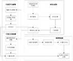
图2为本发明实施例所述基于单目相机的可通行区域检测方法的整体流程框图;FIG. 2 is an overall flowchart of a method for detecting a passable area based on a monocular camera according to an embodiment of the present invention;
图3为本发明实施例所述距离计算示意图;3 is a schematic diagram of distance calculation according to an embodiment of the present invention;
图4为本发明实施例所述通过不同方式计算得到的障碍物距离的示意图;4 is a schematic diagram of obstacle distances calculated in different ways according to an embodiment of the present invention;
图5为本发明实施例所述代价传播示意图;5 is a schematic diagram of cost propagation according to an embodiment of the present invention;
图6为本发明实施例所述尺度因子求解示意图;6 is a schematic diagram of scaling factor solution according to an embodiment of the present invention;
图7为本发明实施例所述基于单目相机的可通行区域检测装置的结构示意图。FIG. 7 is a schematic structural diagram of an apparatus for detecting a passable area based on a monocular camera according to an embodiment of the present invention.
具体实施方式Detailed ways
下面详细描述本发明的实施例,所述实施例的示例在附图中示出,其中自始至终相同或类似的标号表示相同或类似的元件或具有相同或类似功能的元件。下面通过参考附图描述的实施例是示例性的,仅用于解释本发明,而不能理解为对本发明的限制。The following describes in detail the embodiments of the present invention, examples of which are illustrated in the accompanying drawings, wherein the same or similar reference numerals refer to the same or similar elements or elements having the same or similar functions throughout. The embodiments described below with reference to the accompanying drawings are exemplary, only used to explain the present invention, and should not be construed as a limitation of the present invention.
在本发明的描述中,需要理解的是,涉及到方位描述,例如上、下、前、后、左、右等指示的方位或位置关系为基于附图所示的方位或位置关系,仅是为了便于描述本发明和简化描述,而不是指示或暗示所指的装置或元件必须具有特定的方位、以特定的方位构造和操作,因此不能理解为对本发明的限制。In the description of the present invention, it should be understood that the azimuth description, such as the azimuth or position relationship indicated by up, down, front, rear, left, right, etc., is based on the azimuth or position relationship shown in the drawings, only In order to facilitate the description of the present invention and simplify the description, it is not indicated or implied that the indicated device or element must have a particular orientation, be constructed and operated in a particular orientation, and therefore should not be construed as limiting the present invention.
在本发明的描述中,若干的含义是一个或者多个,多个的含义是两个以上,大于、小于、超过等理解为不包括本数,以上、以下、以内等理解为包括本数。如果有描述到第一、第二只是用于区分技术特征为目的,而不能理解为指示或暗示相对重要性或者隐含指明所指示的技术特征的数量或者隐含指明所指示的技术特征的先后关系。In the description of the present invention, the meaning of several is one or more, the meaning of multiple is two or more, greater than, less than, exceeding, etc. are understood as not including this number, above, below, within, etc. are understood as including this number. If it is described that the first and the second are only for the purpose of distinguishing technical features, it cannot be understood as indicating or implying relative importance, or indicating the number of the indicated technical features or the order of the indicated technical features. relation.
本发明的描述中,除非另有明确的限定,设置、安装、连接等词语应做广义理解,所属技术领域技术人员可以结合技术方案的具体内容合理确定上述词语在本发明中的具体含义。In the description of the present invention, unless otherwise clearly defined, words such as setting, installation, connection should be understood in a broad sense, and those skilled in the art can reasonably determine the specific meanings of the above words in the present invention in combination with the specific content of the technical solution.
下面结合附图,对本申请实施例作进一步阐述。The embodiments of the present application will be further described below with reference to the accompanying drawings.
参照图1,本发明实施例提供一种基于单目相机的可通行区域检测方法,包括但不限于以下步骤:1 , an embodiment of the present invention provides a method for detecting a passable area based on a monocular camera, including but not limited to the following steps:
S100.获取单目相机采集的图像;S100. Obtain an image captured by a monocular camera;
S200.利用单目SLAM特征点法对图像进行特征提取和特征匹配,得到三维特征点集;S200. Use the monocular SLAM feature point method to perform feature extraction and feature matching on the image to obtain a three-dimensional feature point set;
S300.确定目标区域,目标区域为图像上的任意一个区域;S300. Determine the target area, and the target area is any area on the image;
S400.对目标区域进行分割,得到多个子区域;S400. Divide the target area to obtain multiple sub-areas;
S500.利用KD-Tree获取每个子区域的邻近特征点集;S500. Use KD-Tree to obtain the adjacent feature point set of each sub-region;
S600.通过计算每个邻近特征点集中每个邻近特征点到达相应子区域的距离,获取每个子区域的最近障碍物距离;S600. Obtain the nearest obstacle distance of each sub-area by calculating the distance from each adjacent feature point in each adjacent feature point set to the corresponding sub-area;
S700.根据每个子区域的最近障碍物距离,通过代价求解器求得代价值和视觉代价地图;S700. According to the nearest obstacle distance of each sub-region, obtain the cost value and the visual cost map through the cost solver;
S800.根据代价值和视觉代价地图,结合预先设定的代价阈值得到可通行区域;S800. According to the cost value and the visual cost map, combined with the preset cost threshold to obtain the passable area;
S900.利用随机采样一致算法对可通行区域的特征点进行过滤,得到地面点集;S900. Use the random sampling consensus algorithm to filter the feature points of the passable area to obtain a ground point set;
S1000.根据地面点集,利用尺度因子求解器获取尺度因子;S1000. According to the ground point set, use the scale factor solver to obtain the scale factor;
S1100.根据尺度因子更正可通行区域的尺度,将视觉代价地图进行投影变换获得可通行方向。S1100. Correct the scale of the passable area according to the scale factor, and perform projective transformation on the visual cost map to obtain the passable direction.
本实施例中,为了稳定、鲁棒地实现纯视觉传感器小车的可通行区域检测,提出了一种基于单目SLAM特征点地图的区域划分算法。利用单目SLAM特征点法计算得到三维特征点集,在相机视野范围内使用障碍物距离求解器计算当前位置与邻近特征点集的最小距离,将得到的最近障碍物距离放入代价求解器中计算得到对应代价值,最后视觉代价地图经过重投影变换获得可通行方向;同时为了解决单目SLAM中的尺度不一致问题,对相机高度和旋转平面进行了一定约束,计算得到尺度因子,通过该尺度因子对可通行区域的尺度进行更正;本发明实施例仅需要低成本的单目相机便可实现可通行区域的检测任务,可方便地移植到轻量级的移动设备。而且,不同于往常的基于深度学习或者点云分割的区域检测算法,本发明实施例计算得到了可通行区域中的代价值,更加方便后续小车进行路径规划任务。In this embodiment, in order to stably and robustly realize the detection of the passable area of the pure vision sensor car, an area division algorithm based on the monocular SLAM feature point map is proposed. Use the monocular SLAM feature point method to calculate the three-dimensional feature point set, use the obstacle distance solver to calculate the minimum distance between the current position and the adjacent feature point set within the camera's field of view, and put the obtained nearest obstacle distance into the cost solver The corresponding cost value is calculated, and finally the visual cost map is reprojected to obtain the passable direction; at the same time, in order to solve the scale inconsistency problem in monocular SLAM, certain constraints are placed on the camera height and rotation plane, and the scale factor is calculated. The scale of the passable area is corrected by the factor; the embodiment of the present invention only needs a low-cost monocular camera to realize the detection task of the passable area, and can be easily transplanted to a lightweight mobile device. Moreover, different from the conventional area detection algorithms based on deep learning or point cloud segmentation, the embodiment of the present invention calculates the cost value in the passable area, which is more convenient for the subsequent car to perform the path planning task.
参照图2,本实施例中,关于步骤S200,在获取单目相机采集的图像之后,利用单目SLAM特征点法对图像进行特征提取和特征匹配,得到三维特征点集

关于步骤S300和步骤S400,本实施例中,可以当前图像中的前方区域空间S为目标区域,然后对前方区域空间S进行均匀分割成多个细小的子区域(s1,s2,...,sm,)。分割完成后,执行步骤S500,也就是利用KD-Tree查找每个子区域


本实施例中,通过KD-Tree获取每个子区域的邻近特征点集之后,进一步执行步骤S600,也就是通过计算每个邻近特征点集中每个邻近特征点到达相应子区域的距离,获取每个子区域的最近障碍物距离这一步骤,具体地,该步骤包括以下子步骤:In this embodiment, after obtaining the adjacent feature point set of each sub-region through KD-Tree, step S600 is further performed, that is, by calculating the distance from each adjacent feature point in each adjacent feature point set to the corresponding sub-region, obtain each sub-region. The step of the nearest obstacle distance in the area, specifically, this step includes the following sub-steps:
S601.计算每个邻近特征点集中每个邻近特征点到达相应子区域的距离;S601. Calculate the distance from each adjacent feature point in each adjacent feature point set to the corresponding sub-region;
S602.根据每个邻近特征点集中每个邻近特征点到达相应子区域的距离,计算得到平均距离;S602. Calculate the average distance according to the distance from each adjacent feature point in each adjacent feature point set to the corresponding sub-region;
S603.根据每个邻近特征点集中每个邻近特征点的概率分布密度函数,通过高斯核密度估计计算得到第一距离;S603. According to the probability distribution density function of each adjacent feature point in each adjacent feature point set, calculate the first distance through Gaussian kernel density estimation;
S604.根据平均距离和第一距离,计算得到每个子区域的最近障碍物距离。S604. According to the average distance and the first distance, calculate the nearest obstacle distance of each sub-area.
具体地,平均距离通过以下公式计算得到:Specifically, the average distance is calculated by the following formula:

式中,dave表示平均距离,n表示邻近特征点数量,di表示邻近特征点集中第i个邻近特征点到达相应子区域的距离。In the formula, dave represents the average distance, n represents the number of adjacent feature points, and di represents the distance from the ith adjacent feature point in the adjacent feature point set to the corresponding sub-region.
第一距离通过以下公式计算得到:The first distance is calculated by the following formula:

式中,dkde表示第一距离,peaki(fh(d))表示邻近特征点的分布密度函数fh(d)对应的密度分布图像中的第i个波峰值;In the formula, dkde represents the first distance, and peaki (fh (d)) represents the i-th peak value in the density distribution image corresponding to the distribution density function fh (d) of the adjacent feature points;
其中,
其中,

最近障碍物距离通过以下公式执行:The nearest obstacle distance is performed by the following formula:
d=α·dkde+(1-α)·dave;d=α·dkde +(1−α)·dave ;
式中,d表示最近障碍物距离,dkde表示第一距离,dave表示平均距离,α表示权重因子。In the formula, d represents the distance to the nearest obstacle, dkde represents the first distance, dave represents the average distance, and α represents the weight factor.
本实施例中,考虑到如果直接使用平均距离进行计算不能很好表示不同位置之间的差异,从而并不能获取准确的最近障碍物距离。而核密度估计一般求解随机变量的分布密度问题,因此,本实施例采用高斯核密度估计来获取子区域附近邻近特征点的分布情况,并结合平均距离进行最近障碍物距离求解。同样以目标区域中的第一个正方体小块(子区域)为例,假设通过KD-Tree查找第一个正方体小块附件所有的邻近特征点,将这些所有邻近特征点的集合记为第一邻近特征点集;同样地,通过KD-Tree查找第二个正方体小块附件所有的邻近特征点,将这些所有邻近特征点的集合记为第二邻近特征点集;通过KD-Tree查找第三个正方体小块附件所有的邻近特征点,将这些所有邻近特征点的集合记为第三邻近特征点集。其中,假设第一邻近特征点集中包含有a个邻近特征点,第二邻近特征点集中包含有b个邻近特征点,第三邻近特征点集中包含有c个邻近特征点。计算第一邻近特征点集中a个邻近特征点到达第一个正方体小块的距离,可得到a个距离,通过公式


具体地,参照图3,图3中(a)表示当前计算子区域s邻近特征点的距离值情况,图3中(b)表示使用高斯核密度估计得到的分布情况。Specifically, referring to FIG. 3 , (a) in FIG. 3 represents the currently calculated distance value of the adjacent feature points in the sub-region s, and (b) in FIG. 3 represents the distribution obtained by using Gaussian kernel density estimation.
由图3(b)可以看出,该当前计算子区域s附近有两个特征点簇x1,x2,分别表示两个障碍物O1,O2,为了得到离当前计算子区域s最近的障碍物距离信息,取第一个坡峰f(x1)的距离x1作为当前计算子区域s的最近障碍物距离ds,此做法可以实现简单的聚类功能,实现了对不同位置障碍物的区分处理。本实施例在图3(b)中选取x1=0.3作为当前场景下的最近障碍物距离值。As can be seen from Figure 3(b), there are two feature point clusters x1 , x2 near the current calculation sub-area s, which represent two obstacles O1 , O2 respectively. In order to obtain the closest to the current calculation sub-area s The obstacle distance information of , take the distance x1 of the first slope peak f(x1 ) as the nearest obstacle distance ds of the current calculation sub-area s, this method can realize a simple clustering function, and realize the Discrimination of obstacles. In this embodiment, x1 =0.3 is selected as the nearest obstacle distance value in the current scene in FIG. 3( b ).
参照图4,图4(a)表示使用公式

如图4(a)和(d)所示,道路中间(水平偏移量为0处)数据方差小,数值较接近,直接取第一个坡峰数据作为距离量会有较大波动和误差,直接使用dkde或dave均不能很好地满足道路中间障碍物距离小,道路两侧障碍物距离大的原则,本实施例将dkde和dave相结合,当方差较小时增大dave的权重,最终求得d如图4(b)所示,很好地解决了这个问题。As shown in Figure 4(a) and (d), the data variance in the middle of the road (where the horizontal offset is 0) is small, and the values are relatively close. Directly taking the first slope peak data as the distance will have large fluctuations and errors , the direct use of dkde or dave cannot well satisfy the principle that the distance between obstacles in the middle of the road is small and the distance between obstacles on both sides of the road is large. In this embodiment, dkde and dave are combined, and when the variance is small, d is increased. The weight ofave , and finally d is obtained as shown in Figure 4(b), which solves this problem well.
本实施例中,计算得到每个子区域的最近障碍物距离之后,也就是得到了各个位置的最近障碍物距离信息之后,为了降低机器人撞击障碍物的概率和方便后续机器人进行路径规划,距障碍物较近区域代价值应当远高于距障碍物较远区域代价值。为此,本实施例借鉴路径规划中一种常见的避障技术(人工势场法),对人工势场法中的代价函数进行了一定修改。另外,由于基于特征点进行代价求解还有两个问题,一是障碍物背部的特征点信息缺失,如果直接进行代价计算,该算法会将障碍物背部视为空闲区域,针对该问题,本实施例引入了代价传播机制;二是空闲区域中心位置附近特征点数量较少,此时计算得到的距离信息可能会有较大误差,如果不加以修正,会出现中心空闲区域代价值更高的情况,这是不合逻辑的,尽管该问题可以通过增大KD-Tree搜索范围解决,但此举会增加时间复杂度,降低实时性。为保证实时性和避免少数邻近特征点带来过大误差,本实施例倾向于引入一个数量临界值,若邻近特征点数量过小,表示当前区域距离障碍物过远,应当适当减小代价值。In this embodiment, after the nearest obstacle distance of each sub-area is calculated, that is, after the nearest obstacle distance information of each position is obtained, in order to reduce the probability of the robot hitting the obstacle and facilitate the subsequent path planning of the robot, the distance from the obstacle The cost value of the closer area should be much higher than the cost value of the area farther away from the obstacle. For this reason, this embodiment makes reference to a common obstacle avoidance technology (artificial potential field method) in path planning, and makes certain modifications to the cost function in the artificial potential field method. In addition, there are two problems in the cost solution based on feature points. One is that the feature point information on the back of the obstacle is missing. If the cost calculation is performed directly, the algorithm will regard the back of the obstacle as an idle area. To solve this problem, this implementation In this example, a cost propagation mechanism is introduced; second, the number of feature points near the center of the free area is small, and the distance information calculated at this time may have a large error. If it is not corrected, the cost of the central free area will be higher. , which is illogical, although this problem can be solved by increasing the KD-Tree search range, but this will increase the time complexity and reduce the real-time performance. In order to ensure real-time performance and avoid excessive errors caused by a few adjacent feature points, this embodiment tends to introduce a number threshold. If the number of adjacent feature points is too small, it means that the current area is too far from the obstacle, and the cost value should be appropriately reduced. .
具体地,经过测试,代价求解器公式如下:Specifically, after testing, the cost solver formula is as follows:

式中,C表示子区域的代价值,d表示最近障碍物距离,d*表示影响半径,n表示邻近特征点数量,n*表示邻近特征点数量边界值,η表示代价尺度因子。本实施例中,将影响半径d*设置为1.0,邻近特征点数量边界值n*设置为100,代价尺度因子η设置为0.1。In the formula, C represents the cost value of the sub-region, d represents the distance to the nearest obstacle, d* represents the influence radius, n represents the number of adjacent feature points, n* represents the boundary value of the number of adjacent feature points, and η represents the cost scale factor. In this embodiment, the influence radius d* is set to 1.0, the boundary value n* of the number of adjacent feature points is set to 100, and the cost scale factor η is set to 0.1.
参照图5,本实施例中,为了避免因障碍物背面检测不到特征点而导致可通行区域计算出现错误的情况,本实施例增加一个代价传播步骤,如图5所示,由相机位置(原点)向障碍物潜在区域(代价值较大区域)发射射线,将障碍物代价值向后方区域传播。Referring to FIG. 5, in this embodiment, in order to avoid an error in the calculation of the passable area due to the fact that the feature points are not detected on the back of the obstacle, this embodiment adds a cost propagation step, as shown in FIG. 5, by the camera position ( The origin) emits rays to the potential area of the obstacle (the area with high cost value), and spreads the cost value of the obstacle to the rear area.
本实施例中,将障碍物距离信息ds,s∈S代入代价求解器可求得代价值和视觉代价地图,然后结合预先设定好的代价阈值对空间进行划分得到可通行区域。本实施例考虑到单目SLAM中存在尺度不一致问题,因此需要进一步获取尺度因子对得到的可通行区域的尺度进行更正。具体地,利用随机采样一致算法对所述可通行区域的特征点进行过滤,得到地面点集。然后根据地面点集,利用尺度因子求解器获取尺度因子。其中,步骤S1000,也就是根据地面点集,利用尺度因子求解器获取尺度因子这一步骤,具体包括:In this embodiment, the cost value and the visual cost map can be obtained by substituting the obstacle distance information ds , s∈S into the cost solver, and then the space is divided into the passable area in combination with the preset cost threshold. In this embodiment, considering the problem of scale inconsistency in monocular SLAM, it is necessary to further obtain a scale factor to correct the scale of the obtained passable area. Specifically, a random sampling consensus algorithm is used to filter the feature points of the passable area to obtain a ground point set. Then according to the ground point set, the scale factor is obtained using the scale factor solver. Among them, step S1000, that is, according to the ground point set, using the scale factor solver to obtain the scale factor, specifically includes:
S1001.根据地面点集,计算归一化尺度下的地面高度;S1001. Calculate the ground height under the normalized scale according to the ground point set;
S1002.根据地面高度和预设单目相机高度,计算得到尺度因子。S1002. Calculate the scale factor according to the ground height and the preset monocular camera height.
具体地,本实施例中,根据地面高度和预设单目相机高度,计算得到尺度因子是通过以下公式执行:Specifically, in this embodiment, according to the ground height and the preset monocular camera height, the calculation of the scale factor is performed by the following formula:

式中,fscale表示尺度因子,h表示预设单目相机高度,h′表示地面高度。In the formula, fscale represents the scale factor, h represents the preset monocular camera height, and h′ represents the ground height.
参照图6,本实施例假定单目相机高度一定并且单目相机只进行水平面旋转。首先使用得到的可通行区域和随机采样一致算法(RANSAC)对特征点进行过滤,得到地面点集。然后算出归一化尺度下的地面高度,即图6中的h′,然后利用预设相机高度h计算尺度因子
本发明实施例一种基于单目相机的可通行区域检测方法具有以下技术效果:A method for detecting a passable area based on a monocular camera according to an embodiment of the present invention has the following technical effects:
本发明实施例通过利用单目SLAM特征点法对单目相机采集的图像进行特征提取和特征匹配,得到三维特征点集;确定目标区域,并对目标区域进行分割,得到多个子区域;然后利用KD-Tree获取每个子区域的邻近特征点集;通过计算每个邻近特征点集中每个邻近特征点到达相应子区域的距离,获取每个子区域的最近障碍物距离;然后通过代价求解器求得代价值和视觉代价地图,并结合预先设定的代价阈值得到可通行区域;利用随机采样一致算法对可通行区域的特征点进行过滤,得到地面点集,并利用尺度因子求解器获取尺度因子;最后根据尺度因子更正可通行区域的尺度,并将视觉代价地图进行投影变换获得可通行方向。本发明通过计算得到最近障碍物距离,通过代价求解器得到可通行区域,即仅需要低成本的单目相机便可实现可通行区域的检测任务,而且同时计算得到了可通行区域中的代价值,更加方便后续小车的路径规划模块;计算得到的尺度因子对可通行区域的尺度进行更正,能够解决单目SLAM中的尺度不一致问题。The embodiment of the present invention obtains a three-dimensional feature point set by using the monocular SLAM feature point method to perform feature extraction and feature matching on the image collected by the monocular camera; determine the target area, and segment the target area to obtain multiple sub-areas; and then use the KD-Tree obtains the adjacent feature point set of each sub-region; obtains the nearest obstacle distance of each sub-region by calculating the distance from each adjacent feature point in each adjacent feature point set to the corresponding sub-region; and then obtains the nearest obstacle distance through the cost solver The cost value and visual cost map are combined with the preset cost threshold to obtain the passable area; the feature points of the passable area are filtered by the random sampling consensus algorithm to obtain the ground point set, and the scale factor is obtained by the scale factor solver; Finally, the scale of the passable area is corrected according to the scale factor, and the passable direction is obtained by projective transformation of the visual cost map. The present invention obtains the distance of the nearest obstacle through calculation, and obtains the passable area through the cost solver, that is, only a low-cost monocular camera is needed to realize the detection task of the passable area, and at the same time, the cost value in the passable area is calculated. , which is more convenient for the path planning module of the subsequent car; the calculated scale factor corrects the scale of the passable area, which can solve the scale inconsistency problem in monocular SLAM.
参照图7,本发明实施例还提供了一种基于单目相机的可通行区域检测装置200,具体包括:Referring to FIG. 7 , an embodiment of the present invention further provides an
至少一个处理器210;at least one
至少一个存储器220,用于存储至少一个程序;at least one
当至少一个程序被至少一个处理器210执行,使得至少一个处理器210实现如图1所示的方法。When at least one program is executed by at least one
其中,存储器220作为一种非暂态计算机可读存储介质,可用于存储非暂态软件程序以及非暂态性计算机可执行程序。存储器220可以包括高速随机存取存储器,还可以包括非暂态存储器,例如至少一个磁盘存储器件、闪存器件、或其他非暂态固态存储器件。在一些实施方式中,存储器220可选包括相对于处理器210远程设置的远程存储器,这些远程存储器可以通过网络连接至处理器210。上述网络的实例包括但不限于互联网、企业内部网、局域网、移动通信网及其组合。The
可以理解到,图7中示出的装置结构并不构成对装置200的限定,可以包括比图示更多或更少的部件,或者组合某些部件,或者不同的部件布置。It can be understood that the device structure shown in FIG. 7 does not constitute a limitation to the
如图7所示的装置200中,处理器210可以调取存储器220中储存的程序,并执行但不限于图1所示实施例的步骤。In the
以上所描述的装置200实施例仅仅是示意性的,其中作为分离部件说明的单元可以是或者也可以不是物理上分开的,即可以位于一个地方,或者也可以分布到多个网络单元上。可以根据实际的需要选择其中的部分或者全部模块来实现实施例的目的。The above-described embodiment of the
本发明实施例还提供了一种计算机可读存储介质,该计算机可读存储介质存储有处理器可执行的程序,处理器可执行的程序在被处理器执行时用于实现如图1所示的方法。An embodiment of the present invention further provides a computer-readable storage medium, where the computer-readable storage medium stores a program executable by a processor, and the program executable by the processor is used to implement the program as shown in FIG. 1 when executed by the processor Methods.
本申请实施例还公开了一种计算机程序产品或计算机程序,该计算机程序产品或计算机程序包括计算机指令,该计算机指令存储在计算机可读存介质中。计算机设备的处理器可以从计算机可读存储介质读取该计算机指令,处理器执行该计算机指令,使得该计算机设备执行图1所示的方法。Embodiments of the present application further disclose a computer program product or computer program, where the computer program product or computer program includes computer instructions, and the computer instructions are stored in a computer-readable storage medium. A processor of the computer device can read the computer instructions from the computer-readable storage medium, and the processor executes the computer instructions to cause the computer device to perform the method shown in FIG. 1 .
可以理解的是,上文中所公开方法中的全部或某些步骤、系统可以被实施为软件、固件、硬件及其适当的组合。某些物理组件或所有物理组件可以被实施为由处理器,如中央处理器、数字信号处理器或微处理器执行的软件,或者被实施为硬件,或者被实施为集成电路,如专用集成电路。这样的软件可以分布在计算机可读介质上,计算机可读介质可以包括计算机存储介质(或非暂时性介质)和通信介质(或暂时性介质)。如本领域普通技术人员公知的,术语计算机存储介质包括在用于存储信息(诸如计算机可读指令、数据结构、程序模块或其他数据)的任何方法或技术中实施的易失性和非易失性、可移除和不可移除介质。计算机存储介质包括但不限于RAM、ROM、EEPROM、闪存或其他存储器技术、CD-ROM、数字多功能盘(DVD)或其他光盘存储、磁盒、磁带、磁盘存储或其他磁存储装置、或者可以用于存储期望的信息并且可以被计算机访问的任何其他的介质。此外,本领域普通技术人员公知的是,通信介质通常包含计算机可读指令、数据结构、程序模块或者诸如载波或其他传输机制之类的调制数据信号中的其他数据,并且可包括任何信息递送介质。It will be understood that all or some of the steps and systems in the methods disclosed above may be implemented as software, firmware, hardware, and suitable combinations thereof. Some or all physical components may be implemented as software executed by a processor, such as a central processing unit, digital signal processor or microprocessor, or as hardware, or as an integrated circuit, such as an application specific integrated circuit . Such software may be distributed on computer-readable media, which may include computer storage media (or non-transitory media) and communication media (or transitory media). As known to those of ordinary skill in the art, the term computer storage media includes both volatile and nonvolatile implemented in any method or technology for storage of information, such as computer readable instructions, data structures, program modules or other data flexible, removable and non-removable media. Computer storage media include, but are not limited to, RAM, ROM, EEPROM, flash memory or other memory technology, CD-ROM, digital versatile disk (DVD) or other optical disk storage, magnetic cartridges, magnetic tape, magnetic disk storage or other magnetic storage devices, or may Any other medium used to store desired information and which can be accessed by a computer. In addition, communication media typically embodies computer readable instructions, data structures, program modules, or other data in a modulated data signal such as a carrier wave or other transport mechanism, and can include any information delivery media, as is well known to those of ordinary skill in the art .
上面结合附图对本发明实施例作了详细说明,但是本发明不限于上述实施例,在技术领域普通技术人员所具备的知识范围内,还可以在不脱离本发明宗旨的前提下作出各种变化。The embodiments of the present invention have been described in detail above in conjunction with the accompanying drawings, but the present invention is not limited to the above-mentioned embodiments, and within the scope of knowledge possessed by those of ordinary skill in the technical field, various changes can also be made without departing from the purpose of the present invention. .
Claims (10)
Translated fromChinese


Priority Applications (1)
| Application Number | Priority Date | Filing Date | Title |
|---|---|---|---|
| CN202110676537.XACN113409268B (en) | 2021-06-18 | 2021-06-18 | Method and device for detecting passable area based on monocular camera and storage medium |
Applications Claiming Priority (1)
| Application Number | Priority Date | Filing Date | Title |
|---|---|---|---|
| CN202110676537.XACN113409268B (en) | 2021-06-18 | 2021-06-18 | Method and device for detecting passable area based on monocular camera and storage medium |
Publications (2)
| Publication Number | Publication Date |
|---|---|
| CN113409268Atrue CN113409268A (en) | 2021-09-17 |
| CN113409268B CN113409268B (en) | 2023-04-18 |
Family
ID=77685022
Family Applications (1)
| Application Number | Title | Priority Date | Filing Date |
|---|---|---|---|
| CN202110676537.XAActiveCN113409268B (en) | 2021-06-18 | 2021-06-18 | Method and device for detecting passable area based on monocular camera and storage medium |
Country Status (1)
| Country | Link |
|---|---|
| CN (1) | CN113409268B (en) |
Cited By (1)
| Publication number | Priority date | Publication date | Assignee | Title |
|---|---|---|---|---|
| CN116339160A (en)* | 2021-12-24 | 2023-06-27 | 广东栗子科技有限公司 | Linkage control method and device of equipment |
Citations (5)
| Publication number | Priority date | Publication date | Assignee | Title |
|---|---|---|---|---|
| CN104282009A (en)* | 2013-07-02 | 2015-01-14 | 上海联影医疗科技有限公司 | Coronary artery extraction method |
| CN110244321A (en)* | 2019-04-22 | 2019-09-17 | 武汉理工大学 | A detection method of road passable area based on 3D lidar |
| CN110673632A (en)* | 2019-09-27 | 2020-01-10 | 中国船舶重工集团公司第七0九研究所 | Unmanned aerial vehicle autonomous obstacle avoidance method and device based on visual SLAM |
| CN111366917A (en)* | 2020-03-13 | 2020-07-03 | 北京百度网讯科技有限公司 | Driving area detection method, apparatus, device, and computer-readable storage medium |
| CN112116644A (en)* | 2020-08-28 | 2020-12-22 | 辽宁石油化工大学 | A vision-based obstacle detection method and device, and obstacle distance calculation method and device |
- 2021
- 2021-06-18CNCN202110676537.XApatent/CN113409268B/enactiveActive
Patent Citations (5)
| Publication number | Priority date | Publication date | Assignee | Title |
|---|---|---|---|---|
| CN104282009A (en)* | 2013-07-02 | 2015-01-14 | 上海联影医疗科技有限公司 | Coronary artery extraction method |
| CN110244321A (en)* | 2019-04-22 | 2019-09-17 | 武汉理工大学 | A detection method of road passable area based on 3D lidar |
| CN110673632A (en)* | 2019-09-27 | 2020-01-10 | 中国船舶重工集团公司第七0九研究所 | Unmanned aerial vehicle autonomous obstacle avoidance method and device based on visual SLAM |
| CN111366917A (en)* | 2020-03-13 | 2020-07-03 | 北京百度网讯科技有限公司 | Driving area detection method, apparatus, device, and computer-readable storage medium |
| CN112116644A (en)* | 2020-08-28 | 2020-12-22 | 辽宁石油化工大学 | A vision-based obstacle detection method and device, and obstacle distance calculation method and device |
Non-Patent Citations (2)
| Title |
|---|
| 刘瑞雪 等: "一种基于高效边界探索的机器人自主建图方法", 《广东工业大学学报》* |
| 钟煜华: "基于三维激光雷达的救援机器人环境感知研究", 《中国优秀博硕士学位论文全文数据库(硕士)信息科技辑》* |
Cited By (1)
| Publication number | Priority date | Publication date | Assignee | Title |
|---|---|---|---|---|
| CN116339160A (en)* | 2021-12-24 | 2023-06-27 | 广东栗子科技有限公司 | Linkage control method and device of equipment |
Also Published As
| Publication number | Publication date |
|---|---|
| CN113409268B (en) | 2023-04-18 |
Similar Documents
| Publication | Publication Date | Title |
|---|---|---|
| CN108802785B (en) | Vehicle self-positioning method based on high-precision vector map and monocular vision sensor | |
| CN111611853B (en) | Sensing information fusion method, device and storage medium | |
| Zou et al. | Real-time full-stack traffic scene perception for autonomous driving with roadside cameras | |
| JP6760114B2 (en) | Information processing equipment, data management equipment, data management systems, methods, and programs | |
| CN112347205B (en) | Updating method and device for vehicle error state | |
| CN114966734A (en) | Bidirectional depth vision inertial pose estimation method combined with multi-line laser radar | |
| WO2020164092A1 (en) | Image processing method and apparatus, moveable platform, unmanned aerial vehicle and storage medium | |
| CN110033489A (en) | A kind of appraisal procedure, device and the equipment of vehicle location accuracy | |
| CN112132857A (en) | Dynamic Object Detection and Static Map Reconstruction Method for Dynamic Environment Hybrid Vision System | |
| CN115077519A (en) | Method and device for positioning and mapping based on loose coupling between template matching and laser inertial navigation | |
| WO2019136613A1 (en) | Indoor locating method and device for robot | |
| CN112509051A (en) | Bionic-based autonomous mobile platform environment sensing and mapping method | |
| CN110827353A (en) | A robot positioning method based on monocular camera assistance | |
| CN117671022B (en) | Mobile robot vision positioning system and method in indoor weak texture environment | |
| CN114969221A (en) | A method for updating a map and related equipment | |
| CN114924287A (en) | Map construction method, apparatus and medium | |
| CN110992424A (en) | Positioning method and system based on binocular vision | |
| CN117593650A (en) | Moving point filtering visual SLAM method based on 4D millimeter wave radar and SAM image segmentation | |
| CN114202701A (en) | A UAV Vision Relocation Method Based on Object Semantics | |
| CN114248778B (en) | Positioning method and positioning device of mobile equipment | |
| CN110864670B (en) | Method and system for acquiring position of target obstacle | |
| CN112598736A (en) | Map construction based visual positioning method and device | |
| CN113409268B (en) | Method and device for detecting passable area based on monocular camera and storage medium | |
| CN119164407A (en) | Laser visual-inertial fusion positioning method based on positioning error distribution and trajectory optimization | |
| JP2020149186A (en) | Position / orientation estimation device, learning device, mobile robot, position / orientation estimation method, learning method |
Legal Events
| Date | Code | Title | Description |
|---|---|---|---|
| PB01 | Publication | ||
| PB01 | Publication | ||
| SE01 | Entry into force of request for substantive examination | ||
| SE01 | Entry into force of request for substantive examination | ||
| GR01 | Patent grant | ||
| GR01 | Patent grant |