CN112753001A - Flight guidance method, device, system, control terminal and readable storage medium - Google Patents
Flight guidance method, device, system, control terminal and readable storage mediumDownload PDFInfo
- Publication number
- CN112753001A CN112753001ACN202080005072.9ACN202080005072ACN112753001ACN 112753001 ACN112753001 ACN 112753001ACN 202080005072 ACN202080005072 ACN 202080005072ACN 112753001 ACN112753001 ACN 112753001A
- Authority
- CN
- China
- Prior art keywords
- drone
- flight
- obstacle
- icon
- flight guidance
- Prior art date
- Legal status (The legal status is an assumption and is not a legal conclusion. Google has not performed a legal analysis and makes no representation as to the accuracy of the status listed.)
- Pending
Links
- 238000000034methodMethods0.000titleclaimsabstractdescription96
- 230000033001locomotionEffects0.000claimsabstractdescription67
- 230000000875corresponding effectEffects0.000claimsdescription42
- 238000004590computer programMethods0.000claimsdescription20
- 230000005540biological transmissionEffects0.000claimsdescription14
- 239000003550markerSubstances0.000claimsdescription14
- 238000005259measurementMethods0.000claimsdescription14
- 230000008859changeEffects0.000claimsdescription13
- 230000009194climbingEffects0.000claimsdescription13
- 239000003086colorantSubstances0.000claimsdescription7
- 230000001960triggered effectEffects0.000claimsdescription6
- 230000001276controlling effectEffects0.000claimsdescription5
- 230000002596correlated effectEffects0.000claimsdescription5
- 230000004888barrier functionEffects0.000description84
- 210000003128headAnatomy0.000description13
- 230000008447perceptionEffects0.000description13
- 238000004891communicationMethods0.000description9
- 230000008569processEffects0.000description7
- 238000010586diagramMethods0.000description6
- 239000004973liquid crystal related substanceSubstances0.000description4
- RZVHIXYEVGDQDX-UHFFFAOYSA-N9,10-anthraquinoneChemical compoundC1=CC=C2C(=O)C3=CC=CC=C3C(=O)C2=C1RZVHIXYEVGDQDX-UHFFFAOYSA-N0.000description3
- 238000001514detection methodMethods0.000description3
- 230000001133accelerationEffects0.000description2
- 238000013459approachMethods0.000description2
- 230000003287optical effectEffects0.000description2
- 238000012545processingMethods0.000description2
- QNRATNLHPGXHMA-XZHTYLCXSA-N(r)-(6-ethoxyquinolin-4-yl)-[(2s,4s,5r)-5-ethyl-1-azabicyclo[2.2.2]octan-2-yl]methanol;hydrochlorideChemical compoundCl.C([C@H]([C@H](C1)CC)C2)CN1[C@@H]2[C@H](O)C1=CC=NC2=CC=C(OCC)C=C21QNRATNLHPGXHMA-XZHTYLCXSA-N0.000description1
- 230000002159abnormal effectEffects0.000description1
- 238000005516engineering processMethods0.000description1
- 210000000887faceAnatomy0.000description1
- 238000012986modificationMethods0.000description1
- 230000004048modificationEffects0.000description1
- 238000006467substitution reactionMethods0.000description1
Images


Classifications
- G—PHYSICS
- G05—CONTROLLING; REGULATING
- G05D—SYSTEMS FOR CONTROLLING OR REGULATING NON-ELECTRIC VARIABLES
- G05D1/00—Control of position, course, altitude or attitude of land, water, air or space vehicles, e.g. using automatic pilots
- G05D1/08—Control of attitude, i.e. control of roll, pitch, or yaw
- G05D1/0808—Control of attitude, i.e. control of roll, pitch, or yaw specially adapted for aircraft
- G—PHYSICS
- G05—CONTROLLING; REGULATING
- G05D—SYSTEMS FOR CONTROLLING OR REGULATING NON-ELECTRIC VARIABLES
- G05D1/00—Control of position, course, altitude or attitude of land, water, air or space vehicles, e.g. using automatic pilots
- G05D1/10—Simultaneous control of position or course in three dimensions
- G05D1/101—Simultaneous control of position or course in three dimensions specially adapted for aircraft
Landscapes
- Engineering & Computer Science (AREA)
- Aviation & Aerospace Engineering (AREA)
- Radar, Positioning & Navigation (AREA)
- Remote Sensing (AREA)
- Physics & Mathematics (AREA)
- General Physics & Mathematics (AREA)
- Automation & Control Theory (AREA)
- User Interface Of Digital Computer (AREA)
- Traffic Control Systems (AREA)
Abstract
Description
Technical Field
The present application relates to the field of information display technologies, and in particular, to a flight guidance method, apparatus, system, control terminal, and readable storage medium.
Background
With the increasing expansion of the application field of the unmanned aerial vehicle, the occasions using the unmanned aerial vehicle become more and more diversified, the user can control the unmanned aerial vehicle to fly to the destination through the control terminal, and it is extremely important to control the safe flight of the unmanned aerial vehicle, when the user controls the unmanned aerial vehicle to fly to the destination, the unmanned aerial vehicle can fly to the destination safely only by continuously adjusting the flight control parameters of the unmanned aerial vehicle, however, the user can only observe the flight condition of the unmanned aerial vehicle through eyes and adjust the flight control parameters of the unmanned aerial vehicle based on the observed flight condition, and the flight condition that eyes observed and obtain is inaccurate, and the user just also can't accurate adjustment unmanned aerial vehicle's flight control parameter, need spend more time just can control the safe flight of unmanned aerial vehicle to the destination, also can't guarantee the security that unmanned aerial vehicle flies, and user experience is not good.
Disclosure of Invention
Based on this, the application provides a flight guidance method, device, system, control terminal and readable storage medium, aims at guiding the user to control the flight of the unmanned aerial vehicle, and improves the safety of the flight of the unmanned aerial vehicle.
In a first aspect, the present application provides a flight guidance method, applied to a control terminal, where the control terminal is configured to communicate with a drone, and the method includes:
displaying a flight guidance page on the control terminal;
acquiring the operation of a user on the control terminal, wherein the operation is used for generating a control command to control the unmanned aerial vehicle;
generating a motion vector icon on the flight guidance page according to the operation, wherein the motion vector icon is used for representing the flight direction and the flight power of the unmanned aerial vehicle.
In a second aspect, the present application further provides a control terminal, where the control terminal includes a display device, a memory, and a processor, and the control terminal is connected to an unmanned aerial vehicle;
the memory is used for storing a computer program;
the processor is configured to execute the computer program and, when executing the computer program, implement the following steps:
displaying a flight guidance page through the display device;
acquiring the operation of a user on the control terminal, wherein the operation is used for generating a control command to control the unmanned aerial vehicle;
generating a motion vector icon on the flight guidance page according to the operation, wherein the motion vector icon is used for representing the flight direction and the flight power of the unmanned aerial vehicle.
In a third aspect, the present application further provides a flight guidance device, which is applied to a control terminal, where the control terminal communicates with a drone, and the flight guidance device includes a processor and a memory;
the memory is used for storing a computer program;
the processor is configured to execute the computer program and, when executing the computer program, implement the following steps:
controlling the control terminal to display a flight guidance page;
acquiring the operation of a user on the control terminal, wherein the operation is used for generating a control command to control the unmanned aerial vehicle;
generating a motion vector icon on the flight guidance page according to the operation, wherein the motion vector icon is used for representing the flight direction and the flight power of the unmanned aerial vehicle.
In a fourth aspect, the present application further provides a flight guidance system, the flight guidance system includes control terminal and unmanned aerial vehicle, control terminal and unmanned aerial vehicle communication connection.
In a fifth aspect, the present application further provides a computer-readable storage medium storing a computer program which, when executed by a processor, causes the processor to implement the flight guidance method according to any one of the aspects provided herein.
The embodiment of the application provides a flight guidance method, a device, a system, a control terminal and a readable storage medium, wherein a flight guidance page is displayed at the control terminal, then the operation of a user on the control terminal is obtained, and a motion vector icon used for representing the flight direction and the flight power of an unmanned aerial vehicle is generated on the flight guidance page according to the operation of the user on the control terminal, so that the user can know the flight direction and the flight power of the unmanned aerial vehicle based on the motion vector icon, the user can control the flight of the unmanned aerial vehicle conveniently, and the flight safety of the unmanned aerial vehicle is ensured.
It is to be understood that both the foregoing general description and the following detailed description are exemplary and explanatory only and are not restrictive of the application.
Drawings
In order to more clearly illustrate the technical solutions of the embodiments of the present application, the drawings needed to be used in the description of the embodiments are briefly introduced below, and it is obvious that the drawings in the following description are some embodiments of the present application, and it is obvious for those skilled in the art to obtain other drawings based on these drawings without creative efforts.
Fig. 1 is a schematic view of a scenario for implementing a flight guidance method provided in an embodiment of the present application;
FIG. 2 is a flow chart illustrating steps of a flight guidance method according to an embodiment of the present disclosure;
FIG. 3 is a schematic view of a flight guidance page displayed by the control terminal in an embodiment of the present application;
FIG. 4 is another schematic view of a flight guidance page displayed by the control terminal in an embodiment of the present application;
FIG. 5 is another schematic view of a flight guidance page displayed by the control terminal in an embodiment of the present application;
FIG. 6 is another schematic view of a flight guidance page displayed by the control terminal in an embodiment of the present application;
FIG. 7 is another schematic view of a flight guidance page displayed by the control terminal in an embodiment of the present application;
FIG. 8 is another schematic view of a flight guidance page displayed by the control terminal in an embodiment of the present application;
FIG. 9 is another schematic view of a flight guidance page displayed by the control terminal in an embodiment of the present application;
FIG. 10 is another schematic view of a flight guidance page displayed by the control terminal in an embodiment of the present application;
FIG. 11 is another schematic view of a flight guidance page displayed by the control terminal in an embodiment of the present application;
FIG. 12 is another schematic view of a flight guidance page displayed by the control terminal in an embodiment of the present application;
FIG. 13 is another illustration of a flight guidance page displayed by the control terminal in an embodiment of the present application;
FIG. 14 is another schematic view of a flight guidance page displayed by the control terminal in an embodiment of the present application;
FIG. 15 is another schematic view of a flight guidance page displayed by the control terminal in an embodiment of the present application;
FIG. 16 is another schematic view of a flight guidance page displayed by the control terminal in an embodiment of the present application;
fig. 17 is a schematic block diagram of a structure of a control terminal according to an embodiment of the present application;
fig. 18 is a schematic block diagram of a structure of a flight guidance device provided in an embodiment of the present application.
Detailed Description
The technical solutions in the embodiments of the present application will be clearly and completely described below with reference to the drawings in the embodiments of the present application, and it is obvious that the described embodiments are some, but not all, embodiments of the present application. All other embodiments, which can be derived by a person skilled in the art from the embodiments given herein without making any creative effort, shall fall within the protection scope of the present application.
The flow diagrams depicted in the figures are merely illustrative and do not necessarily include all of the elements and operations/steps, nor do they necessarily have to be performed in the order depicted. For example, some operations/steps may be decomposed, combined or partially combined, so that the actual execution sequence may be changed according to the actual situation.
Some embodiments of the present application will be described in detail below with reference to the accompanying drawings. The embodiments described below and the features of the embodiments can be combined with each other without conflict.
Based on the above problem, an embodiment of the present application provides a flight guidance method, where the flight guidance method is applied to a control terminal, please refer to fig. 1, fig. 1 is a scene schematic diagram for implementing the flight guidance method provided in the embodiment of the present application, as shown in fig. 1, thecontrol terminal 100 is in communication connection with adrone 200, thecontrol terminal 100 includes adisplay device 101, thedisplay device 101 is configured to display a flight guidance page, and when an operation of a user on the control terminal is acquired, a motion vector icon for representing a flight direction and a flight power of the drone is generated on the flight guidance page according to the operation, so that the user can know the flight direction and the flight power of the drone based on the motion vector icon, and the user can conveniently control the flight of the drone.
In some embodiments, the unmannedaerial vehicle 200 includes theobstacle sensing device 201, and theobstacle sensing device 201 is used for acquiring sensing signals around the unmannedaerial vehicle 200, and by analyzing the sensing signals, obstacle information can be obtained, and obstacle information is displayed on the flight guidance page, so that a user can know the obstacle sensed by the unmanned aerial vehicle, and the user can control the unmanned aerial vehicle to avoid the obstacle conveniently. Thedisplay device 101 may be a liquid crystal display or a touch screen, and thecontrol terminal 100 includes a remote controller, a ground control platform, a mobile phone, a tablet computer, a notebook computer, a PC computer, and the like.
In some embodiments, theobstacle sensing arrangement 201 may comprise at least one sensor for acquiring a sensing signal from thedrone 200 in at least one direction. For example, theobstacle sensing device 201 may include a sensor for detecting an obstacle in front of thedrone 200. For example, theobstacle sensing device 201 may include two sensors for detecting obstacles in front of and behind thedrone 200, respectively. For example, theobstacle sensing device 201 may include four sensors for detecting obstacles in front of, behind, to the left of, and to the right of thedrone 200, respectively. For example, theobstacle sensing device 201 may include five sensors for detecting obstacles in front of, behind, to the left of, to the right of, and above thedrone 200, respectively. For example, theobstacle sensing device 201 may include six sensors for detecting obstacles in front of, behind, to the left, to the right, above, and below thedrone 200, respectively. The sensors in theobstacle sensing device 201 may be implemented separately or integrally. The detection direction of the sensor can be set according to specific needs to detect obstacles in various directions or direction combinations, and is not limited to the form disclosed in the present application.
Thedrone 200 may have one or more propulsion units to allow thedrone 200 to fly in the air. The one or more propulsion units may cause thedrone 200 to move at one or more, two or more, three or more, four or more, five or more, six or more free angles. In some cases, thedrone 200 may rotate about one, two, three, or more axes of rotation. The axes of rotation may be perpendicular to each other. The axes of rotation may be maintained perpendicular to each other throughout the flight of thedrone 200. The axis of rotation may include a pitch axis, a roll axis, and/or a yaw axis. Thedrone 200 may be movable in one or more dimensions. For example, thedrone 200 can move upward due to the lift generated by one or more rotors. In some cases, thedrone 200 may be movable along a Z-axis (which may be upward with respect to thedrone 200 direction), an X-axis, and/or a Y-axis (which may be lateral). Thedrone 200 may move along one, two, or three axes that are perpendicular to each other.
Thedrone 200 may have multiple rotors. The rotor may be connected to the body of thedrone 200, which may include a control unit, an Inertial Measurement Unit (IMU), a processor, a battery, a power source, and/or other sensors. The rotor may be connected to the body by one or more arms or extensions that branch off from a central portion of the body. For example, one or more arms may extend radially from the central body of thedrone 200 and may have rotors at or near the ends of the arms.
Referring to fig. 2, fig. 2 is a schematic flowchart illustrating steps of a flight guidance method according to an embodiment of the present application. Specifically, as shown in fig. 2, the flight guidance method includes steps S101 to S103.
And S101, displaying a flight guidance page on the control terminal.
The control terminal comprises an integrally arranged display device, or the control terminal comprises a bearing platform, the bearing platform is used for bearing display equipment, a user can install the display equipment on the bearing platform and establish communication connection between the control terminal and the display equipment, the display device can be a liquid crystal display screen or a touch display screen, and the display equipment comprises a mobile phone, a tablet computer and the like.
At the in-process that the user passes through control terminal control unmanned aerial vehicle flight, show flight guide page on control terminal's display device or the display device who is connected with control terminal, the user of being convenient for knows unmanned aerial vehicle's flight condition. The flight guidance page comprises a return point of the unmanned aerial vehicle, a current flying speed, a current relative height and a current absolute height, and the current relative height is the height of the unmanned aerial vehicle relative to the return point at the current position.
In some embodiments, the flight guidance page further comprises a speed indicator bar for indicating the flight speed of the drone and a height indicator bar for indicating the height of the drone, the speed indicator bar having the current flight speed of the drone displayed thereon, the height indicator bar having the current relative height of the drone displayed thereon; this speed indication strip shows the flying speed that has many speed scale marks and every speed scale mark respectively to correspond, shows the relative altitude that has many height scale marks and every height scale mark respectively to this altitude indication strip, and this relative altitude can be for unmanned aerial vehicle height relative to the point of returning to the navigation, also can be for unmanned aerial vehicle height relative to other positions. The number of the speed scale marks and the height scale marks may be set based on actual conditions, which is not specifically limited in the present application. In another embodiment, the height indication bar may also indicate the absolute height of the drone, and is not specifically limited herein. Through show speed instruction strip and height instruction strip on the flight guides the page, can the convenience of customers know unmanned aerial vehicle's airspeed and flying height.
It can be understood that the display positions of the speed indication bar and the height indication bar on the flight guidance page may be set according to actual situations, which is not specifically limited in this application, for example, the speed indication bar is displayed in the left display area of the flight guidance page, the height indication bar is displayed in the right display area of the flight guidance page, or the speed indication bar is displayed in the right display area of the flight guidance page, and the height indication bar is displayed in the left display area of the flight guidance page.
In some embodiments, the flight guidance page further includes a vertical speed of the drone, a wind speed and a wind direction of an environment where the drone is located, where the vertical speed includes a climbing speed or a descending speed of the drone, and the vertical speed of the drone, the wind speed and the wind direction of the environment where the drone is located may be set according to an actual situation, which is not specifically limited in this application.
Illustratively, as shown in FIG. 3, the left display area of the flight guidance page displays a speed indicator bar, while the right display area displays a height indicator bar, the speed indicator bar displaying 4 speed scale lines from top to bottomThe corresponding flight speeds of the lower speed scale lines are 07m/s, 06m/s, 05.2m/s and 04m/s respectively, the 05.2m/s is the current flight speed of the unmanned aerial vehicle, and the wind speed of the environment where the unmanned aerial vehicle is located, which is displayed in the display area issued by the speed indicator bar, is 04.0 m/s; the height indication strip is displayed with 4 height scale marks, the relative heights corresponding to the height scale marks from top to bottom are respectively 160m, 140 m, 120m and 100 m, 120m is the current relative height of the unmanned aerial vehicle, the vertical speed displayed in the lower display area of the height indication strip is 2.5m/s, the current absolute height is 1234.5m, and the return flight point displayed on the flight guidance page is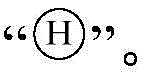

In some embodiments, the flight guidance page further comprises a nose icon of the drone, the body icon being used to represent a nose of the drone, the body icon always being located at the very center of the flight guidance page, the flight guidance page further comprising a pose indicator line of the drone, the pose indicator line being used to represent a current pose of the drone; this gesture pilot line changes along with the change of unmanned aerial vehicle's gesture. The shape and the size of the handpiece icon can be set based on actual conditions, the shape and the size are not specifically limited in the application, and the input handpiece icon is in a cross shape, a circular shape, a square shape or other shapes. The change condition of the posture of the unmanned aerial vehicle can be reflected through the displayed machine head icon and the posture indicating line, so that the user can know the change condition of the posture of the unmanned aerial vehicle, and the user can control the flight of the unmanned aerial vehicle conveniently.
In some embodiments, the attitude indicator line is a sea horizon or a ground horizon, the movement of the attitude indicator line in the up-and-down direction in the flight guidance page indicates that the pitch angle of the unmanned aerial vehicle changes, and the left-and-right inclination of the attitude indicator line indicates that the roll angle of the unmanned aerial vehicle changes. Specifically, the attitude indicator line moves upwards to indicate that the pitch angle of the unmanned aerial vehicle is a depression angle, and the unmanned aerial vehicle tilts downwards; the attitude indicator line moves downwards to indicate that the pitch angle of the unmanned aerial vehicle is an elevation angle, and the unmanned aerial vehicle tilts upwards; the gesture indicating line inclines to the left, the roll angle of the unmanned aerial vehicle is the right roll angle, and the unmanned aerial vehicle inclines to the right; this gesture guideline inclines to the right and shows that unmanned aerial vehicle's roll angle is left roll angle, and unmanned aerial vehicle inclines to the left.
Illustratively, as shown in fig. 4, the flight guidance page displays a nose icon "+", a posture indication line "-", a nose icon "+" and a posture indication line "-" between the speed indication bar and the height indication bar, the nose icon being located at the midpoint of the posture indication line.
S102, obtaining the operation of the user on the control terminal, wherein the operation is used for generating a control command to control the unmanned aerial vehicle.
After the flight guidance page is displayed, the operation of the user on the control terminal is acquired, so that the control operation generates a control command based on the operation to control the unmanned aerial vehicle to execute a series of actions, such as controlling the unmanned aerial vehicle to steer, brake, accelerate, ascend, descend, fly obliquely, return and adjust the posture of the holder.
The user can include touch operation, pole operation, slide operation, button operation etc. and be used for remote control unmanned aerial vehicle's operation to control terminal's operation.
S103, generating a motion vector icon on the flight guidance page according to the operation, wherein the motion vector icon is used for representing the flight direction and the flight power of the unmanned aerial vehicle.
Specifically, when the operation of a user on a control terminal is obtained, the current attitude of the unmanned aerial vehicle and the Measurement data of an Inertial Measurement Unit (IMU) are obtained; and generating a motion vector icon on a flight guidance page according to the operation of the user on the control terminal, the current attitude and the measurement data of the IMU, namely determining the flight direction and the flight power of the unmanned aerial vehicle according to the operation of the user on the control terminal, the current attitude and the measurement data of the IMU, and generating the motion vector icon on the flight guidance page according to the flight direction and the flight power. The measurement data of the IMU comprise angular acceleration information of the IMU, the current attitude of the unmanned aerial vehicle can be measured through an attitude sensor, and the motion vector icon is used for representing the flight direction and the flight power of the unmanned aerial vehicle.
At one endIn some embodiments, the motion vector icon includes a plurality of line segments and a circular icon, each line segment is connected with the circular icon, the flight guidance page further includes a nose icon of the unmanned aerial vehicle, a connection line is displayed between the nose icon and the motion vector icon, the connection line is used for representing flight power of the unmanned aerial vehicle, the position of the motion vector icon is used for representing the flight direction of the unmanned aerial vehicle, the operation is a pole-hitting operation, the length of the connection line between the nose icon and the motion vector icon is determined according to the pole-hitting amount of the pole-hitting operation, and the length of the connection line between the nose icon and the motion vector icon is positively correlated with the pole-hitting amount of the pole-hitting operation. The holder vector icons can be square, circular, rhombic, regular pentagon and the like. Illustratively, as shown in FIG. 5, the flight guidance page displays a motion vector icon of Handpiece icon is "+" and motion vector icon
 A line and a motion vector icon are displayed between the head icon "+"
 And a handpiece icon "+" is displayed between the speed and height indicator bars. The flight power may also be displayed by a numerical display or other graphic means, which is not limited herein.


In another embodiment, the flight guidance interface may also include only icons indicating flight direction, or only icons indicating flight dynamics.
In some embodiments, the flight indication page further comprises an obstacle indicator bar for indicating a distance between the drone and the obstacle when the obstacle is sensed above and/or below the drone, the obstacle indicator bar varying in length as the distance between the drone and the obstacle varies. Wherein, the distance between unmanned aerial vehicle and the barrier is according to unmanned aerial vehicle's image sensor, radar and/or range sensor and confirm, and this barrier instruction strip can set up based on actual conditions in the display position of flight guidance page, and this application does not do specific limitation to this. Through showing barrier indicator strip for the user can know the distance between barrier and the unmanned aerial vehicle of unmanned aerial vehicle top and/or below, convenience of customers control unmanned aerial vehicle and avoid the barrier flight, guarantees unmanned aerial vehicle's flight safety.
In some embodiments, only when an obstacle is sensed above the unmanned aerial vehicle, the upper end of the obstacle indicator bar displays an obstacle sign, and a distance value between the unmanned aerial vehicle and the obstacle is also displayed near the upper end; when the obstacle is sensed below the unmanned aerial vehicle, the lower end of the obstacle indicating bar displays an obstacle sign, and a distance value between the unmanned aerial vehicle and the obstacle is displayed near the lower end; when the barrier is all perceived to unmanned aerial vehicle's top and below, the upper end and the lower extreme of this barrier instruction strip all show barrier sign, and near the distance numerical value between the barrier of unmanned aerial vehicle and top of showing in upper end, near the distance numerical value between the barrier of lower extreme demonstration unmanned aerial vehicle and below. Wherein, the shape of this barrier sign can be for circular, rectangle, triangle-shaped or other shapes etc. and perception is to the barrier in unmanned aerial vehicle's top, and when unmanned aerial vehicle constantly was close to the barrier, the barrier sign constantly down pushes for the barrier of demonstration instructs the strip to shorten gradually, when unmanned aerial vehicle constantly keeps away from the barrier, the barrier sign constantly rises toward, makes the barrier of demonstration instruct the strip constantly to extend.
In some embodiments, when the distance between the drone and the obstacle is greater than or equal to a first preset distance, the obstacle indicator strip includes a first line segment, a second line segment, and a third line segment, and the first line segment, the second line segment, and the third line segment are different in color, and the lengths of the first line segment, the second line segment, and the third line segment change as the distance between the drone and the obstacle changes. The colors of the first line segment, the second line segment and the third line segment may be set based on actual conditions, which is not specifically limited in the present application, for example, the color of the first line segment is red, the color of the second line segment is yellow, and the color of the third line segment is green. Through showing three line segments with different colours, whether the user of being convenient for knows the distance between unmanned aerial vehicle and the barrier and be safe distance, convenience of customers controls unmanned aerial vehicle and flies.
It can be understood that red indicates that the distance between unmanned aerial vehicle and the barrier is very close, and the possibility that unmanned aerial vehicle and barrier collide is very big, and yellow indicates that the distance between unmanned aerial vehicle and the barrier is nearer, and the possibility that unmanned aerial vehicle and barrier collide is great, and green indicates that the distance between unmanned aerial vehicle and the barrier is far away, and the possibility that unmanned aerial vehicle and barrier collide is less.
In some embodiments, when the distance between the unmanned aerial vehicle and the obstacle is smaller than a first preset distance and is greater than or equal to a second preset distance, the obstacle indicator strip includes a first line segment and a second line segment and broadcasts a first preset alarm sound, and the first preset alarm sound is used for reminding the user that the unmanned aerial vehicle is within an obstacle avoidance alarm range. Reach through the distance between unmanned aerial vehicle and the barrier and keep away when the barrier is reported an emergency and asked for help or increased vigilance the distance, show red first line segment and yellow second line segment to report and report an emergency and ask for help or increased vigilance sound, thereby remind user unmanned aerial vehicle to be in and keep away the barrier and report an emergency and ask for help or increased vigilance the within range, unmanned aerial vehicle has the risk of colliding with the barrier, and the timely control unmanned aerial vehicle of convenience.
In some embodiments, when the distance between the unmanned aerial vehicle and the obstacle is smaller than a second preset distance and is greater than or equal to a third preset distance, the obstacle indicator strip includes a first line segment and broadcasts a second preset alarm sound, and the second preset alarm sound is used for reminding the user that the unmanned aerial vehicle is within the obstacle avoidance braking range. When unmanned aerial vehicle is close to the barrier gradually, and when the distance between unmanned aerial vehicle and the barrier was comparatively dangerous, only showed red first line segment and reported an alarm sound to remind the user to be in keeping away the barrier and stopping the within range, unmanned aerial vehicle and barrier bump's risk is great, and the timely control unmanned aerial vehicle of convenience of customers avoids the barrier and flies.
In some embodiments, when the distance between the unmanned aerial vehicle and the obstacle reaches a fourth preset distance, controlling the unmanned aerial vehicle to brake, wherein the first preset distance is greater than the second preset distance, the second preset distance is greater than the third preset distance, and the third preset distance is greater than the fourth preset distance. When unmanned aerial vehicle is close to the barrier gradually, and the distance between unmanned aerial vehicle and the barrier is very near, when unmanned aerial vehicle is about to collide the barrier, automatic control unmanned aerial vehicle stops, avoids unmanned aerial vehicle and barrier collision, guarantees unmanned aerial vehicle's flight safety.
Wherein the first preset distance, the second preset distance, the third preset distance and the fourth preset distance may be set by a user, which is not specifically limited in the present application, for example, the first preset distance is 16 meters, the second preset distance is 12 meters, the third preset distance is 8 meters and the fourth preset distance is 5 meters, when the obstacle is sensed above the unmanned aerial vehicle, if the distance between the obstacle and the unmanned aerial vehicle is 18 meters, the displayed obstacle indicator bar includes a red line segment, a yellow line segment and a green line segment, during the process that the unmanned aerial vehicle continuously approaches the obstacle, the green line segment of the obstacle indicator bar is continuously shortened, when the distance between the obstacle and the unmanned aerial vehicle is less than or equal to 12 meters, the green line segment of the obstacle indicator bar disappears, only the red line segment and the yellow line segment are displayed, if the unmanned aerial vehicle continuously approaches the obstacle, the yellow line segment of the obstacle indicator bar is gradually shortened, when the distance between the obstacle and the unmanned aerial vehicle is less than or equal to 8 meters, the yellow line segment of the obstacle indicating strip disappears, only the red line segment is displayed, if the unmanned aerial vehicle is continuously close to the obstacle, the red line segment of the obstacle indicating strip is gradually shortened, and when the distance between the obstacle and the unmanned aerial vehicle is less than or equal to 5 meters, the unmanned aerial vehicle is controlled to brake.
For example, as shown in fig. 6, when an obstacle is sensed above the drone, the flight guidance page further displays an obstacle indicator bar for indicating a distance between the obstacle above and the drone, the obstacle indicator bar is located in a left display area of the height indicator bar, and an obstacle indicator is displayed at an upper end of the obstacle indicator bar The distance between the obstacle displayed near the upper end and the unmanned aerial vehicle is 20.8m, and the obstacleThe height scale mark of instructing strip lower extreme and unmanned aerial vehicle's height indication strip aligns.

For example, as shown in fig. 7, when the obstacle is sensed below the drone, the flight guidance page further displays an obstacle indicator bar for indicating a distance between the obstacle below and the drone, the obstacle indicator bar is located in a left display area of the height indicator bar, and an obstacle indicator is displayed at a lower end of the obstacle indicator bar The distance between the barrier that shows near the lower extreme and the unmanned aerial vehicle is 18.5m, and the upper end of barrier instruction strip aligns with the height scale mark of unmanned aerial vehicle's height instruction strip.

For example, as shown in fig. 8, when the obstacle is sensed above and below the drone, the flight guidance page further displays an obstacle indicator bar for indicating the distance between the above obstacle and the below obstacle and the drone, the obstacle indicator bar is located in a left display area of the height indicator bar, and both upper and lower ends of the obstacle indicator bar display obstacle indicators The distance between the top barrier that near the upper end shows and the unmanned aerial vehicle is 20.8m, and the distance between the below barrier that near the lower extreme shows and the unmanned aerial vehicle is 5m, and this barrier indication strip comprises top barrier indication strip and below barrier indication strip, and the line of intersection of top barrier indication strip and below barrier indication strip aligns with the height scale mark of the height indication strip of unmanned aerial vehicle.

In some embodiments, the flight indication page further includes a flight distance indication line of the drone, the flight distance indication line is used for indicating a flight distance of the drone in a vertical direction, and a length of the flight distance indication line is determined according to a vertical speed of the drone and a preset time, wherein the vertical speed includes a climbing speed or a descending speed; the barrier indication strip is adjacent to the flying distance indication line to display, so that a user can determine whether the unmanned aerial vehicle is safe according to the adjacent barrier indication strip and the flying distance indication line.
It is understood that the preset time may be set based on actual conditions, and the preset time is not specifically limited in this application, for example, the preset time is 2 seconds. Can know the distance that unmanned aerial vehicle can fly from the current position flight time according to this vertical velocity (current vertical velocity) through the flying distance instruction line for the user can confirm whether safe of unmanned aerial vehicle according to flying distance instruction line and barrier instruction strip, convenience of customers in time controls unmanned aerial vehicle and avoids the barrier, guarantees unmanned aerial vehicle's flight safety.
In some embodiments, the colors of the barrier indication strip and the flight distance indication line are different, and the barrier indication strip and the flight distance indication line are displayed in different colors, so that a user can distinguish the barrier indication strip from the flight distance indication line, the user can determine whether the unmanned aerial vehicle is safe according to the flight distance indication line and the barrier indication strip, the user can control the unmanned aerial vehicle to avoid the barrier in time, and the flight safety of the unmanned aerial vehicle is guaranteed.
In some embodiments, the flight indication page further comprises a height indication bar on which the obstacle indication bar and the flight distance indication line are displayed. Through show barrier instruction strip and flying distance instruction line on the height instruction strip, the user of being convenient for distinguishes barrier instruction strip and flying distance instruction line for the user can confirm whether safe of unmanned aerial vehicle according to flying distance instruction line and barrier instruction strip, and convenience of customers controls unmanned aerial vehicle in time and avoids the barrier, guarantees unmanned aerial vehicle's flight safety. For example, as shown in fig. 9, when an obstacle is sensed above the drone, the flight guidance page further displays an obstacle indicator bar for indicating a distance between the obstacle above and the drone, the obstacle indicator bar is located in a left display area of the height indicator bar, and an obstacle indicator is displayed at an upper end of the obstacle indicator bar The distance between the obstacle displayed near the upper end and the unmanned aerial vehicle is 20.8m, and the right side of the obstacle indicator stripA flight distance indicating line "|" is displayed, and the lower end of the barrier indicating bar and the lower end of the flight distance indicating line are aligned with the height scale line of the height indicating bar of the unmanned aerial vehicle.

In some embodiments, the flight guidance page further includes a flight guidance compass for indicating the orientation of the drone. In a preferred embodiment, the flight director compass indicates a surrounding spatial area at a predetermined distance. The aircraft nose of unmanned aerial vehicle is shown near this flight guidance compass and is faced the corresponding angle numerical value, this angle numerical value of demonstration is used for instructing the aircraft nose of unmanned aerial vehicle and faces, wherein, this angle numerical value is the angle of aircraft nose of unmanned aerial vehicle orientation relative to true north direction, true south direction, true west or true east, flight guidance compass includes any one of attitude ball and Horizontal State Indicator (HSI), this preset distance and flight guidance compass's display position can set up according to actual conditions, this application does not specifically limit to this, for example, preset distance is 16m, show flight guidance compass in the lower side middle part region of flight guidance page. Through show flight guide compass at the flight instruction page for the user can know unmanned aerial vehicle's position according to this flight guide compass, is convenient for the user to control unmanned aerial vehicle flight.
In some embodiments, the flight guidance compass rotates with the rotation of the drone, a central area of the flight guidance compass displays a drone icon for representing the drone, the drone icon does not rotate with the rotation of the drone, the drone icon is an arrow icon that is fixed pointing above the flight guidance page, and the orientation of the arrow icon is consistent with the head orientation of the drone. Show the unmanned aerial vehicle icon on the compass is guided in flight, when unmanned aerial vehicle is rotatory, the compass is guided in flight and is rotated thereupon, and the unmanned aerial vehicle icon irrotational, and convenience of customers knows unmanned aerial vehicle's position, and the user of being convenient for controls unmanned aerial vehicle flight.
In some embodiments, the central area of the flight guidance compass also displays a speed indicator line of the drone, the speed indicator line intersecting the drone icon, the speed indicator line indicating the flight speed and the flight direction of the drone, the speed indicator line changing in orientation as the flight direction of the drone changes, and the speed indicator line changing in length as the flight speed of the drone changes. Wherein, the bigger the flight speed of unmanned aerial vehicle is, the longer the length of this speed instruction line, and the slower the flight speed of unmanned aerial vehicle is, the shorter the length of this speed instruction line. Through the central zone demonstration unmanned aerial vehicle's that guides the compass in flight speed indicateing line, the user of being convenient for knows unmanned aerial vehicle's direction of flight and airspeed, and convenience of customers controls unmanned aerial vehicle flight. In another embodiment, the speed indicator line may also be used to indicate other dynamic parameters such as acceleration.
In some embodiments, the edge region of the flight guidance compass displays indication characters corresponding to the east direction, the west direction, the south direction and the north direction, and the edge region of the flight guidance compass also displays a plurality of angle scale lines and angle values corresponding to each angle scale line, wherein the angle values are angles relative to the north direction. The indication characters may be set according to actual conditions, which is not specifically limited in this application, for example, E, W, S and N are respectively corresponding to the east direction, the west direction, the south direction and the north direction. Through the marginal zone demonstration at the flight guide compass east direction, west direction, south direction and the respective instruction character that corresponds of north direction, the user of being convenient for knows unmanned aerial vehicle's position, convenience of customers control unmanned aerial vehicle flight.
Illustratively, as shown in fig. 10, the flight guidance page is displayed with a flight guidance compass, the flight guidance compass is displayed in the lower middle area of the flight guidance page, and the central area of the flight guidance compass displays the drone icon as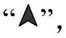 The aircraft nose of the unmanned aerial vehicle displayed near the upper side of the flight guidance compass faces towards a corresponding angle value of 300 degrees, and the indications corresponding to the east-right direction, the west-right direction, the south-right direction and the north-right direction displayed in the edge area of the flight guidance compass respectivelyThe characters are E, W, S and N respectively, 6 angle scale marks are displayed in the edge area of the flight directing compass, the numerical value of the angle corresponding to each scale mark is 33, 3, 6, 12, 15 and 24 respectively according to the clockwise direction, and 33, 3, 6, 12, 15 and 24 are displayed in shorthand form of angles of 330 degrees, 30 degrees, 60 degrees, 120 degrees, 150 degrees and 240 degrees.

In some embodiments, a pan-tilt icon is further displayed on the edge area of the flight guidance compass, the pan-tilt icon is used for representing a pan-tilt of the unmanned aerial vehicle, the position of the pan-tilt icon in the edge area of the flight guidance compass is determined according to the orientation of the Yaw axis of the pan-tilt, the position of the pan-tilt icon in the edge area changes along with the change of the orientation of the Yaw axis of the pan-tilt, when the unmanned aerial vehicle comprises a plurality of pan-tilt platforms, the edge area of the flight guidance compass displays a pan-tilt icon corresponding to each pan-tilt, and the color of each pan-tilt icon is different. The holder icon may be pentagonal, triangular or other shapes. Through show cloud platform icon on the compass is guided in flight for the user can know the orientation of cloud platform and for unmanned aerial vehicle's position, convenience of customers controls unmanned aerial vehicle and unmanned aerial vehicle's cloud platform.
For example, as shown in fig. 11, three pan-tilt icons are displayed in the edge area of the flight guidance compass, and the three displayed pan-tilt icons are respectively
 Pan-tilt icon
 The position on the flight guiding compass deviates 300 degrees from the north direction, and the tripod head icon
 The angle of the position on the flight guidance compass is between 330 degrees and 360 degrees from the north
 The location on the flight director compass is offset from true north by 210.


In some embodiments, the flight guidance compass further displays a return point icon of the drone, the return point icon representing a return point of the drone, the position of the return point icon on the flight guidance compass being determined according to a direction and distance of the return point of the drone relative to the drone; when the distance between the return point of the unmanned aerial vehicle and the unmanned aerial vehicle is less than the preset distance, the return point map is positioned inside the flight guidance compass, and when the distance between the return point of the unmanned aerial vehicle and the unmanned aerial vehicle is greater than or equal to the preset distance, the return point map is positioned inside the edge area of the flight guidance compass; the vicinity of the flight guidance compass also displays a return point icon and a distance of the return point of the drone relative to the drone. The backspace point icon may be set based on actual conditions, which is not specifically limited in this application, for example, the shape of the backspace point icon is a circle, a rectangle, a triangle, or another shape. Through show unmanned aerial vehicle's point mark of returning the flight on the flight guidance compass for the user can know unmanned aerial vehicle and for the direction and the distance of returning the flight point, and the user control unmanned aerial vehicle of being convenient for returns the flight.
In some embodiments, the flight guidance compass further comprises a marker point icon for representing a marked spatial point of the drone, the position of the marker point icon on the flight guidance compass being determined according to the direction and distance of the marked spatial point relative to the drone; when the distance between the marked space point and the unmanned aerial vehicle is smaller than the preset distance, the mark point icon is positioned inside the flight guidance compass, and when the distance between the marked space point and the unmanned aerial vehicle is larger than or equal to the preset distance, the mark point icon is positioned on the inner side of the edge area of the flight guidance compass; the vicinity of the flight guidance compass also displays a marker point icon and a distance of the marked spatial point relative to the drone. The mark point icons can be set based on actual conditions, and are not specifically limited in this application, for example, the mark point icons are rhombus frames, a dotting button is further displayed on the flight guidance page, when a user touches the dotting button, the control terminal controls the unmanned aerial vehicle to mark the space points, the three-dimensional coordinates of the space points are obtained, and the mark point icons of the marked space points are displayed on the flight guidance compass according to the three-dimensional coordinates of the space points. Through show unmanned aerial vehicle's return point map mark on the compass is guided in flight for the user can know unmanned aerial vehicle for the direction and the distance of the space point of mark, and the user control unmanned aerial vehicle of being convenient for flies to the space point of mark.
In some embodiments, the flight guidance compass further comprises a follow icon for representing an object followed by the drone, the position of the follow icon on the flight guidance compass being determined according to the direction and distance of the object followed by the drone relative to the drone; when the distance between the object followed by the unmanned aerial vehicle and the unmanned aerial vehicle is smaller than the preset distance, the following icon is positioned inside the flight guidance compass, and when the distance between the object followed by the unmanned aerial vehicle and the unmanned aerial vehicle is larger than or equal to the preset distance, the following icon is positioned on the inner side of the edge area of the flight guidance compass; the vicinity of the flight guidance compass also displays a marker point icon and a distance of the marked spatial point relative to the drone. The following icon may be set based on actual conditions, which is not specifically limited in the present application, for example, the following icon is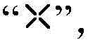 The flight guides the page and still shows there is the object to follow the button, when the user follows the button and carries out the touch-control to this object, objects such as unmanned aerial vehicle automatic identification people's car ship to the focus of adjustment camera, make objects such as people's car ship be located picture central authorities, after the object that the user selection was followed, according to the object of following for unmanned aerial vehicle's direction and distance, show the icon of following on the flight guides the compass.

Illustratively, as shown in fig. 12, the flight guidance compass displays a return point map of the drone therein At the same time, a return point mark is displayed near the lower right side of the flight guiding compass
 And the distance between the return point of the unmanned aerial vehicle and the unmanned aerial vehicle is 10 m; the inner side of the edge area of the flight guiding compass is displayed with a mark point icon
 Meanwhile, a mark point icon is displayed near the left lower side of the flight guide compass
 And
Anddistance 45m of the marked spatial point relative to the drone; the interior of the flight guiding compass is displayed with a following icon While a following icon is displayed near the upper left side of the flight guidance compass
 And the
distance 5m of the following object relative to the drone.


In some embodiments, the flight guidance compass includes an obstacle sensing blind zone and an obstacle sensing zone, the obstacle sensing blind zone and the obstacle sensing zone being different in color, the number of obstacle sensing blind zones being determined according to the number of rotors of the drone. The obstacle perception blind area is a space area where the unmanned aerial vehicle cannot perceive obstacles, the obstacle perception blind areas on the flight guide compass are symmetrically distributed, the obstacle perception blind areas are fan-shaped with preset angles, and the area of the obstacle perception blind areas is larger than that of the obstacle perception blind areas. Through show barrier perception blind area and barrier perception region on the compass is guided in the flight for the user knows barrier perception blind area, improves unmanned aerial vehicle's flight safety.
Illustratively, as shown in fig. 13, the flight guiding compass includes 4 obstacle sensing dead zones and 4 obstacle sensing zones, the color of the obstacle sensing dead zone is gray, the color of the obstacle sensing zone is white, the angle range of the first obstacle sensing dead zone viewed from the head in a clockwise direction is between 330 ° and 360 ° from the due north direction, the angle range of the second obstacle sensing dead zone is between 60 ° and 90 ° from the due north direction, the angle range of the third obstacle sensing dead zone is between 150 ° and 180 ° from the due north direction, and the angle range of the fourth obstacle sensing dead zone is between 240 ° and 270 ° from the due north direction.
In some embodiments, the flight guidance compass displays an obstacle icon for representing an obstacle perceived by the drone when the obstacle is perceived in at least one direction of the drone, the at least one direction of the drone including at least one of a front, a rear, a left, and a rear of the drone, the obstacle icon being determined at the flight guidance compass location based on the perceived direction of the obstacle relative to the drone. Through show obstacle icon on the compass is guided in flight for the user can know the obstacle and be equivalent to unmanned aerial vehicle's position, and the user of being convenient for is timely controls unmanned aerial vehicle and avoids the obstacle, guarantees unmanned aerial vehicle's flight safety.
In some embodiments, the shape of the obstacle icon is determined according to the shape of the perceived obstacle, or the shape of the obstacle icon is determined according to the distance between the perceived obstacle and the unmanned aerial vehicle, specifically, the distance between the perceived obstacle and the unmanned aerial vehicle is greater than or equal to a preset distance, the shape of the obstacle icon is an arc line segment, and when the distance between the perceived obstacle and the unmanned aerial vehicle is less than the preset distance, the shape of the obstacle icon is a quadrangle or a pentagon; the colour and/or size of the obstacle icon is determined from the distance between the perceived obstacle and the drone. Through showing obstacle picture marks of different shapes, colors and/or sizes, the user can know the distance change situation between unmanned aerial vehicle and the obstacle, and the user timely control unmanned aerial vehicle of being convenient for avoids the obstacle, guarantees unmanned aerial vehicle's flight safety.
The closer the perceived distance between the obstacle and the drone, the larger the obstacle icon, and the further the perceived distance between the obstacle and the drone, the smaller the obstacle icon is, when the distance between the perceived obstacle and the unmanned aerial vehicle is greater than the preset warning distance, the color of the obstacle icon is green, when the distance between the sensed obstacle and the unmanned aerial vehicle is smaller than or equal to the preset warning distance, the color of the obstacle icon is yellow, when the sensed distance between the obstacle and the unmanned aerial vehicle is smaller than or equal to the preset stopping distance, the color of the obstacle icon is red, the preset alarm distance is greater than the preset brake distance, the preset alarm distance and the preset brake distance can be set by a user, and the method is not specifically limited to this, for example, the preset alarm distance is 10m, and the preset brake distance is 4 m.
In some embodiments, when the distance between the sensed obstacle and the unmanned aerial vehicle is less than or equal to the preset warning distance, the obstacle icon flashes at intervals of a preset duration and/or broadcasts an alarm prompt tone to remind the user to avoid the obstacle, specifically, when the distance between the sensed obstacle and the unmanned aerial vehicle is smaller than or equal to the preset warning distance, the color of the obstacle icon is yellow, meanwhile, the yellow obstacle icon flickers at preset time intervals, and broadcasts a first warning prompt tone, when the sensed distance between the obstacle and the unmanned aerial vehicle is smaller than or equal to the preset stopping distance, the color of the obstacle icon is red, and meanwhile, the red obstacle icon flickers at intervals for a preset time length, and broadcasts a second warning prompt tone, wherein the first warning prompt tone is different from the second warning prompt tone, and the second warning prompt tone is denser and more urgent than the first warning prompt tone.
In some embodiments, when an obstacle is sensed in at least one of the front, rear, left, and rear directions of the drone, an obstacle icon is displayed on the flight director compass, if the distance between the sensed obstacle and the unmanned aerial vehicle is greater than the preset warning distance and the preset warning distance is greater than the preset distance, the obstacle is marked as a green arc line segment, if the distance between the sensed obstacle and the unmanned aerial vehicle is smaller than or equal to the preset warning distance, the obstacle is marked as a yellow arc line segment, and the yellow arc line segments flash at intervals of preset duration, and simultaneously broadcast a first warning prompt tone, if the distance between the sensed obstacle and the unmanned aerial vehicle is smaller than or equal to the preset brake-stop distance, the obstacle graph is marked as a red arc line segment, and the red arc line segment flickers at intervals of preset duration, and simultaneously broadcasts a second alarm prompt tone.
If the distance between the perceived obstacle and the unmanned aerial vehicle is greater than the preset warning distance, and the preset warning distance is smaller than the preset distance, the obstacle icon is a green frame, if the distance between the perceived obstacle and the unmanned aerial vehicle is smaller than or equal to the preset warning distance, the obstacle icon is a yellow frame, the yellow frame flickers at intervals for preset time, and a first warning prompt tone is broadcast at the same time, if the distance between the perceived obstacle and the unmanned aerial vehicle is smaller than or equal to the preset stopping distance, the obstacle icon is a red frame, the red frame flickers at intervals for preset time, and a second warning prompt tone is broadcast at the same time.
Illustratively, as shown in fig. 14, the flight guidance compass displays two obstacle icons, and when viewed from the head in a clockwise direction, the first obstacle icon is located in a position area deviated from the due north direction by 60 °, the first obstacle icon is an arc line segment, the second obstacle icon is located in a position area deviated from the due north direction by 180 °, and the second obstacle icon is a quadrangle.
In some embodiments, a picture switching instruction triggered by a user is acquired, and a background picture of the flight guidance page is switched from a current picture to a picture corresponding to the picture switching instruction according to the picture switching instruction. For example, the background frame of the flight guidance page is switched from the fpv (first PERSON view) frame to the main shot frame according to the frame switching instruction. The flight guidance page comprises a flight guidance page and a control terminal, wherein the flight guidance page is provided with a main shot picture transmission picture, the main shot picture transmission picture is displayed on the lower right corner of the flight guidance page in a small window mode, when a user touches the main shot picture transmission picture displayed in the small window mode, a picture switching instruction is triggered, so that the control terminal switches a background picture of the flight guidance page from an FPV picture transmission picture to the main shot picture transmission picture, and the FPV picture transmission picture is displayed on the lower right corner of the flight guidance page in the small window mode.
The left display area of the flight guidance compass in the flight guidance page after the background picture is switched displays the current flight speed of the unmanned aerial vehicle and the wind speed and the wind direction of the environment where the unmanned aerial vehicle is located, the right display area of the flight guidance compass displays the height of the unmanned aerial vehicle relative to a return point, the current absolute height and the vertical speed of the unmanned aerial vehicle, the vertical speed is any one of the climbing speed and the descending speed, and the speed indication bar and the height indication bar are not displayed. After the background picture of the page is switched to other pictures through being guided in flight, the flight speed and the relative altitude of the unmanned aerial vehicle are displayed in the display areas on the two sides of the flight guide compass, the speed indication strip and the altitude indication strip are not displayed, the situation that the speed indication strip and the altitude indication strip shield the picture can be avoided, and the unmanned aerial vehicle is inconvenient to control by a user.
In some embodiments, when an obstacle is sensed above and/or below the drone, the right display area of the flight guidance compass further displays an obstacle indicator bar for indicating a distance between the drone and the obstacle, and the right display area of the flight guidance compass further displays a flight distance indicator line for indicating a flight distance of the drone in a vertical direction, and a length of the flight distance indicator line is determined according to a vertical speed of the drone and a preset time. Through showing barrier instruction strip and flight distance instruction line on the right side of flight guide compass, the user of being convenient for distinguishes barrier instruction strip and flight distance instruction line for the user can confirm whether safe of unmanned aerial vehicle according to flight distance instruction line and barrier instruction strip, and convenience of customers controls unmanned aerial vehicle in time and avoids the barrier, guarantees unmanned aerial vehicle's flight safety.
Illustratively, as shown in fig. 15, the current flying speed of the drone is displayed in the left display area of the flight guidance compass05.2m/s, the wind speed shown is 04.0m/s, and the wind direction shown is The current relative height of the unmanned aerial vehicle displayed in the right display area of the flight guidance compass is 120m, the current absolute height is 1234.5m, the vertical speed is 2.5m/s, the right display area of the flight guidance compass is also displayed with a bar for indicating obstacles, and the upper end and the lower end of the bar for indicating obstacles are both displayed with obstacle marks
 The distance between the top barrier that near upper end shows and the unmanned aerial vehicle is 20.8m, the distance between the below barrier that near lower extreme shows and the unmanned aerial vehicle is 5m, this barrier instruction strip comprises top barrier instruction strip and below barrier instruction strip, the line of intersection of top barrier instruction strip and below barrier instruction strip aligns with the straight line that unmanned aerial vehicle's current relative altitude corresponds, this barrier instruction strip's right side shows has flying distance instruction line "|", and the lower extreme of flying distance instruction line aligns with the straight line that unmanned aerial vehicle's current relative altitude corresponds.


In some embodiments, the flight guidance page further includes a status indication bar, a positioning module identifier, a map transmission identifier, an obstacle avoidance module identifier, a control terminal connection identifier, a network identifier and a battery identifier are displayed in the status indication bar, the positioning module identifier is used for indicating the type of a positioning module used by the unmanned aerial vehicle and the working condition of the positioning module, the map transmission identifier is used for indicating the map transmission condition between the unmanned aerial vehicle and the control terminal, the obstacle avoidance module identifier is used for indicating the working condition of an obstacle avoidance module of the unmanned aerial vehicle, the control terminal connection identifier is used for indicating the communication connection condition between the unmanned aerial vehicle and the control terminal, the network identifier is used for indicating the network condition of the control terminal, the battery identifier is used for indicating the electric quantity, the voltage and the working condition of a battery of the unmanned aerial vehicle, the positioning module identifier, the map transmission identifier, the obstacle avoidance module, The network identifier and the battery identifier may be set based on actual conditions, which is not specifically limited in this application.
Exemplarily, as shown in fig. 16, the status indication bar is displayed in the top area of the flight guidance page, the positioning module identifier displayed by the status indication bar, the image transmission identifier, the obstacle avoidance module identifier, the control terminal connection identifier, the network identifier and the battery identifier can be known, the unmanned aerial vehicle is positioned by using the GPS positioning module, the image transmission between the unmanned aerial vehicle and the control terminal is normal, the obstacle avoidance module normally works, the communication connection between the unmanned aerial vehicle and the control terminal is normal, the network of the control terminal is good, the electric quantities of the two batteries of the unmanned aerial vehicle are 80% and 100%, and the working voltages of the two batteries are 20.7v and 26.1v, respectively. In addition, the abnormal state and the normal state of the battery can be identified by preset different color marks.
According to the flight guidance method provided by the embodiment, the flight guidance page is displayed at the control terminal, then the operation of the user on the control terminal is obtained, and the motion vector icon used for representing the flight direction and the flight power of the unmanned aerial vehicle is generated on the flight guidance page according to the operation of the user on the control terminal, so that the user can know the flight direction and the flight power of the unmanned aerial vehicle based on the motion vector icon, the user can control the unmanned aerial vehicle to fly conveniently, and the flight safety of the unmanned aerial vehicle is ensured.
Referring to fig. 17, fig. 17 is a schematic block diagram of a control terminal according to an embodiment of the present application. In one embodiment, the control terminal includes, but is not limited to, a remote controller, a ground control platform, a mobile phone, a tablet computer, a notebook computer, a PC computer, and the like. Further, thecontrol terminal 300 includes aprocessor 301, amemory 302 and adisplay device 303, and theprocessor 301, thememory 302 and thedisplay device 303 are connected by abus 304, such as an I2C (Inter-integrated Circuit)bus 304. Thedisplay device 303 may be a liquid crystal display, a touch screen, or an external display device, such as a mobile phone and a tablet computer.
In some embodiments, thecontrol terminal 300 includes a carrying platform for carrying a display device, and a user may mount the display device on the carrying platform and establish a communication connection between the control terminal and the display device so that the display device can display a flight guidance page.
Specifically,control terminal 300 and a unmanned aerial vehicle communication connection, unmanned aerial vehicle include obstacle perception device, and obstacle perception device is used for acquireing the sensing signal around the unmanned aerial vehicle, through carrying out the analysis to the sensing signal, can obtain obstacle information to show obstacle information on this flight guide page, make the user can know the obstacle that unmanned aerial vehicle perceived, the user control unmanned aerial vehicle of being convenient for avoids the obstacle.
In some embodiments, the obstacle sensing arrangement may comprise at least one sensor for acquiring a sensing signal from the drone in at least one direction. For example, the obstacle sensing device may comprise a sensor for detecting an obstacle in front of the drone. For example, the obstacle sensing device may comprise two sensors for detecting obstacles in front of and behind the drone, respectively. For example, the obstacle sensing device may include four sensors for detecting obstacles in front of, behind, to the left of, and to the right of the drone, respectively. For example, the obstacle sensing device may include five sensors for detecting obstacles in front of, behind, to the left of, to the right of, and above the drone. For example, the obstacle sensing device may include six sensors for detecting obstacles in front of, behind, to the left, to the right, above, and below the drone, respectively. The sensors in the obstacle sensing device may be implemented separately or integrally. The detection direction of the sensor can be set according to specific needs to detect obstacles in various directions or direction combinations, and is not limited to the form disclosed in the present application.
Specifically, theProcessor 301 may be a Micro-controller Unit (MCU), a Central Processing Unit (CPU), a Digital Signal Processor (DSP), or the like.
Specifically, theMemory 302 may be a Flash chip, a Read-Only Memory (ROM) magnetic disk, an optical disk, a usb disk, or a removable hard disk.
Wherein theprocessor 301 is configured to run a computer program stored in thememory 302, and when executing the computer program, implement the following steps:
displaying a flight guidance page through the display device;
acquiring the operation of a user on the control terminal, wherein the operation is used for generating a control command to control the unmanned aerial vehicle;
generating a motion vector icon on the flight guidance page according to the operation, wherein the motion vector icon is used for representing the flight direction and the flight power of the unmanned aerial vehicle.
Optionally, the processor is configured to implement, when generating a motion vector icon on the flight guidance page according to the operation, to implement:
acquiring the current attitude of the unmanned aerial vehicle and measurement data of the IMU;
and generating a motion vector icon on the flight guidance page according to the operation, the current attitude and the measurement data of the IMU.
Optionally, the motion vector icon includes a plurality of line segments and a circular icon, and each line segment is connected to the circular icon.
Optionally, the flight guidance page further includes a nose icon of the drone, and a connection line is displayed between the nose icon and the motion vector icon, and the connection line is used for representing flight power of the drone.
Optionally, the position of the motion vector icon is used to represent the flight direction of the drone.
Optionally, the operation is a striking rod operation, and the length of the connecting line is determined according to a striking rod amount of the striking rod operation.
Optionally, the length of the connecting line is positively correlated with the striking amount of the striking rod operation.
Optionally, the flight guidance page further comprises a pose indication line of the drone, the pose indication line being used to represent a current pose of the drone.
Optionally, the attitude indicator line varies with a change in attitude of the drone.
Optionally, the attitude indicator line is a sea horizon or a ground horizon, the movement of the attitude indicator line in the up-down direction in the flight guide page indicates that the pitch angle of the unmanned aerial vehicle changes, and the left-right inclination of the attitude indicator line indicates that the roll angle of the unmanned aerial vehicle changes.
Optionally, the attitude indicator line moving upwards indicates that the pitch angle of the drone is a pitch angle, and the drone tilts downwards;
the gesture indicating line moves downwards to indicate that the pitch angle of the unmanned aerial vehicle is an elevation angle, and the unmanned aerial vehicle tilts upwards;
the gesture indicating line inclines to the left to indicate that the roll angle of the unmanned aerial vehicle is a right roll angle, and the unmanned aerial vehicle inclines to the right;
the gesture indicating line inclines to the right and shows that unmanned aerial vehicle's roll angle is left roll angle, unmanned aerial vehicle inclines to the left.
Optionally, the flight guidance page further includes a current picture of a camera of the drone.
Optionally, the flight guidance page further includes a return point, a current flying speed, a current relative altitude, and a current absolute altitude of the drone, where the current relative altitude is an altitude of the drone at the current position relative to the return point.
Optionally, the flight guidance page further includes a speed indication bar and a height indication bar, the speed indication bar is used for indicating the flight speed of the unmanned aerial vehicle, the height indication bar is used for indicating the height of the unmanned aerial vehicle, the current flight speed is displayed on the speed indication bar, and the current relative height is displayed on the height indication bar.
Optionally, the speed indication bar displays a plurality of speed scale lines and a flight speed corresponding to each of the speed scale lines, the height indication bar displays a plurality of height scale lines and a relative height corresponding to each of the height scale lines, and the relative height is a height of the unmanned aerial vehicle relative to a return point.
Optionally, the flight guidance page further includes a vertical speed of the drone, a wind speed and a wind direction of an environment in which the drone is located, wherein the vertical speed includes a climbing speed or a descending speed.
Optionally, the wind speed and wind direction of the environment where the unmanned aerial vehicle is located are displayed in the display area below the speed indicator bar, and the vertical speed of the unmanned aerial vehicle is displayed in the display area below the height indicator bar.
Optionally, when an obstacle is sensed above and/or below the drone, the flight indication page further includes an obstacle indicator bar for indicating a distance between the drone and the obstacle.
Optionally, the length of the obstacle indicator strip varies with the distance between the drone and the obstacle.
Optionally, the distance between the drone and the obstacle is determined from an image sensor, a radar, and/or a ranging sensor of the drone.
Optionally, when the distance between the unmanned aerial vehicle and the obstacle is greater than or equal to a first preset distance, the obstacle indicator strip includes a first line segment, a second line segment, and a third line segment, and the first line segment, the second line segment, and the third line segment are different in color.
Optionally, when the distance between the unmanned aerial vehicle and the obstacle is smaller than a first preset distance and is greater than or equal to a second preset distance, the obstacle indicator strip includes a first line segment and a second line segment.
Optionally, the distance between unmanned aerial vehicle and the barrier is less than first preset distance, and when being greater than second preset distance, reports first preset warning sound, first preset warning sound is used for reminding the user unmanned aerial vehicle is in keeps away the barrier and reports an emergency and asks for help or increased vigilance within range.
Optionally, when the distance between the unmanned aerial vehicle and the obstacle is smaller than a second preset distance and is greater than or equal to a third preset distance, the obstacle indicator strip includes a first line segment.
Optionally, distance between unmanned aerial vehicle and the barrier is less than the second and predetermines the distance, and when being greater than or equal to the third predetermines the distance, report the second and predetermine the sound of reporting an emergency and asking for help or increased vigilance, the second is predetermine the sound of reporting an emergency and asking for help or increased vigilance and is used for reminding the user unmanned aerial vehicle is in and keeps away the barrier braking within range.
Optionally, when the distance between the unmanned aerial vehicle and the obstacle reaches a fourth preset distance, the unmanned aerial vehicle is controlled to brake, wherein the third preset distance is greater than the fourth preset distance.
Optionally, the flight indication page further includes a flight distance indication line of the unmanned aerial vehicle, and the flight distance indication line is used for indicating a flight distance of the unmanned aerial vehicle in a vertical direction.
Optionally, the length of the flight distance indicator line is determined according to a vertical speed of the drone and a preset time, wherein the vertical speed includes a climbing speed or a descending speed.
Optionally, the obstacle indicator strip is displayed adjacent to the flight distance indicator line, so that a user can determine whether the unmanned aerial vehicle is safe according to the adjacently displayed obstacle indicator strip and the flight distance indicator line.
Optionally, the obstacle indicator strip and the flight distance indicator line are different in color.
Optionally, the flight indication page further comprises a height indication bar, and the obstacle indication bar and the flight distance indication line are displayed on the height indication bar.
Optionally, the flight guidance page further comprises a flight guidance compass for representing a spatial area around the drone by a preset distance.
Optionally, an angle value corresponding to the head orientation of the drone is displayed near the flight directing compass, and the displayed angle value is used for indicating the head orientation of the drone, wherein the angle value is an angle of the head orientation of the drone relative to a north, south, west, or east direction.
Optionally, the flight guidance compass rotates as the drone rotates.
Optionally, a drone icon is displayed in a central area of the flight guidance compass, the drone icon representing the drone, the drone icon not rotating with the rotation of the drone.
Optionally, the drone icon is an arrow icon, the arrow icon points above the flight guidance page, and the arrow icon is oriented in the same direction as the head of the drone.
Optionally, a speed indication line of the unmanned aerial vehicle is further displayed in a central area of the flight guidance compass, the speed indication line intersects with the unmanned aerial vehicle icon, and the speed indication line is used for indicating the flight speed and the flight direction of the unmanned aerial vehicle.
Optionally, the orientation of the speed indication line varies with the direction of flight of the drone.
Optionally, the length of the speed indication line varies with the flight speed of the drone.
Optionally, an edge region of the flight guidance compass displays indication characters corresponding to a true east direction, a true west direction, a true south direction, and a true north direction.
Optionally, a pan-tilt icon is further displayed in an edge region of the flight directing compass, the pan-tilt icon is used for representing a pan-tilt of the unmanned aerial vehicle, and a position of the pan-tilt icon in the edge region is determined according to an orientation of a Yaw axis of the pan-tilt.
Optionally, when the unmanned aerial vehicle includes a plurality of cloud platforms, the edge area of the flight guidance compass displays a cloud platform icon corresponding to each cloud platform, and the color of each cloud platform icon is different.
Optionally, the position of the pan-tilt icon in the edge region changes with the change of the orientation of the Yaw axis of the pan-tilt.
Optionally, a plurality of angle calibration lines and an angle numerical value corresponding to each angle calibration line are further displayed in an edge region of the flight directing compass.
Optionally, the flight guidance compass displays a back-navigation point icon of the drone, the back-navigation point icon is used for representing a back-navigation point of the drone, and the position of the back-navigation point icon on the flight guidance compass is determined according to the direction and distance of the back-navigation point of the drone relative to the drone.
Optionally, when the distance of the return point of the unmanned aerial vehicle relative to the unmanned aerial vehicle is less than the preset distance, the return point icon is located inside the flight guidance compass, and when the distance of the return point of the unmanned aerial vehicle relative to the unmanned aerial vehicle is greater than or equal to the preset distance, the return point icon is located inside an edge area of the flight guidance compass.
Optionally, the flight guidance compass further comprises a marker point icon for representing a marked spatial point of the drone, and the position of the marker point icon on the flight guidance compass is determined according to the direction and distance of the marked spatial point relative to the drone.
Optionally, the distance of the marked space point relative to the unmanned aerial vehicle and the mark point icon are also displayed in the vicinity of the flight guidance compass.
Optionally, the flight guidance compass further comprises a following icon for representing an object followed by the drone, the position of the following icon on the flight guidance compass being determined according to the direction and distance of the object followed by the drone relative to the drone.
Optionally, a distance of an object followed by the drone relative to the drone and the follow icon are also displayed in the vicinity of the flight director compass.
Optionally, when an obstacle is sensed in at least one direction of the drone, the flight directing compass displays an obstacle icon representing the obstacle sensed by the drone.
Optionally, the at least one direction of the drone includes at least one of a front, a rear, a left, and a rear of the drone.
Optionally, the location of the obstacle icon on the flight guidance compass is determined according to the direction of the perceived obstacle relative to the drone.
Optionally, the shape of the obstacle icon is determined from the shape of the perceived obstacle.
Optionally, the shape of the obstacle icon is determined according to a distance between a perceived obstacle and the drone.
Optionally, the colour and/or size of the obstacle icon is determined from the distance between the perceived obstacle and the drone.
Optionally, when the distance between the perceived obstacle and the unmanned aerial vehicle is smaller than or equal to a preset warning distance, the obstacle icon flashes at intervals for a preset time, and/or a warning prompt tone is broadcasted to remind the user of avoiding the obstacle.
Optionally, the flight guidance compass includes an obstacle sensing blind area and an obstacle sensing area, and the obstacle sensing blind area and the obstacle sensing area are different in color.
Optionally, the number of obstacle sensing blind zones is determined from the number of rotors of the drone.
Optionally, the processor is further configured to implement the following steps:
acquiring a picture switching instruction triggered by a user, and switching a background picture of the flight guidance page from a current picture to a picture corresponding to the picture switching instruction;
the current flight speed of the unmanned aerial vehicle and the wind speed and the wind direction of the environment where the unmanned aerial vehicle is located are displayed in a left display area of the flight guidance compass in the flight guidance page after the background picture is switched, the height of the unmanned aerial vehicle relative to a return point, the current absolute height of the unmanned aerial vehicle and the vertical speed are displayed in a right display area of the flight guidance compass, and the vertical speed is any one of climbing speed and descending speed.
Optionally, when an obstacle is sensed above and/or below the drone, an obstacle indicator bar is further displayed on the right display area of the flight guidance compass, and the obstacle indicator bar is used for indicating the distance between the drone and the obstacle.
Optionally, a flying distance indicating line is further displayed in a right display area of the flying guide compass, the flying distance indicating line is used for indicating the flying distance of the unmanned aerial vehicle in the vertical direction, and the length of the flying distance indicating line is determined according to the vertical speed of the unmanned aerial vehicle and the preset time.
It should be noted that, as will be clearly understood by those skilled in the art, for convenience and brevity of description, the specific working process of the control terminal described above may refer to the corresponding process in the foregoing embodiment of the flight guidance method, and is not described herein again.
Referring to fig. 18, fig. 18 is a schematic block diagram of a flight directing apparatus according to an embodiment of the present application.
As shown in fig. 18, theflight directing apparatus 400 includes aprocessor 401 and amemory 402, and theprocessor 401 and thememory 402 are connected by abus 403, such as an I2C (Inter-integrated Circuit)bus 403. Theflight guidance device 400 is applied to a control terminal, which communicates with an unmanned machine.
In some embodiments, the control terminal includes a display device, the display device may be a liquid crystal display or a touch panel, or the control terminal includes a bearing platform, the bearing platform is used for bearing the display device, and the user may install the display device on the bearing platform and establish a communication connection between the control terminal and the display device.
In some embodiments, unmanned aerial vehicle includes obstacle perception device, and obstacle perception device is used for acquireing the sensing signal around the unmanned aerial vehicle, through carrying out the analysis to the sensing signal, can obtain obstacle information to show obstacle information on this flight guide page, make the user can know the obstacle that unmanned aerial vehicle perceived, the user control unmanned aerial vehicle of being convenient for avoids the obstacle.
In some embodiments, the obstacle sensing arrangement may comprise at least one sensor for acquiring a sensing signal from the drone in at least one direction. For example, the obstacle sensing device may comprise a sensor for detecting an obstacle in front of the drone. For example, the obstacle sensing device may comprise two sensors for detecting obstacles in front of and behind the drone, respectively. For example, the obstacle sensing device may include four sensors for detecting obstacles in front of, behind, to the left of, and to the right of the drone, respectively. For example, the obstacle sensing device may include five sensors for detecting obstacles in front of, behind, to the left of, to the right of, and above the drone. For example, the obstacle sensing device may include six sensors for detecting obstacles in front of, behind, to the left, to the right, above, and below the drone, respectively. The sensors in the obstacle sensing device may be implemented separately or integrally. The detection direction of the sensor can be set according to specific needs to detect obstacles in various directions or direction combinations, and is not limited to the form disclosed in the present application.
Specifically, theProcessor 401 may be a Micro-controller Unit (MCU), a Central Processing Unit (CPU), a Digital Signal Processor (DSP), or the like.
Specifically, theMemory 402 may be a Flash chip, a Read-Only Memory (ROM) magnetic disk, an optical disk, a usb disk, or a removable hard disk.
Wherein theprocessor 401 is configured to run a computer program stored in thememory 402, and when executing the computer program, implement the following steps:
controlling the control terminal to display a flight guidance page;
acquiring the operation of a user on the control terminal, wherein the operation is used for generating a control command to control the unmanned aerial vehicle;
generating a motion vector icon on the flight guidance page according to the operation, wherein the motion vector icon is used for representing the flight direction and the flight power of the unmanned aerial vehicle.
Optionally, the processor is configured to implement, when generating a motion vector icon on the flight guidance page according to the operation, to implement:
acquiring the current attitude of the unmanned aerial vehicle and measurement data of the IMU;
and generating a motion vector icon on the flight guidance page according to the operation, the current attitude and the measurement data of the IMU.
Optionally, the motion vector icon includes a plurality of line segments and a circular icon, and each line segment is connected to the circular icon.
Optionally, the flight guidance page further includes a nose icon of the drone, and a connection line is displayed between the nose icon and the motion vector icon, and the connection line is used for representing flight power of the drone.
Optionally, the position of the motion vector icon is used to represent the flight direction of the drone.
Optionally, the operation is a striking rod operation, and the length of the connecting line is determined according to a striking rod amount of the striking rod operation.
Optionally, the length of the connecting line is positively correlated with the striking amount of the striking rod operation.
Optionally, the flight guidance page further comprises a pose indication line of the drone, the pose indication line being used to represent a current pose of the drone.
Optionally, the attitude indicator line varies with a change in attitude of the drone.
Optionally, the attitude indicator line is a sea horizon or a ground horizon, the movement of the attitude indicator line in the up-down direction in the flight guide page indicates that the pitch angle of the unmanned aerial vehicle changes, and the left-right inclination of the attitude indicator line indicates that the roll angle of the unmanned aerial vehicle changes.
Optionally, the attitude indicator line moving upwards indicates that the pitch angle of the drone is a pitch angle, and the drone tilts downwards;
the gesture indicating line moves downwards to indicate that the pitch angle of the unmanned aerial vehicle is an elevation angle, and the unmanned aerial vehicle tilts upwards;
the gesture indicating line inclines to the left to indicate that the roll angle of the unmanned aerial vehicle is a right roll angle, and the unmanned aerial vehicle inclines to the right;
the gesture indicating line inclines to the right and shows that unmanned aerial vehicle's roll angle is left roll angle, unmanned aerial vehicle inclines to the left.
Optionally, the flight guidance page further includes a current picture of a camera of the drone.
Optionally, the flight guidance page further includes a return point, a current flying speed, a current relative altitude, and a current absolute altitude of the drone, where the current relative altitude is an altitude of the drone at the current position relative to the return point.
Optionally, the flight guidance page further includes a speed indication bar and a height indication bar, the speed indication bar is used for indicating the flight speed of the unmanned aerial vehicle, the height indication bar is used for indicating the height of the unmanned aerial vehicle, the current flight speed is displayed on the speed indication bar, and the current relative height is displayed on the height indication bar.
Optionally, the speed indication bar displays a plurality of speed scale lines and a flight speed corresponding to each of the speed scale lines, the height indication bar displays a plurality of height scale lines and a relative height corresponding to each of the height scale lines, and the relative height is a height of the unmanned aerial vehicle relative to a return point.
Optionally, the flight guidance page further includes a vertical speed of the drone, a wind speed and a wind direction of an environment in which the drone is located, wherein the vertical speed includes a climbing speed or a descending speed.
Optionally, the wind speed and wind direction of the environment where the unmanned aerial vehicle is located are displayed in the display area below the speed indicator bar, and the vertical speed of the unmanned aerial vehicle is displayed in the display area below the height indicator bar.
Optionally, when an obstacle is sensed above and/or below the drone, the flight indication page further includes an obstacle indicator bar for indicating a distance between the drone and the obstacle.
Optionally, the length of the obstacle indicator strip varies with the distance between the drone and the obstacle.
Optionally, the distance between the drone and the obstacle is determined from an image sensor, a radar, and/or a ranging sensor of the drone.
Optionally, when the distance between the unmanned aerial vehicle and the obstacle is greater than or equal to a first preset distance, the obstacle indicator strip includes a first line segment, a second line segment, and a third line segment, and the first line segment, the second line segment, and the third line segment are different in color.
Optionally, when the distance between the unmanned aerial vehicle and the obstacle is smaller than a first preset distance and is greater than or equal to a second preset distance, the obstacle indicator strip includes a first line segment and a second line segment.
Optionally, the distance between unmanned aerial vehicle and the barrier is less than first preset distance, and when being greater than second preset distance, reports first preset warning sound, first preset warning sound is used for reminding the user unmanned aerial vehicle is in keeps away the barrier and reports an emergency and asks for help or increased vigilance within range.
Optionally, when the distance between the unmanned aerial vehicle and the obstacle is smaller than a second preset distance and is greater than or equal to a third preset distance, the obstacle indicator strip includes a first line segment.
Optionally, distance between unmanned aerial vehicle and the barrier is less than the second and predetermines the distance, and when being greater than or equal to the third predetermines the distance, report the second and predetermine the sound of reporting an emergency and asking for help or increased vigilance, the second is predetermine the sound of reporting an emergency and asking for help or increased vigilance and is used for reminding the user unmanned aerial vehicle is in and keeps away the barrier braking within range.
Optionally, when the distance between the unmanned aerial vehicle and the obstacle reaches a fourth preset distance, the unmanned aerial vehicle is controlled to brake, wherein the third preset distance is greater than the fourth preset distance.
Optionally, the flight indication page further includes a flight distance indication line of the unmanned aerial vehicle, and the flight distance indication line is used for indicating a flight distance of the unmanned aerial vehicle in a vertical direction.
Optionally, the length of the flight distance indicator line is determined according to a vertical speed of the drone and a preset time, wherein the vertical speed includes a climbing speed or a descending speed.
Optionally, the obstacle indicator strip is displayed adjacent to the flight distance indicator line, so that a user can determine whether the unmanned aerial vehicle is safe according to the adjacently displayed obstacle indicator strip and the flight distance indicator line.
Optionally, the obstacle indicator strip and the flight distance indicator line are different in color.
Optionally, the flight indication page further comprises a height indication bar, and the obstacle indication bar and the flight distance indication line are displayed on the height indication bar.
Optionally, the flight guidance page further comprises a flight guidance compass for representing a spatial area around the drone by a preset distance.
Optionally, an angle value corresponding to the head orientation of the drone is displayed near the flight directing compass, and the displayed angle value is used for indicating the head orientation of the drone, wherein the angle value is an angle of the head orientation of the drone relative to a north, south, west, or east direction.
Optionally, the flight guidance compass rotates as the drone rotates.
Optionally, a drone icon is displayed in a central area of the flight guidance compass, the drone icon representing the drone, the drone icon not rotating with the rotation of the drone.
Optionally, the drone icon is an arrow icon, the arrow icon points above the flight guidance page, and the arrow icon is oriented in the same direction as the head of the drone.
Optionally, a speed indication line of the unmanned aerial vehicle is further displayed in a central area of the flight guidance compass, the speed indication line intersects with the unmanned aerial vehicle icon, and the speed indication line is used for indicating the flight speed and the flight direction of the unmanned aerial vehicle.
Optionally, the orientation of the speed indication line varies with the direction of flight of the drone.
Optionally, the length of the speed indication line varies with the flight speed of the drone.
Optionally, an edge region of the flight guidance compass displays indication characters corresponding to a true east direction, a true west direction, a true south direction, and a true north direction.
Optionally, a pan-tilt icon is further displayed in an edge region of the flight directing compass, the pan-tilt icon is used for representing a pan-tilt of the unmanned aerial vehicle, and a position of the pan-tilt icon in the edge region is determined according to an orientation of a Yaw axis of the pan-tilt.
Optionally, when the unmanned aerial vehicle includes a plurality of cloud platforms, the edge area of the flight guidance compass displays a cloud platform icon corresponding to each cloud platform, and the color of each cloud platform icon is different.
Optionally, the position of the pan-tilt icon in the edge region changes with the change of the orientation of the Yaw axis of the pan-tilt.
Optionally, a plurality of angle calibration lines and an angle numerical value corresponding to each angle calibration line are further displayed in an edge region of the flight directing compass.
Optionally, the flight guidance compass displays a back-navigation point icon of the drone, the back-navigation point icon is used for representing a back-navigation point of the drone, and the position of the back-navigation point icon on the flight guidance compass is determined according to the direction and distance of the back-navigation point of the drone relative to the drone.
Optionally, when the distance of the return point of the unmanned aerial vehicle relative to the unmanned aerial vehicle is less than the preset distance, the return point icon is located inside the flight guidance compass, and when the distance of the return point of the unmanned aerial vehicle relative to the unmanned aerial vehicle is greater than or equal to the preset distance, the return point icon is located inside an edge area of the flight guidance compass.
Optionally, the flight guidance compass further comprises a marker point icon for representing a marked spatial point of the drone, and the position of the marker point icon on the flight guidance compass is determined according to the direction and distance of the marked spatial point relative to the drone.
Optionally, the distance of the marked space point relative to the unmanned aerial vehicle and the mark point icon are also displayed in the vicinity of the flight guidance compass.
Optionally, the flight guidance compass further comprises a following icon for representing an object followed by the drone, the position of the following icon on the flight guidance compass being determined according to the direction and distance of the object followed by the drone relative to the drone.
Optionally, a distance of an object followed by the drone relative to the drone and the follow icon are also displayed in the vicinity of the flight director compass.
Optionally, when an obstacle is sensed in at least one direction of the drone, the flight directing compass displays an obstacle icon representing the obstacle sensed by the drone.
Optionally, the at least one direction of the drone includes at least one of a front, a rear, a left, and a rear of the drone.
Optionally, the location of the obstacle icon on the flight guidance compass is determined according to the direction of the perceived obstacle relative to the drone.
Optionally, the shape of the obstacle icon is determined from the shape of the perceived obstacle.
Optionally, the shape of the obstacle icon is determined according to a distance between a perceived obstacle and the drone.
Optionally, the colour and/or size of the obstacle icon is determined from the distance between the perceived obstacle and the drone.
Optionally, when the distance between the perceived obstacle and the unmanned aerial vehicle is smaller than or equal to a preset warning distance, the obstacle icon flashes at intervals for a preset time, and/or a warning prompt tone is broadcasted to remind the user of avoiding the obstacle.
Optionally, the flight guidance compass includes an obstacle sensing blind area and an obstacle sensing area, and the obstacle sensing blind area and the obstacle sensing area are different in color.
Optionally, the number of obstacle sensing blind zones is determined from the number of rotors of the drone.
Optionally, the processor is further configured to implement the following steps:
acquiring a picture switching instruction triggered by a user, and switching a background picture of the flight guidance page from a current picture to a picture corresponding to the picture switching instruction;
the current flight speed of the unmanned aerial vehicle and the wind speed and the wind direction of the environment where the unmanned aerial vehicle is located are displayed in a left display area of the flight guidance compass in the flight guidance page after the background picture is switched, the height of the unmanned aerial vehicle relative to a return point, the current absolute height of the unmanned aerial vehicle and the vertical speed are displayed in a right display area of the flight guidance compass, and the vertical speed is any one of climbing speed and descending speed.
Optionally, when an obstacle is sensed above and/or below the drone, an obstacle indicator bar is further displayed on the right display area of the flight guidance compass, and the obstacle indicator bar is used for indicating the distance between the drone and the obstacle.
Optionally, a flying distance indicating line is further displayed in a right display area of the flying guide compass, the flying distance indicating line is used for indicating the flying distance of the unmanned aerial vehicle in the vertical direction, and the length of the flying distance indicating line is determined according to the vertical speed of the unmanned aerial vehicle and the preset time.
It should be noted that, as will be clear to those skilled in the art, for convenience and brevity of description, the specific working process of the flight guidance device described above may refer to the corresponding process in the foregoing embodiment of the flight guidance method, and is not described herein again.
The embodiment of this application still provides a flight guidance system, flight guidance system includes unmanned aerial vehicle and like this application embodiment provide any kind of control terminal, unmanned aerial vehicle with control terminal communication connection. It should be noted that, as will be clearly understood by those skilled in the art, for convenience and brevity of description, the specific working process of the flight guidance system described above may refer to the corresponding process in the foregoing embodiment of the flight guidance method, and is not described herein again.
Embodiments of the present application further provide a computer-readable storage medium, where a computer program is stored in the computer-readable storage medium, where the computer program includes program instructions, and the processor executes the program instructions to implement the steps of the flight guidance method provided in the foregoing embodiments.
The computer-readable storage medium may be an internal storage unit of the control terminal according to any of the foregoing embodiments, for example, a hard disk or a memory of the control terminal. The computer readable storage medium may also be an external storage device of the control terminal, such as a plug-in hard disk, a Smart Media Card (SMC), a Secure Digital (SD) Card, a Flash memory Card (Flash Card), and the like, provided on the control terminal.
It is to be understood that the terminology used in the description of the present application herein is for the purpose of describing particular embodiments only and is not intended to be limiting of the application. As used in the specification of the present application and the appended claims, the singular forms "a," "an," and "the" are intended to include the plural forms as well, unless the context clearly indicates otherwise.
It should also be understood that the term "and/or" as used in this specification and the appended claims refers to and includes any and all possible combinations of one or more of the associated listed items.
While the invention has been described with reference to specific embodiments, the scope of the invention is not limited thereto, and those skilled in the art can easily conceive various equivalent modifications or substitutions within the technical scope of the invention. Therefore, the protection scope of the present application shall be subject to the protection scope of the claims.
Claims (127)
Translated fromChineseApplications Claiming Priority (1)
| Application Number | Priority Date | Filing Date | Title |
|---|---|---|---|
| PCT/CN2020/086868WO2021212518A1 (en) | 2020-04-24 | 2020-04-24 | Flight direction method, apparatus and system, control terminal, and readable storage medium |
Publications (1)
| Publication Number | Publication Date |
|---|---|
| CN112753001Atrue CN112753001A (en) | 2021-05-04 |
Family
ID=75651278
Family Applications (1)
| Application Number | Title | Priority Date | Filing Date |
|---|---|---|---|
| CN202080005072.9APendingCN112753001A (en) | 2020-04-24 | 2020-04-24 | Flight guidance method, device, system, control terminal and readable storage medium |
Country Status (2)
| Country | Link |
|---|---|
| CN (1) | CN112753001A (en) |
| WO (1) | WO2021212518A1 (en) |
Cited By (1)
| Publication number | Priority date | Publication date | Assignee | Title |
|---|---|---|---|---|
| CN113721037A (en)* | 2021-08-30 | 2021-11-30 | 中国商用飞机有限责任公司 | Method, system, and medium for graphically indicating wind speed and direction on a nacelle display |
Families Citing this family (1)
| Publication number | Priority date | Publication date | Assignee | Title |
|---|---|---|---|---|
| CN114966718B (en)* | 2022-05-12 | 2023-04-28 | 国网安徽省电力有限公司马鞍山供电公司 | A distance measuring device adapted to an unmanned aerial vehicle and its application method |
Citations (6)
| Publication number | Priority date | Publication date | Assignee | Title |
|---|---|---|---|---|
| KR20130009894A (en)* | 2013-01-05 | 2013-01-23 | 이상윤 | Unmanned aeriel vehicle for precision strike of short-range |
| CN106796761A (en)* | 2014-09-30 | 2017-05-31 | 深圳市大疆创新科技有限公司 | Systems and methods for supporting simulated movement |
| CN107077145A (en)* | 2016-09-09 | 2017-08-18 | 深圳市大疆创新科技有限公司 | Method and system for displaying obstacle detection for unmanned aerial vehicles |
| CN108139759A (en)* | 2015-09-15 | 2018-06-08 | 深圳市大疆创新科技有限公司 | Systems and methods for path planning and control of unmanned aerial vehicles |
| CN108803641A (en)* | 2018-06-08 | 2018-11-13 | 深圳臻迪信息技术有限公司 | flight control method and aircraft |
| CN110291481A (en)* | 2018-06-30 | 2019-09-27 | 深圳市大疆创新科技有限公司 | A kind of information cuing method and controlling terminal |
Family Cites Families (1)
| Publication number | Priority date | Publication date | Assignee | Title |
|---|---|---|---|---|
| CN205028159U (en)* | 2015-08-19 | 2016-02-10 | 无锡觅睿恪科技有限公司 | Unmanned aerial vehicle's controlling means and operation interface thereof |
- 2020
- 2020-04-24CNCN202080005072.9Apatent/CN112753001A/enactivePending
- 2020-04-24WOPCT/CN2020/086868patent/WO2021212518A1/ennot_activeCeased
Patent Citations (6)
| Publication number | Priority date | Publication date | Assignee | Title |
|---|---|---|---|---|
| KR20130009894A (en)* | 2013-01-05 | 2013-01-23 | 이상윤 | Unmanned aeriel vehicle for precision strike of short-range |
| CN106796761A (en)* | 2014-09-30 | 2017-05-31 | 深圳市大疆创新科技有限公司 | Systems and methods for supporting simulated movement |
| CN108139759A (en)* | 2015-09-15 | 2018-06-08 | 深圳市大疆创新科技有限公司 | Systems and methods for path planning and control of unmanned aerial vehicles |
| CN107077145A (en)* | 2016-09-09 | 2017-08-18 | 深圳市大疆创新科技有限公司 | Method and system for displaying obstacle detection for unmanned aerial vehicles |
| CN108803641A (en)* | 2018-06-08 | 2018-11-13 | 深圳臻迪信息技术有限公司 | flight control method and aircraft |
| CN110291481A (en)* | 2018-06-30 | 2019-09-27 | 深圳市大疆创新科技有限公司 | A kind of information cuing method and controlling terminal |
Cited By (1)
| Publication number | Priority date | Publication date | Assignee | Title |
|---|---|---|---|---|
| CN113721037A (en)* | 2021-08-30 | 2021-11-30 | 中国商用飞机有限责任公司 | Method, system, and medium for graphically indicating wind speed and direction on a nacelle display |
Also Published As
| Publication number | Publication date |
|---|---|
| WO2021212518A1 (en) | 2021-10-28 |
Similar Documents
| Publication | Publication Date | Title |
|---|---|---|
| CN112771350A (en) | Flight guidance method, device and system, remote control terminal and readable storage medium | |
| CN104807474B (en) | System and method for displaying flight path information in a rotorcraft | |
| US10176724B2 (en) | Obstacle avoidance system | |
| JP6026088B2 (en) | Remote control system | |
| CN106796761B (en) | System and method for supporting simulated mobility | |
| US11467179B2 (en) | Wind estimation system, wind estimation method, and program | |
| US7010398B2 (en) | Control system providing perspective flight guidance | |
| CN107077144B (en) | Method, system and control device for displaying state of movable device | |
| US11699349B2 (en) | Electronic exocentric symbol display device and associated display method and computer program product | |
| CN112771464A (en) | Flight prompting method, device, control terminal, system and storage medium | |
| CN112424852B (en) | User interface for mutually exclusive three-dimensional flight spaces | |
| US20230341875A1 (en) | Unmanned aerial vehicle, control method and control system thereof, handheld control device, and head-mounted device | |
| CN112753001A (en) | Flight guidance method, device, system, control terminal and readable storage medium | |
| JP5971466B2 (en) | Flight path display system, method and program | |
| US9422051B2 (en) | Hover hold aid system for a helicopter | |
| EP0817952A1 (en) | Aircraft flight instrument displays | |
| RU39960U1 (en) | INFORMATION TEAM LEADER SYSTEM | |
| EP3961603A1 (en) | Horizontal evasion guidance display methods and systems | |
| JP4074726B2 (en) | Three-dimensional game apparatus and information storage medium thereof | |
| EP4227217A1 (en) | Automatic landing system for vertical take-off and landing aircraft, vertical take-off and landing aircraft, and landing control method for vertical take-off and landing aircraft | |
| CN114641744A (en) | Control method, apparatus, system, and computer-readable storage medium | |
| CN117693663A (en) | Control method, head-mounted display device, control system and storage medium | |
| KR20230070890A (en) | Region of interest visualization method of electronic apparatus | |
| Sedlmajer et al. | Effective Remote Drone Control using Augmented Virtuality. | |
| CN119248006B (en) | Aircraft landing guidance method, display system and aircraft |
Legal Events
| Date | Code | Title | Description |
|---|---|---|---|
| PB01 | Publication | ||
| PB01 | Publication | ||
| SE01 | Entry into force of request for substantive examination | ||
| SE01 | Entry into force of request for substantive examination | ||
| WD01 | Invention patent application deemed withdrawn after publication | Application publication date:20210504 | |
| WD01 | Invention patent application deemed withdrawn after publication |