CN111861230A - A multi-satellite collaborative observation mission planning method and device for disaster emergency - Google Patents
A multi-satellite collaborative observation mission planning method and device for disaster emergencyDownload PDFInfo
- Publication number
- CN111861230A CN111861230ACN202010723076.2ACN202010723076ACN111861230ACN 111861230 ACN111861230 ACN 111861230ACN 202010723076 ACN202010723076 ACN 202010723076ACN 111861230 ACN111861230 ACN 111861230A
- Authority
- CN
- China
- Prior art keywords
- observation
- satellite
- imaging
- task
- target
- Prior art date
- Legal status (The legal status is an assumption and is not a legal conclusion. Google has not performed a legal analysis and makes no representation as to the accuracy of the status listed.)
- Granted
Links
Images


Classifications
- G—PHYSICS
- G06—COMPUTING OR CALCULATING; COUNTING
- G06Q—INFORMATION AND COMMUNICATION TECHNOLOGY [ICT] SPECIALLY ADAPTED FOR ADMINISTRATIVE, COMMERCIAL, FINANCIAL, MANAGERIAL OR SUPERVISORY PURPOSES; SYSTEMS OR METHODS SPECIALLY ADAPTED FOR ADMINISTRATIVE, COMMERCIAL, FINANCIAL, MANAGERIAL OR SUPERVISORY PURPOSES, NOT OTHERWISE PROVIDED FOR
- G06Q10/00—Administration; Management
- G06Q10/06—Resources, workflows, human or project management; Enterprise or organisation planning; Enterprise or organisation modelling
- G06Q10/063—Operations research, analysis or management
- G06Q10/0631—Resource planning, allocation, distributing or scheduling for enterprises or organisations
- G06Q10/06315—Needs-based resource requirements planning or analysis
- G—PHYSICS
- G06—COMPUTING OR CALCULATING; COUNTING
- G06Q—INFORMATION AND COMMUNICATION TECHNOLOGY [ICT] SPECIALLY ADAPTED FOR ADMINISTRATIVE, COMMERCIAL, FINANCIAL, MANAGERIAL OR SUPERVISORY PURPOSES; SYSTEMS OR METHODS SPECIALLY ADAPTED FOR ADMINISTRATIVE, COMMERCIAL, FINANCIAL, MANAGERIAL OR SUPERVISORY PURPOSES, NOT OTHERWISE PROVIDED FOR
- G06Q50/00—Information and communication technology [ICT] specially adapted for implementation of business processes of specific business sectors, e.g. utilities or tourism
- G06Q50/10—Services
- G06Q50/26—Government or public services
Landscapes
- Business, Economics & Management (AREA)
- Human Resources & Organizations (AREA)
- Engineering & Computer Science (AREA)
- Strategic Management (AREA)
- Economics (AREA)
- Tourism & Hospitality (AREA)
- General Physics & Mathematics (AREA)
- Theoretical Computer Science (AREA)
- Entrepreneurship & Innovation (AREA)
- Marketing (AREA)
- Development Economics (AREA)
- General Business, Economics & Management (AREA)
- Educational Administration (AREA)
- Physics & Mathematics (AREA)
- Quality & Reliability (AREA)
- Operations Research (AREA)
- Game Theory and Decision Science (AREA)
- Health & Medical Sciences (AREA)
- General Health & Medical Sciences (AREA)
- Primary Health Care (AREA)
- Image Processing (AREA)
Abstract
Translated fromChinese
Description
Translated fromChinese技术领域technical field
本发明涉及灾害监测技术领域,尤其涉及一种面向灾害应急的多星协同观测任务规划方法及装置。The invention relates to the technical field of disaster monitoring, in particular to a multi-satellite coordinated observation task planning method and device for disaster emergency.
背景技术Background technique
我国地域辽阔,地理环境复杂,是世界上自然灾害最为严重的国家之一,给人民的生命财产安全和社会经济正常发展带来巨大威胁。自然灾害具有突发性强、波及面广、危害性大等特点,传统的地面监测技术越来越难以满足大范围、多时相、快速响应的灾害应急观测需求。卫星遥感技术具有宏观、快速、动态、准确等特点,对地观测卫星不仅可以实现千米尺度的全球宏观观测和米级尺度的重点区域高分辨率观测,而且具有高时间分辨率的连续观测能力和针对特定目标的机动观测能力,已成为防灾、减灾、救灾领域不可或缺的技术和信息支持手段。With a vast territory and complex geographical environment, my country is one of the countries with the most serious natural disasters in the world, posing a huge threat to the safety of people's lives and property and the normal development of society and economy. Natural disasters have the characteristics of strong suddenness, wide spread and great harm. Traditional ground monitoring technology is more and more difficult to meet the needs of large-scale, multi-temporal and rapid response disaster emergency observation. Satellite remote sensing technology has the characteristics of macroscopic, fast, dynamic and accurate. Earth observation satellites can not only achieve global macroscopic observations at the kilometer scale and high-resolution observations of key areas at the meter-scale, but also have continuous observation capabilities with high temporal resolution. It has become an indispensable technical and information support means in the fields of disaster prevention, mitigation and relief.
目前,国内外学者针对卫星任务规划开展的研究多以常规任务为背景,主要以研究任务规划模型及算法为主,通常采用提前预设观测计划模式。例如,中国电子科技集团公司第五十四研究所(如专利文献CN109409775A[P].2019-03-01)提出一种卫星联合任务规划方法,包括构建卫星任务观测模型、在假设条件下构建卫星观测任务规划模型、基于约束条件构建数学模型、利用贪婪策略的遗传算法完成卫星任务规划。该发明的目的是解决现有求解卫星联合观测任务规划问题时建模考虑约束条件不足、算法收敛速度慢、算法计算时间长的问题。合肥工业大学(如:专利文献CN107239860B[P].2018-02-23)针对现有技术中遗传算法处理成像卫星任务规划时确定的最优任务序列通常不是全局最优解,且收敛慢,处理时间较长这一技术问题,发明一种成像卫星任务规划方法和装置。中国电子科技集团公司第五十四研究所和合肥工业大学(如:专利文献CN107239661B[P].2018-02-16)联合发明一种采用动态变邻域禁忌搜索算法处理遥感卫星观测任务规划问题的方法,提高算法的运行效率,扩大解的搜索范围且算法不易陷入循环搜索状态。At present, the research on satellite mission planning carried out by domestic and foreign scholars is mostly based on the background of conventional missions, mainly researching mission planning models and algorithms, and usually adopts the pre-set observation plan mode. For example, the 54th Research Institute of China Electronics Technology Group Corporation (such as patent document CN109409775A[P].2019-03-01) proposed a satellite joint mission planning method, including building a satellite mission observation model, building a satellite under hypothetical conditions Observation mission planning model, building mathematical model based on constraints, and using greedy strategy genetic algorithm to complete satellite mission planning. The purpose of the invention is to solve the problems of insufficient modeling consideration constraints, slow algorithm convergence speed and long algorithm calculation time when solving the satellite joint observation task planning problem. Hefei University of Technology (for example: patent document CN107239860B[P].2018-02-23) The optimal task sequence determined by the genetic algorithm in the prior art when processing the imaging satellite mission planning is usually not the global optimal solution, and the convergence is slow. To solve the technical problem of long time, an imaging satellite mission planning method and device are invented. The 54th Research Institute of China Electronics Technology Group Corporation and Hefei University of Technology (eg patent document CN107239661B[P].2018-02-16) jointly invented a method of using dynamic variable neighborhood tabu search algorithm to deal with remote sensing satellite observation task planning problem The method can improve the operating efficiency of the algorithm, expand the search range of the solution, and the algorithm is not easy to fall into the loop search state.
但是,现有的卫星观测任务规划技术多以常规任务为背景,主要以研究任务规划模型及算法为主,与灾害应急观测是存在较大的差异的,如此得到的多星协同观测任务规划方案,没有考虑灾害应急观测需求,因此使得应急数据获取时效性差、观测目标范围覆盖程度也不够高。However, the existing satellite observation mission planning technologies are mostly based on the background of conventional missions, and mainly focus on researching mission planning models and algorithms, which are quite different from disaster emergency observation. , which does not consider the need for emergency observation of disasters, so the timeliness of emergency data acquisition is poor, and the coverage of the observation target range is not high enough.
发明内容SUMMARY OF THE INVENTION
有鉴于此,本发明提供一种面向灾害应急的多星协同观测任务规划方法及装置,主要目的在于以涉及考虑灾害应急观测需求而构建多星观测任务规划模型,继而利用该多星观测任务规划模型完成多星观测任务规划问题求解,得到多星任务规划方案,有助于确保应急数据获取时效性、较高的观测目标范围覆盖程度。In view of this, the present invention provides a multi-satellite collaborative observation mission planning method and device for disaster emergency, the main purpose of which is to construct a multi-satellite observation mission planning model in consideration of disaster emergency observation requirements, and then use the multi-satellite observation mission planning model. The model solves the multi-satellite observation mission planning problem and obtains the multi-satellite mission planning scheme, which helps to ensure the timeliness of emergency data acquisition and a higher coverage of the observation target range.
为了达到上述目的,本发明主要提供如下技术方案:In order to achieve the above object, the present invention mainly provides the following technical solutions:
一方面,本发明提供了一种面向灾害应急的多星协同观测任务规划方法,该方法包括:In one aspect, the present invention provides a multi-satellite collaborative observation mission planning method for disaster emergency, the method comprising:
获取灾情信息和观测需求信息;Obtain disaster information and observation needs information;
根据所述灾情信息及观测需求信息,确定观测目标和成像时间;Determine the observation target and imaging time according to the disaster information and observation demand information;
根据所述灾情信息及观测需求信息,确定参与任务规划的卫星资源;According to the disaster situation information and observation demand information, determine the satellite resources participating in the mission planning;
根据所述观测需求信息,设计观测成像策略,所述观测成像策略至少包括:时间优先成像策略和质量优先成像策略,所述时间优先成像策略指优先短时间覆盖观测目标区域,所述质量优先成像策略指在既定时间内优先进行不侧摆成像,剩余区域按照侧摆角度最小原则进行覆盖;According to the observation requirement information, an observation imaging strategy is designed. The observation imaging strategy at least includes: a time priority imaging strategy and a quality priority imaging strategy. The time priority imaging strategy refers to preferentially covering the observation target area in a short time, and the quality priority imaging The strategy refers to prioritizing non-swing imaging within a given time, and covering the remaining areas according to the principle of minimum swing angle;
根据所述参与观测任务的卫星资源、所述观测目标、所述成像时间、所述观测成像策略,构建多星观测任务规划模型;Building a multi-satellite observation mission planning model according to the satellite resources participating in the observation mission, the observation target, the imaging time, and the observation imaging strategy;
利用所述多星观测任务规划模型,完成多星观测任务规划问题求解,得到多星任务规划方案。Using the multi-satellite observation mission planning model, the solution of the multi-satellite observation mission planning problem is completed, and the multi-satellite mission planning scheme is obtained.
可选的,所述根据所述灾情信息及观测需求信息,确定参与任务规划的卫星资源,包括:Optionally, determining satellite resources participating in mission planning according to the disaster situation information and observation demand information, including:
根据所述灾情信息,确定灾害种类、目标应急响应等级、灾区气象条件;According to the disaster information, determine the disaster type, the target emergency response level, and the meteorological conditions of the disaster area;
根据所述观测需求信息,确定观测要素;According to the observation requirement information, determine the observation element;
通过查找应急响应等级、观测任务等级两者之间的预设映射关系,得到所述目标应急响应等级对应的观测任务等级,所述观测任务等级用于指示调用卫星资源规则;By searching for the preset mapping relationship between the emergency response level and the observation task level, the observation task level corresponding to the target emergency response level is obtained, and the observation task level is used to indicate the calling satellite resource rule;
根据所述观测任务等级,并结合所述灾害种类、所述灾区气象条件及所述观测要素,调用与所述灾害种类匹配的卫星资源。According to the observation task level and in combination with the disaster type, the meteorological conditions of the disaster area and the observation elements, the satellite resources matching the disaster type are called.
可选的,所述观测目标至少包括点目标和区域目标,其中,所述点目标是指由单星可以一次观测完成的目标;所述区域目标是指成像区域由一个多边形表示并需要由多次观测来完成的目标。Optionally, the observation target includes at least a point target and an area target, wherein the point target refers to a target that can be observed by a single star at one time; the area target means that the imaging area is represented by a polygon and needs to be composed of multiple objects. the objective of the observation.
可选的,根据所述观测目标、所述成像时间、所述参与任务规划的卫星资源、所述观测成像策略,构建多星观测任务规划模型,包括:Optionally, building a multi-satellite observation mission planning model according to the observation target, the imaging time, the satellite resources participating in the mission planning, and the observation imaging strategy, including:
根据所述观测目标,构建对应的观测任务;According to the observation target, construct a corresponding observation task;
根据所述观测任务,构建考虑任务分解及任务合成的多目标整数规划模型,所述模型包含三个优化目标函数:最大化任务收益、最小化成像完成时间、最小化分解方案的平均侧摆角度,所述任务收益为对点目标及区域目标分别构造收益函数,再综合计算对应的收益;According to the observation task, a multi-objective integer programming model considering task decomposition and task synthesis is constructed. The model includes three optimization objective functions: maximizing the task revenue, minimizing the imaging completion time, and minimizing the average roll angle of the decomposition scheme. , and the task revenue is to construct a revenue function for the point target and the regional target respectively, and then comprehensively calculate the corresponding revenue;
根据不同观测成像策略,选取优化目标组合,其中,时间优先成像策略选取最大化任务收益、最小化成像完成时间两个优化目标,质量优先成像策略选取最大化任务收益、最小化分解方案的平均侧摆角度两个优化目标;According to different observation and imaging strategies, the optimization objective combination is selected. Among them, the time-first imaging strategy selects two optimization objectives to maximize the mission revenue and minimize the imaging completion time, and the quality-priority imaging strategy selects to maximize the mission revenue and minimize the average side of the decomposition scheme. Two optimization objectives for the pendulum angle;
设置所述规划模型的约束条件,所述约束条件至少包括:点目标的唯一性约束、相邻任务转换时间约束、任务时间窗口约束、任务合成时间约束、任务合成角度约束、卫星单圈成像时长约束、卫星存储约束、卫星能量约束。Setting constraints of the planning model, the constraints at least include: uniqueness constraints of point targets, adjacent task transition time constraints, task time window constraints, task synthesis time constraints, task synthesis angle constraints, and satellite single-circle imaging duration Constraints, satellite storage constraints, satellite energy constraints.
可选的,所述根据所述观测目标,构建对应的观测任务,包括:Optionally, constructing a corresponding observation task according to the observation target includes:
获取观测目标包含的点目标和区域目标;Obtain the point target and area target included in the observation target;
将所述区域目标对应观测任务分解成多个子任务;Decomposing the observation task corresponding to the regional target into a plurality of subtasks;
将所述点目标在每个时间窗口内构造为一个子任务;Constructing the point target as a subtask within each time window;
将所述点目标对应的子任务和所述区域目标对应的子任务统一构建为元任务;The subtasks corresponding to the point targets and the subtasks corresponding to the area targets are unifiedly constructed as meta-tasks;
将对时间窗口和成像角度满足预设约束条件的多个所述元任务进行任务合成。Task synthesis is performed on a plurality of the meta-tasks whose time windows and imaging angles satisfy preset constraints.
可选的,所述利用所述多星观测任务规划模型,完成多星观测任务规划问题求解,得到多星任务规划方案,包括:Optionally, the multi-satellite observation mission planning model is used to complete the solution of the multi-satellite observation mission planning problem, and a multi-satellite mission planning scheme is obtained, including:
利用所述多星观测任务规划模型,采用多目标遗传算法,完成多星观测任务规划问题求解,得到多星任务规划方案,以用于基于所述多星任务规划方案安排成像并采集数据。Using the multi-satellite observation mission planning model and using a multi-objective genetic algorithm, the multi-satellite observation mission planning problem is solved to obtain a multi-satellite mission planning scheme, which is used for arranging imaging and collecting data based on the multi-satellite mission planning scheme.
另一方面,本发明还提供了一种面向灾害应急的多星协同观测任务规划装置,该装置包括:On the other hand, the present invention also provides a multi-satellite collaborative observation mission planning device for disaster emergency, the device comprising:
获取单元,用于获取灾情信息和观测需求信息;The acquisition unit is used to acquire disaster situation information and observation demand information;
确定单元,用于根据所述获取单元获取到的灾情信息和观测需求信息,确定观测目标和成像时间;a determination unit, configured to determine an observation target and an imaging time according to the disaster situation information and observation demand information acquired by the acquisition unit;
所述确定单元,还用于根据所述获取单元获取的灾情信息和观测需求信息,确定参与任务规划的卫星资源;The determining unit is further configured to determine satellite resources participating in mission planning according to the disaster situation information and observation demand information acquired by the acquiring unit;
设计单元,用于根据所述获取单元获取到的观测需求信息,设计观测成像策略,所述观测成像策略至少包括:时间优先成像策略和质量优先成像策略,所述时间优先成像策略指优先短时间覆盖观测目标区域,所述质量优先成像策略指在既定时间内优先进行不侧摆成像,剩余区域按照侧摆角度最小原则进行覆盖;A design unit, configured to design an observation imaging strategy according to the observation requirement information acquired by the acquisition unit, the observation imaging strategy at least includes: a time priority imaging strategy and a quality priority imaging strategy, and the time priority imaging strategy refers to prioritizing short time Covering the observation target area, the quality-priority imaging strategy means that the non-swing imaging is prioritized within a given time, and the remaining area is covered according to the principle of the minimum swing angle;
构建单元,用于根据所述确定单元确定的参与观测任务的卫星资源、所述确定单元确定的观测目标、所述确定单元确定的成像时间、所述设计单元得到的观测成像策略,构建多星观测任务规划模型;A construction unit, configured to construct a multi-satellite satellite according to the satellite resources determined by the determination unit to participate in the observation task, the observation target determined by the determination unit, the imaging time determined by the determination unit, and the observation imaging strategy obtained by the design unit Observation mission planning model;
执行单元,用于利用所述构建单元构建的多星观测任务规划模型,完成多星观测任务规划问题求解,得到多星任务规划方案。The execution unit is configured to use the multi-satellite observation mission planning model constructed by the construction unit to complete the solution of the multi-satellite observation mission planning problem and obtain the multi-satellite mission planning scheme.
可选的,所述确定单元包括:Optionally, the determining unit includes:
确定模块,用于根据所述灾情信息,确定灾害种类、目标应急响应等级、灾区气象条件;a determination module, used for determining the disaster type, the target emergency response level, and the meteorological conditions of the disaster area according to the disaster situation information;
所述确定模块,还用于根据所述观测需求信息,确定观测要素;The determining module is further configured to determine the observation element according to the observation requirement information;
获取模块,用于通过查找应急响应等级、观测任务等级两者之间的预设映射关系,得到所述目标应急响应等级对应的观测任务等级,所述观测任务等级用于指示调用卫星资源规则;an acquisition module, configured to obtain the observation task level corresponding to the target emergency response level by searching for a preset mapping relationship between the emergency response level and the observation task level, where the observation task level is used to instruct the invocation of satellite resource rules;
调用模块,用于根据所述获取模块获取到的观测任务等级,并结合所述灾害种类、所述灾区气象条件及所述观测要素,调用与所述灾害种类匹配的卫星资源。The calling module is configured to call satellite resources matching the disaster type according to the observation task level obtained by the obtaining module and in combination with the disaster type, the meteorological conditions of the disaster area and the observation elements.
可选的,所述观测目标至少包括点目标和区域目标,其中,所述点目标是指由单星可以一次观测完成的目标;所述区域目标的成像区域由一个多边形表示并需要由多次观测来完成对一个区域目标的观测。Optionally, the observation target includes at least a point target and an area target, wherein the point target refers to a target that can be observed by a single star at one time; the imaging area of the area target is represented by a polygon and requires multiple Observation to complete the observation of an area target.
可选的,所述构建单元包括:Optionally, the building unit includes:
构建模块,用于根据所述观测目标,构建对应的观测任务;a building module for constructing a corresponding observation task according to the observation target;
所述构建模块,还用于根据所述观测任务,构建考虑任务分解及任务合成的多目标整数规划模型,所述模型包含三个优化目标函数:最大化任务收益、最小化成像完成时间、最小化分解方案的平均侧摆角度,所述任务收益为对点目标及区域目标分别构造收益函数,再综合计算对应的收益;The building module is also used to construct a multi-objective integer programming model considering task decomposition and task synthesis according to the observation task, and the model includes three optimization objective functions: maximizing the task revenue, minimizing the imaging completion time, and minimizing the imaging completion time. Calculate the average side swing angle of the decomposition scheme, and the task income is to construct the income function for the point target and the regional target respectively, and then comprehensively calculate the corresponding income;
选取模块,用于根据不同观测成像策略,从所述优化目标函数中选取优化目标组合,其中,时间优先成像策略选取最大化任务收益、最小化成像完成时间两个优化目标,质量优先成像策略选取最大化任务收益、最小化分解方案的平均侧摆角度两个优化目标;The selection module is used to select an optimization target combination from the optimization objective function according to different observation and imaging strategies, wherein the time-priority imaging strategy selects two optimization objectives of maximizing the task revenue and minimizing the imaging completion time, and the quality-priority imaging strategy selects There are two optimization objectives to maximize the task revenue and minimize the average roll angle of the decomposition scheme;
设置模块,用于设置所述构建模块得到的规划模型的约束条件,所述约束条件至少包括:点目标的唯一性约束、相邻任务转换时间约束、任务时间窗口约束、任务合成时间约束、任务合成角度约束、卫星单圈成像时长约束、卫星存储约束、卫星能量约束。The setting module is used to set the constraints of the planning model obtained by the building module, the constraints at least include: the uniqueness constraints of the point target, the adjacent task conversion time constraints, the task time window constraints, the task synthesis time constraints, the task Synthetic angle constraints, satellite single-circle imaging duration constraints, satellite storage constraints, and satellite energy constraints.
可选的,所述构建模块包括:Optionally, the building blocks include:
获取子模块,用于获取观测目标包含的点目标和区域目标;The acquisition sub-module is used to acquire the point target and area target contained in the observation target;
分解子模块,用于将所述获取子模块获取到的区域目标对应观测任务分解成多个子任务;A decomposition sub-module for decomposing the observation task corresponding to the regional target acquired by the acquisition sub-module into a plurality of sub-tasks;
构造子模块,用于将所述获取子模块获取到的点目标在每个时间窗口内构造为一个子任务;Constructing a submodule for constructing the point target acquired by the acquiring submodule into a subtask within each time window;
构建子模块,用于将所述点目标对应的子任务和所述区域目标对应的子任务统一构建为元任务;A submodule is constructed, which is used to uniformly construct the subtask corresponding to the point target and the subtask corresponding to the area target into a meta task;
合成子模块,用于将对时间窗口和成像角度满足预设约束条件的多个所述元任务进行任务合成。The synthesis sub-module is configured to perform task synthesis on a plurality of the meta-tasks whose time windows and imaging angles satisfy preset constraints.
可选的,所述执行单元包括:Optionally, the execution unit includes:
执行模块,用于利用所述多星观测任务规划模型,采用多目标遗传算法,完成多星观测任务规划问题求解,得到多星任务规划方案,以用于基于所述多星任务规划方案安排成像并采集数据。The execution module is configured to use the multi-satellite observation mission planning model and adopt a multi-objective genetic algorithm to solve the multi-satellite observation mission planning problem and obtain a multi-satellite mission planning scheme for arranging imaging based on the multi-satellite mission planning scheme and collect data.
再一方面,本发明还提供了一种电子设备,包括:存储器、处理器及存储在存储器上并可在处理器上运行的程序,所述处理器执行所述程序时,实现如上所述的面向灾害应急的多星协同观测任务规划方法。In yet another aspect, the present invention also provides an electronic device, comprising: a memory, a processor, and a program stored in the memory and running on the processor, when the processor executes the program, the above-mentioned program is implemented. Multi-satellite collaborative observation mission planning method for disaster emergency.
又一方面,本发明还提供了一种计算机可读存储介质,其上存储有计算机程序,所述程序运行时实现如上所述的面向灾害应急的多星协同观测任务规划方法。In yet another aspect, the present invention also provides a computer-readable storage medium on which a computer program is stored, and when the program runs, the above-mentioned disaster emergency-oriented multi-satellite collaborative observation mission planning method is implemented.
借由上述技术方案,本发明提供的技术方案至少具有下列优点:By the above-mentioned technical scheme, the technical scheme provided by the present invention has at least the following advantages:
本发明提供的一种面向灾害应急的多星协同观测任务规划方法及装置,本发明根据灾情信息和观测需求信息而确定参与观测任务的卫星资源、观测目标和成像时间、设计观测成像策略,进而充分考虑到参与观测任务的卫星资源、观测目标、成像时间、观测成像策略等这些因素,来构建多星观测任务规划模型,以利用该模型完成面向灾害应急的多星协同观测任务规划。相较于现有技术的卫星观测任务规划技术多以常规任务为背景(主要以研究任务规划模型及算法为主,与灾害应急观测是存在较大的差异的),本发明以涉及考虑灾害应急观测需求而构建多星观测任务规划模型,继而利用该多星观测任务规划模型完成多星观测任务规划问题求解,得到多星任务规划方案,有助于确保应急数据获取时效性、较高的观测目标范围覆盖程度的观测需求。The invention provides a multi-satellite collaborative observation task planning method and device for disaster emergency. The invention determines the satellite resources, observation targets and imaging time participating in the observation task according to the disaster situation information and observation demand information, designs observation and imaging strategies, and furthermore The multi-satellite observation mission planning model is constructed by fully considering the satellite resources involved in the observation mission, the observation target, the imaging time, and the observation and imaging strategy, so as to use the model to complete the multi-satellite collaborative observation mission planning for disaster emergency. Compared with the prior art satellite observation task planning technology mostly based on conventional tasks (mainly based on research task planning models and algorithms, which is quite different from disaster emergency observation), the present invention is based on the consideration of disaster emergency. The multi-satellite observation mission planning model is constructed according to the observation needs, and then the multi-satellite observation mission planning model is used to solve the multi-satellite observation mission planning problem, and the multi-satellite mission planning scheme is obtained, which helps to ensure the timeliness of emergency data acquisition and high observation. Observational requirements for the extent to which the target range is covered.
上述说明仅是本发明技术方案的概述,为了能够更清楚了解本发明的技术手段,而可依照说明书的内容予以实施,并且为了让本发明的上述和其它目的、特征和优点能够更明显易懂,以下特举本发明的具体实施方式。The above description is only an overview of the technical solutions of the present invention, in order to be able to understand the technical means of the present invention more clearly, it can be implemented according to the content of the description, and in order to make the above and other purposes, features and advantages of the present invention more obvious and easy to understand , the following specific embodiments of the present invention are given.
附图说明Description of drawings
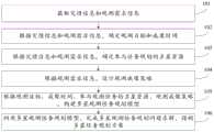
通过阅读下文优选实施方式的详细描述,各种其他的优点和益处对于本领域普通技术人员将变得清楚明了。附图仅用于示出优选实施方式的目的,而并不认为是对本发明的限制。而且在整个附图中,用相同的参考符号表示相同的部件。在附图中:Various other advantages and benefits will become apparent to those of ordinary skill in the art upon reading the following detailed description of the preferred embodiments. The drawings are for the purpose of illustrating preferred embodiments only and are not to be considered limiting of the invention. Also, the same components are denoted by the same reference numerals throughout the drawings. In the attached image:
图1为本发明实施例提供的一种面向灾害应急的多星协同观测任务规划方法流程图;1 is a flowchart of a method for planning a multi-satellite collaborative observation task for disaster emergency provided by an embodiment of the present invention;
图2为本发明实施例提供的另一种面向灾害应急的多星协同观测任务规划方法流程图;FIG. 2 is a flowchart of another method for planning a multi-satellite collaborative observation task for disaster emergency provided by an embodiment of the present invention;
图3为本发明实施例提供的包含区域目标的元任务合成示意图;3 is a schematic diagram of a meta-task synthesis including a regional target provided by an embodiment of the present invention;
图4为本发明实施例提供的元任务对区域目标的综合覆盖示意图;4 is a schematic diagram of comprehensive coverage of a regional target by a meta-task provided by an embodiment of the present invention;
图5为本发明实施例提供的一种面向灾害应急的多星协同观测任务规划装置的组成框图;5 is a block diagram of a composition of a multi-satellite collaborative observation task planning device for disaster emergency provided by an embodiment of the present invention;
图6为本发明实施例提供的另一种面向灾害应急的多星协同观测任务规划装置的组成框图。FIG. 6 is a block diagram of the composition of another multi-satellite collaborative observation task planning device for disaster emergency provided by an embodiment of the present invention.
具体实施方式Detailed ways
下面将参照附图更详细地描述本发明的示例性实施例。虽然附图中显示了本发明的示例性实施例,然而应当理解,可以以各种形式实现本发明而不应被这里阐述的实施例所限制。相反,提供这些实施例是为了能够更透彻地理解本发明,并且能够将本发明的范围完整的传达给本领域的技术人员。Exemplary embodiments of the present invention will be described in more detail below with reference to the accompanying drawings. While exemplary embodiments of the present invention are shown in the drawings, it should be understood that the present invention may be embodied in various forms and should not be limited by the embodiments set forth herein. Rather, these embodiments are provided so that the present invention will be more thoroughly understood, and will fully convey the scope of the present invention to those skilled in the art.
本发明实施例提供了一种面向灾害应急的多星协同观测任务规划方法,如图1所示,对此本发明实施例提供以下具体步骤:The embodiment of the present invention provides a multi-satellite collaborative observation task planning method for disaster emergency. As shown in FIG. 1 , the embodiment of the present invention provides the following specific steps:
101、获取灾情信息和观测需求信息。101. Obtain disaster information and observation demand information.
102、根据灾情信息和观测需求信息,确定观测目标和成像时间。102. Determine the observation target and imaging time according to the disaster situation information and observation demand information.
在本发明实施例中,观测目标包括点目标和区域目标,其中,点目标是指那些成像区域较小、在较短的时间内由单星可以一次观测完成的目标。区域目标的成像区域较为复杂,一般由一个多边形表示,一次观测难以覆盖整个目标区域,需要由多次观测来完成一个区域目标的观测。而成像时间包括观测开始时间、观测结束时间。In the embodiment of the present invention, the observation targets include point targets and regional targets, wherein the point targets refer to those targets whose imaging area is small and can be observed by a single star in a short period of time. The imaging area of a regional target is relatively complex and is generally represented by a polygon. It is difficult for one observation to cover the entire target area, and multiple observations are required to complete the observation of a regional target. The imaging time includes the observation start time and the observation end time.
103、根据灾情信息和观测需求信息,确定参与任务规划的卫星资源。103. Determine satellite resources to participate in mission planning according to disaster situation information and observation demand information.
在本发明实施例中,根据我国灾害应急响应分级,示例性的,如表1设计三级灾害应急观测任务等级,每个观测任务等级调用不同卫星资源,进一步的,如果当应急响应等级相同时,以人口密集程度为优先观测条件。In the embodiment of the present invention, according to the classification of disaster emergency response in my country, exemplarily, three-level disaster emergency observation task levels are designed as shown in Table 1, and each observation task level calls different satellite resources. Further, if the emergency response level is the same , with population density as the priority observation condition.
表一Table I

进一步的,根据观测任务等级,并结合灾害种类、观测要素及灾区气象条件,确定参与规划的卫星资源。如表2例举的可用卫星资源与灾种的适应性举例。Further, according to the observation task level, combined with disaster types, observation elements and meteorological conditions in the disaster area, determine the satellite resources participating in the planning. Examples of adaptability of available satellite resources and disaster types are listed in Table 2.
例如,假设可用的卫星资源包括以下高分系列、资源系列、环境系列及商用系列共12颗成像卫星,考虑的灾害种类包括地震、洪涝、台风、地质灾害、雪灾、旱灾、火灾共7种。假设某地发生重大地震,启动Ⅱ级响应,则观测任务等级为次高级,应优先调用与地震灾害观测适应性较高的卫星资源,如果观测要素为灾区建筑物及道路桥梁受损情况,成像时间(白天)内的灾区气象条件为晴,则可以确定参与规划的卫星资源为GF-1/2/3/6、ZY-1/3、CBERS-04、GJ-1、BJ-2。For example, assuming that the available satellite resources include 12 imaging satellites in the following high score series, resource series, environment series and commercial series, the types of disasters to be considered include earthquakes, floods, typhoons, geological disasters, snow disasters, droughts, and fires. A total of 7 kinds. Assuming that a major earthquake occurs in a certain place and a level II response is activated, the observation task level is the second highest, and the satellite resources with higher adaptability to earthquake disaster observation should be called first. If the observation elements are damage to buildings and roads and bridges in the disaster area, imaging If the meteorological conditions in the disaster area during the time (daytime) are clear, it can be determined that the satellite resources participating in the planning are GF-1/2/3/6, ZY-1/3, CBERS-04, GJ-1, and BJ-2.
表二Table II


104、根据观测需求信息,设计观测成像策略。104. According to the observation demand information, design the observation and imaging strategy.
在本发明实施例中,根据应急观测中对数据时效性及成像质量的需求,设计时间优先和质量优先两种成像策略。In the embodiment of the present invention, according to the requirements for data timeliness and imaging quality in emergency observation, two imaging strategies of time priority and quality priority are designed.
所述时间优先成像策略指最短时间覆盖观测目标区域;质量优先成像策略指在给定时间内,优先进行不侧摆成像,剩余区域按照侧摆角度最小原则进行覆盖。The time-priority imaging strategy refers to covering the observation target area in the shortest time; the quality-priority imaging strategy refers to prioritizing non-swing imaging within a given time, and covering the remaining areas according to the principle of minimum yaw angle.
根据灾害演进过程、获取灾情信息情况、重点观测要素等,选择成像策略。时间优先成像策略适用于灾后第一时间或初步掌握灾情信息的情况下,以初步获取灾区大体范围、初步判断受灾程度为观测目的,快速获取灾区数据;质量优先成像策略适用于评估灾损情况、识别损毁目标,对影像质量要求较高的情况。According to the disaster evolution process, the situation of obtaining disaster information, and the key observation elements, the imaging strategy is selected. The time-priority imaging strategy is suitable for the first time after the disaster or when the information of the disaster situation is preliminarily grasped. For the observation purpose of initially obtaining the general scope of the disaster area and judging the degree of damage, the data of the disaster area can be quickly obtained; the quality-priority imaging strategy is suitable for assessing disaster damage, Identify damaged targets and require high image quality.
105、根据观测目标、成像时间、参与观测任务的卫星资源、观测成像策略,构建多星观测任务规划模型。105. Build a multi-satellite observation mission planning model according to the observation target, imaging time, satellite resources participating in the observation mission, and observation imaging strategy.
106、利用多星观测任务规划模型,完成多星观测任务规划问题求解,得到多星任务规划方案。106. Use the multi-satellite observation mission planning model to solve the multi-satellite observation mission planning problem, and obtain the multi-satellite mission planning scheme.
本发明实施例提供的一种面向灾害应急的多星协同观测任务规划方法,本发明实施例根据灾情信息和观测需求信息而确定参与观测任务的卫星资源、观测目标和成像时间、设计观测成像策略,进而充分考虑到参与观测任务的卫星资源、观测目标、成像时间、观测成像策略等这些因素,来构建多星观测任务规划模型,以利用该模型完成面向灾害应急的多星协同观测任务规划。相较于现有技术的卫星观测任务规划技术多以常规任务为背景(主要以研究任务规划模型及算法为主,与灾害应急观测是存在较大的差异的),本发明实施例以涉及考虑灾害应急观测需求而构建多星观测任务规划模型,继而利用该多星观测任务规划模型完成多星观测任务规划问题求解,得到多星任务规划方案,有助于确保应急数据获取时效性、较高的观测目标范围覆盖程度的观测需求。The embodiment of the present invention provides a multi-satellite collaborative observation task planning method for disaster emergency. The embodiment of the present invention determines satellite resources, observation targets and imaging time, and designs observation and imaging strategies according to disaster situation information and observation demand information. , and then fully consider the satellite resources involved in the observation mission, the observation target, the imaging time, the observation and imaging strategy and other factors to build a multi-satellite observation mission planning model, so as to use the model to complete the multi-satellite collaborative observation mission planning for disaster emergency. Compared with the prior art satellite observation mission planning technology mostly based on conventional missions (mainly based on research mission planning models and algorithms, which is quite different from disaster emergency observation), the embodiments of the present invention are based on the consideration of The multi-satellite observation mission planning model is constructed to meet the emergency observation needs of disasters, and then the multi-satellite observation mission planning model is used to solve the multi-satellite observation mission planning problem, and the multi-satellite mission planning scheme is obtained, which helps to ensure the timeliness and high efficiency of emergency data acquisition. The observation requirements for the coverage of the observation target range.
为了对上述实施例做出更加详细的说明,本发明实施例还提供了另一种面向灾害应急的多星协同观测任务规划方法,如图2所示,该方法是对上述实施例的细化陈述和补充陈述,对此本发明实施例提供以下具体步骤:In order to describe the above embodiment in more detail, the embodiment of the present invention further provides another multi-satellite collaborative observation task planning method for disaster emergency. As shown in FIG. 2 , this method is a refinement of the above embodiment Statements and supplementary statements, this embodiment of the present invention provides the following specific steps:
201、获取灾情信息和观测需求信息。201. Obtain disaster information and observation demand information.
202、根据灾情信息和观测需求信息,确定观测目标和成像时间。202. Determine the observation target and imaging time according to the disaster situation information and observation demand information.
在本发明实施例中,观测目标包括点目标和区域目标。点目标是指那些成像区域较小、在较短的时间内由单星可以一次观测完成的目标;区域目标的成像区域较为复杂,一般由一个多边形表示,一次观测难以覆盖整个目标区域,需要由多次观测来完成一个区域目标的观测。而成像时间包括观测开始时间、观测结束时间。In the embodiment of the present invention, the observation target includes a point target and an area target. Point targets refer to those targets whose imaging area is small and can be completed by a single star in a short period of time; the imaging area of regional targets is relatively complex, generally represented by a polygon, and it is difficult to cover the entire target area with one observation. Multiple observations are made to complete the observation of an area target. The imaging time includes the observation start time and the observation end time.
203、根据灾情信息及观测需求信息,确定参与任务规划的卫星资源。203. Determine satellite resources to participate in mission planning according to disaster situation information and observation demand information.
在本发明实施例中,对于步骤102进行补充陈述,可以预先设置应急响应等级、观测任务等级两者之间的预设映射关系,从而在根据灾情信息确定应急响应等级之后,就可以通过自动地查找该预设映射关系而获取到与灾情信息匹配的观测任务等级。进一步的,还预先可以为每个观测任务等级匹配对应的调用卫星资源规则,进而扩展得到如表1包含字段(即:应急响应分级、观测任务等级、对应的调用卫星资源)之间存在的映射关系。In the embodiment of the present invention, for the supplementary statement in
利用如上扩展得到的三者存在的映射关系,就能够自动地确定参与任务规划的卫星资源,具体操作步骤,陈述如下:Using the mapping relationship between the three obtained by the above expansion, the satellite resources participating in the mission planning can be automatically determined. The specific operation steps are as follows:
首先是,根据灾情信息,确定灾害种类、目标应急响应等级、灾区气象条件,根据观测需求信息,确定观测要素。The first is to determine the type of disaster, target emergency response level, and meteorological conditions in the disaster area according to the disaster situation information, and determine the observation elements according to the observation demand information.
其次是,通过查找应急响应等级、观测任务等级两者之间的预设映射关系,得到目标应急响应等级对应的观测任务等级,利用该观测任务等级用于指示调用卫星资源规则,如结合上述扩展的三者存在映射关系进行自动查找操作。Secondly, by finding the preset mapping relationship between the emergency response level and the observation task level, the observation task level corresponding to the target emergency response level is obtained, and the observation task level is used to indicate the calling of satellite resource rules. There is a mapping relationship among the three for automatic search operation.
在后是,根据观测任务等级,确定了调用卫星资源规则,如表1中包含的“调用的卫星资源”字段,筛选出一个大范围的卫星资源,然后还需结合灾害种类、灾区气象条件及观测要素,进一步筛选卫星资源,以调用与灾害种类匹配的卫星资源。Then, according to the observation task level, the rules for invoking satellite resources are determined, such as the "Recalling satellite resources" field included in Table 1, and a large-scale satellite resource is screened out. Observation elements, and further filter satellite resources to call satellite resources that match the type of disaster.
具体的,示例性的,得到如上表2确定参与规划的卫星资源为GF-1/2/3/6、ZY-1/3、CBERS-04、GJ-1、BJ-2,对于表2的描述,在此不再赘述。Specifically, it is exemplified that the satellite resources participating in the planning are determined as GF-1/2/3/6, ZY-1/3, CBERS-04, GJ-1, BJ-2 as shown in Table 2 above. description, which will not be repeated here.
204、根据观测需求信息,设计观测成像策略。204. Design an observation imaging strategy according to the observation demand information.
在本发明实施例中,根据应急观测中对数据时效性及成像质量的需求,设计时间优先和质量优先两种成像策略。In the embodiment of the present invention, according to the requirements for data timeliness and imaging quality in emergency observation, two imaging strategies of time priority and quality priority are designed.
时间优先成像策略指最短时间覆盖观测目标区域;质量优先成像策略指在给定时间内,优先进行不侧摆成像,剩余区域按照侧摆角度最小原则进行覆盖。The time-priority imaging strategy refers to covering the observation target area in the shortest time; the quality-priority imaging strategy refers to prioritizing non-swing imaging within a given time, and the remaining areas are covered according to the principle of minimum yaw angle.
根据灾害演进过程、获取灾情信息情况、重点观测要素等,选择成像策略。时间优先成像策略适用于灾后第一时间或初步掌握灾情信息的情况下,以初步获取灾区大体范围、初步判断受灾程度为观测目的,快速获取灾区数据;质量优先成像策略适用于评估灾损情况、识别损毁目标,对影像质量要求较高的情况。According to the disaster evolution process, the situation of obtaining disaster information, and the key observation elements, the imaging strategy is selected. The time-priority imaging strategy is suitable for the first time after the disaster or when the information of the disaster situation is preliminarily grasped. For the observation purpose of initially obtaining the general scope of the disaster area and judging the degree of damage, the data of the disaster area can be quickly obtained; the quality-priority imaging strategy is suitable for assessing disaster damage, Identify damaged targets and require high image quality.
205、根据观测目标,构建对应的观测任务。205. According to the observation target, construct a corresponding observation task.
在本发明实施例中,对本步骤细化陈述如下:In this embodiment of the present invention, this step is described in detail as follows:
第一步骤,获取观测目标包含的点目标和区域目标,将点目标在每个时间窗口内构造为一个子任务,将区域目标对应观测任务分解成多个子任务。具体的,区域目标任务分解过程如下:In the first step, the point target and the area target included in the observation target are obtained, the point target is constructed as a subtask in each time window, and the observation task corresponding to the area target is decomposed into multiple subtasks. Specifically, the regional target task decomposition process is as follows:
设卫星集合

设规划时段内,卫星sj对区域目标任务ti的时间窗口数量为Nij,卫星sj在第k个时间窗口内对任务ti进行分解,得到的子任务数量为Nijk,
任务ti依据卫星sj的第k个时间窗口分解的元任务集合
任务ti依据卫星sj分解的元任务集合
任务ti分解的元任务集合
综上,任务ti分解后的子任务集合可以表示为:
具体的,解释说明区域目标动态分解流程如下:Specifically, the dynamic decomposition process of regional targets is explained as follows:
(1)遍历TP中的每个区域目标。针对区域目标ti的观测要求,选择可用卫星集合S′。(1) Traverse each area target inTP . According to the observation requirements of the regional targetti , the available satellite set S' is selected.
(2)遍历S′中的每个卫星,根据每颗卫星sj对ti进行分解。(2) Traverse each satellite in S', and decompose ti according to each satellite sj .
(3)根据卫星轨道预报模型,计算sj与ti的时间窗口集合Obs(i,j),并删除其中不满足ti时间要求的时间窗口。(3) Calculate the time window set Obs(i,j) of sj and ti according to the satellite orbit prediction model, and delete the time windows that do not meet the time requirement of ti .
(4)遍历Obs(i,j)中的每个时间窗口obsijk,根据每个时间窗口进行分解。(4) Traverse each time window obsijk in Obs(i,j), and decompose according to each time window.
a)、得到时间窗口obsijk内,卫星sj指向区域目标ti顶点的最小、最大角度gmin(i,j),gmax(i,j)。a), obtain the minimum and maximum angles gmin (i, j) and gmax (i , j) of the satellite sj pointing to the vertex of the regional target ti within the time window obsijk .
b)、得到时间窗口obsijk内,卫星对ti有效观测的最小角度gS,最大角度gE。b), obtain the minimum angle gS and the maximum anglegE of the satellite's effective observation of ti within the time window obsijk .

c)、按照不同的观测角度g′对区域进行分解。g′从最小角度gS开始,以Δλ为角度偏移量进行偏移,直至最大角度gE结束。c), decompose the area according to different observation angles g'. g' starts from the minimum angle gS and shifts with Δλ as the angle offset until the maximum angle gE ends.
d)、在每种观测角度g′下,均生成一个子任务


e)、将卫星sj与ti在时间窗口obsijk内分解的子任务加入集合
(5)将卫星sj与ti在各个时间窗口内分解得到的子任务加入集合
(6)将所有卫星与ti分解的子任务加入集合Oi。(6) Add all satellites and subtasks decomposed by ti to the set Oi .
(7)依次分解其他任务,若分解完毕,则返回并输出结果。(7) Decompose other tasks in turn, if the decomposition is completed, return and output the result.
由于区域目标分解的每个子任务都是卫星的一个可选的观测活动,为便于统计子任务对区域目标的覆盖关系,必须记录其坐标信息。子任务的坐标信息采用顺时针顺序的四个顶点的经纬度坐标表示。分解得到的子任务采用六元组表示:
第二步骤:将点目标对应的子任务和区域目标对应的子任务统一构建为元任务,具体陈述如下:Step 2: The subtasks corresponding to the point target and the subtasks corresponding to the area target are unifiedly constructed as meta-tasks, and the specific statements are as follows:
点目标在每个时间窗口内只能构造为一个子任务。为统一描述,把点和区域目标分解的子任务统一为元任务,并作为任务规划的基本元素,避免两类目标在处理上的差异,便于两类目标的统一规划。A point objective can only be constructed as one subtask in each time window. For unified description, the sub-tasks decomposed by point and area targets are unified into meta-tasks and used as the basic elements of task planning to avoid differences in the processing of the two types of targets and facilitate the unified planning of the two types of targets.
(1)区域目标的元任务按照第一步骤的区域目标动态分解方法进行构造。(1) The meta-task of the regional target is constructed according to the dynamic decomposition method of the regional target in the first step.
(2)为统一表示,点目标的元任务构造仍采用区域目标分解时的表示法,其在每个时间窗口内只构造一个元任务,不再赘述。(2) For unified representation, the meta-task construction of point target still adopts the representation of regional target decomposition, which only constructs one meta-task in each time window, and will not be repeated here.
(3)每个任务分解后得到的元任务集合称为该任务的元任务组。任务ti分解得到的元任务组Oi表示为:


第三步骤,对时间窗口和成像角度满足一定约束条件的多个元任务进行任务合成,由卫星传感器一次性进行成像,提高观测效率。由于区域目标的特殊性,将按照只包含点目标的合成任务与包含区域目标的合成任务两种情况进行处理,具体任务合成约束如下:The third step is to perform task synthesis on multiple meta-tasks whose time window and imaging angle satisfy certain constraints, and the satellite sensor performs imaging at one time to improve the observation efficiency. Due to the particularity of regional targets, the processing will be carried out in two cases: the synthesis task containing only point targets and the synthesis task containing regional targets. The specific task synthesis constraints are as follows:
(1)一种方式是:只包含点目标的合成任务(1) One way is: synthesis tasks that only contain point targets
首先考虑最简化情况,即两个点目标的元任务合成观测而生成合成任务的情况。We first consider the simplest case, where the meta-tasks of two point targets synthesize observations to generate a synthetic task.
设卫星sj的单次最大开机时间为Δdj,视场角为Δθj。若点目标ti,ti'分别存在两个元任务


则两个元任务可以被卫星传感器合成观测。其中,式(2)为时间窗口约束,表示两个元任务的时间窗口必须在卫星的单次最大开机时间内。式(3)为成像角度约束,表示两个元任务的侧视角度必须在传感器的单个视场角度限制内。设该合成任务为卫星sj的第l个合成任务,以


合成任务


同理,可以得到


(2)另一种方式:包含区域目标的合成任务。(2) Another way: a synthetic task containing regional targets.
区域目标分解的元任务代表了卫星在特定侧视角度下,对地面覆盖的条形区域,如果对其观测角度进行修正,则卫星的观测条带就会偏移,不能覆盖原定的区域。因此,当合成任务中包含区域目标分解的元任务时,卫星必须采用区域目标分解的元任务的观测角度进行成像。如图3所示,若合成任务包含了某区域目标元任务时,该合成任务的观测角度必定等于区域目标元任务的观测角度。因此,此情况下的合成任务只能通过扩展观测时间实现对点目标的合成观测。而且,若待合成元任务中包含多个区域目标元任务时,区域目标元任务的观测角度必须相同才有可能合成。如附图3所示包含区域目标的元任务合成示意图,该示意图中包含待合成的元任务(a)和合成任务(b)。The meta-task of regional target decomposition represents the strip area covered by the ground under a specific side view angle. If the observation angle is corrected, the satellite's observation strip will be offset and cannot cover the original area. Therefore, when the meta-task of regional target decomposition is included in the composite mission, the satellite must use the observation angle of the meta-task of regional target decomposition for imaging. As shown in Figure 3, if the composite task includes a certain regional target meta-task, the observation angle of the composite task must be equal to the observation angle of the regional target meta-task. Therefore, the synthetic task in this case can only achieve synthetic observations of point targets by extending the observation time. Moreover, if the meta-tasks to be synthesized include multiple regional target meta-tasks, the observation angles of the regional target meta-tasks must be the same to be possible to synthesize. As shown in FIG. 3, a schematic diagram of meta-task synthesis including regional targets is shown, and the schematic diagram includes meta-task (a) and synthesis task (b) to be synthesized.
设区域目标元任务集合


式(12)为时间约束,表示元任务的时间窗口必须在卫星的单次最大开机时间内。式(13)(14)为观测角度约束,式(13)表示其中包含的点目标元任务的观测角度必须在以区域目标元任务观测角度为中心的视场角度内,式(14)表示若其中包含多个区域目标元任务,则区域目标元任务的观测角度必须相同。Equation (12) is a time constraint, indicating that the time window of the meta-task must be within the single maximum start-up time of the satellite. Equations (13) and (14) are the observation angle constraints. Equation (13) indicates that the observation angle of the point target meta-task included in it must be within the field of view angle centered on the observation angle of the regional target meta-task. Equation (14) indicates that if If there are multiple regional target meta-tasks, the observation angles of the regional target meta-tasks must be the same.
若


206、根据观测任务,构建考虑任务分解及任务合成的多目标整数规划模型,模型包含三个优化目标函数:最大化任务收益、最小化成像完成时间、最小化分解方案的平均侧摆角度,任务收益为对点目标及区域目标分别构造收益函数,再综合计算对应的收益。206. According to the observation task, construct a multi-objective integer programming model considering task decomposition and task synthesis. The model includes three optimization objective functions: maximizing the task revenue, minimizing the imaging completion time, and minimizing the average roll angle of the decomposition scheme. The income is to construct the income function for the point target and the regional target respectively, and then comprehensively calculate the corresponding income.
在本发明实施例中,构建考虑任务分解及合成的多目标整数规划模型,此模型包含三个优化目标函数:最大化任务收益Profit,最小化成像完成时间CT,最小化分解方案的平均侧摆角度SA。In the embodiment of the present invention, a multi-objective integer programming model considering task decomposition and synthesis is constructed. This model includes three optimization objective functions: maximizing the task profit Profit, minimizing the imaging completion time CT, and minimizing the average rollover of the decomposition scheme. Angle SA.
(1)灾害应急成像过程中需要获得整个灾区范围和受损程度,需要尽可能的全覆盖,利用任务的收益率进行衡量。(1) In the process of disaster emergency imaging, it is necessary to obtain the entire disaster area and the degree of damage, which needs to be covered as fully as possible, and is measured by the rate of return of the task.
点目标和区域目标的特征决定了其收益计算方式存在差异,点目标只需安排一个元任务即可视为完成任务,只存在安排与未安排两种状态。区域目标还存在部分完成状态,必须统计多个元任务对区域目标的综合覆盖率,以计算观测区域目标获取的收益。因此,构造收益函数时必须兼顾二者的差异,对两类目标分别计算。The characteristics of the point target and the regional target determine the difference in the calculation method of their income. The point target only needs to arrange a meta-task to be regarded as a completed task, and there are only two states: arranged and not arranged. The regional target still has a partially completed state, and the comprehensive coverage ratio of multiple meta-tasks to the regional target must be counted to calculate the benefits obtained by observing the regional target. Therefore, the difference between the two must be taken into account when constructing the revenue function, and the two types of targets should be calculated separately.
由于点和区域目标均分解为元任务,因此,任务的收益可以根据其元任务的完成状态进行计算。设任务完成情况下,任务ti的收益为pi,


根据任务ti的元任务的安排状态,可以得到卫星观测任务ti的收益。下面分别针对点目标及区域目标建立收益函数。According to the arrangement status of the meta-tasks of the taskti , the income of the satellite observation taskti can be obtained. In the following, the revenue function is established for the point target and the regional target respectively.
设卫星sj共有

由于点目标在每个观测时间窗口内只分解了一个元任务,Nijk=1,因此,上式可简写为:Since the point target decomposes only one meta-task in each observation time window, Nijk =1, the above formula can be abbreviated as:

点目标具有唯一性约束,即只能安排一次成像。在调度过程中,只会选择安排点目标的一个元任务,因此,此处并不会重复计算点目标的收益。Point targets have a unique constraint that only one imaging can be scheduled. During the scheduling process, only one meta-task of the point target will be selected, so the benefits of the point target will not be double-counted here.
区域目标的收益是根据其所有被安排的元任务对区域目标的综合覆盖情况而定的,因此,必须首先计算多个元任务对区域目标ti的覆盖率Cover(ti):The income of a regional target is determined according to the comprehensive coverage of all its arranged meta-tasks to the regional target. Therefore, it is necessary to first calculate the coverage ratio Cover(ti ) of multiple meta-tasks to the regional targetti :

此处采用集合论中的“并”关系表示多个元任务代表的小区域的组合关系,采用“交”关系表示多个元任务对区域的覆盖关系。其中

如图4所示的元任务对区域目标的综合覆盖示意图,利用图4说明元任务间的“并”以及元任务与区域目标的“交”关系。假设安排了两个元任务o1,o2对区域目标P进行观测,首先,对安排的元任务进行“并运算”,得到o1,o2的并集O=o1∪o2(如图4(b)所示);然后,对区域O与P进行“交”运算(如图4(c)中阴影部分所示),O∩P即为两个元任务对区域的有效观测区域。通过统计O∩P的面积与区域目标P面积的比率,即可得到对区域目标被观测的综合覆盖率。Figure 4 is a schematic diagram of the comprehensive coverage of meta-tasks to regional targets. Figure 4 is used to illustrate the "union" between meta-tasks and the "intersection" relationship between meta-tasks and regional targets. Assuming that two meta-tasks o1 , o2 are arranged to observe the regional target P, first, perform a "union operation" on the arranged meta-tasks to obtain the union of o1 , o2 O=o1 ∪ o2 (such as As shown in Figure 4(b)); then, the "intersection" operation is performed on the regions O and P (shown in the shaded part in Figure 4(c)), O∩P is the effective observation area of the two meta-task pair regions . By calculating the ratio of the area of O∩P to the area of the regional target P, the comprehensive coverage rate of the observed regional target can be obtained.
得到多个元任务对区域目标的综合覆盖率后,就可以根据回报函数得到区域目标的收益。假设区域目标的收益为线性回报函数,即卫星观测区域目标获取的收益与对区域目标的覆盖率成正比。因此,区域目标的收益为:After obtaining the comprehensive coverage ratio of multiple meta-tasks to the regional target, the income of the regional target can be obtained according to the reward function. It is assumed that the income of the regional target is a linear return function, that is, the income obtained by the satellite observation of the regional target is proportional to the coverage rate of the regional target. Therefore, the benefits of the regional target are:

优化目标Profit最大化任务收益为:The optimization goal Profit maximizes the task revenue as:
max:Profit=Cspot+Cpolygon 公式(22)max: Profit=Cspot +Cpolygon formula (22)
依据公式(19)可以得到卫星观测点目标的总收益为:According to formula (19), the total revenue of the satellite observation point target can be obtained as:

依据公式(21)可以得到卫星观测区域目标的总收益为:According to formula (21), the total revenue of the satellite observation area target can be obtained as:

(2)尽可能快的完成观测目标的覆盖,保证数据的时效性。优化目标CT表示观测完成时间,用所选观测条带中的最晚成像时间进行衡量。Ts为规划开始时间。(2) Complete the coverage of the observation target as quickly as possible to ensure the timeliness of the data. The optimized target CT represents the observation completion time, measured by the latest imaging time in the selected observation band. Ts is the planning start time.

(3)卫星侧摆角度尽可能小,以免造成图像严重的几何畸变。优化目标SA衡量目标分解方案的平均侧摆角大小。

207、根据不同观测成像策略,选取优化目标组合,其中,时间优先成像策略选取最大化任务收益、最小化成像完成时间两个优化目标,质量优先成像策略选取最大化任务收益、最小化分解方案的平均侧摆角度两个优化目标。207. According to different observation and imaging strategies, select the optimal target combination. Among them, the time-priority imaging strategy selects two optimization objectives of maximizing the task revenue and minimizing the imaging completion time, and the quality-priority imaging strategy selects the one that maximizes the task revenue and minimizes the decomposition scheme. Two optimization objectives for the average roll angle.
时间优先成像策略选取最大化任务收益、最小化成像完成时间两个优化目标。针对成像目标范围,根据区域目标分解及元任务构造获取每颗卫星对目标的时间窗口集合,从中选取最先通过目标区域的卫星进行成像,然后从目标区域中排除最先成像的范围,再计算剩余区域中最先成像的卫星,以此类推,最终完成整个目标区域的成像。这种策略可以大大提高数据获取时效性,并且可以避免对目标区域重复观测,同时能有效减小运算量。The time-priority imaging strategy selects two optimization objectives, maximizing the task revenue and minimizing the imaging completion time. For the imaging target range, the time window set of each satellite to the target is obtained according to the regional target decomposition and meta-task structure, and the satellite that first passes through the target area is selected for imaging, and then the first imaging range is excluded from the target area, and then the calculation The first imaged satellite in the remaining area, and so on, finally completes the imaging of the entire target area. This strategy can greatly improve the timeliness of data acquisition, avoid repeated observations of the target area, and effectively reduce the amount of computation.
质量优先成像策略选取最大化任务收益、最小化分解方案的平均侧摆角度两个优化目标。针对成像目标范围,根据目标分解及元任务构造获取每颗卫星对目标的时间窗口和观测角度集合,从中选取不侧摆的卫星优先成像,然后从目标区域中排除最先成像的范围,再计算剩余区域中有观测机会的侧摆角最小的卫星,以此类推。质量优先成像策略有可能在规划时间段内无法完全覆盖目标区域,这种情况下在完成质量优先成像后,可对剩余观测区域利用时间优先成像策略进行任务规划。The quality-first imaging strategy selects two optimization objectives to maximize the task revenue and minimize the average roll angle of the decomposition scheme. For the imaging target range, the time window and observation angle set of each satellite to the target are obtained according to the target decomposition and meta-task structure, and the satellites that do not sway are selected for priority imaging, and then the first imaging range is excluded from the target area, and then the calculation The satellite with the smallest yaw angle in the remaining area has an observation opportunity, and so on. The quality-priority imaging strategy may not completely cover the target area within the planning time period. In this case, after the quality-priority imaging is completed, the time-priority imaging strategy can be used for mission planning for the remaining observation area.
208、设置规划模型的约束条件,约束条件至少包括:点目标的唯一性约束、相邻任务转换时间约束、任务时间窗口约束、任务合成时间约束、任务合成角度约束、卫星单圈成像时长约束、卫星存储约束、卫星能量约束。208. Set the constraints of the planning model, the constraints at least include: the uniqueness constraints of the point target, the adjacent task transition time constraints, the task time window constraints, the task synthesis time constraints, the task synthesis angle constraints, the satellite single circle imaging duration constraints, Satellite storage constraints, satellite energy constraints.
(1)点目标的唯一性约束,表示每个点目标最多被观测一次。(1) The uniqueness constraint of the point target means that each point target is observed at most once.

(2)转换时间约束,表示两个相邻任务之间必须有足够的转换时间,其中表示两个连续观测活动之间的转换时间;(2) The transition time constraint, which means that there must be enough transition time between two adjacent tasks, which means the transition time between two consecutive observation activities;

式中,


(3)时间窗口约束,表示每个任务必须在其时间窗口内进行成像;(3) Time window constraint, indicating that each task must be imaged within its time window;

(4)任务紧凑合成时间约束,表示任何一个时间窗口若与成像方案中的某个任务合成,必须满足时间约束;(4) Task compact synthesis time constraint, which means that if any time window is synthesized with a certain task in the imaging scheme, the time constraint must be satisfied;

式中,

(5)任务紧凑合成角度约束,表示任何一个时间窗口若与成像方案中的某个任务合成,二者必须同时位于卫星观测视场内;(5) The task compact synthesis angle constraint means that if any time window is synthesized with a certain task in the imaging scheme, both must be located in the satellite observation field of view at the same time;

(6)单圈成像时长约束,表示在卫星运行的任何单圈时长

式中,Ts、Te分别为规划开始时间、结束时间,
(7)卫星的存储约束,表示卫星观测方案的内存消耗不能超过最大储存容量限制;(7) The storage constraints of the satellite, which means that the memory consumption of the satellite observation scheme cannot exceed the maximum storage capacity limit;

式中,mj表示卫星sj的观测单位时间需要的存储容量,Mj表示卫星sj的最大存储容量。In the formula, mj represents the storage capacity required for the observation unit time of the satellite sj , and Mj represents the maximum storage capacity of the satellite sj .
(8)卫星的能量约束,表示卫星规划方案消耗的能量不能超过最大能量限制。(8) The energy constraint of the satellite, which means that the energy consumed by the satellite planning scheme cannot exceed the maximum energy limit.

式中,pwj表示卫星sj观测单位时间消耗的能量,spwj表示卫星sj侧摆单位角度消耗的能量,PWj卫星sj的最大能量。In the formula, pwj represents the energy consumed by the satellite sj observation unit time, spwj represents the energy consumed by the satellite sj side sway unit angle, PWj the maximum energy of the satellite sj .
209、利用多星观测任务规划模型,采用多目标遗传算法,完成多星观测任务规划问题求解,得到多星任务规划方案,以用于基于多星任务规划方案安排成像并采集数据。209. Using the multi-satellite observation mission planning model and using the multi-objective genetic algorithm, the solution of the multi-satellite observation mission planning problem is completed, and the multi-satellite mission planning scheme is obtained, which is used for arranging imaging and collecting data based on the multi-satellite mission planning scheme.
在本发明实施例中,可以基于NSGA-II多目标遗传算法的卫星任务规划求解算法,具体陈述如下:In the embodiment of the present invention, the satellite mission planning and solving algorithm based on the NSGA-II multi-objective genetic algorithm can be specifically stated as follows:
根据约束条件的数学模型,采用Deb等提出的NSGA-II多目标遗传算法,完成多星观测任务规划问题求解,得到多星任务规划方案,基于观测方案安排成像,采集数据。According to the mathematical model of constraints, the NSGA-II multi-objective genetic algorithm proposed by Deb et al. is used to solve the multi-satellite observation mission planning problem, obtain the multi-satellite mission planning scheme, arrange imaging based on the observation scheme, and collect data.
NSGA-II算法原理:在传统遗传算法的基础上,增加一个非支配选择排序和拥挤度计算的环节。将NSGA-II算法应用于成像卫星任务规划中,对其作适当改正。在该流程中,引入精英解保持策略过程。在形成新父代种群之前,将旧父代和子代合为一体并进行非支配排序和拥挤度计算。运用这种方式,不仅能够保留旧父代中的精英解,而且扩大了个体的采样空间。算法流程如下:Principle of NSGA-II algorithm: On the basis of traditional genetic algorithm, a link of non-dominated selection sorting and crowding degree calculation is added. The NSGA-II algorithm is applied to the imaging satellite mission planning, and appropriate corrections are made to it. In this process, an elite solution retention strategy process is introduced. Before forming a new parent population, the old parents and children are merged into one and non-dominated sorting and crowding are calculated. In this way, not only the elite solutions in the old parent generation can be preserved, but also the sampling space of individuals can be expanded. The algorithm flow is as follows:
1)设计问题编码,设置种群大小M,最大迭代次数T,当前迭代次数t=0,并初始化种群Pt。1) Design the problem code, set the population size M, the maximum iteration number T, the current iteration number t=0, and initialize the population Pt .
2)对种群Pt进行选择、交叉、变异遗传操作,产生新种群Qt。2) Select, crossover and mutate genetic operations on the population Pt to generate a new population Qt .
3)对新种群Rt=(Pt∪Qt)进行非支配排序,得到Rt的非支配前沿F=(F1,F2,…)。3) Perform non-dominated sorting on the new population Rt =(Pt ∪Qt ), and obtain the non-dominated frontier F = (F1 , F2 ,...) of Rt .
4)令
5)令i=i+1,若|Pt+1|+|Fi|<M,转到步骤4);若|Pt+1|+|Fi|=M,转到步骤7)。5) Leti =i +1, if |Pt+1 |+|Fi |<M, go to step 4); if |Pt+1 |+|Fi |=M, go to step 7) .
6)计算Fi中个体的拥挤距离,并按拥挤距离选出最好的|M-|Pt+1||个体,
7)t=t+1,若t+1<T且Pt+1∩Pt≠Pt,重复步骤2)。7) t=t+1, if t+1<T and Pt+1 ∩Pt ≠Pt , repeat step 2).
8)输出Pt中的非支配pareto解,并解码。8) Output the non-dominated pareto solution inPt , and decode.
在本发明实施例中,具体的,首先是:问题编码。In this embodiment of the present invention, specifically, the first is: problem coding.
将每个卫星的任务序列设计为一个染色体片段。染色体是由多个基因排列组成的,每个基因表示此位置上的任务,染色体片段的首末两个基因位为两个虚拟的任务,用来标识该染色体片段的开始和结束。每个基因采用实数编码,存储相应位置上的任务信息,包括时间窗口,最早开始时间,最晚开始时间,侧摆角度,包含的元任务等。The mission sequence for each satellite is designed as a chromosome segment. Chromosomes are composed of multiple gene arrangements, each gene represents a task at this position, and the first and last two loci of a chromosome segment are two virtual tasks, which are used to identify the start and end of the chromosome segment. Each gene is encoded with real numbers and stores the task information at the corresponding position, including time window, earliest start time, latest start time, side swing angle, included meta-tasks, etc.
其次是:种群初始化。The second is: population initialization.
采用随机插入算法构建初始种群,产生若干个个体。其基本思想是从未安排任务中随机选择时间窗口进行插入。The random insertion algorithm is used to construct the initial population and generate several individuals. The basic idea is to randomly select time windows for insertion from unscheduled tasks.
最后是:遗传算子设计。Finally: genetic operator design.
(1)选择算子(1) Selection operator
选择算子用以选择生成下一代的父代个体,对算法的性能影响较大。选择算子主要作用是对个体进行优胜劣汰操作,即从种群中选择精英个体繁殖下一代,淘汰较差的个体。选择算子保证好的个体有更大的选择机率,同时较差的个体也有较小的被选择的机会,使得搜索过程是全局的,不会过早收敛。The selection operator is used to select the parent individual to generate the next generation, which has a great impact on the performance of the algorithm. The main function of the selection operator is to perform the survival of the fittest operation on individuals, that is, to select elite individuals from the population to reproduce the next generation, and to eliminate poor individuals. The selection operator ensures that good individuals have a greater chance of being selected, while poor individuals have a smaller chance of being selected, so that the search process is global and will not converge prematurely.
为了避免算法早熟收敛,搜索结果尽可能与全局pareto最优解接近,使用二元锦标赛选择方法进行选择配对。每次随机从父代种群中选择两个个体,比较两者的非支配等级,选出其中非支配等级小的作为父个体,重复该过程直至填满交配池。In order to avoid premature convergence of the algorithm, the search results are as close as possible to the global pareto optimal solution, and the binary tournament selection method is used for selection and pairing. Each time, two individuals are randomly selected from the parent population, the non-dominant levels of the two are compared, and the smaller non-dominant level is selected as the parent individual, and the process is repeated until the mating pool is filled.
(2)交叉算子(2) Crossover operator
通过交叉算子,父代个体优良的基因信息在进化过程中会传递给下一代。交叉概率表示父个体被选择后进行交叉的概率。采用两点交叉的方式,在染色体片段连接处,随机选择两个位置作为交叉点,对两个父个体交叉点之间的染色体片段相互交换;由于交换染色体片段后产生的新个体可能为不可行解,需依据模型中的约束条件对两个子个体进行调整,最终得到代表可行解的新个体。交叉算子的流程主要包括选择交叉点,染色体片段交换,删除重复基因,修复丢失基因四个步骤。Through the crossover operator, the excellent genetic information of the parent individual will be passed on to the next generation in the evolutionary process. Crossover probability represents the probability of crossover after the parent individual is selected. Using the method of two-point crossover, at the junction of chromosome fragments, two positions are randomly selected as crossover points, and the chromosome fragments between the crossover points of the two parent individuals are exchanged with each other; because the new individuals generated after the exchange of chromosome fragments may not be feasible solution, the two sub-individuals need to be adjusted according to the constraints in the model, and finally a new individual representing a feasible solution is obtained. The process of the crossover operator mainly includes four steps: selection of crossover points, exchange of chromosome segments, deletion of duplicate genes, and repair of lost genes.
删除重复基因具体是指当两个染色体片段交换后,产生的代表任务序列的新个体中可能出现重复的任务,不满足唯一性约束。这种情况下,将非交换染色体片段中的重复任务。Deletion of duplicate genes specifically refers to the possibility of duplicate tasks appearing in new individuals representing task sequences when two chromosomal segments are exchanged, which does not satisfy the uniqueness constraint. In this case, there will be non-exchanging chromosomal segments in repetitive tasks.
修复丢失基因具体指在交换的染色体片段中子个体丢失了父个体上的某些基因,因此需要把丢失的任务插入到子个体中。Repairing lost genes specifically refers to the fact that the child individual has lost some genes on the parent individual in the exchanged chromosome segments, so the lost task needs to be inserted into the child individual.
(3)变异算子(3) Mutation operator
变异是指随机将染色体中的某些基因值用其它基因值来替换,从而形成一个新的个体。变异算子是产生新个体的辅助方法,决定了遗传算法的局部搜索能力,同时保持种群的多样性。交叉算子和变异算子的相互配合,共同实现对搜索空间的局部搜索和全局搜索。Mutation refers to the random replacement of some gene values in a chromosome with other gene values to form a new individual. The mutation operator is an auxiliary method to generate new individuals, which determines the local search ability of the genetic algorithm while maintaining the diversity of the population. The mutual cooperation of the crossover operator and the mutation operator jointly realizes the local search and global search of the search space.
根据多星任务规划问题的特点,采用单点变异算子,主要有三种操作:基因删除,基因转移,基因插入。According to the characteristics of the multi-star mission planning problem, the single-point mutation operator is used, and there are three main operations: gene deletion, gene transfer, and gene insertion.
基因删除是指将随机选择的任务从成像方案中删除。Gene deletion refers to the removal of randomly selected tasks from the imaging protocol.
基因转移是指将随机选择的任务安排到其他时间窗口,即先将此任务从规划方案中删除,再将随机选择的时间窗口进行插入。Gene transfer refers to arranging a randomly selected task to another time window, that is, first removing the task from the planning scheme, and then inserting the randomly selected time window.
基因插入是从未规划任务集中搜索在变异点位置有时间窗口的任务,安排到当前变异点位置前后。Gene insertion is a task that searches for a time window at the position of the mutation point from the unplanned task set, and arranges it before and after the current mutation point position.
进一步的,作为对上述图1、图2所示方法的实现,本发明实施例提供了一种面向灾害应急的多星协同观测任务规划装置。该装置实施例与前述方法实施例对应,为便于阅读,本装置实施例不再对前述方法实施例中的细节内容进行逐一赘述,但应当明确,本实施例中的装置能够对应实现前述方法实施例中的全部内容。该装置应用于给出面向灾害应急的多星协同观测任务规划,具体如图5所示,该装置包括:Further, as an implementation of the methods shown in FIG. 1 and FIG. 2 above, an embodiment of the present invention provides a multi-satellite collaborative observation task planning device oriented to disaster emergency. This apparatus embodiment corresponds to the foregoing method embodiments. For ease of reading, this apparatus embodiment will not repeat the details in the foregoing method embodiments one by one, but it should be clear that the apparatus in this embodiment can correspondingly implement the foregoing method embodiments. the entire contents of the example. The device is used to provide multi-satellite collaborative observation mission planning for disaster emergency, as shown in Figure 5. The device includes:
获取单元31,用于获取灾情信息和观测需求信息;an
确定单元32,用于根据所述获取单元31获取的灾情信息及观测需求信息,确定观测目标和成像时间;a determining
所述确定单元32,还用于根据所述获取单元31获取到的灾情信息及观测需求信息,确定参与任务规划的卫星资源;The determining
设计单元33,用于根据所述获取单元31获取到的观测需求信息,设计观测成像策略,所述观测成像策略至少包括:时间优先成像策略和质量优先成像策略,所述时间优先成像策略指优先短时间覆盖观测目标区域,所述质量优先成像策略指在既定时间内优先进行不侧摆成像,剩余区域按照侧摆角度最小原则进行覆盖;The
构建单元34,用于根据所述确定单元32确定的观测目标和成像时间、所述确定单元32确定的参与任务规划的卫星资源、所述设计单元33得到的观测成像策略,构建多星观测任务规划模型;The
执行单元35,用于利用所述构建单元34构建的多星观测任务规划模型,完成多星观测任务规划问题求解,得到多星任务规划方案。The
进一步的,如图6所示,所述确定单元32包括:Further, as shown in FIG. 6 , the determining
确定模块321,用于根据所述灾情信息,确定灾害种类、目标应急响应等级、灾区气象条件;A
所述确定模块321,还用于根据所述观测需求信息,确定观测要素;The determining
获取模块322,用于通过查找应急响应等级、观测任务等级两者之间的预设映射关系,得到所述目标应急响应等级对应的观测任务等级,所述观测任务等级用于指示调用卫星资源规则;The obtaining
调用模块323,用于根据所述获取模块322获取到的观测任务等级,并结合所述灾害种类、所述灾区气象条件及所述观测要素,调用与所述灾害种类匹配的卫星资源。The calling
进一步的,所述观测目标至少包括点目标和区域目标,其中,所述点目标是指由单星可以一次观测完成的目标;所述区域目标的成像区域由一个多边形表示并需要由多次观测来完成对一个区域目标的观测。Further, the observation targets include at least point targets and regional targets, wherein the point target refers to a target that can be observed by a single star at one time; the imaging area of the regional target is represented by a polygon and needs to be observed by multiple times. to complete the observation of an area target.
进一步的,如图6所示,所述构建单元34包括:Further, as shown in Figure 6, the
构建模块341,用于根据所述观测目标,构建对应的观测任务;A
所述构建模块341,还用于根据所述观测任务,构建考虑任务分解及任务合成的多目标整数规划模型,所述模型包含三个优化目标函数:最大化任务收益、最小化成像完成时间、最小化分解方案的平均侧摆角度,所述任务收益为对点目标及区域目标分别构造收益函数,再综合计算对应的收益;The
选取模块342,用于根据不同观测成像策略,从所述优化目标函数中选取优化目标组合,其中,时间优先成像策略选取最大化任务收益、最小化成像完成时间两个优化目标,质量优先成像策略选取最大化任务收益、最小化分解方案的平均侧摆角度两个优化目标;The
设置模块343,用于设置所述构建模块341得到的规划模型的约束条件,所述约束条件至少包括:点目标的唯一性约束、相邻任务转换时间约束、任务时间窗口约束、任务合成时间约束、任务合成角度约束、卫星单圈成像时长约束、卫星存储约束、卫星能量约束。The
进一步的,如图6所示,所述构建模块341包括:Further, as shown in FIG. 6 , the
获取子模块3411,用于获取观测目标包含的点目标和区域目标;The acquisition sub-module 3411 is used to acquire the point target and the area target contained in the observation target;
分解子模块3412,用于将所述获取子模块3411获取到的区域目标对应观测任务分解成多个子任务;The
构造子模块3413,用于将所述获取子模块3411获取到的点目标在每个时间窗口内构造为一个子任务;The
构建子模块3414,用于将所述点目标对应的子任务和所述区域目标对应的子任务统一构建为元任务;The
合成子模块3415,用于将对时间窗口和成像角度满足预设约束条件的多个所述元任务进行任务合成。The
进一步的,如图6所示,所述执行单元35包括:Further, as shown in FIG. 6 , the
执行模块351,用于利用所述多星观测任务规划模型,采用多目标遗传算法,完成多星观测任务规划问题求解,得到多星任务规划方案,以用于基于所述多星任务规划方案安排成像并采集数据。The
所述面向灾害应急的多星协同观测任务规划装置包括处理器和存储器,上述获取单元、确定单元、设计单元、构建单元和执行单元等均作为程序单元存储在存储器中,由处理器执行存储在存储器中的上述程序单元来实现相应的功能。The disaster emergency-oriented multi-satellite collaborative observation mission planning device includes a processor and a memory. The above acquisition unit, determination unit, design unit, construction unit, and execution unit are all stored in the memory as program units, and are executed by the processor and stored in the memory. The above program units in the memory implement the corresponding functions.
处理器中包含内核,由内核去存储器中调取相应的程序单元。内核可以设置一个或以上,通过调整内核参数来以涉及考虑灾害应急观测需求而构建多星观测任务规划模型,继而利用该多星观测任务规划模型完成多星观测任务规划问题求解,得到多星任务规划方案,有助于确保应急数据获取时效性、较高的观测目标范围覆盖程度。The processor includes a kernel, and the kernel calls the corresponding program unit from the memory. One or more kernels can be set. By adjusting the kernel parameters, a multi-satellite observation mission planning model can be constructed to take into account the emergency observation needs of disasters. Then, the multi-satellite observation mission planning model can be used to solve the multi-satellite observation mission planning problem, and a multi-satellite mission can be obtained. The planning scheme helps to ensure the timeliness of emergency data acquisition and the high coverage of the observation target range.
本发明实施例提供了一种电子设备,包括:存储器、处理器及存储在存储器上并可在处理器上运行的程序,所述处理器执行所述程序时,实现如上所述的面向灾害应急的多星协同观测任务规划方法。An embodiment of the present invention provides an electronic device, including: a memory, a processor, and a program stored in the memory and running on the processor, when the processor executes the program, the above-mentioned disaster-oriented emergency response is realized A multi-satellite collaborative observation mission planning method.
本发明实施例提供了一种计算机可读存储介质,其上存储有计算机程序,所述程序运行时实现如上所述的面向灾害应急的多星协同观测任务规划方法。An embodiment of the present invention provides a computer-readable storage medium on which a computer program is stored, and when the program runs, the above-mentioned disaster emergency-oriented multi-satellite collaborative observation task planning method is implemented.
本领域技术人员应明白,本申请的实施例可提供为方法、系统或计算机程序产品。因此,本申请可采用完全硬件实施例、完全软件实施例或结合软件和硬件方面的实施例的形式。而且,本申请可采用在一个或多个其中包含有计算机可用程序代码的计算机可用存储介质(包括但不限于磁盘存储器、CD-ROM、光学存储器等)上实施的计算机程序产品的形式。It will be appreciated by those skilled in the art that the embodiments of the present application may be provided as a method, a system or a computer program product. Accordingly, the present application may take the form of an entirely hardware embodiment, an entirely software embodiment, or an embodiment combining software and hardware aspects. Furthermore, the present application may take the form of a computer program product embodied on one or more computer-usable storage media (including, but not limited to, disk storage, CD-ROM, optical storage, etc.) having computer-usable program code embodied therein.
以上仅为本申请的实施例而已,并不用于限制本申请。对于本领域技术人员来说,本申请可以有各种更改和变化。凡在本申请的精神和原理之内所作的任何修改、等同替换、改进等,均应包含在本申请的权利要求范围之内。The above are merely examples of the present application, and are not intended to limit the present application. Various modifications and variations of this application are possible for those skilled in the art. Any modification, equivalent replacement, improvement, etc. made within the spirit and principle of this application shall be included within the scope of the claims of this application.
Claims (10)
Translated fromChinesePriority Applications (1)
| Application Number | Priority Date | Filing Date | Title |
|---|---|---|---|
| CN202010723076.2ACN111861230B (en) | 2020-07-24 | 2020-07-24 | A multi-satellite collaborative observation mission planning method and device for disaster emergency |
Applications Claiming Priority (1)
| Application Number | Priority Date | Filing Date | Title |
|---|---|---|---|
| CN202010723076.2ACN111861230B (en) | 2020-07-24 | 2020-07-24 | A multi-satellite collaborative observation mission planning method and device for disaster emergency |
Publications (2)
| Publication Number | Publication Date |
|---|---|
| CN111861230Atrue CN111861230A (en) | 2020-10-30 |
| CN111861230B CN111861230B (en) | 2023-11-28 |
Family
ID=72950574
Family Applications (1)
| Application Number | Title | Priority Date | Filing Date |
|---|---|---|---|
| CN202010723076.2AActiveCN111861230B (en) | 2020-07-24 | 2020-07-24 | A multi-satellite collaborative observation mission planning method and device for disaster emergency |
Country Status (1)
| Country | Link |
|---|---|
| CN (1) | CN111861230B (en) |
Cited By (14)
| Publication number | Priority date | Publication date | Assignee | Title |
|---|---|---|---|---|
| CN112529437A (en)* | 2020-12-17 | 2021-03-19 | 中国科学院空天信息创新研究院 | Multi-target satellite imaging planning method |
| CN112801394A (en)* | 2021-02-05 | 2021-05-14 | 中国科学院空天信息创新研究院 | Resource scheduling method |
| CN113343777A (en)* | 2021-05-14 | 2021-09-03 | 武汉大学 | Satellite rapid planning method and system for natural disaster emergency response |
| CN113408835A (en)* | 2021-08-20 | 2021-09-17 | 北京道达天际科技有限公司 | Multi-satellite collaborative planning method based on marine moving target |
| CN114781851A (en)* | 2022-03-28 | 2022-07-22 | 中国人民解放军国防科技大学 | Multi-satellite joint planning method and system considering task splitting |
| CN115016910A (en)* | 2022-05-31 | 2022-09-06 | 北京市遥感信息研究所 | A multi-satellite collaborative mission planning method and device for multi-observation missions |
| CN115204628A (en)* | 2022-06-24 | 2022-10-18 | 上海交通大学 | Satellite minimum quantity element task planning method based on imaging resource adaptive adjustment |
| CN115204559A (en)* | 2022-05-06 | 2022-10-18 | 合肥工业大学 | Multi-satellite earth observation task planning method and system |
| CN116222513A (en)* | 2022-12-09 | 2023-06-06 | 国家卫星气象中心(国家空间天气监测预警中心) | Intelligent decision-making method, system, equipment and computer-readable storage medium for fast imager observation requirements |
| CN116681235A (en)* | 2023-05-30 | 2023-09-01 | 中国科学院微小卫星创新研究院 | Spaceborne Distributed Constellation Cooperative Autonomous Mission Planning System and Method |
| CN117332624A (en)* | 2023-12-01 | 2024-01-02 | 武汉大学 | Hypersensitivity satellite task planning method and system considering image MTF degradation |
| CN117743773A (en)* | 2024-02-07 | 2024-03-22 | 中国人民解放军战略支援部队航天工程大学 | A continuous observation method of remote sensing satellites based on historical big data |
| CN118446244A (en)* | 2024-05-27 | 2024-08-06 | 武汉大学 | Multi-satellite observation planning method and device based on immune multi-target evolutionary algorithm |
| CN120125417A (en)* | 2025-01-07 | 2025-06-10 | 二十一世纪空间技术应用股份有限公司 | Adaptive optimization method and system for onboard remote sensing image processing based on resource constraints |
Citations (15)
| Publication number | Priority date | Publication date | Assignee | Title |
|---|---|---|---|---|
| JPH05158540A (en)* | 1991-12-06 | 1993-06-25 | Fujitsu Ltd | Spacecraft arm control system and attitude control system for spacecraft with spacecraft |
| JP2003252299A (en)* | 2002-02-26 | 2003-09-10 | Mitsubishi Electric Corp | Satellite attitude control device |
| US20050103941A1 (en)* | 2003-10-21 | 2005-05-19 | Eads Astrium Gmbh | Dynamic yaw steering method for spacecrafts |
| CN101894367A (en)* | 2010-05-26 | 2010-11-24 | 中国人民解放军国防科学技术大学 | Target Clustering Method for Imaging Satellite Observation Scheduling |
| CN106353771A (en)* | 2016-08-12 | 2017-01-25 | 北京空间飞行器总体设计部 | Method for global optimization and distribution of agile satellite imaging tasks |
| EP3364212A1 (en)* | 2017-02-15 | 2018-08-22 | Deutsches Zentrum für Luft- und Raumfahrt e.V. | A method and an apparatus for computer-assisted processing of sar raw data |
| CN108803647A (en)* | 2018-08-14 | 2018-11-13 | 上海航天控制技术研究所 | A kind of model-free data drive control method for Spacecraft Attitude Control |
| CN108845976A (en)* | 2018-06-25 | 2018-11-20 | 湖南国科轩宇信息科技有限公司 | Large-scale area observation scheduling method and system under multi satellites joint imaging |
| CN108932384A (en)* | 2018-07-04 | 2018-12-04 | 北京市遥感信息研究所 | Based on the maximized imaging satellite regional aim covering method of a covering tape |
| CN109034531A (en)* | 2018-06-19 | 2018-12-18 | 上海卫星工程研究所 | A kind of satellite imagery multi-source task dynamic programming method considering multi-time-windows constraint |
| CN110210700A (en)* | 2019-04-19 | 2019-09-06 | 中国科学院遥感与数字地球研究所 | More star dynamic task planing methods of task based access control priority towards emergency response |
| JP2019202587A (en)* | 2018-05-21 | 2019-11-28 | Necネッツエスアイ株式会社 | Satellite observation scheduling system, and scheduling method |
| CN110728447A (en)* | 2019-10-10 | 2020-01-24 | 合肥工业大学 | Partitioned satellite task planning method for achieving regional target coverage at earliest |
| CN110751353A (en)* | 2018-07-24 | 2020-02-04 | 民政部国家减灾中心 | A multi-satellite collaborative observation method and device for flood emergency |
| CN110986963A (en)* | 2019-12-25 | 2020-04-10 | 北京理工大学 | Spacecraft multi-target online clustering planning method based on attitude information |
- 2020
- 2020-07-24CNCN202010723076.2Apatent/CN111861230B/enactiveActive
Patent Citations (15)
| Publication number | Priority date | Publication date | Assignee | Title |
|---|---|---|---|---|
| JPH05158540A (en)* | 1991-12-06 | 1993-06-25 | Fujitsu Ltd | Spacecraft arm control system and attitude control system for spacecraft with spacecraft |
| JP2003252299A (en)* | 2002-02-26 | 2003-09-10 | Mitsubishi Electric Corp | Satellite attitude control device |
| US20050103941A1 (en)* | 2003-10-21 | 2005-05-19 | Eads Astrium Gmbh | Dynamic yaw steering method for spacecrafts |
| CN101894367A (en)* | 2010-05-26 | 2010-11-24 | 中国人民解放军国防科学技术大学 | Target Clustering Method for Imaging Satellite Observation Scheduling |
| CN106353771A (en)* | 2016-08-12 | 2017-01-25 | 北京空间飞行器总体设计部 | Method for global optimization and distribution of agile satellite imaging tasks |
| EP3364212A1 (en)* | 2017-02-15 | 2018-08-22 | Deutsches Zentrum für Luft- und Raumfahrt e.V. | A method and an apparatus for computer-assisted processing of sar raw data |
| JP2019202587A (en)* | 2018-05-21 | 2019-11-28 | Necネッツエスアイ株式会社 | Satellite observation scheduling system, and scheduling method |
| CN109034531A (en)* | 2018-06-19 | 2018-12-18 | 上海卫星工程研究所 | A kind of satellite imagery multi-source task dynamic programming method considering multi-time-windows constraint |
| CN108845976A (en)* | 2018-06-25 | 2018-11-20 | 湖南国科轩宇信息科技有限公司 | Large-scale area observation scheduling method and system under multi satellites joint imaging |
| CN108932384A (en)* | 2018-07-04 | 2018-12-04 | 北京市遥感信息研究所 | Based on the maximized imaging satellite regional aim covering method of a covering tape |
| CN110751353A (en)* | 2018-07-24 | 2020-02-04 | 民政部国家减灾中心 | A multi-satellite collaborative observation method and device for flood emergency |
| CN108803647A (en)* | 2018-08-14 | 2018-11-13 | 上海航天控制技术研究所 | A kind of model-free data drive control method for Spacecraft Attitude Control |
| CN110210700A (en)* | 2019-04-19 | 2019-09-06 | 中国科学院遥感与数字地球研究所 | More star dynamic task planing methods of task based access control priority towards emergency response |
| CN110728447A (en)* | 2019-10-10 | 2020-01-24 | 合肥工业大学 | Partitioned satellite task planning method for achieving regional target coverage at earliest |
| CN110986963A (en)* | 2019-12-25 | 2020-04-10 | 北京理工大学 | Spacecraft multi-target online clustering planning method based on attitude information |
Non-Patent Citations (2)
| Title |
|---|
| 徐雪仁: "资源卫星(可见光)遥感数据获取 任务调度优化算法研究",资源卫星(可见光)遥感数据获取 任务调度优化算法研究, vol. 11, no. 1, pages 109 - 114* |
| 王智勇: "多星联合任务规划方法", 中国空间科学技术, vol. 2, no. 1, pages 8 - 14* |
Cited By (20)
| Publication number | Priority date | Publication date | Assignee | Title |
|---|---|---|---|---|
| CN112529437A (en)* | 2020-12-17 | 2021-03-19 | 中国科学院空天信息创新研究院 | Multi-target satellite imaging planning method |
| CN112529437B (en)* | 2020-12-17 | 2024-02-09 | 中国科学院空天信息创新研究院 | Multi-target satellite imaging planning method |
| CN112801394A (en)* | 2021-02-05 | 2021-05-14 | 中国科学院空天信息创新研究院 | Resource scheduling method |
| CN113343777A (en)* | 2021-05-14 | 2021-09-03 | 武汉大学 | Satellite rapid planning method and system for natural disaster emergency response |
| CN113408835A (en)* | 2021-08-20 | 2021-09-17 | 北京道达天际科技有限公司 | Multi-satellite collaborative planning method based on marine moving target |
| CN113408835B (en)* | 2021-08-20 | 2022-01-28 | 北京道达天际科技有限公司 | Multi-satellite collaborative planning method based on marine moving target |
| CN114781851A (en)* | 2022-03-28 | 2022-07-22 | 中国人民解放军国防科技大学 | Multi-satellite joint planning method and system considering task splitting |
| CN114781851B (en)* | 2022-03-28 | 2024-12-27 | 中国人民解放军国防科技大学 | Multi-satellite joint planning method and system considering task splitting |
| CN115204559A (en)* | 2022-05-06 | 2022-10-18 | 合肥工业大学 | Multi-satellite earth observation task planning method and system |
| CN115204559B (en)* | 2022-05-06 | 2025-07-18 | 合肥工业大学 | Multi-star earth observation task planning method and system |
| CN115016910A (en)* | 2022-05-31 | 2022-09-06 | 北京市遥感信息研究所 | A multi-satellite collaborative mission planning method and device for multi-observation missions |
| CN115204628B (en)* | 2022-06-24 | 2023-04-07 | 上海交通大学 | Satellite minimum quantity element task planning method based on imaging resource adaptive adjustment |
| CN115204628A (en)* | 2022-06-24 | 2022-10-18 | 上海交通大学 | Satellite minimum quantity element task planning method based on imaging resource adaptive adjustment |
| CN116222513A (en)* | 2022-12-09 | 2023-06-06 | 国家卫星气象中心(国家空间天气监测预警中心) | Intelligent decision-making method, system, equipment and computer-readable storage medium for fast imager observation requirements |
| CN116681235A (en)* | 2023-05-30 | 2023-09-01 | 中国科学院微小卫星创新研究院 | Spaceborne Distributed Constellation Cooperative Autonomous Mission Planning System and Method |
| CN117332624B (en)* | 2023-12-01 | 2024-03-08 | 武汉大学 | Hypersensitivity satellite task planning method and system considering image MTF degradation |
| CN117332624A (en)* | 2023-12-01 | 2024-01-02 | 武汉大学 | Hypersensitivity satellite task planning method and system considering image MTF degradation |
| CN117743773A (en)* | 2024-02-07 | 2024-03-22 | 中国人民解放军战略支援部队航天工程大学 | A continuous observation method of remote sensing satellites based on historical big data |
| CN118446244A (en)* | 2024-05-27 | 2024-08-06 | 武汉大学 | Multi-satellite observation planning method and device based on immune multi-target evolutionary algorithm |
| CN120125417A (en)* | 2025-01-07 | 2025-06-10 | 二十一世纪空间技术应用股份有限公司 | Adaptive optimization method and system for onboard remote sensing image processing based on resource constraints |
Also Published As
| Publication number | Publication date |
|---|---|
| CN111861230B (en) | 2023-11-28 |
Similar Documents
| Publication | Publication Date | Title |
|---|---|---|
| CN111861230A (en) | A multi-satellite collaborative observation mission planning method and device for disaster emergency | |
| Bielecki et al. | The externalities of energy production in the context of development of clean energy generation | |
| CN108388958B (en) | Method and device for researching two-dimensional attitude maneuvering satellite mission planning technology | |
| Wu et al. | Multi-type multi-objective imaging scheduling method based on improved NSGA-III for satellite formation system | |
| Fairbanks et al. | Species and environment representation: selecting reserves for the retention of avian diversity in KwaZulu-Natal, South Africa | |
| Issa et al. | A decision support model for civil engineering projects based on multi-criteria and various data | |
| Kritter et al. | On the real-world applicability of state-of-the-art algorithms for the optimal camera placement problem | |
| Thorne et al. | Collaborative decision-analytic framework to maximize resilience of tidal marshes to climate change | |
| CN113706050A (en) | Multi-satellite region observation planning method based on adaptive genetic algorithm | |
| CN117829523A (en) | A multi-satellite mission planning method for joint scheduling of data transmission and imaging for regional targets | |
| CN116109036B (en) | Regional gridded multi-satellite observation planning methods, devices and equipment | |
| Cruz-Rodriguez et al. | HIPER: interactive tool for mid-term transmission expansion planning in a deregulated environment | |
| Cavalcante et al. | Modelling 21st century refugia and impact of climate change on Amazonia's largest primates | |
| Azmi et al. | Photovoltaic site suitability analysis using analytical hierarchy process and sensitivity analysis methods with GIS and remote sensing in Southern Morocco: case of Draa-Tafilatet Region | |
| Adedeji | Hybrid renewable energy-based facility location: a Geographical Information System (GIS) integrated multi-criteria decision-making (MCDM) approach | |
| CN118313696B (en) | Mangrove ecological restoration potential detection method based on aerospace, land and sea integration | |
| CN116562466B (en) | Planning method for high orbit satellite observation task | |
| Sarkar et al. | 16. The ConsNet Software Platform for Systematic Conservation Planning. | |
| Ravula | Design, simulation, analysis and optimization of transportation system for a biomass to ethanol conversion plant | |
| CN114565203A (en) | Multi-satellite multi-task planning method based on large neighborhood search algorithm and K-means | |
| Adeboboye et al. | Site Suitability Analysis for Solar Energy Farms in Enugu State, Using GIS and Remote Sensing | |
| Mohammed et al. | A Spatiotemporal Analysis of Urban Densification in an Organically Growing Urban Area | |
| CN112183921A (en) | A monitoring task planning method and system for remote sensing satellite networking | |
| CN118446244B (en) | Multi-satellite observation planning method and device based on immune multi-objective evolutionary algorithm | |
| CN118628681B (en) | Urban ecological security pattern diagram generation method, system and computer equipment |
Legal Events
| Date | Code | Title | Description |
|---|---|---|---|
| PB01 | Publication | ||
| PB01 | Publication | ||
| SE01 | Entry into force of request for substantive examination | ||
| SE01 | Entry into force of request for substantive examination | ||
| GR01 | Patent grant | ||
| GR01 | Patent grant |