CN110887472A - A fully autonomous attitude calculation method for deep fusion of polarization-geomagnetic information - Google Patents
A fully autonomous attitude calculation method for deep fusion of polarization-geomagnetic informationDownload PDFInfo
- Publication number
- CN110887472A CN110887472ACN201911250895.3ACN201911250895ACN110887472ACN 110887472 ACN110887472 ACN 110887472ACN 201911250895 ACN201911250895 ACN 201911250895ACN 110887472 ACN110887472 ACN 110887472A
- Authority
- CN
- China
- Prior art keywords
- vector
- geomagnetic
- under
- information
- polarization
- Prior art date
- Legal status (The legal status is an assumption and is not a legal conclusion. Google has not performed a legal analysis and makes no representation as to the accuracy of the status listed.)
- Granted
Links
Images

Classifications
- G—PHYSICS
- G01—MEASURING; TESTING
- G01C—MEASURING DISTANCES, LEVELS OR BEARINGS; SURVEYING; NAVIGATION; GYROSCOPIC INSTRUMENTS; PHOTOGRAMMETRY OR VIDEOGRAMMETRY
- G01C21/00—Navigation; Navigational instruments not provided for in groups G01C1/00 - G01C19/00
- G01C21/005—Navigation; Navigational instruments not provided for in groups G01C1/00 - G01C19/00 with correlation of navigation data from several sources, e.g. map or contour matching
- G—PHYSICS
- G01—MEASURING; TESTING
- G01C—MEASURING DISTANCES, LEVELS OR BEARINGS; SURVEYING; NAVIGATION; GYROSCOPIC INSTRUMENTS; PHOTOGRAMMETRY OR VIDEOGRAMMETRY
- G01C21/00—Navigation; Navigational instruments not provided for in groups G01C1/00 - G01C19/00
- G01C21/02—Navigation; Navigational instruments not provided for in groups G01C1/00 - G01C19/00 by astronomical means
- G01C21/025—Navigation; Navigational instruments not provided for in groups G01C1/00 - G01C19/00 by astronomical means with the use of startrackers
- G—PHYSICS
- G01—MEASURING; TESTING
- G01C—MEASURING DISTANCES, LEVELS OR BEARINGS; SURVEYING; NAVIGATION; GYROSCOPIC INSTRUMENTS; PHOTOGRAMMETRY OR VIDEOGRAMMETRY
- G01C21/00—Navigation; Navigational instruments not provided for in groups G01C1/00 - G01C19/00
- G01C21/04—Navigation; Navigational instruments not provided for in groups G01C1/00 - G01C19/00 by terrestrial means
- G01C21/08—Navigation; Navigational instruments not provided for in groups G01C1/00 - G01C19/00 by terrestrial means involving use of the magnetic field of the earth
Landscapes
- Engineering & Computer Science (AREA)
- Remote Sensing (AREA)
- Radar, Positioning & Navigation (AREA)
- Physics & Mathematics (AREA)
- Automation & Control Theory (AREA)
- General Physics & Mathematics (AREA)
- Life Sciences & Earth Sciences (AREA)
- Environmental & Geological Engineering (AREA)
- General Life Sciences & Earth Sciences (AREA)
- Geology (AREA)
- Astronomy & Astrophysics (AREA)
- Navigation (AREA)
Abstract
Translated fromChinese
Description
Translated fromChinese技术领域technical field
本发明涉及一种偏振-地磁信息深度融合全自主姿态解算方法,该方法通过结合大气偏振矢量场信息和地磁矢量场信息,实现了运动体在GNSS拒止或失效条件下,全自主的解算航向角和姿态角。属于运动体导航中的定姿定向领域。The invention relates to a fully autonomous attitude calculation method for deep fusion of polarization-geomagnetic information. The method realizes the fully autonomous solution of a moving body under the condition of GNSS rejection or failure by combining atmospheric polarization vector field information and geomagnetic vector field information. Calculate the heading and attitude angles. It belongs to the field of fixed attitude orientation in moving body navigation.
背景技术Background technique
目前,全球导航卫星系统GNSS是多领域普遍使用的导航方式,但其通信信号易被干扰、遮挡,甚至篡改,可靠性差,惯性导航及惯导作为主体的组合导航是最常用的全自主导航方式,存在误差累积的原理性不足,因此,GNSS拒止或失效条件下,全自主地准确获取运动体的航向角和姿态角成为一个关键问题。偏振导航启发于沙蚁、帝王蝶等生物眼睛的巧妙结构,太阳光经过大气散射形成含有丰富方位信息的偏振分布场,运动体通过获取天空偏振光信息,可实现姿态和航向的精确解算。地磁导航作为最常用的地球物理场导航方式,利用地磁场固有的地磁矢量场分布信息,可为运动体提供姿态和航向的可靠参考。现有研究中对二者信息的利用,都是简单的作为量测量来补偿惯导误差,在运动体长时间运行时,导航解算效果不佳。At present, the global navigation satellite system GNSS is a navigation method commonly used in many fields, but its communication signals are easily interfered, blocked, or even tampered with, and the reliability is poor. The combined navigation of inertial navigation and inertial navigation as the main body is the most commonly used fully autonomous navigation method , there is a lack of principle of error accumulation. Therefore, under the condition of GNSS rejection or failure, fully autonomous and accurate acquisition of the heading angle and attitude angle of the moving body becomes a key issue. Polarization navigation is inspired by the ingenious structure of the eyes of creatures such as sand ants and monarch butterflies. The sunlight is scattered by the atmosphere to form a polarization distribution field with rich orientation information. By obtaining the polarized light information of the sky, the moving body can realize the accurate solution of attitude and heading. Geomagnetic navigation, as the most commonly used method of geophysical field navigation, uses the inherent geomagnetic vector field distribution information of the geomagnetic field to provide a reliable reference for the attitude and heading of the moving body. In the existing research, the use of the information of the two is simply used as a quantitative measurement to compensate the inertial navigation error. When the moving body runs for a long time, the navigation solution effect is not good.
现有研究中,例如,卢鸿谦等发表的论文“偏振光/地磁/GPS/SINS组合导航方法”和范之国等发表的论文“利用偏振光,地磁,GPS进行多信息源融合导航方法的研究与实现”,导航解算中对GPS有很大的依赖性,无法实现运动体的自主导航解算。现有专利中,例如,申请中的中国专利(201510312112.5)“一种双模式仿生偏振/地磁辅助组合导航系统”和中国授权专利(ZL201410628075.4)“一种基于偏振光传感器的航姿测定方法”,进行全自主导航信息解算时,只是简单地将偏振信息、地磁信息作为量测信息,通过与惯导输出量的差值从而修正惯导误差,这种松组合模式下,没有实现对偏振和地磁信息的深度融合与利用,只是基于量测信息的统计意义对惯导信息修正,修正量有限,不能达到很好的解算精度和导航效果,机动条件下加速度计被影响,导航系统极可能失效。申请中的中国专利(201811336222.5)“一种基于偏振-地磁矢量紧组合的导航方法”,以姿态角误差为状态量,通过对偏振量测方程与地磁量测方程进行叉乘实现偏振和地磁的深融合,再将融合信息与惯导信息联合解算姿态角和航向角,其在融合过程中为简化舍去了高阶小角度量,这样使得精度有所损失,并且,该融合方法不可直接由偏振/地磁融合信息解算得到姿态角和航向角。由此可分析,在GNSS拒止或失效条件下,全自主导航解算主要还是依赖惯导为主体的组合导航方法,现有方法对偏振和地磁信息没有实现充分利用。In the existing research, for example, the paper "Polarized Light/Geomagnetic/GPS/SINS Integrated Navigation Method" published by Lu Hongqian et al. ”, there is a great dependence on GPS in the navigation solution, and the autonomous navigation solution of the moving body cannot be realized. Among the existing patents, for example, the pending Chinese patent (201510312112.5) "A dual-mode bionic polarization/geomagnetic aided integrated navigation system" and the Chinese authorized patent (ZL201410628075.4) "A method of heading attitude determination based on polarized light sensor" ”, when the fully autonomous navigation information is calculated, the polarization information and geomagnetic information are simply used as the measurement information, and the inertial navigation error is corrected by the difference with the inertial navigation output. The deep fusion and utilization of polarization and geomagnetic information is only based on the statistical significance of the measurement information to correct the inertial navigation information. The correction amount is limited, and it cannot achieve a good solution accuracy and navigation effect. The accelerometer is affected under maneuvering conditions, and the navigation system very likely to fail. The pending Chinese patent (201811336222.5) "a navigation method based on the tight combination of polarization-geomagnetic vector", takes the attitude angle error as the state quantity, and realizes the polarization and geomagnetism through the cross product of the polarization measurement equation and the geomagnetic measurement equation. Deep fusion, and then the fusion information and inertial navigation information are combined to solve the attitude angle and heading angle. In the fusion process, the high-order small angle is discarded for simplicity, which causes a loss of accuracy, and the fusion method cannot be directly The attitude angle and heading angle are calculated from the polarization/geomagnetic fusion information. It can be analyzed that under the condition of GNSS rejection or failure, the fully autonomous navigation solution mainly relies on the integrated navigation method with inertial navigation as the main body, and the existing methods do not fully utilize the polarization and geomagnetic information.
发明内容SUMMARY OF THE INVENTION
本发明提出了一种偏振-地磁信息深度融合全自主姿态解算方法。通过构建二阶方位张量,用一种全新的融合方式对偏振信息和地磁信息进行深度融合,算法简单,并且可直接从二者融合信息中解算求取绝对姿态角和航向角,实现了在GNSS拒止或失效条件下,运动体的全自主的航向和姿态解算。由于二者的矢量分布规律均不受运动体的运动状态改变的影响,具有很好的稳定性、可靠性、隐蔽性和误差不累积的优势,对于运动体机动条件下的全自主航向和姿态的解算也有很好的适用性。The invention proposes a fully autonomous attitude calculation method for deep fusion of polarization-geomagnetic information. By constructing a second-order azimuth tensor, a new fusion method is used to deeply fuse the polarization information and the geomagnetic information. The algorithm is simple, and the absolute attitude angle and heading angle can be calculated directly from the fusion information of the two. Fully autonomous heading and attitude solutions for moving bodies under GNSS denial or failure conditions. Because the vector distribution laws of the two are not affected by the change of the motion state of the moving body, they have the advantages of good stability, reliability, concealment and no accumulation of errors. The solution also has good applicability.
本发明解决上述技术问题采用的技术方案为:一种偏振-地磁信息深度融合全自主姿态解算方法,包括如下步骤:The technical solution adopted by the present invention to solve the above technical problems is: a fully autonomous attitude calculation method for deep fusion of polarization-geomagnetic information, comprising the following steps:
步骤(1)、利用运动体上安装的偏振传感器获取天空偏振场信息,通过偏振矢量p与太阳矢量s*b的信息传递关系,解算机体系下的太阳矢量s*b并进行单位化得sb,结合运动体当地位置及时间,确定导航系下的太阳矢量sn;所述机体系是指以运动体为参考建立的坐标系;Step (1), use the polarization sensor installed on the moving body to obtain the sky polarization field information, through the information transfer relationship between the polarization vector p and the sun vector s* b , solve the sun vector s* b under the computer system and unite it to obtain sb , combined with the local position and time of the moving body, determine the sun vector sn under the navigation system; the machine system refers to the coordinate system established with the moving body as a reference;
步骤(2)、通过三轴磁力计测量并解算,得到机体系下的地磁矢量mb,参考世界地磁模型WMM求解导航系下地磁矢量mn,对mb和mn进行单位化得到

步骤(3)、结合前两步骤得到的矢量,通过符号公式:

步骤(4)、根据矢量叉乘运算法则,联合机体系下单位化的地磁矢量


步骤(5)、通过姿态转换关系建立Fb与Fn的信息传递关系:

进一步的,所述步骤(1)的利用偏振传感器获取天空偏振场信息,通过偏振矢量p与太阳矢量s*b的信息传递关系,解算机体系下的太阳矢量s*b并进行单位化得sb,结合运动体当地位置及时间,确定导航系下的太阳矢量sn,具体要求如下:Further, in the step (1), the polarization sensor is used to obtain the sky polarization field information, and through the information transfer relationship between the polarization vector p and the sun vector s* b , the sun vector s* b under the computer system is solved and unitized to obtain sb , combined with the local position and time of the moving body, determine the sun vector sn under the navigation system, the specific requirements are as follows:
通过偏振传感器获取两个不同方向di,dj的偏振角αi,αj,方向矢量di,dj在传感器坐标系中表示为(μiνi)和(μjνj),其中,μi,μj为传感器坐标系中的天顶角,νi,νj为传感器坐标系中的方位角,即与x轴顺时针夹角,那么di,dj两方向上的偏振矢量pi,pj表示为:The polarization angles αi , αj of two different directions di , dj are obtained by the polarization sensor, and the direction vectors di , dj are expressed as (μi νi ) and (μj νj ) in the sensor coordinate system, Among them, μi , μj are the zenith angles in the sensor coordinate system, νi , νj are the azimuth angles in the sensor coordinate system, that is, the clockwise angle with the x-axis, then the di , dj two directions The polarization vectors pi , pj are expressed as:
pi=[sinμicosνi-sinμisinνi cosμi]Tpi =[sinμi cosνi -sinμi sinνi cosμi ]T
pj=[sinμjcosνj-sinμjsinνj cosμj]Tpj =[sinμj cosνj -sinμj sinνj cosμj ]T
根据瑞利散射理论,建立偏振矢量与太阳位置矢量之间的信息传递关系,得到传感器坐标系下的太阳矢量ss,表示为:According to the Rayleigh scattering theory, the information transfer relationship between the polarization vector and the sun position vector is established, and the sun vector ss in the sensor coordinate system is obtained, which is expressed as:
ss=pi×pjss = pi ×pj
将传感系坐标系下的太阳矢量ss,通过安装矩阵转换关系:

根据运动体的位置信息和时间信息,通过查询天文年历得到太阳相对于地理坐标系的天顶角σ和方位角δ,则对应的导航系下的太阳矢量为:According to the position information and time information of the moving body, the zenith angle σ and azimuth angle δ of the sun relative to the geographic coordinate system can be obtained by querying the astronomical almanac, then the corresponding sun vector in the navigation system is:
sn=[sinσcosδ -sinσsinδ cosσ]T。sn =[sinσcosδ -sinσsinδ cosσ]T .
进一步的,所述步骤(2)的通过三轴磁力计测量并解算,得到机体系下的地磁矢量mb,参考世界地磁模型(World Magnetic Model,WMM)求解导航系下地磁矢量mn,对mb和mn进行单位化得到

标定后的三轴地磁传感器测量值通过矫正补偿后得到传感器坐标系下地磁矢量:


通过世界地磁模型WMM,参考运动体的位置信息和时间信息,求得导航系下的地磁场三维方向的分量mx,my,mz,将其定义为导航系下地磁矢量mn:Through the world geomagnetic model WMM, referring to the position information and time information of the moving body, the components mx , my , mz of the three-dimensional direction of the geomagnetic field under the navigation system are obtained, and they are defined as the geomagnetic vector mn under the navigation system:
mn=[mx my mz]Tmn =[mx my mz ]T
将mb和mn通过二范数进行单位化,提取地磁矢量中的角度信息:Unitize mb and mn by the two-norm to extract the angle information in the geomagnetic vector:


进一步的,所述步骤(3)中的结合前两步骤得到的矢量,通过符号公式:

由于步骤(1)中解算得到的机体下太阳矢量sb存在±180o的二义性,用下式消除其二义性,Since the sun vector sb under the body obtained in step (1) has an ambiguity of ±180o, the ambiguity is eliminated by the following formula,

进一步的,所述步骤(4)中的根据矢量叉乘运算法则,联合机体系下单位化的地磁矢量


联合单位化的地磁矢量


基于太阳矢量sn和单位化的地磁矢量

进一步的,所述步骤(5)中的通过姿态转换关系建立Fb与Fn的信息传递关系:

通过姿态转换关系建立Fb与Fn的信息传递关系,满足:
则结合步骤(3)和步骤(4)中解得的矢量Fb与Fn,求得姿态转换矩阵

在此令:

再进一步进行角度的象限判断和矫正,Then further carry out the quadrant judgment and correction of the angle,
对于俯仰角θ:θ=θ;For pitch angle θ: θ=θ;
对于横滚角γ:若c33>0,则γ=γ;若c33<0,γ>0,则γ=γ-180;若c33<0,γ<0,则γ=γ+180;For the roll angle γ: if c33 >0, then γ=γ; if c33 <0, γ>0, then γ=γ-180; if c33 <0, γ<0, then γ=γ+180 ;
对于航向角ψ:若c22>0,则ψ=ψ;若c22<0,c12>0,则ψ=ψ+180;若c22<0,c12<0,则ψ=ψ-180;For heading angle ψ: if c22 >0, then ψ=ψ; if c22 <0, c12 >0, then ψ=ψ+180; if c22 <0, c12 <0, then ψ=ψ- 180;
因此,得到运动体在任意时刻的航向角和姿态角信息。Therefore, the heading angle and attitude angle information of the moving body at any time are obtained.
与现有的技术相比,本发明具有以下的优点:Compared with the prior art, the present invention has the following advantages:
现有利用偏振与地磁信息进行姿态解算的导航方式大都对卫星导航有很强的依赖性,在GPS等信号受到干扰时,这些方法无法完成运动体自主导航,在GNSS拒止或失效条件下,目前的全自主导航解算方法,主要还是依赖惯导为主体的组合导航方法,对偏振和地磁信息没有实现充分融合,导航算法和精度仍有些缺陷。本发明将偏振信息和地磁信息进行了深度融合,实现了在GNSS拒止或失效条件下,全自主解算运动体的航向和姿态信息。两种矢量分布场均不受运动体的运动状态改变的影响,具有很好的稳定性、可靠性、隐蔽性和误差不累积的优势,对于运动体机动条件下的全自主航向和姿态的解算也有很好的适用性。同时,解算方法计算量小,器件成本低,易实现应用。Most of the existing navigation methods using polarization and geomagnetic information for attitude calculation have a strong dependence on satellite navigation. When GPS and other signals are interfered, these methods cannot complete the autonomous navigation of moving bodies, and under the condition of GNSS rejection or failure , The current fully autonomous navigation solution method mainly relies on the integrated navigation method with inertial navigation as the main body. It does not fully integrate the polarization and geomagnetic information, and the navigation algorithm and accuracy still have some defects. The invention deeply integrates the polarization information and the geomagnetic information, and realizes the fully autonomous solution of the heading and attitude information of the moving body under the condition of GNSS rejection or failure. The two vector distribution fields are not affected by the change of the motion state of the moving body, and have the advantages of good stability, reliability, concealment and no accumulation of errors. It also has good applicability. At the same time, the calculation method of the solution method is small in calculation amount, low in device cost, and easy to implement and apply.
附图说明Description of drawings
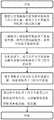
图1为本发明一种偏振-地磁信息深度融合全自主姿态解算方法的流程图;1 is a flowchart of a fully autonomous attitude solution method for deep fusion of polarization-geomagnetic information of the present invention;
图2为根据矢量叉乘法则构造机体系下二阶方位张量Fb的说明图。FIG. 2 is an explanatory diagram for constructing a second-order azimuth tensor Fb under the machine system according to the vector cross multiplication rule.
具体实施方式Detailed ways
下面将结合本发明实施例中的附图,对本发明实施例中的技术方案进行清楚、完整的描述,显然,所描述的实施例仅为本发明的一部分实施例,而不是全部的实施例,基于本发明中的实施例,本领域的普通技术人员在不付出创造性劳动的前提下所获得的所有其他实施例,都属于本发明的保护范围。The technical solutions in the embodiments of the present invention will be clearly and completely described below with reference to the accompanying drawings in the embodiments of the present invention. Obviously, the described embodiments are only a part of the embodiments of the present invention, rather than all the embodiments. Based on the embodiments of the present invention, all other embodiments obtained by persons of ordinary skill in the art without creative efforts shall fall within the protection scope of the present invention.
本发明的方法适用于全球导航卫星系统GNSS拒止或失效、无人机、导弹等运动体。The method of the invention is suitable for moving objects such as global navigation satellite system GNSS rejection or failure, unmanned aerial vehicle and missile.
根据本发明的一个实施例,选取至少有三个通道的偏振传感器,在获取得到三通道的偏振信息时,采用偏振度较高的两组进行解算;选取精度同偏振传感器同量级的三轴地磁计;将两传感器坐标系对应三轴分别同向平行进行集成。According to an embodiment of the present invention, a polarization sensor with at least three channels is selected, and when the polarization information of the three channels is obtained, two groups with a higher degree of polarization are used for calculation; Geomagnetometer; integrate the two sensor coordinate systems corresponding to the three axes in the same direction and parallel.
偏振传感器安装在运动体上时,应同机体系对应三轴分别同向平行安装,此时安装矩阵为单位阵I3×3,若以其他方式安装,则解算过程中应考虑安装旋转矩阵的转换关系。所述机体系是指以运动体为参考建立的坐标系;When the polarization sensor is installed on the moving body, it should be installed in the same direction and parallel to the corresponding three axes of the same machine system. At this time, the installation matrix is the unit matrix I3×3 . If it is installed in other ways, the rotation matrix should be installed in the calculation process. conversion relationship. The machine system refers to a coordinate system established with a moving body as a reference;
如图1所示,本发明的一种偏振-地磁信息深度融合全自主姿态解算方法,具体实现步骤为:As shown in Figure 1, a polarization-geomagnetic information deep fusion fully autonomous attitude calculation method of the present invention, the specific implementation steps are:
步骤1.利用偏振传感器获取天空偏振场信息,通过偏振矢量p与太阳矢量s*b的信息传递关系,解算机体系下的太阳矢量s*b并进行单位化得sb,结合运动体当地位置及时间,确定导航系下的太阳矢量sn,具体实现为:Step 1. Use the polarization sensor to obtain the information of the sky polarization field. Through the information transfer relationship between the polarization vector p and the sun vector s*b , the sun vector s*b under the computer system is solved and unitized to obtain sb , combined with the local movement of the moving body. position and time, determine the sun vectorsn under the navigation system, and the specific implementation is as follows:
通过偏振传感器获取两个不同方向di,dj的偏振角αi,αj,方向矢量di,dj在传感器坐标系中可表示为(μiνi)和(μjνj),其中,μi,μj为传感器坐标系中的天顶角,νi,νj为传感器坐标系中的方位角(即与x轴顺时针夹角),那么两方向上的偏振矢量pi,pj可表示为:The polarization angles αi , αj of two different directions di , dj are obtained by the polarization sensor, and the direction vectors di , dj can be expressed as (μi νi ) and (μj νj ) in the sensor coordinate system , where μi , μj are the zenith angles in the sensor coordinate system, νi , νj are the azimuth angles in the sensor coordinate system (ie, the clockwise angle with the x-axis), then the polarization vector p in the two directionsi ,pj can be expressed as:
pi=[sinμicosνi-sinμisinνi cosμi]Tpi =[sinμi cosνi -sinμi sinνi cosμi ]T
pj=[sinμjcosνj-sinμjsinνj cosμj]Tpj =[sinμj cosνj -sinμj sinνj cosμj ]T
根据瑞利散射理论,建立偏振矢量与太阳位置矢量之间的信息传递关系,则可以得到传感器坐标系下的太阳矢量ss,表示为:According to the Rayleigh scattering theory, the information transfer relationship between the polarization vector and the sun position vector can be established, and the sun vector ss in the sensor coordinate system can be obtained, which is expressed as:
ss=pi×pjss = pi ×pj
将传感系坐标系下的太阳矢量ss,通过安装矩阵转换关系:

根据运动体的位置信息和时间信息,通过查询天文年历可以得到太阳相对于地理坐标系的天顶角σ和方位角δ,则对应的导航系下的太阳矢量为:According to the position information and time information of the moving body, the zenith angle σ and azimuth angle δ of the sun relative to the geographic coordinate system can be obtained by querying the astronomical almanac, then the corresponding sun vector in the navigation system is:
sn=[sinσcosδ -sinσsinδ cosσ]Tsn = [sinσcosδ -sinσsinδ cosσ]T
步骤2.通过三轴磁力计测量并解算,得到机体系下的地磁矢量mb,参考世界地磁模型(World Magnetic Model,WMM)求解导航系下地磁矢量mn,对mb和mn进行单位化得到

标定后的三轴地磁传感器测量值通过矫正补偿后得到传感器坐标系下地磁矢量:


通过世界地磁模型WMM,参考运动体的位置信息和时间信息,可求得导航系下的地磁场三维方向的分量mx,my,mz,将其定义为导航系下地磁矢量mn:Through the world geomagnetic model WMM, referring to the position information and time information of the moving body, the components mx , my , mz of the three-dimensional direction of the geomagnetic field under the navigation system can be obtained, which are defined as the geomagnetic vector mn under the navigation system:
mn=[mx my mz]Tmn =[mx my mz ]T
将mb和mn通过二范数进行单位化,提取地磁矢量中的角度信息:Unitize mb and mn by the two-norm to extract the angle information in the geomagnetic vector:


步骤3.结合前两步骤得到的矢量,通过符号公式:

由于步骤(1)中解算得到的机体下太阳矢量sb存在±180o的二义性,用下式消除其二义性,Since the sun vector sb under the body obtained in step (1) has an ambiguity of ±180o, the ambiguity is eliminated by the following formula,

步骤4.根据矢量叉乘运算法则,如图2,联合机体系下单位化的地磁矢量


联合单位化的地磁矢量


基于太阳矢量sn和单位化的地磁矢量

步骤5.通过姿态转换关系建立Fb与Fn的信息传递关系:

通过姿态转换关系建立Fb与Fn的信息传递关系,满足:
则结合步骤(3)和步骤(4)中解得的矢量Fb与Fn,可求得姿态转换矩阵

在此令:

再进一步进行角度的象限判断和矫正,Then further carry out the quadrant judgment and correction of the angle,
对于俯仰角θ:θ=θ;For pitch angle θ: θ=θ;
对于横滚角γ:若c33>0,则γ=γ;若c33<0,γ>0,则γ=γ-180;若c33<0,γ<0,则γ=γ+180;For the roll angle γ: if c33 >0, then γ=γ; if c33 <0, γ>0, then γ=γ-180; if c33 <0, γ<0, then γ=γ+180 ;
对于航向角ψ:若c22>0,则ψ=ψ;若c22<0,c12>0,则ψ=ψ+180;若c22<0,c12<0,则ψ=ψ-180;For heading angle ψ: if c22 >0, then ψ=ψ; if c22 <0, c12 >0, then ψ=ψ+180; if c22 <0, c12 <0, then ψ=ψ- 180;
因此,得到运动体在任意时刻的航向角和姿态角信息。Therefore, the heading angle and attitude angle information of the moving body at any time are obtained.
尽管上面对本发明说明性的具体实施方式进行了描述,以便于本技术领域的技术人员理解本发明,且应该清楚,本发明不限于具体实施方式的范围,对本技术领域的普通技术人员来讲,只要各种变化在所附的权利要求限定和确定的本发明的精神和范围内,这些变化是显而易见的,一切利用本发明构思的发明创造均在保护之列。Although illustrative specific embodiments of the present invention have been described above to facilitate understanding of the present invention by those skilled in the art, it should be clear that the present invention is not limited in scope to the specific embodiments, to those skilled in the art, As long as various changes are within the spirit and scope of the present invention as defined and determined by the appended claims, these changes are obvious, and all inventions and creations utilizing the inventive concept are included in the protection list.
Claims (6)
Translated fromChinese


Priority Applications (1)
| Application Number | Priority Date | Filing Date | Title |
|---|---|---|---|
| CN201911250895.3ACN110887472B (en) | 2019-12-09 | 2019-12-09 | A fully autonomous attitude calculation method for deep fusion of polarization-geomagnetic information |
Applications Claiming Priority (1)
| Application Number | Priority Date | Filing Date | Title |
|---|---|---|---|
| CN201911250895.3ACN110887472B (en) | 2019-12-09 | 2019-12-09 | A fully autonomous attitude calculation method for deep fusion of polarization-geomagnetic information |
Publications (2)
| Publication Number | Publication Date |
|---|---|
| CN110887472Atrue CN110887472A (en) | 2020-03-17 |
| CN110887472B CN110887472B (en) | 2021-10-22 |
Family
ID=69751098
Family Applications (1)
| Application Number | Title | Priority Date | Filing Date |
|---|---|---|---|
| CN201911250895.3AActiveCN110887472B (en) | 2019-12-09 | 2019-12-09 | A fully autonomous attitude calculation method for deep fusion of polarization-geomagnetic information |
Country Status (1)
| Country | Link |
|---|---|
| CN (1) | CN110887472B (en) |
Cited By (5)
| Publication number | Priority date | Publication date | Assignee | Title |
|---|---|---|---|---|
| CN111624531A (en)* | 2020-05-26 | 2020-09-04 | 中国人民解放军国防科技大学 | Component calculation method for TMR three-axis integrated magnetic sensor |
| CN114018257A (en)* | 2021-11-05 | 2022-02-08 | 北京航空航天大学杭州创新研究院 | Polarization/inertia installation error non-support self-calibration method |
| CN114018258A (en)* | 2021-11-05 | 2022-02-08 | 北京航空航天大学杭州创新研究院 | Bionic combined navigation method based on polarization measurement noise variance adaptive estimation |
| CN115014354A (en)* | 2022-06-13 | 2022-09-06 | 北京航空航天大学 | A Compass Computation Method for Adaptive Fusion of Underwater Sun Spot and Polarization Field |
| CN118884547A (en)* | 2024-07-30 | 2024-11-01 | 中勘地球物理有限责任公司 | Integration and calibration method of geomagnetic vector measurement device for exploration |
Citations (10)
| Publication number | Priority date | Publication date | Assignee | Title |
|---|---|---|---|---|
| CN103323005A (en)* | 2013-03-06 | 2013-09-25 | 郭雷 | Multi-objective optimization anti-interference filtering method for SINS/GPS/polarized light combined navigation system |
| CN104374388A (en)* | 2014-11-10 | 2015-02-25 | 大连理工大学 | Flight attitude determining method based on polarized light sensor |
| CN104880192A (en)* | 2015-06-12 | 2015-09-02 | 北京航空航天大学 | Carrier course angle calculation method based on polarization compass |
| CN105021188A (en)* | 2015-06-09 | 2015-11-04 | 北京航空航天大学 | Dual-mode bionic polarization/geomagnetic-aided integrated navigation system |
| CN106441372A (en)* | 2016-11-24 | 2017-02-22 | 北京航空航天大学 | Method for coarsely aligning static base based on polarization and gravity information |
| CN106679645A (en)* | 2016-08-24 | 2017-05-17 | 大连理工大学 | Real-time navigation device based on multi-directional polarized light |
| CN106767752A (en)* | 2016-11-25 | 2017-05-31 | 北京航空航天大学 | A kind of Combinated navigation method based on polarization information |
| CN109459027A (en)* | 2018-11-09 | 2019-03-12 | 北京航空航天大学 | It is a kind of based on polarization-ground magnetic vector tight integration air navigation aid |
| CN109470237A (en)* | 2018-12-17 | 2019-03-15 | 大连理工大学 | Navigation attitude measurement method based on combination of polarized light and geomagnetism |
| CN109556631A (en)* | 2018-11-26 | 2019-04-02 | 北方工业大学 | INS/GNSS/polarization/geomagnetic combined navigation system alignment method based on least squares |
- 2019
- 2019-12-09CNCN201911250895.3Apatent/CN110887472B/enactiveActive
Patent Citations (11)
| Publication number | Priority date | Publication date | Assignee | Title |
|---|---|---|---|---|
| CN103323005A (en)* | 2013-03-06 | 2013-09-25 | 郭雷 | Multi-objective optimization anti-interference filtering method for SINS/GPS/polarized light combined navigation system |
| CN103323005B (en)* | 2013-03-06 | 2017-04-19 | 北京航空航天大学 | Multi-objective optimization anti-interference filtering method for SINS/GPS/polarized light combined navigation system |
| CN104374388A (en)* | 2014-11-10 | 2015-02-25 | 大连理工大学 | Flight attitude determining method based on polarized light sensor |
| CN105021188A (en)* | 2015-06-09 | 2015-11-04 | 北京航空航天大学 | Dual-mode bionic polarization/geomagnetic-aided integrated navigation system |
| CN104880192A (en)* | 2015-06-12 | 2015-09-02 | 北京航空航天大学 | Carrier course angle calculation method based on polarization compass |
| CN106679645A (en)* | 2016-08-24 | 2017-05-17 | 大连理工大学 | Real-time navigation device based on multi-directional polarized light |
| CN106441372A (en)* | 2016-11-24 | 2017-02-22 | 北京航空航天大学 | Method for coarsely aligning static base based on polarization and gravity information |
| CN106767752A (en)* | 2016-11-25 | 2017-05-31 | 北京航空航天大学 | A kind of Combinated navigation method based on polarization information |
| CN109459027A (en)* | 2018-11-09 | 2019-03-12 | 北京航空航天大学 | It is a kind of based on polarization-ground magnetic vector tight integration air navigation aid |
| CN109556631A (en)* | 2018-11-26 | 2019-04-02 | 北方工业大学 | INS/GNSS/polarization/geomagnetic combined navigation system alignment method based on least squares |
| CN109470237A (en)* | 2018-12-17 | 2019-03-15 | 大连理工大学 | Navigation attitude measurement method based on combination of polarized light and geomagnetism |
Cited By (9)
| Publication number | Priority date | Publication date | Assignee | Title |
|---|---|---|---|---|
| CN111624531A (en)* | 2020-05-26 | 2020-09-04 | 中国人民解放军国防科技大学 | Component calculation method for TMR three-axis integrated magnetic sensor |
| CN111624531B (en)* | 2020-05-26 | 2022-05-24 | 中国人民解放军国防科技大学 | A Component Solution Method for TMR Three-axis Integrated Magnetic Sensor |
| CN114018257A (en)* | 2021-11-05 | 2022-02-08 | 北京航空航天大学杭州创新研究院 | Polarization/inertia installation error non-support self-calibration method |
| CN114018258A (en)* | 2021-11-05 | 2022-02-08 | 北京航空航天大学杭州创新研究院 | Bionic combined navigation method based on polarization measurement noise variance adaptive estimation |
| CN114018257B (en)* | 2021-11-05 | 2024-05-24 | 北京航空航天大学杭州创新研究院 | Polarization/inertia installation error independent self-calibration method |
| CN115014354A (en)* | 2022-06-13 | 2022-09-06 | 北京航空航天大学 | A Compass Computation Method for Adaptive Fusion of Underwater Sun Spot and Polarization Field |
| CN115014354B (en)* | 2022-06-13 | 2024-04-09 | 北京航空航天大学 | Compass calculation method for self-adaptive fusion of underwater solar light spots and polarized fields |
| CN118884547A (en)* | 2024-07-30 | 2024-11-01 | 中勘地球物理有限责任公司 | Integration and calibration method of geomagnetic vector measurement device for exploration |
| CN118884547B (en)* | 2024-07-30 | 2025-05-16 | 国冶地球物理有限责任公司 | Integration and calibration method of geomagnetic vector measurement device for exploration |
Also Published As
| Publication number | Publication date |
|---|---|
| CN110887472B (en) | 2021-10-22 |
Similar Documents
| Publication | Publication Date | Title |
|---|---|---|
| CN106289246B (en) | A kind of flexible link arm measure method based on position and orientation measurement system | |
| CN110887472A (en) | A fully autonomous attitude calculation method for deep fusion of polarization-geomagnetic information | |
| CN104880191B (en) | A kind of polarization auxiliary navigation method based on solar vector | |
| CN101858748B (en) | Fault-tolerance autonomous navigation method of multi-sensor of high-altitude long-endurance unmanned plane | |
| CN104635251B (en) | A kind of INS/GPS integrated positionings determine appearance new method | |
| CN101788296B (en) | SINS/CNS deep integrated navigation system and realization method thereof | |
| CN110487301A (en) | A kind of airborne strapdown inertial navigation system Initial Alignment Method of radar auxiliary | |
| CN102901977B (en) | Method for determining initial attitude angle of aircraft | |
| CN110672131B (en) | UKF (unscented Kalman Filter) alignment method for inertial/polarized light integrated navigation system under large misalignment angle | |
| CN104880192B (en) | A kind of carrier heading computing method based on polarization compass | |
| CN104374388B (en) | Flight attitude determining method based on polarized light sensor | |
| CN112697138B (en) | A method for biomimetic polarization synchronization positioning and composition based on factor graph optimization | |
| CN106767787A (en) | A kind of close coupling GNSS/INS combined navigation devices | |
| CN110672130B (en) | An EKF alignment method for inertial/polarized light integrated navigation system under large misalignment angle | |
| CN104713555A (en) | Autonomous vehicle navigation method for assisting orientation by applying omnimax neutral point | |
| CN114018242B (en) | Autonomous attitude determination method based on polarization/sun/inertia information intelligent matching | |
| CN106767752A (en) | A kind of Combinated navigation method based on polarization information | |
| CN112880669B (en) | A spacecraft starlight refraction and single-axis rotation modulation inertial integrated navigation method | |
| CN110926468A (en) | Communication-in-motion antenna multi-platform navigation attitude determination method based on transfer alignment | |
| CN109459027A (en) | It is a kind of based on polarization-ground magnetic vector tight integration air navigation aid | |
| CN102393201A (en) | Dynamic lever arm compensating method of position and posture measuring system (POS) for aerial remote sensing | |
| CN103196445A (en) | Geomagnetism-assisted inertial carrier attitude measurement method based on matching technology | |
| CN110887478A (en) | Autonomous navigation positioning method based on polarization/astronomical assistance | |
| CN113834484B (en) | An Inertial Navigation/Polarization Integrated Navigation Method Based on Non-Rayleigh Scattering Model Errors | |
| CN110887476A (en) | Autonomous heading and attitude determination method based on polarization-astronomical angle information observation |
Legal Events
| Date | Code | Title | Description |
|---|---|---|---|
| PB01 | Publication | ||
| PB01 | Publication | ||
| SE01 | Entry into force of request for substantive examination | ||
| SE01 | Entry into force of request for substantive examination | ||
| GR01 | Patent grant | ||
| GR01 | Patent grant |