CN103236063A - Multi-scale spectral clustering and decision fusion-based oil spillage detection method for synthetic aperture radar (SAR) images - Google Patents
Multi-scale spectral clustering and decision fusion-based oil spillage detection method for synthetic aperture radar (SAR) imagesDownload PDFInfo
- Publication number
- CN103236063A CN103236063ACN2013101628780ACN201310162878ACN103236063ACN 103236063 ACN103236063 ACN 103236063ACN 2013101628780 ACN2013101628780 ACN 2013101628780ACN 201310162878 ACN201310162878 ACN 201310162878ACN 103236063 ACN103236063 ACN 103236063A
- Authority
- CN
- China
- Prior art keywords
- scale
- oil spill
- detection
- spectral clustering
- decision
- Prior art date
- Legal status (The legal status is an assumption and is not a legal conclusion. Google has not performed a legal analysis and makes no representation as to the accuracy of the status listed.)
- Granted
Links
- 238000001514detection methodMethods0.000titleclaimsabstractdescription65
- 230000003595spectral effectEffects0.000titleclaimsabstractdescription39
- 230000004927fusionEffects0.000titleclaimsabstractdescription30
- 239000003305oil spillSubstances0.000claimsabstractdescription63
- 238000000034methodMethods0.000claimsabstractdescription38
- 230000011218segmentationEffects0.000claimsabstractdescription31
- 238000013528artificial neural networkMethods0.000claimsabstractdescription18
- 238000011156evaluationMethods0.000claimsabstractdescription6
- 238000003709image segmentationMethods0.000claimsabstractdescription5
- 239000003921oilSubstances0.000claimsdescription26
- 238000000354decomposition reactionMethods0.000claimsdescription11
- 239000011159matrix materialSubstances0.000claimsdescription7
- 238000004458analytical methodMethods0.000claimsdescription6
- 230000003044adaptive effectEffects0.000claimsdescription5
- 230000000694effectsEffects0.000claimsdescription4
- 238000003062neural network modelMethods0.000claimsdescription3
- 239000012075bio-oilSubstances0.000claimsdescription2
- 230000000052comparative effectEffects0.000claimsdescription2
- 238000005553drillingMethods0.000claimsdescription2
- 238000002474experimental methodMethods0.000claimsdescription2
- 238000012360testing methodMethods0.000claimsdescription2
- 238000011160researchMethods0.000description5
- 238000012937correctionMethods0.000description4
- 238000005516engineering processMethods0.000description3
- 238000000605extractionMethods0.000description3
- 238000001914filtrationMethods0.000description3
- 238000003384imaging methodMethods0.000description3
- 238000007781pre-processingMethods0.000description3
- 238000012795verificationMethods0.000description3
- 238000003064k means clusteringMethods0.000description2
- 238000012545processingMethods0.000description2
- 230000005855radiationEffects0.000description2
- 239000013598vectorSubstances0.000description2
- 230000009286beneficial effectEffects0.000description1
- 238000004364calculation methodMethods0.000description1
- 230000001427coherent effectEffects0.000description1
- 238000011161developmentMethods0.000description1
- 230000018109developmental processEffects0.000description1
- 230000007613environmental effectEffects0.000description1
- 238000013100final testMethods0.000description1
- 239000004519greaseSubstances0.000description1
- 230000001788irregularEffects0.000description1
- 238000012986modificationMethods0.000description1
- 230000004048modificationEffects0.000description1
- 238000012544monitoring processMethods0.000description1
- 230000000877morphologic effectEffects0.000description1
- 238000005457optimizationMethods0.000description1
- 238000012805post-processingMethods0.000description1
- 230000003449preventive effectEffects0.000description1
- 230000000717retained effectEffects0.000description1
- 239000013535sea waterSubstances0.000description1
- 239000000126substanceSubstances0.000description1
- 230000009466transformationEffects0.000description1
- 230000000007visual effectEffects0.000description1
Images
Landscapes
- Image Analysis (AREA)
Abstract
Translated fromChineseDescription
Translated fromChinese技术领域technical field
本发明涉及一种基于多尺度谱聚类及决策级融合的SAR图像溢油检测方法,属于图像检测技术领域。The invention relates to a SAR image oil spill detection method based on multi-scale spectral clustering and decision-level fusion, and belongs to the technical field of image detection.
背景技术Background technique
近年来,随着海洋运输业和海洋石油开采业的迅猛发展,溢油事故屡见不鲜,使海洋环境严重污染。利用卫星遥感技术可及时、准确、全面地监测海洋溢油污染,积极采取溢油清除和预防措施,保护海洋环境。In recent years, with the rapid development of marine transportation and offshore oil exploitation, oil spill accidents are common, causing serious pollution to the marine environment. The use of satellite remote sensing technology can monitor marine oil spill pollution in a timely, accurate and comprehensive manner, and actively take oil spill removal and preventive measures to protect the marine environment.
SAR图像检测海面油膜具有如下显著特点:图像信息丰富、观测目标轮廓清晰、对比度好,能显现出目标更多的细节,能够精确地确定目标地域的大小,能更好地区分邻近目标的特征,因此在油污检测和舰船检测方面的应用受到高度重视。合成孔径雷达(SAR)卫星是唯一被部署用来执行跟踪监测海上溢油的日常任务的卫星。SAR image detection of oil slicks on the sea surface has the following salient features: rich image information, clear outline of the observed target, good contrast, can show more details of the target, can accurately determine the size of the target area, and can better distinguish the characteristics of adjacent targets. Therefore, the application in oil pollution detection and ship detection is highly valued. Synthetic Aperture Radar (SAR) satellites are the only ones deployed on a routine basis to track and monitor oil spills at sea.
海面溢油具有低雷达后向散射的特性,在海平面上,浮油膜区域形成的Bragg波抑制雷达的后向散射,浮油膜在海平面上显示为较暗的斑点或条带,而周围波浪形成明暗混杂的背景数据。由于海洋波浪的干扰,造成雷达数据的高噪声和低对比度,严重影响了浮油膜特征的提取与解译。同时雨区、低风速区、生物溢油和油脂冰等类油污现象也具有后向散射的特性,给SAR图像溢油检测带来很大困难。当SAR图像上同时包含有与油污表现相似的成像特征时,如何将油污快速、准确地区分出来成为SAR数据处理的关键问题。Sea oil spills are characterized by low radar backscatter. At sea level, Bragg waves formed in the area of the oil slick suppress the radar backscatter. The oil slick appears as a darker spot or band at sea level, while the surrounding waves Form the background data of mixed light and dark. Due to the interference of ocean waves, the radar data has high noise and low contrast, which seriously affects the extraction and interpretation of oil slick features. At the same time, oil-like phenomena such as rainy areas, low wind speed areas, biological oil spills, and grease ice also have the characteristics of backscattering, which brings great difficulties to the detection of oil spills in SAR images. When SAR images contain imaging features similar to oil pollution, how to quickly and accurately distinguish oil pollution becomes a key issue in SAR data processing.
传统的检测算法是使用滤波、梯度等对溢油进行检测,但要求图像对比度高,当溢油区的形状不规则或者检测区域对比不明显时,传统算法并不理想。基于谱聚类(Spectral Clustering)的溢油检测是近几年兴起的研究热点,该聚类建立在谱图理论之上,利用数据点之间的相似性构造相似性矩阵,求得该矩阵的特征值和特征向量,并对得到的特征向量进行聚类,从而实现图像的分割,取得较好的效果。The traditional detection algorithm uses filtering, gradient, etc. to detect oil spills, but requires high image contrast. When the shape of the oil spill area is irregular or the contrast of the detection area is not obvious, the traditional algorithm is not ideal. Oil spill detection based on spectral clustering (Spectral Clustering) is a research hotspot that has emerged in recent years. This clustering is based on the spectral graph theory, and the similarity matrix is constructed by using the similarity between data points, and the matrix is obtained. Eigenvalues and eigenvectors, and cluster the obtained eigenvectors to achieve image segmentation and achieve better results.
谱聚类算法需要计算图像中每一对像素间相似性,而通常溢油监测的SAR图像数据量巨大,计算整幅图像相似性矩阵及特征值和特征向量很复杂且耗时的,导致谱聚类算法在SAR图像溢油检测的大规模数据集的处理中存在一定的局限性。而采用基于对象的分析方法可利用对象的固有尺寸和形状提取基于对象的特征,从而提高不同地物的类间可分性,在后期处理中,也更容易通过融合专家的地理知识发现遥感数据中隐藏的地学含义。同时,与基于像素的谱聚类算法相比,基于对象构造相似性矩阵并计算特征值和特征向量,计算量会显著降低。为突破谱聚类算法在对时间要求较高的应用场合存在的局限提供了一条解决途径。The spectral clustering algorithm needs to calculate the similarity between each pair of pixels in the image, and usually the SAR image data volume of oil spill monitoring is huge, and it is very complicated and time-consuming to calculate the similarity matrix, eigenvalue and eigenvector of the entire image, resulting in spectral Clustering algorithms have certain limitations in the processing of large-scale data sets of SAR image oil spill detection. The object-based analysis method can use the inherent size and shape of the object to extract object-based features, thereby improving the separability of different types of ground objects. In post-processing, it is also easier to discover remote sensing data by fusing the geographical knowledge of experts. hidden geoscience meaning. At the same time, compared with the pixel-based spectral clustering algorithm, the calculation amount will be significantly reduced by constructing a similarity matrix based on objects and calculating eigenvalues and eigenvectors. It provides a solution to break through the limitations of spectral clustering algorithm in applications with high time requirements.
另外,现有溢油检测算法大多在单一尺度上检测,只利用了某一尺度的信息,而根据专家知识,把不同尺度或不同方法得到的结果进行融合可以得到更好的结果。例如某种分辨率下无法发现的特性在另一种空间分辨率下可能很容易被发现,利用多尺度技术可深刻的分析单幅影像中的对象。由于SAR图像溢油检测中存在多种非溢油区域与溢油区域具有相似的后向散射特性,且相干斑噪声严重,在单一尺度进行的检测结果并不可靠。而通过多尺度技术可更加深刻的分析溢油及疑似溢油区域,从而提高检测精度与可靠性。目前提出的多尺度分析方法主要有小波变换、Ridgelet、Contourlet等。其中小波变换的应用范围最广,小波变换是时间(空间)频率的局部化分析,它通过伸缩平移运算对信号(函数)逐步进行多尺度细化,实质是对信号的滤波过程,可将信号分解为平滑逼近信号和离散细节信号,最终达到高频处时间细分,低频处频率细分。In addition, most of the existing oil spill detection algorithms detect on a single scale and only use the information of a certain scale. According to expert knowledge, better results can be obtained by fusing the results obtained by different scales or different methods. For example, features that cannot be found at a certain resolution may be easily found at another spatial resolution, and the use of multi-scale technology can deeply analyze objects in a single image. Due to the similar backscattering characteristics of non-oil spilled areas and oil spilled areas in SAR image oil spill detection, and severe coherent speckle noise, the detection results at a single scale are not reliable. Through multi-scale technology, oil spills and suspected oil spill areas can be analyzed more deeply, thereby improving detection accuracy and reliability. Currently proposed multi-scale analysis methods mainly include wavelet transform, Ridgelet, Contourlet and so on. Among them, wavelet transform has the widest application range. Wavelet transform is a localized analysis of time (space) frequency. It is decomposed into smooth approximation signal and discrete detail signal, and finally achieves time subdivision at high frequency and frequency subdivision at low frequency.
发明内容Contents of the invention
发明目的:针对以上问题,本发明提供一种基于多尺度谱聚类及决策级融合的SAR图像溢油检测方法,基于小波的多分尺度分析,研究在不同尺度下以对象(区域块)代替像素作为基本单元进行基于谱聚类的分割以及海面溢油与疑似溢油区域识别。同时引入多尺度决策级融合策略,对各尺度获得的检测结果进行融合得到最终检测结果。Purpose of the invention: In view of the above problems, the present invention provides a SAR image oil spill detection method based on multi-scale spectral clustering and decision-making fusion, based on multi-scale analysis of wavelets, to study the use of objects (blocks) instead of pixels at different scales As the basic unit, the segmentation based on spectral clustering and the identification of sea surface oil spill and suspected oil spill area are carried out. At the same time, a multi-scale decision-level fusion strategy is introduced to fuse the detection results obtained at each scale to obtain the final detection result.
技术方案:一种基于多尺度谱聚类及决策级融合的SAR图像溢油检测方法,首先,建立基于小波变换的SAR图像多尺度对象级谱聚类分割方法,在不同尺度下分别提取溢油或疑似溢油区域;其次,对上述影像分割结果,利用多元指标组合的神经网络溢油识别方法在单一尺度上进行识别,建立多尺度决策级融合策略,融合单一尺度的检测结果完成检测并形成统一的检测框架;最后,以识别过程中的主要性能指标为基础,进行新建溢油识别方法的性能评估。具体研究内容如下:Technical solution: A SAR image oil spill detection method based on multi-scale spectral clustering and decision-level fusion. First, a multi-scale object-level spectral clustering and segmentation method for SAR images based on wavelet transform is established to extract oil spills at different scales. or suspected oil spill areas; secondly, for the above image segmentation results, use the neural network oil spill recognition method combined with multiple indicators to identify on a single scale, establish a multi-scale decision-making fusion strategy, and integrate the detection results of a single scale to complete the detection and form A unified detection framework; finally, based on the main performance indicators in the identification process, the performance evaluation of the new oil spill identification method is carried out. The specific research contents are as follows:
(1)多尺度的对象级谱聚类分割方法研究(1) Research on multi-scale object-level spectral clustering and segmentation methods
首先建立小波尺度分解次数自适应快速选择算法,最佳分解尺度应使后期的多尺度分析取得运算时间与检测精度的平衡;在此基础上,通过尺度自适应分割方法,对不同尺度上的低频子图像进行快速分割预处理,进而在每一尺度上构建基于分割结果(区域块)的相似性矩阵,计算特征值及特征向量,构建对象级谱聚类分割方法。从而获得单一尺度的分割结果。对每一尺度独立进行分割,提取油膜或疑似油膜在多个尺度下所在的区域。Firstly, an adaptive fast selection algorithm for wavelet scale decomposition times is established. The optimal decomposition scale should make the later multi-scale analysis achieve a balance between operation time and detection accuracy; on this basis, through the scale adaptive segmentation method, the low-frequency The sub-images are preprocessed quickly, and then the similarity matrix based on the segmentation results (region blocks) is constructed at each scale, the eigenvalues and eigenvectors are calculated, and the object-level spectral clustering segmentation method is constructed. In this way, a single-scale segmentation result is obtained. Segment each scale independently to extract the area where the oil film or suspected oil film is located at multiple scales.
(2)基于多元综合指标的神经网络溢油识别方法选择(2) Selection of neural network oil spill identification method based on multiple comprehensive indicators
根据不同尺度下获得的不同分割结果,利用多元综合指标神经元网络算法在单一尺度上识别溢油区域。在现有算法基础上,通过引入区域灰度直方图来统一描述区域灰度及纹理特征,替代常用灰度特征和纹理特征的描述方法。测试常用的神经网络模型对SAR溢油检测的性能,在多尺度下综合比较模型运行时间与检测效果,选择一种较优的纳入本项目拟建的检测框架。According to the different segmentation results obtained at different scales, the multivariate comprehensive index neural network algorithm is used to identify the oil spill area on a single scale. On the basis of the existing algorithm, the regional gray level and texture features are described uniformly by introducing the area gray level histogram, which replaces the common description methods of gray level features and texture features. Test the performance of the commonly used neural network model for SAR oil spill detection, comprehensively compare the model running time and detection effect under multiple scales, and select a better detection framework to be included in this project.
(3)多尺度溢油识别决策级融合策略(3) Multi-scale oil spill identification decision-level fusion strategy
研究多尺度决策级融合策略,融合不同尺度下溢油检测结果,实现最终的溢油区域识别。在研究现有经典决策级融合算法基础上,拟建立一种新的多尺度决策级溢油检测融合算法,与对象级谱聚类分割及识别结合,形成完整的检测框架。Research the multi-scale decision-level fusion strategy, integrate the oil spill detection results at different scales, and realize the final oil spill area identification. On the basis of studying the existing classic decision-level fusion algorithm, a new multi-scale decision-level oil spill detection fusion algorithm is proposed to be combined with object-level spectral clustering, segmentation and recognition to form a complete detection framework.
(4)应用验证(4) Application Verification
拟通过多幅ENVISAT-1ASAR数据,采用所建立的检测框架用于解决我国海洋主要航线、石油钻井平台密集区域等典型区域的溢油检测。以检测过程中主要性能指标为基础,进行所构建框架的性能评估。并结合波浪、生物油膜等因素,对参数进行优化,通过对比试验验证所提框架的效果。It is planned to use multiple pieces of ENVISAT-1ASAR data and use the established detection framework to solve the oil spill detection in typical areas such as my country's main ocean routes and densely populated areas of oil drilling platforms. Based on the main performance indicators in the detection process, the performance evaluation of the constructed framework is carried out. Combined with factors such as waves and bio-oil films, the parameters are optimized, and the effect of the proposed framework is verified through comparative experiments.
有益效果:与现有技术相比,本发明提供的基于多尺度谱聚类及决策级融合的SAR图像溢油检测方法,在不同尺度下以对象代替像素作为基本单元进行基于谱聚类的分割以及海面溢油与疑似溢油区域识别,并通过多尺度决策级溢油检测融合算法,使得溢油检测更快速、准确。Beneficial effects: Compared with the prior art, the SAR image oil spill detection method based on multi-scale spectral clustering and decision-level fusion provided by the present invention uses objects instead of pixels as the basic unit to perform segmentation based on spectral clustering at different scales And sea surface oil spill and suspected oil spill area identification, and through multi-scale decision-level oil spill detection fusion algorithm, make oil spill detection faster and more accurate.
附图说明Description of drawings
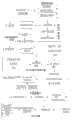
图1为本发明实施例的方法流程图。Fig. 1 is a flow chart of the method of the embodiment of the present invention.
具体实施方式Detailed ways
下面结合具体实施例,进一步阐明本发明,应理解这些实施例仅用于说明本发明而不用于限制本发明的范围,在阅读了本发明之后,本领域技术人员对本发明的各种等价形式的修改均落于本申请所附权利要求所限定的范围。Below in conjunction with specific embodiment, further illustrate the present invention, should be understood that these embodiments are only used to illustrate the present invention and are not intended to limit the scope of the present invention, after having read the present invention, those skilled in the art will understand various equivalent forms of the present invention All modifications fall within the scope defined by the appended claims of the present application.
如图1所示,基于多尺度谱聚类及决策级融合的SAR图像溢油检测方法,首先,建立基于小波变换的SAR图像多尺度对象级谱聚类分割方法,在不同尺度下分别提取溢油或疑似溢油区域;其次,对上述影像分割结果,利用多元指标组合的神经网络溢油识别方法在单一尺度上进行识别,建立多尺度决策级融合策略,融合单一尺度的检测结果完成检测并形成统一的检测框架;最后,以识别过程中的主要性能指标为基础,进行新建溢油识别方法的性能评估。具体研究内容如下:As shown in Figure 1, the oil spill detection method for SAR images based on multi-scale spectral clustering and decision-level fusion, firstly, establish a multi-scale object-level spectral clustering and segmentation method for SAR images based on wavelet transform, and extract the Secondly, for the above-mentioned image segmentation results, the neural network oil spill recognition method combined with multiple indicators is used to identify on a single scale, and a multi-scale decision-making fusion strategy is established, and the detection results of a single scale are fused to complete the detection and A unified detection framework is formed; finally, based on the main performance indicators in the identification process, the performance evaluation of the new oil spill identification method is carried out. The specific research contents are as follows:
(1)基于对象的多尺度-谱聚类分割(1) Object-based multi-scale-spectral clustering and segmentation
在对SAR图像进行多尺度分解之前,需要对原始图像进行预处理,主要包括辐射校正、地理位置校正以及滤除斑点噪声。辐射校正可消除SAR图像侧视成像造成的从近距离点到远距离点的投影灰度级差异;地理位置校正可定位目标中各点的地理经纬度;滤除斑点噪声可去除SAR图像中由于相干成像引起的斑点噪声。通常采用形态重建滤波器等方法可有效去除噪声而对而保留图像细节信息,也可通过小波变化利用系数相关性去噪,也能取得良好而效果。Before multi-scale decomposition of SAR images, the original images need to be preprocessed, mainly including radiation correction, geographic location correction and filtering speckle noise. Radiation correction can eliminate the projected gray level difference from near-distance points to far-distance points caused by side-view imaging of SAR images; geographic location correction can locate the geographic longitude and latitude of each point in the target; filtering speckle noise can remove the SAR image due to coherence Imaging-induced speckle noise. Usually, methods such as morphological reconstruction filters can be used to effectively remove noise and retain image detail information, and wavelet transformation can also be used to denoise using coefficient correlation, which can also achieve good results.
由所有尺度上的小波分解结果构成的特征空间中,某一尺度的分解结果是该特征空间中的一个模式特征向量。根据聚类的思想,可按照最佳分解时使得所有尺度上分解结果的距离和达到最大来确定最佳分解尺度。距离的计算公式如下所示:In the feature space composed of wavelet decomposition results on all scales, the decomposition result of a certain scale is a pattern feature vector in the feature space. According to the idea of clustering, the optimal decomposition scale can be determined by maximizing the distance sum of the decomposition results on all scales during the optimal decomposition. The formula for calculating the distance is as follows:
式中:Sf(li+1,x)为信号f(t)在尺度li上的小波变换;li与li+1为两相邻尺度;N为小波变换的数据点数。这种距离描述了相邻尺度之间小波变换结果的接近程度。In the formula: Sf(li +1, x) is the wavelet transform of signal f(t) on scale li ; li and li +1 are two adjacent scales; N is the number of data points of wavelet transform. This distance describes how close the wavelet transform results are between adjacent scales.
尺度自适应的快速分割方法拟采用经典的图切方法,利用相邻像素的同质性和异质性,得到相邻像素属于同一对象的似然函数,求解优化问题后,可得到每个像素所属的对象,从而实现快速分割预处理。因此尺度的自适应问题转化为不同的尺度下求最优解的问题。The scale-adaptive fast segmentation method intends to use the classic graph cut method, using the homogeneity and heterogeneity of adjacent pixels to obtain the likelihood function that adjacent pixels belong to the same object. After solving the optimization problem, each pixel can be obtained The object to which it belongs, so as to achieve fast segmentation preprocessing. Therefore, the scale adaptive problem is transformed into the problem of finding the optimal solution at different scales.
MS谱聚类算法较标准谱聚类算法使用多个特征向量包含更多信息,更稳定,效率更高。同时MS谱聚类具有较为完善的理论框架,可直接嵌入本项目的谱聚类分割。本项目拟对分割预处理后尺度图像,采用MS谱聚类算法代替标准的谱聚类算法。但聚类的基本单元不再是像素,而采用分割预处理产生的所有对象(区域块)进行聚类,提取溢油或疑似溢油区域。The MS spectral clustering algorithm uses multiple feature vectors to contain more information than the standard spectral clustering algorithm, which is more stable and efficient. At the same time, MS spectral clustering has a relatively complete theoretical framework, which can be directly embedded in the spectral clustering segmentation of this project. This project intends to use the MS spectral clustering algorithm to replace the standard spectral clustering algorithm for the scaled images after segmentation preprocessing. However, the basic unit of clustering is no longer a pixel, but all objects (area blocks) generated by segmentation preprocessing are used for clustering to extract oil spills or suspected oil spill areas.
(2)基于神经网络的多尺度溢油识别(2) Multi-scale oil spill identification based on neural network
通常对分割后的结果进行特征提取主要包括几何特征,纹理特征,灰度特征等。拟采用区域灰度直方图统一提取图像的纹理特征与灰度特征,同时提取几何特征并结合风速环境参数等形成组合特征作为神经网络识别的输入,并选用常用的神经网络模型BP神经网络、径向基神经网络RBF和概率神经网络对图像中溢油和海水等物质进行训练网络收敛后,拟综合多尺度检测信息,通过对识别结果的比较,评价三种网络模型对SAR溢油图像的识别效果与算法性能,选择较优的一种纳入本项目的检测框架。Usually, the feature extraction of the segmented results mainly includes geometric features, texture features, grayscale features, etc. It is planned to use the regional gray histogram to uniformly extract the texture features and gray features of the image, and at the same time extract the geometric features and combine the wind speed and environmental parameters to form a combined feature as the input of the neural network recognition, and choose the commonly used neural network model BP neural network, path After the basic neural network RBF and probabilistic neural network are trained for oil spills and seawater and other substances in the image, after the network converges, the multi-scale detection information is proposed to be synthesized. By comparing the recognition results, the three network models are evaluated for the recognition of SAR oil spill images Effect and algorithm performance, choose the better one to be included in the detection framework of this project.
(3)基于多尺度决策级融合策略(3) Based on multi-scale decision-level fusion strategy
基于多尺度下不同的检测结果,拟研究建立一种基于尺度因子的投票决策融合算法。为了进行决策级融合,在进行快速分割与溢油识别之前,需要将所有尺度的低频图像变换到与原始图像相同的尺寸。由于分解后每一尺度的高频信息都保留在上一层的低频图像中,因此考虑直接对每个尺度低频图像进行多次独立重构实现。根据每一尺度下获得的识别结果,对每一个像素采用投票机制进行多尺度决策融合,得票数多的结果作为最终决策。在决策准则中拟加入尺度因子作为投票机制中不同尺度像素的投票权重,尺度因子的确定拟根据SAR图像数据质量、油膜区域的大致形态、各低频图像的尺寸等多种因素综合确定,随着尺度的增大,重采样后的像素投票的权重应相应的降低。Based on different detection results at multiple scales, it is proposed to establish a voting decision fusion algorithm based on scale factors. For decision-level fusion, low-frequency images at all scales need to be transformed to the same size as the original image before fast segmentation and oil spill identification. Since the high-frequency information of each scale is retained in the low-frequency image of the previous layer after decomposition, it is considered to directly perform multiple independent reconstructions on the low-frequency image of each scale. According to the recognition results obtained at each scale, a voting mechanism is used for each pixel for multi-scale decision fusion, and the result with the most votes is the final decision. In the decision-making criteria, the scale factor is proposed to be added as the voting weight of pixels of different scales in the voting mechanism. The scale factor is to be determined comprehensively based on various factors such as the quality of SAR image data, the general shape of the oil slick area, and the size of each low-frequency image. As the scale increases, the weight of resampled pixel votes should decrease accordingly.
(4)应用验证(4) Application Verification
应用验证时,拟采用多幅ENVISAT-1ASAR数据,首先根据运行时间、分割剩余块数等方面,对比评价单一尺度下对象级的MS聚类算法与基于像素的标准谱聚类算法及经典k-均值聚类(KM)算法。进而通过BP神经网络、径向基神经网络RBF和概率神经网络三种神经网络识别方法验证基于灰度直方图的纹理及灰度统一提取方式的有效性,分析比较三种识别方法哪一种更适合于SAR图像溢油检测识别。在对最终检测结果评价时,在条件允许时可直接依据现场实测数据,也可采用目视解译的方法,从原始影像上获取参考数据。建立混淆矩阵,根据Kappa系数、总体精度、虚警率等精度指标进行评定,并优化对象级谱聚类分割、神经网络溢油识别以及特征级融合策略的相关参数。In the application verification, it is planned to use multiple ENVISAT-1ASAR data. First, according to the running time and the number of remaining blocks in the segmentation, compare and evaluate the object-level MS clustering algorithm at a single scale with the pixel-based standard spectral clustering algorithm and the classic k- Means clustering (KM) algorithm. Then, through the three neural network recognition methods of BP neural network, radial basis neural network (RBF) and probabilistic neural network, the effectiveness of texture and gray level unified extraction method based on gray histogram is verified, and the three recognition methods are analyzed and compared which one is better. It is suitable for SAR image oil spill detection and identification. When evaluating the final test results, when conditions permit, the on-site measured data can be directly used, or the method of visual interpretation can be used to obtain reference data from the original image. Confusion matrix is established, evaluated according to Kappa coefficient, overall accuracy, false alarm rate and other accuracy indicators, and related parameters of object-level spectral clustering and segmentation, neural network oil spill recognition and feature-level fusion strategies are optimized.
Claims (4)
Translated fromChinesePriority Applications (1)
| Application Number | Priority Date | Filing Date | Title |
|---|---|---|---|
| CN201310162878.0ACN103236063B (en) | 2013-05-03 | 2013-05-03 | Based on the SAR image oil spilling detection method of multiple dimensioned spectral clustering and decision level fusion |
Applications Claiming Priority (1)
| Application Number | Priority Date | Filing Date | Title |
|---|---|---|---|
| CN201310162878.0ACN103236063B (en) | 2013-05-03 | 2013-05-03 | Based on the SAR image oil spilling detection method of multiple dimensioned spectral clustering and decision level fusion |
Publications (2)
| Publication Number | Publication Date |
|---|---|
| CN103236063Atrue CN103236063A (en) | 2013-08-07 |
| CN103236063B CN103236063B (en) | 2016-01-06 |
Family
ID=48884102
Family Applications (1)
| Application Number | Title | Priority Date | Filing Date |
|---|---|---|---|
| CN201310162878.0AActiveCN103236063B (en) | 2013-05-03 | 2013-05-03 | Based on the SAR image oil spilling detection method of multiple dimensioned spectral clustering and decision level fusion |
Country Status (1)
| Country | Link |
|---|---|
| CN (1) | CN103236063B (en) |
Cited By (19)
| Publication number | Priority date | Publication date | Assignee | Title |
|---|---|---|---|---|
| CN103413146A (en)* | 2013-08-23 | 2013-11-27 | 西安电子科技大学 | Method for finely classifying polarized SAR images based on Freeman entropy and self-learning |
| CN103606154A (en)* | 2013-11-22 | 2014-02-26 | 河海大学 | Multiple-dimensioned offshore oil-spill SAR image segmentation method based on JSEG and spectrum clustering |
| CN104134076A (en)* | 2014-07-10 | 2014-11-05 | 杭州电子科技大学 | SAR image target recognition method based on CS and SVM decision fusion |
| CN104166859A (en)* | 2014-08-13 | 2014-11-26 | 西安电子科技大学 | Polarization SAR image classification based on SSAE and FSALS-SVM |
| CN104933714A (en)* | 2015-06-12 | 2015-09-23 | 北京理工大学 | SAR remote sensing scene oil-spilling segmentation and detection method based on context relation |
| CN106651880A (en)* | 2016-12-27 | 2017-05-10 | 首都师范大学 | Method for detecting marine moving target of thermal infrared remote sensing image based on multi-feature fusion |
| CN107292328A (en)* | 2016-03-31 | 2017-10-24 | 武汉大学 | The remote sensing image shadow Detection extracting method and system of multiple dimensioned multiple features fusion |
| CN108257119A (en)* | 2018-01-08 | 2018-07-06 | 浙江大学 | A kind of immediate offshore area floating harmful influence detection method for early warning based near ultraviolet image procossing |
| CN108596065A (en)* | 2018-04-13 | 2018-09-28 | 深圳职业技术学院 | One kind is based on deep semantic segmentation marine oil spill detecting system and method |
| CN109919123A (en)* | 2019-03-19 | 2019-06-21 | 自然资源部第一海洋研究所 | Oil spill detection method on sea surface based on multi-scale feature deep convolutional neural network |
| CN110047093A (en)* | 2019-04-23 | 2019-07-23 | 南昌航空大学 | Edge-protected type RGBD scene flows estimation method in high precision |
| CN110189280A (en)* | 2019-06-28 | 2019-08-30 | 南京硕基信息科技有限公司 | A kind of radar oil spilling detection system and its detection method |
| CN110231625A (en)* | 2019-06-24 | 2019-09-13 | 南京邮电大学 | A kind of aperture synthesis imaging method based on Multiscale Fusion |
| CN113570589A (en)* | 2021-08-03 | 2021-10-29 | 河海大学 | A deep learning SAR image oil spill identification method based on feature fusion |
| CN113920445A (en)* | 2021-10-08 | 2022-01-11 | 自然资源部第一海洋研究所 | Oil spill detection method on sea surface based on decision fusion of multi-core classification model |
| CN114332655A (en)* | 2021-12-30 | 2022-04-12 | 西安建筑科技大学 | A vehicle adaptive fusion detection method and system |
| CN117115175A (en)* | 2023-10-25 | 2023-11-24 | 天津东泉石油技术开发有限公司 | Online monitoring and early warning method and system for oil spilling |
| CN117029701B (en)* | 2023-10-09 | 2023-12-15 | 交通运输部天津水运工程科学研究所 | A non-contact oil spill monitoring method in coastal waters |
| CN120318611A (en)* | 2025-06-18 | 2025-07-15 | 自然资源部第一海洋研究所 | A method and system for oil spill characterization based on wide-spectrum satellite optical remote sensing images |
Citations (1)
| Publication number | Priority date | Publication date | Assignee | Title |
|---|---|---|---|---|
| CN102831600A (en)* | 2012-07-24 | 2012-12-19 | 长安大学 | An Image Hierarchical Segmentation Method Based on Weighted Cut Merging |
- 2013
- 2013-05-03CNCN201310162878.0Apatent/CN103236063B/enactiveActive
Patent Citations (1)
| Publication number | Priority date | Publication date | Assignee | Title |
|---|---|---|---|---|
| CN102831600A (en)* | 2012-07-24 | 2012-12-19 | 长安大学 | An Image Hierarchical Segmentation Method Based on Weighted Cut Merging |
Non-Patent Citations (2)
| Title |
|---|
| C.OZKAN ET AL.: "Testing the generalization efficiency of oil slick classification algorithm using multiple sar data for deepwater horizon oil spill", 《INTERNATIONAL ARCHIVES OF THE PHOTOGRAMMETRY, REMOTE SENSING AND SPATIAL INFORMATION SCIENCES》* |
| 万红林等: "基于交互式分割技术和决策级融合的SAR图像变化检测", 《测绘学报》* |
Cited By (29)
| Publication number | Priority date | Publication date | Assignee | Title |
|---|---|---|---|---|
| CN103413146A (en)* | 2013-08-23 | 2013-11-27 | 西安电子科技大学 | Method for finely classifying polarized SAR images based on Freeman entropy and self-learning |
| CN103413146B (en)* | 2013-08-23 | 2017-03-29 | 西安电子科技大学 | Polarimetric SAR Image sophisticated category method based on Freeman entropys and self study |
| CN103606154A (en)* | 2013-11-22 | 2014-02-26 | 河海大学 | Multiple-dimensioned offshore oil-spill SAR image segmentation method based on JSEG and spectrum clustering |
| CN104134076A (en)* | 2014-07-10 | 2014-11-05 | 杭州电子科技大学 | SAR image target recognition method based on CS and SVM decision fusion |
| CN104134076B (en)* | 2014-07-10 | 2017-06-06 | 杭州电子科技大学 | SAR image target recognition method based on CS and SVM decision level fusions |
| CN104166859A (en)* | 2014-08-13 | 2014-11-26 | 西安电子科技大学 | Polarization SAR image classification based on SSAE and FSALS-SVM |
| CN104166859B (en)* | 2014-08-13 | 2017-09-22 | 西安电子科技大学 | Based on SSAE and FSALS SVM Classification of Polarimetric SAR Image |
| CN104933714A (en)* | 2015-06-12 | 2015-09-23 | 北京理工大学 | SAR remote sensing scene oil-spilling segmentation and detection method based on context relation |
| CN107292328A (en)* | 2016-03-31 | 2017-10-24 | 武汉大学 | The remote sensing image shadow Detection extracting method and system of multiple dimensioned multiple features fusion |
| CN106651880A (en)* | 2016-12-27 | 2017-05-10 | 首都师范大学 | Method for detecting marine moving target of thermal infrared remote sensing image based on multi-feature fusion |
| CN106651880B (en)* | 2016-12-27 | 2020-04-14 | 首都师范大学 | Marine moving target detection method based on thermal infrared remote sensing images based on multi-feature fusion |
| CN108257119A (en)* | 2018-01-08 | 2018-07-06 | 浙江大学 | A kind of immediate offshore area floating harmful influence detection method for early warning based near ultraviolet image procossing |
| CN108257119B (en)* | 2018-01-08 | 2020-09-01 | 浙江大学 | Near-shore sea area floating hazardous chemical detection early warning method based on near-ultraviolet image processing |
| CN108596065A (en)* | 2018-04-13 | 2018-09-28 | 深圳职业技术学院 | One kind is based on deep semantic segmentation marine oil spill detecting system and method |
| CN109919123A (en)* | 2019-03-19 | 2019-06-21 | 自然资源部第一海洋研究所 | Oil spill detection method on sea surface based on multi-scale feature deep convolutional neural network |
| CN109919123B (en)* | 2019-03-19 | 2021-05-11 | 自然资源部第一海洋研究所 | Oil spill detection method on sea surface based on multi-scale feature deep convolutional neural network |
| CN110047093A (en)* | 2019-04-23 | 2019-07-23 | 南昌航空大学 | Edge-protected type RGBD scene flows estimation method in high precision |
| CN110047093B (en)* | 2019-04-23 | 2021-04-27 | 南昌航空大学 | High-precision edge protection type RGBD scene flow estimation method |
| CN110231625A (en)* | 2019-06-24 | 2019-09-13 | 南京邮电大学 | A kind of aperture synthesis imaging method based on Multiscale Fusion |
| CN110231625B (en)* | 2019-06-24 | 2023-01-31 | 南京邮电大学 | Synthetic aperture imaging method based on multi-scale fusion |
| CN110189280A (en)* | 2019-06-28 | 2019-08-30 | 南京硕基信息科技有限公司 | A kind of radar oil spilling detection system and its detection method |
| CN113570589A (en)* | 2021-08-03 | 2021-10-29 | 河海大学 | A deep learning SAR image oil spill identification method based on feature fusion |
| CN113920445A (en)* | 2021-10-08 | 2022-01-11 | 自然资源部第一海洋研究所 | Oil spill detection method on sea surface based on decision fusion of multi-core classification model |
| CN113920445B (en)* | 2021-10-08 | 2025-06-03 | 自然资源部第一海洋研究所 | Sea surface oil spill detection method based on decision fusion of multi-kernel classification model |
| CN114332655A (en)* | 2021-12-30 | 2022-04-12 | 西安建筑科技大学 | A vehicle adaptive fusion detection method and system |
| CN117029701B (en)* | 2023-10-09 | 2023-12-15 | 交通运输部天津水运工程科学研究所 | A non-contact oil spill monitoring method in coastal waters |
| CN117115175A (en)* | 2023-10-25 | 2023-11-24 | 天津东泉石油技术开发有限公司 | Online monitoring and early warning method and system for oil spilling |
| CN117115175B (en)* | 2023-10-25 | 2024-01-09 | 天津东泉石油技术开发有限公司 | Online monitoring and early warning method and system for oil spilling |
| CN120318611A (en)* | 2025-06-18 | 2025-07-15 | 自然资源部第一海洋研究所 | A method and system for oil spill characterization based on wide-spectrum satellite optical remote sensing images |
Also Published As
| Publication number | Publication date |
|---|---|
| CN103236063B (en) | 2016-01-06 |
Similar Documents
| Publication | Publication Date | Title |
|---|---|---|
| CN103236063B (en) | Based on the SAR image oil spilling detection method of multiple dimensioned spectral clustering and decision level fusion | |
| Tong et al. | An approach for flood monitoring by the combined use of Landsat 8 optical imagery and COSMO-SkyMed radar imagery | |
| Misra et al. | Simple approaches to oil spill detection using sentinel application platform (SNAP)-ocean application tools and texture analysis: a comparative study | |
| Mazur et al. | An object-based SAR image iceberg detection algorithm applied to the Amundsen Sea | |
| Sunder et al. | Inter-comparison of remote sensing sensing-based shoreline mapping techniques at different coastal stretches of India | |
| Zanchetta et al. | Wind direction retrieval from Sentinel-1 SAR images using ResNet | |
| Song et al. | A globally statistical active contour model for segmentation of oil slick in SAR imagery | |
| CN110516646B (en) | Superglacial moraine covering type glacier identification method combining polarization decomposition and topographic features | |
| CN103606154B (en) | Based on JSEG and the multiple dimensioned offshore spilled oil SAR image segmentation method of spectral clustering | |
| Dai et al. | Policy-driven changes in enclosure fisheries of large lakes in the Yangtze Plain: Evidence from satellite imagery | |
| Yang et al. | Evaluation and mitigation of rain effect on wave direction and period estimation from X-band marine radar images | |
| CN104361582A (en) | Method of detecting flood disaster changes through object-level high-resolution SAR (synthetic aperture radar) images | |
| Ciecholewski | Review of segmentation methods for coastline detection in sar images | |
| Hou et al. | End-to-end automatic ship detection and recognition in high-resolution Gaofen-3 spaceborne SAR images | |
| Zhang et al. | Oil-spill pollution remote sensing by synthetic aperture radar | |
| CN116343113A (en) | Method and system for detecting oil spill based on polarized SAR characteristics and coding and decoding network | |
| Ding et al. | Coastline detection in SAR images using multiscale normalized cut segmentation | |
| Kim et al. | Surface sediment classification using a deep learning model and unmanned aerial vehicle data of tidal flats | |
| Hernández-Hamón et al. | Google Earth Engine app using Sentinel 1 SAR and deep learning for ocean seep methane detection and monitoring | |
| Marghany et al. | Modification of fractal algorithm for oil spill detection from RADARSAT-1 SAR data | |
| Sun et al. | A Wave Texture Difference Method for Rainfall Detection Using X‐Band Marine Radar | |
| Zhang et al. | Ice floe segmentation and floe size distribution in airborne and high-resolution optical satellite images: towards an automated labelling deep learning approach | |
| CN116299305B (en) | Multi-feature SAR oil spill detection method | |
| Tian et al. | Use of intensity and coherence of X-band SAR data to map thermokarst lakes on the Northern Tibetan Plateau | |
| Zhao et al. | Automatic extraction of floating ice at Antarctic continental margin from remotely sensed imagery using object-based segmentation |
Legal Events
| Date | Code | Title | Description |
|---|---|---|---|
| C06 | Publication | ||
| PB01 | Publication | ||
| C10 | Entry into substantive examination | ||
| SE01 | Entry into force of request for substantive examination | ||
| C14 | Grant of patent or utility model | ||
| GR01 | Patent grant |