Savianges | |
|---|---|
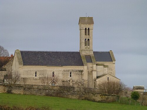
 The Castle of Savianges | |
 Location of Savianges | |
| Coordinates:46°41′32″N4°36′27″E / 46.6922°N 4.6075°E /46.6922; 4.6075 | |
| Country | France |
| Region | Bourgogne-Franche-Comté |
| Department | Saône-et-Loire |
| Arrondissement | Chalon-sur-Saône |
| Canton | Givry |
Area 1 | 6.56 km2 (2.53 sq mi) |
| Population (2022)[1] | 80 |
| • Density | 12/km2 (32/sq mi) |
| Time zone | UTC+01:00 (CET) |
| • Summer (DST) | UTC+02:00 (CEST) |
| INSEE/Postal code | 71505 /71460 |
| Elevation | 252–419 m (827–1,375 ft) (avg. 263 m or 863 ft) |
| 1 French Land Register data, which excludes lakes, ponds, glaciers > 1 km2 (0.386 sq mi or 247 acres) and river estuaries. | |
Savianges (French pronunciation:[savjɑ̃ʒ]) is acommune in theSaône-et-Loiredepartment in theregion ofBourgogne-Franche-Comté in easternFrance.
The landscape is mainly composed of grass pastures and a hill named "Le bois Rougeon" overlooking the village. The riverGuye flows through from the north to the south. The main roads are connecting the village toGermagny to the south,Cersot to the north, andFley to the east.
Savianges gets its name fromGallo-Romanvilla, named "Savianga Villa",[2] its existence has been documented from the year 840.[3]ARoman road joiningAutun toMâcon viaSaint-Gengoux,[3] was passing through the land.
Savianges used to have 308 people in 1827, the number fell to 187 in 1901 and 73 in 2009.[3] In 1870, François Dulac was Maire of Savianges and member ofFrench Senate. As anarchitect, he built several schools and public buildings inSaône-et-Loire.[4] At this period, Savianges had two schools: One public school built by Dulac and one Religious School (named Saint-Louis) build by Miss Julia de La Bussière for the Sisters of the Blessed Sacrament ofAutun.

 | ThisArrondissement of Chalon-sur-Saône geographical article is astub. You can help Wikipedia byexpanding it. |