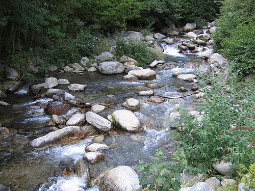
TheVésubie is a river in the southeast ofFrance. It is a left tributary of theVar in theMaritime Alps. It is 45.9 km (28.5 mi) long.[1] Itsdrainage basin is 392 km2 (151 sq mi).[2] The source is in theMercantour National Park near the border withItaly. The river flows through the town ofSaint-Martin-Vésubie, a major center for hiking. It flows into the Var nearLevens. One of its tributaries is theGordolasque.
| Vésubie | |
|---|---|
 The Vésubie inSaint-Martin-Vésubie | |
 | |
| Location | |
| Country | France |
| Physical characteristics | |
| Mouth | |
• location | Var |
• coordinates | 43°51′35″N7°11′51″E / 43.85972°N 7.19750°E /43.85972; 7.19750 |
| Length | 46 km (29 mi) |
| Basin size | 392 km2 (151 sq mi) |
| Basin features | |
| Progression | Var→Mediterranean Sea |
Towns along the river
editReferences
edit- ^Sandre."Fiche cours d'eau - La Vésubie (Y63-0400)".
- ^Bassin versant : Vésubie (La), Observatoire Régional Eau et Milieux Aquatiques en PACA
ThisAlpes-Maritimes geographical article is astub. You can help Wikipedia byexpanding it. |
This article related to a river in France is astub. You can help Wikipedia byexpanding it. |
Retrieved from "https://en.wikipedia.org/w/index.php?title=Vésubie&oldid=1216016384"