 | Wikimedia Commons Atlas of the World TheWikimedia Atlas of the World is an organized and commented collection of geographical, political and historical maps available atWikimedia Commons. Discussion •Update the atlas •Index of the Atlas •Atlas in categories •Other atlases on line |  |
|
| ||||||||||||||||||||||||||||||||||||||||
 | Topographic map of Bulgaria[8] |
 | Map of Bulgaria[9] |
 | Map of Bulgaria |
This section holds a short summary of the history of the area of present-day Bulgaria, illustrated with maps, including historical maps of former countries and empires that included present-day Bulgaria.
 | Ancient map of Thrace (made in 1585) |
 | The Expedition ofAlexander the Great 334-323 BCE |
 | Hellenistic successor states of theMacedon Empire: |
 | Territorial development of theRoman Empire 264 BC-192, including the conquest of present |
 | Extent of theRoman Republic and theRoman Empire; |
 | Invasions of the Roman Empire 100-500 |
 | Roman era Balkans, map by Alexander G. Findlay, 1849 |
 | Roman era Balkans |
 | Map of theRoman Empire in 50 |
 | Camps of the Roman Legions in 80 |
 | Map of theRoman Empire in 116 |
 | The division of the Empire after the death ofTheodosius I, ca.395 AD superimposed on modern borders. |
 | Eastern Roman Empire under emperor Justinianus 527-565 |
 | Map showing the location ofBulgars, c. 650. |
 | Foundation of theFirst Bulgarian Empire in 681 |
 | The First Bulgarian Empire underKhan Krum 803–814 (The empire includes the both lands painted in yellow and green) |
}}
 | The First Bulgarian Empire underKnyaz Boris 852–889 (The empire includes the both lands painted in lighter and darker yellow colours) |
 | The First Bulgarian Empire's greatest territorial extent during the reign ofTsar Simeon (The empire includes the both lands painted in beige and orange) |
 | The First Bulgarian Empire underTsar Samuil 997–1014 |
 | The Byzantine Empire underBasil II,c. 1025 |
 | The Byzantine Empire at the accession ofAlexios I Komnenos,c. 1081 |
 | TheSecond Bulgarian Empire under TsarsIvan Asen I andPeter IV 1185–1197 (in dark yellow) and underTsar Kaloyan 1197-1207 (in both light and dark yellow) |
 | Territorial expansion of the Second Bulgarian Empire during the reign ofTsar Ivan Asen II 1218-1241 (The empire includes the both lands painted in lighter and darker yellow colours) |
 | The Second Bulgarian Empire during the reign ofTsar Theodore Svetoslav 1300–1322 |
 | Fragmenting of the Second Bulgarian Empire into two Bulgarian Tsardoms and many small possessions (in the late 14th century) followed byOttoman conquering of the state |
 | Growth of the Ottoman Empire |
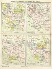
 | Development of the European part of the Ottoman Empire 15th-19th century |
 | Location of the Ottoman Empire in 1683 |
 | Ethnic map of the Ottoman Empire (1861) |
 | The Spread of Slavs in the Balkan Peninsula and the Carpathian-Danubian space (1869) |
 | Proposed restoration of Bulgaria after the Conference of Constantinople, 1876 (rejected proposal by the Ottoman Empire) |
 | Restoration of Bulgarian state (now as Third Bulgarian state) in 1878, but still asclient state of the Ottoman Empire |
 | The Third Bulgarian state lost most of its territories in the same 1878 |
 | Ethnic map of the Balkan Peninsula (1898) |
 | Bulgarians in 1912 |
 | Boundaries on the Balkans before and after the First and the Second Balkan War 1912-1913 (The Third Bulgarian state has been completely independent and not client state since 1908) |
 | Map of Bulgaria duringWWI |
 | Bulgaria after WWI 1918-1941 |
 | Map of Bulgaria duringWWII |
 | Scythia Minor |
 | Map of Romania and Bulgaria withDobruja highlighted |
 | Borders in Dobruja |
 | The fronteer between Northern and Southern Dobruja |
 | The fronteer between Romania and Bulgaria (1913-1940) |
 | Ethnic map of Dobruja (1918) |
 | Dobruja Germans |
 | Oblasti between 1987 and 1999 |
 | Greater Macedonia (region) |
 | Borders of Macedonia (region) according authors (1843-1927) |
 | French Ethnographic map of the modern Macedonia (region), 19th century (point of view of Bulgarians) |
 | French Ethnographic map of the modern Macedonia (region), 19th century (point of view of Serbs) |
 | Division of Macedonia (region) between the Balkan states (Greece, Serbia, Bulgaria and Albania), 1913 |
 | Geographic region of Macedonia through the years |
This section holds copies of original general maps more than 70 years old.
 | Bulgaria as part of the Ottoman Empire, a map by T. Jefferys, 1785 |
 | Map of the South-East Balkans |
 | Provinces of Bulgaria |
 | Municipalities of Bulgaria |
 | Eparchy of the Bulgarian Orthodox Church |
 | Extreme points |
 | Satellite map |
General remarks:
|