Iste fichero ye de Wikimedia Commons y pueden emplegar-lo atros prochectos.Debaixo s'amuestra a descripción d'a suyapachina de descripción.
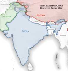
| DescripciónIndia location map.svg | English: Location map of India. Equirectangular projection.Strechted by 106.0%.Geographic limits of the map:
|
| Calendata | |
| Fuent | Treballo de qui la cargó |
| Autor | Uwe Dedering deBiquipedia en alemán |
| Atras versions | Derivative works of this file: [editar]
|
 | Se debate la exactitud fáctica de este map. seeCommunications from government of India to Wikimedia Foundation regarding content about maps depicting the borders of India |
 | Se gosa premetir a copia, a destribución y a modificación d'iste decumento baixo d'os termins d'alicencia de decumentación libre GNU, Versión 1.2 u qualsiquier altra versión posteriorment expublicata por aFree Software Foundation; sin de seccions invariaderas (Unvariant Sections), textos de portalada (Front-Cover Texts), ni textos de contraportalada (Back-Cover Texts). S'enclui una copia d'ista licencia en anglés en l'articloGNU Free Documentation License".http://www.gnu.org/copyleft/fdl.htmlGFDLGNU Free Documentation Licensetruetrue |


The extent of the former territory of the British Indian Empire, seceeded by Republic of India depicted on this map may not be accepted by most countries as legal due to ongoing border disputes:
For a detailed map of all disputed regions in South Asia, seeImage:India disputed areas map.svg
The borders of the state of Meghalaya, Assam and Arunachal Pradesh are shown as interpreted from the North-Eastern Areas (Reorganisation) Act, 1971, but has yet to be verified.
The limit of the territorial waters of India extends to twelve nautical miles measured from the appropriate baseline. Seethisarchive copy at theWayback Machine for more information.
Transferred fromde.wikipedia to Commons byUwe Dedering.
Punche en una calendata/hora ta veyer o fichero como amaneixeba por ixas envueltas.
| Calendata/Hora | Miniatura | Dimensions | Usuario | Comentario | |
|---|---|---|---|---|---|
| actual | 09:24 4 abr 2021 |  | 1500 × 1615(1,23 MB) | TKsdik8900 | Fulfilling the edit request (File talk:India location map.svg#Upload more compact version of India location map) byC1MM |
| 16:50 14 oct 2020 |  | 1500 × 1615(1,64 MB) | NordNordWest | correct Telangana/Andhra Pradesh | |
| 23:10 3 nov 2019 |  | 1500 × 1615(1,62 MB) | RaviC | slight colour change for consistency | |
| 23:06 3 nov 2019 |  | 1500 × 1615(1,62 MB) | RaviC | == {{int:filedesc}} == {{Information |Description={{en|Location map of India. Equirectangular projection. Strechted by 106.0%. Geographic limits of the map: * N: 37.5° N * S: 5.0° N * W: 67.0° E * E: 99.0° E Made with Natural Earth. Free vector and raster map data @ naturalearthdata.com.}} |Source={{own}} |Date=2010-02-20 |Author={{user at project|Uwe Dedering|wikipedia|de}} |Permission= |other_versions={{DerivativeVersions|India location map2.svg|India location map 3.png}} {{Other versions/I... | |
| 21:42 19 ago 2014 |  | 1500 × 1615(1,59 MB) | M0tty | Update by Sémhur : add the state of Telangana | |
| 11:51 7 chun 2011 |  | 1500 × 1615(1,49 MB) | NordNordWest | Nagaland corrected | |
| 16:10 18 chi 2011 |  | 1500 × 1615(2,36 MB) | Uwe Dedering | Reverted to version as of 15:50, 17 January 2011 and again, layer structure destroyed, and first discuss this! | |
| 19:04 17 chi 2011 |  | 1500 × 1615(1,52 MB) | AshwiniKalantri | The disputed land of Kashmir are shown in a different shade. | |
| 15:50 17 chi 2011 |  | 1500 × 1615(2,36 MB) | Uwe Dedering | Reverted to version as of 11:34, 22 September 2010 vandalism | |
| 23:30 16 chi 2011 |  | 1500 × 1615(2,01 MB) | AshwiniKalantri | {{Information |Description=Location Map of India |Source= |Date= |Author= |Permission= |other_versions= }} |
As 77 pachinas emplegan iste fichero:
Os siguients wikis fan servir iste fichero:
Veyermas información sobre l'uso global d'iste fichero.
Iste fichero contiene información adicional, probablement adhibida dende a camara dichital, o escáner u o programa emplegau ta creyar-lo u dichitalizar-lo. Si o fichero ha estau modificau dende o suyo estau orichinal, bells detalles podrían no refleixar de tot o fichero modificau.
| Amplaria | 1500px |
|---|---|
| Altaria | 1614.844px |