This articleneeds additional citations forverification. Please helpimprove this article byadding citations to reliable sources. Unsourced material may be challenged and removed. Find sources: "A131 autoroute" – news ·newspapers ·books ·scholar ·JSTOR(June 2017) (Learn how and when to remove this message) |
| A131 autoroute | |
|---|---|
 | |
| Route information | |
Part of E5 E5 | |
| Maintained bySANEF Paris Normandie and DIR Nord-Ouest | |
| Length | 36.3 km (22.6 mi) |
| Existed | 1974–present |
| Major junctions | |
| South-East end |    E5 /E46 /A 13 inBourneville-Sainte-Croix E5 /E46 /A 13 inBourneville-Sainte-Croix |
| Major intersections |   E44 /A 29 inRogerville E44 /A 29 inRogerville |
| North-West end |   E5 /N 282 inGonfreville-l'Orcher E5 /N 282 inGonfreville-l'Orcher |
| Location | |
| Country | France |
| Major cities | Le Havre |
| Highway system | |
| |
The A131 Autoroute starts nearBourneville-Sainte-Croix close to exit 26 on theA13 and ends at the outskirts ofLe Havre.
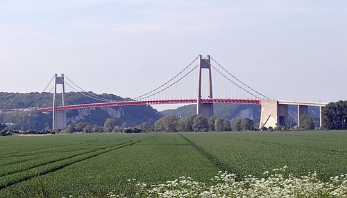
It is operated by theSANEF Paris Normandie and DIR Nord-Ouest.[1] Its total length is 36.3 km (22.6 mi). Apart from thePont de Tancarville where a toll is applicable, the motorway is toll-free. The road section on the Pont de Tancarville is renumbered RN182 to allow non-motorway traffic to cross theSeine.

This autoroute is the result of the merger of the former RN 182, transformed into a motorway between Bourneville-Sainte-Croix and the Pont de Tancarville, and the motorway linking the Pont de Tancarville to Le Havre, originally numberedA15.
| Region | Department | Junction | Destinations | Notes | |||
|---|---|---|---|---|---|---|---|
| Normandie | Eure |  A13 - A131 A13 - A131 | Paris,Rouen - sud,Alençon,Évreux,Elbeuf | Entry and exit from Paris | |||
 Péage de Bourneville (Flux Péage) Péage de Bourneville (Flux Péage) | |||||||
 28 : Bourneville 28 : Bourneville | Elbeuf,Bourgtheroulde,Brionne,Bourneville | Entry and exit from Le Havre | |||||
 29 : Saint-Aubin-sur-Quillebeuf 29 : Saint-Aubin-sur-Quillebeuf | Alençon,Pont-Audemer,Saint-Aubin-sur-Quillebeuf,Quillebeuf-sur-Seine,Sainte-Opportune | ||||||
 30 : Quillebeuf 30 : Quillebeuf | Beuzeville,Évreux | ||||||
  E5 /A 131 becomes E5 /A 131 becomes  E5 /N 182 E5 /N 182 | |||||||
 Péage duPont de Tancarville Péage duPont de Tancarville | |||||||
| Seine-Maritime |  31 : Tancarville 31 : Tancarville | Tancarville,Bolbec,Étretat,Saint-Romain-de-Colbosc | |||||
 32 : Lillebonne 32 : Lillebonne | Lillebonne, Port Jérôme Port Jérôme | ||||||
  E5 /N 182 becomes E5 /N 182 becomes  E5 /A 131 E5 /A 131 | |||||||
 33 : Le Hode 33 : Le Hode | Saint-Vigor-d'Ymonville,Port 4000-6000, Port 5000-6000,Centre Routier | ||||||
 A29 - A131 A29 - A131 | Caen,Port du Havre,Pont de Normandie,Port 1000-3000Dieppe,Calais,Amiens, Rouen - nord | ||||||
 34 : Rogerville-Oudalle 34 : Rogerville-Oudalle |  Rogerville-Oudalle Rogerville-Oudalle | ||||||
  E5 /A 131 becomes E5 /A 131 becomes  E5 /N 282 E5 /N 282 | |||||||
 Gonfreville-l'Orcher Gonfreville-l'Orcher | Gonfreville-l'Orcher,Harfleur | Entry and exit from A13 | |||||
 Port 3000-4000 Port 3000-4000 | Le Havre - sud,Montivilliers, Havre - Nord Havre - Nord | Entry and exit from A13 | |||||
 Mayville Mayville | Gonfreville-l'Orcher | Exit from A13 | |||||
 RD 6015 -RN 282 RD 6015 -RN 282 | Rouen, Amiens,Fécamp, Dieppe, Harfleur, Gonfreville-l'Orcher, Montivilliers | Entry and exit from Le Havre | |||||
  E5 /N 282 becomes E5 /N 282 becomes  E5 / D 6015 and enters in Le Havre E5 / D 6015 and enters in Le Havre | |||||||
| 1.000 mi = 1.609 km; 1.000 km = 0.621 mi | |||||||
This article about road transport in France is astub. You can help Wikipedia byexpanding it. |