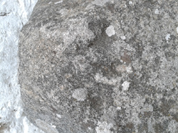

| : Ordnance Survey Benchmarks that can be observed along : | the Peak Forest Canal | < other canal Benchmarks for copy/paste |
  | Parapet bridge 28, road level |
| ( ) | |
| streetmap of SJ 9968 8490 or | |
| what3words /// | |
| click image to enlarge |
  | 33 Redhouse Lane, 100 yds S of canal |
| ( ) | |
| streetmap of SJ 9807 8491 or | |
| what3words /// panther.unscrew.exclaim | |
| click image to enlarge |
  | canal bridge 21, Ridge End |
| ( ) | |
| streetmap of SJ 9651 8697 or | |
| what3words /// nourished.freezers.riverbank | |
| click image to enlarge |
  | Posset Bridge 18, Lock 13 |
| ( ) | |
| streetmap of SJ 9610 8868 or | |
| what3words /// relocated.satellite.steadily | |
| click image to enlarge |
  | Bridge 17, Station Rd, Lock 9 |
| ( ) | |
| streetmap of SJ 9620 8910 or | |
| what3words /// thundered.downhill.chatters | |
| click image to enlarge |
  | Lea bridge 13, road level |
| ( ) | |
| streetmap of SJ 9359 9166 or | |
| what3words /// irritable.brave.stealthier | |
| click image to enlarge |
  | SE of Apethorne footbridge, canal |
| ( ) | |
| streetmap of SJ 9416 9371 or | |
| what3words /// mile.saves.cried | |
| click image to enlarge |
  | Apethorne bridge 8, canal |
| ( ) | |
| streetmap of SJ 9430 9408 or | |
| what3words /// gains.guises.stir | |
| click image to enlarge |
  | Hyde bridge 6, Manchester Rd, road level |
| ( ) | |
| streetmap of SJ 9433 9509 or | |
| what3words /// valley.beyond.gather | |
| click image to enlarge |
  | canal milestone, Dukinfield 2 |
| ( ) | |
| streetmap of SJ 9418 9552 or | |
| what3words /// throw.shows.pose | |
| click image to enlarge |
  | gatepost, canal towpath |
| ( ) | |
| streetmap of SJ 9411 9564 or | |
| what3words /// epic.eager.scales | |
| click image to enlarge |
  | horse bridge, Dukinfield Junction |
| ( ) | |
| streetmap of SJ 9338 9831 or | |
| what3words /// strictly.diverting.blaze | |
| click image to enlarge |
| X |  | X |
| ffff | info | |
| < | > |